
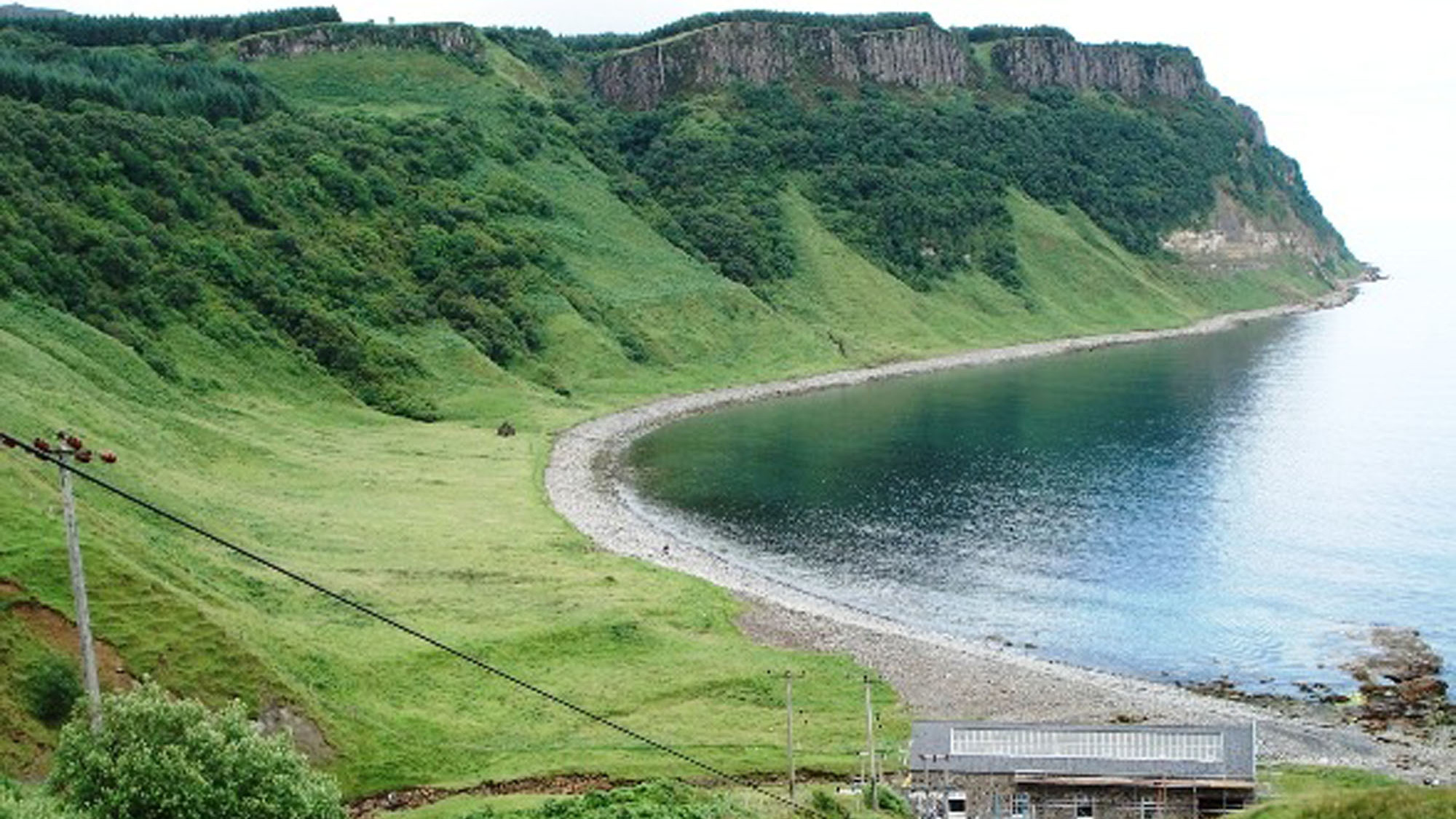
Overview
Directions
- From Portree take the A855 towards Staffin. Immediately beyond Storr Lochs, turn right onto the small hydro road. The current walking route identifies parking before the dam, around grid reference NG 516 524; use lawful available space and keep access clear.
- Continue on foot, following the signed pedestrian route around the house and turning area to the winch-house viewpoint, then the steep zigzag path and steps down to the bay. Keep away from the cliff railway, pipeline and other operational hydro structures; follow on-site restrictions.
- Return by the same steep path. The route beyond the power station involves a burn crossing which can be impassable in high water. Do not cross if the flow or footing is unsafe.
- The original guide’s locality reference is 57.49953°N, 6.14887°W. This identifies the bay area, not a guaranteed parking space. Check the current walking route, local tide predictions and weather before setting out.
Location photographs
Swipe to browse · Select a photograph to enlarge


Fossil Hunting
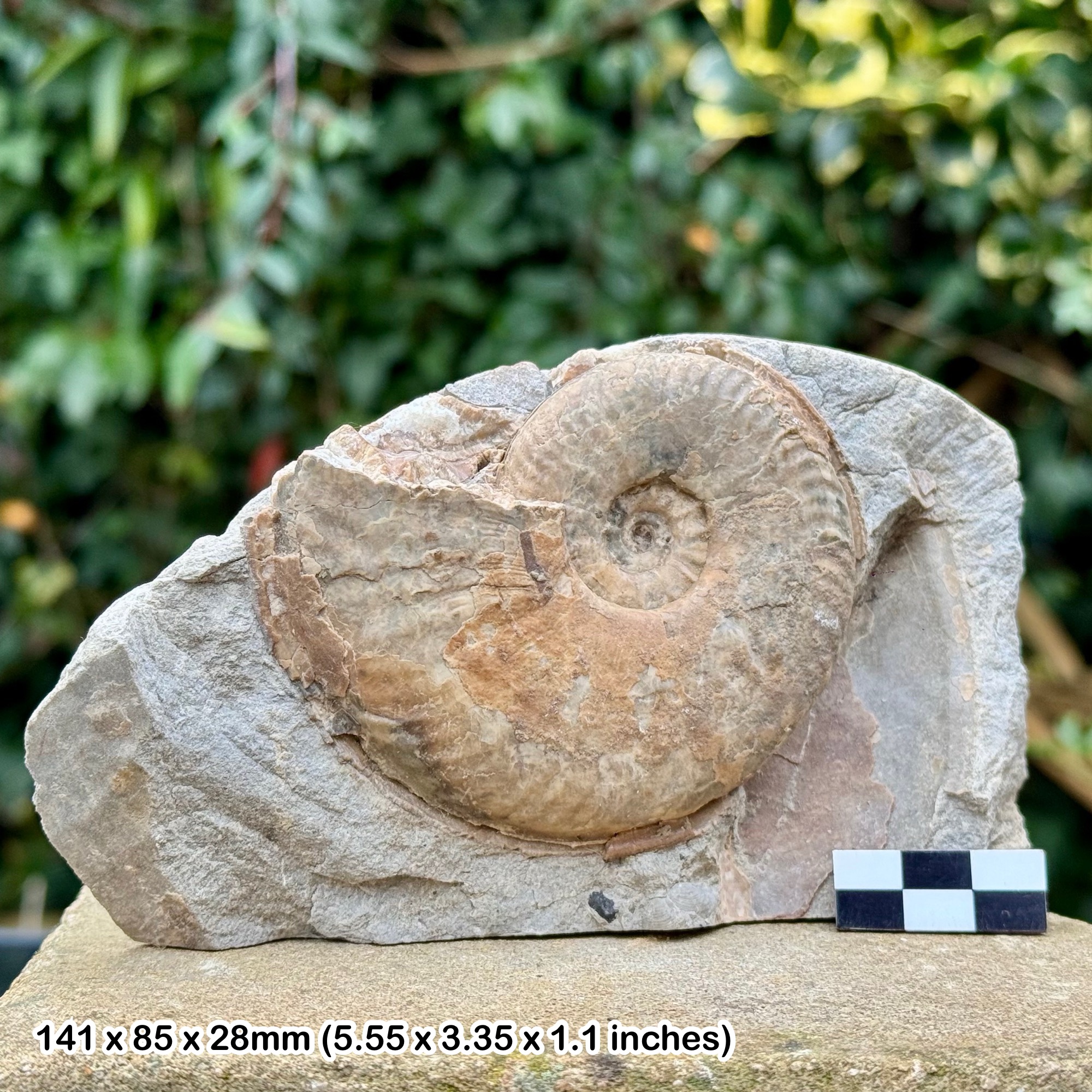
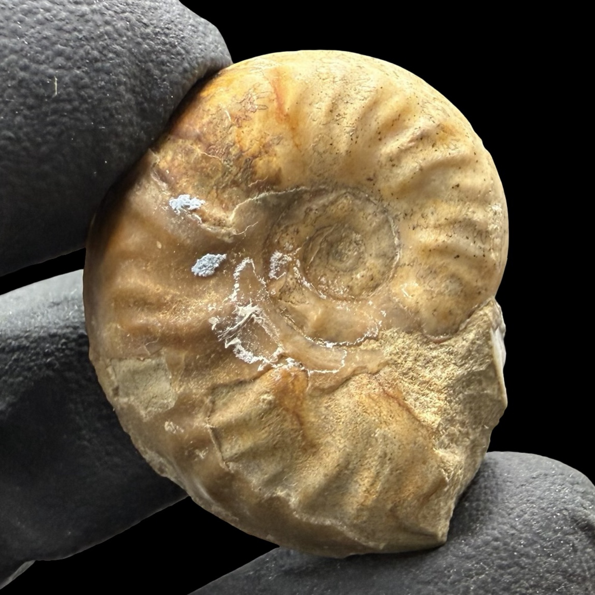
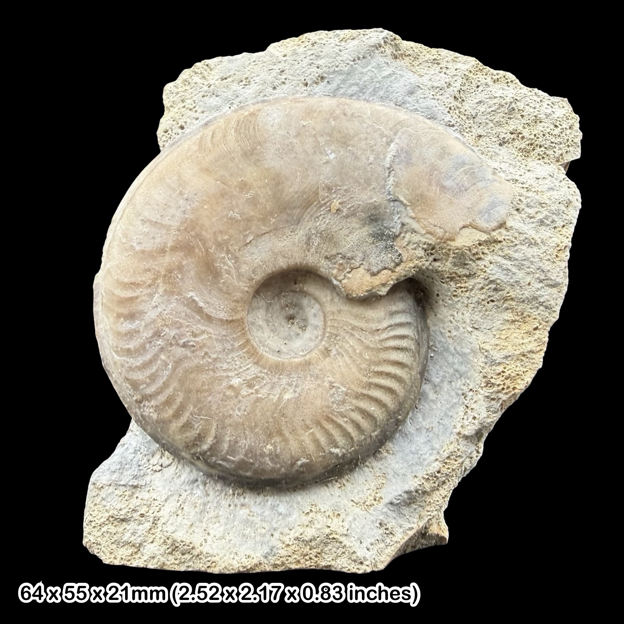
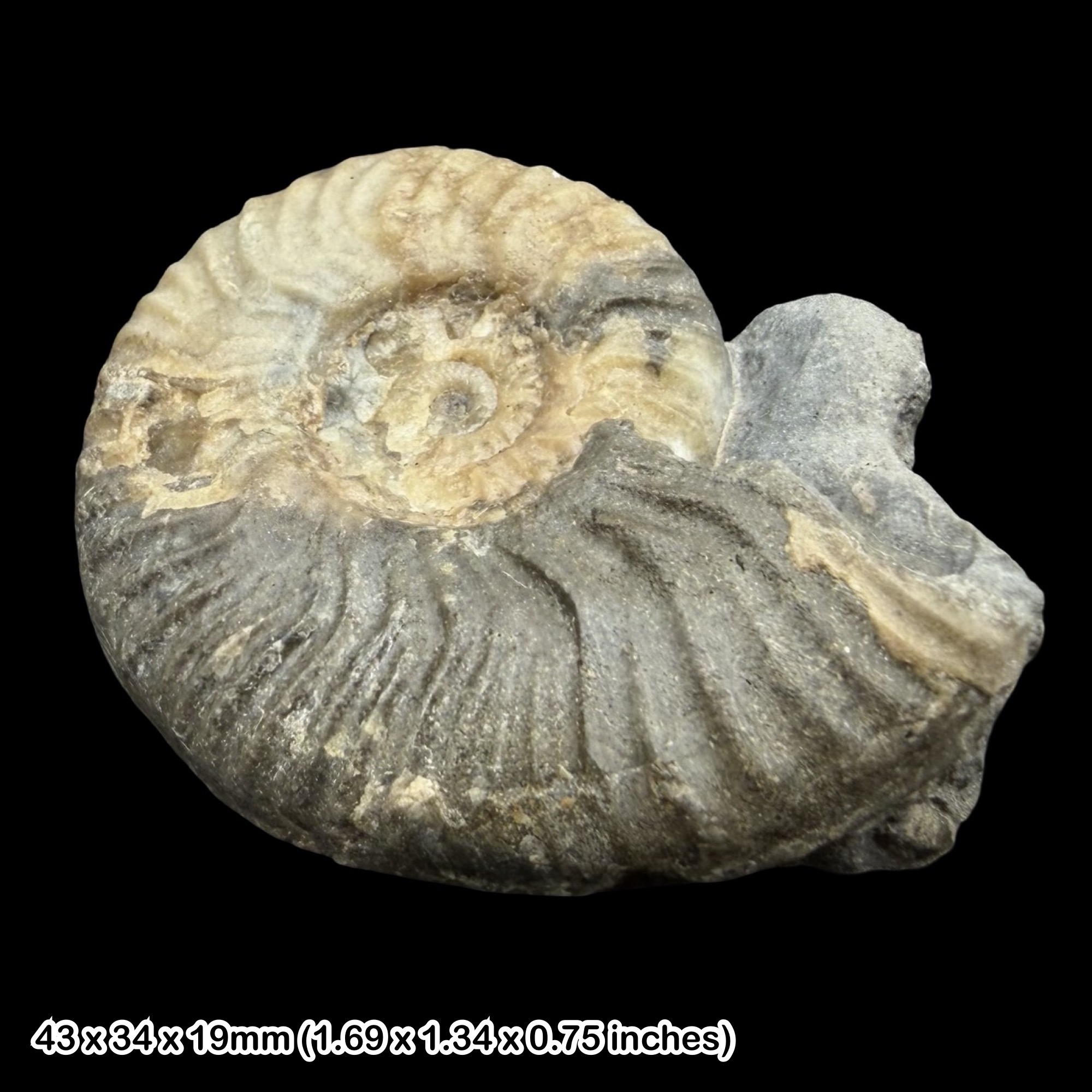
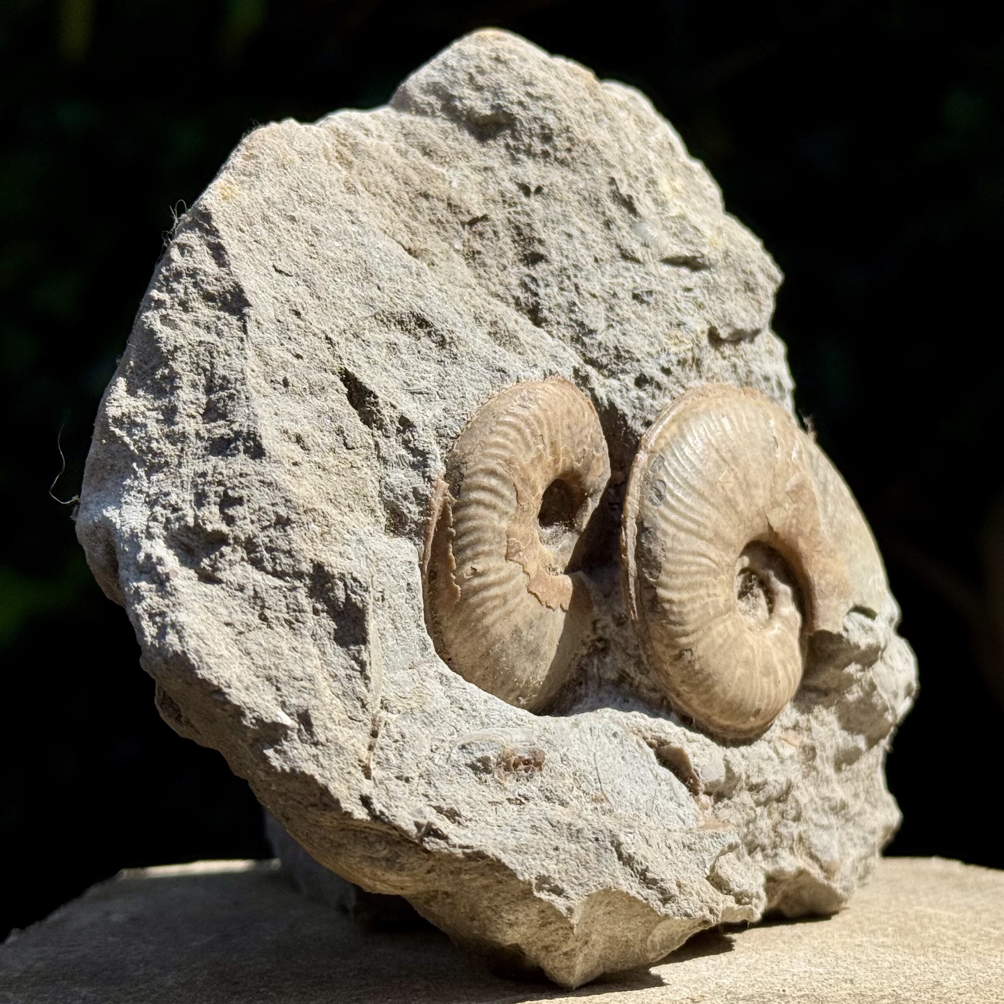
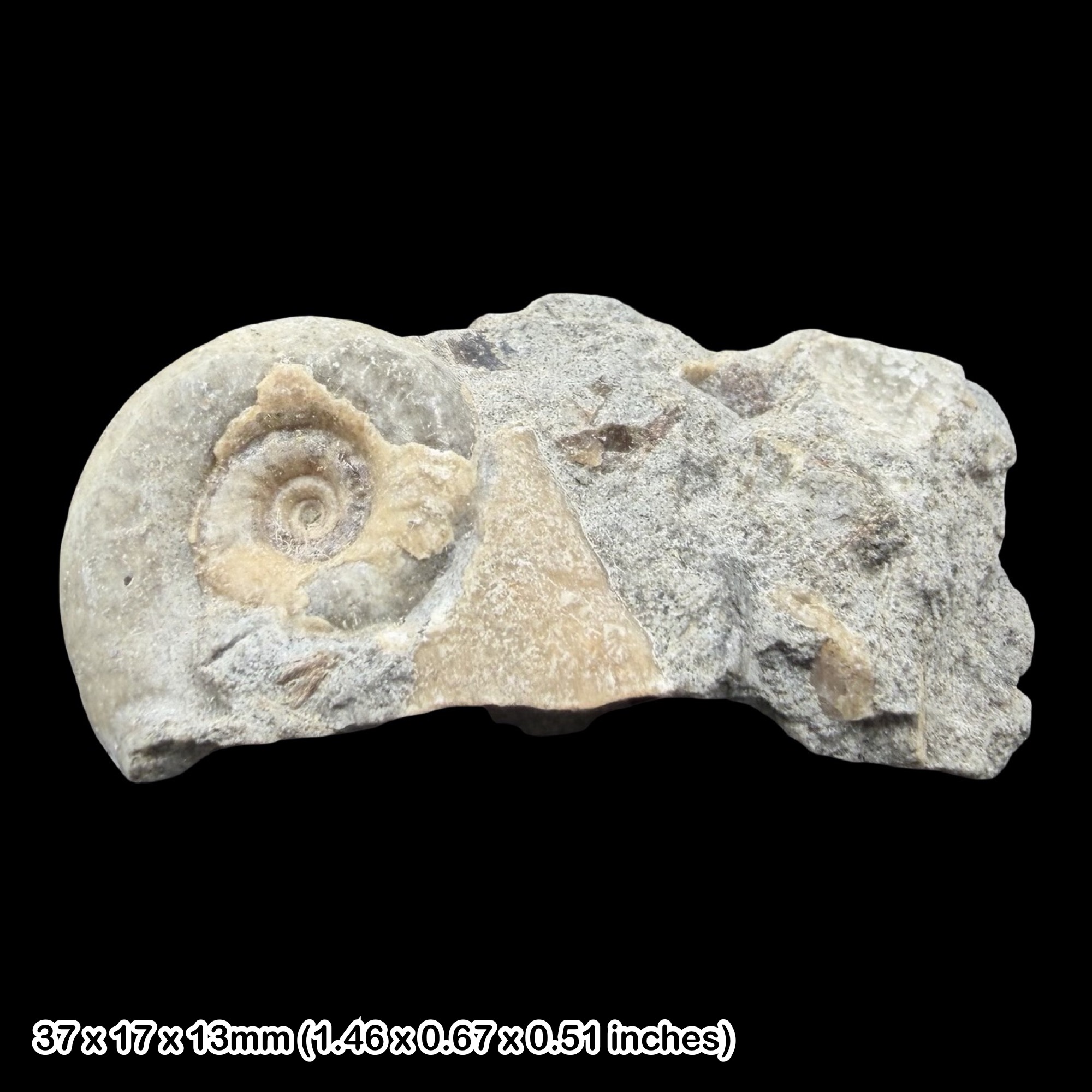
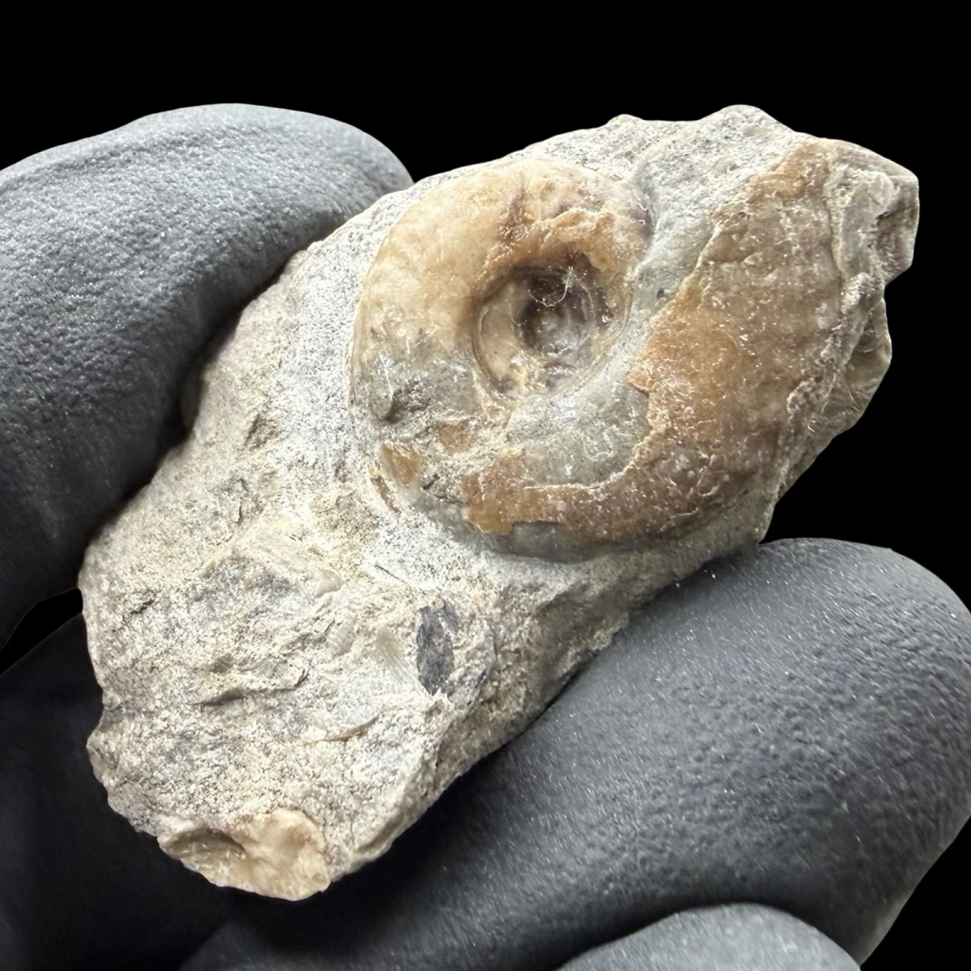
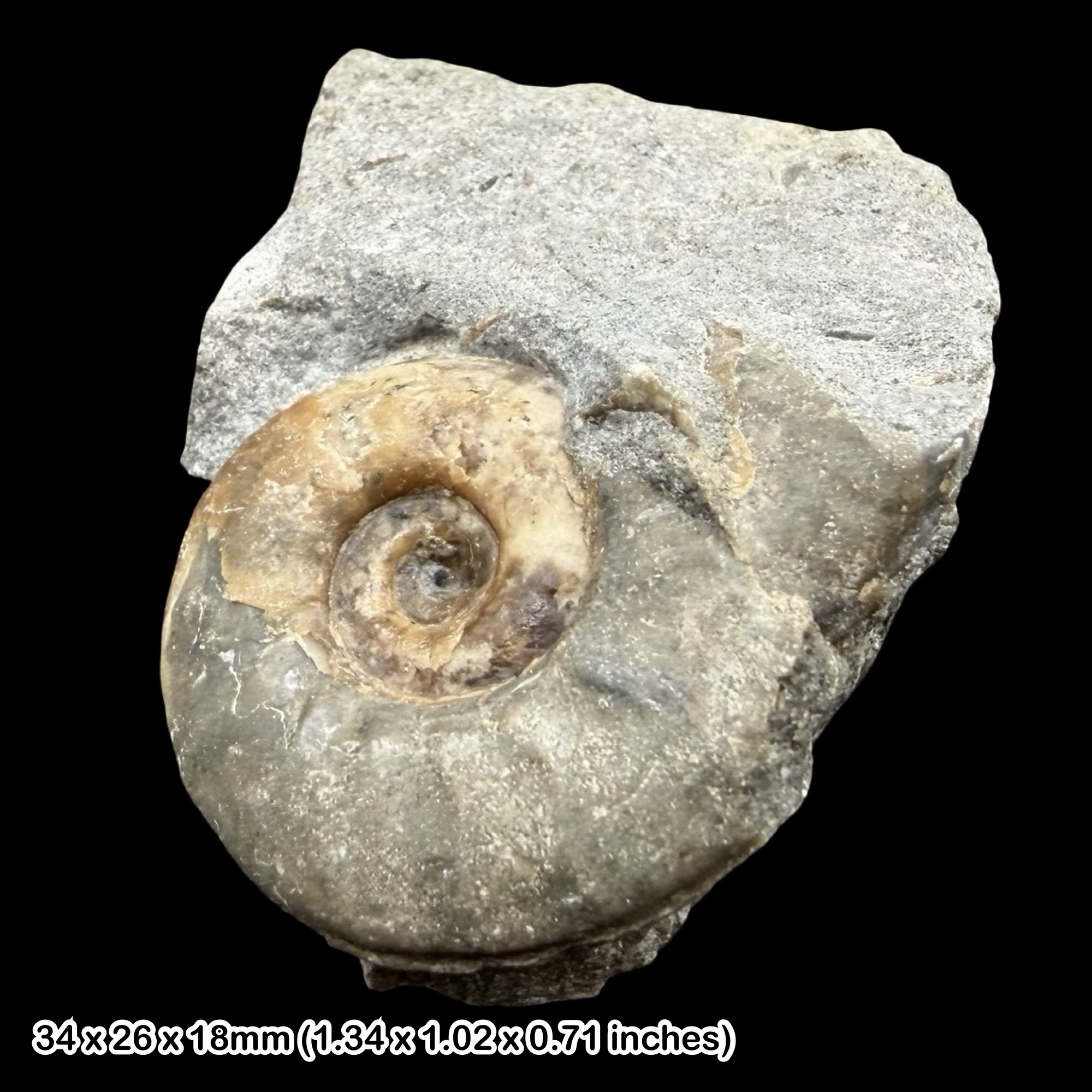
Ammonites, belemnites and bivalves are the main fossils to look for in Bearreraig’s calcareous sandstone and sandy limestone. Naturally weathered rock faces can reveal coiled ammonite whorls, pointed belemnite guards and the outlines of shells; a hand lens helps with smaller fragments. Many fossils remain firmly enclosed in hard matrix, so examine the exposed surfaces of boulders carefully. A fossil-rich block often reveals more of the original shell concentration intact than it would as broken fragments.
The lower foreshore and low cliff south of the bay expose fossiliferous parts of the Ollach Sandstone Member. Their sandy limestone and calcareous sandstone layers, logged as O1–O15 at Bearreraig Point, contain Ludwigia and Brasilia, belemnites, bivalves and plant fragments. The thin O16 belemnite-rich marker is a distinct horizon above these basal shell concentrations. Many ammonites are juveniles, so small coils and partial whorls can be more realistic targets for observation than large complete shells. Examine existing surfaces with a hand lens rather than assuming every nodule is fossiliferous. Sand cover changes what is visible, and the southward shore is only approachable when tide and waves leave a safe return.
Bearreraig is the type locality of Ludwigia murchisonae, but the fame of that species should not be confused with a promise that it is the commonest ammonite here. The detailed field guide identifies O11 as the most likely source of the original type, but its exact provenance is unproven. Historical collections include many other ammonites, and accurate identification may need the ribbing, keel, whorl section and a reliable horizon. Record the rock type and whether a specimen was attached to an exposure or already loose. A beach block can have fallen from higher beds, so its position on the shore alone does not establish its member.
Belemnites are especially recognisable: their solid, elongate guards can appear as pointed rods, broken cylinders or circular sections through the rock. Some Rigg Sandstone bedding surfaces contain large examples. Bivalves occur as paired or single valves, moulds and shell sections; the documented succession includes Camptonectes, oysters, Mesomiltha, Nuculoma and Pleuromya. Small gastropods and patches of crinoid debris add variety, but should be examined in their matrix rather than forced out of hard limestone.
The lower Udairn Shale nodules preserve Graphoceras and Hyperlioceras, while the higher succession includes occasional large Stephanoceras and Dorsetensia. These records explain why different fallen blocks can hold quite different faunas. They are not directions to climb cliffs, enter the pipeline cutting or scramble into waterfall exposures. Photograph accessible natural faces from safe ground and preserve the relationship between a fossil and its host rock.
Fossil wood and smaller plant fragments are another important part of the locality. Dark woody patches may retain grain or cellular structure, and some concretions preserve exceptional microscopic anatomy. Research has documented fern and conifer remains, the leaf organ-species Otozamites mortonii and the cone Scitistrobus duncaanensis. Most of this botanical record consists of small fragments studied using specialist preparation; it does not mean complete leaves and cones are ordinary beach finds. The plant material was transported from land into a marine setting.
Rare vertebrate discoveries include the loose ichthyosaur bones named Dearcmhara shawcrossi and thyreophoran dinosaur limb bones from the wider coast at Rubha Sùghar. If you suspect bone, a tooth or a footprint, leave it in place, photograph it with a scale without damaging it, record the location privately and report it through NatureScot’s Skye fossil guidance. Do not extract or take it home, even if it is loose.
Fossil photographs
Swipe to browse · Select a photograph to enlarge


Discoveries and milestones
A chronological record of fossil discoveries, geological research and conservation at Bearreraig Bay.
1826 – Lady Murchison’s ammonite
During the Murchisons’ visit, Lady Murchison collected the ammonite that later became the type of Ludwigia murchisonae. Its inferred source is less than half a kilometre south of the bay, within the wider Bearreraig coastal section. Later detailed work identified O11 as the most likely source bed, without proving the original find horizon.
1829 – An ammonite species named
J. de C. Sowerby named and figured Ammonites murchisonae, now Ludwigia murchisonae, from the Bearreraig material. The species subsequently became an important Aalenian zonal index.
1920 – The ammonite succession documented
G.W. Lee’s geological memoir, incorporating ammonite work by S.S. Buckman, established a detailed record of the shore’s fossil succession and its value for Jurassic correlation.
1953 – Hydroelectric works change access
Completion of the small hydroelectric power station and its access road made the bay more readily accessible for geological study. The historical infrastructure development does not establish permission to use present operational facilities.
Around 1959 – Brian Shawcross recovers ichthyosaur bones
Brian Shawcross recovered four associated bones loose at Bearreraig Bay. They would later form the basis of Dearcmhara shawcrossi; their exact source bed remains unknown.
1963–1984 – Plant-bearing material collected systematically
Nicol Morton’s collections from the Bearreraig study sections revealed permineralised plant fragments alongside marine molluscs. These collections helped establish the unusual anatomical preservation and its distribution through the succession.
1964 – The Bearreraig succession receives its name
Nicol Morton and John Hudson introduced the Bearreraig Sandstone Series, named from the bay’s type succession. Later work revised the formal rank and member terminology.
1965 – The type succession studied in detail
Morton’s study of the Bearreraig Sandstone Series on Skye and Raasay developed the geological framework for interpreting the bay and its regional facies changes.
1973 – Ammonite aptychi studied
Nicol Morton described Papilliceras with paired aptychi preserved in their normal position inside the body chamber. The relevant material came from upper-Holm fallen blocks at Rubha Sùghar, retaining a loose-block rather than in-situ bed provenance.
1976 – Formation and members formalised
Morton formalised the Bearreraig Sandstone Formation and its member subdivisions. This helped distinguish the Trotternish succession from the different local subdivisions elsewhere in the Hebrides.
1981 – Calcite growth in ammonite chambers investigated
Marshall studied complex calcite crystallisation in three ammonite phragmocones from the Rubha Sùghar material. The work concerns the preservation history of those specimens rather than a single process demonstrated throughout the bay.
1986 and 1995 – Productive plant horizons resampled
Richard Bateman and Farrington resampled productive horizons P6, P9 and P10, supplementing earlier collections. Some material came from loose blocks, a distinction important to its geological interpretation.
1987 – Rigg – Bile SSSI designated
Designation on 16 June protected the larger coastal site containing Bearreraig, recognising its geological and biological interest. The designation encompasses more than the immediate bay.
1990–1991 – The stage boundary investigated
Detailed ammonite and microfossil work developed Bearreraig’s case as a reference section for the Aalenian–Bajocian boundary. Its candidacy for the global boundary point was followed by selection as an auxiliary point.
1991 – Preliminary magnetic correlations reported
Hailwood and colleagues reported preliminary magnetic-polarity results in the Dun Caan–Ollach succession, including a reversal transition below the paired Dun Caan nodule beds. These results supplemented fossil correlation, while weak magnetisation left some boundaries uncertain.
1991 – Different generations of concretions distinguished
Wilkinson investigated the contrast between early small fossil-preserving nodules and larger doggers formed later under meteoric-water influence. The distinction helped explain why not every conspicuous concretion contains well-preserved fossils.
1994 – An auxiliary boundary section proposed
International deliberations advanced Bearreraig as a complementary Auxiliary Stratotype Point alongside the Portuguese global reference section. Proposal and later ratification were separate steps.
May 1995 – A distinctive conifer cone found
Richard Bateman collected the cone later named Scitistrobus duncaanensis from the Dun Caan Shale Member. The specimen provides an anatomically preserved Aalenian record of early cupressaceous conifers.
1995 – Detailed measured sections published
Morton and Hudson published the bed-by-bed Dun Caan, Ollach, Udairn and Holm sections and the associated fossil succession. The record distinguishes the southern composite, Bearreraig Point, gully, pipeline and burn sections, making local thickness and exposure differences explicit.
January 1996 – Auxiliary Stratotype Point ratified
The international boundary proposal was ratified, including the Bearreraig auxiliary point at the base of U10. The global GSSP was established at Murtinheira, Cabo Mondego, Portugal.
1997 – Boundary definition published
Giulio Pavia and Raymond Enay published the formal boundary definition and the role of Bearreraig’s complementary ammonite-bearing section, distinguishing the auxiliary point from the global GSSP.
1997 – Dinosaur bones discovered
Colin Aitken found dinosaur bone north of the power station and alerted Dugald Ross. The recovered material included parts of an ulna and radius, subsequently described by Neil Clark in 2001 as an indeterminate thyreophoran from the wider Rubha Sùghar coast.
2000 – Fourteen plant horizons documented
Bateman, Morton and Barbara Dower documented fourteen plant-bearing research horizons through approximately 120 m of the succession. Their study distinguished preservation types and uncertain or loose-block occurrences, linking the marine deposits to vegetation on adjacent land.
2000 – Belemnites refine boundary correlation
John McArthur, Morton and Matthew Thirlwall published a strontium-isotope study of belemnites around the auxiliary boundary section. This added a geochemical correlation tool alongside the fossil succession.
2001 – Thyreophoran limb bones described
Neil Clark described a partial right ulna and radius of an indeterminate thyreophoran dinosaur from the Bearreraig Formation, subsequently located in his review at Rubha Sùghar. The remains are Early Bajocian but do not securely identify a stegosaur species.
2004 – A leaf species named for Morton
Dower, Bateman and Dennis Stevenson named Otozamites mortonii from exceptionally preserved Bearreraig leaves. This is a bennettitalean leaf organ-species, rather than a reconstructed whole plant.
2015 – The ichthyosaur Dearcmhara named
Stephen Brusatte and colleagues named Dearcmhara shawcrossi from the four associated bones recovered around 1959. The Bearreraig Formation is their probable source, but neither a precise member nor a bed can be assigned to the loose material.
2015 – Scitistrobus formally described
Andrew Spencer and colleagues named Scitistrobus duncaanensis from the cone collected in 1995. Its internal anatomy helped clarify the early evolution of the cypress family.
2019 – Additional protection for vertebrate fossils
The Skye Nature Conservation Order included the Bearreraig Bay GCR coast. It added specific protection for vertebrate body and trace fossils, including material in beach and cliff-fall deposits.
Geology
The cliffs at Bearreraig expose the type area of the Bearreraig Sandstone Formation, a marine succession extending from latest Toarcian into Bajocian time. The lower end therefore reaches back into the Early Jurassic, while the Aalenian and Bajocian belong to the Middle Jurassic. Five members are exposed in the type section, from the Dun Caan Shale through the Ollach Sandstone, Udairn Shale and Holm Sandstone to the Rigg Sandstone. The succeeding Garantiana Mudstone is part of the same formation, but its contact and mudstones are not exposed in the modern bay account.
The alternation of mud and sand records repeated changes on a marine sea floor. Muddy intervals accumulated below wave base and were churned by burrowing organisms; sandier intervals reflect the movement and build-up of offshore sand bars. Cross-bedding and ripple lamination preserve evidence of those currents: the shelly Ollach bed O19 has south-east-dipping foresets, while planar cross-bedding in Holm H19 dips north. These distinct directions should not be reduced to one current direction for the whole formation. Ammonites, belemnites and other marine animals lived in normal-salinity water, while wood and plant fragments were carried in from land. Their exceptional preservation therefore records neighbouring vegetation within marine rocks.
Lime cement formed nodules and larger doggers within the sediment. Some developed early enough to protect shells and tiny plant structures before burial compaction, explaining why fossils can be better preserved in particular concretions than in the surrounding rock. Other concretions formed later and are comparatively barren. The same hard cement that aids preservation makes many specimens difficult to prepare, especially where fossil and matrix break together.
The Udairn Shale contains the Aalenian–Bajocian boundary. Bearreraig is an Auxiliary Stratotype Point, an internationally recognised complementary reference section, at the base of bed U10. The global GSSP is in Portugal. Careful ammonite work is essential here: transitional Hyperlioceras occurs below the boundary, so a genus name alone cannot identify the exact stage change. The expanded account now includes the individually numbered D, O, U and H beds, preserving the differences between composite, point, gully and pipeline sections. Plant P1–P14 labels remain a separate research-horizon scheme.
The sedimentary beds dip gently, about 6° towards just north of west, and are cut by minor faults. Much later, during the Palaeogene, magma entered them as dykes and dolerite sills. The columnar-jointed sill capping the northern cliff cooled underground; it is not a lava layer and is not the separate Kilt Rock locality. Heating effects are concentrated near the intrusions rather than having destroyed all fossils in the bay.
Lower Jurassic rocks around Holm and Prince Charles’ Cave form a geographically separate southern context. They include the Scalpay Sandstone, Portree Shale and Raasay Ironstone formations of the Lias Group. They must not be confused with Yorkshire’s Scalby Formation or treated as a complete numbered section on the immediate Bearreraig beach. The long coastal succession is geologically valuable, but its continuity on a map does not imply a continuously safe or accessible shore route.

Detailed geology and bed-by-bed succession
Explore the detailed succession, boundary beds and plant-bearing horizons at Bearreraig Bay.
This account follows the main bay, its burn and the wider Bearreraig coastal type section, integrating the measured sections published by Morton and Hudson in 1995 with later boundary ratification and revised formal terminology. It separates formal members from informal lithological horizons, numbered boundary beds and plant-research horizons. The lowest beds occur south of Holm, outside the Bearreraig GCR site; higher beds may be known from cliffs or fallen blocks rather than an accessible continuous foreshore. Published exposure gaps do not by themselves indicate missing geological time.
Bearreraig Sandstone Formation
This is a stand-alone formation with no parent group. Its regional age extends from the latest Toarcian into the late Bajocian. The BGS thickness range of 156–228 m applies to Trotternish, including the type area, rather than one measured beach section. The much greater Strathaird maximum must not be transferred here. Marine calcareous sandstone, sandy limestone, siltstone and mudstone record repeated changes in sediment supply and sea-floor conditions. Older Scottish descriptions used “Inferior Oolite”; this is historical terminology, not a modern group assignment.
Base and exposure limit. The formation overlies the Raasay Ironstone Formation south of Holm, where the locality account recognises a substantial hiatus above the ironstone. Parallel or apparently conformable bedding does not mean continuous deposition. The lowest 3.5 m lie outside the Bearreraig GCR exposure coverage; they are not demonstrably eroded from the bay. At the base of the 1995 Dun Caan composite, an intrusive dolerite sill lies above Portree Shale and below the logged sedimentary beds. The sill is a much younger intrusion, not a depositional unit or evidence against the regional non-sequential relationship above the Raasay Ironstone.
Dun Caan Shale Member
The lowest member consists of dark-grey micaceous shale, becoming siltier upwards, and spans latest Toarcian into Aalenian strata in the wider type-area account. The 1995 D1–D20 log is a southern composite extending from south of Bearreraig to just south of Holm, not one exposure on the bay beach. Figure 25 labels its total as 21.25 m, but the individually printed thicknesses sum to 22.22 m. This internal discrepancy remains unresolved; about 21 m is a useful rounded description, not a reconciled exact total. The earlier approximately 15 m excursion estimate and later BGS approximately 21 m south-of-bay figure are historical comparisons. A generic Lexicon entry with Toarcian-only beds and a different overlying member does not replace this local succession.
Small coarsening-upward cycles. Several cycles, each about 2 m thick in the GCR description, show increasing silt content and extensive disturbance by burrowing animals. Belemnites and driftwood occur, and the bivalve Mesomiltha is locally preserved in life position. These are sedimentary cycles, not individually named or numbered formal beds.
Two calcareous nodule bands. The large, flat, elongate, locally septarian marker nodules correspond to D17 and D19 in the 1995 composite. D17 is 0.15 m and impersistent, D19 is 0.25 m, and 0.30 m of silty shale in D18 separates them. Their ammonites include Leioceras and Pachylytoceras. The broader GCR description places the pair about two-thirds up the member.
D1–D20: the southern composite log. The following measurements and lithologies follow figure 25. Parentheses around the D1 thickness are retained from the source. The 21.25 m labelled total and 22.22 m sum of printed bed values differ, so no exact cumulative depths are derived. These bed numbers are distinct from similarly named excursion localities.
D1 — (3.75 m) as printed. Dark grey-black laminated micaceous shale. The basal part is baked next to the underlying younger dolerite sill. The thickness is parenthesised in the printed log.
D2 — 0.48 m. Mottled medium-dark grey thinly bedded shale.
D3 — 1.33 m. Slightly harder medium-dark grey shale.
D4 — 0.44 m. Soft medium-dark grey flaky micaceous shale. The published Pleydellia record is from an equivalent level south of Holm, in the Aalensis Subzone, not an exact-bay find.
D5 — 0.80 m. Slightly harder paler grey mottled shale.
D6 — 1.16 m. Soft dark-grey thinly bedded shale; darkens upward.
D7 — 0.73 m. Harder more calcareous mottled grey shale; prominent ledge and sharp base.
D8 — 0.73 m. Soft dark-grey shale; darkens upward.
D9 — 0.86 m. Harder more calcareous mottled grey shale; pale-weathering prominent ledge.
D10 — 0.27 m. Soft grey shale.
D11 — 0.64 m. Slightly harder mottled grey shale.
D12 — 0.94 m. Grey shale.
D13 — 0.80 m. Slightly harder mottled grey shale.
D14 — 0.43 m. Soft dark-grey shale.
D15 — 0.52 m. Harder more calcareous shale.
D16 — 1.34 m. Dark-grey silty shale.
D17 — 0.15 m. Lower nodule bed; impersistent. Leioceras opalinum indicates the Opalinum Zone.
D18 — 0.30 m. Dark-grey silty shale.
D19 — 0.25 m. Upper nodule bed. Leioceras opalinum, L. costosum and Pachylytoceras are recorded in the Opalinum interval.
D20 — 6.30 m. Dark-grey thinly bedded micaceous shale; silty near top; minor hardness changes produce stepped platform. The figure indicates large Pachylytoceras within the bed and queries a Scissum assignment; the text reports no diagnostic ammonites for a secure zonal placement.
Magnetostratigraphic interval. Preliminary results reported by Hailwood and colleagues in 1991 place a reversed-to-normal transition about 1 m below the D17–D19 nodule pair. No exact D-bed is specified. The upper-Dun-Caan normal-polarity interval continues into lower Ollach; weak magnetisation leaves the later normal-to-reversed transition around O20 unresolved.
Ollach Sandstone Member
The Aalenian Ollach begins by gradual coarsening from Dun Caan shale into silty sandstone, with fossil-rich calcareous beds low in the member. At Bearreraig Point, the 25 printed O-bed thicknesses in the 1995 log sum to 18.78 m: approximately 18.8 m is calculated from those labels, not quoted as the source’s total. The older excursion table’s ambiguous 15 m entry is no longer the only local evidence. The point log and nearby southern gully have different upper-bed measurements, retained separately below.
Basal fossiliferous sandy limestones. O1–O15 include the fossiliferous calcareous silty sandstone and sandy limestone layers. Ammonites, belemnites, bivalves and permineralised plants are locally concentrated, with many juvenile ammonites. The refined 1995 text places O1–O11 in the Murchisonae Zone: O1–O3 in the Haugi interval (Aa-4), O5 in Obtusiformis (Aa-5), and O7–O11 in the Murchisonae interval (Aa-6–7). O13–O15 belong to the Bradfordensis Zone/Subzone, with Aa-8–10 not individually distinguished. The text is more precise than the broad zone bracket on the figure. These are multiple fossil-rich beds, not a demonstrated universal 30 cm mass-mortality layer.
Massive yellow sandstone. The main sandstone facies contains calcareous doggers and nodules. Fossils become less abundant upwards; the presence of a concretion alone is no guarantee that it contains a fossil. Early-formed concretions can protect shells and plants from compaction, whereas some larger later concretions are poorly fossiliferous.
Cross-bedded bed. O19 is the 0.45 m shelly cross-bedded sandstone in the point log. Its foresets dip towards the south-east, unlike the north-dipping planar cross-bedding in Holm bed H19. Neither orientation should be generalised to every sandstone in the formation.
Upper ripple-laminated and shelly lenticles. O21 contains small northward-directed ripple-drift lamination and lenses of small bivalves, including Meleagrinella and small pectinids. The harder O21 bed forms a prominent reef and overhang in the historical description; that is a geological observation, not an invitation to enter beneath an overhang.
Upper harder calcareous sandstone beds. The upper harder beds indicated in the GCR schematic are resolved in the 1995 point log as O23 (0.70 m) and O25 (0.80 m), separated by the darker, softer O24 sandstone (2.10 m). In the southern gully, O24 and O25 instead measure 1.80 m and 0.60 m. These section-specific values must not be combined into a single invented column.
Upper transition. The upper Ollach becomes darker and siltier before passing rapidly into Udairn shale. The Bradfordensis–Concavum boundary lies within O20 but cannot be fixed precisely; O24 is assigned to the Limitatum Subzone in the 1995 text. The lithological Ollach–Udairn change is below the later ratified Aalenian–Bajocian boundary.
O1–O25: Bearreraig Point log. The following individual bed thicknesses follow figure 26 and sum to 18.78 m. Fossil names reproduce the published identifications and their question marks, affinity and comparison qualifiers, rather than claiming a new taxonomic revision. References to rock flats, notches or overhangs describe the historical exposure, not a safe route. Only the upper 0.40 m of D20 is seen beneath O1 here; that partial exposure is distinct from the 6.30 m full D20 in the southern composite.
O1 — 0.20 m. Calcareous silty sandstone with scattered fossil patches. Ludwigia crassa and Ancolioceras opalinoides at basal horizon.
O2 — 0.35 m. Silty sandstone with few scattered fossils.
O3 — 0.20 m. Slightly harder calcareous silty sandstone with fossil patches and large lytoceratid. Ludwigia haugi and L. buttifera.
O4 — 0.15 m. Soft silty sandstone.
O5 — 0.40 m. Harder calcareous silty sandstone with fossil pockets. Ludwigia obtusiformis and L. subtuberculata.
O6 — 0.50 m. Softer slightly calcareous silty sandstone; fewer fossils.
O7 — 0.35 m. Harder calcareous silty sandstone with fossil patches; rock flat. Ancolioceras spp.; Ludwigia spp.
O8 — 0.17 m. Soft silty sandstone; undercut.
O9 — 0.23 m. Harder calcareous silty sandstone.
O10 — 0.15 m. Soft silty sandstone.
O11 — 0.40 m. Hard calcareous silty sandstone with numerous fossil patches; flat reef. Published Ludwigia murchisonae and other Ludwigia accompany the shell patches. Morton and Hudson regard this as the most likely source of Sowerby’s holotype, not a proven original find horizon.
O12 — 0.20 m. Soft silty sandstone; undercut at cliff base.
O13 — 0.55 m. Hard calcareous sandstone with few fossils and large nautiloid. Brasilia aff. bradfordensis.
O14 — 0.55 m. Soft silty sandstone with hard calcareous concretions. The figure labels Ludwigia sp.; this is retained as a historical identification.
O15 — 0.30 m. Hard calcareous silty sandstone with fossil patches; cave roof. Brasilia bradfordensis; B. umbilicata.
O16 — 0.08 m. Calcareous sandstone with numerous belemnites. Numerous Megateuthis ellipticus guards show no preferred orientation in the published account. This belemnite marker is traced south beyond Portree, a correlation rather than an extension of the accessible bay locality.
O17 — 0.35 m. Bedded slightly calcareous sandstone at base of massive sandstones. Brasilia sp.
O18 — 2.00 m. Massive soft sandstone with elongate doggers of slightly calcareous bedded sandstone.
O19 — 0.45 m. Cross-bedded shelly sandstone, partly in notch. Brasilia sp.; foresets dip southeast (p249).
O20 — 3.30 m. Massive soft yellow sandstone with elongate doggers and nodules of slightly bedded calcareous sandstone. Lower ?Brasilia and an upper ?Graphoceras fragment are figured with small bivalves. The Bradfordensis–Concavum boundary lies within the bed but cannot be fixed precisely.
O21 — 1.20 m. Harder more calcareous sandstone; prominent reef and high cliff overhang. The historical figure records Graphoceras ?carinata; the text places ripple-drift lamination and small-bivalve lenses here.
O22 — 3.10 m. Massive soft yellowish sandstone with harder nodules. Historical labels include Graphoceras (Ludwigella) ?rudis and Graphoceras sp.
O23 — 0.70 m. Harder calcareous sandstone bed resembling a dogger line.
O24 — 2.10 m. Soft massive sandstone, darker than O23, with nodules. The figure records Graphoceras (Ludwigella) robustum, Graphoceras (Graphoceras) sp. and an unnamed Graphoceras (Ludwigella) form. The text assigns the interval to the Limitatum Subzone.
O25 — 0.80 m. Hard grey calcareous sandstone; prominent feature. Graphoceras concavum.
Upper Ollach in the southern gully. Figure 27 measures O24 as 1.80 m of soft medium-dark grey silty sandstone and O25 as 0.60 m of slightly harder, more calcareous material weathering to soft yellow sandstone, with Graphoceras concavum. The point values are 2.10 m and 0.80 m respectively. These are local section variants, not new bed IDs or corrections to be mixed into the point total.
Udairn Shale Member
The Udairn spans late Aalenian into early Bajocian time. Grey micaceous silty shale contains carbonate nodules, including lower red-brown-weathering nodules, and harder calcareous layers; sand increases upwards. About 70 m is an approximate member-scale figure, not an exact sum of the composite U1–U66 log. Lower beds are measured in a southern gully, the boundary is detailed beside the pipeline, and higher beds are assembled through burn exposures with gaps. Lower nodules contain juvenile-rich Graphoceras and Hyperlioceras faunas. Bivalves include Nuculoma variabilis, Mesomiltha lirata and Grammatodon inaequivalvis; Mytiloceramus polyplocus appears around the stage boundary and becomes prominent higher without evidence of an abrupt environmental change.
Lower numbered interval, U1–U6. Figure 27 of the 1995 guide individually logs U1–U6 in the southern gully: soft shale alternates with thin harder shale beds, and U3 and U5 include nodules. The complete descriptions and printed measurements are given below; these are not inferred from odd and even bed numbers.
Microfossil marker interval. The 1995 text places Gregory’s uppermost-Aalenian foraminiferal diversification within U7. Its historical species list includes Lenticulina quenstedti, L. galeata, L. volubilis, L. dictyoides, Nodosaria opalini, Falsopalmula deslongchampsi and Palaeomiliolina rawiensis. These published identifications are retained without claiming a new taxonomic revision. Riding and colleagues’ palynological markers were tied to the ammonite succession but sampled more widely.
U12 composite-section gap. The 1995 figure labels the calculated gap as more than 1 m, while its prose gives approximately 1 m; the later 2000 isotope study calculates less than 1 m for its composite. That later study combines three sections within 400 m and associates the gap with a minor fault. The differing estimates are retained rather than forced into agreement, and none establishes a depositional hiatus.
Upper numbered intervals. The recovered 1995 log supplies individual descriptions for U13–U19, including the 0.15 m nodule bands U14 and U17. U13–U17 probably represent ammonite horizon Bj-2a and U18 Bj-2b. The later belemnite strontium-isotope samples remain a separate research record tied to the numbered succession; their old absolute-age calibration is not reused here.
Two burn exposure gaps. The broad GCR log shows two intervals without exposure in the burn. The detailed 1995 account identifies U20 as an 18.35 m largely covered interval, supplemented by shale observations in a southern gully. A 1.20 m stream exposure observed within it in 1988 is not an additional bed to add to its thickness. The upper log proceeds from U21 to U66; its coordinate ticks are heights, not additional U-bed numbers. These exposure limitations must not be converted into unconformities.
Upper ammonite-rich shales. Near the top of the Udairn, the 1995 text places its large-ammonite Fauna 3 in U64, whereas the figure arrow points to U65. The defensible attribution is around U64–U65, in the Laeviuscula Zone, Trigonalis Subzone, horizon Bj-8. Published identifications include Fissilobiceras fissilobatum, Shirbuirnia trigonalis or S. stephani, Euhoploceras ?cf. adicrum, Witchellia and Emileia aff. catamorpha. The older excursion’s ammonite-rich shales 2–3 m below the top are retained as a broader observation, not a reason to suppress the U64/U65 discrepancy or recommend access to waterfalls.
U1–U9: southern gully section. Figure 27 records these lower beds in a gully approximately 300 m south of Bearreraig Point. U7–U9 also appear in the separate pipeline section, with different exposure or measurements. No gully thickness is substituted into the boundary calculation.
U1 — 0.70 m. Soft dark-grey shale.
U2 — 0.25 m. Slightly harder shale bed.
U3 — 1.00 m. Soft dark-grey shale with occasional nodules. Graphoceras limitatum–carbatinum.
U4 — 0.10 m. Slightly harder shale bed.
U5 — 0.90 m. Soft dark-grey shale with nodules. Graphoceras limitatum–carbatinum.
U6 — 0.25 m. Harder slightly more calcareous silty shale. Graphoceras aff. concavum and G. limitatum–carbatinum.
U7 — southern gully — 3.50 m. Soft dark-grey shale with scattered nodules and one nodule layer. The published assemblage includes Graphoceras limitatum and limitatum–carbatinum forms, with upper G. v-scriptum, G. debile–sp. A forms and Eudmetoceras amplectens. The foraminiferal diversification described above occurs within U7.
U8 — southern gully — 0.35 m. Harder silty shale forming step. This gully measurement is 0.35 m; the corresponding pipeline bed is 0.26 m.
U9 — southern gully — more than 3.00 m visible. Medium-dark grey silty shale. More than 3 m is exposed here; this is not the complete 4.73 m measured beside the pipeline.
U7–U11: pipeline boundary section. Figure 28 records the pipeline outcrop, the basis of the later GCR boundary log. Its U8 is 0.26 m and U9 is 4.73 m. The final ratified boundary is the base of U10; transitional earlier Hyperlioceras in U9 does not move that boundary.
U7 — pipeline — thickness not stated. Soft dark-grey shale. The lower exposure is truncated, so the pipeline drawing supplies no complete bed thickness. It records Graphoceras aff. v-scriptum.
U8 — pipeline — 0.26 m. Harder slightly more calcareous silty shale forming step.
U9 — pipeline — 4.73 m. Medium-dark grey silty shale with occasional nodules. Low in the bed are Graphoceras limitatum/carbatinum forms; transitional Hyperlioceras incisum–rotabilis and H. micca occur higher, with mixed Hyperlioceras and Graphoceras near the top. Their first appearance is below the later ratified boundary.
U10 — 0.25 m. Harder slightly calcareous silty shale with large elongate nodule. The base lies 12.27 m above the member base and defines the ratified Bajocian Auxiliary Stratotype Point, in the basal Discites Zone, Walkeri Subzone. The distinctive assemblage includes Hyperlioceras mundum, H. furcatum and H. aspera, with Graphoceras limitatum and G. carbatinum; the 1995 figure also labels H. micca. The global GSSP is at Murtinheira, Cabo Mondego, Portugal. Earlier 1995 prose placing basal Bajocian forms in U9 is superseded by the final base-U10 ratification.
U11 — 1.00 m visible. Medium-dark grey silty shale. The 1.00 m shown is the visible thickness in this outcrop, not a complete measured bed. It lies in the Discites Zone, Walkeri Subzone.
U12–U19: lower-burn composite. Figure 29 combines lower-burn exposures. U12 is a numbered gap; its conflicting published estimates are retained. U13–U17 probably fall in Bj-2a and U18 in Bj-2b.
U12 — more than 1 m calculated in the 1995 figure. Gap in section. This is a calculated exposure gap rather than an observed rock bed. The figure prints >1 m, its accompanying text about 1 m, and the later 2000 composite less than 1 m; see the explanation above.
U13 — 2.00 m. Dark-grey micaceous silty shale with medium nodules. Historical labels include Hyperlioceras mundum–walkeri macroconchs and aspera microconchs, Graphoceras limitatum–carbatinum, Euaptetoceras and Euhoploceras.
U14 — 0.15 m. Band of large elongate nodules.
U15 — 2.00 m. Dark-grey micaceous silty shale with some small nodules. Hyperlioceras aspera is indicated in the upper part.
U16 — 2.67 m. Medium-dark grey silty micaceous shale with occasional larger fossiliferous nodules. The upward fauna sequence includes Hyperlioceras mundum–aspera, H. walkeri–aspera, then H. contorta, indeterminate Hyperlioceras, Euhoploceras marginata/dominans, and H. walkeri.
U17 — 0.15 m. Harder partly nodular band with purplish weathered surface.
U18 — 3.67 m. Medium-dark grey silty shale with mica flakes, white weathered skin and brown-red joint veins; few 3–5 mm nodules. The lower Hyperlioceras liodiscites and higher H. walkeri–contorta records lie in the Discites Zone, Walkeri Subzone.
U19 — 0.50 m. Slightly harder lighter sandy bed.
U20–U66: upper-burn composite. Figure 30 begins with a largely covered interval and continues through the upper burn towards the main waterfall. U21 and U24 represent upper Discites faunas; the higher, generally sparsely fossiliferous shale was largely assigned to presumed Ovalis, with Bj-4–7 not identified. The near-top U64–U65 fauna is Laeviuscula/Trigonalis, Bj-8. The log does not provide separate thicknesses for U65 and U66.
U20 — 18.35 m. Mostly covered interval; silty shale observed in southern gully NG5183 5221. This is the largely covered composite interval described above, with silty shale seen in the southern gully. A 1.20 m stream exposure within it was noted in 1988; it is not an extra bed to add to 18.35 m.
U21 — 2.50 m. Silty shale. Large body-chamber fragments are recorded as Euhoploceras ?cf. modestum or ?cf. costatum, in the upper Discites interval.
U22 — 0.65 m. Prominent harder calcareous silty shale.
U23 — 1.60 m. Silty shale.
U24 — 0.40 m. Calcareous siltstone band. Euhoploceras dominans is recorded in the upper Discites interval, horizon Bj-3.
U25 — 1.00 m. Silty shale.
U26 — 0.10 m. Calcareous siltstone band.
U27 — 0.70 m. Silty shale.
U28 — 0.10 m. Calcareous siltstone band.
U29 — 1.00 m. Silty shale.
U30 — 0.40 m. Calcareous siltstone.
U31 — 0.60 m. Silty shale.
U32 — 0.06 m. Nodule band.
U33 — 1.90 m. Silty shale.
U34 — 0.15 m. Calcareous siltstone.
U35 — 0.90 m. Silty shale.
U36 — 0.10 m. Calcareous siltstone.
U37 — 0.70 m. Silty shale.
U38 — 0.12 m. Calcareous siltstone.
U39 — 1.60 m. Silty shale.
U40 — 0.20 m. Calcareous siltstone.
U41 — 0.80 m. Silty shale.
U42 — 0.20 m. Calcareous siltstone.
U43 — 1.00 m. Silty shale.
U44 — 0.10 m. Calcareous siltstone.
U45 — 0.70 m. Silty shale.
U46 — 0.30 m. Calcareous siltstone, lower of prominent double bed.
U47 — 0.30 m. Calcareous siltstone, upper of prominent double bed.
U48 — 0.20 m. Silty shale.
U49 — 0.02 m. Nodule band.
U50 — 0.90 m. Silty shale.
U51 — 0.10 m. Nodule band.
U52 — 0.50 m. Silty shale.
U53 — 0.30 m. Calcareous siltstone.
U54 — 1.80 m. Silty shale with nodule band.
U55 — 0.45 m. Calcareous siltstone.
U56 — 1.90 m. Silty shale.
U57 — 0.40 m. Calcareous siltstone.
U58 — 0.60 m. Silty shale.
U59 — 1.00 m. Calcareous siltstone.
U60 — 0.30 m. Silty shale.
U61 — 0.15 m. Nodule band.
U62 — 0.10 m. Silty shale.
U63 — 0.40 m. Calcareous siltstone.
U64 — 3.00 m. Silty shale. The prose assigns Fauna 3 to this bed, while the figure arrow points to U65. The assemblage is therefore described above as around U64–U65, not fixed silently to one bed.
U65 — individual thickness not stated. Nodule band. The figure places the Fauna 3 arrow here, whereas the prose names U64; the combined near-top fauna and Bj-8 attribution are explained above.
U66 — individual thickness not stated. Silty shale; gradual transition to Holm Sandstone. These shales grade into the Holm Sandstone Member.
Holm Sandstone Member
The lower Holm grades from sandier Udairn shale into mottled grey sandy silt and silty sandstone with calcareous nodule bands. The H1–H23 measurements in the 1995 main-waterfall composite sum to 34.90 m, corroborating the approximate 35 m older estimate. The basal faunas are already Laeviuscula; the presumed Ovalis interval is placed largely in upper Udairn by the more detailed 1995 account, although the broader schematic zonation is less precise. Upper Holm spans the Sauzei interval. These published sections describe geology, not safe present-day waterfall access.
Dogger-rich band. The detailed Holm log resolves multiple marker levels: H1, H3, H5, H7, H9, H11, H13, H15 and H17. They vary from thin nodule bands to continuous large doggers. Some concretions preserve fossils; larger later-formed doggers may be relatively barren. Their individual measurements are retained below rather than treating all as one unnumbered horizon.
Massive pale sandstone and upper calcareous bed. Above the lower silty beds, H18 is 9.10 m of massive pale sandstone across both columns of the printed figure, not two separate beds. H19 is 2.10 m of large-scale north-dipping planar cross-bedded sandstone; H20 is 8.00 m with faint low-angle cross-bedding and few doggers. H21–H23 complete the top of the member. These structures support migrating marine sand bars. The broader benthic fauna includes Mesomiltha, Grammatodon, Pleuromya, Oxytoma and pectinids.
Transition into Rigg. The change is rapid but includes interbedding of Holm and Rigg facies. A lithological transition should not be confused with an instantaneous time boundary.
H1–H23: main-waterfall composite. Figure 31 logs the Holm beds through the main waterfall section. Their printed thicknesses sum to 34.90 m. The H36 axis tick is a height coordinate, not a bed H36; the bed sequence stops at H23. H18 continues across both printed columns as one 9.10 m bed.
H1 — 0.40 m. Calcareous dogger band.
H2 — 0.20 m. Grey mottled sandy silt.
H3 — 0.15 m. Nodule band.
H4 — 1.00 m. Grey mottled sandy silt with scattered nodules.
H5 — 0.20 m. Calcareous dogger band.
H6 — 0.60 m. Grey mottled sandy silt with scattered nodules.
H7 — 0.90 m. Band of continuous large doggers.
H8 — 3.00 m. Grey mottled sandy silts grading to silty sandstone. The published fauna includes Euhoploceras alternata, Witchellia cf. sutneri and Pelekodites aurifer, in the Laeviuscula Zone/Subzone, horizon Bj-9.
H9 — 0.45 m. Band of continuous large doggers.
H10 — 3.00 m. Grey mottled silty sandstone with scattered calcareous nodules.
H11 — 0.40 m. Calcareous dogger band.
H12 — 1.00 m. Pale-grey slightly silty sandstone with scattered calcareous nodules.
H13 — 0.30 m. Calcareous dogger band.
H14 — 1.50 m. Pale-grey slightly silty sandstone with scattered calcareous nodules.
H15 — 0.50 m. Band of continuous large doggers.
H16 — 0.70 m. Pale-grey mottled sandstone.
H17 — 0.30 m. Calcareous dogger band. Historical identifications include Witchellia aff. rubra, aff. laeviuscula and aff. romanoides; Pelekodites zurcheri, P. macer and P. minimus; and Sonninia corrugata, in Bj-9.
H18 — 9.10 m. Massive pale-grey sandstone with darker mottling and few large doggers. The 9.10 m covers the whole bed across both printed figure columns. The Bj-10 fauna includes Sonninia (Papilliceras) arenata, S. ?corrugata, Pelekodites macer and Strigoceras ?languidum.
H19 — 2.10 m. Massive pale grey-cream sandstone with large-scale planar cross-bedding dipping north.
H20 — 8.00 m. Massive pale grey-cream sandstone with few doggers and faint large-scale low-angle cross-bedding.
H21 — 0.55 m. Medium-light grey calcareous sandstone with wavy base.
H22 — 0.15 m. Brown-grey soft laminated sandstone.
H23 — 0.40 m. Medium-light grey-brown soft sandstone. This is the top logged Holm bed below the Rigg transition.
Upper Holm fauna and its loose-block provenance. Sauzei faunas attributed to H19–H23 come from fallen blocks at Rubha Sùghar, not fossils observed in place at the waterfall. They must retain that provenance when used to date the upper member. The upper Holm/lower Rigg fallen-block assemblages also document upper Sauzei into lower Humphriesianum; their present shore position alone does not fix an exact source bed.
Rigg Sandstone Member
The Rigg alternates softer muddy or silty sandstone with harder calcareous sandstone or sandy limestone. Morton and Hudson (1995) report 71 m at Bearreraig, including the upper grit; their more than 90 m section at Rigg is a separate locality about 4 km north and must not replace the bay figure. Older approximate estimates of 65 m of alternations plus 5 m of grit remain historical comparisons, not extra thickness to add to 71 m. Upper Sauzei faunas occur near the base, most of the member is Humphriesianum, and the uppermost Humphriesianum/Subfurcatum attribution remains uncertain between accounts.
Lower alternations. Individual beds commonly range from 0.5 to 1 m. Large belemnites are abundant on some bedding planes, and Camptonectes, oysters and driftwood occur. Occasional large Stephanoceras and Dorsetensia ammonites are documented, but they are not guaranteed finds in every fallen block.
Upper thinner alternations. Beds commonly thin to 0.3–0.5 m higher in the member. The succession remains an alternation of muddy sandstone and more calcareous sandstone or sandy limestone; no exact bed count is implied.
Bearreraig Grit. This historical name denotes the upper Rigg facies, not a separate modern formation or member. At the foot of the dam, coarse calcareous cross-bedded sandstone contains quartz granules and abundant comminuted shell material; complete identifiable fossils are uncommon. The older excursion estimates about 5 m for the grit, included within the later 71 m whole-member figure. Its precise uppermost age is uncertain; the GCR schematic’s Subfurcatum placement should not be mistaken for a finely resolved dated bed.
Rigg ammonite markers at Bearreraig. The pipeline section records Stephanoceras pyritosum and S. aff. triplex in the Humphriesianum Subzone, with Teloceras blagdeni approximately 4 m higher in the Blagdeni Subzone. No numbered R-bed scheme is supplied for the immediate bay. The detailed northern Rigg shore logs and the Torvaig rootlet horizon and Dorsetensia hebridica type locality are separate sites and are not part of this bay succession.
Garantiana Mudstone Member: not exposed in the bay
This is the current name of the older Garantiana Clay Member. It belongs to the Bearreraig Sandstone Formation above the Rigg. The modern locality account states that the sandstone-to-dark-shale contact and the mudstones are not exposed at Bearreraig Bay. A ledge near the dam marks their position; actual outcrops are described farther south below Fiurnean. A regional contact description must not be presented as a visible bay exposure.
Lower dolerite sill. A Palaeogene sill intrudes the Jurassic succession in the burn and pipeline section and dies out northwards. The older excursion describes about 4 m at a small waterfall. That historical observation is not a present access instruction.
Upper columnar dolerite sill. A larger sill caps the cliff north of the bay and cuts down through the upper formation. Its columnar joints formed as magma cooled underground. It is neither a sedimentary member nor a lava flow, and this bay is not the Kilt Rock locality. Dykes also cut the succession; heating effects on the sediments are locally concentrated.
Structure and depositional setting. The strata dip about 6° towards just north of west and are displaced by two minor faults with reported throws of 4 m and 2 m. The GCR recognises three major coarsening-upward cycles and part of a fourth. Muddy lower intervals record burrowed, organic-rich sea floors below wave base, while sandier upper intervals represent offshore sand-bar migration. Ammonites and belemnites indicate normal marine salinity. Plants arrived from land; their presence does not turn this succession into an estuarine deposit.
Plant-research horizons P1–P14. Bateman, Morton and Dower documented fourteen horizons through approximately 120 m, beginning in the Dun Caan Shale and extending into higher members. These P labels are a research sampling scheme, not formal lithostratigraphic beds or equivalents of U numbers. Anatomical preservation includes charcoal, non-charcoal permineralisation and pyritisation. The following condensed record retains the published uncertainty and loose-block qualifications; it is not a promise of visible plants in every exposure. Some identifications were subsequently revised, so an unnamed cone in the original matrix must not automatically be called Scitistrobus.
P1 (Dun Caan). Brachyphyllum, Phlebopteris, large cf. Otozamites, conifer-cone material and wood. Cone identifications were later revised; not every cone record represents a named species.
P2 (Dun Caan). Brachyphyllum, small cf. Otozamites and wood, with an uncertain fern-rachis identification.
P3 (lower Ollach). Hausmannia buchii, Brachyphyllum, an ovule and wood. An individual bed thickness is not specified.
P4 (lower Ollach). Brachyphyllum and Phlebopteris; the latter record is from loose blocks only.
P5 (around lower Udairn). Phlebopteris and Brachyphyllum. Suggested Cladophlebis, rachis and woody-axis records are uncertain and loose-block-only.
P6 (Udairn). An important productive horizon with Hausmannia dichotoma, H. buchii, Coniopteris, Phlebopteris and Brachyphyllum. The cf. Otozamites record is uncertain.
P7 (Udairn). Phlebopteris and Brachyphyllum, with an uncertain conifer-cone identification.
P8 (Udairn). Brachyphyllum and wood; the suggested Equisetites identification is uncertain.
P9 (Udairn). A productive horizon with cf. Otozamites, sporophyll or ovule material, Brachyphyllum and wood. Conifer-cone attribution is uncertain.
P10 (Udairn). A productive horizon with Nilssonia cf. tenuinervis, cf. Otozamites, Phlebopteris, Brachyphyllum and wood. Hausmannia and ovule records carry uncertainty.
P11 (upper study succession). Phlebopteris and Brachyphyllum, with uncertain cf. Otozamites. The exact relation to a member boundary is not resolved here.
P12 (upper study succession). Pyritised horsetail material, Phlebopteris and conifer remains. All records at this horizon are from loose blocks, with their stratigraphic provenance interpreted by the original researchers.
P13 (Holm interval). Phlebopteris and woody axes, with uncertain cf. Otozamites.
P14 (Holm interval). Phlebopteris, cone material, Brachyphyllum and woody axes. The conifer-cone attribution is uncertain.
Overlying regional context, separate from the exposed bay column. The units below are included to clarify the top of the formation, not to promise that all are visible on the immediate beach.
GREAT ESTUARINE GROUP
Cullaidh Shale Formation
Farther south below Fiurnean, the Garantiana mudstones are followed by the Cullaidh Shale Formation of the Great Estuarine Group. No exact-bay thickness is claimed.
Elgol Sandstone Formation
The Cullaidh shales coarsen upwards into the Elgol Sandstone Formation, also part of the Great Estuarine Group. Neither formation is an additional member of the Bearreraig Sandstone Formation.
Southern geological context: Holm and Prince Charles’ Cave. This is a separate Lower Jurassic coastal locality, more than 2 km from the main bay exposures in the GCR access account. Its numbered log must not be transplanted into the Bearreraig beach succession, and its geological continuity does not establish a safe coastal walking route.
LIAS GROUP: SOUTHERN CONTEXT
Scalpay Sandstone Formation
Around Holm and farther south, late Pliensbachian marine sandstones contain large calcareous doggers. The southern GCR composite log numbers beds 1–4, based mainly on Holm; Bed 3 is the conspicuous dogger band with Pleuroceras spinatum. Beds 5–6, described farther south north of Prince Charles’ Cave, include finer silty upper beds and a calcareous ferruginous top; the uppermost age is not fully resolved here. This is Scalpay Sandstone (older spelling Scalpa), not the Yorkshire Scalby Formation or Ravenscar Group. Historical jet near Holm is a separate southern record, not a guarantee of jet on the main bay beach.
Portree Shale Formation
The principal southern log, including numbered beds 7–24, is south of Prince Charles’ Cave, outside the immediate Bearreraig Bay locality. It includes Early Toarcian mudstone, nodule and limestone horizons with ammonites. Its proposed type-section position is not on Bearreraig beach; no detailed southern bed thicknesses are imported into the bay account.
Raasay Ironstone Formation
Beds 25–27 in the southern composite log comprise ferruginous limestone or ironstone, claystone and an upper ooidal ironstone. The basal part of Bed 25 there is 0.49 m; this is a southern-section measurement. Its detailed zonal allocation has been debated. A borehole near the Bearreraig river mouth separately proved low-grade sideritic ironstone beneath the surface: a later BGS account gives about 1.6 m, while the older account reports 5 ft 9 in. These slightly differing figures do not describe an exposed beach bed.
Limits of this account. The recovered Morton and Hudson (1995) guide supplies the D1–D20, O1–O25, U1–U66 and H1–H23 logs summarised here. They comprise several local and composite sections, not a single continuously exposed beach column. U12 and U20 are numbered exposure gaps; U65 and U66 lack separate printed thicknesses. Metre-axis labels such as U72 or H36 are not extra beds. The printed Dun Caan total, U12 gap estimates and U64/U65 fauna placement have unresolved discrepancies, which remain explicit. Northern Rigg shore and Torvaig logs are geographically separate and are not imported. Later formal terminology and the ratified base-U10 datum take precedence over superseded 1995 interpretations.
References
Morton, N. and Hudson, J.D. (1995), “Field guide to the Jurassic of the Isles of Raasay and Skye, Inner Hebrides, NW Scotland”, in Taylor (ed.), Field Geology of the British Jurassic, pp. 209–280; Bearreraig text pp. 245–256 and figures 24–31. The measured logs and associated section descriptions were directly consulted for this revision.
Morton, N. (2002), “Bearreraig Bay, Isle of Skye”, in Cox and Sumbler, British Middle Jurassic Stratigraphy, GCR 26, pp. 415–422.
Barron, A.J.M., Lott, G.K. and Riding, J.B. (2012), Stratigraphical framework for the Middle Jurassic strata of Great Britain and the adjoining continental shelf, BGS RR/11/06, section 8.1.1; BGS Lexicon, Bearreraig Sandstone and Garantiana Mudstone entries.
Bell, B.R. and Harris, J.W. (1986), “Bearreraig Bay–The Storr”, geological excursion, Geological Society of Glasgow.
Pavia, G. and Enay, R. (1997), “Definition of the Aalenian–Bajocian Stage boundary”, Episodes 20(1), 16–22.
McArthur, J.M., Morton, N. and Thirlwall, M.F. (2000), “Strontium isotope stratigraphy of the Aalenian/Bajocian Auxiliary Stratotype Point at Bearreraig”, GeoResearch Forum 6, 137–142.
Bateman, R.M., Morton, N. and Dower, B.L. (2000), “Early Middle Jurassic plant communities in Northwest Scotland”, GeoResearch Forum 6, 501–512.
Dower, B.L., Bateman, R.M. and Stevenson, D.W. (2004), anatomically preserved cycadophyte leaves from Bearreraig Bay, The Botanical Review 70(2), 105–120.
Spencer, A.R.T. and colleagues (2015), “Middle Jurassic evidence for the origin of Cupressaceae”, American Journal of Botany 102(6), 942–961.
Morton, N. (2004), “Prince Charles’ Cave to Holm”, British Lower Jurassic Stratigraphy, GCR 30, pp. 345–352.
Anderson, F.W. and Dunham, K.C. (1966), The Geology of Northern Skye, chapter 2; Emeleus, C.H. and Bell, B.R. (2005), The Palaeogene volcanic districts of Scotland, Jurassic chapter.
Safety
The descent and return climb are steep, with steps, exposed drops and slippery ground in wet weather. Stay on the established pedestrian path; grass beside it can be more hazardous, and historical handrail descriptions are not an assurance of current protection. Allow enough energy and daylight for the climb back.
High unstable cliffs, overhangs, landslides and loose gullies are serious hazards. Keep clear of cliff bases and recent falls, do not climb the exposures and avoid working beneath anyone on the slope. Large fallen blocks can be unstable; never lever or undermine them.
Check local tide times together with wind, swell and weather. Plan a conservative low-water visit and turn back well before your return route narrows; a falling tide alone is not a guarantee of safe passage. The southern shore has tidal pinch points, including the obstacle called the “bad step” in the old guide. Do not rely on unverified signs or an old turnaround time to judge it.
The burn can become difficult or impossible to cross, and hydro operations or rainfall may alter flows. Do not enter the water if uncertain, and stay away from operational structures and waterfalls. Carry a charged phone, tell someone your route and return time, and turn back if conditions exceed the party’s abilities.
Equipment
Wear sturdy boots with good grip and bring waterproof clothing, drinking water, food, a charged phone, navigation and tide information. A hand lens, camera, scale and notebook are the most useful tools for documenting fossils and rock relationships. If you have established permission to take small invertebrate specimens, carry labels, wrapping and a rigid box, keeping each find’s provenance with it. Do not bring a hammer as a substitute for permission; this guide does not authorise hammering bedrock, cutting boulders or removing protected vertebrate material.
Cleaning And Treating
Only prepare material you were entitled to collect. Keep its locality, rock type and loose or in-situ status recorded before cleaning. Let wet pieces dry slowly at room temperature and begin with a soft dry brush. Friable shale, charcoal-like plant matter and delicate shell surfaces can be damaged by soaking or vigorous scrubbing.
Calcareous sandstone and sandy limestone can be extremely hard. Do not try to force matrix away when the fossil breaks with the rock, and avoid acids, bleach and routine varnishing. Fine mechanical preparation under magnification may be appropriate for an ordinary robust specimen, but specialist help is sensible where the fossil–matrix boundary is unclear. Consolidation should be selective and reversible, rather than coating every surface.
Leave potentially significant plant structures or unusual fossils unprepared and seek expert advice. Pyritised material can deteriorate in damp conditions, so keep it dry and stable and obtain conservation advice if cracking, powdering or acidic residues develop. Suspected vertebrate fossils should have been left at the site and reported, not brought home for preparation.
Identify Your Finds
Need help identifying a fossil? Share clear photos, where you found it and its size with the community.
Further Reading
Deposits: Interpreting ammonite fossils (includes Bearreraig)
Deposits: Staffin Museum and its Skye fossil collections
Deposits: Neil Clark on dinosaur discoveries in Scotland, including Bearreraig
GCR: Bearreraig Bay stratigraphy
BGS-hosted geological excursion (historical access descriptions)
Pavia and Enay: Aalenian–Bajocian boundary definition
GCR: Bearreraig fossil plants
NatureScot: Skye fossil protection and reporting
Access Rights
Bearreraig lies within Rigg – Bile SSSI. Responsible pedestrian access does not confer a right to extract or remove fossils. The site’s operations requiring consent include removal of geological specimens, and no current blanket permission for visitors to take loose invertebrate fossils has been established for this guide. Before collecting, establish the landowner or mineral-owner permission and any necessary NatureScot consent for the exact area and activity. Where common invertebrate collecting is permitted, keep it small-scale and selective within the agreed conditions. Otherwise, observe, photograph and leave the material in place.
The Skye Nature Conservation Order 2019 specifically protects vertebrate body and trace fossils within its mapped Bearreraig area, including beach deposits and cliff-fall material. Do not damage, excavate or remove suspected vertebrate fossils, including small loose fragments. A general landowner permission alone does not satisfy the Order’s narrow institutional exception. Report a find using the official guidance.
Common invertebrate fossils are outside the NCO’s vertebrate prohibition, but that is not permission to collect them: owner permission and SSSI requirements remain separate. The older management statement’s view that small-scale loose collecting need not threaten conservation does not remove its consent requirement. Check NatureScot’s current sampling guidance before making plans.

Skye’s vertebrate fossils need special care. Read NatureScot’s guidance on safeguarding Skye’s fossil heritage before visiting.
Follow the Scottish Fossil Code at every Scottish locality. Leave important material undamaged and retain the geological information that makes a fossil scientifically useful.
It is important to follow our ‘Code of Conduct’ when collecting fossils or visiting any site. Please also read our ‘Terms and Conditions’.
Links
♦ Fossil Discussions
♦ Fossil Articles
♦ Buy Fossils, Tools and Equipment
♦ Buy Crystals, Meteorites, and Artefacts
♦ Join Fossil Hunts
♦ UK Fossils Network


