

Beckton Bunny reveals the upper Barton succession and its transition into the freshwater and brackish Headon Hill Formation. Shells are generally more scattered and broken than farther west at Barton on Sea, although the Chama horizon is notably fossiliferous when exposed. Eroding cliffs and uncertain shore access require careful planning.


FIND FREQUENCY: ♦♦ – Shells are scattered and often broken. Beach cover controls exposure of the fossiliferous Chama horizon.
CHILDREN: ♦♦♦ – The unstable cliffs and narrow, tide-affected shore make this an unsuitable place for unsupervised exploration.
ACCESS: ♦♦♦ – A car park or historical route does not establish a safe descent. Check current council notices and signs before visiting.
TYPE: Cliffs and foreshore; distinguish natural shell-bearing blocks from imported sea-defence stone.
DIRECTIONS
♦ Beckton Bunny lies at the eastern end of Barton on Sea. Approach from the A337 and follow roads towards the seafront and Marine Drive. The original guide records three eastern seafront car parks.
♦ The original longer approach followed the seafront from near the café, using a slipway and continuing past the sea defences. Coastal erosion and closures may interrupt that route; use it only if the entire outward and return route is open and safe.
♦ The shorter historical approach ran east from the end of Marine Drive through woodland beside the golf course to the bunny. Do not climb down the eroding chine or treat that description as a currently open beach access. Follow signed routes and barriers.
♦ Original locality reference: SZ 23940 92840. It is a historical collecting-area reference, not a newly verified entrance or descent.
FOSSIL HUNTING
The value of Beckton Bunny lies in comparing the upper marine Barton sequence with the transition to more restricted coastal and freshwater environments. The lettered beds I–L are important here, but continue laterally and are not unique to this bunny. The exposure differs from the lower fossil-rich Barton cliffs farther west.
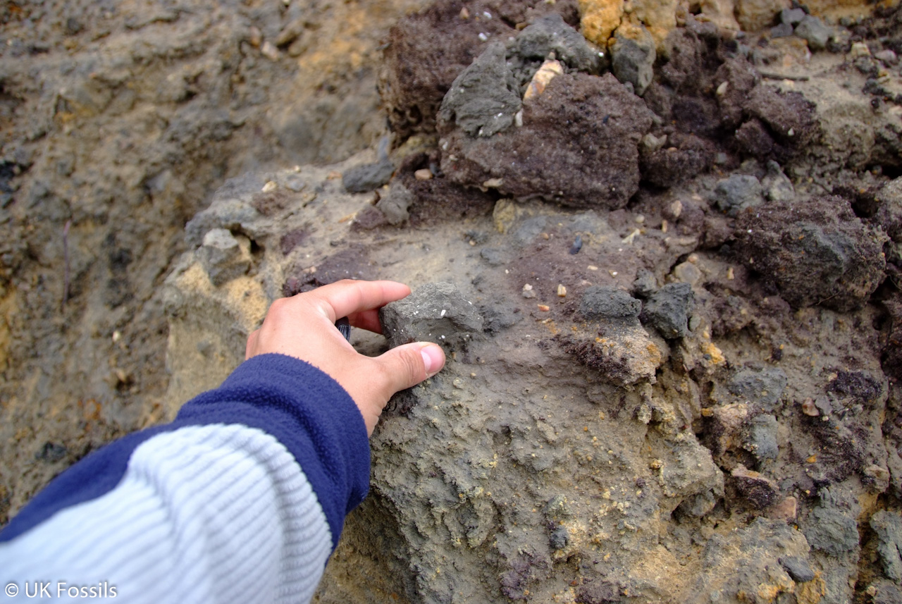
The sandy clay and glauconitic sand of the Chama horizon contain Chama squamosa and other molluscs, including turritellid gastropods. Its visibility near beach level changes with beach cover. Hard, shell-rich blocks derived from the underlying Stone Band may lie on the foreshore after transport from elsewhere along the coast or offshore; they are separate from imported sea-defence rock.
The older UK Fossils account recorded Glycymeris deleta, Crassatella tenuisulcata, Cardita oblonga, Conorbis dormitor, Hemiconus scabriculus and Pollia lavata at the Chama horizon. These are historical guide identifications; the combinations and exact specimen provenance have not all been independently confirmed.
For Bed J, the same historical account listed Pollia, Olivella, Nucula, Pitar, Potamides, Bayania and Corbicula. Independent exact coastal corroboration for that list is incomplete, so it is retained as a historical observation rather than a verified identification checklist. Inland borehole assemblages are not substitutes for coastal records.
Where shore access and collecting permission allow, inspect loose natural material without damaging the cliff or sea defences. Record the matrix and position of any find; a loose fossil alone may not establish which bed supplied it. Fragile shells in the clay-rich layers can fragment readily.


Explore how the lettered beds and changing coastal environments were distinguished around Becton.
1929–1933 – Lettered Barton beds established
Burton’s subdivisions established the lettered framework used to distinguish the Chama horizon and the overlying sandy succession. The framework applies along the Barton coast rather than exclusively at this bunny.
1987 – Survey mapping separates the upper marine formations
The Southampton memoir set out the Chama Sand and Becton Sand succession and its changing marine and brackish faunas, providing the regional framework for interpreting the coastal beds.
1991 – The coastal geological interest protected
Renotification of Highcliffe to Milford Cliffs recognised the importance of the Eocene coastal succession, including the transition through the upper Barton deposits.
GEOLOGY
The Middle–Late Eocene succession becomes sandier upwards through the Chama Sand and Becton Sand formations of the Barton Group. Above it, lignitic beds of the basal Headon Hill Formation mark a change towards freshwater and brackish conditions. Quaternary river gravels cap the eroded Eocene succession. Geological unit names use the spelling Becton, while this guide retains Beckton Bunny as its title.
In the historical lettered scheme, H is the Chama horizon; I, J and K lie in the Becton Sand Formation. Bed J is the formal Becton Bunny Member, while K is the historical Long Mead End Bed. Bed L belongs to the Totland Bay Member of the Headon Hill Formation, rather than to the Barton Group.
The lower Becton sands are commonly decalcified, so apparent scarcity of shells does not mean an originally barren sea. Burrowing and changing shoreface environments complicate the contacts. The older Stone Band, Bed G in the Barton Clay Formation, is underlying or derived context at this reach. Published coastal-composite thicknesses are not the height of a single present cliff.

Geology and stratigraphy
The Middle–Late Eocene succession around Beckton Bunny becomes sandier upwards before passing into the freshwater and brackish deposits of the Headon Hill Formation. The geological names Becton Sand and Becton Bunny use the spelling without “k”. The historical lettered beds remain useful for comparing old fossil records, but they are not all members of one formation.
Quaternary gravel cover
River gravels overlie an eroded Eocene surface and form the upper cliff cap. They are not a member of either the Barton or Solent groups.
SOLENT GROUP
Headon Hill Formation
Totland Bay Member
Bed L — basal lignitic beds
Black, organic-rich clay and crushed shells mark the change to the Headon succession. Despite its old designation “Upper Barton Bed L”, this unit belongs to the Headon Hill Formation rather than the Becton Sand Formation. Lateral variation and local palaeochannel deposits complicate the transition.
BARTON GROUP
Becton Sand Formation
Bed K — Long Mead End Bed
The upper sand-dominated interval records marginal-marine to beach/shoreface conditions. This is the historical bed name; it is not treated as a formal member here. The clean sand contrasts with the more clay-rich Becton Bunny Member below.
Becton Bunny Member
Bed J
Grey-brown, shelly, sandy clay and clayey silt interrupt the surrounding sands. Its basal break introduces another depositional cycle, though burrowing can obscure the contact. Marine and brackish molluscan associations reflect a changing coastal setting. The unit is laterally variable and impersistent inland; no inland borehole thickness is applied to the bunny.
Becton Sand Formation — below the Becton Bunny Member
Bed I — lower Becton sands, below the Becton Bunny Member
Clean, fine-grained sands represent shoreface sedimentation and are commonly decalcified in the coastal section. Burrows attributed to Ophiomorpha are documented in this interval. A lack of preserved shells does not mean the sands were deposited in a lifeless environment. The GCR’s approximately 22 m refers to the coastal Becton composite, not the visible height of this bed.
Chama Sand Formation
Bed H — Chama Bed
Clayey, silty, glauconitic fine sand and sandy clay yield Chama squamosa and other molluscs. Exposure near beach level changes with beach cover. The GCR coastal composite is about 5.5 m, while other Survey accounts use somewhat different boundaries and quote different coastal values; it is not appropriate to attach one number to every present exposure.
Barton Clay Formation
Bed G — Stone Band: underlying/derived context
The indurated shell-rich band below the Chama interval is the source of some limestone-like shell blocks. At this reach it may be below beach level, and loose blocks can be transported. Such blocks should not be confused with construction stone in the sea defences.
Nomenclature and age
This account follows the BGS Chama Sand–Becton Sand formation division, with the Becton Bunny Member within Becton Sand. An alternative published scheme combines Chama and Becton into a broader Becton Formation. The BGS Lexicon places Chama Sand in the Bartonian and Becton Sand across the Bartonian–Priabonian range; this does not locate a precise stage boundary at the bunny.
References
Daley & Balson (1999), British Tertiary Stratigraphy, GCR 15, Barton Cliffs and Studley Wood
Edwards & Freshney (1987), Geology of the country around Southampton, sheet 315 memoir
Bristow, Freshney & Penn (1991), Geology of the country around Bournemouth, sheet 329 memoir
BGS Lexicon: Becton Bunny Member
BGS Lexicon: Becton Sand Formation
BGS Lexicon: Chama Sand Formation
BGS Lexicon: Barton Clay Formation
BGS Lexicon: Headon Hill Formation
SAFETY
The cliffs are sheer, actively eroding and unstable. Stay well away from both cliff edges and toes, and never descend the chine or climb fresh slumps. Rock armour is uneven and slippery and is not a substitute access route.
The sea can approach the cliff base and cut off the beach. Check tides, waves, council notices and the whole return route; turn back if access is unclear. A past intention to reopen a route does not mean it is open today.
EQUIPMENT
A hand lens, camera, notebook, sturdy footwear and tide information are more useful than excavation tools. Optional knee pads may help when examining permitted loose material. Carry padding for fragile finds only where collecting is allowed.
CLEANING AND TREATING
Keep fragile shells supported in their surrounding matrix. Gentle dry brushing is a safer first step than soaking, splitting hard blocks or trying to extract shells from damp clay. Let stable mineral specimens dry slowly, but seek specialist advice for friable or scientifically important material. Do not routinely apply glue, varnish or acids.
IDENTIFY YOUR FINDS
Need help identifying a fossil? Share clear photos, where you found it and its size with the community.
FURTHER READING
Chapman (2021), The Barton Beds of Hampshire, Deposits Magazine
Daley & Balson (1999), British Tertiary Stratigraphy, GCR 15, Barton Cliffs and Studley Wood
Edwards & Freshney (1987), Geology of the country around Southampton, sheet 315 memoir
Bristow, Freshney & Penn (1991), Geology of the country around Bournemouth, sheet 329 memoir
BGS Lexicon: Becton Bunny Member
BGS Lexicon: Becton Sand Formation
BGS Lexicon: Chama Sand Formation
BGS Lexicon: Barton Clay Formation
BGS Lexicon: Headon Hill Formation
West, Loades & Bentley (2020), Hordle Cliff field guide
ACCESS RIGHTS
The coast lies within the Highcliffe to Milford Cliffs SSSI. Designation does not establish landownership or unrestricted collecting rights. Current closure signs and landowner requirements take precedence over historical routes. No current reopening of the Barton–Becton shore route is established here. Obtain permission before any in-situ sampling, and do not excavate cliffs or damage active sea defences.
Archived Natural England site citation. Current access and permission requirements must be checked separately.
It is important to follow our ‘Code of Conduct’ when collecting fossils or visiting any site. Please also read our ‘Terms and Conditions‘
LINKS
♦ Fossil Discussions
♦ Fossil Articles
♦ Buy Fossils, Tools and Equipment
♦ Buy Crystals, Meteorites, and Artefacts
♦ Join Fossil Hunts
♦ UK Fossils Network


