

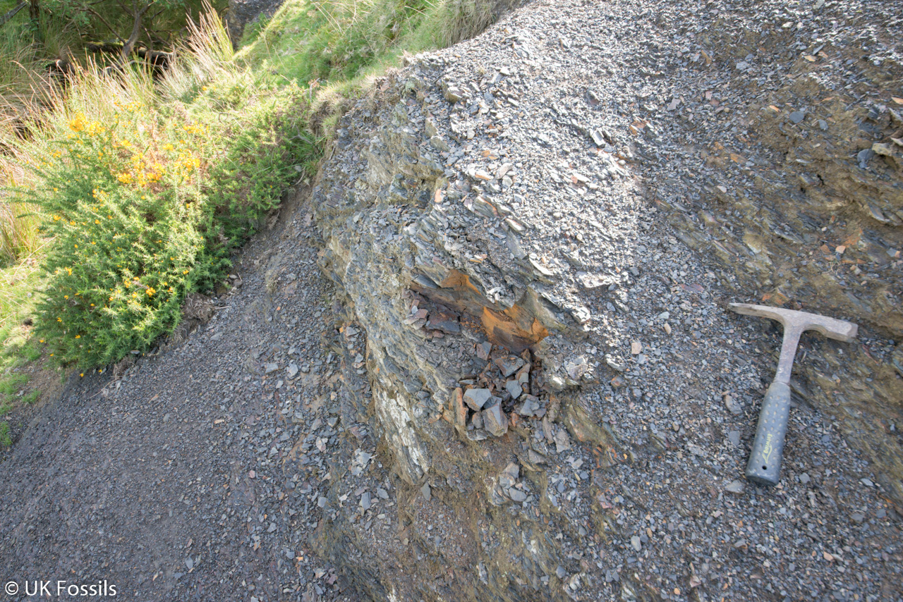
A small stream cutting near Bettws exposes Ordovician mudstone with occasional trilobite fragments and graptolites. Its dark, fissile rocks offer a close view of marine life preserved in a much older succession than many of the surrounding Silurian hills.


FIND FREQUENCY – Trilobite fragments and occasional graptolites are recorded, but finds are patchy and often incomplete.
CHILDREN – Road traffic, a steep bank and changing stream conditions make careful supervision and a safe agreed approach essential.
ACCESS – A small roadside stream exposure; access onto the bank and a lawful stopping place need checking before a visit.
TYPE – Middle Ordovician mudstone and shale in a stream cutting south of Upper Gilwern.
DIRECTIONS
♦ The original locality is the small roadside stream cutting at 52.20083, -3.33706, equivalent to approximately SO0871856686. Use this to identify the intended site rather than substituting Upper Gilwern Quarry, Bettws Mill or Howey Brook.
♦ Confirm a lawful parking place and an agreed route to the bank before visiting. Do not park on blind bends, obstruct traffic or entrances, cross fences or assume that a public road provides access to adjoining stream banks.
♦ The old guide’s turning instructions are ambiguous. Check the approach on a current map and follow the landowner’s directions rather than relying on an unverified roadside manoeuvre.
FOSSIL HUNTING
The useful surfaces are the fine bedding planes of the dark mudstone and weathered shale. The original guide records disarticulated trilobite remains and occasional graptolites, rather than a reliably abundant fauna. Inspect naturally exposed surfaces carefully with a hand lens; a small diagnostic fragment can be more informative than a larger featureless piece.
Trilobites may be represented by parts of the head shield, tail shield or individual body segments. Look for regular ribs, a curved border or a consistent segmented pattern. Broken or weathered fragments should not be assigned a species merely because that species is known elsewhere in the Builth district.
Graptolites are typically flattened impressions. A branching line with repeated small structures can be a useful clue, but mineral marks and broken plant-like streaks can be misleading. Photograph the specimen with a scale and suitable side lighting before any cleaning, preserving the fine surface on which the impression lies.
The formation contains well-studied faunas elsewhere, but those records are not an exact list for this small cutting. Bivalves from Camnant Ravine, type material from Howey Brook and exceptional fossils from other neighbouring sites must remain separate. No museum-vouchered species collection has been verified from the precise roadside point used in this guide.
If collecting has been specifically agreed, keep to the material and methods allowed by the landowner. Record the actual loose find position and remember that a stream fragment may have moved from its source bed. Retain matching halves, protect delicate films and avoid digging into or undercutting the bank to obtain fresh rock.


Significant discoveries, geological research and conservation milestones at Bettws.
2004 – District mapping establishes the mudstone framework
The district map and explanation documented the Camnant Mudstone Formation in the area of the small Bettws exposure, distinguishing the mudstone succession from separately located volcanic and tuff units.
2025 – Camnant succession placed in the Shelve Hill Group
A revised regional framework assigned Camnant Mudstone to the Shelve Hill Group and clarified its wider stratigraphic relationships. This is a nomenclatural milestone rather than a new fossil discovery at the roadside cutting.
GEOLOGY
The original guide reference lies on the Camnant Mudstone Formation in current BGS mapping. These are Middle Ordovician rocks, broadly Darriwilian and described regionally as Abereiddian. The 2025 framework assigns the formation to the Shelve Hill Group; older map metadata does not yet give that group assignment.
Dark grey mudstone accumulated in comparatively quiet offshore water, commonly with oxygen-poor conditions near the sea floor. Weathering breaks it into fragile shale. Regionally, thin micaceous fine sandstone beds record occasional sediment flows into this quieter environment, while volcanic ash also entered parts of the basin.
The formation includes named tuff units elsewhere, but the Bettws roadside cutting has not been matched securely to one of those beds. Bettws Mill Tuff and Gelli Tuff exposures described in the district literature are separate places, despite the tempting similarity of the name Bettws. A regional formation thickness approaching a kilometre must not be presented as the thickness seen in this small stream bank.
The regional formation crosses the artus–murchisoni graptolite biozonal boundary. The precise position of this exposure within those zones remains uncertain. The surrounding Silurian rocks are not universally unfossiliferous; they simply belong to a different geological succession and are outside this guide’s small locality.

The mapped Camnant Mudstone, its regional framework and the limits of the small Bettws stream exposure.
SHELVE HILL GROUP
The 2025 stratigraphical framework assigns Camnant Mudstone to the Shelve Hill Group within the Preseli Supergroup. This is an updated regional classification; older mapping and Lexicon metadata omit a parent group. It does not represent a new bed exposed at Bettws, and the formation should not be placed in the overlying Builth Volcanic Group.
Camnant Mudstone Formation
BGS 1:50 000 mapping identifies Camnant Mudstone at the original guide point, SO0871856686. The unit is Middle Ordovician, broadly Darriwilian and regionally Abereiddian. ‘Camnant Mudstones’ is the plural form used in some report descriptions; it does not denote a separate formation.
Mudstone and weathered shale. The regional lithology is dark grey mudstone, locally with thin micaceous fine sandstone. Quiet offshore deposition below storm-wave base, commonly with oxygen-poor bottom water, helps explain the fine sediment and preservation of flattened fossils. Thin regional sand beds are interpreted as density-flow deposits. The small roadside cutting exposes only a restricted interval, not a complete regional succession.
Local fossils and age limits. The original field account records trilobite fragments and occasional graptolites. Species-level vouchers and an independently established roadside biozone have not been verified. The formation spans the artus–murchisoni boundary regionally, so its name alone cannot prove the old guide’s precise artus assignment. The historical zonal name Didymograptus artus refers to a stratigraphic interval; it does not identify every graptolite photographed at the site.
Regional thickness and basal contact. The district explanation gives up to about 915 m for the formation, with its base unexposed, while the summary table uses 900 m or more. The referenced Camnant Brook section extends from SO08885771 to SO09595560. Neither value is a thickness measured at the guide’s road cutting.
Tuff members belong to separate exposures. The formation includes unnamed tuffs and named Bettws Mill and Gelli tuff units. The Bettws Mill descriptions concern outcrops kilometres east of this guide, including sharp-based, planar, cross-bedded and graded lapilli tuff. The Gelli figure at SO09625577 shows silty mudstone, amalgamated tuff turbidites and debris flows with rhyolitic clasts. These source logs do not establish a named member at the Bettws roadside point, so no member bar or transferred bed thickness is used here.
Nearby faunas kept separate. The Rhayader memoir’s graptolite records at Nant, the northern Ithon and Camnant Brook concern separately located sections. Camnant Ravine bivalve studies, Howey Brook type material and Little Wern exceptional fossils also have different provenances. Historical revisions involving Cryptolithus gibbosus and Bettonolithus chamberlaini are not identifications of the original Bettws photographs.
Section limits. No exact numbered roadside bed log was found in the checked sources. Nearby dolerite, baked contacts and the overlying volcanic formations are not inserted as a complete local column. The regional correlation evidence does not establish a measured local succession.
References. Schofield and colleagues (2004), Geology of the Hay-on-Wye district, BGS Sheet 197 explanation, Ordovician section and figures 1–2; Davies and colleagues (1997), Geology of the country around Rhayader, BGS memoir, Builth biostratigraphy and Camnant descriptions; Davies (2025), BGS OR/25/018, section 2.1.2 and Camnant entry; BGS Lexicon, Camnant Mudstone Formation; BGS Geology 50k map query at the original guide point, dataset version 9.25.
SAFETY
Assess the road and bank before approaching. Traffic, slippery steep ground, loose mudstone and an uneven stream bed can all be hazardous. Do not work beneath an undercut bank or where stones could fall onto the road.
Avoid high or rising water and visits during heavy rain or an adverse forecast; stream levels can change outside winter as well. Carry suitable clothing and a charged phone, tell someone your route and do not rely on shallow water as proof of safety.
EQUIPMENT
Take a hand lens, camera, scale, notebook and sturdy footwear. Small rigid boxes with soft padding protect fragile shale better than loose wrapping in a bag.
Where the landowner specifically allows splitting of loose rock, use appropriate geological tools and eye protection, well clear of others. Make minimal controlled splits along bedding. Wood chisels, files and indiscriminate breaking of every thick piece are unsuitable recommendations.
CLEANING AND TREATING
Weathered mudstone and graptolite films can be damaged by soaking, scrubbing or repeated handling. Support specimens, let damp pieces dry gradually and begin with a very gentle dry brush only on sound surfaces.
Keep diagnostic trilobite parts, matching halves and matrix together with the field label. Avoid acids, varnish and aggressive preparation. Seek expert identification before removing rock from a potentially significant specimen.
IDENTIFY YOUR FINDS
Need help identifying a fossil? Share clear photos, where you found it and its size with the community.
FURTHER READING
BGS: Geology of the Hay-on-Wye district
BGS: Camnant Mudstone Formation
BGS: Geology of the country around Rhayader
BGS: revised Lower Palaeozoic stratigraphical framework
ACCESS RIGHTS
Check with the landowner before entering the stream bank or collecting. A public road beside the cutting does not give a right to descend onto adjoining land or remove fossils. Parking rights and present collecting conditions have not been established.
Collect only where the landowner has allowed it and keep to loose material within the agreed limits. Do not dig into or undercut the banks. If permission is not available, do not enter the bank or take material merely because the exposure is beside the road.
It is important to follow our ‘Code of Conduct’ when collecting fossils or visiting any site. Please also read our ‘Terms and Conditions‘
Updated 2017, Edited by Jon Trevelyan 2013
LINKS
♦ Fossil Discussions
♦ Fossil Articles
♦ Buy Fossils, Tools and Equipment
♦ Buy Crystals, Meteorites, and Artefacts
♦ Join Fossil Hunts
♦ UK Fossils Network


