

Cwm Craig Ddu’s roadside siltstones preserve small marine shells and rare fragments of early land plants. This Silurian quarry near Garth is important for understanding plants that grew on land while their remains were carried into a neighbouring sea.


FIND FREQUENCY: ♦♦♦ – Small shells were recorded in the roadside cutting; the scientifically important plant fragments are rare and the old quarry is partly overgrown.
CHILDREN: ♦♦ – The roadside setting is unsuitable for young children; fast traffic and uneven slopes require particular care.
ACCESS – The cutting is beside the B4519 cattle grid. Keep the road, grid and livestock gate clear.
TYPE – Silurian siltstone cutting and old quarry, with marine fossils and rare carbonaceous plant remains.
DIRECTIONS
♦ From Llangammarch Wells, join the A483 towards Garth, then take the B4519 south. Cross the river, continue through the crossroads and round the sharp bend to the cattle grid beside the roadside rocks.
♦ The cutting lies immediately beyond the cattle grid. The roadside space described in the original guide is not an official car park: stop only where lawful and safe, without obstructing the carriageway, cattle grid or livestock gate. Do not rely on being able to move a vehicle only after livestock arrive.
♦ Original locality reference: SN962475; 52.115618, -3.517352. This identifies the quarry area, not a reserved parking place.
FOSSIL HUNTING
Examine the fine siltstone surfaces with a hand lens. The original site account distinguished small shell-bearing material in the lower roadside cutting from the rarer plant-bearing beds of the older quarry higher on the slope. Vegetation and weathering change what is visible; those observations do not guarantee fresh exposures today.
Small bivalves are the most useful starting point. Look for curved shell margins and repeated fine ornament rather than an isolated pale mark. The documented marine assemblage also includes rhynchonellid brachiopods, bryozoans, nautiloids and rare graptolites. These groups describe the recorded fauna, rather than a promise that each will be readily recognisable in loose fragments.
The plant remains are usually tiny, dark compressions. Straight or branching axes may be only millimetres long; most lack the reproductive structures needed for a close identification. Sterile axes have been recorded as Hostinella sp. and should not all be called Cooksonia. Rare fertile material has been described as Cooksonia pertoni, Cooksonia sp. and material compared with C. cambrensis, with some species distinctions uncertain.
A terminal swelling or branching pattern is more informative than a featureless carbonaceous streak. Photograph possible plant remains with a scale and oblique light, recording the precise surface and whether it is in place or loose. Do not scratch the film to test it. A fertile plant fragment may be scientifically valuable even when it looks less conspicuous than a shell.
Keep observations tied to the roadside quarry, rather than assuming every historical specimen labelled Cwm Craig Ddu came from this small exposure. If authorised collecting produces matching halves, keep the part and counterpart together and retain their field label. Leave promising in-situ surfaces undisturbed and seek specialist advice about exceptional material.


Significant discoveries, geological research and conservation milestones at Cwm Craig Ddu.
1953 – Early plant remains reported
Straw’s published account recorded plant remains from Cwm Craig Ddu, establishing an early scientific record of the quarry’s palaeobotanical interest. The publication appeared in 1953 in a volume dated for 1952.
1973 – Further plants recovered during a geological visit
A Geologists’ Association meeting yielded further plant material, contributing to the small collection subsequently studied in detail.
1979 – Plant morphology examined in detail
Edwards, Bassett and Rogerson described the rare coalified axes and fertile specimens, assessing their relationship to early land plants. Their study distinguished morphological evidence from the absence of demonstrated isolated tracheids.
1980–1983 – Quarry protected for its scientific interest
The site was designated in 1980 and its notification revised in 1983, recognising the scientific value of the early land-plant exposure.
1995 – Palaeobotanical importance synthesised
The national geological conservation account reviewed the quarry’s plant material, marine setting and competing biostratigraphic age indications, establishing its place among important British palaeobotanical sites.
2024 – Zircon study adds an age constraint
A study of detrital zircon from the locality proposed a maximum depositional age of 423 ± 3 million years. The result constrains the age of deposition rather than directly dating a plant specimen.
2025 – Regional stratigraphic framework revised
A revised Lower Palaeozoic framework placed the succession in the Epynt Group and Knucklas Castle Formation, replacing the earlier Cwm Graig ddu Formation terminology while identifying the need for map revision.
GEOLOGY
These rocks record a marine environment receiving fine sand, silt and occasional plant debris from the land. The plants did not grow on the sea floor beside the shells: fragments were transported into the marine basin and compressed into thin carbonaceous films. That combination makes the quarry valuable for studying early land vegetation without making every dark fragment identifiable.
The exposure has traditionally been described as the Pterinea Beds in the basal part of the Wilsonia Shales. Later mapping used Cwm Graig ddu Formation, while the 2025 regional framework places the corresponding succession in the Knucklas Castle Formation of the Epynt Group. These names reflect successive classifications of the rocks, rather than three separate formations stacked in this small quarry.
The broader succession coarsens upwards through mudstone, siltstone and fine sandstone, recording changes in sediment supply on a marine slope. Local transport and disturbance helped mix land-derived material with marine remains. The quarry does not expose the complete regional thickness, and adjacent formations shown on regional diagrams must not be treated as a measured local section.
Biostratigraphic studies place the plant-bearing rocks in the Gorstian part of the Ludlow Series, although different fossil groups have suggested somewhat different positions within that stage. A later zircon study proposed a maximum depositional age of 423 ± 3 million years. This dates the limit provided by transported mineral grains, not the exact age of a plant, and does not remove the published uncertainties.

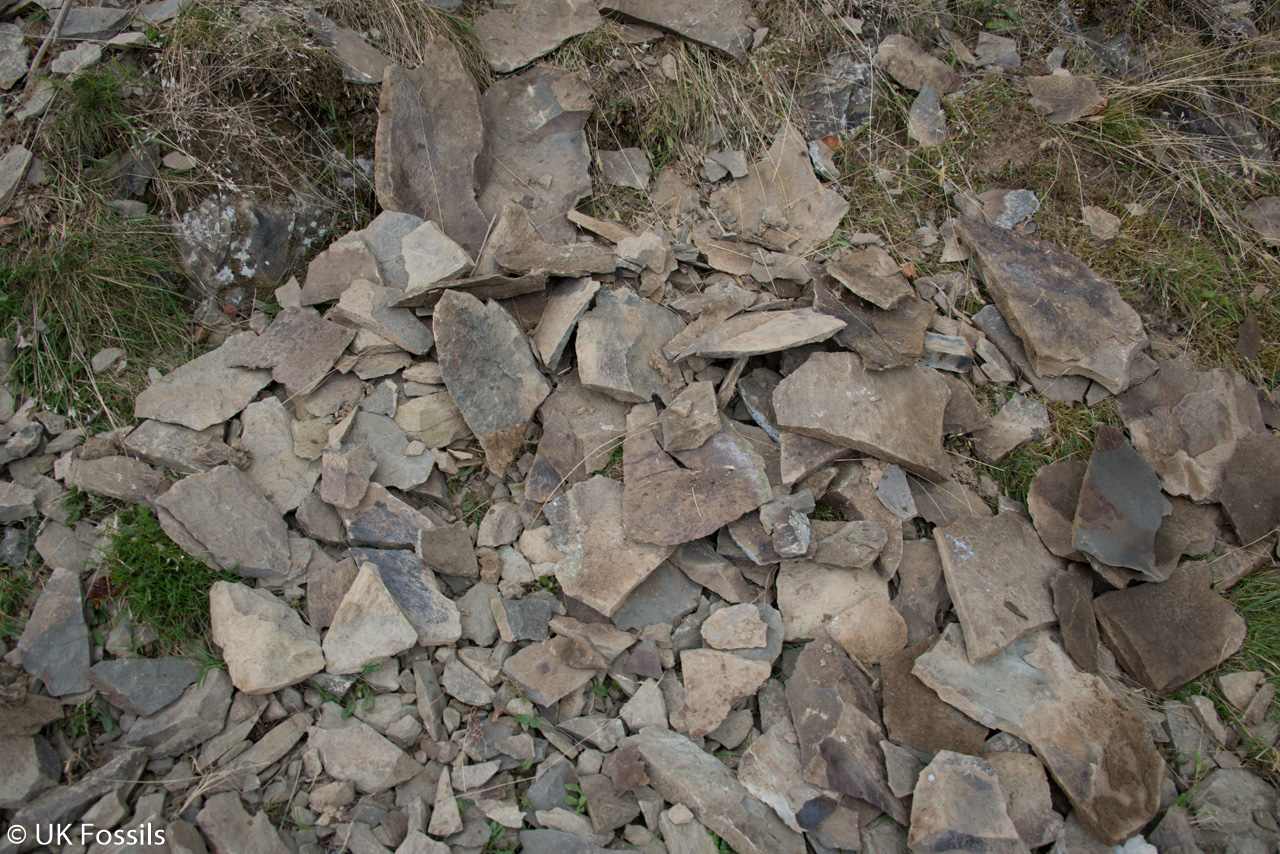
The marine siltstones, historical Pterinea Beds and early plant record at Cwm Craig Ddu Quarry.
EPYNT GROUP
The 2025 regional framework places this succession in the Epynt Group. It recommends revised lithostratigraphic names while recognising the need for targeted map revision; it is not evidence that every older mapped boundary has already been resurveyed.
Knucklas Castle Formation
The name Knucklas Castle Formation replaces Cwm Graig ddu Formation in the revised framework. Older Builth Wells mapping describes a coarsening-upward succession of weakly burrowed mudstone, siltstone and fine sandstone above the Irfon Formation and below the Aberedw Formation. Those bounding units are regional context, not demonstrated beds of the small quarry section. The mapped formation’s regional thickness of 230–580 m is not the height or thickness exposed here.
Historical Pterinea Beds and Wilsonia Shales terminology. The fossil-bearing quarry beds were described as Pterinea Beds within the basal Wilsonia Shales. These are useful historical exposure names; they are not additional modern formations or a securely correlated modern member. No Fibua, Cam-rhiw or Cwm-yr-hob member assignment is established for this precise exposure.
Fine-grained marine beds. Micaceous flaggy siltstone and darker siltstone contain marine shells and transported plant compressions. The published interpretation places deposition on a marine palaeoslope, with changing sand supply and local sediment disturbance. The documented fauna includes rhynchonellid brachiopods, bryozoans, nautiloids, bivalves and rare graptolites. The lower roadside shell-bearing cutting and higher plant-bearing quarry are historical field observations, not a newly verified map of productive surfaces.
Early land-plant material. The rare coalified fragments are commonly millimetric. Published identifications include sterile Hostinella sp. axes, Cooksonia pertoni, Cooksonia sp. and material compared with C. cambrensis. The species distinctions in the sparse fertile material are not all secure. Three fertile specimens included one part and counterpart; these are not four independent finds. The figured specimen NMW79.17G3 is a documented voucher, not a newly designated holotype.
Preservation and anatomical limits. Branching axes and terminal sporangia provide morphological evidence for early land plants, but isolated tracheids were not demonstrated in the material studied. The quarry therefore should not be described as proving microscopic vascular tissue in every specimen. Sterile fragments cannot all be identified as Cooksonia, and a present-day ‘oldest in the world’ or ‘oldest in Britain’ claim is not justified by this record.
Age evidence. The traditional age is Gorstian, in the Ludlow Series. Graptolites have suggested a late-Gorstian position whereas acritarchs indicated a mid-Gorstian age. The 2024 detrital-zircon study proposed a maximum depositional age of 423 ± 3 Ma from sample 19CGD02. A maximum depositional age is a constraint derived from transported grains, not an exact plant age. Analytical sensitivity and the paper’s differing Gorstian/Ludfordian discussion prevent replacing the biostratigraphy with an unqualified numerical date.
Section limits. The reviewed locality account does not supply a numbered measured-bed log. Regional architecture diagrams and broad historical Pterinea/Lingula intervals cannot be converted into quarry bed thicknesses. These regional and historical intervals do not establish a numerical succession through the present small quarry. The modern geological sample point also must not replace the original visitor reference.
References. Cleal, C. J. and Thomas, B. A. (1995), Palaeozoic Palaeobotany of Great Britain, Geological Conservation Review 9, Cwm Craig Ddu Quarry, pp. 38–39; Edwards, D., Bassett, M. G. and Rogerson, E. C. W. (1979), Lethaia 12, pp. 313–324; Schofield and colleagues (2004), BGS Sheet 196, Geology of the Builth Wells district; Garza and colleagues (2024), Detrital U–Pb ages for the first well-preserved vascular plant Cooksonia from the UK and Irish macrofossil record, Geological Magazine; Davies (2025), BGS OR/25/018, section 4.2.4, Text Box 15 and figures 21–22.
SAFETY
The B4519 is the principal immediate hazard. Stay out of the carriageway, keep clear of moving traffic and never allow stones or equipment to fall onto the road. Do not work where attention to a fossil prevents watching the traffic.
The quarry slopes are uneven, vegetated and locally steep, with loose rock and concealed footing. Keep away from unstable faces, supervise any older children closely and leave livestock routes unobstructed.
EQUIPMENT
Take a hand lens, camera, scale and notebook, with sturdy footwear for the rough slope. Observation and photography need no hammer. Tools are appropriate only for work expressly authorised by the landowner and any relevant conservation consent.
CLEANING AND TREATING
Fragile plant films can be lost through rubbing, washing or scraping. Support any lawfully obtained specimen, wrap it individually and retain both halves of a split. Let damp material dry gradually; begin with a very soft dry brush only where the surface is sound.
Avoid acids, wire brushes, improvised film pulls and adhesive across a fossil surface. Do not attempt to expose a suspected fertile plant by breaking away more rock. Photograph it and seek museum or specialist advice before preparation.
IDENTIFY YOUR FINDS
Need help identifying a fossil? Share clear photos, where you found it and its size with the community.
FURTHER READING
Geological Conservation Review: Cwm Craig Ddu Quarry
BGS: Geology of the Builth Wells district
BGS: revised Lower Palaeozoic stratigraphical framework
The 1979 study of the quarry’s plant remains
ACCESS RIGHTS
Cwm Craig Ddu Quarry is a geological SSSI on registered common land, and the site management statement supports public access. Follow current signs and use safe, lawful stopping places. Public access does not itself grant permission to remove specimens or disturb the rocks.
Ask the landowner or relevant rights-holder before collecting, and check any agreement required from Natural Resources Wales for work affecting the protected exposure. The list of potentially damaging operations is a consent framework, not a blanket statement that all collecting is prohibited or that loose rock may freely be hammered. Leave the rock faces and plant-bearing surfaces undamaged.
It is important to follow our ‘Code of Conduct’ when collecting fossils or visiting any site. Please also read our ‘Terms and Conditions‘
Updated 2017, Edited by Jon Trevelyan 2014
LINKS
♦ Fossil Discussions
♦ Fossil Articles
♦ Buy Fossils, Tools and Equipment
♦ Buy Crystals, Meteorites, and Artefacts
♦ Join Fossil Hunts
♦ UK Fossils Network


