

Overview
Directions
- Approach Easington village and follow Seaside Road to the council-listed coastal access, HU12 0TY. The council’s Easington coastline page lists free parking for 30 cars. Follow current signs and keep the access clear.
- Beach access is by a narrow road and a muddy slope used by fishermen. The council warns that erosion means access cannot always be guaranteed; inspect the descent and return route before going down.
- Do not use gas-terminal service roads or cross restricted land. If the public slope is unsafe or closed, abandon the descent rather than climb down elsewhere.
- Ref: TA 40794 18745
Location photographs
Swipe to browse · Select a photograph to enlarge


Fossil Hunting
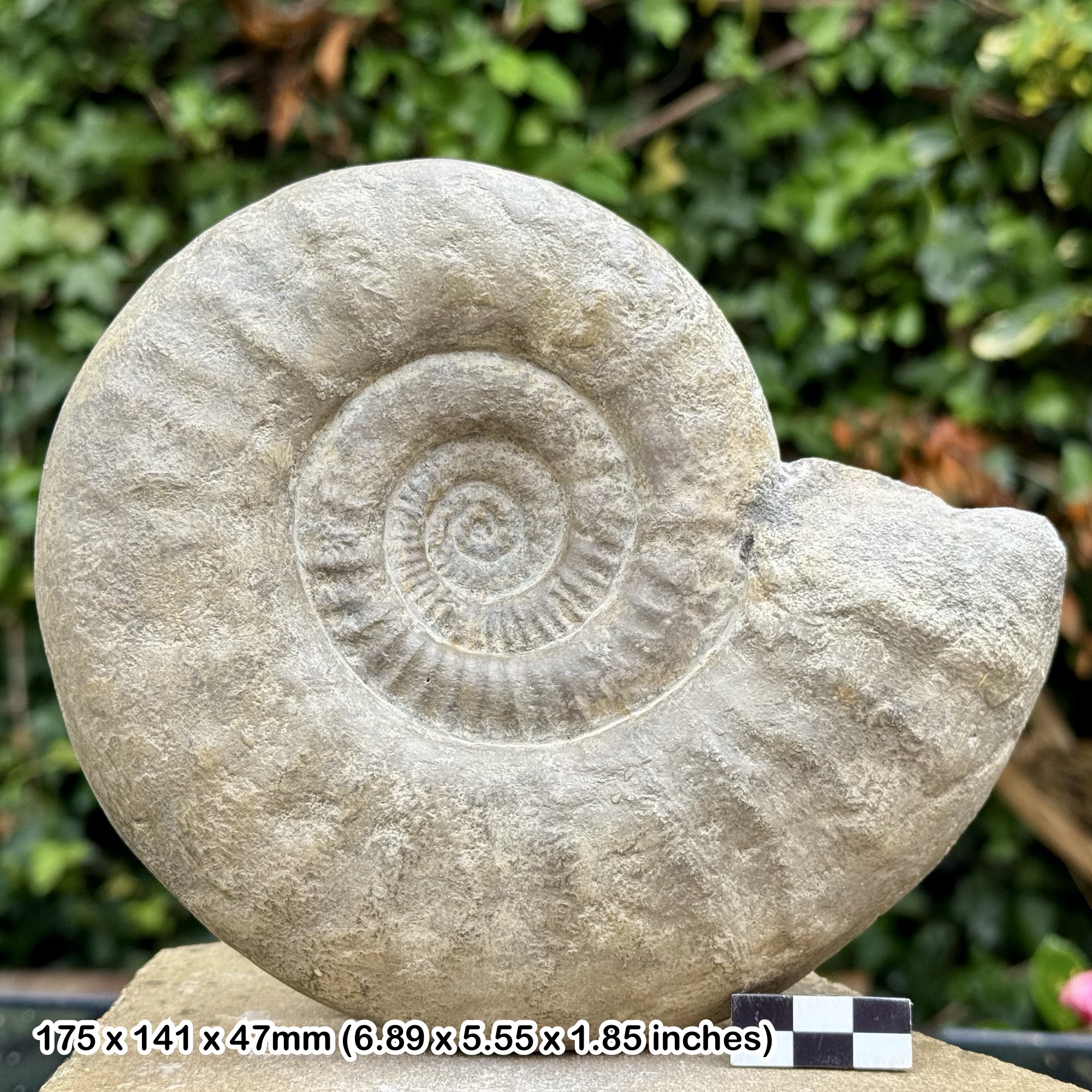
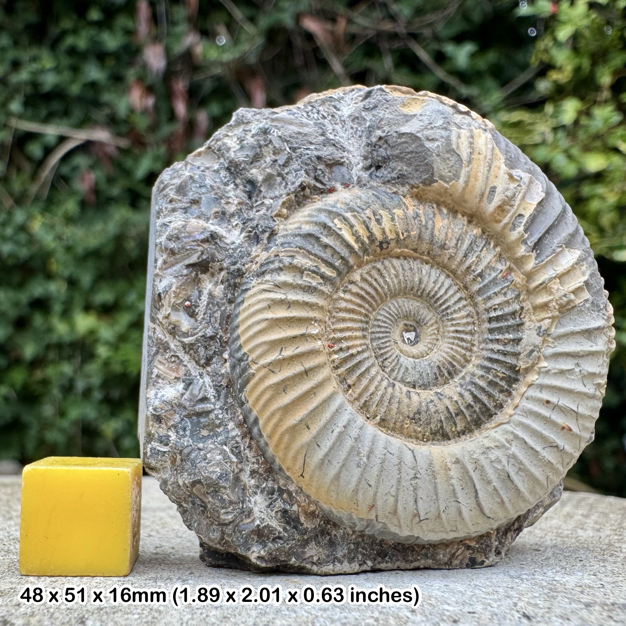
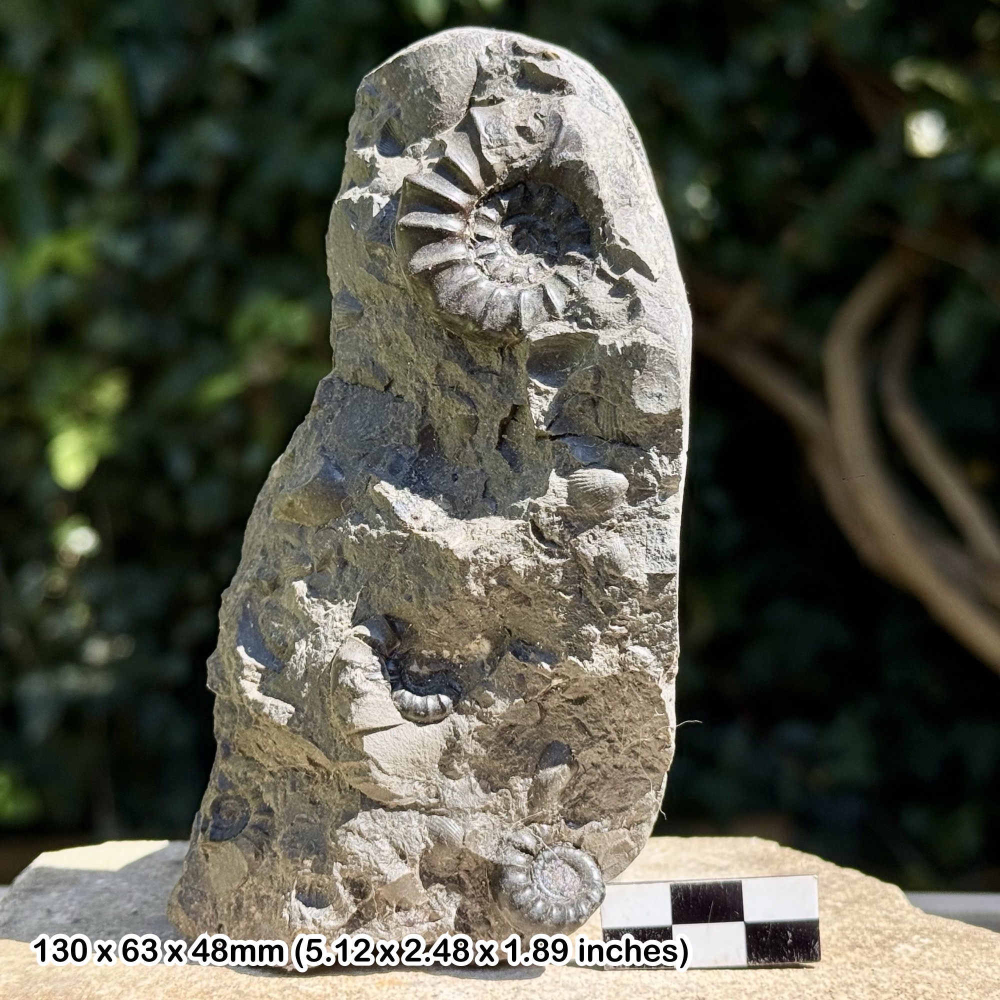
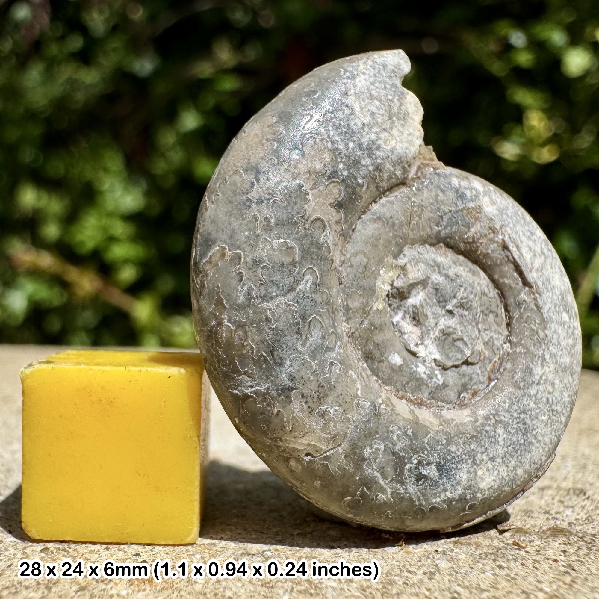
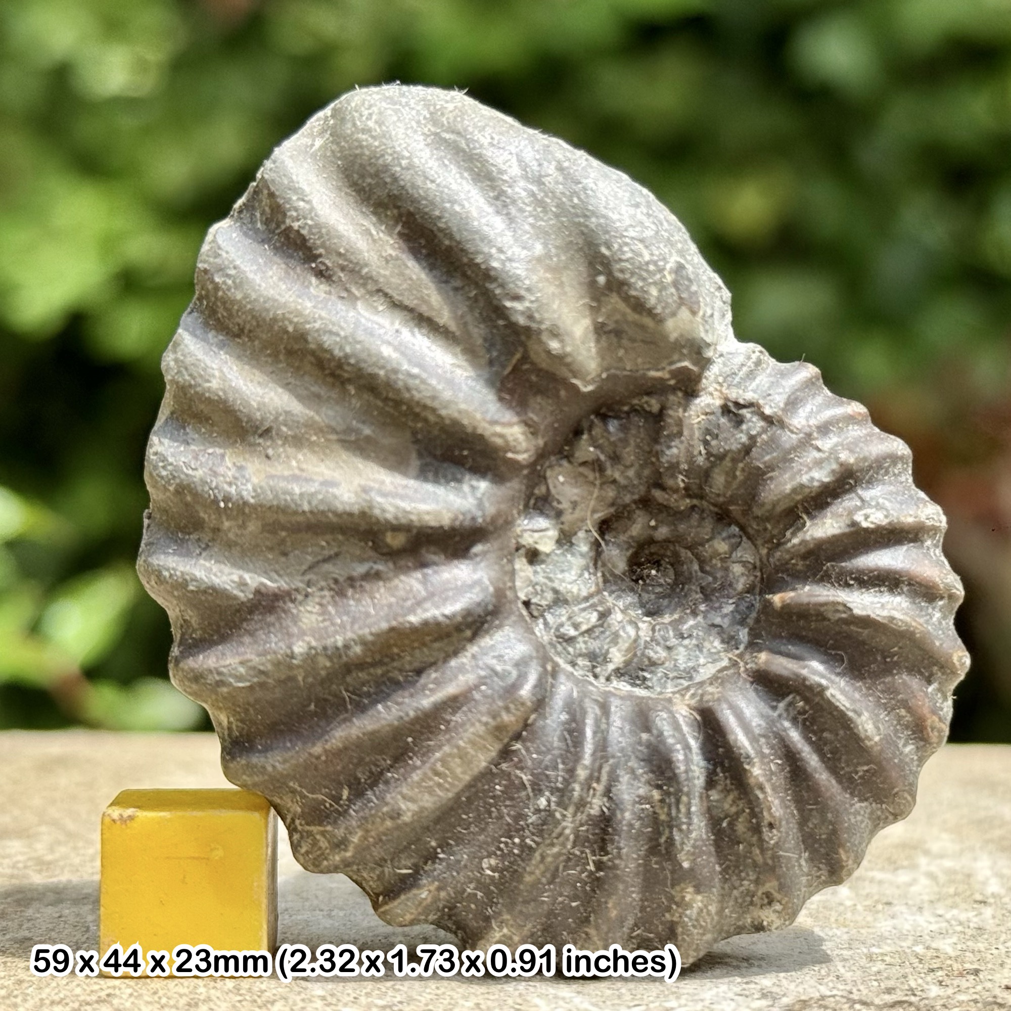
Search loose stones on the accessible open beach, keeping away from the cliff foot, terminal defences and soft mud. Recorded erratics include Gryphaea in limestone, Carboniferous corals identified as Lithostrotion, crinoidal limestone and Lower Jurassic ammonite material. Fossils can be worn or concealed within a rounded block.
Shelly till has also been recorded on the foreshore north of Seaside Road, with broken Arctica islandica and other marine shells. These shells require different interpretation from a Jurassic ammonite in an erratic limestone: they relate to marine sediment incorporated into the Quaternary deposits. A shell found on the beach is not automatically a fossil, so retain its matrix and context.
Take only modest loose finds where allowed. Do not dig out a foreshore section or prize material from an intact exposure. Photograph any unusual bone, tooth or tusk and seek specialist advice before cleaning; historical mammoth remains have been recorded at Easington.
Fossil photographs
Swipe to browse · Select a photograph to enlarge


Discoveries and milestones
Significant discoveries and geological milestones at Easington.
1900 – Erratic composition compared
John Walker Stather included Easington in his comparison of boulder types along the Holderness coast, documenting its varied transported material.
1905–1906 – Mammoth tusk fragments reported
Two tusk fragments found at Easington in November and December 1905 were reported by J. Wilkinson in January 1906. Thomas Sheppard examined them and considered both to be from the same mammoth tusk.
1985–1988 – Basement Till investigated by boreholes
Boreholes drilled at Easington in July 1985 were described by J. A. Catt and P. G. N. Digby in 1988. They provided subsurface evidence for the thickness and composition of Basement Till beyond the small portion exposed on the shore.
1988 – Laminated silts observed on the foreshore
Gently folded laminated silts were recorded on Basement Till north of Easington and interpreted as local representatives of the Dimlington Silts. Such exposures are temporary and need not be visible on a later visit.
2018 – New material collected for dating research
Graham Kings and Rodger Connell collected a block of Basement Till from Easington foreshore for luminescence investigation. The published project report described sampling, not a completed age determination.
Geology
Easington exposes a glacial landscape developed above buried Chalk. The Holderness Formation includes the Late Devensian Skipsea and Withernsea tills and associated waterlaid sediments. A local sand-and-gravel channel is recorded near Easington, so the sequence is not simply uniform clay.
Older-looking shelly Basement Till is intermittently visible on the foreshore. Its age and relationship to the later glacial deposits have been debated, and its name should not be treated as a precise age determination. Local laminated silts interpreted as Dimlington Silts were recorded above it north of Easington in 1988; their appearance today depends on the constantly changing shore.
Detailed geology and bed-by-bed succession
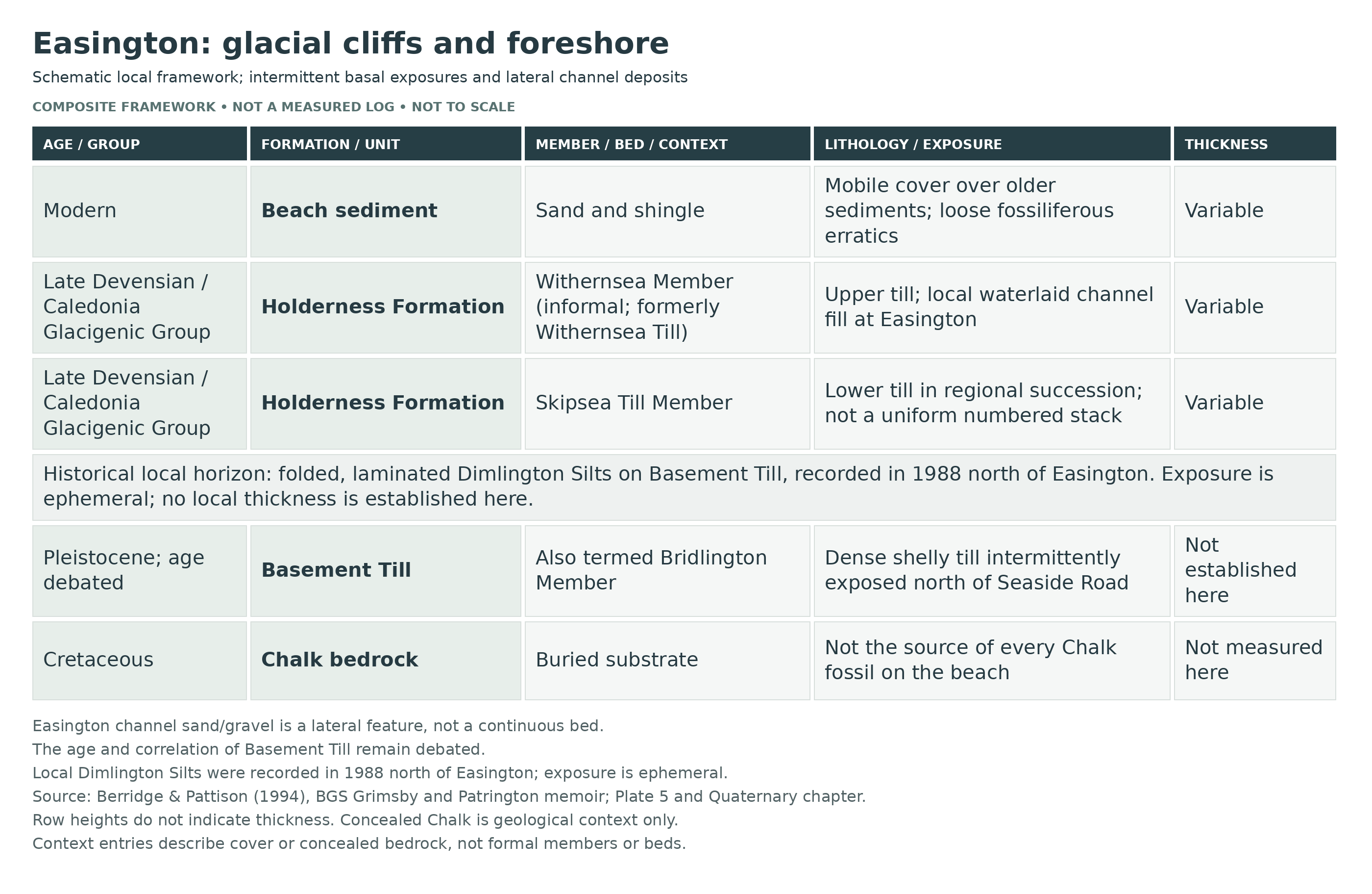
Detailed geology and stratigraphy of Easington.
The framework below distinguishes the glacial deposits from younger surface material and older fossils carried within them. Exposure varies as beach sediment and landslips move.
CALEDONIA GLACIGENIC GROUP
NORTH SEA COAST GLACIGENIC SUBGROUP
Holderness Formation
These are the regional formal units for the Late Devensian glacial succession. Historical till names and local research subdivisions are explained below; a colour change alone does not prove a separate ice advance.
Skipsea Till Member
The former Drab Till is the lower widespread Late Devensian till. Within the Easington coastal tract it is associated with waterlaid sand, gravel, silt and clay; no numbered bed sequence is imposed without an exact measured section.
Withernsea Member — informal member name
The former Purple Till or Withernsea Till forms the upper part of the regional succession. Sand-and-gravel partings complicate its internal structure, and weathering can obscure its distinction from neighbouring till.
Till lithology and weathering
Skipsea Till is comparatively variable and stony, with chalk fragments in a sandy to silty clay matrix. Withernsea Till is generally less stony and more silty; it weathers to reddish brown. Thin sand and gravel partings interrupt the clay. These contrasts are regional guides, not infallible tests for identifying every exposure.
Easington waterlaid channel
Sand and gravel at TA 405 193 occupy a local drainage-channel feature associated with the Withernsea Till. It is a lateral body, not a continuous bed that can be drawn uniformly across the locality.
Dimlington Silts — historical local exposure
In 1988, folded laminated silt was exposed on Basement Till at TA 4037 1970 and TA 4046 1959, north of Easington. It was interpreted as a local occurrence of the Dimlington Silts. Neither an exact local thickness nor present visibility is assumed.
Basement Till — age and formal placement debated
Dark olive-grey, gritty, chalk-bearing clay with a chaotic or contorted fabric and shelly inclusions is recorded on Easington foreshore and is also called the Bridlington Member in revised regional schemes. Its age remains disputed, so it is separated here from any firm Late Devensian assignment. Boreholes proved at least 30 m, but that is a buried thickness, not an exposed cliff height.
Shelly inclusions and reworking
Marine shells occur in the basal deposits and can be broken or incorporated from older marine sediment. Such material is different from both living beach shells and much older fossils in limestone erratics; collection context is essential.
Modern cover and conservation of the section
Sand and shingle move across the foreshore, hiding and revealing the older units. A photograph of an exposed contact is valuable; excavation of an intact section is not needed to appreciate its geology.
References
Berridge and Pattison (1994), Grimsby and Patrington memoir
Connell and colleagues (2021), Bisat Research Group report
East Riding Boulder Committee 2011–2021
BGS superficial-deposit framework, RR/10/03
Safety
Check the tide and sea conditions before setting out, and keep enough time and open beach for your return. Water can reach the cliff foot and cut off a route even when a distant tide prediction appears favourable. Never attempt to escape by climbing the clay cliffs.
Stay well clear of cliff faces, overhangs and the edge above. Rain-soaked till can slide without warning; fresh falls and soft mud are not safe collecting platforms. Wear grippy footwear, supervise children closely and turn back if the route is narrowing. For a coastal emergency call 999 and ask for the Coastguard.
Equipment
Take sturdy grippy footwear, tide information, a charged phone, a hand lens, a small soft brush, wrapping and rigid specimen boxes. Photograph each useful find and record the beach locality and date.
Loose surface finds are the priority. Do not dig into unstable till or disturb a standing section. If a permitted loose block genuinely needs splitting, use eye protection and keep other people clear; never strike sea defences, suspicious objects or a fossil-bearing surface blindly.
Cleaning And Treating
Begin with a soft brush and preserve the surrounding matrix. Robust limestone or flint specimens can be briefly rinsed in fresh water to remove salt and clay, but test a small area first and stop if the surface softens or flakes. Do not soak shale, pyrite, fragile shells or carbonised plant material.
Allow stable specimens to dry slowly at room temperature. Keep pyritic fossils dry and inspect them for cracking or powdery decay. Avoid acids, bleach and household varnish. If a fossil is crumbly, large or scientifically unusual, leave it unprepared and seek specialist conservation advice.
Identify Your Finds
Need help identifying a fossil? Share clear photos, where you found it and its size with the community.
Further Reading
Deposits Magazine: a fossil hunter’s guide to the Yorkshire coast (regional background)
BGS: Grimsby and Patrington geology, including Easington
Bisat Research Group: Easington sampling and Holderness stratigraphy
East Riding Boulder Committee: Easington erratics and shelly till
Council: Easington coastline access
Access Rights
Use only the public coastal access and respect restrictions around the gas terminal. The protected lagoons and dunes south towards Spurn are sensitive wildlife habitat: keep to permitted routes, observe seasonal signs and do not disturb nesting birds. They are not an alternative collecting area or a shortcut around a closure.
Do not assume that public access grants permission to excavate scientific exposures. Prefer loose beach finds and leave intact shelly till, laminated sediment and standing cliff sections undamaged. The separate Dimlington Cliff protected site should not be treated as unrestricted simply because it lies along the same coast.
It is important to follow our ‘Code of Conduct’ when collecting fossils or visiting any site. Please also read our ‘Terms and Conditions’.
Links
♦ Fossil Discussions
♦ Fossil Articles
♦ Buy Fossils, Tools and Equipment
♦ Buy Crystals, Meteorites, and Artefacts
♦ Join Fossil Hunts
♦ UK Fossils Network


