
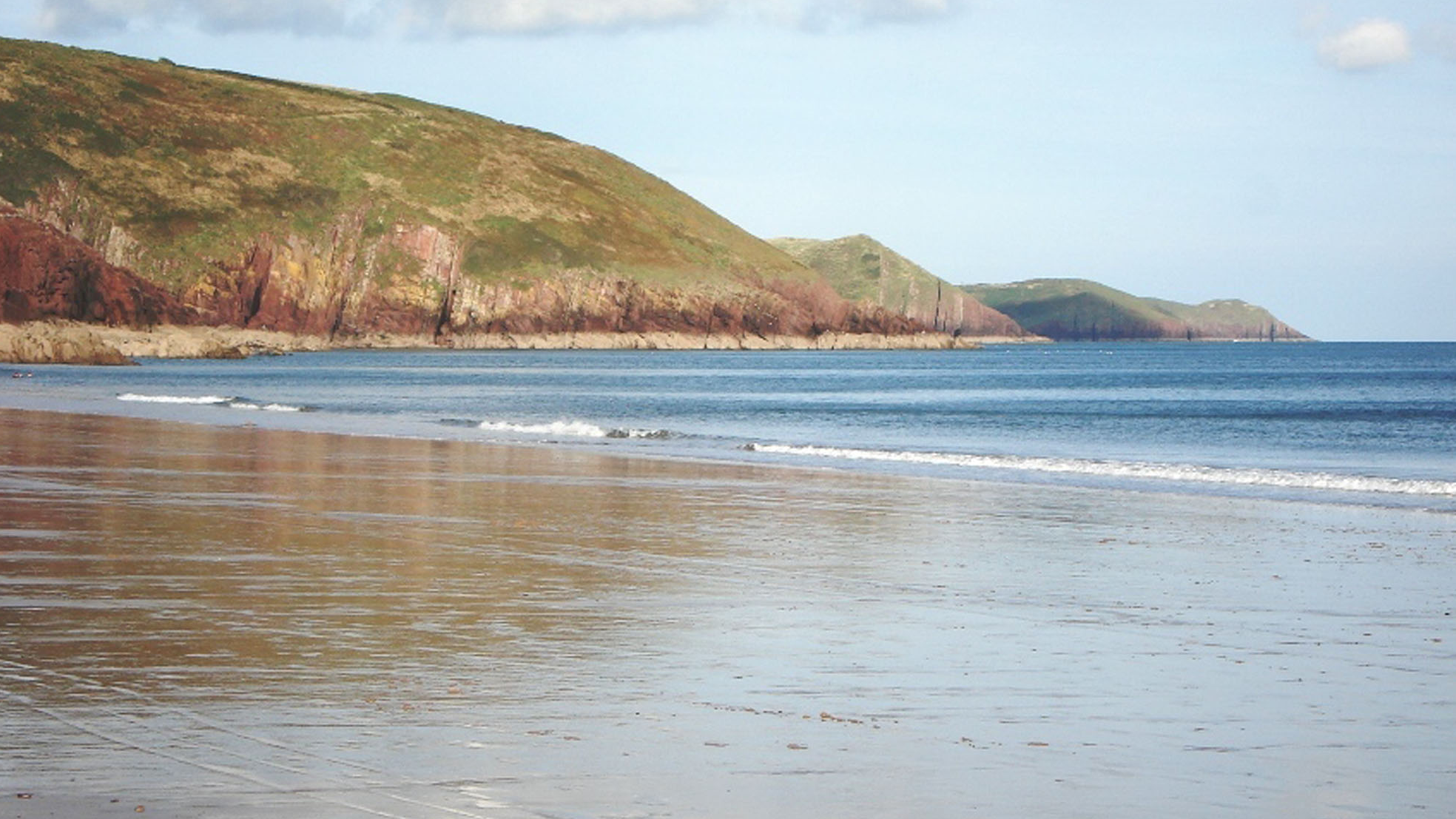
Overview
FIND FREQUENCY – Occasional fossils in suitable exposures and loose material; important plant and trace records require careful identification.
CHILDREN – The main beach is suitable for a supervised family visit. Keep children away from cliffs, rockfalls, deep channels and rough rocky margins.
ACCESS – A car park and toilets serve the beach. Soft sand, tides and uneven rocks limit access to geological exposures.
TYPE – Sandstone and mudstone exposures, foreshore blocks and loose pebbles. Photograph important surfaces in place.
Directions
- Follow signs for Freshwater East and use the designated beach car park; check current charges and signs on arrival.
- Cross the road carefully and follow the signed access towards the beach. Toilets are close to the main approach.
- The National Park describes a separate blue-badge parking area and a path onto soft sand. This does not provide step-free access to every rocky exposure.
- Explore only where tides and conditions leave a safe return route. Do not scramble down cliffs to reach Trewent Point or another exposure.
- Original guide reference: 51.64570°N, 4.86412°W. Use current waymarks and an up-to-date map for the approach.
Location photographs
Swipe to browse · Select a photograph to enlarge


Fossil Hunting
Marine fossils occur in the older sandstone and mudstone around the bay, including shells, corals, trilobite fragments and crinoid remains. Weathering can leave moulds and casts in soft, decalcified “rottenstone”. Their position and rock type matter: a loose fossil cannot automatically be assigned to a particular cliff bed.
The north side is also the type locality of the early plants Cooksonia cambrensis and Tortilicaulis transwalliensis, described in 1979. These are generally small, fragmentary carbon films in a particular grey-green sandstone layer. Not every dark film is a plant: some associated fragments are animal remains, and identification usually needs specialist study.
Trackways and burrows provide a different record of early life. Published evidence includes Diplichnites gouldi and an illustrated bilobed Diplopodichnus trail from Freshwater East. Photograph traces with a scale and record their setting; do not detach track-bearing surfaces.
The original guide photographs document fossiliferous limestone pebbles and cobbles, including corals, brachiopods and crinoid pieces, particularly towards the stream and western side. These transported stones are separate from the local Silurian succession. Their precise source and the old guide’s proposed glacial transport history have not been established by the evidence used here.
This coast includes protected geological features. Observation and photography should be the starting point. Obtain the necessary landowner and Natural Resources Wales permissions before removing material; do not hammer bedrock, undermine cliffs or break fixed fossil surfaces.

Fossil photographs
Swipe to browse · Select a photograph to enlarge


Discoveries and milestones
Significant discoveries and geological research at Freshwater East.
1921 – Historical coastal sections
Dixon published separate marine and red-bed logs, fossil tables and locality registers for the bay. This is a documentation milestone, not a claimed first discovery. He credited J. Pringle with recognising the district’s historical Wenlock division, without supplying a recognition date.
1979 – Type-locality early plants
Dianne Edwards described the drifted flora and named Cooksonia cambrensis and Tortilicaulis transwalliensis from Freshwater East. The NMW accession prefix is not used to invent a collection date.
1982 – The formation is named
The BGS framework credits Williams and colleagues with naming the Freshwater East Formation in 1982. This is a nomenclatural milestone, distinct from a fossil collection or discovery date.
2004 – A documented trail assemblage
Morrissey and Braddy reported local Diplichnites gouldi and illustrated the bilobed Diplopodichnus trail with its possible burrow entrance.
2015 – Modern formation framework
The BGS framework set out the modern type-section boundaries, 50.25 m total and local trace-genera report.
2015 – Preliminary palynology findings
Higgs presented the type section’s spore assemblages at the CIMP meeting in Bergen, using seven productive mudstone samples to support an early–mid Přídolí correlation and restricted marine or brackish influence. This preliminary announcement preceded the 2022 journal paper.
2022 – Microscopic spores refine the age
Higgs reported a diverse spore assemblage from the type section and named Cymbohilates richardsonii and Velamisporites edwardsae. The published abstract supports an early mid Přídolí correlation; it does not establish a collection date.
2024 – Comparative plant anatomy
Research on Tortilicaulis offaeus from Brown Clee Hill clarified vascular anatomy in the genus; it did not reveal new tissue in Freshwater East’s type material.
Geology
The oldest exposed rocks include the marine Gray Sandstone Formation, placed by the 2025 BGS framework in the Marloes Group of the Hafren Supergroup. Its age is poorly constrained but believed to be largely Wenlock. Dixon’s older “Wenlock” and “Ludlow” labels are retained in the detailed historical records without treating them as modern member names or confirmed ages for every exposure.
Above an unconformity, the Freshwater East Formation contains conglomerate, sandstone and mudstone with four grey-green units separated by red, finer-grained beds and ancient soil carbonates. It belongs to the Milford Haven Subgroup of the Daugleddau Group and is late Silurian, Přídolí. Its type section is 50.25 m thick, including the basal 1.8 m heterolithic unit.
The succeeding Moor Cliffs Formation is dominated by red calcretised mudstone. The regional unit extends from the Přídolí into the earliest Lochkovian; this does not date each exposed surface precisely. The plant-bearing layer belongs to the Freshwater East Formation, below that boundary.
These rocks record changes between marine or brackish conditions, coastal wetlands and dryland alluvial environments. Faults, folds and lateral changes complicate the exposures, so neither side of the bay should be treated as a simple copy of the other.

Detailed geology and bed-by-bed succession
Freshwater East’s marine logs, early plants, trace fossils and modern formation boundaries.
Reading the bay. Modern formation names, early Survey subdivisions and individual fossil horizons describe different things. The north-side type section, southern marine exposure windows and transported limestone pebbles are kept separate below. Historical thicknesses retain their original units and uncertainty.
Hafren Supergroup
MARLOES GROUP
Gray Sandstone Formation
The 2025 BGS framework places the Gray Sandstone Formation in this marine parent hierarchy. It is poorly dated but believed to be largely Wenlock. There is no complete modern formation thickness established here. The historical south-side “base Ludlow” sandstone and other numbered divisions are not automatically relabelled as modern members.
Southern lower marine window, Dixon (1921). His historical “Wenlock” section begins with about 30 ft seen, base unexposed, of green-grey mudstone containing impersistent fine sandstone bands a few inches thick. Fossiliferous calcareous layers are commonly decalcified to rottenstone and contain phosphatic material. A locally Favosites-rich bed occurs with brachiopods, bivalves, gastropods, trilobite fragments and ostracods. Above are 2–2½ ft of sandy mudstone with thin muddy sandstone and phosphatic material; the upper 1–2 in of laminated sandstone and shale may belong to the next package.
Near the top of the lower package and in the next, Dixon found few fossils beyond Atrypa reticularis, Strophonella cf. euglypha and Homalonotus fragments, apart from informal “worm-casts” and “fucoids”. Those old terms do not establish modern worm or plant identifications. Lower down, Favosites fibrosus locally formed a coral bed; Spirifer elevatus, Atrypa and Strophonella were common, while Orthis (Dalmanella) cf. lunata was less abundant than in higher beds. These are historical vertical abundance observations.
Dixon also described straight, mud-filled cylinders with shelly-sand walls on sandy mudstone partings. They were 7 in or more long and about ¾ in in external diameter. He regarded them as organic and compared their appearance with caddis cases, but left their precise identity uncertain; they are not a confirmed insect occurrence.
Southern upper marine window, ascending. Dixon’s historical “Ludlow” log comprises: (1) 5 ft seen of quartzitic or calcareous sandstone, partly rottenstone, with irregular or lenticular bedding, coarse sand, shale fragments, mica, small plant fragments and marine fossils, its top cut out by strike-faulting; (2) probably less than 20 ft of shale, thin green sandstone and brown rottenstone, chiefly with brachiopods; (3) probably 20–30 ft of sandstone with grey shale flakes, coarse mica, rough quartz, shale partings, crinoid ossicles and brachiopods; (4) probably 175 ft towards the red-bed base, comprising many sandstone, mudstone and shale alternations. Faulting makes the estimates uncertain.
In the fourth package, sandstones become thickest towards the top, locally several feet thick, with hard green quartzitic beds and decalcified calcareous bands. Some beds thicken eastwards. The lowest 10–20 ft chiefly contain brachiopods; bivalves and gastropods predominate higher up, with recurring brachiopod beds. The highest few feet were unseen. Fossils were recorded through at least 135 ft plus 40 ft of higher exposure, to within 10 ft of the red-bed base; a Holopella gregaria-rich horizon lay about 75 ft above the fourth package’s base. Dixon’s estimated 200–250 ft southern total is a historical, fault-affected estimate, not a new modern formation measurement.
Northern upper marine window, ascending. The separately described historical “Ludlow” section has at least 30 ft resembling the southern fourth package, with brachiopods; 3 ft of green-grey sandstone; 26 ft with fewer rottenstones, absent at the top, and brachiopods and crinoids; then 12 ft of unfossiliferous, micaceous, current-bedded sandstone below the red beds. These at least 71 ft are an exposure window. The separate historical estimate of at least 225 ft to the northern top is not the same measurement, and the regional 400 ft figure is not a local total.
Historical marine fossil records
The following lists preserve every positive Freshwater East cell in Dixon’s 1921 Survey collection table, in its three original locality divisions. Names and open identifications are historical, rather than a modern validated-species checklist. A blank or dash in the table does not prove absence. The separate Freshwater West columns are not used to add taxa here.
Southern historical “Wenlock” division. Favosites fibrosus (Goldf.); “Petraia” sp.; Anastrophia deflexa ? (J. de C. Sow.); Atrypa reticularis (Linn.); “Discina” striata (J. de C. Sow.); Leptaena rhomboidalis (Wilck.); Meristina spp.; Orthis (Dalmanella) cf. lunata J. de C. Sow.; “Rhynchonella” spp.; Spirifer elevatus (Dalm.); Cf. Stropheodonta compressa (J. de C. Sow.); Stropheodonta cf. filosa (J. de C. Sow.); Stropheodonta sp. [imbrex group]; Strophonella cf. euglypha (His.); Wilsonia wilsoni (J. Sow.); Wilsonia wilsoni var. davidsoni McCoy; Edmondia ?; Orthonota cf. rigida (J. de C. Sow.); Spathella ? [or possibly a new genus]; Lophospira ?; Orthoceras sp.; Phacops downingiae (Murch.); Eurypterid.
Southern historical “Ludlow” division. Favosites fibrosus (Goldf.); Anastrophia deflexa ? (J. de C. Sow.); Camarotoechia cf. nucula (J. de C. Sow.); Leptaena rhomboidalis (Wilck.); Lingula symondsi Salter; Meristina spp.; Orthis (Dalmanella) elegantula Dalm.; Orthis (Dalmanella) cf. lunata J. de C. Sow.; “Rhynchonella” spp.; Spirifer sp. [elevatus group]; Stropheodonta cf. filosa (J. de C. Sow.); Strophomena cf. pecten (Linn.); Wilsonia wilsoni (J. Sow.); Ambonychia sp.; Cucullella ovata (J. de C. Sow.); Bellerophon trilobatus J. de C. Sow.; Holopella gregaria (J. de C. Sow.); Platyceras haliotis (J. de C. Sow.); Platyschisma ?; Tentaculites tenuis J. de C. Sow.; Beyrichia cf. kloedeni McCoy; Calymene blumenbachi Brongn.; Dalmanites sp.; Homalonotus delphinocephalus (Green); Homalonotus johannis ? Salter; Phacops caudatus (Brünn); Phacops downingiae (Murch.).
Northern historical “Ludlow” division. Camarotoechia nucula (J. de C. Sow.); Chonetes sp.; Orbiculoidea sp.; Orthis (Dalmanella) cf. lunata J. de C. Sow.; Stropheodonta cf. filosa (J. de C. Sow.); Wilsonia wilsoni (J. Sow.); Cleidophorus coarctatus (Phill.); Cucullella antiqua (J. de C. Sow.); Bellerophon trilobatus ? J. de C. Sow.; Loxonema ?; Tentaculites anglicus Salter; Phacops musheni ? Salter; Eurypterid.
Museum records separate from the Survey crosses. Dixon recorded Leptaena rhomboidalis 13356, figured by Davidson (1866), plate XXXIX figure 18, with matrix suggesting the lower division; Actinodonta cuneata 12466, a Phillips (1848) plate XXI figure 4 syntype from the northern historical “Ludlow”, plus another bay-labelled specimen without a side; Cleidophorus ovalis 12465, possibly the Actinodonta syntype figured in plate XXI figure 3; and Cucullella cawdori 6665, the Silurian System plate III figure 11 holotype, with matrix suggesting the lower division. These are historical identifications and collection records.
Orthoceras semipartitum 26729–26732 came from the southern historical “Ludlow” and was figured by Blake (1882), plate XIV figures 9–11. Phacops downingiae 19377–19378 was figured by Phillips, plate V figures 2–3; specimens 6591–6592 may have come from lower beds and carried older Asaphus subcaudatus/A. cawdori labels. A fifth specimen was bay-labelled. Museum-only Orthis basalis? and Arca? primitiva were also recorded from the historical “Ludlow” division. The label “Freshwater (n. side)” on Ceratiocaris does not resolve East versus West. Types of Arca? primitiva, Nucula coarctata and Orthoceras textile from the south side could not be found in the Museum of Practical Geology when Dixon wrote; surviving holdings are not inferred.
Historical provenance. The eastern north-side marine exposure supplied Pl.1241–1243; the western exposure supplied E.D.876 and Pr.3731–3758. An old quarry north-west of Marine Villa yielded the eurypterid plate Pl.1238. These are locality register sets, not one-to-one identifications for each fossil in the table. Dixon’s distinction between Spirifer elevatus and a higher “Spirifer sp. [elevatus group]” was part of his historical age interpretation, which does not override the modern dating caveat.
Southern reef and cliff registers. The lower marine cliff-foot locality λ2 and reefs λ11–λ12, with the uncertain western extension at λ13, collectively supplied E.D.877–879 and 1870–1875; Pr.3791; Pl.1206–1235, 1293–1332, 1345 and 1349–1353. The historical basal “Ludlow” on the southern part of reef λ11 supplied Pl.1333–1336 and 1346–1348; the same bed at cliff locality λ10 supplied Pl.1239–1240 and 1337–1344. Southern groups 3–4 supplied Pr.3760, 3767, 3768, 3770, 3771, 3797 and 3799, and Pl.1270–1292 and 1354–1359. These sets retain source locality provenance without inventing an accession for each named taxon.
Dixon credited J. Pringle with first recognising the district’s historical Wenlock division. He also reviewed Murchison’s 1839 map, Phillips’s 1848 correlation, Aveline’s revision around 1857 and the 1865 Jermyn Street catalogue. These are older interpretations reported in 1921, not newly verified collection dates or modern age determinations. The inland quarry half a mile north-west of Trewent, with about 6 ft of red staining below the basal conglomerate and Camarotoechia nucula, E.D.1436–1438, is a separate comparison rather than a measured beach interval.
DAUGLEDDAU GROUP
MILFORD HAVEN SUBGROUP
Freshwater East Formation
Modern type section. BGS gives a 50.25 m section on the north side at SS021981. The formation begins at the base of a 1.8 m conglomerate-dominated heterolithic unit, locally scouring into Gray Sandstone; this 1.8 m is included in the 50.25 m total. Pebble and cobble conglomerate passes into buff, cross-stratified pebbly sandstone. Four grey-green heterolithic units are separated by finer red sandstone and mudstone with calcrete palaeosols, often tubular, and mottled red-green wetting-and-drying features.
The upper boundary is the top of the fourth grey-green unit, grading into red calcretised mudstone with wedge-shaped soil peds of the Moor Cliffs Formation. Older accounts used different boundaries: the 2005 GCR describes a 1.4 m basal “Basement Group” and places the four green complexes within lower Moor Cliffs. That older scheme is not a second modern thickness and does not move the plant horizon into the overlying formation. Old Red Sandstone is used here as a regional facies term; Milford Haven Group is the historical rank superseded by Subgroup.
Dixon’s ten-bed northern basal log, ascending, beds 1–5. Bed 1: 4¼ ft of conglomerate and grey quartzitic sandstone on an irregular sharp base. Bed 2: 3½ ft of green marl above hard grey sandstone, both with rod-like or nodular “race”, locally angular quartz. Bed 3: 40 ft of red marl like bed 9. Bed 4: about 5 ft of green-grey marl or mudstone, shale, sandstone and thin coarse breccia, with Cephalaspis and frequent Lingula. Bed 5: 25 ft of red marl like bed 9. These are historical lithological descriptions and identifications.
Beds 6–10. Bed 6: 5 ft of green-grey beds like 8 and 10, including dark plant-rich layers, abundant Pachytheca, occasional fish including Cephalaspis, and fairly frequent Lingula; sandstone becomes fine breccia westwards as colours change. Bed 7: 7½ ft of red marl with race and a green top. Bed 8: 3 ft of green-grey beds with a thin basal breccia. Bed 9: 43 ft of red marl with race, red conglomeratic cornstones and a green top. Bed 10: 20 ft of green-grey mudstone, shale and finely laminated sandstone, with plant layers, rare fish, lenticular feldspathic grits, pale and pink rhyolitic breccias up to 6 ft thick, and small phosphatic concretions.
The row values sum to 156¼ ft, while Dixon printed an approximate total of 160 ft. The two definitions are retained without forcing equality or substituting them for the modern 50.25 m section. Bed 10’s breccia has an upper value only: the source’s nearby “p. 32” is a page reference, not a lower thickness in inches. Edwards later placed the approximately 0.3 m plant layer within bed 8, the third grey sandstone complex.
The unconformity can appear deceptively transitional where basal sandstone resembles the marine sandstone beneath, or where strike faults repeat beds. The conglomerate includes angular quartz and quartzite pebbles up to 6 in. Bands 4, 6, 8 and 10 change laterally; malachite coats some joints. At western localities 7 and 8, thin sandstone fills small potholes and sends narrow “veins” into marl above or below. These are physical sedimentary relationships, not named trace fossils.
The early land-plant horizon
Edwards (1979) described patches of drifted plant and animal fragments in an approximately 0.3 m grey-green micaceous sandstone on the north side, within the third grey sandstone complex, Dixon’s bed 8. The source prints grid reference SS09 0236 9812. Most remains are coalified compressions, sometimes accompanied by iron oxides or sulphides; no completely petrified specimens were reported. Hostinella-type sterile axes are common, with Nematothallus, Prototaxites and Pachytheca. Some films are animal fragments, including eurypterids. This is transported material, not an in-situ forest.
Freshwater East is the type locality of Cooksonia cambrensis. The alpha holotype is NMW 77.6G.105, figured in Plate 2 figure 1. The source’s beta holotype designation is internally inconsistent: prose gives 77.6G.34, while Plate 2 figure 8 and text-figure 1E captions give 77.6G.13. Both readings are preserved rather than choosing an accession without a museum or erratum check. The plants have smooth axes, occasional dichotomy and terminal circular to elliptical sporangia.
The GB3D type-fossil catalogue records NMW 77.6G.10 as a Cooksonia cambrensis paratype from Freshwater East, held by Amgueddfa Cymru–National Museum of Wales, citing Edwards’s Plate 2 figure 4. The same block number also appears for cf. C. pertonii in Plate 4 figure 12. More than one fossil can occur on a block, so these records are kept distinct rather than silently changing an identification or inventing another accession.
The historically identified local C. hemisphaerica material includes axes 0.25–1.6 mm across and sporangia 0.3–2 mm wide and 0.2–2 mm high. Its holotype V58012 (Lang 181) is from Targrove, not this bay. Local cf. C. pertonii includes NMW 77.6G.10; the definitive specimen 114 shown for comparison is from Perton Lane. Specimens 33 and 113 were only cf. C. caledonica, and 113 was destroyed during preparation. Specimens 3, 74, 27a/b and 35 include material kept in open identification; apparent overtopping or unusual outlines do not establish a new local species.
The study sorted 83 more complete fertile specimens into six practical morphology groups, not 83 species; 77 axes could be measured. Six sporangia supplied the separate spore measurements. A printed conflict remains between the amplified C. hemisphaerica spore diagnosis, 22.5–34.5 micrometres, and Table 2 specimen 111, 25.5–37.5 micrometres. Other figure and accession disagreements also occur in the original paper. Later restricted concepts of Cooksonia, discussed by Gess and Prestianni (2021), complicate the historical use of the rounded-sporangium names C. hemisphaerica and C. cambrensis; no automatic renaming of these local specimens is made here.
Tortilicaulis transwalliensis was named from Freshwater East and is the type species of its genus. Holotype NMW 77.6G.2, Plate 5 figure 1, has a 3.9 mm high, 0.95 mm wide terminal body and a 0.4 mm wide axis. The material has elongate terminal bodies interpreted as sporangia and twisted axes, generally 0.1–0.4 mm wide. Seventeen more complete specimens were grouped by shape, not into five species. The observed material was unbranched, but fragmentary; no spores were isolated and no tracheids demonstrated in the original study. Repeated block accessions in the table do not necessarily represent duplicate individual fossils.
The affinity of Tortilicaulis was originally uncertain. Morris and colleagues (2024) demonstrated vascular tissue in the related T. offaeus from Brown Clee Hill in the Welsh Borderland, strengthening a vascular-plant interpretation of the genus. That is comparative evidence, rather than a new anatomical observation of the Freshwater East type material. Later branching T. transwalliensis and trilete spores were documented at Targrove. Neither those younger specimens nor living Pellia illustrated for comparison are Freshwater East fossils.
Other local remains include provisional cf. Salopella sp., NMW 77.6G.109a, figured with spore fragments in Plate 2 figures 13–14; an unnamed elongate body 108; and uncertain material with conflicting printed accession references. Hostinella is a form genus for sterile branching axes, not proof of Zosterophyllum. Spinose material called Psilophytites sp. may represent at least two taxa, but does not establish Psilophyton or Sawdonia. The paper’s regional South Wales plant table does not add Steganotheca, Powysia, Inopinatella or regional tracheid records to this beach.
Edwards interpreted a drifted coastal assemblage, possibly accumulated among channels and sandbanks with sea influence. Saltmarsh vegetation was considered, as were riverbank or lake-margin plants carried into coastal mudflats. The modern sedimentary framework likewise allows periodic marine or brackish influence among alluvial and soil-forming environments. Neither account proves one exclusive habitat for every plant fragment.
Microscopic spores and age evidence
Higgs’s preliminary 2015 conference account reported seven productive grey-mudstone samples from the type section’s green-grey heterolithic units. Cryptospores made up more than 67% of those assemblages, whereas ornamented trilete spores comprised less than 10%. Comparison with the Spanish spore succession suggested an early–mid Přídolí age, and rare prasinophytes and acritarchs indicated restricted marine or brackish influence. These are the preliminary account’s results: the seven samples are not seven independently established fossil horizons or a substitute for the later paper’s sample inventory.
Higgs’s 2022 published abstract describes the Freshwater East type section and reports 11 cryptospore and 31 trilete-spore taxa, with cryptospores making up 67% and smooth monads and dyads predominating. It names the new species Cymbohilates richardsonii and Velamisporites edwardsae. The Chelinospora lavidensis assemblage is correlated with the upper Chelinospora hemiesferica Biozone and interpreted as early mid Přídolí. Spanish chitinozoans supply external age control, rather than another fossil occurrence at this beach.
The abstract also reports rare small spiny and sphaeromorph acritarchs and prasinophyte phycomata in two local assemblages. These microscopic remains support tidal influence in fluvial and estuarine environments. This is an abstract-level summary, not a complete species or specimen inventory: individual sample heights, vouchers and the remaining named taxa are not established by the evidence presented here.
Animal traces and specimen provenance
Morrissey and Braddy (2004) explicitly include Freshwater East at SS025980 and report Diplichnites gouldi in its grey Freshwater East Formation sandstones. Their Figure 5d illustrates an 8 mm externally wide, bilobed Diplopodichnus trail leading to an elliptical pit, suggested as a possible Beaconites entrance. The figure establishes no Freshwater East accession, no Diplopodichnus biformis determination and no confirmed Beaconites species. Manorbier population dimensions and Bristol vouchers must not be reassigned to it, and the trail is not allocated to plant bed 8 without evidence.
The 2015 BGS account separately states “At Freshwater East” before listing Diplichnites, Palmichnium, Rusophycus, Isopodichnus, Striatichnium, Arenicolites and Helminthopsis, citing the 2012 study by Morrissey, Hillier and Marriott. These are retained as BGS-reported local genera at formation level. The evidence used here does not resolve their individual bed heights, species, specimens or figure assignments.
Marriott and colleagues’ 2009 illustrations labelled Freshwater East Formation do not supply exact specimen sites or vouchers for this beach. They are not independent proof of local species records, even where their illustrated genera overlap the later BGS list. Generalized tuff profiles, proposed tsunami transport or colonisation models, and the Actinophyllum record from Little Castle Head are not added as events or fossils at Freshwater East.
Historical red-bed records. Dixon’s locality 6 supplied Pachytheca, Lingula squamiformis and Cephalaspis, with registers E.D.971, 972, 1039, 1040 and 1853–1867. Locality 7 supplied eurypterid fragments, E.D.1868–1869; locality 8 recorded uncertain “tracks of crustaceans?”, E.D.973 and Pl.1236–1237. Locality 10, 450 yd WNW of Trewent Point, recorded Lingula, E.D.874, 875 and 1439. The other numbered localities in that table belong to Manorbier, Caldey, Swanlake, South Studdock or Greenala; their fish, plants and accessions are not Freshwater East records. These old registers do not identify the modern illustrated trail specimen.
Moor Cliffs Formation
Above the fourth grey-green unit, red calcretised mudstone with wedge-shaped soil peds belongs to the Moor Cliffs Formation. Only part of the unit is exposed here; no complete local thickness is inferred. The Townsend Tuff lies within the wider Moor Cliffs succession and should not be used as a blanket base for all Milford Haven rocks or treated as a precisely demonstrated Silurian–Devonian boundary at this bay. Regional type-section thicknesses and tuff intervals from Freshwater West, Gateholm or Priest’s Nose are not local measurements.
Structure and superficial deposits
Dixon’s map of southern Freshwater East distinguishes faults, fossil localities, historical marine and red-marl subdivisions, blown sand and several separate dip or cleavage symbols. Its 80 yd leftward heave is a mapped horizontal relationship, not a vertical throw or uniform bedding angle. The mottled beds at Trewent Point are fault-isolated, and their distance from historical group boundaries could not be determined. A basal conglomerate stack lies between branches of a major north-east fault; largely unexposed green beds prevented direct comparison with the full northern ten-bed log.
Dixon mentioned a submerged forest at Freshwater East on Leach’s authority, but it was not exposed during the Survey work. No measured local forest log or species list was supplied. The separately described Lydstep peat, pig remains, flints and shells cannot be transferred here. The photographed loose fossiliferous limestones likewise require their own provenance rather than being treated as an additional in-situ formation.
Sources. Dixon (1921), The country around Pembroke and Tenby, pp. 12–24, 35–43 and 201; Edwards (1979), A late Silurian flora from the Lower Old Red Sandstone of south-west Dyfed, pp. 23–52, Tables 1–4 and Plates 2–6; GCR31 (2005), Chapter 5; BGS RR/14/02 (2015), sections 4.1.3–4.1.4; BGS OR/25/018 (2025), section 4.2.5 and index; Morrissey & Braddy (2004), DOI 10.1002/gj.991; Marriott and colleagues (2009), DOI 10.1016/j.palaeo.2009.01.001; Gess & Prestianni (2021), DOI 10.1038/s41598-021-90180-z; Morris and colleagues (2024), DOI 10.37520/fi.2024.012. Higgs (2022), Palynology of the Freshwater East Formation (Upper Silurian, Pridoli), Pembrokeshire, South Wales, UK, DOI 10.1080/01916122.2022.2070785 (published abstract); GB3D type-fossil catalogue, object 10001094. Higgs (2015), CIMP Bergen meeting abstracts, p. 15 (preliminary palynological account).
Safety
Check local tide times, weather and sea conditions before visiting. Leave rocky margins and headlands well before the rising tide restricts your return; the open sandy beach does not make every outcrop safe at all tides.
Stay back from cliff bases and edges, avoid fresh falls and unstable blocks, and never climb an exposure for a fossil. Wet sandstone, seaweed and rounded cobbles can be slippery.
Supervise children around the stream and shoreline. Wear sturdy footwear and carry suitable clothing, water and a charged phone. Conditions at the rocky margins can differ greatly from those on the main sandy beach.
Equipment
A camera, scale, notebook and hand lens are the most useful tools. Record whether a find is in bedrock, a fallen block or a loose pebble, together with its location and orientation.
A geological hammer is not needed for a photographic visit. If permission specifically allows a small loose specimen, use supportive wrapping and keep its locality notes with it; do not remove continuous trace surfaces.
Cleaning And Treating
Fragile carbon films and weathered marine moulds are easily damaged. Begin with photography and, only for a lawfully collected detached specimen, gentle dry brushing with a soft brush. Stop if grains or films lift.
Avoid acids on calcrete, carbonate cement or delicate compressions, and do not copy destructive laboratory extraction or coating methods from research papers. Seek specialist advice before consolidating or preparing an important plant or trace fossil.
Identify Your Finds
Need help identifying a fossil? Share clear photos, where you found it and its size with the community.
Further Reading
Dixon (1921), The country around Pembroke and Tenby
BGS (2015), Old Red Sandstone stratigraphical framework
Edwards (1979), A late Silurian flora from south-west Dyfed
Morrissey & Braddy (2004), terrestrial trace fossils
Higgs (2022), Freshwater East palynology: institutional abstract
GB3D catalogue: Cooksonia cambrensis paratype
National Park: Freshwater East walks and access
National Park: geological conservation and collecting
Access Rights
Public beach access is separate from permission to collect. The National Park identifies this coast’s Geological Conservation Review features within designated Sites of Special Scientific Interest; follow current signs and any temporary closures.
Before removing fossils or minerals, contact the landowner and Natural Resources Wales about permission. Stay on established paths, leave gates as found and protect dunes, vegetation and fixed geological features.
The main approach includes parking and toilets, while geological exposures may involve soft sand, uneven rocks and tidal access. Check current National Park information before travelling.
It is important to follow our ‘Code of Conduct’ when collecting fossils or visiting any site. Please also read our ‘Terms and Conditions‘
Links
♦ Fossil Discussions
♦ Fossil Articles
♦ Buy Fossils, Tools and Equipment
♦ Buy Crystals, Meteorites, and Artefacts
♦ Join Fossil Hunts
♦ UK Fossils Network


