
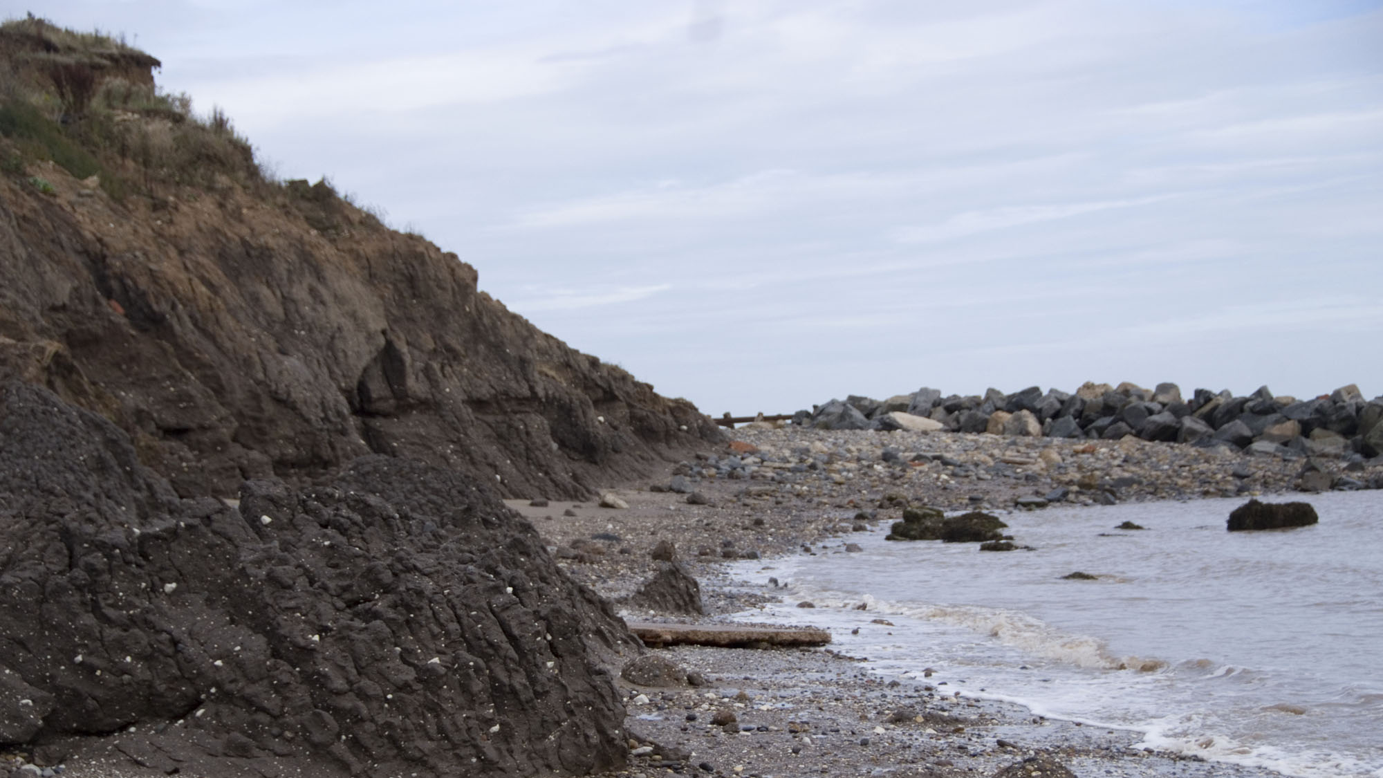
Overview
Directions
- Head to Hornsea and follow signs for the seafront. The collecting stretch described here is south of the main resort frontage.
- The council lists Burton Road Car Park, HU18 1TJ as a free, long-stay car park. Check signs on arrival.
- Use a maintained, open beach access from the promenade. Continue towards the southern collecting shore only while the route is clear and there is ample room to return; do not climb damaged defences or eroding slopes.
Location photographs
Swipe to browse · Select a photograph to enlarge


Fossil Hunting
Begin on the loose shingle along the collecting shore south of Hornsea, looking through the mixture of dark sedimentary stones, pale Chalk and hard limestone rather than searching for one continuous fossil bed. Waves wash the finer sediment from the glacial clay and leave resistant stones behind. Examine already exposed surfaces, including the edges of shell-rich pebbles, while keeping away from the cliff foot and fresh slips. A rounded stone with a short arc of ribs may contain only a fragment, but that fragment is often enough to recognise the fossil group.
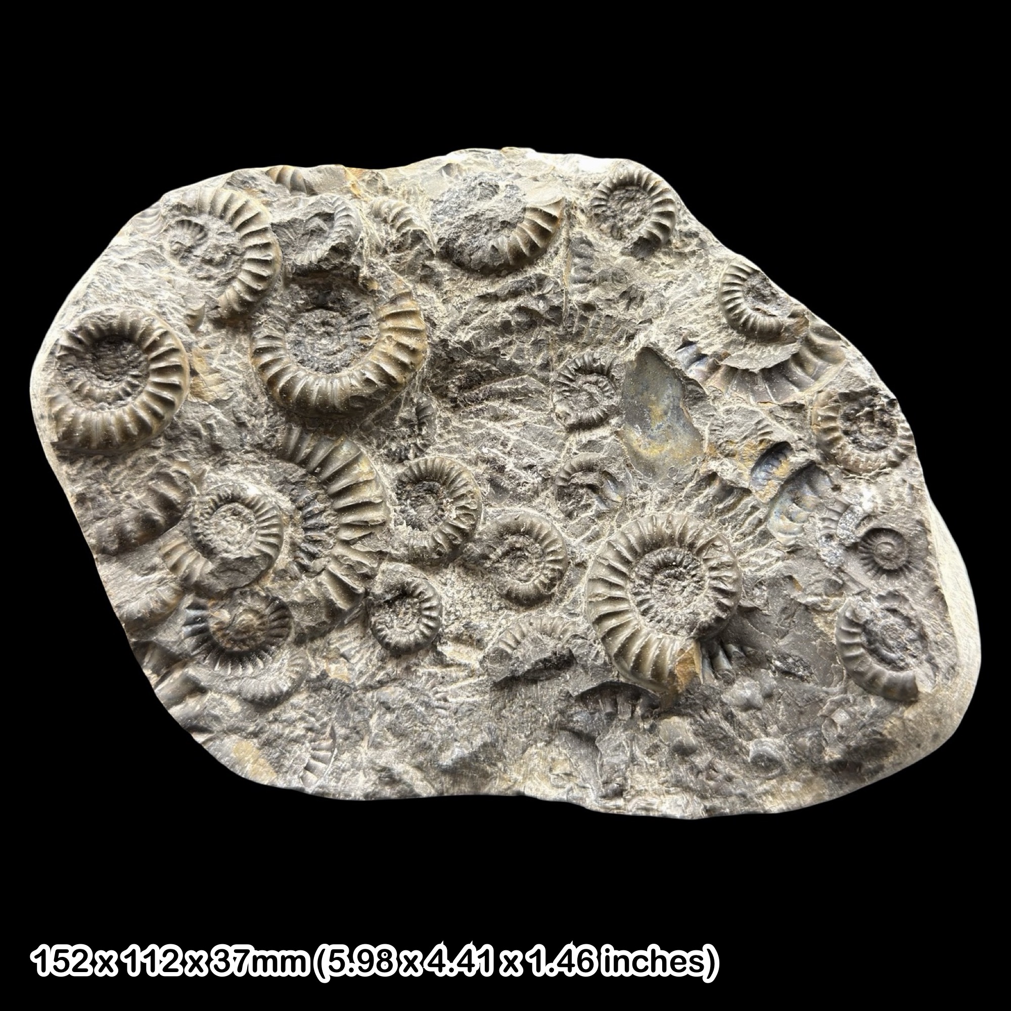
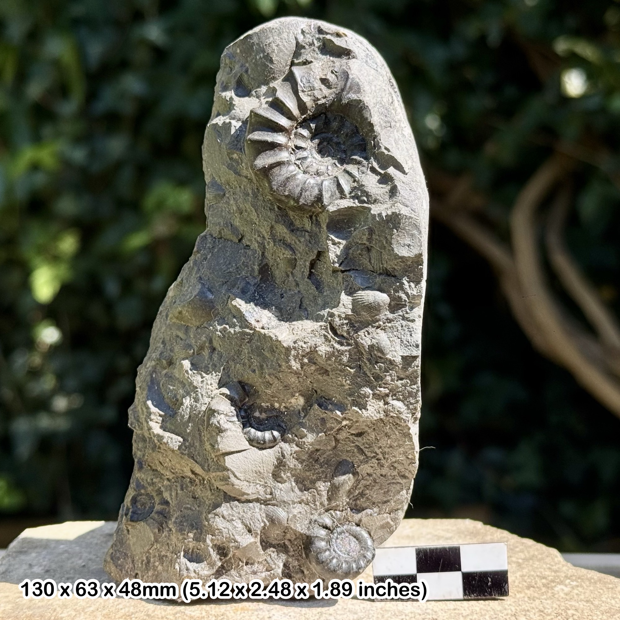
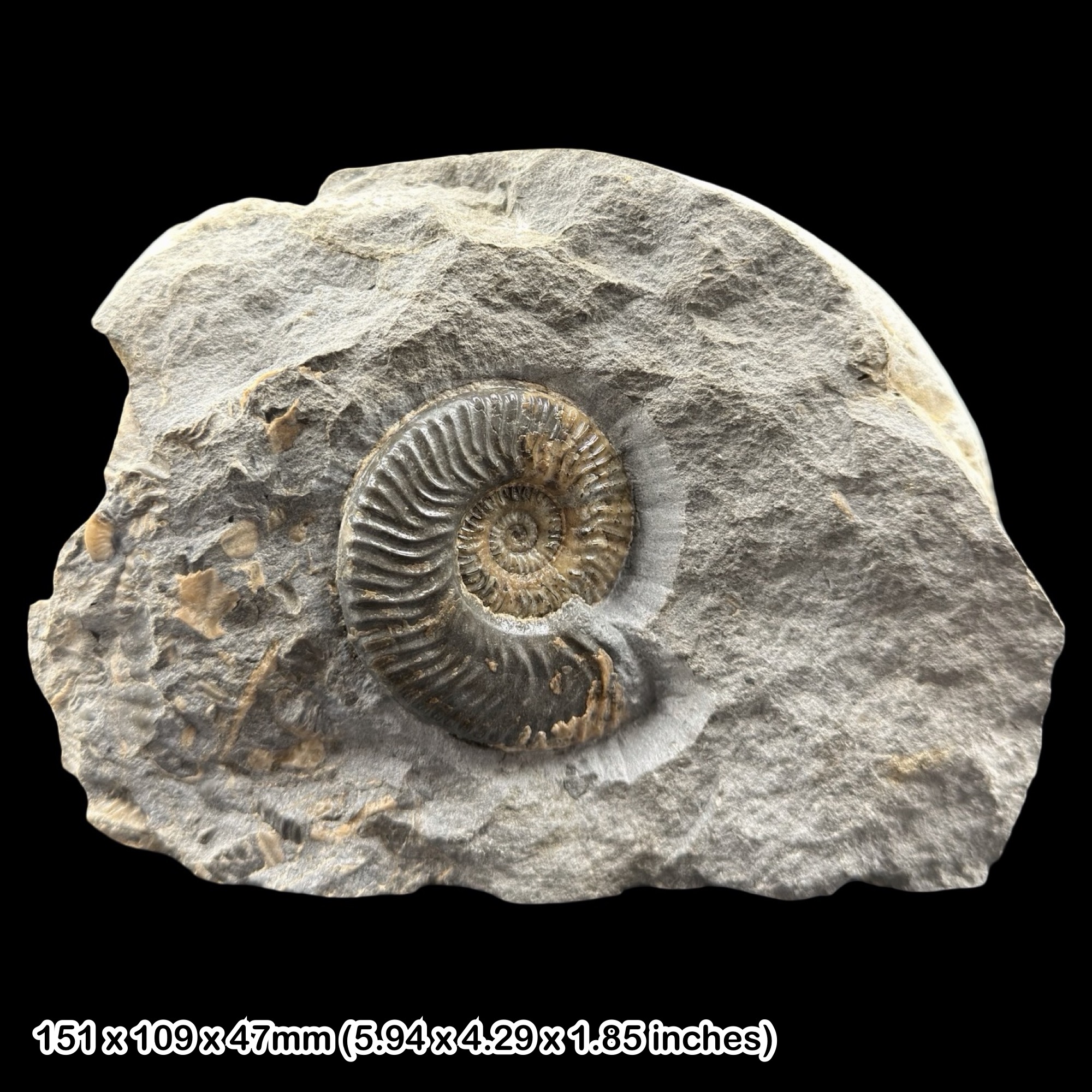
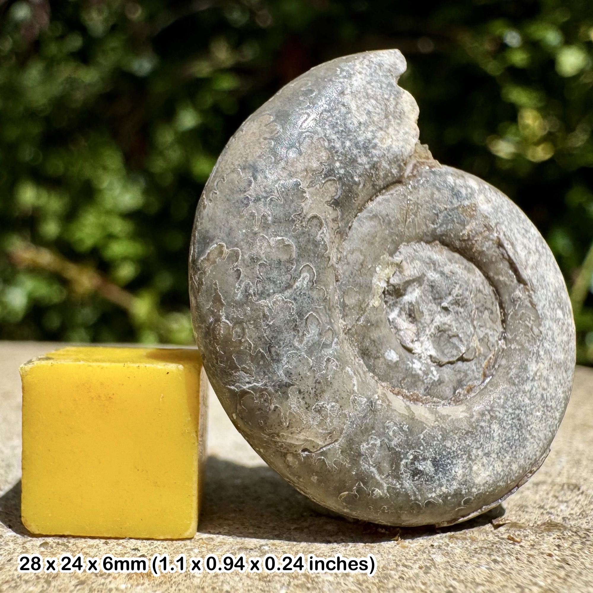
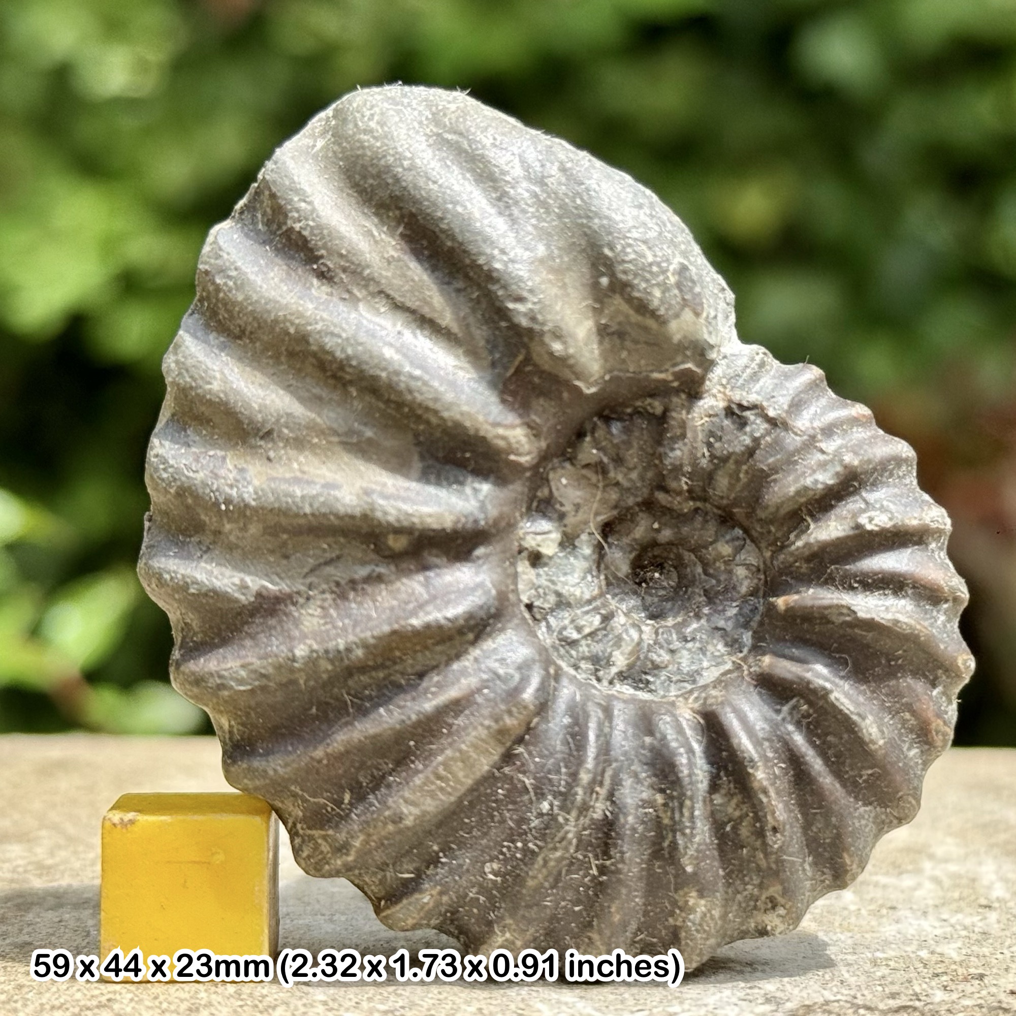
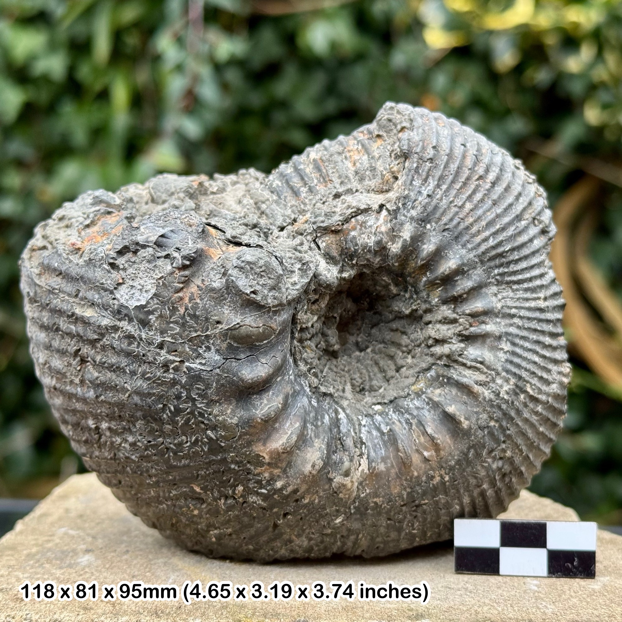
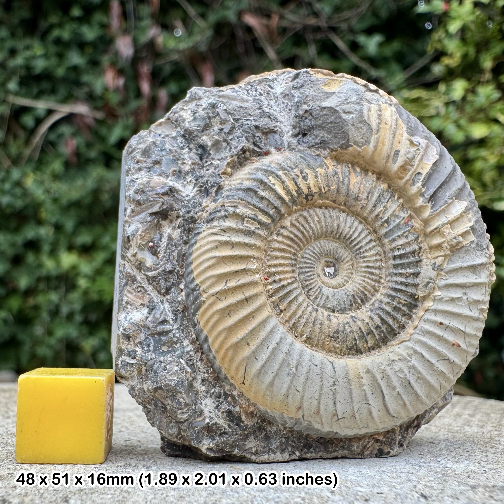
Ammonites and shells. A Hull Geological Society collecting visit to Hornsea recorded Dactylioceras alongside many incomplete ammonites, whole Gryphaea oysters and pieces of concentrated shell beds. These make more realistic search targets than a perfect display ammonite. In Dactylioceras, look for closely spaced ribs crossing the coiled shell; they can fork towards its outer edge. Check both the side and the rounded outer margin, because a worn ribbed crescent alone is not a secure species identification. The sturdy, curved lower valve of Gryphaea has the familiar “devil’s toenail” shape, with growth lines following the shell margin. It can survive transport when thinner shells have broken into fragments.
Corals and sea urchins. The same Hornsea visit reported abundant colonial corals identified as Lithostrotion, and crinoid-rich limestone among the larger beach stones. On a weathered coral-bearing surface, search for repeated small corallites with radial internal partitions; a crinoid stem fragment instead shows a sequence of discs, sometimes visible as rings in cross-section. Recording the whole limestone piece helps distinguish a colonial coral from an isolated circular mark. The society’s separate erratic survey records Echinocorys preserved in flint at Hornsea. Echinoids have a plated test with a fivefold arrangement of pore rows: an outline or partial surface pattern can be more informative than the colour of the stone. Not every rounded flint is an echinoid.
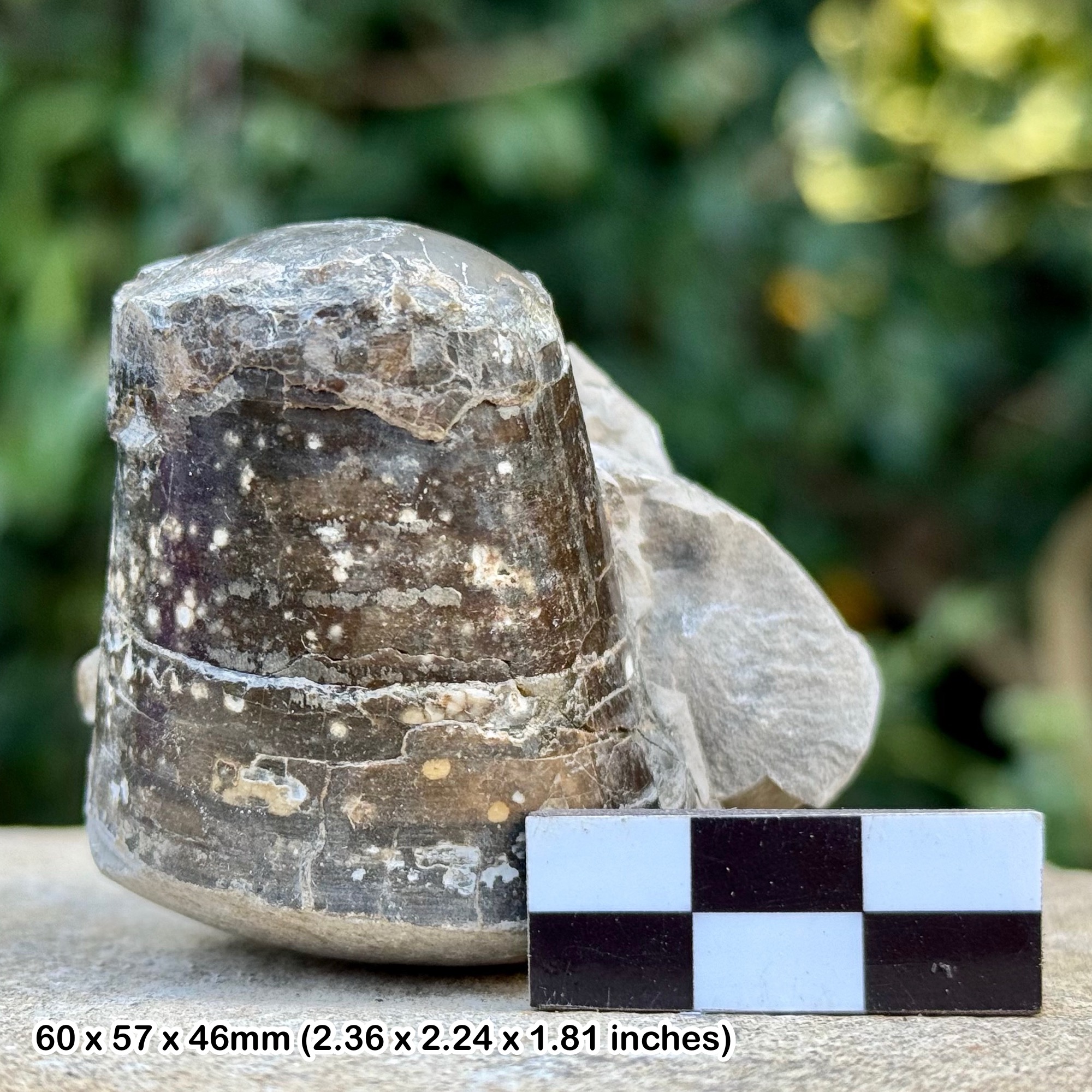
Belemnite guards add a different shape to the search: a tapering, bullet-like piece, sometimes with a hollow socket at the broad end, rather than a coiled shell. Broken guards may show radiating calcite fibres. The Hornsea field report includes a fragment assigned to Acrocoelites; a worn guard should not automatically receive that name. The wider Hornsea–Mappleton survey contains other ammonites and belemnites, but those broader records are not a promise that every listed kind occurs beside the town.
Keep a little matrix with an interesting specimen and record the beach location, date and whether it was loose or in an erratic block. The Carboniferous limestone, Jurassic shells and Cretaceous material were brought together by ice, then mixed again by the sea. Their fossils can help identify the source rock and age, but cannot restore a lost original bed position. Photograph unusual bone or an associated group of fossils before moving it, and seek specialist advice rather than splitting it apart.
Fossil photographs
Swipe to browse · Select a photograph to enlarge

Discoveries and milestones
Significant geological research and coastal-change milestones at Hornsea.
1869 onwards – Coastal defences alter the shoreline
Construction of Hornsea’s coastal defences began in 1869. The contrast between the defended town frontage and the retreating coast to its south became an important control on the shape of the shoreline.
1975 – Till weathering distinguished from a separate deposit
A geological excursion along the coast to Hornsea recorded the weathered top of the till and explained why the old Hessle Clay terminology should not be taken as proof of an additional till sheet. The account was published in 1977.
2021 – Local till divisions clarified
Cliff recording between Hornsea and Mappleton distinguished Middle and Upper Drab deposits separated by Reid’s red band, all within the Skipsea Till. The work demonstrates why a simple two-till regional model can conceal significant detail at this locality.
2025 – Beach-level changes south of the defences analysed
A study comparing surveys from 1994–1998 and 2010–2020 recorded the formation of a low beach feature south of Hornsea’s defences. Its results show how redistribution of beach sediment can expose the till platform and increase wave attack on the cliffs.
Geology
South of Hornsea, the cliff is largely the product of the last glaciation rather than a cliff cut directly into Jurassic fossil beds. The late Devensian Skipsea Till Member, within the Holderness Formation, is a diamicton: stones of very different sizes enclosed in a fine-grained, poorly sorted matrix. Glacier ice transported and mixed material from older rocks, so a Jurassic ammonite, a Carboniferous coral-bearing limestone and a Chalk-derived fossil can occur together without having lived in the same sea or at the same time.
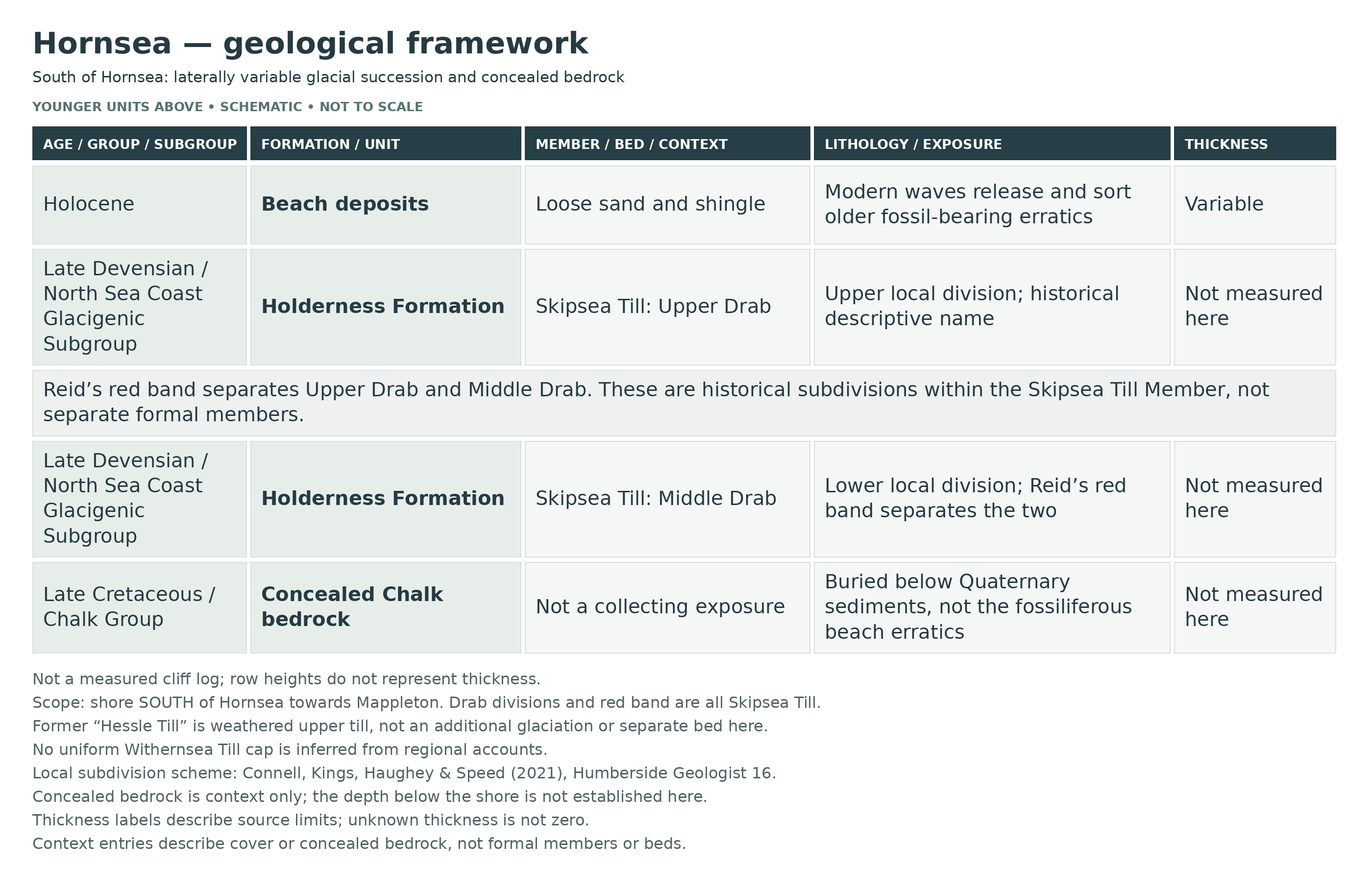
The cliff sequence towards Mappleton contains more structure than the general term “boulder clay” suggests. Recent Hull Geological Society work documents the historical Middle Drab and Upper Drab divisions with Reid’s red band between them. All three belong here within the Skipsea Till; the upper clay is not automatically the separate Withernsea Till simply because it overlies another till. These changes help geologists trace the glacial deposits along the coast, whereas the original beds that supplied the transported fossils must be inferred from the stones themselves.
Modern waves undertake a second sorting process. They disperse clay and move sand while leaving or redistributing heavier shingle and blocks. This produces the mixed collecting ground, but beach sand can conceal it again, and low stretches expose the till platform to renewed wave attack. The amount of visible stone therefore changes without a new fossil horizon appearing. Chalk bedrock lies beneath the superficial deposits; loose Chalk and flint on the shore do not show that it is exposed locally. Keep the natural erratics distinct from constructed sea defences, and compare the changing cliff only from a safe distance.
Detailed geology and bed-by-bed succession
Detailed geology and stratigraphy
The following framework distinguishes the glacial deposits from their older fossil-bearing stones. Exposures change as the cliff retreats; this is not a measured vertical log.
CALEDONIA GLACIGENIC GROUP
NORTH SEA COAST GLACIGENIC SUBGROUP
Holderness Formation
This formation contains the late Devensian glacigenic deposits of Holderness, including till and associated water-laid sediments. Its regional total thickness is not a measurement of the cliff at Hornsea.
Skipsea Till Member
The exposed till is a stony diamicton with a fine-grained matrix and abundant transported clasts, including Chalk. Older descriptions call it Drab Till. The BGS assigns the member to the Dimlington Stadial of the late Devensian, within Marine Isotope Stage 2. Its formation by ice explains why fossils from several older systems can occur together.
Internal sediment bands and transported blocks
Till can contain streaks, sheared lenses and pockets of sandier or more clay-rich material. These are not automatically separate formations or consecutive fossil beds. Record a find’s immediate matrix and setting rather than assigning an original Jurassic bed from its beach position.
Middle Drab
This is the lower of the two historical till divisions identified in recent recording between Hornsea and Mappleton. It belongs to the Skipsea Till Member, rather than a separate formation.
Reid’s red band
A reddish marker separates the Middle Drab below from the Upper Drab above. The band is part of the local Skipsea Till succession. No fixed thickness is assigned here.
Upper Drab
The upper historical division overlies Reid’s red band and is also assigned to the Skipsea Till. These subdivisions preserve useful local detail that a simple regional two-till scheme can obscure.
Weathered upper till
Near-surface alteration changes the colour and character of the till. The old regional Hessle Till terminology should not be read as an extra glacial sheet. Regional accounts also describe Withernsea Till farther south, but that unit is not imposed on this local Hornsea section without exposure-specific evidence.
Concealed Chalk and reworked fossils
Cretaceous Chalk underlies the Quaternary cover, but the collecting beach does not provide a continuously exposed bedrock section. Carboniferous limestone fossils, Jurassic shells and Chalk fossils in the till are transported material, not evidence for a complete local sequence of those rocks.
Modern beach and erosion surface
Present-day waves winnow clay and redistribute sand, shingle and erratic stones. Exposed till platforms, low beach stretches and stranded blocks are features of modern erosion and deposition, not additional ancient fossil beds.
References
BGS Lexicon: Holderness Formation
BGS Lexicon: Skipsea Till Member
BGS: Eastern England from the Tees to The Wash
Connell, Kings, Haughey and Speed (2021): Bisat Research Group cliff stratigraphy
Safety
Visit only in settled weather with an appropriate falling tide, after checking tide times and the state of the return route. Waves can reach the cliff foot and sea defences before the predicted high tide, especially with onshore winds. Leave well before the route narrows.
Keep away from both the edge and foot of the clay cliffs. Fresh slips and apparently firm mud can be unstable or deeply soft. Do not cross debris, undercut ground or broken defences to reach more stones.
Stay clear of damaged sea defences and projecting metalwork. Do not assume the resort’s lifeguard service covers the remote cliff-backed collecting shore.
Carry a charged phone, tell someone your route and return time, and call 999 or 112 and ask for the Coastguard in an emergency.
Equipment
Wear sturdy boots with good grip and carry tide information, a phone, a hand lens, a small ruler and a camera. Bring padded bags or rigid boxes and labels for finds.
A hammer is not essential for beach searching. Do not dig the cliffs or prise material from defences. Any permitted work on a loose block needs eye protection, a safe distance from others and restraint; leave very large or potentially important specimens for specialist assessment.
Cleaning And Treating
Keep a note of the exact beach location and whether a find was loose, embedded in a transported block or associated with a particular exposure. Wrap fragile fossils separately and keep both halves of a split fossil-bearing stone.
Allow damp specimens to dry slowly, then try a soft brush before further preparation. A brief fresh-water rinse is suitable only for robust, water-stable material; clay-rich shale, porous fossils and crumbly shells may disintegrate when soaked. Do not use household acids, bleach or routine varnish.
Hard limestone and ironstone need patient mechanical preparation under magnification. Stop if the fossil breaks with the matrix. Keep any unusual bone or articulated specimen unprepared and seek specialist advice.
Identify Your Finds
Need help identifying a fossil? Share clear photos, where you found it and its size with the community.
Further Reading
Deposits: a fossil hunter’s guide to the Yorkshire coast (regional background)
BGS: Holderness Formation
BGS: Skipsea Till Member
Bisat Research Group: local till subdivisions and coastal sections
2025 study of Holderness beach levels and erosion
East Riding Council: coastal change and monitoring
Access Rights
Use only open public access routes and observe signs, barriers and landowner instructions. The presence of fossils or an eroding cliff does not create a right to enter private land, excavate or collect without the relevant permission.
Keep collecting modest and focused on loose material where permitted. Leave sea defences, cliff faces and any archaeological remains undisturbed. The coastal guide does not grant access to neighbouring private land.
It is important to follow our ‘Code of Conduct’ when collecting fossils or visiting any site. Please also read our ‘Terms and Conditions’.
Links
♦ Fossil Discussions
♦ Fossil Articles
♦ Buy Fossils, Tools and Equipment
♦ Buy Crystals, Meteorites, and Artefacts
♦ Join Fossil Hunts
♦ UK Fossils Network


