
Overview
Directions
- From the B1242 in Mappleton, follow Cliff Lane towards the coast and use Cliff Lane Car Park, HU18 1XX. The council currently lists it as free; obey current signs and keep away from the eroding edge.
- The beach is reached by a long, steep slipway. There may be a drop at its foot as sand levels change. Check that you can return safely before continuing along the beach.
- Use only open areas and obey military warning signs, red flags and any temporary closure. Do not cross a closed area to reach a more promising patch of stones.
- Ref: 53.87571°N, 0.13378°W
Location photographs
Swipe to browse · Select a photograph to enlarge


Fossil Hunting
Search the loose gravel and washed stones on the open foreshore, away from the cliff foot and sea defences. Sand cover shifts between visits, so an apparently barren stretch may conceal material and no part of the beach can be guaranteed to produce fossils. The northern beach should not be dismissed as fossil-free.
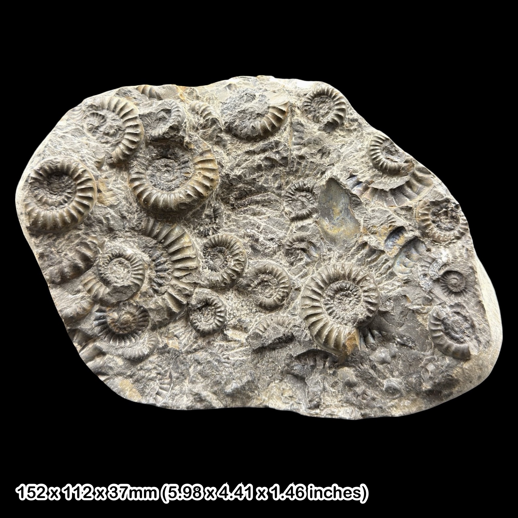
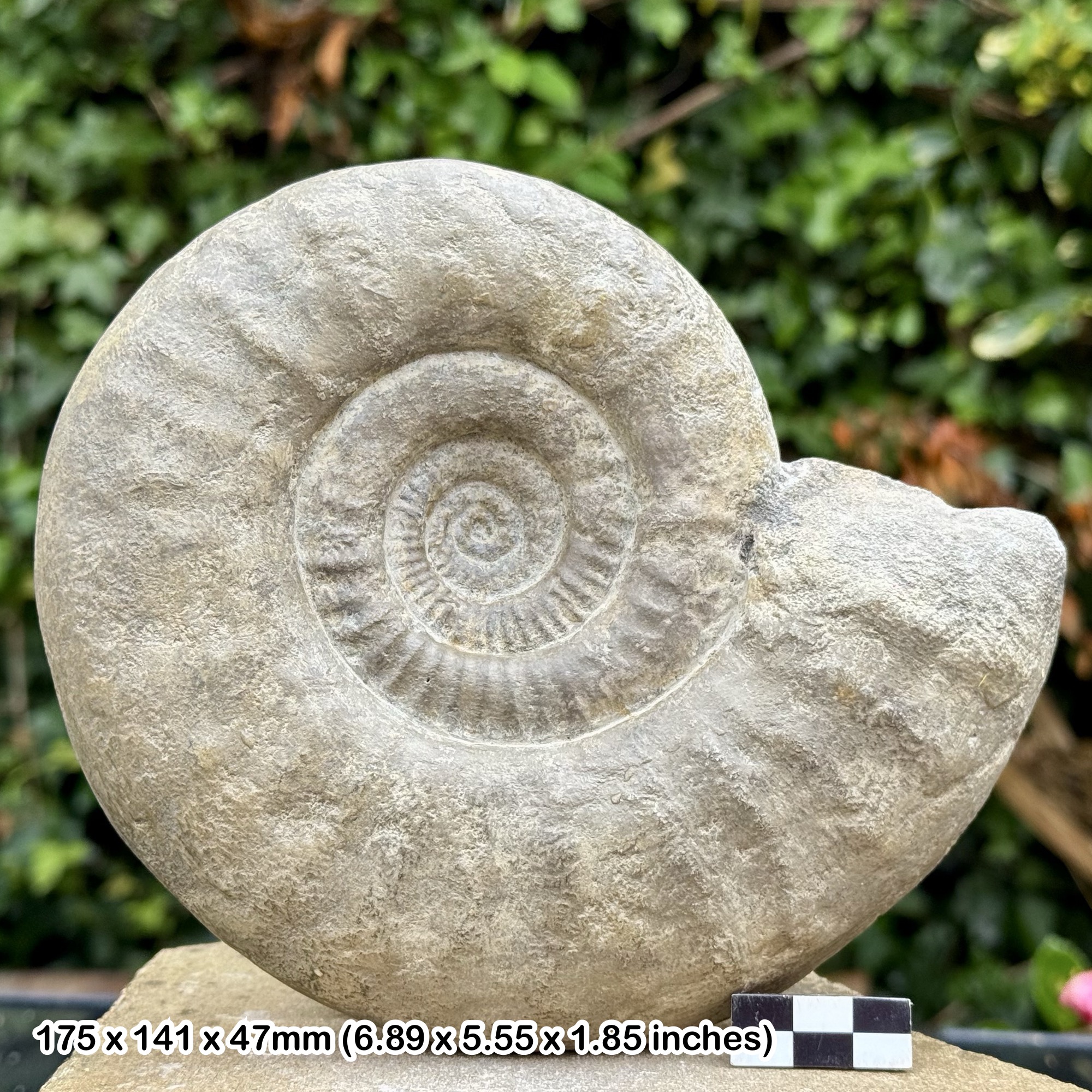
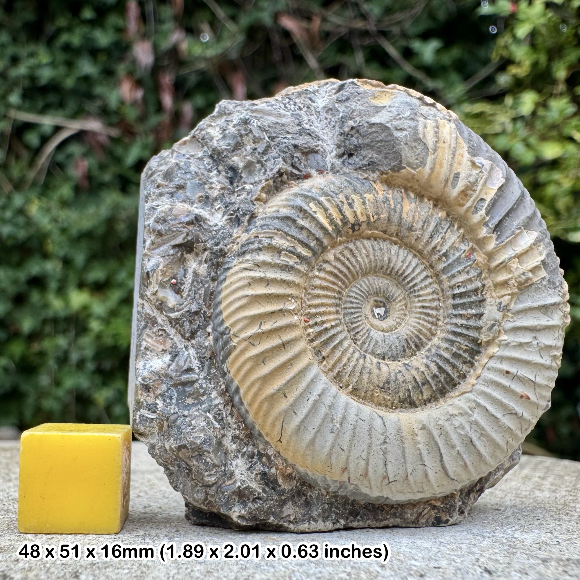
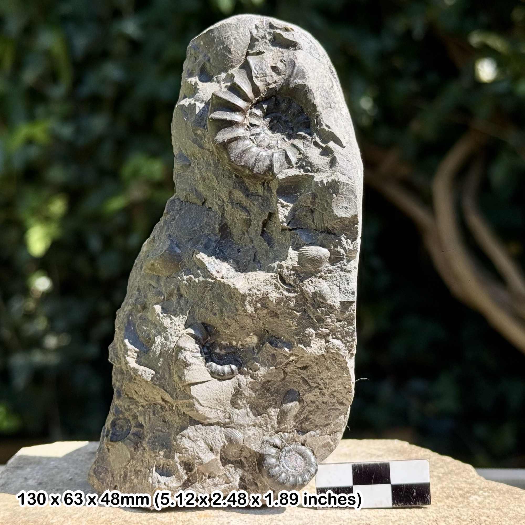
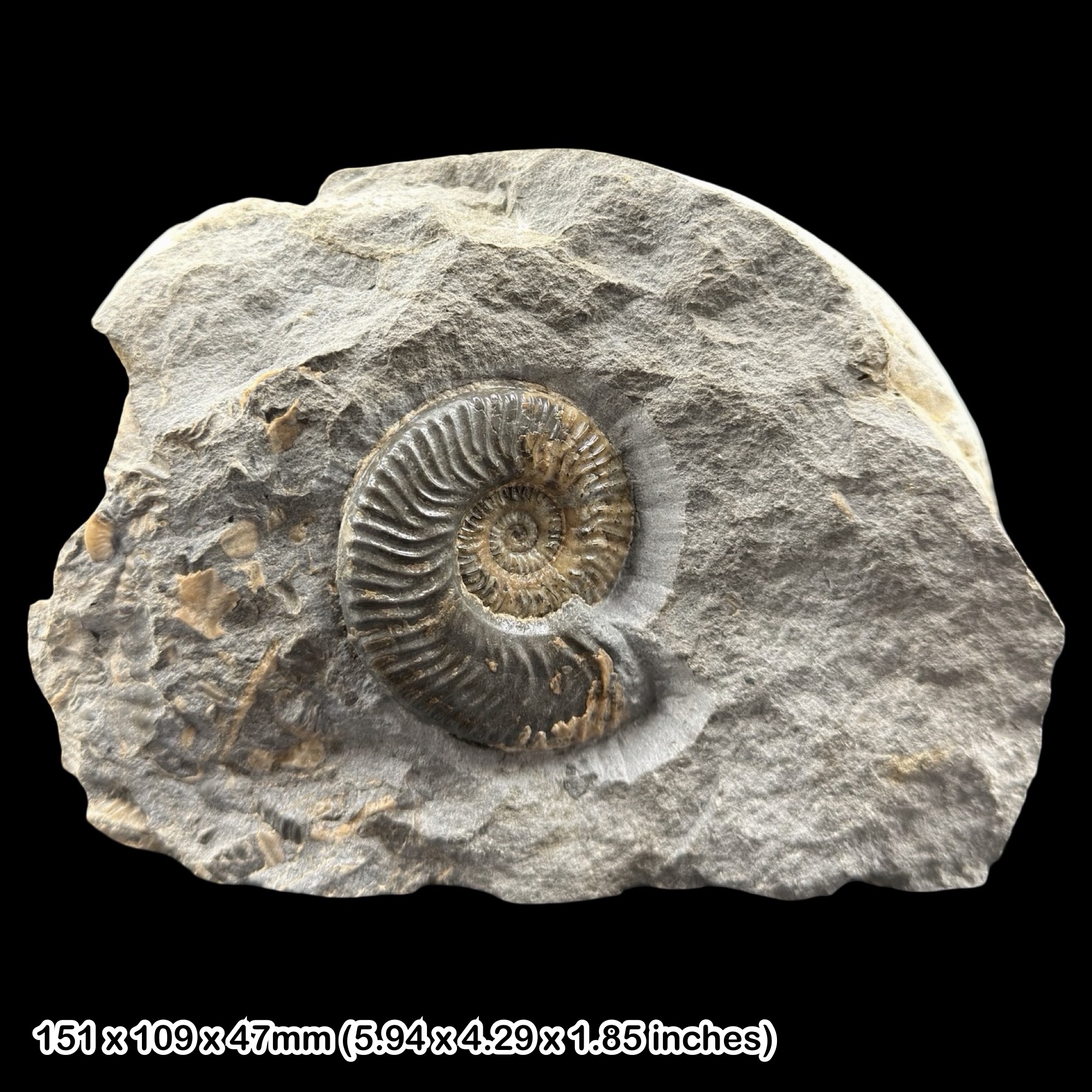
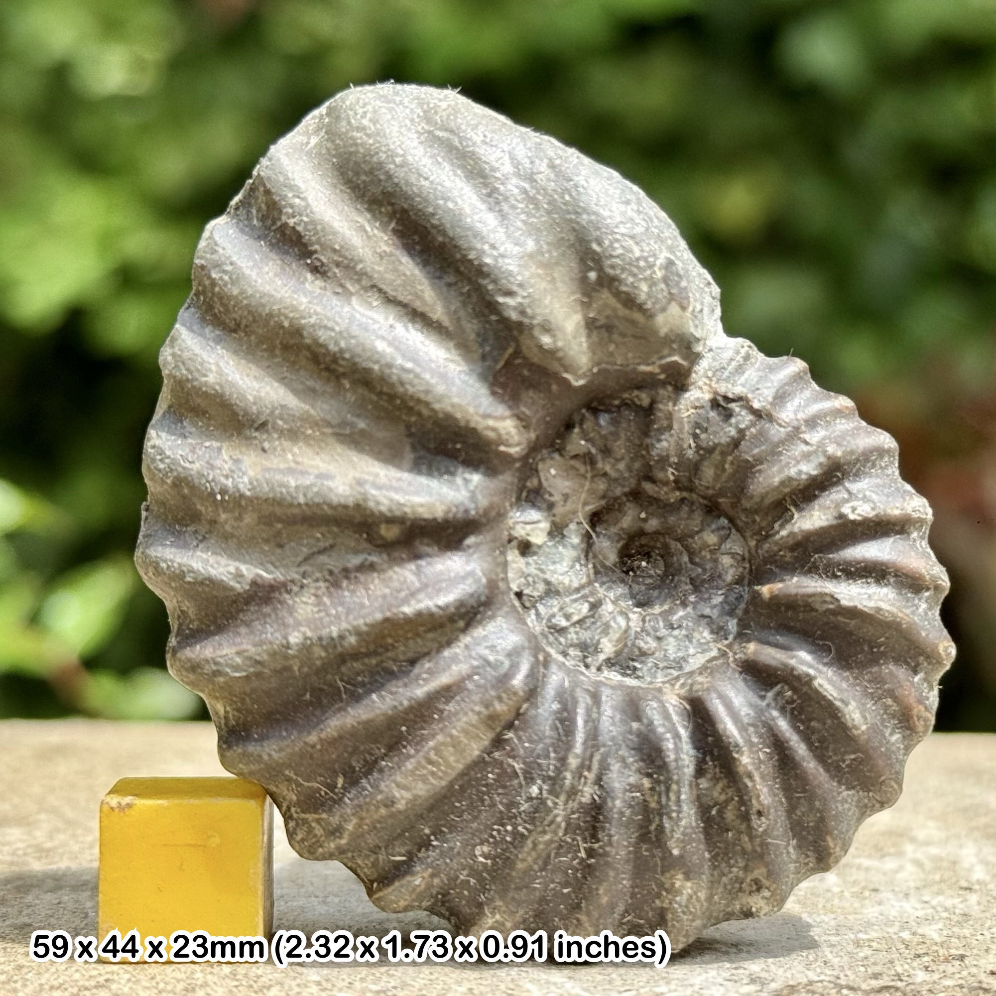
The local reference collection records Arnioceras, Gryphaea, shelly Jurassic limestone and Carboniferous coral-bearing limestone. Belemnites and chalk or flint fossils add to the variety. These are transported pieces of older rocks, not a single Jurassic fossil bed exposed along the cliff.
Study the whole stone before collecting or preparing it. Rounded edges, mixed rock types and glacial scratches provide clues to transport. A detailed label should say Mappleton beach erratic unless the original formation is independently established; some decorative or crystalline rocks on a defended shore may be imported building or armour material.
Fossil photographs
Swipe to browse · Select a photograph to enlarge

Discoveries and milestones
Significant discoveries and geological milestones at Mappleton.
1885 – Red marker band described
Clement Reid described the red band later used to distinguish till subdivisions in the Mappleton part of the Holderness coast.
1900 – Coastal erratics compared
John Walker Stather included Mappleton in a quantitative comparison of coastal boulders, contributing to the study of material transported by ice.
1908 – Large fossil-bearing clay raft recorded
J. W. Stather recorded a substantial transported mass of Speeton Clay at Mappleton containing belemnites and ammonites. The record illustrates that glacial transport moved coherent pieces of older sediment as well as individual stones.
1991 – Sea defences alter the shore
Rock defences were installed to protect Mappleton, changing the setting in which the adjacent glacial cliffs and beach sediments are exposed.
2004 – Mammoth remains recovered
Christopher Brogden found a mammoth tooth and, subsequently, a tusk on the beach between Mappleton and Cowden. The specimens were displayed at Hornsea Museum and at a geological meeting later that year.
2021 – Detailed till subdivisions revisited
Rodger Connell and colleagues illustrated the Middle Drab, red band and Upper Drab sequence immediately north of Mappleton, emphasising detail hidden by a simple two-till description.
Geology
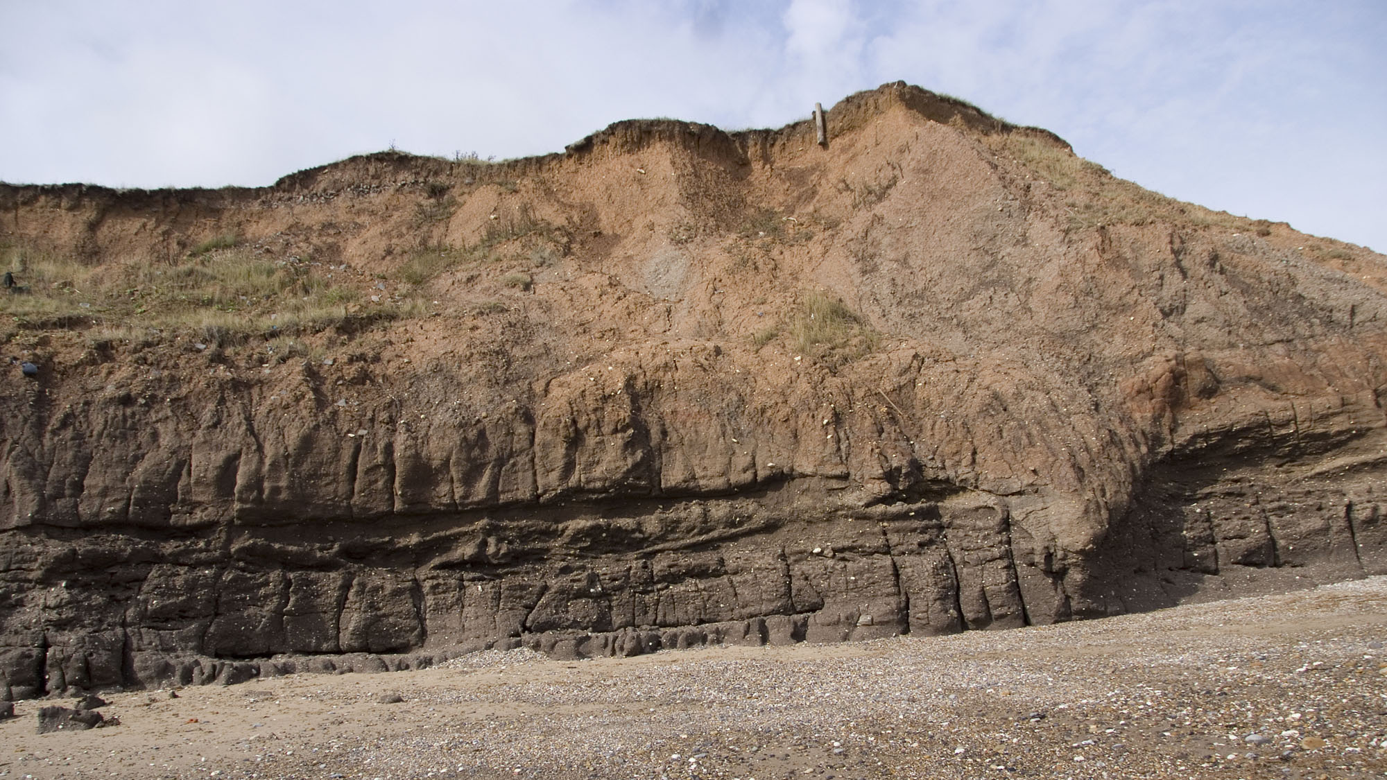
The cliff is dominated by glacial sediment of the Holderness Formation. The clay-rich deposit contains stones of widely different origins and ages, brought together during the last glaciation. Modern erosion frees these stones, while waves redistribute them into shingle patches.
The traditional till terminology needs care. Work on the adjoining cliffs north of Mappleton identifies Middle and Upper Drab divisions separated by a red band, all included within Skipsea Till. A red layer here should not automatically be called Withernsea Till, and the reference section should not be treated as a measured log of the whole beach.

Detailed geology and bed-by-bed succession
Detailed geology and stratigraphy of Mappleton.
The framework below distinguishes the glacial deposits from younger surface material and older fossils carried within them. Exposure varies as beach sediment and landslips move.
CALEDONIA GLACIGENIC GROUP
NORTH SEA COAST GLACIGENIC SUBGROUP
Holderness Formation
These are the regional formal units for the Late Devensian glacial succession. Historical till names and local research subdivisions are explained below; a colour change alone does not prove a separate ice advance.
Skipsea Till Member
The principal supported assignment for the reference cliff succession is Skipsea Till Member, formerly Drab Till. The section immediately north of Mappleton at TA 21998 45186 provides a documented example; the same exposure cannot be assumed to survive unchanged.
Middle Drab — historical lower subdivision
The lower till package lies beneath the red marker horizon. It belongs to the Skipsea Till rather than an independently named formation. No reliable thickness for the collecting access is established here.
Reid’s red band
The reddish horizon separates the Middle and Upper Drab packages in the published northern reference section. It has been followed along a wider coastal tract, but its exposure changes with beach level. A separate northern record near TA 225 447 notes sandstone, mudstone, limestone and other clasts but almost no chalk within the red band. Its colour is not sufficient evidence for identifying Withernsea Till.
Upper Drab — historical upper subdivision
This till overlies the red band in the documented sequence. Middle Drab and Upper Drab are historical descriptive divisions within Skipsea Till; they are not separate formal members.
Transported older rocks
Limestone, mudstone, chalk and flint erratics carry fossils older than their enclosing till. Neither a Jurassic ammonite nor a chalk pebble demonstrates Jurassic or Chalk bedrock exposure at the beach.
Historical Speeton Clay raft
A record for 1908 describes a transported mass of Speeton Clay at Mappleton containing ammonites and belemnites. It demonstrates glacial rafting of coherent older sediment, not an in-situ Cretaceous formation beneath the beach. The historical exposure is not assumed to survive today.
Modern beach cover and buried substrate
Mobile sand and gravel conceal and re-expose the till. Chalk underlies the wider district, but a fixed depth or a currently exposed Chalk collecting bed is not established at this access.
References
Yorkshire Naturalists’ Union, Annual Report for 1908, p. 32
East Riding Boulder Committee 2011–2021: northern Mappleton red band
Connell and colleagues (2021), Bisat Research Group report
BGS Lexicon: Skipsea Till Member
BGS Lexicon: Holderness Formation
Yorkshire Type Erratics collection
Safety
Check the tide and sea conditions before setting out, and keep enough time and open beach for your return. Water can reach the cliff foot and cut off a route even when a distant tide prediction appears favourable. Never attempt to escape by climbing the clay cliffs.
Stay well clear of cliff faces, overhangs and the edge above. Rain-soaked till can slide without warning; fresh falls and soft mud are not safe collecting platforms. Wear grippy footwear, supervise children closely and turn back if the route is narrowing. For a coastal emergency call 999 and ask for the Coastguard.
Unexploded ordnance from the former RAF Cowden range can be exposed by erosion. Never touch, move, collect or strike a suspicious object. Move away, keep other people clear and report it by calling 999. Clearance work does not mean that the shore is permanently free of ordnance.
Equipment
Take sturdy grippy footwear, tide information, a charged phone, a hand lens, a small soft brush, wrapping and rigid specimen boxes. Photograph each useful find and record the beach locality and date.
A hand lens and careful surface searching are preferable to digging or casual hammering here. Do not use a pick in the clay or strike an unidentified object; military debris can resemble harmless scrap or encrusted stones.
Cleaning And Treating
Begin with a soft brush and preserve the surrounding matrix. Robust limestone or flint specimens can be briefly rinsed in fresh water to remove salt and clay, but test a small area first and stop if the surface softens or flakes. Do not soak shale, pyrite, fragile shells or carbonised plant material.
Allow stable specimens to dry slowly at room temperature. Keep pyritic fossils dry and inspect them for cracking or powdery decay. Avoid acids, bleach and household varnish. If a fossil is crumbly, large or scientifically unusual, leave it unprepared and seek specialist conservation advice.
Identify Your Finds
Need help identifying a fossil? Share clear photos, where you found it and its size with the community.
Further Reading
Deposits Magazine: a fossil hunter’s guide to the Yorkshire coast
Hull Geological Society: Yorkshire Type Erratics collection
Bisat Research Group: detailed Holderness cliff stratigraphy
BGS: Skipsea Till Member
Council: Mappleton beach access
MOD: unexploded ordnance at Mappleton
Access Rights
Use the council access and respect all military and local closure signs. Mappleton is recognised by Hull Geological Society as a local geological conservation site. Prefer loose beach specimens, keep collecting modest and avoid damaging standing sections. Public beach access does not authorise excavation, entry onto private land or removal of coastal armour.
It is important to follow our ‘Code of Conduct’ when collecting fossils or visiting any site. Please also read our ‘Terms and Conditions’.
Links
♦ Fossil Discussions
♦ Fossil Articles
♦ Buy Fossils, Tools and Equipment
♦ Buy Crystals, Meteorites, and Artefacts
♦ Join Fossil Hunts
♦ UK Fossils Network


