The steep outline of Parkhouse Hill near Earl Sterndale reveals a Carboniferous reef margin shaped by later faulting and erosion. Brachiopods, corals and crinoid fragments can be seen in its limestone. This protected hill is a place for looking and photographing: leave fossils in place, follow permitted routes and keep clear of steep faces and summit drops.


FIND FREQUENCY: ♦♦♦ – The original field visit records fossiliferous limestone in natural outcrops and loose pieces. Weathering and vegetation affect what is visible.
CHILDREN: ♦♦ – The narrow upper ridge, steep slopes and drops are unsuitable for an informal children’s collecting trip. Supervised observation should remain on safe lower permitted routes.
ACCESS: ♦♦ – Minor roads pass close to the hill, but the original guide did not establish where verge parking was lawful. Check current parking and access arrangements before setting out.
TYPE: – Natural reef-limestone hill with grassy slopes, rock faces and loose stone; an observation-only visit.
DIRECTIONS
♦ Use a current walking map to locate Parkhouse Hill near Earl Sterndale. The original locality reference is SK 07994 66929; it identifies the hill area, not a parking bay or a safe line to the summit.
♦ The old approach followed the small road below the hill. Its suggestion to park beyond a cattle grid did not establish permission. Park only where lawful, obey current signs and leave gates, passing places and verges unobstructed.
♦ Approach on signed public paths or other currently permitted access routes. Check current access mapping and any temporary restrictions. Use gates and stiles, close gates as requested and avoid climbing dry-stone walls.
♦ Look at safely accessible limestone from lower routes. A summit ascent is not necessary to appreciate the geology. Do not approach overhangs, cross unstable scree or scramble up a face to reach a fossil.
♦ Return by a route within your abilities and suitable for the conditions. An extension to nearby Chrome Hill is a separate walk requiring its own planning; its detailed fossil sections do not belong to Parkhouse Hill.
FOSSIL HUNTING
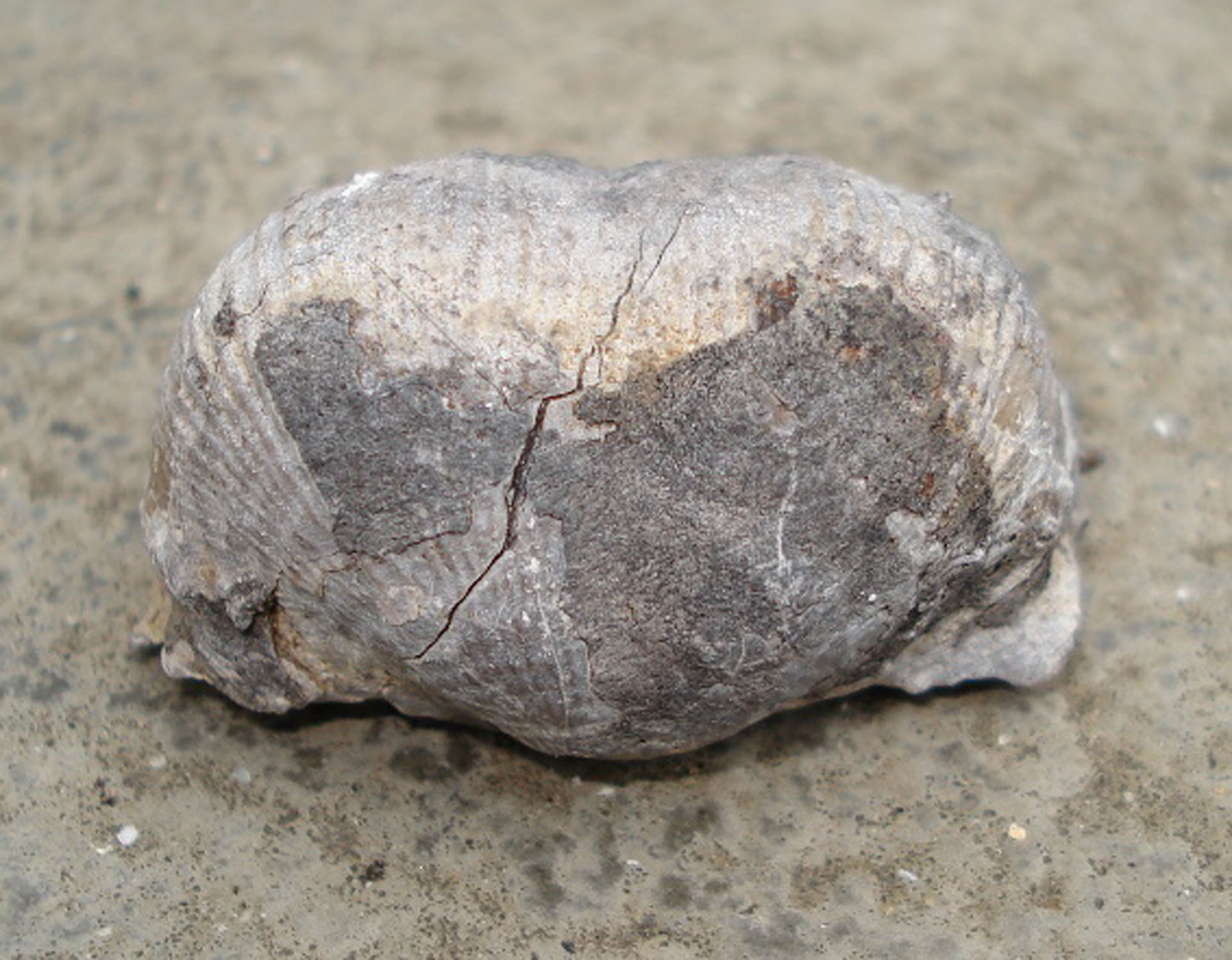
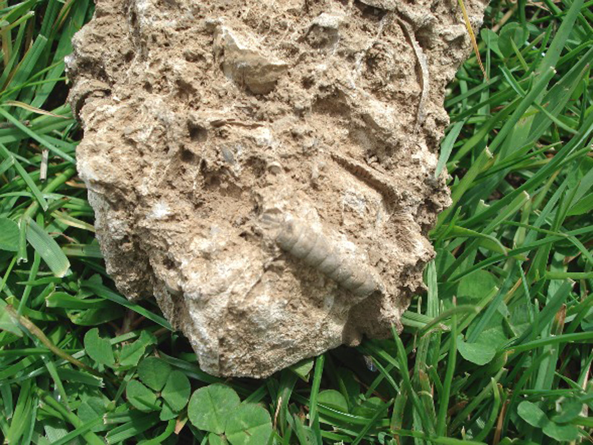
The 2007 field account records brachiopods, crinoids and corals. Search visually on naturally weathered surfaces without removing rock. Fossils can be visible well below the summit, so there is no reason to take a more exposed route simply to see them. Leave loose pieces where they lie as well as specimens still embedded in a face.
Brachiopod shells may appear as curved profiles, ribbed surfaces or broken shell sections. Crinoid stems are built from repeated skeletal plates, commonly seen as discs or short segmented lengths. Corals can show cup-like sections or colonial patterns. The same kind of fossil looks different depending on how erosion has cut through it.
Examine a whole surface before concentrating on small details. A hand lens and photographs with light across the rock can distinguish regular skeletal patterns from veins, cracks and irregular weathering. Photograph a scale beside the specimen only where you can do so safely and without disturbing it. An incomplete section may support a broad identification but not a species name.
The limestone includes fine carbonate mud as well as skeletal debris. Some remains were broken and transported around the reef margin before burial. A cluster of shells is therefore not necessarily a population preserved where it lived, or a marker that continues across the whole hill. Loose material has even less secure bed provenance.
The neighbouring hills have their own scientific records. Chrome Hill’s brachiopod depth zones and shell-rich boulder bed, and the cavity fauna at Dowel Dale, should not be treated as a Parkhouse species list. The exact Parkhouse evidence is described separately in the detailed geology.
Keep the visit non-destructive. Do not hammer, dig, split loose blocks or remove specimens. If you notice an unusual fossil, record its position and photograph it without exposing more of it. The historical specimen photographs preserve the guide’s record; they do not imply present collecting permission.


Significant discoveries, geological research and conservation milestones at Parkhouse Hill.
1869 – An early Survey interpretation stresses faults
Green and colleagues interpreted the unusual local topography chiefly through faulting. Later work gave inherited reef slopes a larger role.
1931 – Hudson recognises exhumed reef knolls
Hudson described Chrome and Parkhouse as reef knolls uncovered from beneath younger mudstone, while also proposing earlier erosion and foundering. Subsequent studies reconsidered that explanation.
1951 – The hills receive their first SSSI notification
The site citation records the first notification under the 1949 Act, recognising the locality’s conservation importance.
1958 – Reef studies highlight original depositional slopes
Wolfenden’s work supported the interpretation that much of the fore-reef slope was inherited from deposition rather than produced entirely by later deformation.
1959 – Further work informs the upper reef interpretation
The Survey cites Wolfenden’s 1958 and 1959 studies in its account of the upper algal reef exposed at Parkhouse and neighbouring hills.
1972 – The earlier SSSI notification is revised
The citation records a 1972 revision of the notification under the 1949 Act. This predates the later notification under the 1981 Act.
1985 – The district memoir reconciles reef form and structure
The Geological Survey described summit reef facies, fore-reef slopes, the Chrome Hill Fault and younger cover, keeping depositional relief and later structural modification distinct.
13 January 1989 – The SSSI is notified under the 1981 Act
The Chrome and Parkhouse Hills citation gives this notification date and records a boundary deletion.
9 June 1991; report published 1993 – An excursion reviews reef growth and fault timing
Aitkenhead’s excursion report discusses the higher summit reef level and the mapped fault termination beside Parkhouse. A late Brigantian, pre-Namurian age for the main movement was considered possible, with positive proof still lacking.
GEOLOGY
Parkhouse Hill is formed from reef limestone of the Bee Low Limestone Formation, within the Peak Limestone Group. The local reef development is late Asbian, in the Viséan part of the Carboniferous. The limestone accumulated at the edge of a carbonate shelf, where environments changed laterally towards deeper water.
The Geological Survey describes a wall-like mass of fossiliferous micritic limestone on the summit ridge. Micrite is very fine carbonate mud. This is the upper algal-reef development of the historical B2 zonal scheme, rather than a separately named member or a numbered bed. Biological activity and the accumulation of carbonate sediment contributed to the reef body.
The main component of Parkhouse and Chrome hills is fore-reef limestone dipping southwards to southwestwards away from the shelf. Much of that inclination is interpreted as an inherited depositional slope. Later tectonic movement and erosion also matter: the modern hill is not an unchanged coral atoll or an exact outline of the original reef.
The Chrome Hill Fault follows the northeastern foot of the hills. Fault surfaces and mineralised breccia are exposed in places, with displacement down to the northeast. The Survey’s maximum throw of about 90 m concerns the regional fault, not every rock face visible at Parkhouse.
Younger Namurian mudstones covered the earlier limestone relief. Their later removal helped reveal the harder reef limestone again. This history of burial and exhumation, combined with faulting and weathering, explains the striking contrast between the hill and the surrounding lower ground.
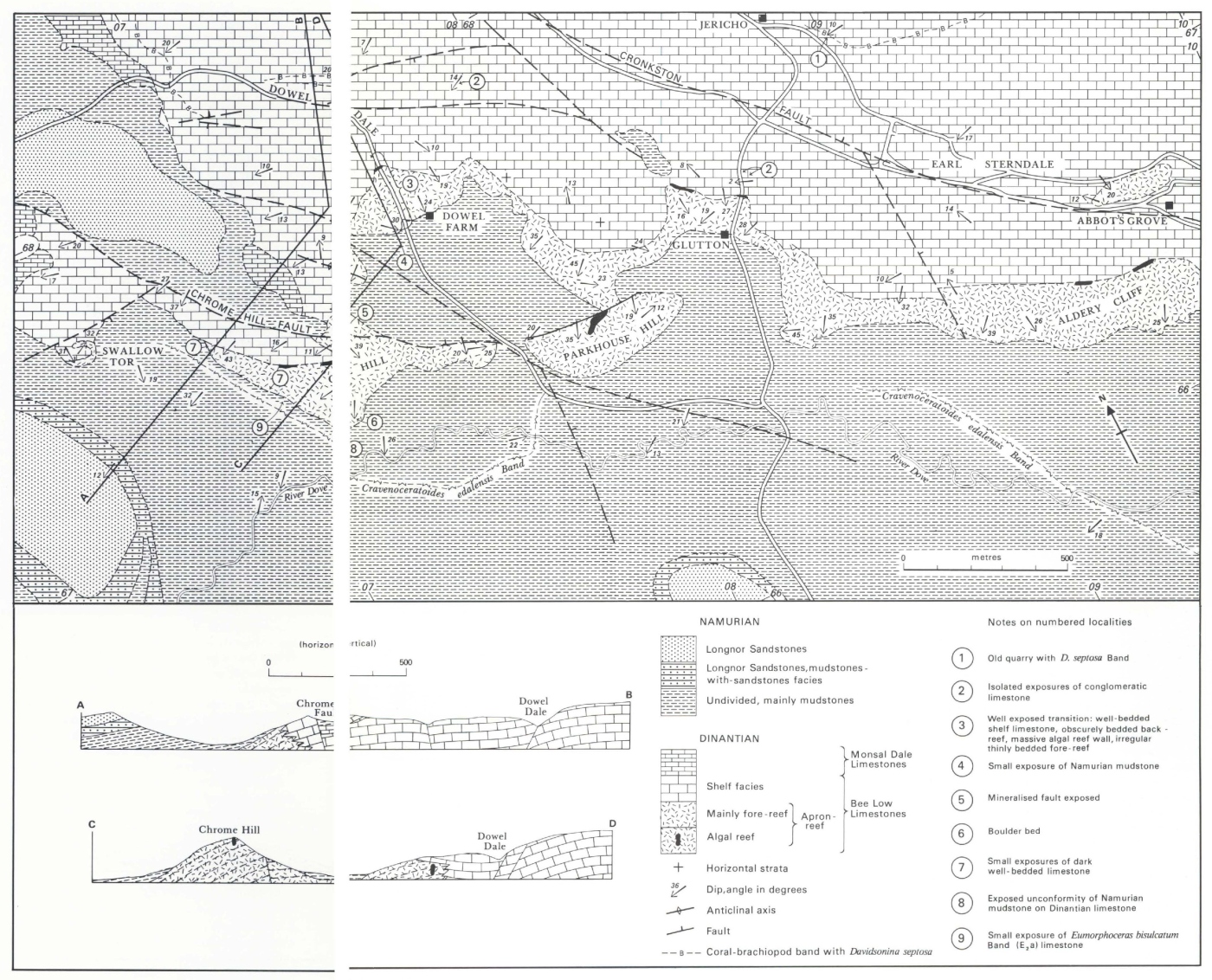
The published Parkhouse account is a description of facies and structure, not a complete measured column. The regional reef-wall dimensions combine observations from several localities. Neither those dimensions nor the numbered sections around Chrome Hill and Dowel provide a missing Parkhouse bed log.

Detailed geology of Parkhouse Hill’s reef margin, fault and later exhumation.
The exact Parkhouse evidence describes a reef margin and its later structure. Reef facies change sideways across the hill; they do not form a complete measured, numbered column. The surrounding Chrome Hill and Dowel Dale sections are useful comparisons, but their fossil beds remain separate localities.
PEAK LIMESTONE GROUP
Bee Low Limestone Formation
The summit reef wall. The Survey places the Parkhouse summit-ridge micritic limestone in the upper B2 algal-reef development, within the late Asbian succession. Fossiliferous fine carbonate mud forms a wall-like mass. The memoir describes these masses collectively at Parkhouse, Chrome Hill and Aldery Cliff as extending no more than 160 m laterally and 21 m vertically within the exposed limits. Those maxima do not measure the thickness of the whole formation at Parkhouse. The 1993 excursion report gives a different generic reef-wall description, up to 24 m high and 9 m wide; it likewise is not a Parkhouse-only measured log.
Biological interpretation of the reef facies. The regional apron-reef description in Aitkenhead’s report, following Wolfenden, interprets the micritic wall as a framework of stromatolitic algae supporting encrusting bryozoans and sponges. This explains the biological character of the facies at the shelf margin; it is not a newly determined list of species from Parkhouse specimens. Detailed recognition of these components required thin-section or etched-surface study, rather than a glance at a weathered cliff.
The fore-reef slope. The principal component of Parkhouse and Chrome hills is fore-reef limestone dipping southwards to southwestwards from the shelf towards the basin. The Survey interprets much of the slope as depositional, while recognising later structural effects. At the regional reef margin, shelf and back-reef limestone can pass into fore-reef limestone without an intervening exposed algal wall. These lateral relationships cannot be represented as two uniform horizontal beds. No separate Parkhouse fore-reef thickness is established.
A second, higher reef development. Aitkenhead’s report attributes to Wolfenden the identification of a higher algal-reef level near the Parkhouse and Chrome summits. Shelf limestone prograded towards the basin, and apron-reef facies migrated southwards during later B2, Asbian, time. This is a named-hill depositional interpretation, not evidence that the lower reef fauna documented at Dowel Dale also occurs in the Parkhouse summit wall.
The faulted northeastern foot. The Chrome Hill Fault has an associated plane and mineralised breccias exposed in places at the northeastern foot of both hills. The Survey records northeastward downthrow reaching 90 m along the regional structure; that maximum is not a local displacement measured at every face. In the 1991 excursion, published 1993, the mapped fault termination on either side of Parkhouse was discussed as evidence for possibly late Brigantian movement, before the Namurian. The report expressly notes that positive proof is lacking. It does not justify a more precise movement date.
Cover, burial and later erosion. The following younger rocks belong to the surrounding landscape history rather than additional beds within the reef limestone.
Namurian mudstone and exhumed relief. The reef limestone is surrounded by younger mudstone that once covered the older topography. Removal of that softer cover helped reveal the resistant limestone relief again. Hudson recognised exhumation but proposed substantial erosion and foundering in its earlier development; later work emphasised the preservation of depositional slopes. The Survey nevertheless describes only a partial knoll form at Parkhouse and Chrome, with faulting also modifying their shapes. The modern hills should not be pictured as intact, unchanged coral islands.
Faunal and mapping limits. The original guide reports brachiopods, crinoids and corals at Parkhouse. The memoir’s detailed brachiopod depth zonation belongs specifically to Chrome Hill. The numbered goniatite, conglomerate and boulder-bed localities in Figure 9 largely lie around Chrome Hill and Dowel, rather than on the Parkhouse summit. They do not establish additional Parkhouse beds or a species list for the specimens illustrated here.
References.
BGS (1985): Buxton, Leek and Bakewell memoir, exact Parkhouse and surrounding reef accounts.
BGS Lexicon: Bee Low Limestone Formation.
BGS Figure 9: separately located reef and younger sections.
Aitkenhead (1993): report of the 9 June 1991 excursion.
Chrome and Parkhouse Hills SSSI citation.
SAFETY
Parkhouse has steep upper slopes, abrupt drops and exposed rock. Avoid the summit in strong wind, poor visibility, ice or wet conditions, and turn back if you are not confident of the route. A lower-level observation visit is a worthwhile alternative.
Keep away from loose faces and overhangs. Do not pull at blocks, dislodge scree or stand below another person on loose ground. Wet grass, mud and limestone can be slippery; vegetation may conceal uneven ground or holes.
Supervise children closely and keep dogs under control around livestock. Wear grippy walking footwear, carry weather protection, water and a map, and allow time for a safe return. Do not improvise a steep descent if you lose the path.
EQUIPMENT
Walking boots, suitable outdoor clothing, a map, water, a camera and a hand lens are sufficient. Binoculars can help you study the reef slopes from a safe distance. A small scale is useful for photographs when placing it will not damage the rock.
Hammers, chisels and collecting tools are inappropriate for this visit. The older equipment advice to split rock conflicts with the site’s observation-only guidance. Leave both outcrops and loose stone undisturbed.
CLEANING AND TREATING
Do not scrub, chip, acid-test or otherwise clean fossils on the hill. Changing a rock surface damages the specimen and its context. Record the natural appearance with photographs instead.
If you already hold lawfully obtained historical material, keep its label and provenance with it. Use only a soft dry brush for loose dust and leave fragile shell surfaces alone. Seek specialist advice before treating an important specimen; avoid acids and aggressive mechanical preparation.
IDENTIFY YOUR FINDS
Need help identifying a fossil? Share clear photos, where you found it and its size with the community.
FURTHER READING
BGS memoir: Buxton, Leek and Bakewell, including the Parkhouse reef margin
BGS Lexicon: Bee Low Limestone Formation
Chrome and Parkhouse Hills SSSI citation
Peak District National Park: access and rights of way
ACCESS RIGHTS
Parkhouse is part of the Chrome and Parkhouse Hills Site of Special Scientific Interest. Leave fossils and stone in place, use currently permitted routes and follow signs protecting the site, livestock and other visitors.
Public paths and access-land rights do not authorise digging, hammering or collecting. Any proposed scientific sampling requires the relevant landowner agreement and conservation permissions beforehand. The old guide’s parking and access remarks are not current permission notices.
It is important to follow our ‘Code of Conduct’ when collecting fossils or visiting any site. Please also read our ‘Terms and Conditions‘
LINKS
♦ Fossil Discussions
♦ Fossil Articles
♦ Buy Fossils, Tools and Equipment
♦ Buy Crystals, Meteorites, and Artefacts
♦ Join Fossil Hunts
♦ UK Fossils Network