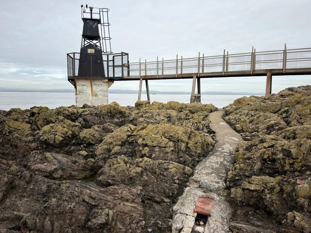
Portishead offers two contrasting fossil-hunting areas on the Severn Estuary. At Portishead Point, also known as Battery Point, Early Carboniferous marine limestones contain corals, crinoids and brachiopods. South-west along Woodhill Bay, the Late Devonian Portishead Subgroup includes the historic Woodhill Bay Fish Bed, with scales, teeth and pieces of armoured fish. Fish remains are rare, but regularly found. Tilted beds, river deposits and an ancient unconformity make this a rewarding geological coast, but powerful tides, soft mud and protected exposures require careful planning.

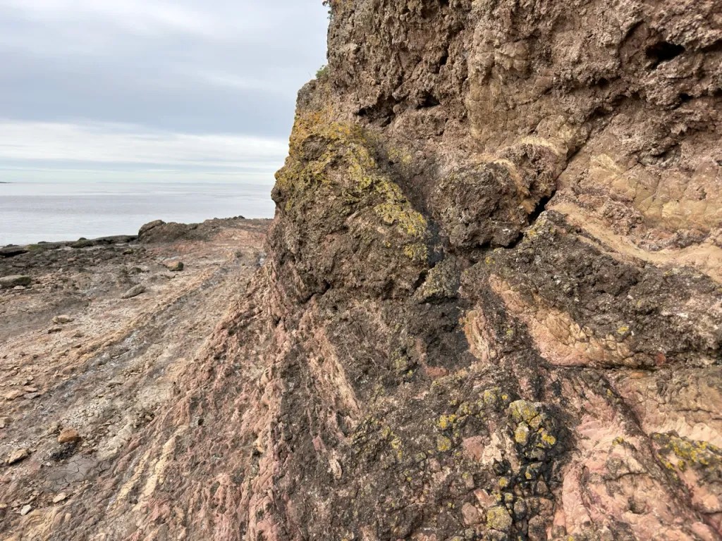
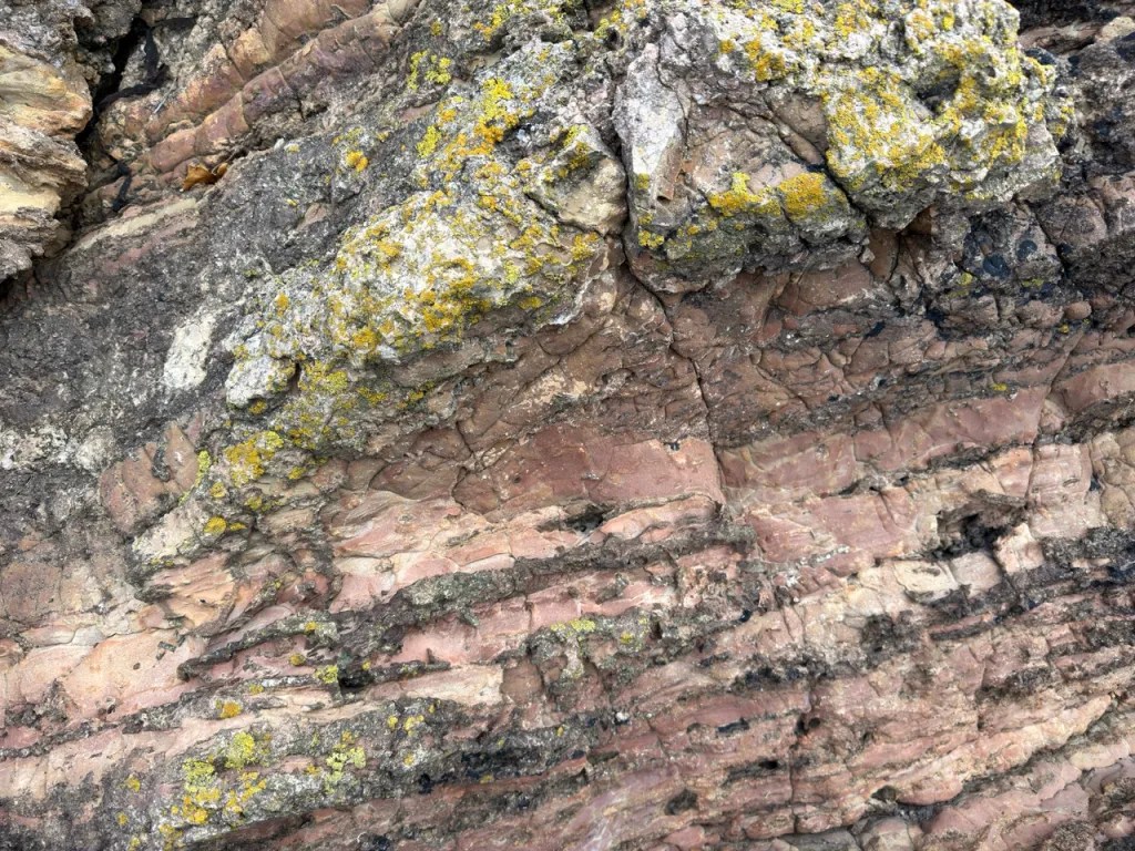
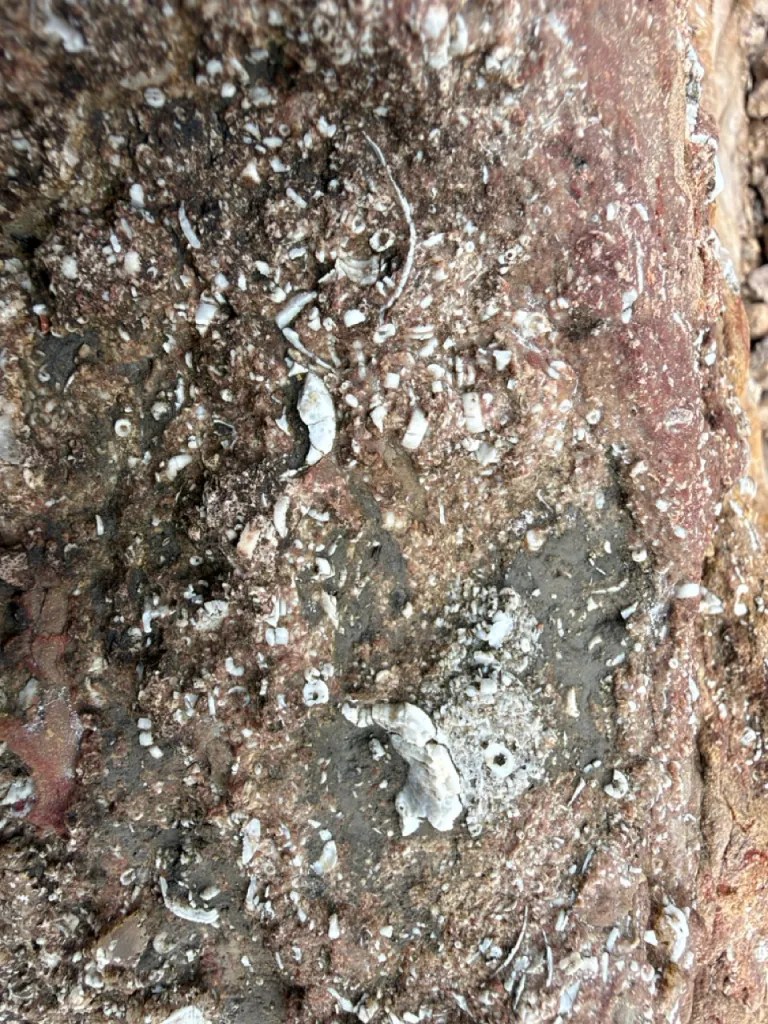
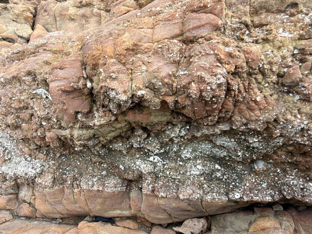
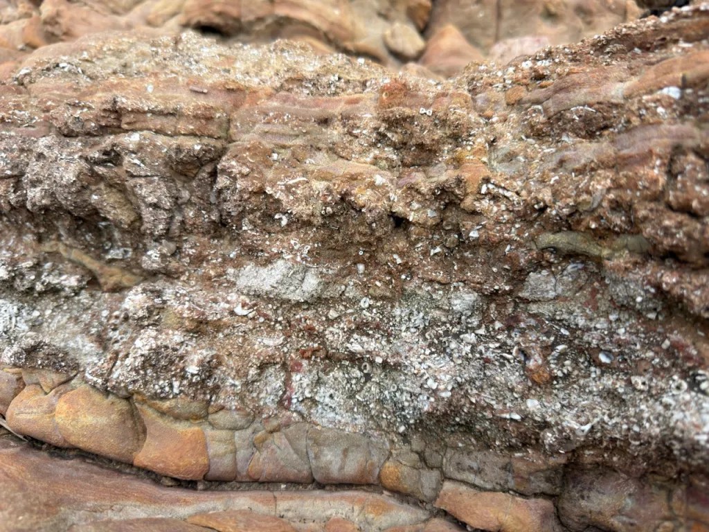
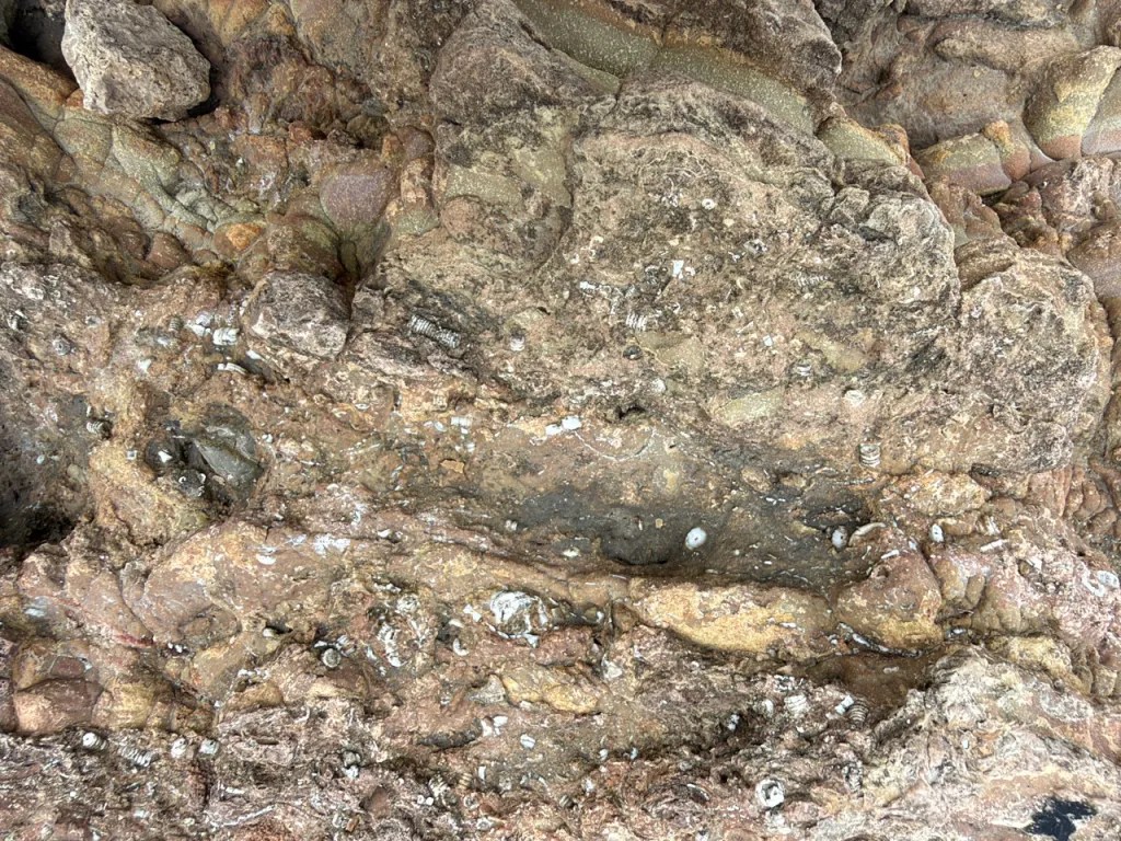
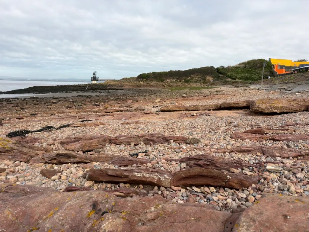
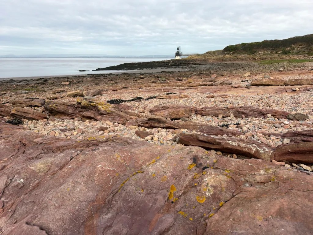

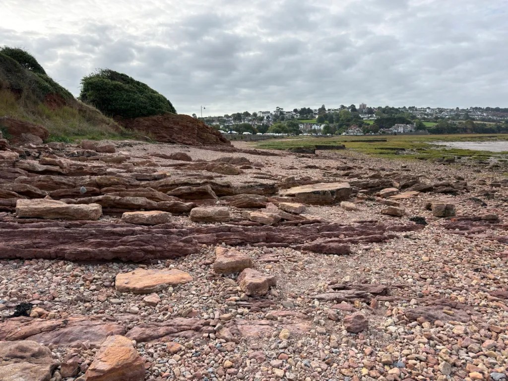
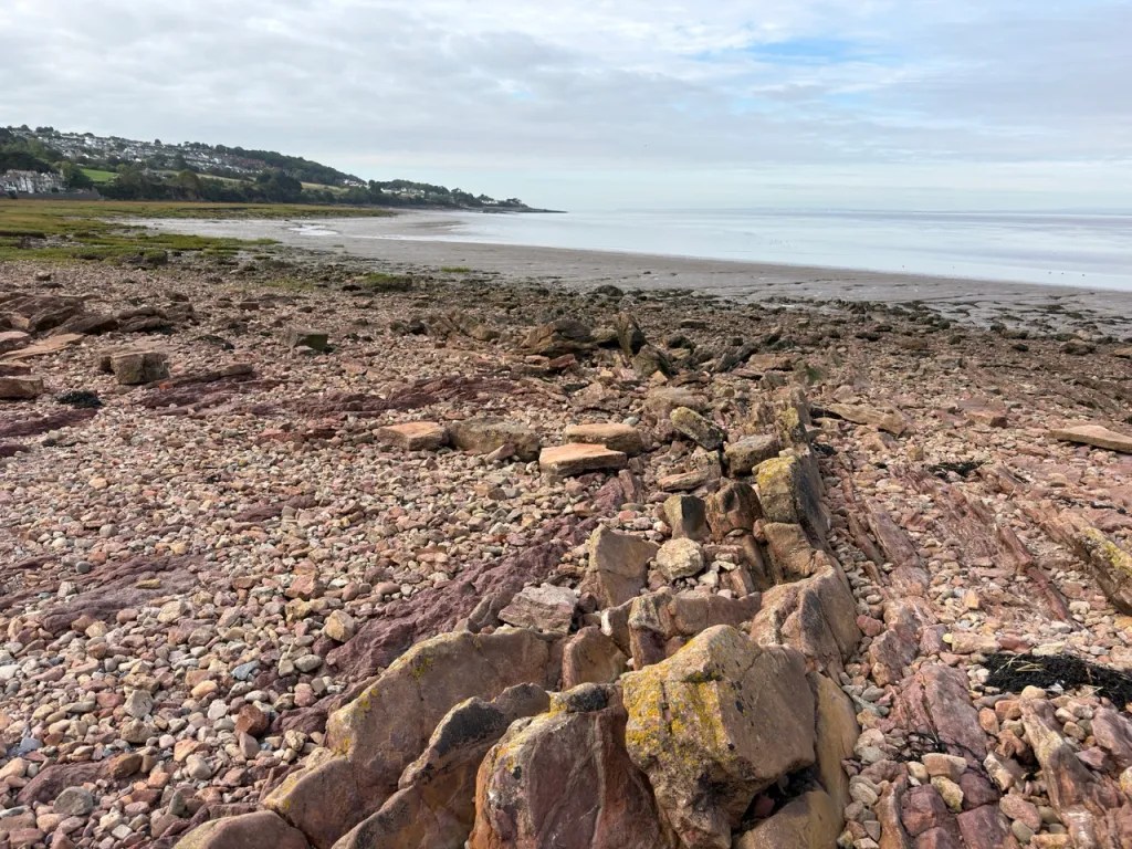
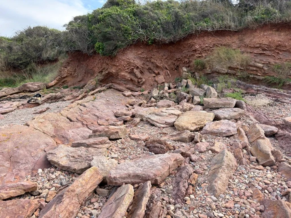
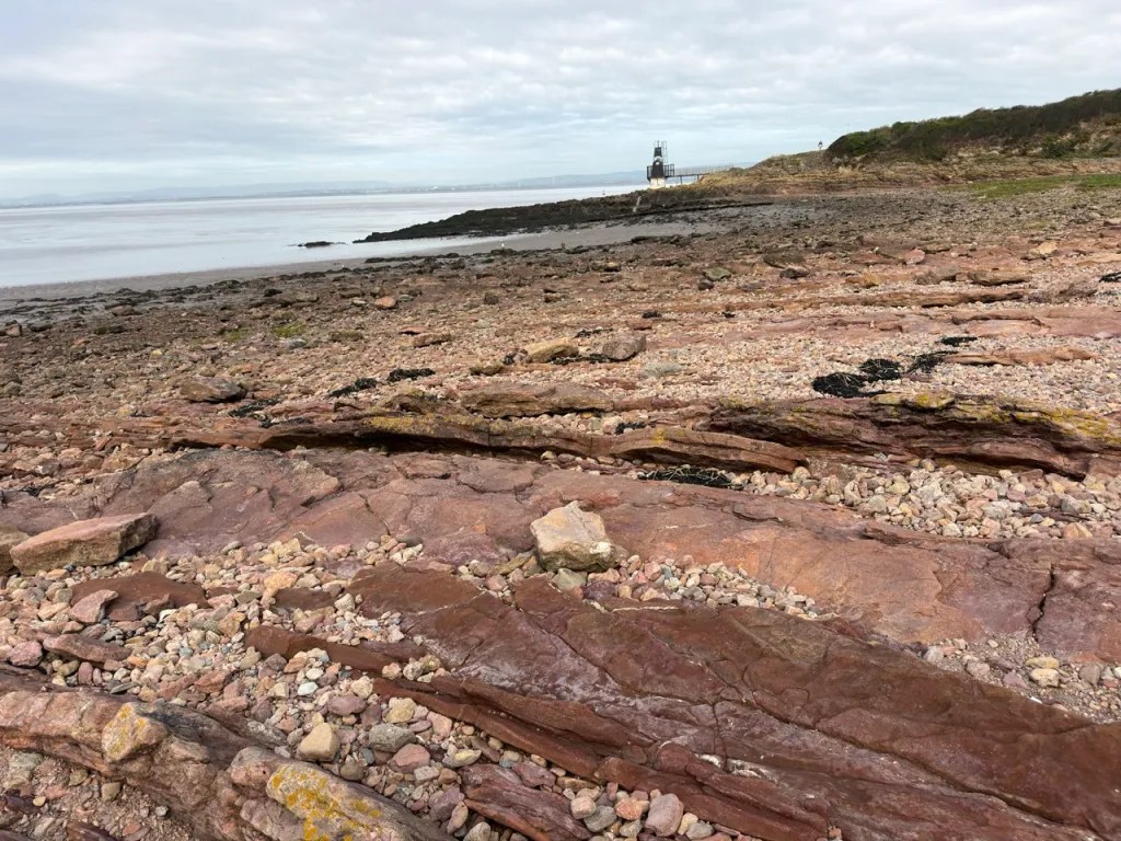
FIND FREQUENCY: ♦♦♦ – Crinoid debris, corals and shells occur in the Carboniferous rocks around Battery Point and northern Woodhill Bay. Devonian fish remains are rare, but regularly found in the appropriate Woodhill Bay material; complete fish should not be expected.
CHILDREN: ♦♦ – The Lake Grounds provide a convenient approach, but the foreshore is uneven, slippery and affected by fast tides and dangerous mud. Close supervision is essential. The longer Devonian shore section is unsuitable for unsupervised children.
ACCESS: ♦♦♦ – Approach from the Lake Grounds and Esplanade Road. Paved seafront access does not continue across the whole fossil-bearing shore; rock steps, mud and tidal cut-off can make sections difficult or inaccessible.
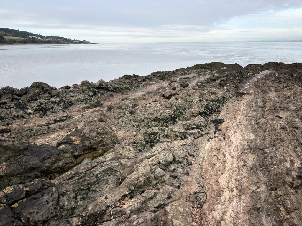
TYPE: Coastal rock platforms, low cliffs and loose foreshore material. Carboniferous marine fossils at Battery Point contrast with Devonian fish-bearing continental deposits farther south-west in Woodhill Bay.
DIRECTIONS
♦ Leave the M5 at Junction 19 and follow the A369 into Portishead, then local signs towards the Lake Grounds and seafront.
♦ North Somerset Council lists Lake Grounds Sea Front car park on Esplanade Road, Portishead, BS20 7HX. View the car park on Google Maps. Check the current signs and any parking conditions when you arrive.
♦ For the Carboniferous shore, use the seafront paths towards the open-air pool and Battery Point. The pool is a useful landmark; its separate postcode is BS20 7HD.
♦ For the Devonian exposures, follow the coast south-west along Woodhill Bay towards the Woodhill–Kilkenny shore section. Use established paths and firm access points; do not shortcut across mud or assume that the whole shoreline is passable.
♦ What3words: Fish bed: ///scavenger.degree.nutty
VIDEO FILM
FOSSIL HUNTING
Treat Portishead as two separate fossil-hunting areas. The limestones around Portishead Point / Battery Point and the northern end of Woodhill Bay contain Early Carboniferous marine fossils. The celebrated Devonian fish-bearing succession lies farther south-west in Woodhill Bay, towards Kilkenny Bay. A specimen found loose between these areas should be labelled carefully, because its position on the modern beach does not necessarily identify the bed from which it came.
Portishead Point / Battery Point – Carboniferous marine fossils
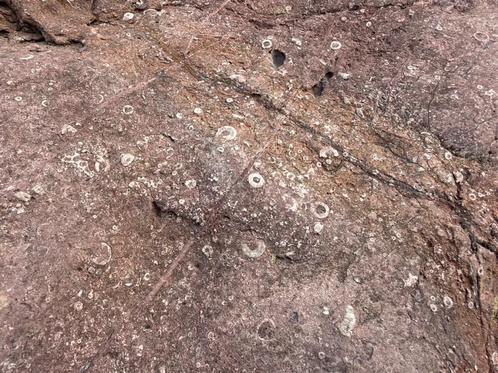
Begin by examining naturally weathered limestone surfaces and small, loose blocks where access and collecting are permitted. Crinoid debris is one of the easiest features to recognise: circular or star-centred stem plates, called columnals or ossicles, may be scattered through the rock or concentrated into densely fossiliferous layers. Short articulated pieces of stem also occur, while complete crinoids are much less likely. These sea-lily relatives lived attached to the floor of a warm, shallow sea.
Corals and brachiopods are also characteristic. Look for the radiating internal partitions of solitary corals, colonial patterns where several corallites occur together, and the ribs or curved outlines of brachiopod shells. The coral Vaughania vetus, recorded in older literature as Cleistopora geometrica, is documented by the British Geological Survey in the red crinoidal limestones on the northern Woodhill foreshore. This is a locality record, not a name to apply automatically to every weathered coral.
The fossils are often firmly enclosed in hard limestone. Weathered surfaces can reveal more detail than a fresh break, so use a hand lens and photograph good examples in place. Do not prise fossils from the cliff or strip bedding surfaces. Modest collecting of naturally loose material is appropriate only where permitted, and the most informative specimen may be a small block showing several fossil groups together rather than an isolated fragment.
Woodhill Bay – Devonian fish remains
The Devonian search is more specialised. The Woodhill Bay Fish Bed occurs within the Portishead Subgroup, the rocks historically called the Portishead Formation or Upper Old Red Sandstone. The classic section is towards the south-western end of Woodhill Bay and the adjoining north-eastern part of Kilkenny Bay. Look at naturally exposed surfaces and loose, identifiable material rather than assuming that every red sandstone block is fossiliferous. Fish remains are rare, but regularly found.
Most finds are isolated scales, teeth, pieces of bone or fragments of dermal armour. The published fauna includes the lobe-finned fishes Holoptychius and Glyptopomus, with armoured fishes such as Bothriolepis and Asterolepis; rare material of Groenlandaspis has also been recorded. These names describe the researched assemblage. Small, worn or broken pieces often cannot be identified securely beyond “fish scale” or “fish bone” without specialist comparison.
A fish scale or plate may show a dark, glossy or finely ornamented surface against the surrounding sediment, but colour alone is not diagnostic. Examine the texture under magnification and retain the surrounding matrix. Plant fragments are recorded in the Devonian succession, and rare eurypterid remains are known from sandstone above the fish bed. These are scientifically interesting records, not fossils to expect on every visit, and they should not all be assigned to the same bed.
Do not dig out the fish bed, undercut cliffs or systematically split the protected outcrop. If an unusual fossil is visible in bedrock, photograph it with a scale and record its position before seeking advice. For a permitted loose find, keep any matching part and counterpart together, label the exact shore sector and date, and leave possible important material unprepared until it has been assessed. A precise record is particularly valuable on a coast where similar-looking rocks belong to different ages and environments.




A chronological record of fossil discoveries, geological research and conservation milestones at Battery Point and the Woodhill Bay coast.
1816–1817 – Magnesian conglomerate and an ancient erosion surface described
Gilby analysed magnesium-rich conglomerate from Portishead and traced its unconformable relationship with tilted older rocks along the coast. His observations were presented in 1816 and published the following year, providing an early scientific account of the contrasting rock successions.
1836 – An early geological map of Portishead
A detailed geological description and map of the parish were published, documenting the arrangement of its rocks long before the fish beds became widely known. The authorship remains uncertain.
1863 – The Woodhill Bay fish remains enter the published record
William Sanders reported Holoptychius from Portishead. The discovery was credited to the Reverend B. Blenkiron, who had found fish-bearing loose blocks on the foreshore. This is the earliest published description cited for the Woodhill Bay Fish Bed.
1864–1865 – Fish remains traced into the coastal succession
William Hellier Baily described fish scales and bones from the beach and recorded further remains in the exposed rocks, including a scale of Holoptychius nobilissimus from a conglomeratic bed. His observations were presented in 1864 and published in the following year’s meeting report.
1867 – The Martyn collection is assembled
A geological visit by the Bristol Naturalists’ Society produced the historic Martyn collection of Woodhill Bay fish remains. The specimens, subsequently held in Bristol’s museum collections, came from the horizon later numbered Bed 8.
1886 – Battery Point and Woodhill Bay mapped together
C. Lloyd Morgan published a detailed study of Portishead’s geology, describing crinoidal limestone at Battery Point, tightly folded beds beside Woodhill Bay and the fish-bearing Old Red Sandstone farther south. His maps and sections helped explain why these contrasting rocks occur so close together.
1892 – The known fish fauna expands
E. J. L. Gardiner described further fish remains from loose blocks near the southern end of Woodhill Bay, identified with the help of A. Smith Woodward. These included Glyptopomus scales, Bothriolepis armour and other teeth and scales, demonstrating that the assemblage was more varied than the early records suggested.
1923–1924 – Coastal sections and geological structure documented
S. H. Reynolds and E. Greenly recorded the local Old Red Sandstone and Carboniferous successions and examined their folding and faulting. Their work placed the Portishead exposures within the structure of the coastal ridge and documented the change from continental deposits to marine limestone.
1927–1928 – The fish-bearing succession measured in detail
F. S. Wallis divided the Woodhill Bay section into numbered beds and related historic collections to particular fossil-bearing horizons. His work established a framework for comparing specimens, sedimentary environments and the distribution of fish remains through the succession.
1948 – Eurypterid remains discovered
In August, F. S. Wallis and B. N. Temperley found a fragment of a eurypterid in fine sandstone associated with the Woodhill Bay fish-bearing succession. Subsequent collecting by Tom Fry produced much more material of this extinct aquatic arthropod.
1951 – Drepanopterus abonensis named
Scott Simpson described the Woodhill Bay eurypterid as the new species Drepanopterus abonensis. Portishead is its type locality, and the original specimens became the reference material against which later discoveries and reconstructions were compared.
1952 – The geological coast receives SSSI protection
The Portishead Pier to Black Nore site was first notified as a Site of Special Scientific Interest. Its protected geological features include the folded Carboniferous rocks at Portishead Point and the Devonian coastal succession containing the Woodhill Bay Fish Bed.
1955 – The Old Red Sandstone succession placed in a regional framework
G. A. Kellaway and F. B. A. Welch distinguished the older Black Nore Sandstone from the overlying Portishead Beds and compared the succession with those across the Severn. The coastal exposures became a key reference for interpreting the Bristol and Mendip Old Red Sandstone.
1964 – River deposits and ancient soils investigated
M. C. Pick published a detailed subdivision of the coastal Old Red Sandstone and interpreted its sedimentary structures, conglomerates and limestone-rich horizons. Recognition of the latter as calcretes, formed in ancient soils, helped establish the continental conditions under which the succession accumulated.
1972 – A temporary Woodhill exposure records the marine transition
M. Butler, B. P. J. Williams and R. Bradshaw described a road cutting created during building work at Woodhill. The section showed sandstone-dominated deposits giving way to limestone and siltstone, preserving evidence of the transition towards the Early Carboniferous sea.
1975 – The rare armoured fish Groenlandaspis recognised
Alexander Ritchie reported Groenlandaspis from the Woodhill Bay Fish Bed. This unusual placoderm record connected Portishead’s Late Devonian fauna with a much wider geographical distribution and became an important reason for the site’s scientific interest.
1977 – The position of the Devonian break reconsidered
B. P. J. Williams and P. L. Hancock reassessed the coastal succession, questioning whether the principal break lay beneath or above the Woodhill Bay Conglomerate. Their interpretation highlighted the need to distinguish local channel erosion and calcrete formation from a major gap in geological time.
1986 – Wind-blown sand proposed within the river succession
Chris Dodd interpreted part of the sandstone beneath the Woodhill Bay Fish Bed as ancient wind-blown dunes. This added a possible aeolian component to the predominantly river-laid succession; the interpretation has subsequently remained a subject for further investigation.
1986 – SSSI boundaries and protection renewed
The coast was re-notified under the Wildlife and Countryside Act, with its boundaries adjusted. The designation brought together the structural interest of Portishead Point and the stratigraphic and fossil importance of the Devonian exposures farther south.
1993 – Geological Survey synthesis refines the fish-bed interpretation
A comprehensive account of the Bristol district reassessed the Portishead succession and its regional relationships. The Woodhill Bay fish assemblage was used to support a middle Famennian age, strengthening its value for comparing otherwise sparsely fossiliferous continental deposits.
1999 – The fossil-fish site’s national significance reviewed
A national review of Britain’s fossil-fish localities documented the diverse Woodhill Bay assemblage and its unusual placoderms. It emphasised the importance of the site for understanding Late Devonian fish communities in southern Britain.
2004 – New eurypterid material collected
O. Erik Tetlie collected additional Drepanopterus abonensis specimens from the Woodhill Bay succession. These joined older collections and helped provide the anatomical evidence needed for a substantially improved reconstruction of the animal.
2005 – The Old Red Sandstone reference section reviewed
A national geological review assessed Portishead’s role as a reference locality for the older and younger Old Red Sandstone. It highlighted the Woodhill Bay Conglomerate, Fish Bed and unusual calcrete development, while identifying unresolved questions about the main unconformity.
2009 – The Portishead eurypterid reconstructed anew
James C. Lamsdell, Simon J. Braddy and O. Erik Tetlie redescribed Drepanopterus abonensis using historic and newly collected specimens. They revised its body proportions and identified specialised feeding structures, showing its relationship to later eurypterids that swept sediment for food.
2015 – Portishead becomes the name of a wider stratigraphic unit
A revised geological classification raised the Portishead Beds or Formation to Portishead Subgroup and retained Woodhill Bay as its partial type section. The revision also included the former Black Nore Sandstone within the Brownstones Formation, explaining the different names encountered in older and modern accounts.
GEOLOGY
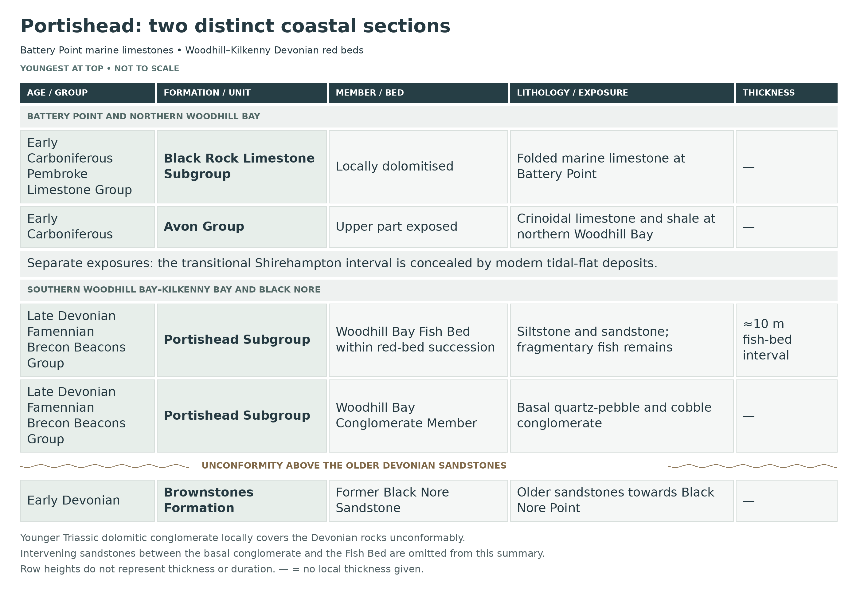
The Portishead coast records a major change from Devonian continental landscapes to Early Carboniferous marine conditions. It is not a single, continuously visible vertical sequence: folding, erosion, later deposits and modern beach sediment interrupt the exposures. This is why the fossils around Battery Point differ so markedly from the fish remains farther along Woodhill Bay.
The main fish-bearing Devonian rocks belong to the Portishead Subgroup of the Brecon Beacons Group. Older accounts commonly use “Portishead Formation”, “Portishead Beds” or “Upper Old Red Sandstone”. Sandstone, siltstone, mudstone and local conglomerate record sediment carried across a continental lowland by rivers and deposited in channels and on adjacent floodplains. The Woodhill Bay Fish Bed is Late Devonian, within the Famennian Stage, and preserves mainly disarticulated vertebrate material rather than a community of complete fish.
An important unconformity separates the upper Devonian succession from older red-bed rocks exposed farther along the Woodhill–Kilkenny coast. The base of the coarse Woodhill Bay Conglomerate is the conventional position of this break in the local succession, although some published interpretations place the principal unconformity above the conglomerate. “Black Nore Sandstone” is a familiar name in older descriptions of the underlying rocks, but current BGS treatment includes that former unit within the Brownstones Formation. These older beds should not be confused with the younger, main Woodhill fish-bearing interval.
Towards the northern end of Woodhill Bay and Battery Point, the Avon Group represents the lower part of the Carboniferous marine succession. It replaces the historical name “Lower Limestone Shale”. Mudstone, shale and limestone record the spread of shallow marine conditions over the former continental landscape; limestone rich in crinoid and shell debris reflects the establishment of marine communities. Red crinoidal limestone and the documented Vaughania vetus coral occurrence are particularly useful features of the northern Woodhill section.
The succession also includes rocks assigned to the Black Rock Limestone Subgroup of the Pembroke Limestone Group, representing more fully developed marine carbonate deposition. Fossiliferous limestone, including crinoid-rich beds, accounts for much of the material encountered around Battery Point. The transitional Shirehampton succession at Portishead is obscured by modern tidal-flat deposits, so the visible shore should not be presented as an uninterrupted Devonian–Carboniferous boundary section.
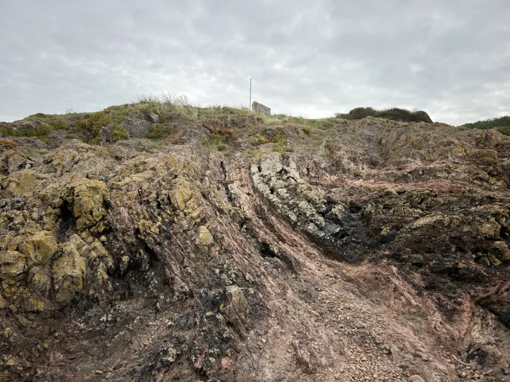
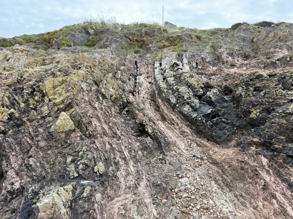
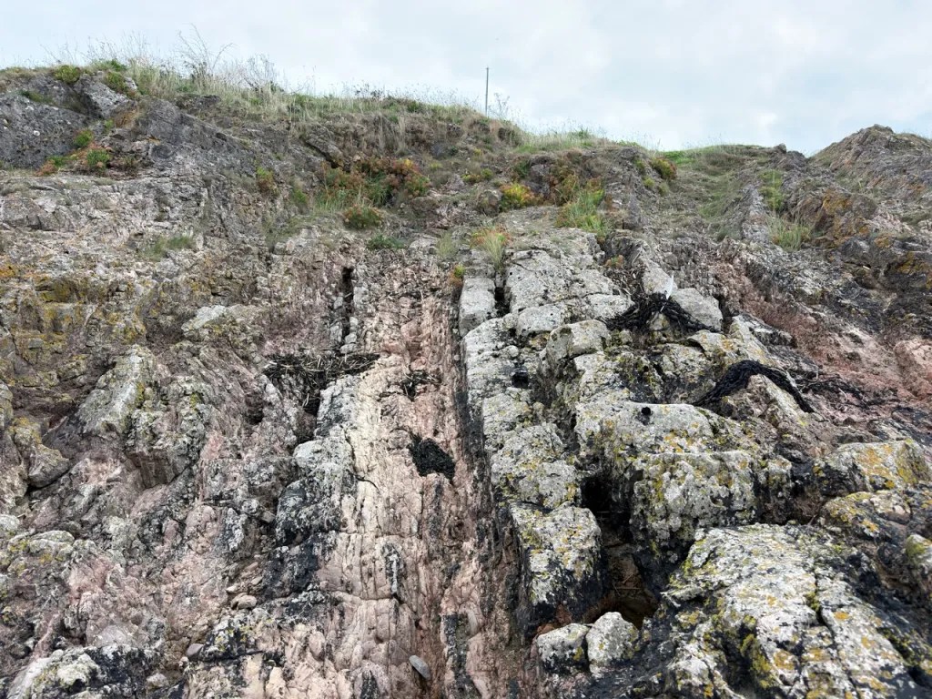
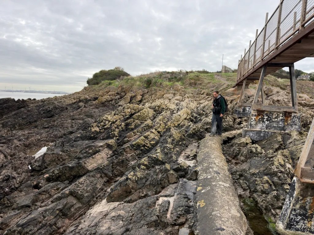
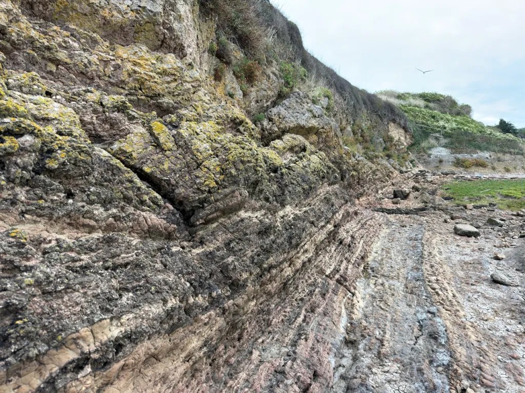
The beds were tilted and folded during later deformation, and younger deposits and faults add to the complexity of the coast. Cross-bedding, contrasting grain sizes, conglomerates and changes between muddy and limestone-rich beds can therefore be just as informative as individual fossils. Record the rock type and geological setting of a find whenever possible; a name without its horizon loses much of its scientific value.

The Portishead coast brings together Devonian continental red beds, Early Carboniferous marine limestones and younger Triassic deposits. This breakdown separates the fish-bearing Woodhill Bay–Kilkenny Bay section from the Carboniferous exposures around Battery Point.
The two fossil-hunting areas expose different parts of the succession. Battery Point, also called Portishead Point, and the northern end of Woodhill Bay expose Early Carboniferous marine rocks. The Devonian fish-bearing cliffs lie farther south-west, at the southern end of Woodhill Bay towards Kilkenny Bay. The name Woodhill Bay Fish Bed is a stratigraphic name and does not mean that every exposure around Woodhill Bay belongs to it.
DEVONIAN
DAUGLEDDAU GROUP: OLDER DEVONIAN ROCKS FARTHER SOUTH-WEST
COSHESTON SUBGROUP
Brownstones Formation
On the wider coastal section towards Black Nore Point, the older river-deposited sandstones were traditionally called the Black Nore Sandstone Formation. The modern BGS framework includes them in the Brownstones Formation, within the Cosheston Subgroup of the Daugleddau Group. They are assigned to the Early Devonian. These beds lie below the younger, fossil-fish-bearing Portishead succession and should not be confused with the Woodhill Bay Fish Bed.
BRECON BEACONS GROUP: UPPER OLD RED SANDSTONE
PORTISHEAD SUBGROUP
The red-bed succession traditionally described as the Portishead Beds or Portishead Formation is now the Portishead Subgroup. It comprises sandstone, siltstone, mudstone and local conglomerate. Around the fish-bearing section, changing grain size, channel-shaped sandstone bodies and finer sediment record rivers crossing a floodplain, with quieter-water deposition between channels. Some sandstone beneath the fish bed has also been interpreted as wind-deposited.
Woodhill Bay Conglomerate Member
The basal conglomerate contains rounded quartz and quartzite pebbles and cobbles in a sandy matrix. Farther south-west along the section it rests on an irregular erosion surface above the older sandstones. This junction is conventionally used to mark the major break between the Lower and Upper Old Red Sandstone successions. Carbonate concretions, traditionally called cornstones, occur around the contact. They are geological features rather than fossils.
Pipe-Like Calcrete Crossing The Contact
At ST 4579 7681, the GCR describes an unusual carbonate body about 2.5 m wide at its base and 2.5 m high, extending from the older sandstone into the Woodhill Bay Conglomerate. Part of its pipe-like shape appears to follow a joint in the conglomerate. It is not interpreted as soil carbonate formed contemporaneously on the top surface of the older sandstone. This cross-contact feature is an important distinction when considering the unconformity; its presence should not be used as a simple marker of an ancient soil at that boundary.
PORTISHEAD SUBGROUP — ABOVE THE BASAL CONGLOMERATE
Woodhill Bay Fish Bed
This named interval is about 10 m thick in the published local section. It contains reddish micaceous siltstone and sandy siltstone, with several harder sandstone beds. Fossil evidence places it in the Famennian, the later part of the Late Devonian. The recorded fish assemblage includes Holoptychius, Glyptopomus, Bothriolepis, Asterolepis and Groenlandaspis. Isolated scales, teeth and fragments of bone or armour characterise the material; complete fish are not a normal expectation.
Fish remains are rare, but regularly found. Carbonised plant fragments also occur. Rare eurypterid remains are documented in sandstone above the fish-bed interval; these records should not be taken to imply that eurypterids are routine finds.
Published Devonian Marker Intervals: Pick’s Historical Letters
The following local subdivisions are retained as historical descriptive units, not modern formal formations. They are listed from the basal conglomerate upwards. Their measurements describe the southern Woodhill–Kilkenny section and must not be applied to Battery Point. The Fish Bed and conglomerate are described in detail above; the intervening sandstones matter because those two units are not directly adjacent.
Unit I — Woodhill Bay Conglomerate
GCR31 describes approximately 4–4.5 m in the local section. Rounded quartz and quartzite pebbles and cobbles lie in a coarse sandy matrix above an irregular erosion surface. Different accounts give broader thickness ranges, so this figure is not a whole-subgroup total.
Unit H — Channelled And Pebbly Sandstones
About 13.5 m of sandstone and pebbly sandstone includes subordinate siltstone and thin conglomerate. Cross-bedding and channel-shaped erosion surfaces record river transport.
Unit G — Pale Green Sandstone
About 14 m of well-sorted sandstone separates the underlying channelled beds from the Fish Bed. Its upper cross-bedded part has been interpreted as wind-deposited; that is an interpretation of this unit, not every green sandstone on the coast.
Unit F — Woodhill Bay Fish Bed
The approximately 10 m interval includes micaceous siltstone and several harder sandstone beds. GCR 31 identifies the principal fish concentrations with horizons correlated to Wallis beds 7, 8 and 10. The unit thins and is eroded out northeastwards; fragmentary remains, rather than complete fish, are characteristic.
Unit E — Overlying Channel Sandstone
A locally 7.5–17 m sandstone package has trough cross-bedding, quartz pebbles and mudstone clasts near its base. Rare eurypterid material is documented in this overlying sandstone, rather than being a routine find from every Fish Bed exposure.
Unit D — Upper Sandy Siltstone And Sandstone
About 3 m of finer red and green sandy siltstone with harder sandstone completes a fining-upwards channel package above unit E. Local mudcracks, burrows and fish fragments are recorded.
Older J1–J3 Subdivisions Below The Unconformity
Pick subdivided the older Black Nore sandstones, now Brownstones Formation, into three descriptive packages. J2 is distinguished by abundant calcrete clasts. The full historical 292 m older-rock section extends towards Black Nore, and is not the thickness exposed at the Fish Bed collecting stop.
Individual Historical Fish Horizons
Wallis Bed 7 — Conglomeratic Sandstone
The historical GCR 16 bed list identifies a conglomeratic sandstone. Several fossil records are assigned jointly to beds 7–8, so an exclusive fauna for bed 7 is not inferred.
Wallis Bed 8 — Conglomeratic Sandstone
A separate conglomeratic sandstone carries documented fish material. Historical collections and combined bed 7–8 records are not used to invent a finer split in occurrence.
Wallis Bed 10 — Brecciated Siltstone
GCR 16 preserves Wallis’s lithological description as brecciated siltstone. GCR 31 discusses the main fish concentrations more generally in the thick sandstone horizons; those descriptions are not silently forced into exact equivalence.
Wallis Bed 18 — Cliff-Top Siltstone
Thin-bedded siltstone at the cliff top has yielded fish fragments in the historical account. This is a separate record above the main named Fish Bed interval.
Pick J1 And J3: Descriptive Limit
The checked GCR account distinguishes J2 by abundant calcrete clasts but does not provide separate lithological descriptions for J1 and J3. Their shared older sandstone context is retained without inventing bed-specific differences.
CARBONIFEROUS
AVON GROUP: EARLY CARBONIFEROUS
The Avon Group belongs to the Carboniferous Limestone Supergroup and includes rocks historically called the Lower Limestone Shale. Its alternation of mudstone and fossiliferous limestone records the establishment of marine conditions over the older continental landscape. The group is of Tournaisian age.
The upper part of this succession is exposed at the northern end of Woodhill Bay, immediately south of Battery Point. The limestone beds contain abundant crinoid debris, and the BGS records the coral Vaughania vetus in red crinoidal limestone here. Older accounts use the name Cleistopora and the historical Cleistopora Zone; Vaughania vetus is the appropriate name for the coral discussed in those accounts. The limestones and intervening finer beds are folded into small anticlines and synclines.
The basal Shirehampton Formation is the regional transition between the red beds and the more fully marine Avon Group. At Portishead this transitional interval is concealed beneath modern tidal-flat deposits, so the Devonian–Carboniferous passage cannot be followed continuously on the open foreshore.
PEMBROKE LIMESTONE GROUP: EARLY CARBONIFEROUS
BLACK ROCK LIMESTONE SUBGROUP
Black Rock Limestone and its dolomitised equivalents form Battery Point and the ridge extending eastwards. These are younger than the Avon Group limestones. The subgroup principally comprises dark, crinoid-rich marine limestone, locally altered to dolomite; alteration can obscure fossil detail. The older term Black Rock Dolomite describes these altered rocks, rather than a separate younger deposit. The headland contains strongly folded beds, including locally overturned strata.
TRIASSIC
MERCIA MUDSTONE GROUP: TRIASSIC MARGINAL DEPOSITS
Younger breccias and conglomerates, traditionally called Dolomitic Conglomerate, occur discontinuously along the coast. They rest unconformably on the much older Palaeozoic rocks. These deposits contain fragments eroded from the older bedrock and must be distinguished from both Devonian fish-bearing sandstone and Carboniferous marine limestone.
The Devonian section lies on the southern side of the Portishead–Clevedon anticline and generally dips south-east. Faulting, local folding, younger deposits and modern beach cover interrupt the exposures. Consequently, a walk around the bay is not a simple, continuously visible passage through every bed between the Devonian and Carboniferous.
References
Barclay, W.J., Davies, J.R., Hillier, R.D. & Waters, R.A. (2015). Lithostratigraphy of the Old Red Sandstone successions of the Anglo-Welsh Basin. British Geological Survey Research Report RR/14/02.
British Geological Survey. Lexicon of Named Rock Units: Brownstones Formation; Portishead Subgroup; Woodhill Bay Conglomerate Member; Avon Group; Shirehampton Formation; Black Rock Limestone Subgroup.
Dineley, D. & Metcalf, S. (1999). Portishead, in Fossil Fishes of Great Britain. Geological Conservation Review Series 16. JNCC.
Kellaway, G.A. & Welch, F.B.A. (1993). Geology of the Bristol district. Memoir of the British Geological Survey, Bristol special sheet; especially the Portishead Down–Portishead–Portishead Point section.
Mitchell, M. (1980). The distribution of Tournaisian and early Visean (Carboniferous) coral faunas from the Bristol and South Wales areas of Britain. Acta Palaeontologica Polonica, 25, 577–585.
Wilby, P.R. (2005). Portishead, North Somerset, in Barclay, W.J. and colleagues, The Old Red Sandstone of Great Britain. Geological Conservation Review Series 31. JNCC.
SAFETY
The Severn Estuary has a very large tidal range, fast tidal currents and extensive soft mud. Check local tide predictions and the weather before leaving, plan to reach the shore on a falling tide, and allow a generous margin to return before access routes are cut off. Low water does not make the mudflats safe. Do not walk out onto soft mud or use it as a shortcut between rock platforms.
Rock surfaces can be slippery with algae, wet sediment and sea spray. Uneven beds, loose stones and sharp edges make sturdy footwear essential. Keep clear of unstable cliff faces, overhangs and recently fallen blocks; do not work directly beneath cliffs or try to reach an exposure when waves are washing across the route. Stay on the established landward path whenever shore conditions are doubtful.
Children need close supervision throughout, including around pools, muddy margins and the seaward edge of the rocks. Carry a charged phone, tell someone your route and expected return time, and avoid exploring isolated shore sections alone. If anyone is in danger on the coast, call 999 or 112 and ask for the Coastguard. Do not enter mud or water to attempt an unassisted rescue.
EQUIPMENT
Take sturdy boots with good grip, weatherproof clothing, a hand lens, a camera or phone, a small scale for photographs and reliable tide information. A notebook or offline map is useful for recording the exact shore sector and bed. Carry drinking water and keep your phone dry and charged.
For any loose specimens collected with permission, bring paper labels, soft wrapping and small rigid boxes. Support thin fish-bearing pieces so that they cannot flex or rub against other rocks. A soft brush is useful for examining loose material, but a hammer and chisel are not needed for observing the geology and should not be used to damage the protected bedrock or cliffs, only for splitting suitable loose rocks where collecting and use of tools are permitted.
CLEANING AND TREATING
Carboniferous limestone fossils: start with a soft, dry brush to remove loose sediment. A brief rinse can be suitable for a sound, robust specimen, but stop if the matrix softens or the fossil surface flakes, and let it dry fully at room temperature before storage. Hard limestone and calcitic fossils may break together, so do not force matrix away with a large tool. Any detailed mechanical preparation should be done carefully under magnification or by an experienced preparator.
Devonian fish remains: preserve the surrounding sandstone or siltstone and keep matching halves together. Thin scales and armour fragments can be damaged by scrubbing, soaking or repeated drying, especially where the matrix is friable. Support the whole piece, avoid chasing a bone with a chisel and seek specialist advice before removing more rock from a potentially important find.
Avoid vinegar and other household acids, bleach, wire brushes, polishing and varnish. Acids can destroy calcitic fossils and carbonate-rich matrix. Routine coating is unnecessary; if a specimen genuinely needs stabilising, ask a fossil conservator about a suitable reversible treatment. Label each specimen with its date, precise locality, whether it was loose or in place, and the bed or rock type where known. Keep Battery Point Carboniferous material clearly distinguished from Woodhill Bay Devonian finds.
IDENTIFY YOUR FINDS
Need help identifying a fossil? Share clear photos, where you found it and its size with the community.
FURTHER READING
Deposits Magazine – British Carboniferous Limestone (regional background)
GCR / GeoGuide – Portishead — Woodhill Bay Fish Bed
GCR / GeoGuide – Portishead, North Somerset
GCR / GeoGuide – Portishead Pier (nearby Upper Carboniferous section)
Newbury Geology Society – Portishead field trip — 19 October 2025
ACCESS RIGHTS
Parts of this geological shore are protected within the Portishead Pier to Black Nore SSSI, an important protected succession of Devonian and Carboniferous rocks. The designated boundary is not identical to every part of the seafront. Check the official site map, current signs and any local instructions for the place you intend to visit. Public access to a path or beach does not automatically give permission to remove fossils or rock.
Obtain the relevant landowner or managing authority’s permission before collecting, and establish whether any additional consent is needed for the proposed activity. Natural England’s site-specific list of operations requiring consent includes mineral extraction and modification of rock faces and outcrops; it should not be read as a blanket ban on every loose fossil or as automatic permission to collect. Do not hammer, prise or excavate the protected bedrock, remove material from cliffs, or disturb the fish-bearing horizons without the necessary permissions. Where collecting of naturally loose material is permitted, take only a modest representative selection and leave scientifically important features intact. Photograph and accurately record unusual finds and seek advice from a museum or specialist rather than trying to extract or prepare them immediately.
It is important to follow our ‘Code of Conduct’ when collecting fossils or visiting any site. Please also read our ‘Terms and Conditions’.
LINKS
♦ Fossil Discussions
♦ Fossil Articles
♦ Buy Fossils, Tools and Equipment
♦ Buy Crystals, Meteorites, and Artefacts
♦ Join Fossil Hunts
♦ UK Fossils Network