
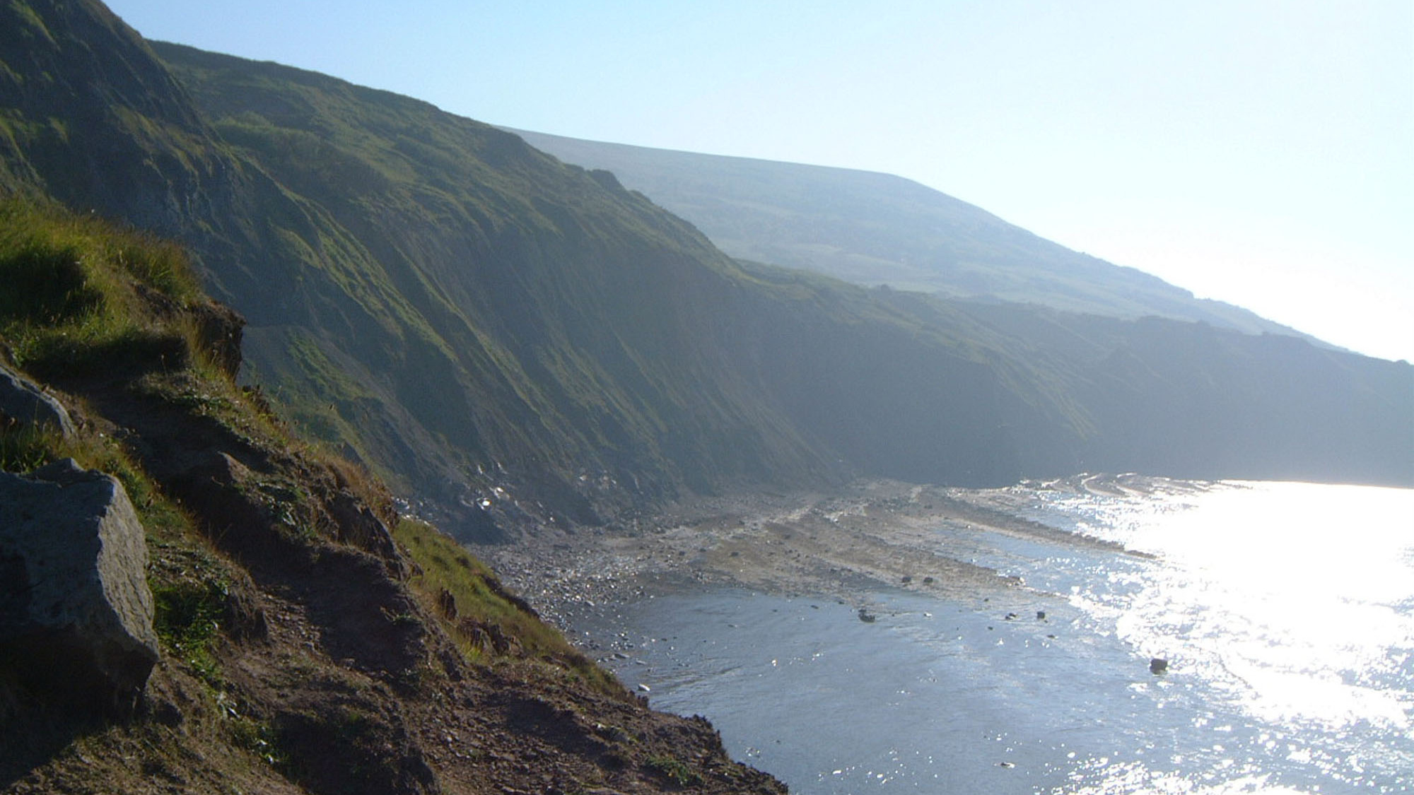
Overview
Directions
- Access notice, checked 9 October 2026: the North York Moors National Park’s Ravenscar page, updated 1 September 2026, states that the golf-course-to-beach footpath is CLOSED following landslip damage. Do not use or bypass it.
- Approach Ravenscar village from the A171. Roadside parking and established clifftop paths provide village and coastal viewpoints; follow current signs and parking restrictions.
- Walkers arriving along the shore from Robin Hood’s Bay or Boggle Hole have no cliff exit at Ravenscar. Do not treat that longer shore walk as a substitute for the closed descent.
- Original locality reference: 54.40780°N, 0.49314°W. This is not a safe-descent or verified parking pin.
Location photographs
Swipe to browse · Select a photograph to enlarge


Fossil Hunting
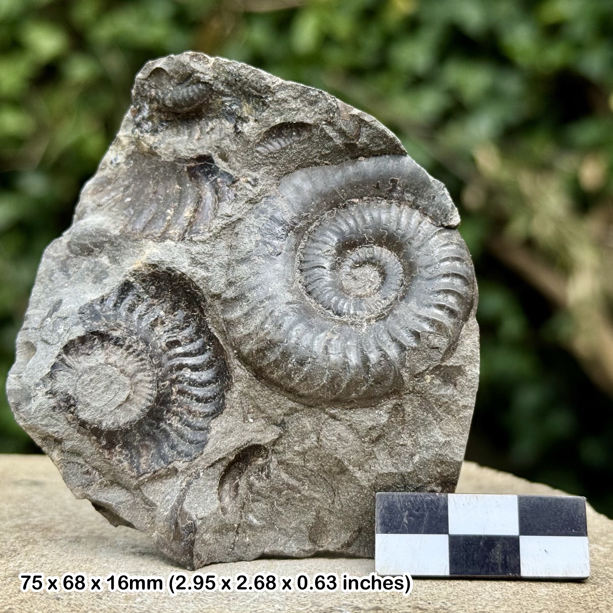
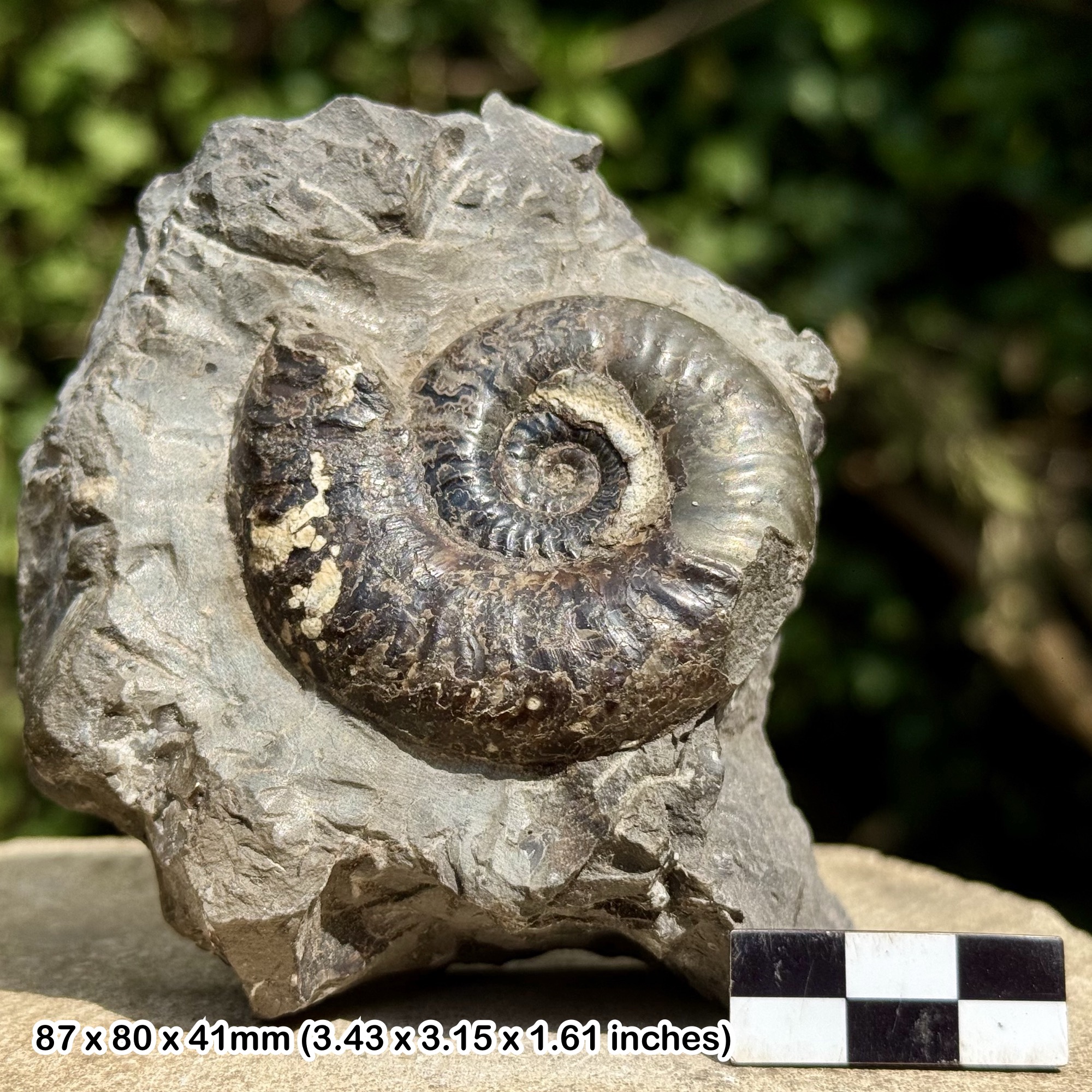
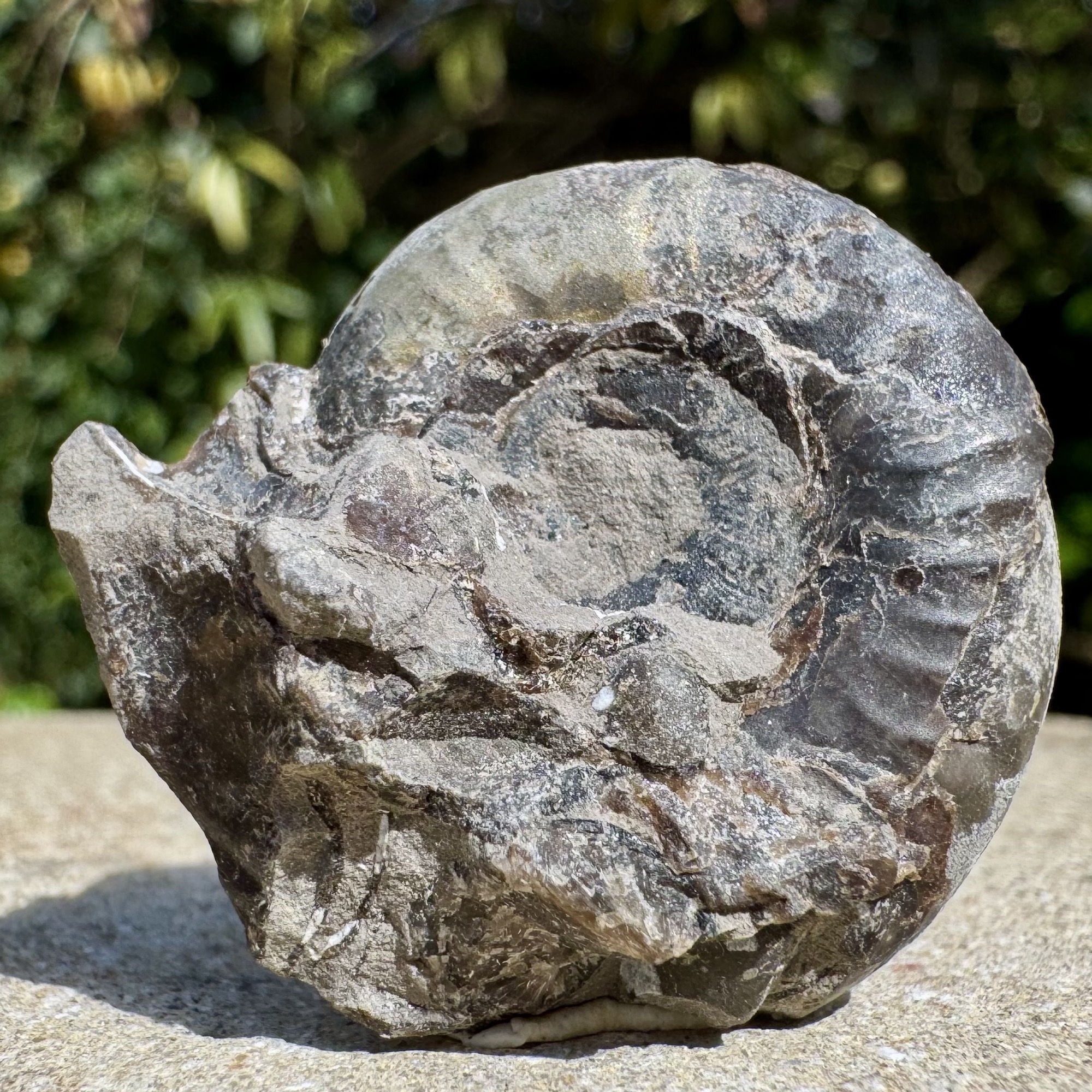
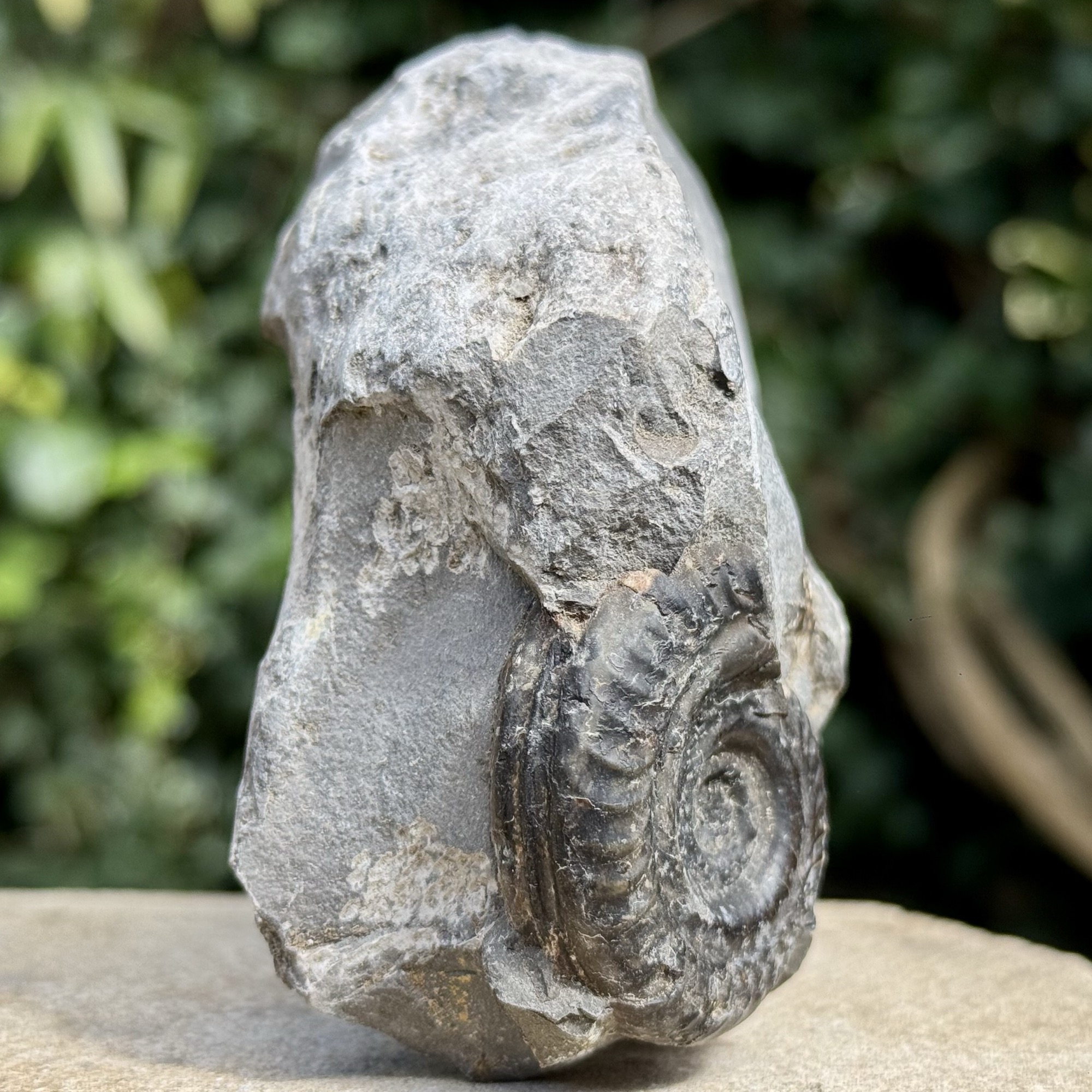
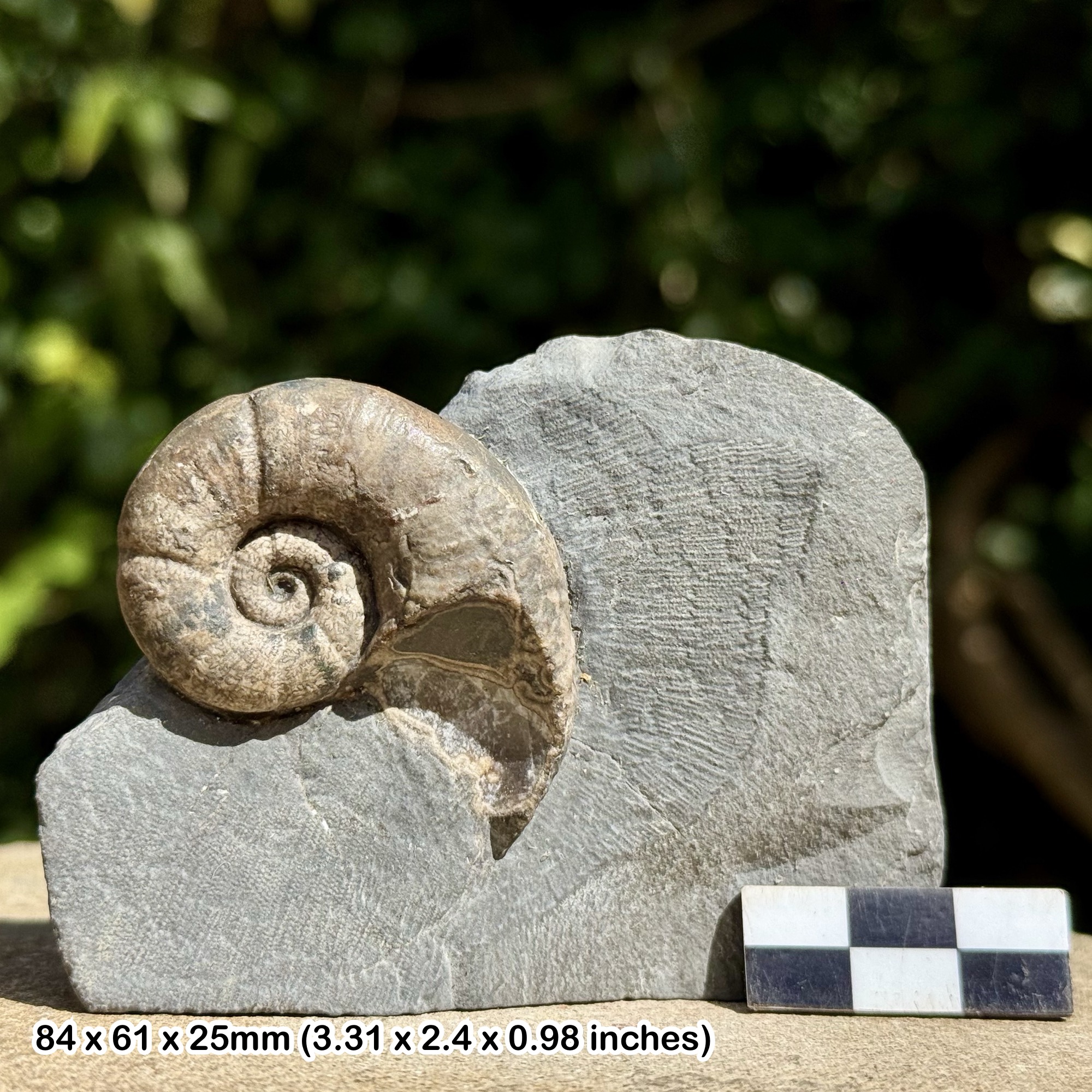
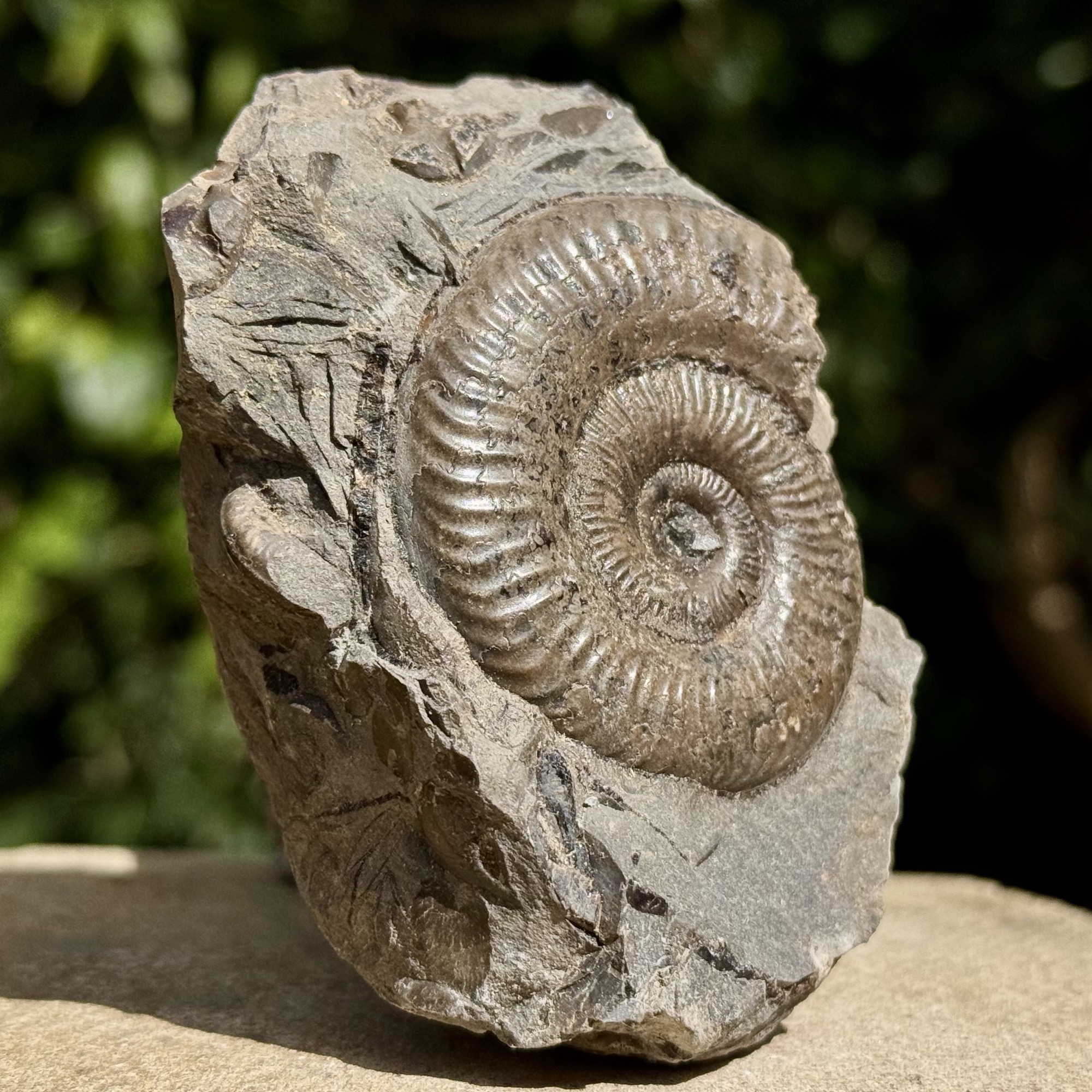
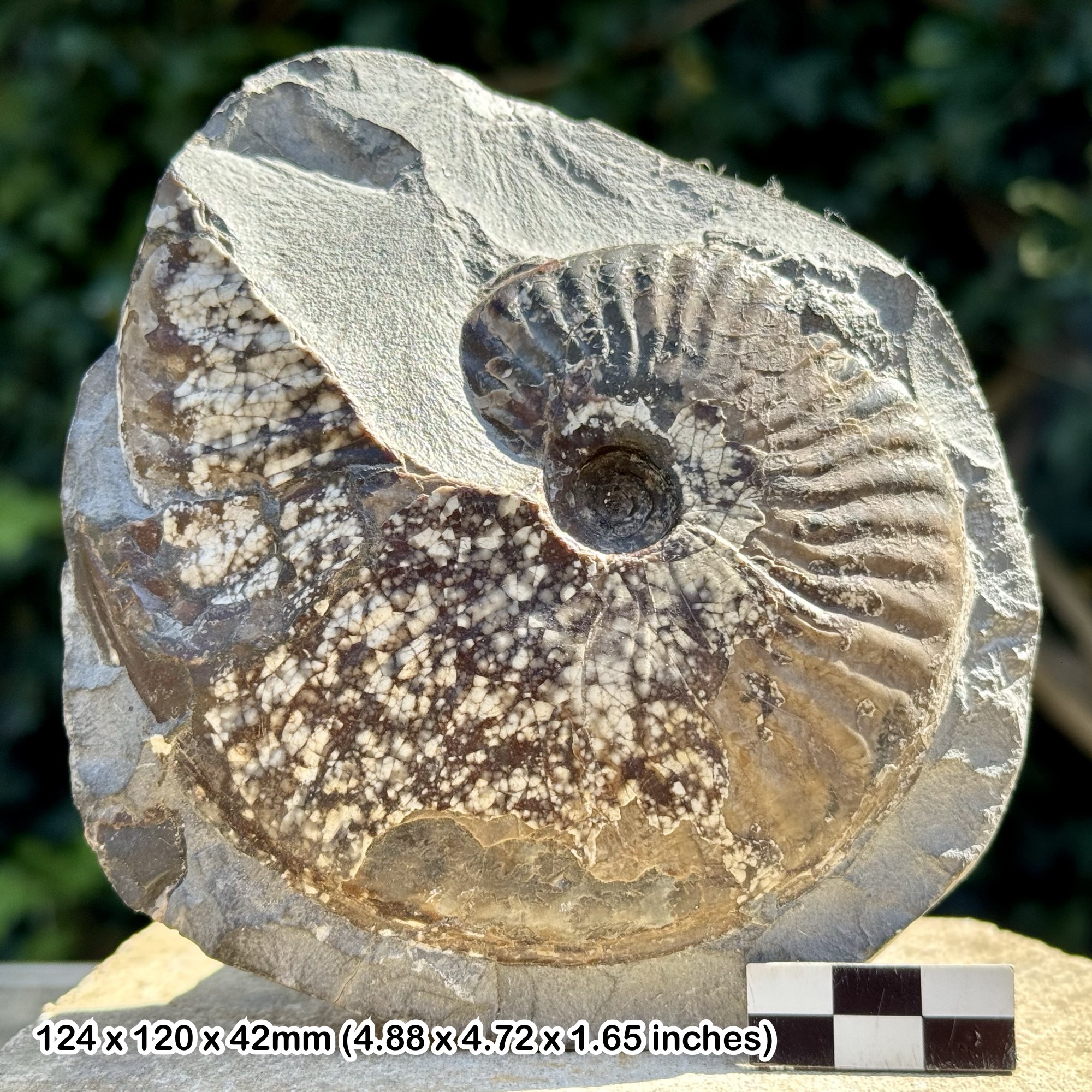
The shore contains a documented fauna of ammonites, belemnites, bivalves and brachiopods in shales, shell beds and concretions. Fossils may occur loose or within fallen rock, but that geological description does not establish safe present access. Do not descend the closed path or approach fresh falls.
Concretions can preserve shells well, while laminated shale may contain flattened or delicate fossils. Recording the matrix and position is important because older material can be reworked into younger beds. An ammonite fragment in a Dogger pebble is not automatically the depositional age of the surrounding Dogger.
The Ovatum Bed’s concentrated, aligned belemnites and the named concretion bands are important scientific features. Leave fixed markers and exposed beds intact. Historical vertebrate records and type specimens show scientific importance rather than frequent finds.
If safe access is formally restored in future, any collecting must follow landowner and protected-site guidance. Document unusual fossils and associations before preparation and seek a suitable museum’s advice. For now, use established clifftop viewpoints.
Fossil photographs
Swipe to browse · Select a photograph to enlarge


Discoveries and milestones
A chronological record of discoveries, research and conservation at Ravenscar.
1822 – A classic ammonite described
The holotype of Lytoceras cornucopia, described by Young and Bird, comes from Ravenscar. Its source is placed within the Alum Shale or Peak Mudstone interval; the surviving evidence does not fix a single numbered bed.
1855–1884 – Simpson’s ammonite types
Simpson described material later discussed as Pseudolioceras boulbiense and P. lythense. Later reassessment connected these types with the Ravenscar upper-Toarcian succession, while retaining uncertainty over some original horizons.
1860–1892 – Early descriptions of the upper succession
Wright, Hudleston, Tate and Blake, and Fox-Strangways successively described the difficult upper-Toarcian exposure. Differences between their measured thicknesses reflect both access difficulties and changing interpretation.
1929–1939 – The Lower–Middle Jurassic boundary clarified
Davies identified the boundary position in 1929. Rastall and Hemingway’s 1939 work refined the Dogger succession, including its basal brachiopod-rich Terebratula Bed.
1954 – Dean’s detailed upper-Toarcian section
Dean published the detailed upper section that underpins much later bed correlation. His numbered scheme must be distinguished from the lower Roman-numbered beds used in subsequent accounts.
1962 – Howarth documents the lower succession
Howarth described the beds from the Grey Shale to the Peak Mudstone interval, using a separate bed scheme south-east of the Peak Fault because its lithology differs from the coast farther north.
1984 – Modern lithostratigraphy and palynology
Knox established the formal upper succession and its sedimentary cycles; Riding examined its palynology. Together these studies strengthened interpretation of the unusually complete late-Toarcian section.
1985 – An articulated ichthyosaur vertebral series observed
An approximately half-metre articulated vertebral series was observed in 1985, probably within Dean’s beds 49–52. The probable horizon is retained rather than converted into an exact-bed discovery.
1990–1993 – Belemnites and the Ovatum accumulation investigated
Doyle documented the belemnite succession in 1990–1992. Doyle and Macdonald’s 1993 work examined concentrated belemnite remains, helping interpret the Ovatum Bed’s distinctive accumulation.
2013 – A Ravenscar ammonite selected as neotype
Howarth designated a Ravenscar macroconch as the neotype of Grammoceras striatulum after loss of the holotype. Its provenance is the Striatulum Subzone; no unsupported numbered bed is assigned.
Geology
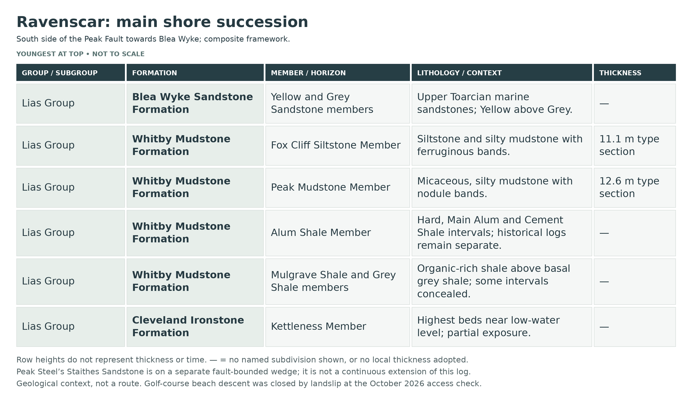
Peak Steel is formed by older Pliensbachian Staithes Sandstone on a fault-bounded block. Across the Peak Fault, the younger shore succession begins at the top of the Cleveland Ironstone and continues through the Whitby Mudstone and Blea Wyke Sandstone formations. This structural juxtaposition is not one continuously traceable bed sequence.
The Whitby Mudstone includes Grey Shale, Mulgrave Shale, Alum Shale, Peak Mudstone and Fox Cliff Siltstone members. Concretion bands, shell concentrations, phosphate nodules and increasingly silty beds record changes within the marine basin. The upper Toarcian sequence is unusually complete here compared with much of the Yorkshire coast.
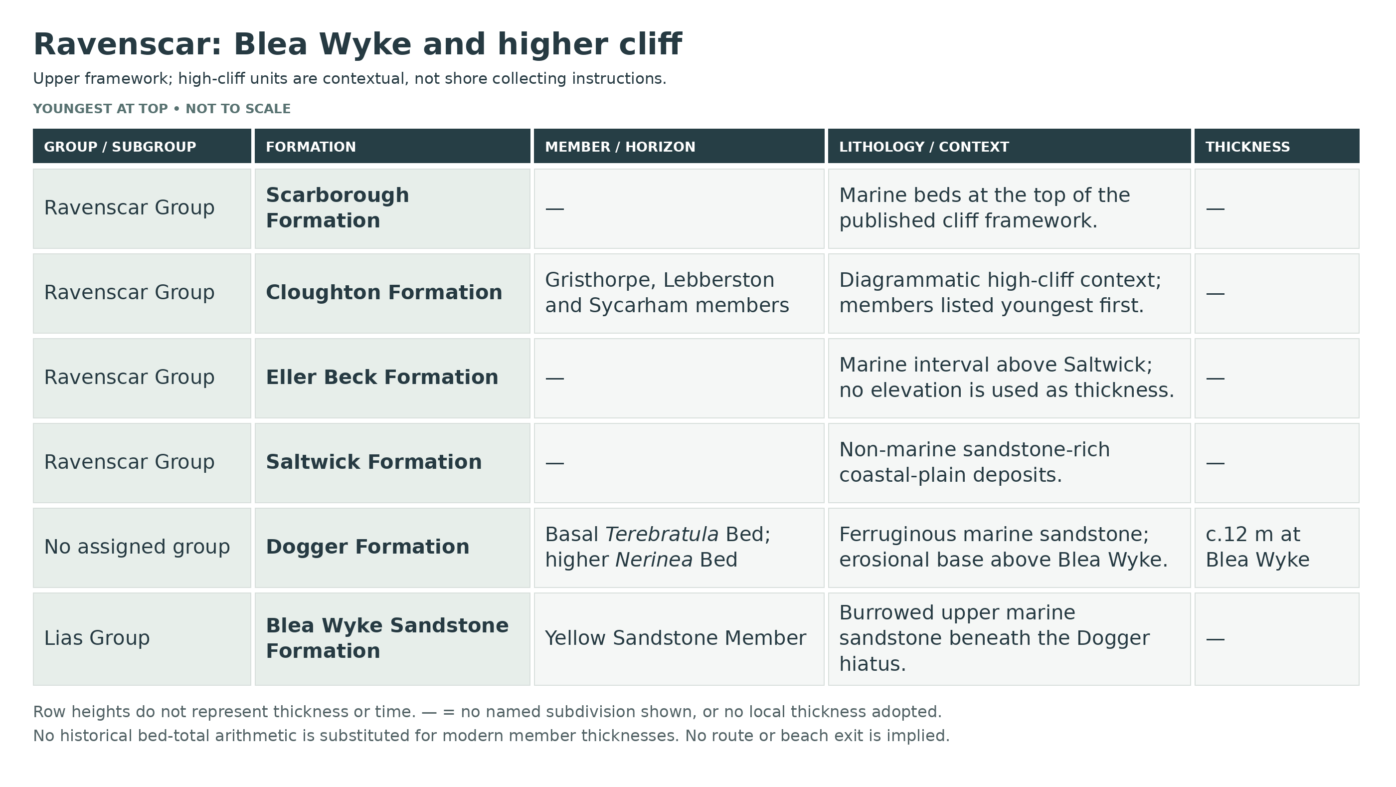
Grey and Yellow Sandstone members of the Blea Wyke Sandstone continue the marine succession, with burrowing and shell-rich levels. They are not Saltwick river-channel sands. The younger Dogger Formation is also marine and has an erosional base that can incorporate reworked older fossils.
Higher cliffs include Saltwick, Eller Beck, Cloughton and Scarborough formations of the Ravenscar Group. These contextual cliff exposures are not accessible collecting ledges. The detailed account below separates historical bed-number schemes and scoped thicknesses rather than forcing them into a single measured total.
Detailed geology and bed-by-bed succession
Detailed geology and fossil-bearing horizons at Ravenscar.
Fault-separated shore and composite bed numbering
Peak Steel is a fault-bounded wedge of Pliensbachian Staithes Sandstone Formation. Across the Peak Fault the younger shore section begins with the top of the Cleveland Ironstone Formation and continues through the Whitby Mudstone and Blea Wyke Sandstone formations. The east-side downthrow is about 150 m. The succession below combines several measured accounts; Roman-numbered lower beds and Dean’s Arabic-numbered upper beds are separate schemes. Their thicknesses must not be added to a modern member thickness without reconciling the measured sections.
LIAS GROUP
The shore succession passes from late Pliensbachian marine rocks into a unusually complete Toarcian sequence. Shales give way upwards to siltier mudrocks and bioturbated sands. Marine conditions persisted through the Blea Wyke Sandstone; these rocks are not the overlying river deposits.
Staithes Sandstone Formation
Micaceous shallow-marine sandstones form Peak Steel on the older, fault-bounded side. This exposure is structurally juxtaposed against the younger sequence rather than being a bed that can be followed continuously up the south-side cliff.
Cleveland Ironstone Formation
The highest beds occur near mean low-water level on the south side of the fault, beneath the Whitby Mudstone succession.
Kettleness Member
The upper Cleveland Ironstone beds are assigned to the Kettleness Member in the published GCR log. They are compared with beds 43–44 at Hawsker Bottoms; those numbers are correlation references, not an independent Ravenscar numbered log.
Whitby Mudstone Formation
The succession preserves the Grey Shale, Mulgrave Shale, Alum Shale, Peak Mudstone and Fox Cliff Siltstone members. Gentle southerly dip brings progressively younger beds towards shore level, but boulders, beach sediment and falls interrupt visibility.
Grey Shale Member
Poorly exposed grey marine shale at the base of the local sequence. The log records no reliable overall exposed thickness; some intervals are hidden by boulders.
Beds 1–2
Grey shale near mean low water. The GCR places these basal beds in the latest Pliensbachian part of the composite log; no total thickness is stated.
Beds 3–11
Grey shale with red-weathering sideritic concretions. Beds 3 and 5 were observed as lithologically comparable with their more northerly equivalents. Do not assume that the entire interval is continuously visible.
Beds 12–27
The middle interval was obscured by boulders in the published section. It is retained as a genuine visibility gap, without importing the measured thickness of another locality.
Beds 28–32
Grey shale containing occasional calcareous nodule bands is exposed below the Jet Rock. Dactylioceras semicelatum is recorded; the interval belongs to the Semicelatum Subzone.
Mulgrave Shale Member
The lower Jet Rock and overlying Bituminous Shales contain laminated, organic-rich marine mudrock and concretions. Local marker bands are less fully developed than farther north: the useful named markers here are Whalestones, Millstones, Peak Stones and the Ovatum Bed. Do not add all northern jet-rock nodule names to Ravenscar.
Bed i
Grey shale with rare concretions, forming the basal numbered Jet Rock interval. The GCR composite gives 2.45 m.
Bed ii
Grey shale with numerous small calcareous concretions and crushed Eleganticeras elegantulum (historically Elegantuliceras elegantulum), especially near its base; the elegantulum biohorizon. The GCR composite gives 1.85 m.
Bed iii
Grey shale with paler calcareous laminae, weathering into a small step on the shore platform. The GCR composite gives 0.30 m.
Bed iv — Whalestones
Numerous small concretions accompany occasional large Whalestones, reported up to 1.5 m long and 0.6 m thick. Some jet and ammonites including Cleviceras exaratum (published as Harpoceras exaratum), Hildaites and Eleganticeras (historically Elegantuliceras) occur. This is the local exaratum biohorizon, correlated with the northern Whalestones rather than given their northern bed number. The GCR composite gives 0.90 m.
Bed v
Pale calcareous laminae in grey shale make another minor resistant platform step. The GCR composite gives 0.22 m.
Beds vi–vii — Millstones
Flat concretions are capped by occasional lenticular Millstones, no more than about 1.2 m across in the cited account. Harpoceras elegans, Phylloceras heterophyllum and Acrocoelites trisulcolosus are recorded. The GCR composite gives 2.60 m.
Beds viii–x — lower Bituminous Shales
Bituminous grey shale contains a scattered row of pyrite-coated concretions above the middle. Crushed Harpoceras of the falciferum group and Dactylioceras, including D. gracile, occur; rare Phylloceras and Lytoceras are also recorded. The GCR composite gives 9.70 m.
Bed xi — Peak Stones
Large lenticular concretions, commonly around 1.5 m across, cap shale pedestals below Ravenscar. These are the “fairy tables”; occasional Harpoceras of the falciferum group occur. Their geometry and shore weathering make them especially recognisable. The GCR composite gives 0.22 m.
Beds xii–xiv — upper Bituminous Shales
Bituminous grey shale includes a red-weathering sideritic mudstone band, Dactylioceras and belemnites. The belemnite record includes Acrocoelites, Simpsonibelus and, towards the base, Youngibelus. The GCR composite gives 13.70 m.
Bed xv — Ovatum Bed
A double row of large red-weathering concretions with pyritic masses marks the top of the member. Ovaticeras ovatum, Dactylioceras and Phylloceras heterophyllum occur. Concentrated, aligned belemnites and associated vertebrate remains give this bed a distinctive taphonomic interest. The GCR composite gives 0.35 m.
Alum Shale Member
The local section is thicker than its counterpart northwest of the Peak Fault. Hard Shale Beds are followed by Main Alum Shale Beds and Cement Shale Beds. These subdivisions are descriptive beds within the member, not additional formations.
Beds xvi–xvii — Hard Shale Beds
Shale capped by large flat nodules; recorded belemnites include Parapassaloteuthis robusta and Acrocoelites subtenuis. The composite thickness is 4.0 m.
Beds xviii–xxv — Main Alum Shale Beds
Nodular shale with large concretions at the top and smaller nodules through the interval. Dactylioceras commune is common; D. temperatum occurs occasionally, while only D. praepositum and D. crassiusculum are restricted in this log to Bed xxv; Frechiella is recorded in beds xviii and xxi. Dacromya ovum first appears in Bed xxii. The log links this package with the commune biohorizon. The composite thickness is 12.6 m.
Bed xxvi
Shale with occasional nodules and Dactylioceras praepositum; Hildoceras and Acrocoelites vulgaris are also recorded. The composite thickness is 1.28 m.
Beds xxvii–xxviii
Shale with scattered nodules and abundant Dactylioceras athleticum, defining the athleticum biohorizon. Rare Hildoceras, small bivalves and belemnites accompany it. The composite thickness is 1.4 m.
Bed xxix
Shale with many small nodules; Peronoceras turriculatum is common alongside other Peronoceras and bivalves. This is the turriculatum biohorizon. The composite thickness is 0.9 m.
Bed xxx
Shale with relatively few nodules. Peronoceras fibulatum and P. perarmatum occur with Hildoceras, Pseudolioceras and belemnites. The composite thickness is 2.15 m.
Bed xxxi
A band of large calcareous concretions records Zugodactylites braunianus, Z. thompsoni, Peronoceras and Hildoceras; the braunianus biohorizon. The composite thickness is 0.15 m.
Bed xxxii
Nodule-rich shale at the top of the Main Alum Shale Beds, with Hildoceras, Pseudolioceras lythense, Dacromya ovum and belemnites. The composite thickness is 2.0 m.
Beds xxxiii–xli — lower Cement Shale Beds
Nodular shale begins with a 0.15 m cementstone band. The diverse fauna includes ammonites, belemnites, bivalves and crinoid ossicles in its lower part. The published correlation with Whitby beds 65–71 does not make the two measured sections identical. The composite thickness is 4.6 m.
Beds xlii–xliv
Shale with many calcareous concretions, Porpoceras of the vortex group, Hildoceras bifrons and occasional Pseudolioceras and Harpoceras. The vortex biohorizon extends down to the base of Bed xliv. The composite thickness is 3.1 m.
Beds xlv–xlvii
A double line of large basal concretions is followed upwards by shale and a band of small nodules. Catacoeloceras crassum and Hildoceras bifrons occur. The composite thickness is 1.3 m.
Beds xlviii–liii
Shale with calcareous nodule bands and Catacoeloceras crassum, Hildoceras semipolitum, bivalves and diverse belemnites. This and the preceding package represent portions of the crassum–semipolitum biohorizon. The composite thickness is 2.5 m.
Beds liv–lvi
Shale contains flat nodules or a red limestone band, with Catacoeloceras dumortieri, C. crassum, Pseudolioceras boulbiense and Phylloceras heterophyllum. The GCR places it in the Navis horizon, while discussing later refinements of Lower–Upper Toarcian correlation. The composite thickness is 1.9 m.
Bed lvii / Dean Bed 37
Calcareous nodules in grey shale mark the first local appearances of Oxytoma substriata and Trigonia literata in the composite log. The composite thickness is 0.08 m.
Bed lviii / Dean Bed 38
Shale records Haugia, Catacoeloceras dumortieri and Phylloceras heterophyllum. The composite thickness is 0.9 m.
Dean Beds 39–41
Grey shale with nodule bands; the last local occurrence of Dacromya ovum in the cited log, accompanied by Gresslya and Oxytoma. The composite thickness is 0.8 m.
Dean Bed 42
Shale with occasional nodules. Dean recorded Lytoceras cornucopia and Haugia; the GCR expressly cautions that his species-level Haugia identifications may need revision. The composite thickness is 0.8 m.
Dean Beds 43–44a
Grey shale with a basal band of large flattened nodules forms the uppermost Cement Shale package. Fossils reported from Dean’s undivided Bed 44 cannot all be assigned separately to 44a below and 44b above the member boundary. The composite thickness is 1.6 m.
Peak Mudstone Member
The basal increase in silt and mica marks a fining-upward cycle. Sideritic and phosphatic nodules provide local markers; the bed scheme below retains the source’s split of Dean Bed 44 at the lower boundary. BGS gives 12.6 m for the type section; the older approximate 13 m observation and composite bed sums are separately scoped measurements, not values silently averaged together.
Dean Bed 44b
Grey, possibly micaceous shale. Fossils attributed by Dean to undivided Bed 44 include Haugia, Pseudolioceras whitbiense, Trigonia literata and Gresslya donaciformis; their exact allocation within that original bed is uncertain. Composite thickness: 0.30 m.
Dean Bed 45–47
Shale bounded by nodule bands, with large fragmentary Haugia. Composite thickness: 0.80 m.
Dean Bed 48
Grey silty micaceous shale with Trigonia literata, Haugia, Pelecoceras and Phylloceras heterophyllum. Composite thickness: 0.90 m.
Dean Bed 49–52
Micaceous silty shale with several nodule bands and large crushed Haugia; bivalves and a varied belemnite fauna occur. An approximately half-metre articulated ichthyosaur vertebral series was observed at a probable level within this interval in 1985. Composite thickness: 2.40 m.
Dean Bed 53
Thin sideritic mudstone preserves uncrushed body chambers of large Podagrosites/Denckmannia, together with bivalves and belemnites. Composite thickness: 0.08 m.
Dean Bed 54
Grey micaceous shale with plentiful belemnites including Acrocoelites tricissus and several Simpsonibelus species. Composite thickness: 2.50 m.
Dean Bed 55
Sideritic nodule band with Pseudolioceras boulbiense, Grammoceras striatulum, other ammonites and a rich bivalve fauna. Composite thickness: 0.15 m.
Dean Bed 56
Grey micaceous shale with belemnites, completing the Peak Mudstone cycle. Composite thickness: 4.15 m.
Fox Cliff Siltstone Member
Two fining-upward cycles contain muddy siltstone, silty mudstone, thin sideritic beds, concretions, phosphate nodules and scattered ferruginous ooids. BGS defines the base at Dean Bed 57. The modern type-section thickness is 11.1 m and decreases northwestwards; older composite bed totals are not an interchangeable modern measurement.
Dean Beds 57
Ferruginous concretionary marker forming the member base. Locally abundant fossils include Pseudolioceras boulbiense, Grammoceras, Pseudogrammoceras and varied bivalves. Historical composite thickness: 0.23 m.
Dean Beds 58
Grey micaceous shale with Podagrosites latescens (Dean’s Pseudogrammoceras latescens) and numerous belemnites. Historical composite thickness: 5.20 m.
Dean Beds 59–62
Micaceous sandy shale with two continuous resistant sideritic mudstone bands. Historical composite thickness: 3.85 m.
Dean Beds 63–67
Grey sandy shale with sandy ferruginous nodules, Phlyseogrammoceras dispansum, belemnites and brachiopods. Historical composite thickness: 2.50 m. The first local occurrence of Lingula beani is recorded in this package.
Dean Beds 68–69
Grey sandy shale becomes ferruginous above; Lingula beani, Discinisca reflexa and the crustacean Eryma birdi are recorded. Historical composite thickness: 0.50 m.
Blea Wyke Sandstone Formation
This marine, upper-Toarcian unit is preserved in the Peak Trough and forms Blea Wyke Point. The lower Grey and upper Yellow Sandstone members are separate upward-coarsening packages. The formation is not missing between Fox Cliff Siltstone and Dogger at this locality.
Grey Sandstone Member
Grey very fine- to fine-grained muddy sandstone with micaceous siltstone interbeds, burrow mottling, sideritic lenses and shell concentrations. Modern BGS gives 7.8–9.0 m. Older bed groupings below use the GCR’s historical composite and should not be summed as though this range were measured in precisely the same way.
Dean Beds 70–78 — lower Grey Sandstone / Lingula-bearing beds
Sandy grey siltstone with ferruginous bands and concretions, historically given as 6.3 m. Belemnites are frequent, especially higher in the package; Lingula beani and Serpula deplexa occur. The traditional “Lingula Beds” denotes the lower part of the Grey Sandstone, not a separate formation.
Dean Beds 79–80 — fossil-rich grey sandstone
Massive grey sandstone forms part of the point. A ferruginous basal band contains ammonites and brachiopods; the upper 0.15 m is also ferruginous and fossil-rich, with serpulids, brachiopods, scaphopods, crustaceans and belemnites. The composite gives 2.0 m. The serpulid-rich upper Grey Sandstone has historically been termed the “Serpula Beds”. The basal fauna includes Phlyseogrammoceras dispansum and Hudlestonia affinis; the upper 0.15 m shell concentration is especially serpulid-rich.
Dean Bed 81 — upper Grey Sandstone
Massive grey sandstone with a very uneven top and scattered ferruginous concretions, concentrated near the top. Brachiopods, serpulids, bivalves and belemnites are recorded. Composite thickness 1.7 m; the shift to yellow-weathering sandstone marks the next member.
Yellow Sandstone Member
Massive yellow-weathering fine sandstone with discontinuous ferruginous layers corresponds to Dean Bed 82, given as 8 m in the composite. Bivalves and brachiopods accompany Dumortieria ammonites and belemnites. Intense bioturbation characterises the upper sandstone.
Dean Bed 82 and the burrowed top surface
The top of the Yellow Sandstone is penetrated by Skolithos-type vertical burrows beneath the basal Dogger. A hiatus removes the youngest Toarcian interval; the Dogger rests above an erosional/non-depositional break rather than a continuous transition.
Dogger Formation
About 12 m of ferruginous sandstone at Blea Wyke, brown on weathering but grey-green when fresh because of berthierine. The basal contact is above the burrowed Yellow Sandstone. This Aalenian marine unit precedes the Ravenscar Group and should not be placed inside it.
Terebratula Bed
The 0.45 m basal bed contains abundant phosphate pebbles and terebratulid brachiopod casts, including Lobothyris trilineata (historically Terebratula). Bivalves, crinoid material, belemnites and wood also occur. Reworked material means a fossil in the basal bed need not be the age of deposition.
Micaceous shaly ironstone above the basal bed
A lenticular ironstone interval of similar thickness to the basal Terebratula Bed follows it, before the main sandstone.
Two higher pebble/nodule horizons
Two approximately 0.08 m pebble or nodule bands are recorded in the sandstone above the basal beds. They are retained as two horizons without inventing separate formal bed names or precise spacing.
Nerinea Bed
A lenticular shell-rich bed lies approximately 3 m below the formation top. High-spired Nerinea cingenda accompanies other gastropods, Neocrassina elegans, Gervillella, Trigonia costata, brachiopods and corals. Siderite replacement allows shells to weather in relief from the sandy berthierine-oolitic matrix. These historical identifications are recorded as the published assemblage.
Upper Dogger sandstone
Large-scale low-angle stratification occurs above the Nerinea Bed. The top metre contains abundant spherulitic siderite. The Saltwick contact is generally sharp, with local reworking of the upper Dogger.
RAVENSCAR GROUP
The high cliffs above Blea Wyke contain younger Middle Jurassic coastal-plain deposits interrupted by marine incursions. These high-level units are geological context, not a claim of safe shore-level access to every bed.
Saltwick Formation
Sandstone-rich non-marine deposits overlie the Dogger, marking the transition to fluvial/coastal-plain deposition.
Eller Beck Formation
A marine interval forms a feature approximately 50 m above the Dogger in the GCR description; it is not readily accessible in the cliff.
Cloughton Formation
The formation lies above Eller Beck and below Scarborough in the high cliff succession. Do not transfer the detailed Cloughton Wyke plant beds or Gristhorpe log to this shore.
Sycarham Member — high-cliff context
Shown within the Cloughton Formation in the GCR Blea Wyke diagrammatic high-cliff succession. No neighbouring measured bed log, thickness or safe collecting access is implied.
Lebberston Member — high-cliff context
Shown within the Cloughton Formation in the GCR Blea Wyke diagrammatic high-cliff succession. No neighbouring measured bed log, thickness or safe collecting access is implied.
Gristhorpe Member — high-cliff context
Shown within the Cloughton Formation in the GCR Blea Wyke diagrammatic high-cliff succession. No neighbouring measured bed log, thickness or safe collecting access is implied.
Scarborough Formation
The marine formation caps the cliff in the published Blea Wyke section. Its full Hundale type-section bed log is outside the Ravenscar collecting exposure.
References
Page in Simms et al. (2004), Miller’s Nab to Blea Wyke, GCR 30, pp.271–281
Cox & Sumbler (2002), Blea Wyke, GCR 26, pp.357–361
BGS Lexicon: Fox Cliff Siltstone Member
BGS Lexicon: Grey Sandstone Member
Howarth (2013), Treatise Online 57: Hildoceratoidea revision
BGS Lexicon: Peak Mudstone Member
Safety
Do not descend the closed golf-course path, climb around barriers or rely on a cliff exit after a long beach approach. The shore is boulder-strewn, slippery and tide-restricted beneath unstable high cliffs. Keep away from caves, voids, industrial remains and fresh falls.
Watch seals from a distance and keep dogs away. Never approach pups, separate animals from the water or block their escape. The previous guide advised avoiding the south cove during October–January grey-seal pupping; current wildlife advice also identifies summer common-seal pupping, so avoiding disturbance matters throughout the year.
Equipment
For established clifftop paths, take suitable footwear, weatherproof clothing, a phone and binoculars or a camera. Collecting tools do not make the closed descent or unstable shore suitable for a visit.
Cleaning And Treating
For existing legitimately collected material, support shale slabs and delicate shells, retain associated pieces and labels, and avoid soaking or rapid drying. Hard concretions can contain fragile shell and may require skilled preparation.
Keep pyritic fossils dry and monitor deterioration. Avoid routine varnish, PVA saturation and household acid. Vertebrate material should be assessed by a suitable museum specialist before cutting or mechanical work.
Identify Your Finds
Need help identifying a fossil? Share clear photos, where you found it and its size with the community.
Further Reading
Deposits: Bringing the best out of your fossils
Page in Simms et al. (2004), Miller’s Nab to Blea Wyke, GCR 30, pp.271–281
Cox & Sumbler (2002), Blea Wyke, GCR 26, pp.357–361
BGS Lexicon: Fox Cliff Siltstone Member
BGS Lexicon: Grey Sandstone Member
North York Moors National Park: Ravenscar, updated 1 September 2026
National Trust: Yorkshire Coast
Natural England coastal access proposals, Filey–Newport Bridge, chapter 2
North York Moors National Park: wildlife watching
Howarth (2013), Treatise Online 57: Hildoceratoidea revision
Access Rights
This coast includes the Robin Hood’s Bay: Maw Wyke to Beast Cliff SSSI and Beast Cliff–Whitby SAC interests described in official coastal-access material. Follow current management and wildlife requirements; protected status is not collecting permission. The original linked SSSI document provides background, but does not override the present footpath closure.
It is important to follow our ‘Code of Conduct’ when collecting fossils or visiting any site. Please also read our ‘Terms and Conditions’.
Links
♦ Fossil Discussions
♦ Fossil Articles
♦ Buy Fossils, Tools and Equipment
♦ Buy Crystals, Meteorites, and Artefacts
♦ Join Fossil Hunts
♦ UK Fossils Network


