

Skinningrove’s rocky shore is a useful place to examine Jurassic shell beds, animal burrows and rippled sandstone. The collecting area lies east of the beck, where hard fossiliferous blocks cover parts of the foreshore. Observation and photography are often more rewarding than trying to extract fossils, and the difficult, tidal route needs careful planning.


FIND FREQUENCY: ♦♦ – Shell-rich blocks, burrows and sedimentary structures reward careful observation; complete removable fossils are less dependable.
CHILDREN: ♦♦ – The rough eastern shore is demanding, with slippery boulders, cliff hazards and tidal cut-off points. Close adult supervision is essential.
ACCESS: ♦♦ – Reach the shore from the village seafront, then negotiate uneven rocks. The farther-east Hummersea route is more difficult and has no reliable escape through the reserve.
TYPE: Cliffs and foreshore – Search safely accessible loose material and weathered surfaces; keep clear of the cliff faces.
DIRECTIONS
♦ From the A 174 near Loftus, follow the signs down into Skinningrove and continue towards the seafront.
♦ Use the main public Way of St Hild car park on the western side of the beck. Current museum visitor guidance describes free parking with a four-hour maximum stay and a requirement to obtain and display a ticket using your vehicle registration. Check the signs when you arrive.
♦ Cross the road bridge over the beck and follow Beach Road to the eastern seafront. The rocky fossil-searching shore is on this side of the village, towards Hummersea.
♦ Visit around a suitable low tide, allowing plenty of time to return by the same shore route. Do not rely on the damaged Hummersea steps or descend through the nature reserve; the reserve manager directs visitors to remain on the Cleveland Way.
♦ Collecting-area reference: 54.57150°N, 0.89612°W.
FOSSIL HUNTING
Begin with the loose rocks on the eastern side of Skinningrove rather than the cliff face. Look over naturally weathered surfaces and the edges of fallen sandstone and ironstone blocks. Bivalves are the most dependable finds: some rocks contain crowded shell impressions or broken shells, while others preserve more complete valves. A hand lens helps reveal shell ornament and the texture of the surrounding rock. Fresh-looking blocks can be extremely hard, and forcing a shell out may destroy the fossil as well as its useful geological context.
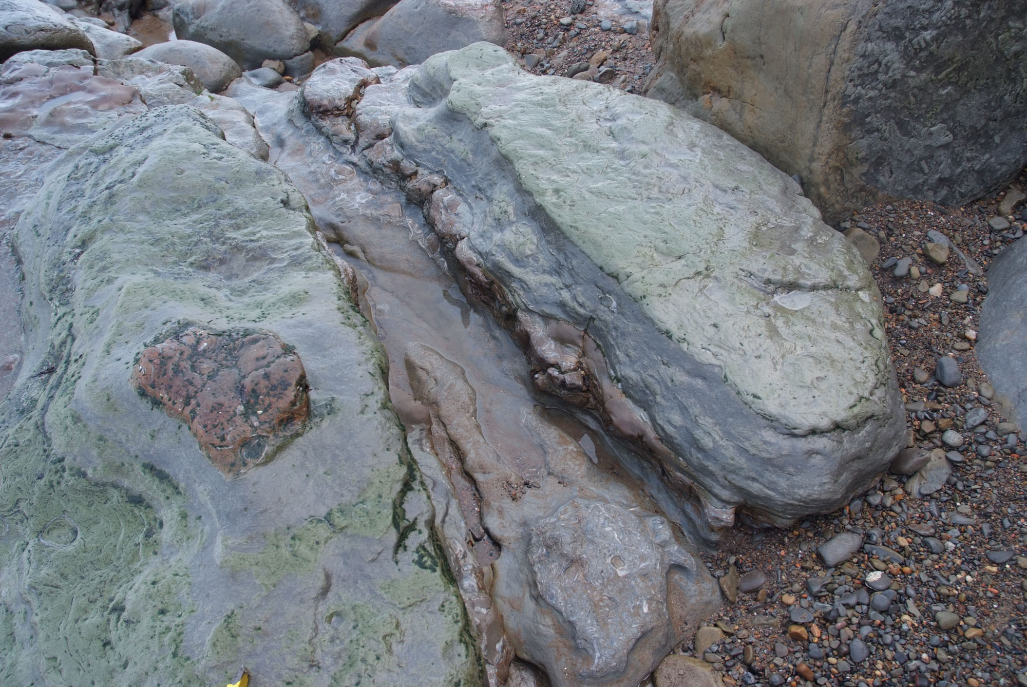
Trace fossils are another characteristic attraction. Tubular and irregular structures record the movement and feeding of animals within the ancient seabed, even where their bodies were not preserved. Examine a block from several angles: a burrow may appear as a rounded section on one face and a longer ridge or tube on another. Rippled surfaces are worth photographing too, but ripple marks are sedimentary structures made by moving water, rather than fossils. Include a scale and an overall view of the rock when recording either feature.
The basal oyster-rich sandstone of the Staithes Sandstone Formation can be followed towards Skinningrove, while ironstone blocks farther east towards Hummersea reflect a different part of the succession. At the Old Gut landslipped exposure, the Pecten Seam contains a particularly fossiliferous shell bed. The Main Seam has yielded the ribbed ammonite Pleuroceras spinatum, associated with greenish iron-rich ooids. This documented occurrence is useful geological evidence; it does not mean that a complete ammonite is a routine find or that the bed should be broken for collecting.
Brittle stars, including Palaeocoma milleri, are recorded from the Skinningrove area, and a sandstone block found on the beach in October 2023 preserved the much rarer starfish Tropidaster pectinatus. Such fossils can look like delicate patterns of small plates or slender arms on a rock surface. Leave an unusual specimen unprepared until it has been identified, and record exactly where it was found. The many-armed starfish Plumaster ophiuroides also has an important historical Skinningrove connection, although the surviving type specimen’s precise locality is uncertain.
Keep the practical search focused on safely accessible loose material and exposed surfaces. Photograph large shell beds, ripples and burrows in place instead of trying to move or split heavy blocks. A loose fossil cannot automatically be assigned to the bed beside it: cliff falls, waves and old industrial workings have mixed material on this shore. Record the rock type, the part of the beach and whether the specimen was loose or still attached, and check the relevant permissions before removing rock.
A chronological record of fossil finds, geological recording and research connected with Skinningrove and its eastern shore.
1829 – The fossiliferous shore is described
John Phillips described the shell-rich rocks between the Rockcliff works and Skinningrove, noting that the beds descended close to sea level and could be examined on the shore. His account also recorded fossil wood with dark, jet-like material in the lower shales near Skinningrove, providing an early scientific description of the locality’s rocks and fossils.
1840 – Ironstone examined at Skinningrove
The Bewick brothers’ examination of the Cleveland coast included the ironstone at Skinningrove. Their investigation helped establish the distribution of the ore, although transport difficulties and doubts about its quality delayed large-scale working.
1848 – The Main Seam enters systematic production
The Roseby brothers began work on 7 August, and the first shipment of Main Seam ironstone left Skinningrove on 26 August. John Marley examined the deposit that September. Recognition that apparently separate beach stones had fallen from a substantial seam helped turn the local outcrop into an important source of iron ore.
1857 – Skinningrove’s ironstone recorded in detail
John Marley published an account of the Main Seam and its exploitation, including a section of the ironstone being worked at Skinningrove. His record linked the local geology with the early development of Cleveland’s iron industry and preserved evidence from workings that have since changed.
1863 – A many-armed starfish is described
Thomas Wright described Plumaster ophiuroides from a specimen he attributed to Middle Lias shales near Skinningrove Bay. He recorded Peter Cullen as its finder and John Leckenby as its owner. The specimen remains scientifically important, although later research records its precise origin as either Skinningrove or Robin Hood’s Bay.
1869 – Brittle-star material enters a wider stratigraphic comparison
Wright explicitly recorded specimens he called Ophioderma gaveyi from Skinningrove Bay while comparing Jurassic strata in Britain and France. The record connects the locality’s fossils with early attempts to correlate Jurassic strata across different regions.
1888 – The Great Slip succession is measured
George Barrow described the displaced cliff mass near Hummersea and recorded the individual ironstone and shale layers exposed on the foreshore. His section distinguished the Avicula, Two-Foot and Pecten seams, the two ironstone blocks of the Main Seam, and the intervening hard and shaly bands. It remains a valuable detailed record of this unusual exposure east of Skinningrove.
1891 – A museum label reveals the starfish locality conflict Henry Woods’s catalogue of the Woodwardian Museum recorded a conflict in the provenance of Plumaster ophiuroides. Wright’s published locality was near Skinningrove, while the specimen label read “Lower Lias, Robin Hood’s Bay”. Woods also recorded the Leckenby Collection. This early museum record explains why the surviving specimen’s exact source remains uncertain.
2010–2011 – The historic starfish type is re-examined
Andrew Gale refigured the surviving Plumaster ophiuroides holotype, CAMSM J 13784, in the Sedgwick Museum and established the family Plumasteridae. The study, published online in 2010 and in its journal volume in 2011, renewed the specimen’s scientific significance while retaining uncertainty between Skinningrove and Robin Hood’s Bay as its source.
2018 – Skinningrove rocks support cliff-weathering research
Saskia de Vilder’s doctoral research used Staithes Sandstone Formation siltstone blocks collected at Skinningrove in experiments on weathering, strength and rock failure. The sampled blocks were light grey-blue siltstone with banding about 2–6 mm thick; their precise source bed was not identified. This provided a direct link between the locality’s rocks and research into how coastal cliffs weaken and break.
2023 – A rare starfish is found on the beach
A sandstone block found during a Skinningrove fossil walk on 31 October preserved the starfish Tropidaster pectinatus. Palaeontologist Liam Herringshaw documented the find in November. Its delicate preserved skeleton adds a modern record to the locality’s long history of echinoderm discoveries.
GEOLOGY
The fossil-bearing rocks around the eastern Skinningrove shore belong mainly to the Early Jurassic Lias Group. They record changing conditions in a shallow sea during the Pliensbachian, from mud deposited on the seabed to sandier layers and iron-rich shell beds. The Redcar Mudstone Formation forms much of the wave-cut platform. Above it, the Staithes Sandstone Formation contains fine sandstone, siltstone and mudstone, including a conspicuous oyster-rich basal interval. Higher beds of the Cleveland Ironstone Formation alternate mud-rich sediment with much harder ironstone seams.
These differences explain the collecting experience. Soft mudstones weather readily, whereas cemented sandstone and ironstone survive as large blocks. Shell concentrations mark particular horizons rather than a uniform distribution of fossils through every rock. Burrows preserve the activity of seabed animals, while ripple structures show that currents or waves moved sediment before it hardened. The ironstone includes siderite and iron-rich ooids, the small rounded grains that distinguish some beds. Older accounts refer to the sandstone and ironstone together as the Middle Lias; the modern formations provide a clearer description.
An unusual feature lies farther east in Hummersea Bay near Old Gut. Here a large displaced mass brings the Staithes Sandstone and Cleveland Ironstone down onto the shore, with beds standing steeply or almost vertically beside much more gently inclined strata in the cliffs. It is interpreted as an old rotational landslip. This is why a succession normally high in the cliff can be examined at foreshore level. Its precise age remains uncertain, and it should not be mistaken for a simple, undisturbed continuation of the surrounding rock platform.
The higher cliffs seen on the eastward coast continue into the Whitby Mudstone Formation and the younger, Middle Jurassic Saltwick Formation. Jet, alum shale and cementstone were worked along this coast, leaving traces of industry alongside the natural exposures. Those upper-cliff units and the more distant Loftus and Boulby quarries should be distinguished from the rocks normally searched beside Skinningrove. The ordinary collecting shore, the displaced ironstone block and the separately measured Hummersea mudstones represent different exposures, rather than a single continuous measured column. Their distinction matters when identifying a loose fossil: a rock’s present position on the beach need not mark the level from which it originally fell.

The Jurassic formations, the Great Slip ironstone beds and the separately measured Hummersea mudstone succession east of Skinningrove.
The shore east of the village is not one uninterrupted measured section. The following account distinguishes the ordinary foreshore from the displaced beds at the Great Slip near Hummersea. Thicknesses for that block are George Barrow’s historical measurements, published in 1888; metric equivalents are approximate. They are not measurements of every present-day exposure or of the entire formation.
Museum records labelled Skinningrove. The British Geological Survey catalogue records Protocardia truncata (GSM 39837–39839), Modiola subcancellata (GSM 118625–118626), Tetrarhynchia tetraedra (GSM 28519–28523), Zeilleria cf. hispidula (GSM 39590–39600, formerly catalogued as Waldheimia perforata) and Belemnites clavatus (GSM 118976) with Skinningrove locality labels. These museum records lack a precise collecting point or bed, so they cannot be placed in the Great Slip log or assigned to the ordinary eastern beach.
Museum records labelled Hummersea. The same catalogue records Oistoceras sp. (ZLL 119) and Pleuromya costata (Zd 1214) from Hummersea. Their broad locality labels do not identify one of Barrow’s measured beds or establish that a comparable fossil can be found at the village shore.
LIAS GROUP
Redcar Mudstone Formation
Ironstone Shale Member
Upper mudstones and nodular horizons. Mudstone with iron-rich nodules forms much of the surrounding shore platform. Barrow distinguished the upper beds exposed between Skinningrove and Hummersea from the lower horizons reached farther east towards Rockcliff. His separately measured Hummersea section includes alternating shales and nodular bands, a white ironstone marker with a fossiliferous base, a cone-in-cone band, shell-bearing nodules and a shale interval containing crinoid fragments. The full historical Hummersea log follows. Its location is farther east along the coast, away from the village access point.
Historical Hummersea mudstone section. Barrow’s 1888 section was measured at Hummersea, farther east along the shore, rather than beside Skinningrove’s village access. It is set out here in his original descending order, from younger to older beds. The fossil names are those used in the historical account and are not a modern taxonomic revision. Several nodular bands have no separately recorded thickness.
Nodular ironstone band: 3 in (approximately 0.08 m). Ammonites fimbriatus.
Micaceous shale: 7 ft (approximately 2.13 m). Ammonites fimbriatus; Ammonites capricornus.
Nodular ironstone band: 5 in (approximately 0.13 m). Ammonites capricornus; Pecten lunularis; Pecten aequivalvis.
Shale: 6 ft (approximately 1.83 m). A shale interval separates the adjacent nodular or ironstone horizons.
White ironstone band (Barrow marker a): 1 ft (approximately 0.30 m). Its base is fossiliferous. Barrow correlated this marker with his band a west of Staithes.
Shale: 5 ft (approximately 1.52 m). A shale interval separates the adjacent nodular or ironstone horizons.
Nodular band: 6 in (approximately 0.15 m). Cone-in-cone structure developed within the band. This is a sedimentary or diagenetic feature, rather than a fossil.
Shale: 3 ft 6 in (approximately 1.07 m). A shale interval separates the adjacent nodular or ironstone horizons.
Nodular band: 3 in (approximately 0.08 m). A distinct nodular horizon interrupts the shale succession.
Shale: 20 ft (approximately 6.10 m). Very few fossils.
Nodular band: 3 in (approximately 0.08 m). Ammonites fimbriatus; Ammonites sp.
Shale: 6 ft (approximately 1.83 m). Crinoid fragments, described historically as encrinite fragments.
Nodular band. A distinct nodular horizon interrupts the shale succession. No separate thickness was stated.
Shale: 6 ft (approximately 1.83 m). A shale interval separates the adjacent nodular or ironstone horizons.
Nodular band. Myacites sp.; Belemnites elegans. No separate thickness was stated.
Shale: 5 ft 6 in (approximately 1.68 m). A shale interval separates the adjacent nodular or ironstone horizons.
Nodular band. Many fossils and small gastropods. No separate thickness was stated.
Shale: 8 ft 6 in (approximately 2.59 m). Few fossils.
Nodular band. A distinct nodular horizon interrupts the shale succession. No separate thickness was stated.
Shale: 8 ft (approximately 2.44 m). Few fossils.
Nodular band. A distinct nodular horizon interrupts the shale succession. No separate thickness was stated.
Shale: 5 ft (approximately 1.52 m). A shale interval separates the adjacent nodular or ironstone horizons.
Nodular band. Ammonites fimbriatus; Pecten lunularis; Belemnites elegans; Myacites sp. No separate thickness was stated.
Shale: 7 ft (approximately 2.13 m). A shale interval separates the adjacent nodular or ironstone horizons.
Scattered small nodules. Small nodules occur scattered through the sediment. No separate thickness was stated.
Shale: 10 ft (approximately 3.05 m). Pecten aequivalvis; Belemnites clavatus; Gryphaea obliquata.
Dispersed nodules. Nodules are dispersed through the sediment. No separate thickness was stated.
Shale: 12 ft (approximately 3.66 m). Ammonites jamesoni; Rhynchonella plicatissima; Pinna folium; Pholadomya decorata.
Local correlation and exposure limits. Barrow traced the white ironstone marker labelled “a” to his section west of Staithes. The correlation concerns this individual marker bed. He also distinguished the upper beds exposed between Hummersea and Skinningrove from lower strata around Rockcliff. Exposure and safe access vary, so the historical section does not imply that every bed can be followed on a visit today.
Fault across Hummersea scar. Barrow described a small fault crossing the scar at Hummersea and noted that it also caused difficulty in Loftus Mine. He did not give a numerical displacement for this fault.
Staithes Sandstone Formation
Basal Oyster Bed and oyster-rich sandstone. This shell-rich horizon marks the lower part of the sandstone succession. Barrow traced the massive oyster-bearing sandstone at approximately high-water level towards Skinningrove, and recent field observations identify the basal Oyster Bed east of the village. This fossiliferous interval provides a useful marker along the shore.
Sandstone, siltstone and mudstone of the displaced block. The northern, stratigraphically lower part of the Great Slip exposes fossiliferous fine-grained silty sandstone and mudstone, dipping at about 80 degrees. Burrowing and sedimentary structures are visible on weathered surfaces. These steep beds belong to the landslipped mass; their attitude does not describe the gently inclined succession in the adjacent cliffs.
Cleveland Ironstone Formation
This late Pliensbachian formation contains silty mudstone, siltstone and sandstone with sideritic and iron-ooidal seams. Its modern subdivisions are the Penny Nab and Kettleness members. The following Great Slip succession is described from older to younger beds. Barrow’s local record uses seam names and measured lithological layers. It is distinct from the numbered succession described at Staithes.
Great Slip block dimensions and faulted contacts. The 2024 field account describes a displaced block with an approximate plan footprint of 120×80 m. A fault-breccia zone at its eastern edge lies against Redcar Mudstone, and minor faults occur within the block. These observations accompany the interpretation of rotational movement; the dimensions describe its surface footprint, rather than bed thickness.
Penny Nab Member
Obscured lower beds. Barrow saw shale below the Avicula Seam, but the lowest part of the displaced succession was broken and covered by seaweed. Those lower beds were not separately measured.
Avicula Seam: 2 ft, approximately 0.61 m. Ironstone forms the lowest separately measured seam in Barrow’s Great Slip log.
Shale above the Avicula Seam: 25 ft, approximately 7.62 m. This mud-rich interval extends from the Avicula Seam to the Two-Foot Seam. Barrow did not subdivide it into additional measured beds.
Two-Foot Seam: 1 ft 3 in, approximately 0.38 m. The traditional name is not the thickness measured here. This ironstone was also recognised in the displaced block during the 2024 field examination.
Shale below the Pecten Seam: 4 ft 6 in, approximately 1.37 m. Shale separates the Two-Foot ironstone from the overlying Pecten Seam.
Two-Foot Seam east of Skinningrove Beck. Barrow recorded 1 ft 9 in, approximately 0.53 m, in small exposures on the east side of Skinningrove Beck near Loftus Mine. This is a separate observation from his 1 ft 3 in measurement in the displaced Great Slip block.
Kettleness Member
Pecten Seam, lowest ironstone: 1 ft, approximately 0.305 m. This basal ironstone begins the Pecten package, which marks the base of the Kettleness Member in the modern regional scheme.
Pecten Seam, lower shale: 3 in, approximately 0.076 m. A thin shale layer separates the lowest ironstone from the particularly fossiliferous band above.
Pecten Seam, very fossiliferous ironstone: 9 in, approximately 0.229 m. Barrow singled out this ironstone for its abundant fossils. It is the third component in his ascending Pecten Seam succession.
Pecten Seam, middle shale: 6 in, approximately 0.152 m. A second shale division overlies the very fossiliferous ironstone.
Pecten Seam, upper-middle ironstone: 5 in, approximately 0.127 m. This ironstone lies between the middle and upper shale divisions.
Pecten Seam, upper shale: 4 in, approximately 0.102 m. The final shale parting separates the upper-middle ironstone from the thin cap.
Pecten Seam, top ironstone: 3 in, approximately 0.076 m. The thin ironstone cap completes seven recorded components with a combined thickness of 3 ft 6 in, approximately 1.07 m. Recent field observations describe fossiliferous Eston Shell Beds at Pecten Seam level.
Ferruginous shale below the Main Seam: 2 ft, approximately 0.61 m. Iron-rich shale separates the uppermost Pecten ironstone from the lower block of the Main Seam.
Main Seam, lower ironstone block: 4 ft 3 in, approximately 1.30 m. This thick ironstone forms the lower part of the divided Main Seam. The two ironstone blocks remain recognisable in the displaced exposure.
Main Seam, shaly dogger: 1 ft, approximately 0.30 m. A shaly hard band divides the lower and upper ironstone blocks. The word dogger here describes a hard band within the ironstone succession, not the younger Dogger Formation.
Main Seam, upper ironstone block: 3 ft 6 in, approximately 1.07 m. This upper block completes the Main Seam total of 8 ft 9 in, approximately 2.67 m, including the intervening shaly dogger. Recent observations record greenish iron-rich ooids and the ammonite Pleuroceras spinatum in the Main Seam exposure, without assigning the fossil to one of the two blocks.
Dogger band above the Main Seam: 7 in, approximately 0.18 m. Barrow recorded this hard band separately above the Main Seam. It completes the measured upper part of his Great Slip log.
1857 Skinningrove working section: shale roof. Marley’s main-seam section describes the Skinningrove workings in descending order. Shale forms the roof, with no thickness supplied. These working-section measurements belong to a separate exposure from Barrow’s later Great Slip log.
1857 working section: dogger ironstone, 6 in. A dogger band of ironstone, approximately 0.15 m thick, lies below the shale roof.
1857 working section: top ironstone block, 5 ft. The upper ironstone block is approximately 1.52 m thick and lies above a thin ironstone parting.
1857 working section: small ironstone parting, 2 in. This thin division, approximately 0.05 m, separates the top and bottom ironstone blocks. Marley calls it an ironstone parting rather than shale.
1857 working section: bottom ironstone block, 5 ft 6 in. The lower block is approximately 1.68 m thick. The measured dogger, two blocks and parting together give Marley’s stated total of 11 ft 2 in, approximately 3.40 m; the unmeasured shale roof is outside that total.
1857 cliff and dip context. In the same account Marley described the main ironstone bed more generally as 12–18 ft thick in the cliffs, approximately 3.66–5.49 m, and reported that it rises towards N 45°E. This broader cliff range is distinct from the particular 11 ft 2 in working section. The compass bearing describes the direction of rise, not a 45° dip angle.
Whitby Mudstone Formation
The younger, Toarcian mudstones occur higher in the eastward cliff succession. Their named industrial horizons help explain the old workings, but they are not part of Barrow’s foreshore ironstone log.
Mulgrave Shale Member
Jet Rock horizon. Evidence of former working identifies this jet-bearing level high in the cliff along the Hummersea coast. Loose jet can reach the beach, but its occurrence there does not establish an accessible in-situ collecting bed.
Alum Shale Member
Alum shale horizon. Alum shale was extracted in the Loftus workings farther east. The higher cliff succession and its workings form the geological and industrial backdrop to Hummersea Bay.
Cementstone horizon. Nodules from this horizon of the Whitby Mudstone Formation supplied the cementstone processing works at Hummersea. Remains of the works survive near the damaged steps in the middle of the bay. The industrial evidence identifies a worked horizon, rather than a measured section beside the village.
RAVENSCAR GROUP
Saltwick Formation
Younger cliff-top continuation. The eastward cliff view continues into the Middle Jurassic Saltwick Formation. Sandstone and mudstone of this younger succession cap parts of the coast. These high beds are cliff context; they are separate from the fossil-searching platform and the historical Great Slip log.
References
Barrow, G. (1888). The geology of North Cleveland. Memoirs of the Geological Survey, pp. 9–13,19–20 and 76. Digitised memoir.
Livera, S. Field Trip: Hummersea and Land of Iron Museum, 8 June 2024. Rotunda Geology Group Magazine and Record 2023–2024. Field report.
British Geological Survey. Cleveland Ironstone Formation.
Cox, B.M., Sumbler, M.G. and Ivimey-Cook, H.C. (1999). A formational framework for the Lower Jurassic of England and Wales (onshore area). BGS Research Report RR/99/01.
British Geological Survey. Saltwick Formation.
Yorkshire Geological Society (2023). Skinningrove: Cleveland Ironstone and associated Jurassic strata.
Marley, J. (1857). Cleveland Ironstone: outline of main or thick stratified bed, discovery, application and results
British Geological Survey Palaeosaurus: Skinningrove- and Hummersea-labelled museum specimens
Woods, H. (1891), Catalogue of the Type Fossils in the Woodwardian Museum, Cambridge, p.36
SAFETY
The eastern shore becomes rougher and more committing towards Hummersea. Large, uneven boulders and slippery rock platforms make progress slow, and the tide can close the route around projecting cliffs well before the whole beach is submerged. Check local tide times and the sea forecast, arrive on a falling tide and leave a generous margin for the return. Do not continue around a headland if the return route is uncertain.
Keep well away from the high cliff faces, fresh falls, overhangs and old mine openings. Rocks can fall without warning, and the foreshore should not be reached by scrambling down unstable reserve slopes or ruined steps. Avoid rough seas and do not treat the old workings as shelters. This is a demanding rocky-shore visit rather than an easy family collecting beach; inexperienced visitors should stay close to the village access or join a knowledgeable local guide.
EQUIPMENT
Wear sturdy footwear with good grip and carry tide information, a charged phone, a hand lens and a camera. A small ruler is useful for photographing traces, shell beds and unusual finds. Bring wrapping and a rigid box only for small loose specimens you have permission to retain. A hammer is not essential here: the hard matrix and fragile fossils often make photography the better option.
CLEANING AND TREATING
Keep shell-bearing pieces supported and begin with gentle dry brushing. Use only a light rinse on compact, stable material; do not soak soft shale or crumbly, iron-rich specimens. Allow damp pieces to dry gradually at room temperature. Avoid acids, bleach, wire brushes and attempts to force hard ironstone away from delicate shells. If a specimen shows starfish arms, an unusual articulated fossil or other potentially important material, leave it unprepared and seek specialist advice with photographs and its find details.
IDENTIFY YOUR FINDS
Need help identifying a fossil? Share clear photos, where you found it and its size with the community.
FURTHER READING
Deposits Magazine: The secret life of starfish, background on starfish biology and fossil preservation
The star of Skinningrove: the 2023 fossil discovery
Rotunda Geology Group: Hummersea field report, June 2024
British Geological Survey: Cleveland Ironstone Formation
Tees Valley Wildlife Trust: current Hummersea reserve access information
ACCESS RIGHTS
Public access to the shore does not provide unrestricted permission to remove fossils or hammer the rocks. Check landowner and site requirements before collecting, leave fixed exposures and industrial remains undisturbed, and favour photography of the large fossiliferous blocks. The coast has recognised geological and wildlife interest. At Hummersea nature reserve, there is currently no access through the reserve to the beach; visitors should remain on the Cleveland Way and keep dogs on a lead.
It is important to follow our ‘Code of Conduct’ when collecting fossils or visiting any site. Please also read our ‘Terms and Conditions‘
LINKS
♦ Fossil Discussions
♦ Fossil Articles
♦ Buy Fossils, Tools and Equipment
♦ Buy Crystals, Meteorites, and Artefacts
♦ Join Fossil Hunts
♦ UK Fossils Network


