
Overview
Directions
- The geology trail is closed following rockfalls. Do not enter it, cross barriers or follow former collecting routes into the quarry.
- For the permitted open parts of Ketton Quarry nature reserve, approach Ketton on the A6121 from the A47 and turn into Pit Lane. LRWT places the reserve entrance on the left about 400 m along Pit Lane, just after the roundabout; follow current signs for open routes.
- LRWT lists roadside parking for the reserve. Check its current visitor and access information before travelling and do not obstruct entrances or use the active quarry entrance.
- Historic trail location: 52.637295°N, 0.555134°W (approximately SK 978 053). This identifies the geological locality, not an invitation to enter the closed trail.
Location photographs
Swipe to browse · Select a photograph to enlarge


Fossil Hunting
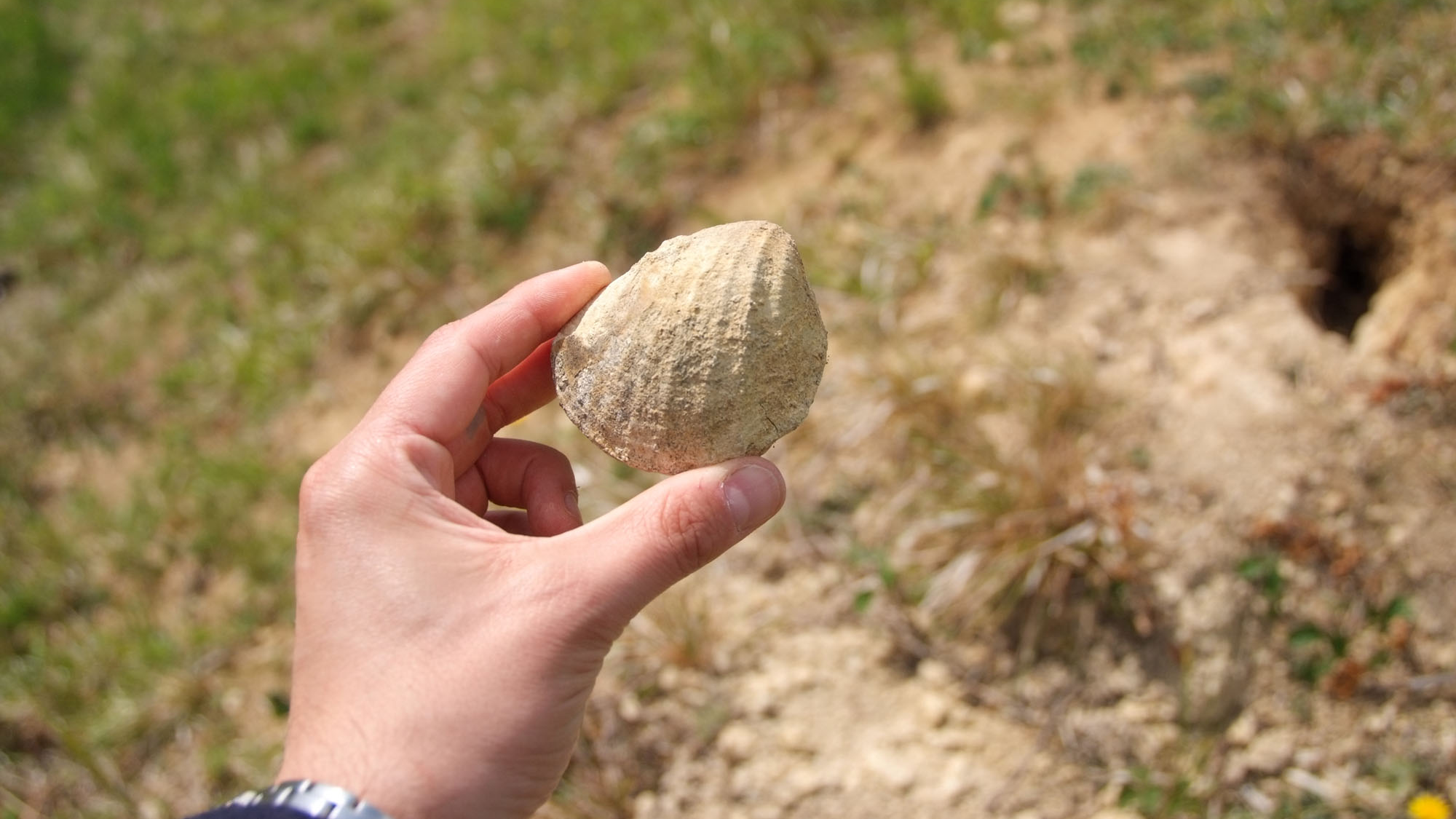
The geology trail is currently closed, so the fossil information below describes its recorded material and can be used to understand the photographs or existing, legally collected specimens. It is not a route for present-day collecting. The locality is the small abandoned quarry beside Pit Lane, separate from the extensive active Grange Top workings, which have their own access arrangements.
The most useful starting point is the fossiliferous Blisworth Limestone. Historical collecting reports describe loose blocks on the quarry floor and slipped material near the softer Blisworth Clay. Bivalves, brachiopods and gastropods are recorded, together with corals and echinoids. Ammonites, shark teeth and bones were also reported, but those broader reports do not provide specimen catalogues or secure bed assignments; they should not be treated as expected finds.
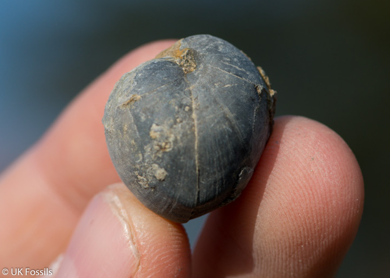
In a limestone specimen, inspect weathered surfaces before considering preparation. A lens can separate a recognisable shell outline from the abundant broken shell fragments making up the rock. Oysters may form crowded, irregular shell concentrations, whereas brachiopods can show a more regular ribbed outline. Gastropods may survive as internal moulds rather than complete shells, and a rounded object should not be called an echinoid without recognisable structural details. Photograph the whole block and its matrix as well as the fossil.
The wider Ketton reference succession gives a more detailed comparison for these rocks. Its lower Blisworth Limestone contains historical records of gastropods such as Bactroptyxis and Natica, bivalves including Modiolus imbricatus, Pholadomya and Pleuromya, the brachiopod Epithyris oxonica and echinoid Clypeus muelleri. Higher beds are strongly oyster-rich, notably with the historically identified Praeexogyra hebridica. These are records from the published Ketton composite, not a species checklist confirmed at every trail face or identifications of the uncaptioned photographs here.
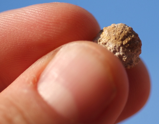
Different-looking material can belong to different parts of the succession. Ooids in the Upper Lincolnshire Limestone are small coated sediment grains; they are not automatically eggs or tiny fossils. Broken shells can lie among them. Borings and oyster encrustation on a hardground record a period when the sea floor was firm and exposed to colonisation. Root traces and dark carbonaceous material in the younger Rutland mudstones instead record vegetation and organic accumulation. Preserve these relationships in photographs rather than separating an isolated mark from its surrounding rock.
The Rutland Formation also contains shell-bearing intervals, interspersed with rooted and carbonaceous beds. In the wider Ketton composite, Lingula is associated particularly with the base of the Ketton rhythm, and bivalve-rich seams record marine or brackish influence. These differ from the more consistently marine Blisworth Limestone above. A fossil embedded in a sandy mudstone should therefore be assessed with its matrix and source information, rather than assigned to the limestone solely because it was found in the same quarry.
Loose blocks can have moved down a slope or been displaced during quarrying. Their position on the floor cannot establish an individual historical bed number. For an existing collection, retain the original label, exact locality, collecting date and any note that the specimen came from loose debris, a slipped block or an observed bed. An uncertain original horizon is worth recording honestly. The photographs preserve historical collecting evidence but cannot establish present exposure or permission.

Discoveries and milestones
Significant discoveries, geological research and conservation milestones at Top Grange Quarry.
1939 – Detailed Ketton succession described
Richardson published the first detailed account of the wider Ketton quarry succession. This early work helped establish the rock framework later used to interpret the smaller geological-trail exposures; it was not a measured survey of the present trail.
1956 – Ketton Quarries first notified
The wider Ketton Quarries site received its original SSSI notification, recognising conservation interests in the quarry landscape of which the old trail forms one part.
1965 – Upper Estuarine beds recorded
Aslin documented the beds then called the Upper Estuarine Series at Ketton. These records contributed to the later composite account of the rooted and shell-bearing sediments now placed in the Rutland Formation.
1978 – Rutland Formation formalised
Bradshaw renamed the Upper Estuarine Series as the Rutland Formation, with Ketton as its type locality. The work placed the recurring shelly, muddy and rooted intervals within a regional stratigraphical framework applicable to the formations preserved at the old trail.
1986 – Blisworth Limestone investigated
Cripps investigated the Blisworth Limestone succession and its regional correlations. The wider Ketton observations helped characterise its oyster-rich northern facies and inform interpretation of the limestone recorded at the trail.
7 October 1986 – SSSI protection renewed
Ketton Quarries was notified under the Wildlife and Countryside Act 1981. The designation recognised the wider quarry’s geological and biological interests; statutory designation did not itself create public access or collecting rights.
2002 – Geological trail placed in its regional succession
A comprehensive Middle Jurassic review explicitly recorded the Ketton Geological Trail at SK 978 053, from upper Lincolnshire Limestone to lower Blisworth Clay. Its separate historical composite sections supplied detailed reference beds while making clear that the wider quarry and small trail had different exposure ranges.
2007 – Ketton stratigraphic terminology revised
Hudson and Clements’ work introduced the Castle Member for the Rutland beds above the Stamford Member at Ketton. Later national synthesis adopted this terminology, distinguishing the local succession from the Wellingborough Limestone Member developed farther south.
2012 – Reference sections reconciled in national framework
The national Middle Jurassic framework set out the Ketton formation and member relationships and gave precise reference-section locations, including the northern working-quarry Blisworth Clay section. These locations allow wider-quarry measurements to be kept separate from the old trail.
December 2016 – Old-trail face and fault documented
Alison Taylor’s field account recorded the small abandoned Grange Quarry’s slumped lower beds, resistant ledge, fossil-bearing debris and a fault with the viewed left side downthrown. Its suggested Cornbrash cap was a reported interpretation, rather than a complete measured extension of the trail succession.
Geology
Top Grange is part of the Ketton quarry landscape in Rutland, where Middle Jurassic rocks record repeated changes between shallow sea, coastal wetland and vegetated land. The old geological trail is specifically documented from the upper Lincolnshire Limestone through the Rutland and Blisworth Limestone formations to the lower Blisworth Clay. This is a smaller stratigraphic range than that exposed at various times in the large active quarry, and it should not be extended by transferring its deeper or younger beds to the trail.
The oldest documented trail rocks belong to the Inferior Oolite Group. Their Upper Lincolnshire Limestone consists predominantly of ooidal grainstone, formed where shallow marine water moved sand-sized carbonate grains. Cross-bedding records that movement. The succeeding Rutland Formation rests above a marked break in deposition: the limestone surface was exposed, altered and locally eroded before the younger sediments accumulated. The GCR places the limestone in the Lower Bajocian and interprets the Rutland beds as early to mid Bathonian, so the contact is not an uninterrupted passage from one environment to another.
The Rutland Formation belongs to the Great Oolite Group. Its basal Stamford Member records nonmarine sedimentation, with silt, mud, roots and carbonaceous layers. The Castle Member above contains repeated changes from shelly marine or brackish sediment into more uniform mud and rooted, plant-bearing tops. These rhythms record shifting water conditions and sediment supply along the margin of the Anglo-Brabant landmass. They do not represent six separate formal formations or a uniformly freshwater interval.
A more sustained marine incursion produced the Blisworth Limestone. Muddy, bioturbated limestone, clay seams and abundant shells contrast with the cleaner ooidal freestone below. Oysters are especially prominent in the northern facies represented at Ketton. The overlying Blisworth Clay records a return to muddier, largely nonmarine conditions with episodes of marine influence; it is much less resistant than the limestone, helping to explain slipping and the accumulation of loose blocks.
Historic observations at the actual trail show how difficult it can be to read a quarry face after abandonment. A report published in 2016 described soft slumped beds below a resistant ledge, damaged fossils in debris and a fault near the right-hand side of the viewed face, with the left side downthrown. Vegetation, slumping and quarry-floor infill obscure contacts. The detailed account below therefore separates the documented trail framework from the older, composite Ketton reference sections; their measurements are not a current measured log of this closed exposure.
Detailed geology and bed-by-bed succession
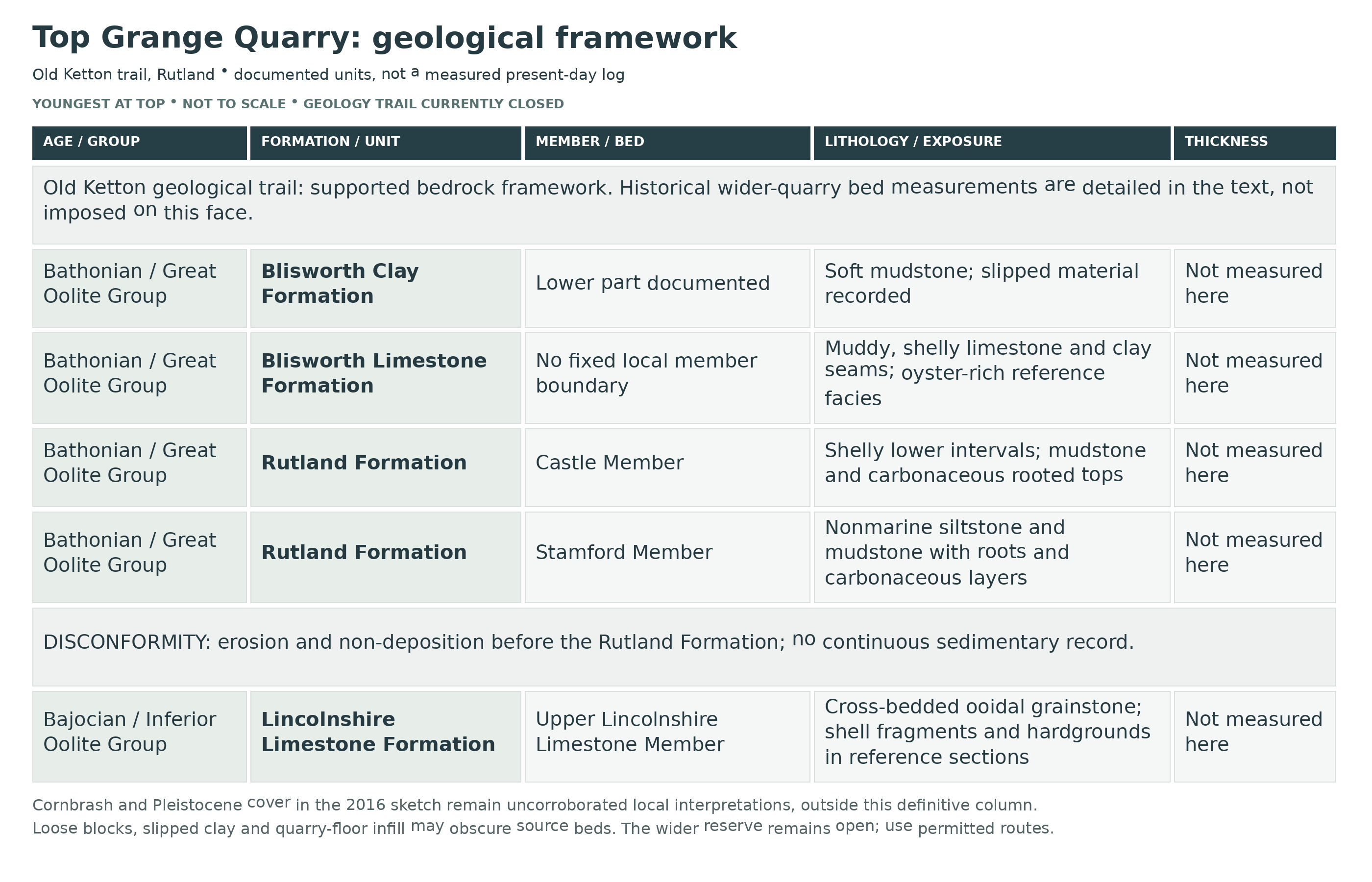
Detailed geology of the old Top Grange trail and its scoped Ketton reference succession.
The framework below runs from oldest to youngest. The old Ketton Geological Trail at SK 978 053 is documented from upper Lincolnshire Limestone to lower Blisworth Clay. Bed numbers and measurements quoted below belong to published historical composite sections from the wider Ketton quarries, assembled from different observations; they are reference context, not a measured log of the present trail. Slumping and vegetation can conceal the units, and the trail is closed.
INFERIOR OOLITE GROUP
Lincolnshire Limestone Formation
Upper Lincolnshire Limestone Member
The upper division is predominantly cross-bedded ooidal grainstone, reflecting comparatively energetic shallow marine carbonate deposition. In the wider reference section, two units provide useful comparisons. The historical names “Ketton Beds” and “Weldon Beds” correspond respectively to beds 12 and 13. Aslin placed the former in his Lower Lincolnshire Limestone because of the conspicuous hardground at its top; this is an older classification, not an additional modern unit. Suggested correlations with members farther north remain speculative.
Reference bed 12, 3.20–3.60 m. Massive, blue-hearted, pinkish ooidal grainstone is cross-bedded in places. A bored, oyster-encrusted hardground caps the bed, with annelid and historically identified Lithophaga borings. The hard surface records an interruption in sediment accumulation and colonisation of the sea floor.
Reference bed 13, 1.60 m. Flaggy, cross-bedded ooidal grainstone contains abundant broken shell material. Historical records include Camptonectes laminatus, Eopecten abjectus, Gervillella, Catinula ampulla, Oxytoma, Plicatula, Pseudolimea duplicata, Microrhynchia barnackensis, terebratulid brachiopods and echinoids. These names are retained as published reference-section identifications, not newly verified trail species records.
Upper contact and hiatus. The limestone top is uneven and altered in the wider Ketton sections, with an iron-enriched junction and local gypsum, including selenite veins. Subaerial weathering before deposition of the Rutland Formation is interpreted to have been intensified by later weathering at outcrop. The junction is a marked disconformity between Lower Bajocian limestone and the younger, inferred early to mid Bathonian Rutland succession; individual mineral veins cannot be assigned to a photographed trail face from this regional description alone.
GREAT OOLITE GROUP
Rutland Formation
The former “Upper Estuarine Series” was formalised as the Rutland Formation, with Ketton as its type locality. The formation contains mudstone, siltstone and sandstone, with repeated changes between nonmarine conditions and marine or brackish influence. Its published wider-quarry reference thickness varies between accounts; no total is assigned here to the old trail.
Stamford Member
This basal nonmarine division records the infilling of a shallow freshwater setting by silt and mud, followed by increasing carbonaceous material and vegetation. The three numbered beds below are from the historical Ketton composite; their variable thicknesses should not be added to produce a new measurement of a trail face.
Reference bed 2, 1.37–1.95 m. White to buff siltstone contains rootlets throughout. Limonite nodules and possible pebbles occur in approximately the lowest 0.4 m. The root traces distinguish vegetated sediment from a purely marine shell bed.
Reference bed 3, 2.03–2.23 m. Grey-mauve to brown silty mudstone has a black carbonaceous upper part and a thin carbonaceous seam at its base. These organic-rich intervals preserve changes within the nonmarine sedimentary setting.
Reference bed 4, 0.38–0.46 m. White siltstone interlaminated with mudstone passes upwards into green to black mudstone containing rootlets, completing the recorded Stamford interval.
Castle Member
At Ketton, current BGS usage assigns the Rutland Formation above the Stamford Member to the Castle Member. The six named rhythms below remain useful historical subdivisions; they are not six formal members. They commonly begin with sandy or silty shelly sediment, pass upwards into mudstone, and end with carbonaceous rooted material truncated by the next rhythm. The Wellingborough rhythm here must not be equated automatically with the formal Wellingborough Limestone Member farther south.
Ketton rhythm, reference bed 5, 1.83–2.00 m. The lower half is grey and green mudstone interlayered with shelly sand and silt; Lingula is notably abundant near the base. Rootlets and ironstone concretions occur towards the top. The upward change records loss of the initial shelly-water conditions and later vegetation.
Clipsham rhythm, reference bed 6, 1.30–1.52 m. Sandy and shelly seams in the less homogeneous lower mudstones pass upwards into purple-brown and green mudstone, with rootlets and sand in the upper part and a black carbonaceous top.
Casterton rhythm, reference bed 7, 1.22 m. Dark-green mudstone with sandy, shelly layers passes upwards into green and black rooted mudstone, again preserving a shelly lower interval beneath a vegetated top.
Wellingborough rhythm, reference bed 8a, 1.90 m. Hard, blue-hearted, cross-bedded sandstone to sandy limestone is interlayered with mudstone and locally very shelly in its lower part. It passes upwards into purple-brown and green mudstone, becoming very dark, carbonaceous and rooted at the top. The lower fauna is more diverse and strongly marine than that of many other rhythms.
Cranford rhythm, reference bed 8b, 0.30–0.60 m. Green mudstone has silt interlayers at its base and becomes carbonaceous and rooted upwards. This thinner rhythm is separately recognised in the reference succession.
Nassington rhythm, reference bed 9, 0.90–1.22 m. Green to orange-brown sandy mudstone contains thin shell-fragment layers at its base and sporadic rootlets in its upper part.
The wider Ketton Rutland fauna includes historical records of Eomiodon angulatus, “Gervillella ovata”, Placunopsis socialis, Praeexogyra hebridica and “Tancredia gibbosa”, often in low-diversity shell concentrations. These are reference-succession records associated with reduced or changing salinity, not an assignment of every taxon to each bed or to the trail photographs.
Transition to Blisworth Limestone. Marine inundation replaced the rooted, siliciclastic-dominated Rutland environments with carbonate deposition. This environmental change explains the contrast between the variable underlying mudstone/siltstone rhythms and the fossiliferous limestone above.
Blisworth Limestone Formation
The formation is a muddy, fossiliferous, commonly bioturbated limestone with peloids, ooids and shell fragments, interspersed with clay seams. The older GCR Ketton composite is approximately 3.9–4.2 m thick; the later BGS framework separately gives a 3.57 m Ketton reference section in Longthorpe Member facies. These measurements refer to different accounts and must not be merged. A precise Roade/Longthorpe member boundary is not established for the old trail. The historical correlation of the basal beds with the Sharpi Beds was disputed, and the old SSSI citation’s “White Limestone” must not be used to import the Oxfordshire member succession.
Reference bed 1, 0.76 m. Hard massive limestone weathers to soft marl in its basal approximately 0.30 m. The recorded fauna comprises Bactroptyxis, Natica, Modiolus imbricatus, Praeexogyra hebridica, Pholadomya, Pleuromya, Protocardia subtrigona, Epithyris oxonica and Clypeus muelleri. These are historical identifications from the composite, useful for comparison with limestone specimens whose provenance is known.
Reference bed 2, 1.52 m. Rubbly limestone is thinly interbedded with clay. Praeexogyra hebridica and other bivalves are common, while sporadic Kallirhynchia sharpi was recorded in the lower approximately 0.4 m. The lower part of this bed and bed 1 form the massive, locally intensely bioturbated basal interval discussed in the historic Sharpi Beds correlation.
Reference bed 3, 0.53 m. Hard limestone rests on a very irregular base and contains Modiolus imbricatus and Praeexogyra hebridica.
Reference bed 4, 0.05–0.08 m. A thin clay parting contains Praeexogyra hebridica, separating the hard limestones above and below.
Reference bed 5, 0.30–0.38 m. Hard limestone contains Praeexogyra hebridica, continuing the oyster-rich character of the upper beds.
Reference bed 6, 0.71 m. Thinly bedded to rubbly limestone is packed with Praeexogyra hebridica, with Modiolus imbricatus, Placunopsis socialis and other fossils. Such concentrated oyster accumulations are characteristic of the northern facies.
Reference bed 7, 0.02–0.05 m. Layers of fibrous calcite, traditionally called “beef”, cap the numbered limestone succession. This is a mineral layer, not an additional fossil-bearing formation.
Blisworth Clay Formation
Reference bed 8, seen to 1.52 m. Clay passes upwards into subsoil in the historical GCR composite. The documented trail framework includes the lower Blisworth Clay, and historic trail accounts describe slipping of soft material. The formation more generally contains rooted mudstone, ironstone nodules and evidence for mainly nonmarine deposition interrupted by marine influence.
The 5.07 m Blisworth Clay reference section with Grange, Tinwell Lodge and Ketton Heath members belongs to the northern working quarry at SK 982 073, about two kilometres from the old trail. It is not a measured member-by-member trail section; those members are therefore not inserted as local layers here.
Observations at the actual trail. The field report published in December 2016 described a face approximately 30 ft high with soft slumped beds and a resistant ledge about 2–3 ft thick. The ledge is not a measurement of the whole Blisworth Limestone Formation. Damaged fossils occurred in harder debris; ooidal Lincolnshire Limestone blocks and overburden lay on an irregular quarried floor. A fault was recorded near the right of the viewed face, with the left side downthrown; no measured throw or orientation was given.
Upper-cover uncertainty. The same report interpreted a higher dark, brittle, shell-packed layer as Cornbrash and labelled Pleistocene cover in a schematic sketch. These observations are retained as a reported interpretation, but an independently corroborated measured cap is not established for the old trail. Neither a full Cornbrash succession nor a named glacial unit is therefore added to its definitive column. Quarry infill and slipped material must also remain distinct from strata in place.
Scope of the older and younger workings. Lower Lincolnshire Limestone, Grantham and Northampton Sand sections, and younger Cornbrash, Kellaways and Oxford Clay records from other Ketton workings do not enlarge the established trail section. Nor do active-quarry vertebrate discoveries establish finds at this locality.
References.
Cox, B. M. & Sumbler, M. G. (2002), British Middle Jurassic Stratigraphy, Geological Conservation Review Series 26, Ketton Quarry account, pp. 276–282.
British Geological Survey (2012), A stratigraphical framework for the Middle Jurassic strata of Great Britain and the adjoining continental shelf, sections 5.2.16–5.2.18.
Taylor, A. (2016), “Grange Quarry, Ketton”, Kent Geologists’ Group Newsletter 25, pp. 4–5.
Natural England, Ketton Quarries SSSI citation.
Safety
The geology trail is closed after rockfalls left unstable quarry faces. Do not enter the trail, approach the foot or edge of the faces, climb quarry slopes or go beneath overhangs. A helmet does not make an unstable quarry face safe. Follow current LRWT guidance and use only permitted open routes in the wider reserve.
On open reserve paths, expect uneven stones, vegetation, slippery mud and changes of level. Keep away from concealed edges and active quarry entrances. Adders occur in the reserve; leave them undisturbed. Keep dogs on leads and follow any livestock or temporary access notices.
Equipment
For a permitted reserve walk, take suitable footwear with good grip, a camera, a notebook and a hand lens. Binoculars can help with distant geological features from a safe open path. Do not take a hammer or collect on the closed trail; leave rocks and fossils in place.
Cleaning And Treating
For already legally collected limestone fossils, retain the original label and photograph the specimen before preparation. Begin with a soft dry brush and work under magnification. Do not force hard matrix away from a shell or mould when both are breaking together; a partly exposed fossil often retains more information than an aggressively cleaned one.
Avoid household acids, which attack calcitic shells and carbonate matrix, and do not bleach, varnish or routinely coat specimens. Only use water after checking that the fossil and surrounding material are sound; fragile weathered clay-rich pieces may disintegrate. Keep unusual or potentially important specimens unprepared until specialist advice has been obtained.
Identify Your Finds
Need help identifying a fossil? Share clear photos, where you found it and its size with the community.
Further Reading
Geological Conservation Review: Ketton Quarry and its geological trail
BGS: Middle Jurassic stratigraphical framework
Alison Taylor: Grange Quarry, Ketton (2016), pages 4–5
LRWT: Ketton Quarry reserve and current geology-trail closure
Natural England: Ketton Quarries SSSI citation
Access Rights
The LRWT reserve information, checked on 11 October 2026, states that the geology trail is closed following rockfalls and unstable faces. The wider reserve is separately listed as open. The notice gives no reopening date or mapped closure boundary; follow signs and ask LRWT about permitted open routes rather than assuming a route is available.
Ketton Quarries SSSI protects geological and biological interests across parts of the quarry complex. Its designation does not itself grant entry or a collecting licence, and the trail and reserve boundaries should not be treated as interchangeable. Do not enter the closed trail or remove fossils there. Walking access elsewhere does not establish permission to excavate, break rocks or remove material; any proposed collecting needs explicit permission and compliance with the applicable conservation requirements.
The official Ketton Quarries SSSI citation explains the designated interests. The separate working quarry is not an alternative way to reach the closed trail and requires its own authorised access arrangements.
It is important to follow our ‘Code of Conduct’ when collecting fossils or visiting any site. Please also read our ‘Terms and Conditions‘
Links
♦ Fossil Discussions
♦ Fossil Articles
♦ Buy Fossils, Tools and Equipment
♦ Buy Crystals, Meteorites, and Artefacts
♦ Join Fossil Hunts
♦ UK Fossils Network


