
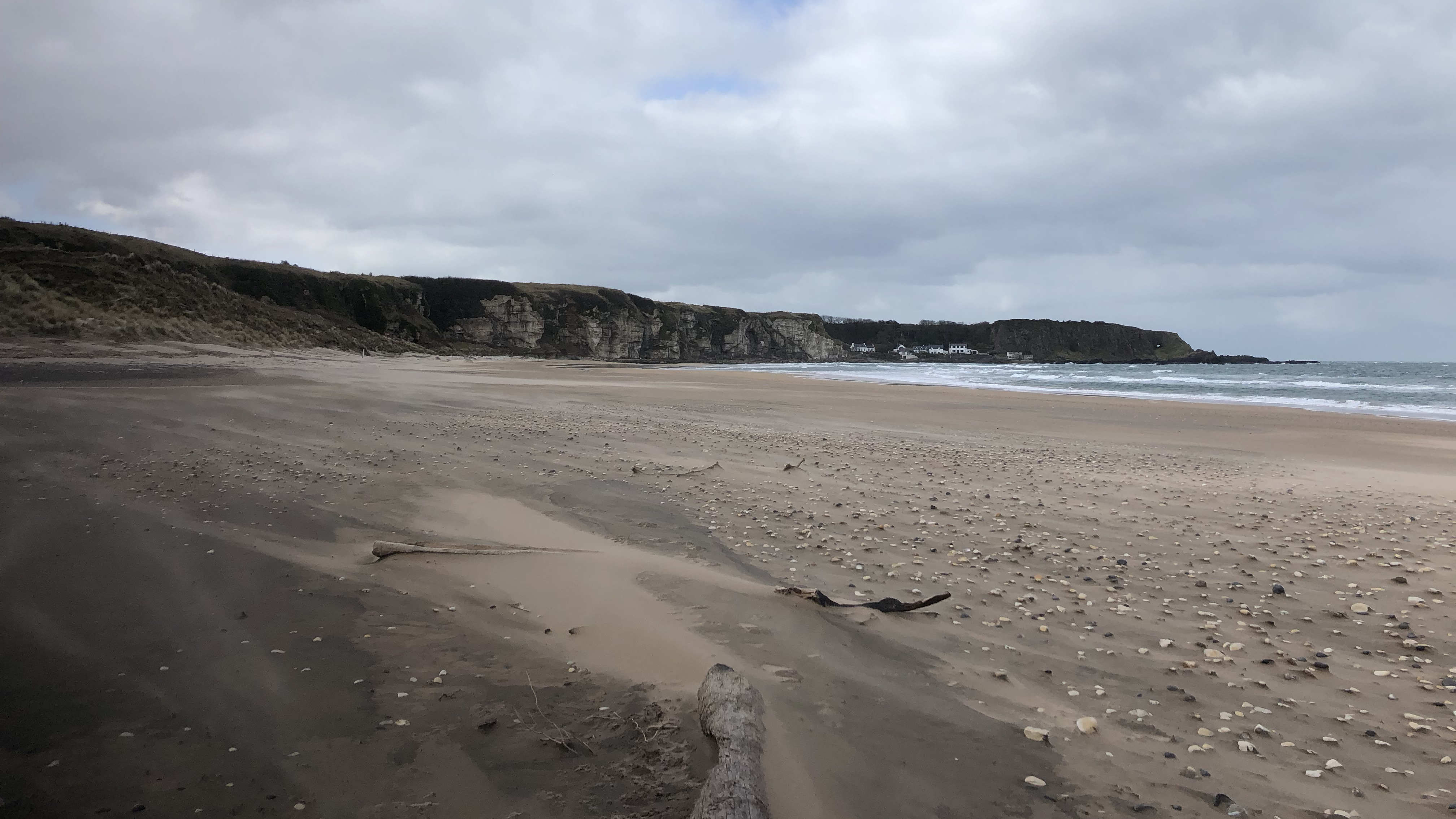
Overview
Directions
- Use the signposted National Trust White Park Bay car park off Whitepark Road, between Ballycastle and Bushmills on the north Antrim coast. Parking is free but spaces are limited; if it is full, return later rather than obstructing entrances.
- Follow the public steps and footpath down from the viewpoint towards the beach, passing the remains of the old school. Keep to the marked approach rather than entering the neighbouring youth hostel grounds.
- The approach includes steep steps and slopes, uneven surfaces and kissing gates. There are no toilets. Check the National Trust visitor information before travelling.
- On reaching the sand, Oweynamuck is towards the eastern end of the bay; Portbraddan lies at the western end. Plan any shore walk around tide and wave conditions and keep a clear return route to the main path.
Location photographs
Swipe to browse · Select a photograph to enlarge


Fossil Hunting
Start with the low-shore exposures in the central and eastern bay, especially towards Oweynamuck. Look over the exposed mudstone surfaces and the natural surfaces of limestone nodules, then compare them with fossils visible in loose chalk blocks and pebbles. The Jurassic outcrops are intermittent: shifting sand can uncover one patch while hiding another. A separate section at the small waterfall towards the eastern end shows Jurassic mudstone beneath the younger basal conglomerate. A falling tide gives time to examine the shore and retreat, but do not approach unstable landslip toes or cliffs to reach a fossil.
White Park Bay has two quite different fossil records: Early Jurassic fossils in the dark Waterloo Mudstone and its limestone nodules, and Late Cretaceous fossils in the chalk. A third source, the basal Cretaceous conglomerate, mixes fossils eroded from older Jurassic rocks with Cretaceous material. Record whether a fossil is still in its bed, enclosed in a loose nodule, or incorporated into this conglomerate; that information can matter as much as its name. Photograph the fossil, its surrounding rock and its position before seeking advice about any removal.
Ammonites are the best-studied Jurassic fossils. Echioceras raricostatoides and E. raricostatum are documented in local nodules, while Leptechioceras macdonnelli, Paltechioceras oosteri and Apoderoceras help distinguish successive parts of the late Sinemurian and earliest Pliensbachian record. Some ammonites occur in the mudstone itself, including pyritic examples, and others are enclosed in calcareous nodules. These are records from scientific study, rather than a promise that each species will be visible on a visit. Do not assign a loose specimen to the nearest exposed bed simply because it was found beside it.
White Park Bay is also the type locality for two ammonites named in 2021. Cheltonia howarthi is recorded from in-situ Densinodulum Subzone mudstones in the centre of the bay and north of Oweynamuck. Vicininodiceras dalriatense was described from loose material, so its precise source horizon remains uncertain. These discoveries show why finds with a recorded position and rock association can be scientifically useful.
The Jurassic fauna extends well beyond ammonites. Shelly nodules contain the oyster Gryphaea mccullochi, and historical studies record numerous other bivalves, brachiopods, gastropods and belemnites. The original locality-by-locality inventory also includes crinoid stem pieces, echinoid fragments, ostracods, fish fragments and wood. These records came from different exposures, including streams and Oweynamuck, and should not be read as a checklist expected in every nodule. Some old identifications need modern revision; in particular, not every local oyster can safely be called Gryphaea arcuata.
Loose nodules and calcareous sandstone cobbles have yielded ammonites older and younger than the securely dated exposed mudstones. Examples include older Asteroceras, younger Beaniceras and Androgynoceras, and Upper Pliensbachian Amaltheus and Pleuroceras. Their original beds are uncertain, and some material may have reached the coast in glacial deposits. An Androgynoceras capricornus-bearing septarian limestone cobble even contained fish scales. Keep such associations together in the record: they are evidence from loose material, not proof of an exposed fish bed or a continuous succession of all these ages.
In the chalk, broken inoceramid bivalve shell is important, especially in the lower succession. The crinoid Marsupites testudinarius is recorded from Cloghastucan Chalk, including a tilted block in the western bay. At Portbraddan, particular Boheeshane horizons contain belemnites assigned historically to the Belemnitella praecursor group, the brachiopod Orbirhynchia bella, and concentrations of Echinocorys. A small, indeterminate pachydiscid ammonite is also recorded there. These are separate, bed-specific occurrences; they do not imply that every loose chalk block contains the same fauna.
The Altachuile Breccia at Portbraddan contains Offaster, whereas the basal conglomerate at Oweynamuck and the waterfall contains reworked Jurassic fossils together with Cretaceous echinoids and bivalves. A fossil in the conglomerate can therefore be older than the rock enclosing it. For any unusual fossil or a possible new association, a clear scale photograph and an accurate location are more useful than an unsupported species name. Confirm the current collecting rules and permission before removing material or using tools; the published fossil record itself establishes neither permission nor present-day exposure.
Fossil photographs
Swipe to browse · Select a photograph to enlarge


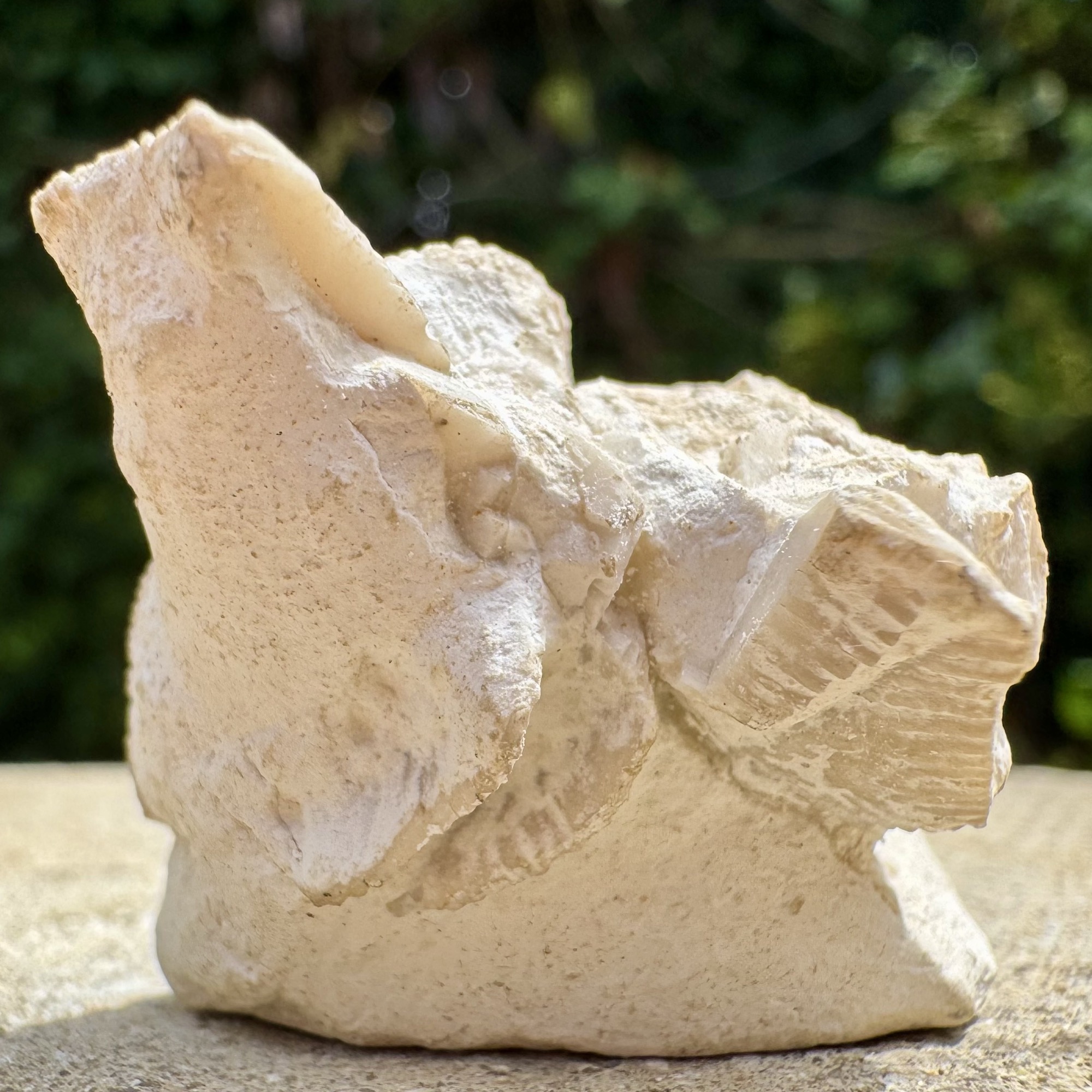
Discoveries and milestones
Significant fossil discoveries, geological research and conservation milestones at White Park Bay.
1816 – The Jurassic–chalk association recognised
W. Conybeare and W. Buckland noted the occurrence of Lias clay and chalk in the area. Their observations form an early record of the contrasting rock successions that make White Park Bay geologically distinctive.
1843 – An early published fossil record
J. E. Portlock published a fossil list that included material attributed to White Park Bay, establishing an early scientific record of its Jurassic fauna. Later work showed why these older lists need care: the source beds of historical specimens were not always recorded, and some apparently wide age ranges could reflect loose or transported material.
1888 – Geological mapping and an explanatory account
R. G. Symes, F. W. Egan and A. McHenry’s mapping and explanatory geological memoir covered the White Park Bay area, placing the coastal exposures within a systematic survey of the surrounding country.
1897 – The chalk and underlying glauconitic deposit described
W. F. Hume drew attention to the substantial chalk succession and the glauconitic sands overlying the Lias. These observations concerned the contact interval later examined in greater detail as the bay’s basal Cretaceous deposit.
1956 – A fossil-rich Oweynamuck exposure sampled
Collecting from Jurassic mudstone at the western extremity of Oweynamuck produced a rich assemblage of molluscs and other marine fossils. The ammonites were subsequently interpreted as indicating the Ibex Zone. Modern reassessment treats precisely dated younger in-situ horizons more cautiously, distinguishing that historical interpretation from the better-established late Sinemurian and earliest Pliensbachian exposures.
1960 – Jurassic faunal lists broadened
J. K. Charlesworth and J. Preston published further lists of Jurassic fossils attributed to White Park Bay. The provenance of historical museum material and loose nodules later became important when reassessing the ages of the exposed mudstones.
1961 – Reworked Jurassic material recognised in the basal conglomerate
J. M. Hancock described the succession at the eastern end of White Park Bay and recognised a basal conglomerate containing reworked Lias material. This helped distinguish fossils inherited from older rocks from the age of the younger deposit enclosing them.
1963 – Further Jurassic fossil records published
J. K. Charlesworth added to the published record of the bay’s Jurassic fauna. The combined lists appeared to span a wide range of ages, but later studies distinguished loose or transported specimens from fossils reliably tied to exposed beds.
1977 – Chalk markers and the Portbraddan breccia documented
T. P. Fletcher’s detailed chalk stratigraphy established the framework for recognising the bay’s lower chalk and its higher Portbraddan succession. The Altachuile Breccia at Portbraddan was illustrated and interpreted as a disturbed sea-floor deposit, with intact Offaster suggesting recolonisation after disturbance. The proposed storm origin remains an interpretation.
1978 – The bay’s fossil sites and chalk sections mapped in detail
H. E. Wilson and P. I. Manning’s detailed geological account recorded Jurassic faunas against seven separate localities and distinguished the main Portbraddan section from its separate fault block. It documented the 6.7 m combined lower-chalk succession at Oweynamuck and local fossil horizons farther west, providing a basis for keeping fossils and rock units tied to the correct parts of the bay.
22 July 1996 – White Park Bay declared an ASSI
White Park Bay was declared an Area of Special Scientific Interest, recognising and protecting its special natural interest. The designated area includes the bay and coastal ground around the eastern Oweynamuck shore; the designation is relevant to conserving its geological exposures as well as planning visits and collecting.
2018 – Microfossils add an independent age test
Azrin Azmi’s study of seven mapped White Park Bay samples used foraminifera and ostracods to investigate the Jurassic mudstones. Five samples were assigned to a late Sinemurian microfossil zone; two were tentatively assigned to an earliest Pliensbachian zone. The latter interpretation remained qualified because its principal marker species was absent.
2021 – Two ammonite species named and the succession reassessed
M. J. Simms and M. Edmunds published a comprehensive ammonite study that named Cheltonia howarthi and Vicininodiceras dalriatense from White Park Bay material. It established five subzones from in-situ ammonites while separating the wider age range represented by loose fossils. Cheltonia howarthi is tied to in-situ late Sinemurian mudstones, whereas the precise source horizon of the loose Vicininodiceras dalriatense material remains uncertain.
Geology
White Park Bay brings together Early Jurassic mudstones and a much younger Late Cretaceous chalk succession, separated by a major gap in the geological record. The eastern headland at Oweynamuck is particularly important for the contact between the two. The western bay and Portbraddan show additional chalk levels, including higher formations in a separate fault block. Together they provide a composite view of the geology, not one uninterrupted cliff section in which every formation can be followed upwards.
The Jurassic rocks belong to the Waterloo Mudstone Formation of the Lias Group. Marine mudstone, silty bands and limestone nodules contain ammonites that securely identify parts of the late Sinemurian and earliest Pliensbachian. Five subzones have been proved by in-situ ammonites, but the exposures are discontinuous and disrupted. Loose fossils indicate a wider span of Jurassic ages; their source beds are not all established, and possible glacial transport prevents treating the whole loose-fossil range as local bedrock.
At the base of the Cretaceous succession, a glauconitic conglomerate with phosphatic material and a chalky matrix rests unconformably on the Jurassic rocks. It contains fossils recycled from the older mudstones as well as Cretaceous fossils. Its formal assignment has varied between accounts, so it is best described by its rock character rather than forced into an unproved greensand or sponge-bed formation. The age of an eroded fossil within it need not be the age of the deposit itself.
The chalk belongs to the Ulster White Limestone Group and includes Santonian and Campanian rocks. At Oweynamuck, the lower succession rises through the Galboly, Cloghastucan and Creggan Chalk formations. The Oweynamuck Flint Band lies within the Cloghastucan Chalk; the younger Bendoo Pebble Bed marks the top of the Creggan Chalk in the western bay. Thickness and flint development change across the bay: the lowest three chalk formations together measure 6.7 m at Oweynamuck, while the lower chalk becomes less flinty westwards. That measurement is neither the thickness of one formation nor the total chalk succession.
The western chalk continues through the Boheeshane, Larry Bane and Ballintoy formations. Portbraddan preserves named belemnite, brachiopod and echinoid horizons, and the disturbed Altachuile Breccia near the top of the Ballintoy Chalk. Higher formations are represented in the separate Portbraddan fault-block succession, which reaches into the Ballymagarry Chalk. Erosion surfaces, pebble beds and brecciation record interruptions and reworking within the chalk; it was not deposited as a uniform, continuously accumulating mass.
Later faulting, basalt dykes and landsliding complicate the original succession. The Portbraddan Fault downthrows to the north, while much of the Jurassic mudstone is nearly horizontal or dips gently northwards between smaller faults. Steeply tilted exposures at Oweynamuck are interpreted as disrupted landslide masses rather than evidence that all the Jurassic beds have the same steep tectonic dip. Sand and other coastal cover conceal parts of the section, so old descriptions record exposures that may not be visible on a particular visit.
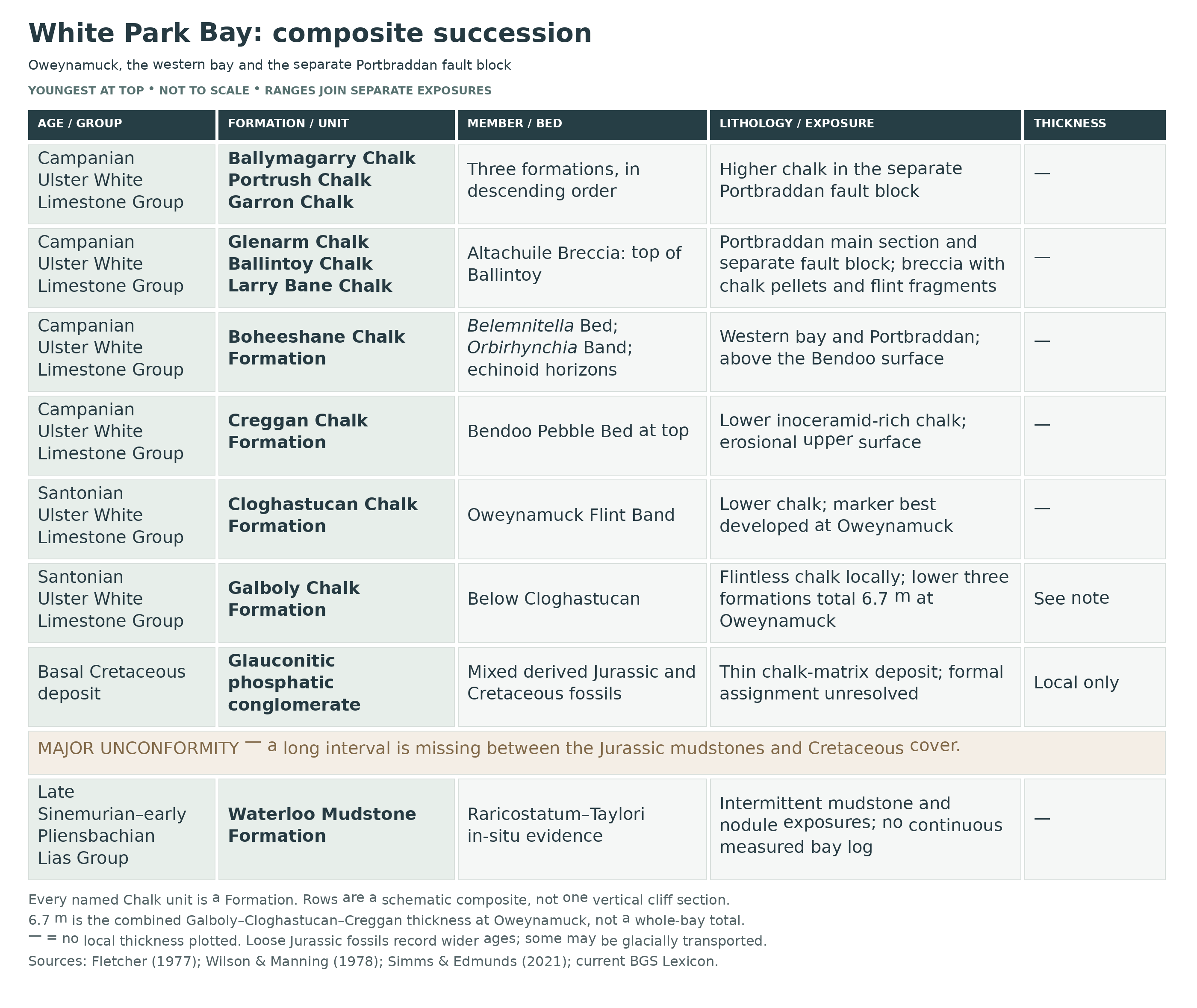
Detailed geology and bed-by-bed succession
The White Park Bay composite succession, its separate exposures and documented fossil horizons.
Scope and order. This account runs from older to younger rocks across White Park Bay, from Portbraddan in the west to Oweynamuck in the east. It combines separate exposures and includes the explicitly identified Portbraddan fault block. It is not a continuous measured log of Oweynamuck. The Jurassic subzones below identify fossil ages rather than formal members; the named chalk beds are kept at bed or horizon level. Older accounts used ‘Ulster White Limestone Formation’ with chalk ‘members’; the current hierarchy is Ulster White Limestone Group with Chalk Formations. Thicknesses are quoted only for their stated local section or interval. Regional lithological descriptions help explain formation names but do not establish that every type-section bed, fossil or hardground is present here; no complete regional species checklist is implied.
LIAS GROUP
Waterloo Mudstone Formation
The local Jurassic succession consists of marine mudstone with silty bands and calcareous nodules. Securely dated in-situ ammonites establish late Sinemurian Raricostatum Zone strata and the earliest Pliensbachian Taylori Subzone. The following five subzones are proved at the bay, but exposure is discontinuous and the available evidence does not justify drawing them as five equal-thickness beds. Nearly horizontal or gently north-dipping mudstones are interrupted by minor faults and basalt dykes; strong tilting at Oweynamuck is attributed to mass movement.
Densinodulum Subzone. In-situ mudstones in the centre of the bay and north of Oweynamuck contain Cheltonia howarthi, a species named from White Park Bay material. Central-bay nodules also yield Eoderoceras bispinigerum. The wider local Densinodulum assemblage includes Oxynoticeras lymense in a nodule with Gryphaea mccullochi, and small ammonites assigned to the Hemimicroceras subplanicosta group.
Raricostatoides Subzone. Echioceras raricostatoides and E. raricostatum are documented from local nodules, including an in-situ nodule in the centre of the bay and nodules at the eastern end. Their stratigraphic value depends on the fossil identification and provenance together. Loose nodules can preserve the same ammonites without revealing the precise location of their source bed.
Macdonnelli Subzone. The local fauna includes Leptechioceras macdonnelli, and pyritic Neomicroceras commune occurs in in-situ mudstone in the centre of the bay. Historical work also identified Macdonnelli-age fossils in the inland Lemnagh Burn. That stream occurrence should be distinguished from the shoreline exposures rather than transferred to whichever beach outcrop is visible today.
Aplanatum Subzone. This younger part of the late Sinemurian is among the subzones established from in-situ ammonites in the modern reassessment. Paltechioceras oosteri, represented by two specimens in one local nodule, provides an additional named Aplanatum indicator.
Taylori Subzone. The earliest Pliensbachian is demonstrated by Apoderoceras, including an in-situ A. aculeatum specimen at Oweynamuck. Local material also includes Phricodoceras and rare Tetraspidoceras associated with the interval around the Sinemurian–Pliensbachian transition, although these records do not all carry equally precise in-situ control.
Microfossil corroboration. Seven mapped mudstone samples provide a separate line of evidence. Samples WPB1–WPB5 were placed in the late Sinemurian JF8 microfossil zone; WPB6–WPB7 were tentatively assigned to earliest Pliensbachian JF9. The latter assignment remains provisional because the principal indicator, Vaginulinopsis denticulatacarinata, was absent. Foraminifera and ostracods therefore supplement the ammonite record without resolving every gap between exposures.
Historical sections beneath the cover. The original survey recorded 0.6 m of Jurassic shale with a few calcareous nodules below the basal conglomerate at the waterfall. At Oweynamuck, one inclined mudstone exposure was about 9 m thick, with a particularly dark, micaceous upper 1.3 m; a separate nearby landslipped exposure showed about 3 m beneath the conglomerate. These are measurements of different historical exposures, not components to add into a continuous modern log. Sand, landsliding and changing exposure prevent assuming that all remain visible.
Older and younger loose fossils. Ex-situ material extends beyond the securely dated mudstones: Asteroceras indicates the older Obtusum Zone, while Beaniceras, Androgynoceras and Oistoceras represent younger Lower Pliensbachian intervals. Loose calcareous sandstone contains Upper Pliensbachian Amaltheus and Pleuroceras. Some source beds may be local, but glacial transport, potentially from farther afield, remains a possibility for some material. These fossils are not evidence for a continuously exposed Obtusum-to-Spinatum succession. The historical Ibex-age interpretation of a 1956 Oweynamuck exposure has not been confirmed with the same modern in-situ control.
Jurassic–Cretaceous unconformity and basal conglomerate. At Oweynamuck and a separate waterfall exposure, a glauconitic, phosphatic conglomerate with a chalk matrix rests on Jurassic mudstone. One studied exposure measured 0.5 m, but this is not a bay-wide thickness. Jurassic fossils were eroded and incorporated alongside Cretaceous echinoids and bivalves, producing a mixed-age assemblage. Historical records include derived ammonites at Oweynamuck and Uptonia at the waterfall. These do not date the enclosing matrix by themselves. Accounts differ over the layer’s relationship to the Hibernian Greensands and Cloghfin Sponge beds; no separately proved Cloghfin formation or complete greensand succession is inserted here.
ULSTER WHITE LIMESTONE GROUP
The locally documented chalk spans the Santonian and Campanian. Oweynamuck exposes a condensed lower succession: Galboly, Cloghastucan and Creggan together total 6.7 m in the published section. The western bay and Portbraddan add higher units, with the upper range extending into Ballymagarry in the separate fault block. Flint development and thickness change laterally, so neither type-section measurements from other sites nor a single complete regional log can be used as White Park Bay dimensions.
Galboly Chalk Formation
The lowest securely identified chalk formation is Santonian Galboly Chalk, beneath the Cloghastucan Chalk. At White Park Bay it is flintless, an important local departure from regional descriptions that include flints elsewhere. It forms the bottom of the condensed three-formation Oweynamuck succession above the basal Cretaceous deposit.
Cloghastucan Chalk Formation
This Santonian formation succeeds Galboly Chalk and includes the characteristic Marsupites-bearing interval. Its regional lithology is gritty chalk with chalk-pebble horizons and flints, but the succession diminishes and loses flint westwards between Oweynamuck and Portbraddan. Marsupites testudinarius-bearing chalk is also documented in a tilted block at the western end of White Park Bay. Such displaced exposures are valuable geological records but should not be mistaken for an undisturbed vertical section.
Oweynamuck Flint Band. Within the Cloghastucan Chalk at the eastern headland, the flint band is semicontinuous and locally reaches 17 cm in thickness. The original account places it normally about 2 m above the formation’s base and records Marsupites only as high as 25 cm below it. These are observations from the local reference section, not universal dimensions or evidence that the fossils occur inside the flint. Westward loss of flint means the marker cannot be expected to retain the same appearance across the bay.
Soft-sediment slumping below the Oweynamuck Flint Band. The basal Cloghastucan Chalk in the middle slipped Oweynamuck section contains minor slumps formed while the sediment was still incompletely consolidated. Similar deformation was recorded in the eastern Oweynamuck section, near the base of the topmost metre below the flint band. This movement during chalk deposition is distinct from the much later landsliding that displaced parts of the coastal succession.
Creggan Chalk Formation
Campanian Creggan Chalk overlies the Cloghastucan Chalk and completes the lower Oweynamuck succession. Abundant inoceramid bivalve debris is a defining feature of this interval. Across the lower chalk, flint development decreases westwards, and the pre-Boheeshane chalk at Portbraddan is flintless.
Bendoo Pebble Bed. At the top of the Creggan Chalk in the western bay, glauconitised chalk pebbles and an erosional surface mark interruption and reworking before the overlying Boheeshane Chalk. The bed provides a useful boundary marker above the lower inoceramid-rich chalk.
Boheeshane Chalk Formation
The Boheeshane Chalk is Campanian and overlies the Creggan Chalk above its upper pebble-bed boundary. The historical working subdivisions A, B and C, with numbered units, are useful for locating the western-bay and Portbraddan fossil horizons below. They are subdivisions of this formation, not three additional formations or invented members. Regional descriptions emphasise finer chalk, flint bands and local pebble horizons; the details below are restricted to explicitly documented White Park Bay and Portbraddan occurrences.
Lower Boheeshane A1: Offaster below erosion surfaces. Small Offaster were recorded below the surfaces labelled a and b in fallen-block sections east of Portbraddan and at the White Park Bay waterfall, corresponding to sections F and D in the original correlation diagram. These records belong to the lower, largely flintless post-Creggan interval; they are separate from the much higher Offaster occurrence in the Altachuile Breccia.
Belemnitella praecursor Bed, A2. The Portbraddan shore platform exposes this named belemnite-rich horizon. Large guards assigned historically to Belemnitella ex gr. praecursor dominate the assemblage described there.
Orbirhynchia Band, B1. At Portbraddan, a roughly 1.5 m interval contains Orbirhynchia bella, with the strongest concentration in its upper 15 cm. A tabular flint marks the top near the cliff base.
Depressed Echinocorys Bed. An echinoid-bearing horizon is recorded in the White Park Bay amphitheatre. Its correlation with the B2 bed recognised at Larry Bane is tentative: the White Park occurrence may lie slightly higher. The local record is retained without turning that uncertain lateral comparison into a fixed numbered bed position.
Whitehead Flint Band and the C1–C2 division. In the regional Boheeshane C scheme, the higher of two massive central flint courses is the Whitehead Flint Band. It separates C1 from C2 and was used to correlate the upper limit of Gonioteuthis. This provides context for the C2 beds documented at Portbraddan, rather than a new claim that the full marker succession has been measured there. The historical Lower–Upper Campanian boundary drawn at this level was already recognised as lacking secure international correlation.
C2 ammonite occurrence. A small indeterminate pachydiscid ammonite is recorded specifically from Portbraddan within the C2 fauna. The available identification supports a chalk ammonite occurrence, but not a named species.
Upper C2 Echinocorys-rich bed. At the northern end of the Portbraddan section, an Echinocorys-rich horizon occurs near the top of the Boheeshane Chalk, below the Larry Bane Chalk. This is a separate local echinoid concentration from the tentatively correlated depressed Echinocorys horizon.
Larry Bane Chalk Formation
Larry Bane Chalk succeeds Boheeshane Chalk and underlies Ballintoy Chalk in the documented Portbraddan succession. It is Campanian. The formal regional description identifies flinty, shell-debris-rich chalk divided by persistent erosion surfaces, useful context for recognising interruptions in chalk sedimentation.
Ballintoy Chalk Formation
The Campanian Ballintoy Chalk follows Larry Bane Chalk and is documented at Portbraddan. The formation is a stratigraphic name: its occurrence here does not make fossil records from Ballintoy Harbour part of White Park Bay. Regional descriptions distinguish small scattered flints below from small discontinuous tabular flints above. The strongest specifically local upper marker is the Altachuile Breccia, which terminates the formation beneath Glenarm Chalk.
Altachuile Breccia. At Portbraddan, the upper Ballintoy Chalk contains disturbed, pellety chalk with angular flint fragments. Intact Offaster within this deposit was interpreted as evidence of animals recolonising the sea floor after disturbance. A storm origin was proposed for the brecciation, but the deposit does not independently prove a particular hurricane.
Glenarm Chalk Formation
Glenarm Chalk follows the Altachuile Breccia in the higher Campanian succession represented towards Portbraddan. Regionally, the formation contains changing nodular and tabular flint development and records interruptions in deposition. At White Park Bay, the upper formations belong in the context of the separate Portbraddan fault-block section, rather than a continuous extension of the lower-chalk log at Oweynamuck.
Garron Chalk Formation
The Campanian Garron Chalk lies above Glenarm Chalk and below Portrush Chalk in the upper succession represented by the Portbraddan fault-block composite. Its formal regional description emphasises conspicuously shelly chalk and very large flints. These characteristics distinguish it within the wider chalk classification, although no separate local thickness or complete three-bed log is established here.
Portrush Chalk Formation
Portrush Chalk succeeds Garron Chalk beneath Ballymagarry Chalk in the Campanian upper fault-block succession. Regional descriptions emphasise tabular flint bands and inoceramid shell debris in its upper part. Its inclusion records the documented local stratigraphic range; the South Antrim hardgrounds described elsewhere are not demonstrated in this section.
Ballymagarry Chalk Formation
The separately mapped Portbraddan fault block reaches into the Campanian Ballymagarry Chalk, the highest chalk formation supported for this composite. The regional unit is characterised by exceptionally large, flat-lying flints that can approach continuous bands. The local range does not establish that the whole formation or its upper boundary is exposed.
Later structure and coastal cover. The Portbraddan Fault downthrows northwards, helping explain why different chalk levels occur close together. Basalt dykes cut the older rocks, and landsliding has displaced both Jurassic and chalk exposures. Beach sand and other cover further interrupt what can be seen. Superficial material and loose transported fossils are therefore kept separate from the bedrock hierarchy: an exposed block, a historical stream section and an undisturbed bed are different kinds of geological evidence.
References
Simms, M. J. & Edmunds, M. (2021). Ammonites from the Lias Group (Lower Jurassic, Sinemurian and Pliensbachian) of White Park Bay, Co. Antrim, Northern Ireland. Proceedings of the Geologists’ Association 132(6), 743–763. Paper and DOI.
Azmi, A. (2018). Late Triassic to early Jurassic microfossils and palaeoenvironments of the Waterloo Mudstone Formation, Northern Ireland. PhD thesis, University of Birmingham. White Park Bay sections and samples, pp. 192–196 and 203–214. Thesis PDF.
Wilson, H. E. & Manning, P. I. (1978). Geology of the Causeway Coast, volume 2. Geological Survey of Northern Ireland. Jurassic sections and fauna, pp. 78–79; chalk sections, correlations and plates, pp. 84–103. Official facsimile.
Fletcher, T. P. (1977). Lithostratigraphy of the Chalk (Ulster White Limestone Formation) in Northern Ireland. Institute of Geological Sciences Report 77/24. Includes the Portbraddan Altachuile Breccia. Official facsimile.
Porter, E. M. White Park Bay, Earth Science Conservation Review site 1208. Locality account.
Mitchell, W. I. (ed.) (2004). The geology of Northern Ireland: our natural foundation. Geological Survey of Northern Ireland. Cretaceous chapter, including the White Park Bay map and local chalk photographs. Chapter text.
Hopson, P. M. (2005). A stratigraphical framework for the Upper Cretaceous Chalk of England and Scotland, with statements on the Chalk of Northern Ireland and the UK Offshore Sector. British Geological Survey Research Report RR/05/01, especially pp. 49–62. Report PDF.
British Geological Survey. Lexicon of Named Rock Units. Current hierarchy, ages and formation definitions: Ulster White Limestone Group; Galboly, Cloghastucan, Creggan, Boheeshane, Larry Bane, Ballintoy, Glenarm, Garron, Portrush and Ballymagarry Chalk formations.
Safety
Check tide times and the coastal weather forecast before setting out. A falling tide usually gives more room to examine the lower shore, but surf and swell can still sweep the rock platforms. Do not round rocky projections or cross boulder fields unless the return route remains safely open; turn back well before the tide closes it.
Stay away from the foot of unstable cliffs and landslips, and do not climb the chalk or loose slip debris. Wet Jurassic mudstone, seaweed and chalk platforms can be very slippery. The approach steps and uneven path also need care, particularly after rain; avoid informal cliff paths.
The National Trust warns that White Park Bay is unsafe for swimming because of dangerous rip currents. Supervise children closely, give grazing livestock space and keep dogs on leads. Carry a charged phone and allow enough daylight for the return climb.
Equipment
Wear sturdy footwear with a good grip and bring waterproofs, drinking water, tide information and a charged phone. A hand lens, camera and small scale are useful for recording fossils without disturbing them. Note the exact part of the bay, rock type and whether a specimen is loose or in bedrock.
Do not treat a hammer or chisel as standard equipment for this protected shore. Establish the landowner’s permission and any required NIEA consent before removing specimens or using tools. If a particular collection is authorised, use individual wrapping and rigid boxes to prevent fragile ammonites being damaged in transit.
Cleaning And Treating
For specimens lawfully collected with the necessary permission, keep the locality and matrix information with each fossil. Jurassic ammonites may be crushed, partly pyritised or embedded in mudstone and limestone nodules; aggressive splitting can destroy the shell surface or separate important associated fossils.
Begin with minimal dry brushing. Do not soak fragile mudstone or pyritised material, use household acids or bleach, or apply routine varnish. Dry stable damp specimens gently at room temperature and store pyritised fossils dry, checking for cracking or powdery deterioration. Seek specialist conservation advice if decay appears.
The local chalk is hard, and fossils can be damaged by forceful removal of the surrounding matrix. For a scientifically important or unusual specimen, photograph it and obtain expert identification before attempting preparation; professional controlled mechanical work is preferable to speculative hammering.
Identify Your Finds
Need help identifying a fossil? Share clear photos, where you found it and its size with the community.
Further Reading
White Park Bay: Earth Science Conservation Review
White Park Bay ammonites: the 2021 scientific study
Geology of the Causeway Coast, volume 2: historic sections and fossil records
Access Rights
White Park Bay is an Area of Special Scientific Interest (ASSI). Its geological interest includes the Jurassic and Cretaceous exposures and their fossils. Avoid damaging cliffs, bedrock, dunes and beach deposits, and do not dig into landslips or move boulders to expose new material.
Public access and the presence of loose fossils do not by themselves give permission to take specimens away. Before removing fossils or using tools, establish the landowner’s permission and check with the Northern Ireland Environment Agency (NIEA) whether the proposed activity and area require consent. The designation documents do not provide a blanket exemption for loose fossils.
Read the official DAERA site information and the White Park Bay citation, protected-site schedule and map. Until the relevant permissions have been established, enjoy and photograph the fossils where they are.
It is important to follow our ‘Code of Conduct’ when collecting fossils or visiting any site. Please also read our ‘Terms and Conditions‘
Links
♦ Fossil Discussions
♦ Fossil Articles
♦ Buy Fossils, Tools and Equipment
♦ Buy Crystals, Meteorites, and Artefacts
♦ Join Fossil Hunts
♦ UK Fossils Network


