
Overview
Directions
- From the A632 between Matlock and Chesterfield, turn towards Ashover at Kelstedge. Continue to the hairpin bend where public paths leave the road on both sides.
- The original approach describes parking farther along, near a side road beside the school. Check current restrictions and find a lawful space without blocking school access, sight lines or passing traffic. Do not assume the older parking advice still applies.
- Walk back towards the hairpin bend. The original route uses the second of the two paths on the eastern side, beside a stone wall and a vertical footpath sign, near the road warning about oncoming vehicles. Use current waymarks and a public-path map if signs or the layout have changed.
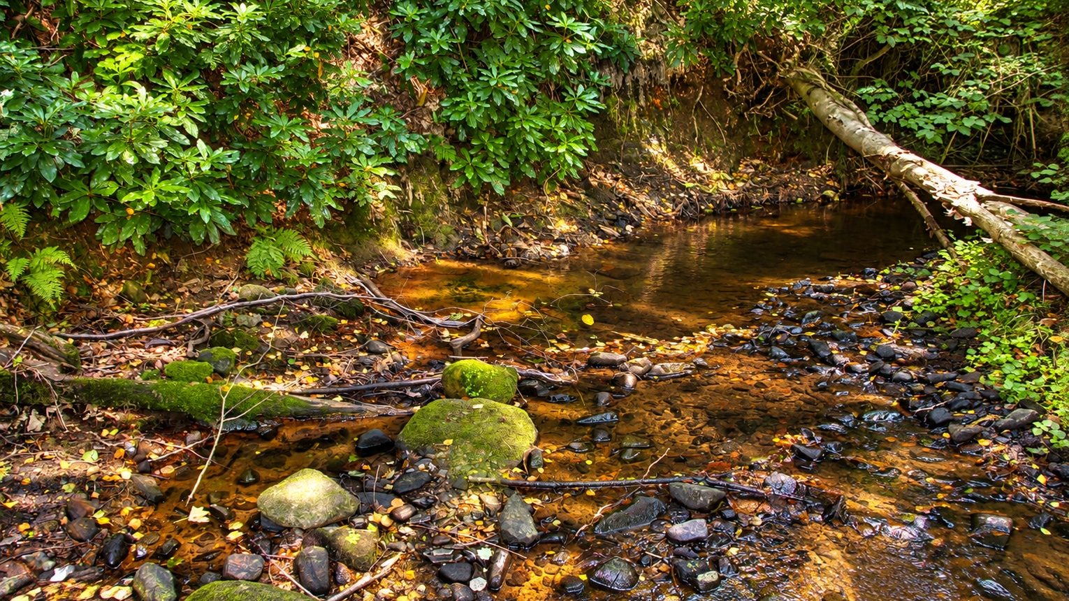
- Follow the public footpath beside the wooded stream valley. The shale exposures are below the path, but leaving it, descending the bank or entering the water requires the landowner’s agreement. Do not treat the older instruction to wade upstream as permission or a safe route.
- Original UK Fossils locality reference: SK 34340 63404. This identifies the stream locality, not a parking space or an authorised collecting entrance. If permission or safe conditions are absent, remain on the public path.
Location photographs
Swipe to browse · Select a photograph to enlarge


Fossil Hunting
The strongest locality evidence is for marine goniatites and bivalves in dark shale. These animals lived in the Carboniferous sea, and their shells were buried in fine sediment that was later compacted into mudrock. The original guide records abundant but commonly flattened material. A dark or silvery-looking shape on a shale surface may preserve only part of a shell, so useful identification often depends on careful lighting and a complete photograph rather than removing more rock.
Goniatites were coiled ammonoid cephalopods. Look for the curve of the shell, the shape of its central opening and, where preserved, ribs or sutures. Flattening can distort these features, and an incomplete coil is rarely enough for a confident species identification. The Geological Survey’s historical upstream collection included Reticuloceras cf. todmordenense, Reticuloceras aff. umbilicatum and a form of the Reticuloceras circumplicatile group. The cf., aff. and group qualifications are important: these were comparative determinations, not three unqualified species identifications.
Bivalve shells can appear as thin curved impressions or flattened valves with traces of their original outline and ornament. The same historical upstream material included Caneyella and Dunbarella. A separate collection from the northernmost exposure recorded Caneyella squamula, Dunbarella rhythmica and Reticuloceras cf. dubium. Keep those records tied to their separate exposures rather than assuming that every named form occurs in each visible bank.
The brook’s shade and wet rock can make fossils difficult to see. During a specifically authorised visit, a hand lens and light directed obliquely across a safely accessible surface may reveal detail. Photograph the rock before any permitted handling, include a scale and distinguish a specimen observed in bedrock from one already lying loose. Do not undercut a bank, prise shale from a face or enter a deeper reach to reach a supposedly better exposure.
Loose shale can mix material washed down the stream or displaced from different bank levels. Its fossil content does not establish a measured bed sequence or an exact collecting horizon. No securely documented numbered log is available for the guide’s two bank sections, and fossil zones recorded in nearby boreholes belong to those boreholes.
The original locality account also reports gastropods, occasional trilobites and microfossils including ostracods and fish teeth. Those additional groups have not been independently confirmed for the particular exposures described here. The Survey’s exact stream records securely establish goniatites and bivalves; the other reports are retained as historical observations rather than a promise of identifiable finds.
Any permitted specimen needs careful handling. Thin shale flakes and flattened shells can break during wrapping, while pyritic material may deteriorate later in a collection. A British Geological Survey conservation study recorded extensive pyrite-decay damage in four historical Marsh Brook specimens. Their exact beds were not recorded, so this is a warning about specimen care and documentation rather than evidence that every piece of shale behaves alike.

Fossil photographs
Swipe to browse · Select a photograph to enlarge


Discoveries and milestones
Significant discoveries, geological research and conservation milestones at Marsh Brook.
1946–1948 – Three Marsh Brook specimens are collected
The later BGS conservation inventory dates specimens Sy1647–Sy1649 to this collection interval. Their labels establish Marsh Brook as the locality, but their original beds were not recorded.
1947–1949 – A further Marsh Brook specimen is collected
The BGS inventory dates specimen Sy1646 to this interval. Like the other Marsh Brook material examined in the conservation study, it lacks a recorded geological horizon.
1967 – The marine faunas are published by the Geological Survey
Smith and colleagues documented the Marsh Brook shale and its historical collections, distinguishing the upstream material from the northernmost resurvey exposure. The publication date is not a newly inferred date of fossil discovery.
2004 – Pyrite decay is documented in stored specimens
Hodgkinson and Martin recorded extensive pyrite-decay damage in all four Marsh Brook comparator specimens examined during a collection-conservation investigation. The affected material came from unrecorded horizons, preserving an important lesson about both storage and provenance.
2023 – Local geological interest is recorded in the neighbourhood plan
The April Ashover Neighbourhood Plan lists Marsh Brook as a recognised Regionally Important Geological and Geomorphological Site. It does not give the original designation date, and recognition does not confer permission to enter the brook or collect.
Geology
The geological value of Marsh Brook lies in a small exposure of fossil-bearing marine mudrock near the northern end of the Ashover inlier. The Survey described dark grey shale dipping north at about 30 degrees and recorded goniatites that establish a Kinderscoutian age. This is part of the Namurian succession, considerably younger than the Asbian reef limestones elsewhere in Derbyshire. The older guide’s Asbian assignment is not supported by the locality’s documented fauna.
The mud accumulated in a marine basin and enclosed shells and other organic material. Burial and compaction flattened many of the fossils and produced the fine fissile structure that allows shale to separate into thin pieces. The fossils help correlate the sediment through time, but an age diagnosis is not the same as identifying a modern formation boundary at one stream-bank outcrop.
The historical memoir discusses these beds within its Kinderscout Grit Group and the broader Edale Shales succession. Those older names should not be read as a statement that the brook exposes a thick sandstone grit. The actual stream description concerns marine shale. BGS mapping places the guide locality in the Bowland Shale Formation, part of the Craven Group in the BGS Lexicon. That formation assignment does not locate an individual fossil bed or boundary in the bank.
Two sets of fossil records are important. Earlier collections came from an upstream stream-bank interval, while the later Survey resurvey recorded a partly different assemblage at the northernmost exposure. Neither account supplies the measured thickness or numbered beds needed to reconstruct a continuous local column. The much fuller zonal succession described immediately afterwards in the memoir comes from separate boreholes and cannot fill that gap.
Pyrite in some fossil-bearing material adds a later conservation problem to the depositional story. Oxidation after collection can damage a specimen and its surrounding shale. Historic Marsh Brook specimens were among material examined in a BGS conservation investigation, but their exact geological horizons were unrecorded. The report’s wider discussion of Coal Measures and Alton Marine Band specimens does not reassign these stream exposures to those units.
Detailed geology and bed-by-bed succession
Detailed geology and separately documented fossil assemblages at Marsh Brook.
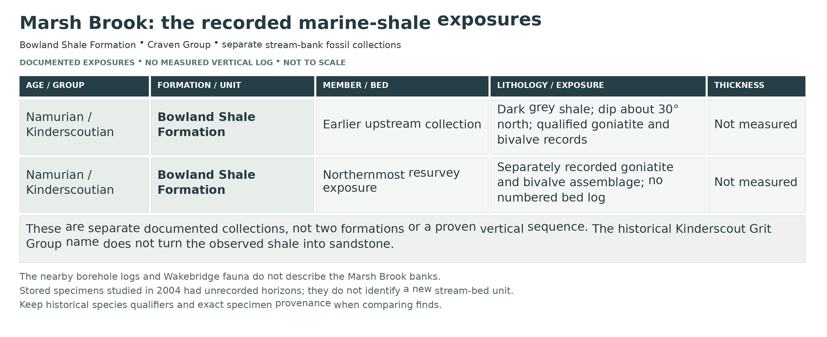
The Marsh Brook records concern marine shale exposed in the stream banks near the northern end of the Ashover inlier. The fossil assemblages establish a Kinderscoutian, Namurian age. BGS mapping places the guide locality in the Bowland Shale Formation, whose formal parent in the BGS Lexicon is the Craven Group. The mapped formation does not establish the position of an individual fossil bed or a formation boundary in the stream bank.
CRAVEN GROUP
Bowland Shale Formation
Historical stratigraphic terminology. The 1967 memoir places the stream beds in its Kinderscout Grit Group. Despite that name, the described exposures are dark marine shale rather than a thick sandstone grit. The historical terminology helps locate the older account, while the modern formation assignment comes from BGS mapping. The Kinderscoutian age belongs to the documented fossil assemblages; the broader age range of the entire formation should not be substituted for it.
The historical upstream collection. The Survey recorded dark grey marine shale dipping north at about 30 degrees. Collections made by W. N. Edwards, J. V. Stephens and C. B. Wedd from a short upstream interval included Caneyella and Dunbarella, together with Reticuloceras cf. todmordenense, Reticuloceras aff. umbilicatum and a form of the Reticuloceras circumplicatile group. The historical locality description places the collection 40 yd upstream of its reference point, itself 110 yd north-north-west of the road bridge. Those distances describe provenance, not an instruction to wade to the bank. No measured bed thickness or numbered local sequence is supplied.
The northernmost resurvey exposure. A separate collection during the Geological Survey resurvey yielded Caneyella squamula, Dunbarella rhythmica and Reticuloceras cf. dubium. The account calls this the most northerly exposure, without supplying a separate measured bed log. Its fauna must remain distinct from the earlier upstream collection; the two lists are not evidence that every species occurs throughout both bank faces.
Fossil determinations and preservation. The species names above are the Survey’s recorded historical identifications. The qualifiers cf., aff. and species-group attribution express uncertainty and must be retained. Flattening can conceal shell form and ornament. A later change in the generic placement of a named species does not independently redetermine the original Marsh Brook specimen.
Separate borehole and stream sections. The memoir’s 110–130 ft Kinderscout Grit Group interval and its detailed succession of goniatite, fish, juvenile-shell and burrow-bearing phases were measured in the Uppertown, Highoredish and Tansley boreholes. They are not a Marsh Brook stream log. The Wakebridge stream fauna near Crich also comes from another locality and a slightly higher horizon. Neither supplies missing beds or thicknesses for these banks.
Historical pyritic specimens with unrecorded horizons. A 2004 BGS conservation investigation examined four specimens labelled Marsh Brook: Sy1646–Sy1649. All were recorded as showing extensive pyrite-decay damage. Their precise geological horizons were unrecorded, and the specimen table does not identify the fossil taxon of each individual item. The report’s wider Coal Measures and Alton Marine Band setting therefore cannot be used to re-date this stream section or identify a new fossil band here.
References.
BGS Lexicon: Bowland Shale Formation and formal Craven Group parent.
BGS 1:50,000 bedrock mapping: locality assignment, checked October 2026.
Smith, Rhys and Eden (1967): Geology of the country around Chesterfield, Matlock and Mansfield, Marsh Brook account.
Hodgkinson and Martin (2004): BGS report IR/04/037, pyritic specimen conservation and Table 1.
UK Fossils: original Marsh Brook locality observations, inspected 2011.
Safety
Keep out of the brook when water is high, rising, fast-flowing or too cloudy to judge its depth. Conditions can change after rainfall upstream even if the weather at the site seems settled. The older description of mostly shallow water should never be used to judge conditions on arrival.
Steep muddy banks, wet shale, submerged stones and fallen branches can make footing unreliable. Do not climb or undercut the shale faces, descend a bank that you cannot safely climb back up, or work beneath overhangs. Stay on the public path if a safe, authorised approach is not available.
Wellington boots do not make deep or moving water safe. Keep children away from the stream edge and do not explore the watercourse alone. Take care when walking back along the road near the hairpin bend, where visibility and passing space may be limited.
Equipment
For a public-path visit, take sturdy footwear, a map, weatherproof clothing and a camera. A hand lens and a small scale are useful for observing fossils that can be viewed safely and lawfully.
Any authorised examination or sampling requires arrangements with the landowner and conditions suitable for the particular approach. Do not use a pick to excavate banks. If a small loose specimen is expressly permitted, wrap it individually, support fragile shale in a rigid box and label its exact source and whether it was loose or in place.
Cleaning And Treating
Begin conservatively with a lawfully obtained specimen. Do not soak pyritic or fragile shale, scrub fossil films or apply acid, bleach or varnish. Keep matching pieces together and avoid forcing open fine layers that may carry flattened shells.
Allow damp material to dry slowly at room temperature and keep it in dry, stable storage. Check periodically for new cracking, crumbling or powdery alteration. If deterioration develops, keep the affected specimen separate from other material and seek a museum conservator’s advice. The specialist historical chemical treatments discussed in the BGS report are not suitable instructions for home use.
Keep the locality label, collection date and any known bed information with the fossil. Historical Marsh Brook material lost useful stratigraphic detail because its original horizon was not recorded; good documentation is as important as retaining the specimen itself.
Identify Your Finds
Need help identifying a fossil? Share clear photos, where you found it and its size with the community.
Further Reading
British Geological Survey: Chesterfield, Matlock and Mansfield district, Marsh Brook marine beds
British Geological Survey: conservation of pyritic collections, including Marsh Brook specimens
Access Rights
The April 2023 Ashover Neighbourhood Plan lists Marsh Brook as a recognised Regionally Important Geological and Geomorphological Site. This acknowledges local geological interest; it does not grant entry or collecting permission.
The public footpath permits passage along the right of way. It does not provide blanket permission to leave the path, enter the brook, excavate banks or remove fossils. Obtain the landowner’s agreement before any such activity and follow any conditions imposed.
No current collecting permission has been established for this guide. The old claim that there were no restrictions on entering the brook should not be relied upon. Respect fences, gates, vegetation and stream banks, and leave the site undisturbed if access is refused or conditions are unsafe.
It is important to follow our ‘Code of Conduct’ when collecting fossils or visiting any site. Please also read our ‘Terms and Conditions‘
Links
♦ Fossil Discussions
♦ Fossil Articles
♦ Buy Fossils, Tools and Equipment
♦ Buy Crystals, Meteorites, and Artefacts
♦ Join Fossil Hunts
♦ UK Fossils Network


