

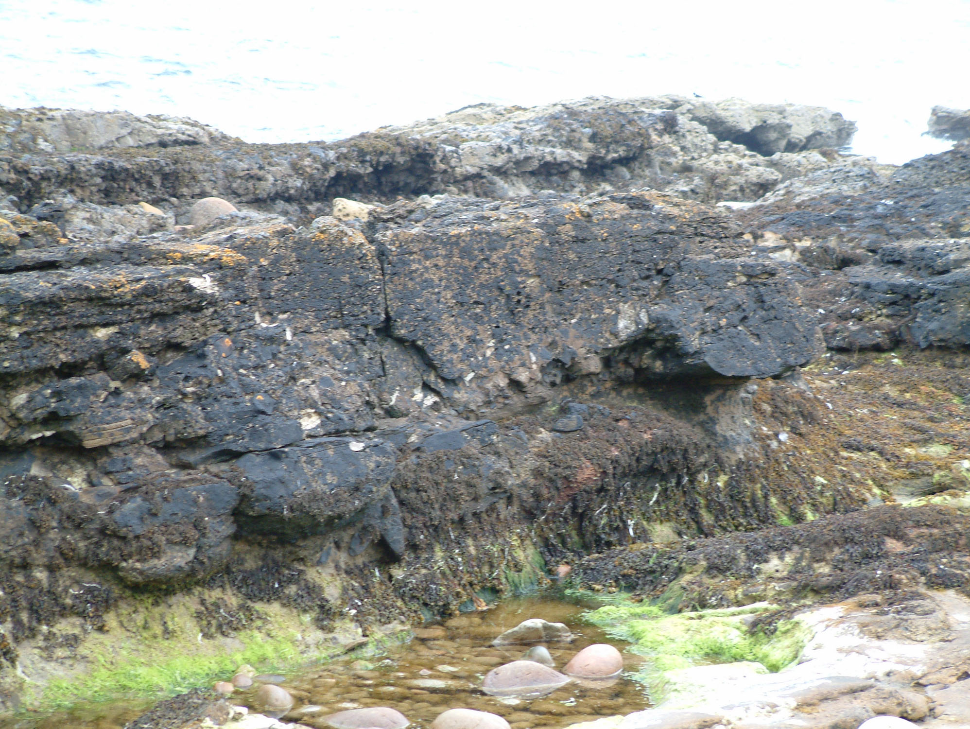
Portgower’s seaweed-covered foreshore exposes Jurassic boulder beds containing shell debris and enormous blocks of much older rock. The best-known is the ‘fallen stack’, a transported mass of Devonian flagstone with traces of ancient lake environments. This is a rewarding shore for studying fossils in their geological setting, although uneven rocks and tidal cover make close examination demanding.


FIND FREQUENCY: ♦♦♦ – Shell debris and other fossil traces are documented, but much of the shore is obscured and complete specimens should not be expected.
CHILDREN: ♦♦♦ – Best suited to older children with close supervision; slippery ledges, pools and loose stones make this a demanding family shore.
ACCESS: ♦♦♦ – Just south-west of Helmsdale, with limited parking and an uneven, tidal approach along the beach.
TYPE: Rocky foreshore with Jurassic sandstone, mudstone and boulder beds; some large blocks preserve much older Devonian rocks and fossils.
DIRECTIONS
♦ Follow the A9 to Portgower, south-west of Helmsdale. The rocky foreshore lies below the village.
♦ Parking is limited. Use a lawful space without obstructing homes, gates or the road, and follow a permitted pedestrian route to the shore. A published route approaches from Craig Loisgte Place, but its present railway-crossing arrangements need checking locally. Use only an authorised crossing and follow its instructions.
♦ The original guide’s shore reference is 58.09350°N, 3.69080°W, approximately ND 0042 1286, close to the published ‘fallen stack’ locality at ND 004 128. This is a shore reference, not a parking point.
♦ Plan for low tide and leave time for the return. The geological stations farther south-west, described below for comparison, are separate exposures; the published field guide advises visiting its sandstone station at ND 000 125 within two hours of low water.
FOSSIL HUNTING
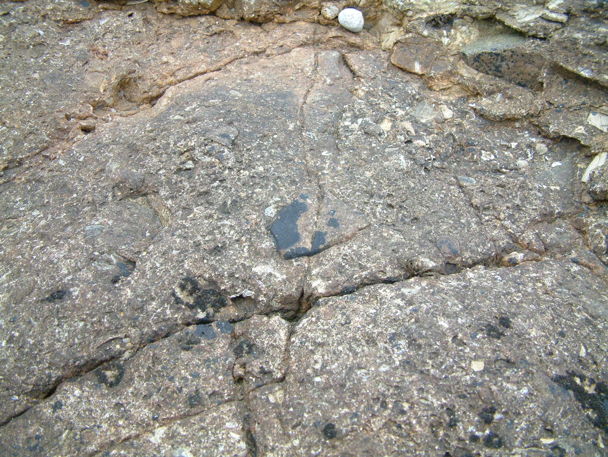
Begin by distinguishing the modern rounded beach cobbles from fragments enclosed in solid bedrock. The boulder beds contain angular pieces of older sandstone and flagstone, held in a finer sandy or muddy matrix. Fossils can occur in that matrix, in the finer sediments between boulder beds, or inside the older blocks themselves. Those settings record different environments and, in the case of the Devonian blocks, very different ages. A close photograph showing both the fossil and its surrounding rock is especially useful here.
Shell debris is a well-documented feature of the Portgower section. In the lower boulder beds at the separate south-western station, ND 000 125, oysters, pectinid bivalves and sea-urchin spines occur in the shelly matrix around pale sandstone clasts. Between that station and ND 003 127, thin breccias also contain oysters, urchin spines and calcitic clasts bored by bivalves identified as Lithophaga. Look at naturally exposed surfaces for curved shell sections and slender spine fragments among the broken rock. A hole or pale patch alone is not enough to identify a fossil boring.
The famous giant block near ND 004 128 offers a different kind of fossil evidence. Its finely laminated Devonian flagstone includes a dark fish-bed horizon near the landward end, where scattered fish scales have been recorded. Incomplete remains of Dipterus are documented from fish-bed laminites among the transported flagstone clasts. These fish lived in Devonian lakes long before the Jurassic sea received the blocks. They are scientifically useful records of the older rocks, rather than members of the Jurassic marine fauna. Examine and photograph existing surfaces without breaking the giant clast or other fish-bearing blocks.
The original visit account also records flattened, fragile ammonites and shells from the shore. Their precise beds and species were not documented, so treat them as a possible find rather than a promise of plentiful complete ammonites. Concentrate on naturally revealed fine-grained surfaces and fragments, remembering that beach cover changes between visits. The historic photographs show outcrop textures, but do not securely identify named fossils; shell-like fragments in the close views remain tentative. There is insufficient exact-locality evidence to describe corals as common here.
Take a hand lens and work slowly over a small exposed area instead of clearing rocks or stripping the shore. Photograph interesting material with a scale, record whether it is in the matrix or an older clast, and note its position before seeking identification. Obtain the relevant landowner or mineral-rights permission before removing specimens, and follow the protected-site guidance under ACCESS RIGHTS. Fragile material that you are authorised to collect should be supported in a rigid box and kept with its locality information.
A chronological record of significant collecting, geological research and conservation milestones at Portgower.
1827–1829 – Early geological description of the shore
Roderick Murchison described shell-rich material, mixed shale, sandstone and limestone conglomerates, and abrupt changes of dip near the Portgower limekilns. His paper was read in 1827 and published in 1829. Its observations helped establish the coast’s geological interest, although its explanations and stratigraphic terminology predate modern understanding.
By 1854 – Hugh Miller’s fish fragments
Hugh Miller’s published collecting history records Devonian fish fragments from the Portgower locality. The remains occur in older flagstone blocks incorporated into the Jurassic deposits; an exact date for the collecting is not established.
1932 – The ‘fallen stack’ explained as submarine debris
E. B. Bailey and J. Weir interpreted the giant flagstone block and associated boulder beds as material derived from an active submarine fault scarp. The block’s setting among deep-water marine sediments challenged the earlier idea of a coastal sea stack simply falling on its side.
1963 – First notification of the wider coastal SSSI
The larger Brora–Helmsdale Coast site was first notified for conservation. This forms the designation history of today’s Helmsdale Coast SSSI; its modern boundary should not be assumed to reproduce the 1963 boundary exactly.
1985 – Detailed study of fault-margin sedimentation
A. C. MacDonald’s research developed the sedimentological account of the boulder beds. The Portgower work underlies the later published composite log showing the upward reduction in sandstone and the change towards angular Devonian flagstone clasts and mudstone-rich breccias.
1986 – Helmsdale Coast re-notified
The Helmsdale Coast SSSI was re-notified on 12 December with a reduction in area. The protected coastal outcrops include important Kimmeridgian rocks and Mesozoic palaeobotanical evidence.
1989 – A refined zonal framework
H. F. Barron’s dinoflagellate-cyst study included samples from Portgower and improved correlation of the Jurassic beds along the coast. It provided a biological timescale against which the changing sandstone and boulder-bed deposits could be compared.
1993 – Fossils and fault-scarp environments reassessed
Paul Wignall and Kevin Pickering examined the relationship between transported shallow-water fossils, deeper-water sedimentation and the history of the boulder beds. Their work helped distinguish the organisms swept into these deposits from those associated with the finer marine sediments.
2009 – The Portgower succession set out station by station
A detailed field itinerary distinguished the lower sandstones, shelly boulder-bed matrix, changing clast types, thin breccias and giant flagstone block. Its map and composite log made the relationship between these separate shore exposures clearer.
2011 – Protected-site documents reviewed
The Helmsdale Coast notification documents were reviewed on 2 February, setting out the geological interest and site-specific operations requiring consent. These documents support conservation of the exposures without making ordinary viewing and fossil removal the same activity.
2014 – Sutherland Group framework revised
A. J. M. Barron and J. B. Riding placed the Jurassic coastal succession within a revised Sutherland Group framework. For Portgower, this provides the wider formation-level context for the Helmsdale Boulder Beds while keeping neighbouring sandstone and boulder-bed formations distinct.
GEOLOGY
Portgower preserves the edge of a Jurassic sea basin beside the active Helmsdale Fault. Movement on the fault lowered the basin floor relative to the land and shallow shelf to the north-west. Mud settled in deeper water, while occasional falls, avalanches and sediment flows brought in sand, shell debris and blocks eroded from the fault scarp. The resulting Helmsdale Boulder Beds Formation belongs to the Sutherland Group. Its coarse deposits interdigitate with dark mudstone, siltstone and sandstone, so the shore is a varied association of beds rather than one uniform mass of boulders.
The rocks near the ‘fallen stack’ are Kimmeridgian, with the giant-clast locality placed in the eudoxus Zone. Farther south-west, separate exposures show a lower, more sandstone-rich part of the section. Their quartz-rich sands were interpreted as sediment delivered directly from a delta. Overlying mudstones and then shell-rich breccias record a change in sediment supply, with marine shelf material once again reaching the deeper basin. Similar-looking sandstone at Lothbeg Point belongs to a different part of the zonal sequence and should not be used as an automatic correlation.
Changes in the blocks reveal changes in the rocks being eroded. Pale, feldspar-bearing sandstones preserve structures formed in rivers; higher in the illustrated Portgower sequence, typical Middle Old Red Sandstone flagstones become important. Sandstone becomes less abundant upwards, clasts are more tightly packed and angular, and breccias with muddy matrices become more prominent. Progressive erosion of the fault scarp helps explain this pattern, although changes in the older rocks along the fault and the influence of cross-faults also matter.
The ‘fallen stack’ is a giant transported block of Devonian lake deposits embedded in Jurassic rock. Its steep internal layering contrasts with the shallow easterly dip of the surrounding shale and sandy boulder beds. Dark lamination, ripples, flute moulds and drying cracks within the block preserve a succession from deeper lake water to shallow water and exposed lake margins. The older bedding travelled with the block; it is not a steeply dipping Jurassic bed or a modern collapsed stack. Its position among other giant clasts with little intervening matrix favours emplacement by a rockfall or avalanche from the submarine scarp.

Detailed geology of the Portgower boulder beds, neighbouring south-western stations and the Devonian rocks within the ‘fallen stack’.
The central locality is the ‘fallen stack’ at ND 004 128, close to the original guide’s shore reference. The lower succession is exposed at separate stations to the south-west. The account below keeps those places distinct and describes the sequence upwards before examining the older beds preserved inside the giant clast. The station numbers refer to the published 2009 itinerary, not numbered geological beds.
SUTHERLAND GROUP
The Jurassic succession is assigned to the Sutherland Group. The revised formation scheme recognises the Helmsdale Boulder Beds, Allt na Cuile Sandstone and Kintradwell Boulder Beds as distinct formations; the latter two are approximately coeval in the regional framework. They are not three obligatory successive layers at Portgower. Regional estimates for group or formation thickness cannot be substituted for the thickness visible on this shore.
Lower quartzose sandstones, station 2: ND 000 125
About half a kilometre south-west of the central guide point, friable medium- to coarse-grained quartzose sandstone is exposed in a gentle anticline. Graded beds and highly carbonaceous shale interbeds occur within the sandstone. Its lack of carbonate cement and carbonate bioclasts supports the interpretation of direct delta-derived sand supply, rather than recycling through a shell-bearing marine shelf. These are the lower beds beneath the field guide’s local base of the Helmsdale Boulder Beds; their resemblance to Allt na Cuile sandstone at Lothbeg does not establish that formation assignment here.
Age qualification at station 2
The itinerary text assigns the basal sandstone to the mutabilis Zone, citing Barron’s biostratigraphy, whereas its map labels the sandstone patch “?cymodoce”. This map–text disagreement remains significant. The central giant-clast station is separately assigned to the eudoxus Zone. Zonal names identify intervals of geological time; they do not establish that a specimen of the index ammonite has been found at every point.
Mudstone and thin sandstone above the lower sands
The more massive sandstone is succeeded by a finer interval of mudstone containing thin sandstone beds. An abrupt change to breccia and sandstone-rich deposits above marks the local base of the Helmsdale Boulder Beds in the field description. No secure individual bed thicknesses are printed for these lower intervals.
Helmsdale Boulder Beds Formation
This formation comprises sedimentary boulder beds and breccias interbedded and interdigitating with finer marine deposits. The Portgower shore records varying clast composition and sediment supply along the basin margin. Published estimates of about 500 m and 800 m refer to broader formation interpretations, not a measured local total, and are not used as the thickness of this exposure.
Portgower Boulder Beds Member: older mapped terminology
The name Portgower Boulder Beds Member is retained in the BGS index and appears on the earlier UK Fossils diagram. It belongs to a different nomenclatural scheme from the revised formation framework used here. It is mentioned to help readers recognise the older name, not added as a second rock unit or assigned new boundaries. The index alone does not provide a sufficiently detailed definition to impose a separate member-scale succession on the outcrop.
Lowest shell-rich boulder beds at station 2
The basal breccia and sandstone-rich sequence contains pale, laminated and cross-bedded sandstone clasts in a shelly matrix. Sea-urchin spines, pectinid bivalves and oysters are recorded here. The change from carbonate-poor lower sands to this shell-bearing matrix was interpreted as the end of direct delta sand supply and the re-establishment of marine shelf conditions on the upthrown side of the fault.
Sandstone-clast facies at the separate station 1: NC 997 123
Farther south-west, sandstone clasts can exceed 2 m in length. Some retain red centres but are bleached brown or green around their margins and fractures. Moderately sorted, medium-grained sandstone shows trough cross-bedding, locally distorted by liquefaction, together with red-mudstone rip-up clasts, occasional subrounded quartzite pebbles and primary current lineation on parallel-laminated surfaces. These features favour a fluvial source of probable Devonian age, rather than a Permo-Triassic origin. Large clasts and little matrix suggest local rockfall, while sandy matrix with oyster and echinoid debris records input from a shallow, oxygenated marine shelf. This exposure is not the central giant-clast station.
Changing clast provenance near station 3: ND 003 127
The lower breccias between stations 2 and 3 contain mainly pale, relatively friable sandstone clasts. Although superficially like some Jurassic sandstones at Brora, they are feldspathic and were interpreted as fragments of older fluvial sandstone, probably Devonian. An earlier account assigned sandstone clasts of the cymodoce and mutabilis intervals to Jurassic sources; the later field interpretation favours probable Devonian derivation for these pale feldspathic clasts. Typical Middle Old Red Sandstone flagstone clasts first appear around station 3. Progressive erosion into older rocks is one explanation, complicated by lateral changes in basement lithology and intersections with older cross-faults. The clast succession is therefore not a simple measured section through the source rocks.
Thin breccias and intervening shale between stations 2 and 3
Near the top of the beach, sometimes obscured by pebbles and boulders, individual breccia beds reach 0.30 m thick. Their sandstone clasts commonly reach 0.10 m, with occasional larger boulders. These two measurements describe bed thickness and clast size respectively. Intervening shale contains sandy laminae and lenticles rich in broken shell and carbonaceous debris. Calcitic clasts bear Lithophaga borings; oysters and echinoid spines also occur. Spine long axes were recorded at 130–150° on several bedding surfaces. Later calcite veins cut the outcrop mainly at 220–240°, with some at 180°.
Composite upward trend and limits of the illustrated log
The published composite log spans approximately 70 m graphically, with numbered scale labels from 10 to 60 m. It shows alternating sandstone, laminated mudstone and breccia, an upward decrease in sandstone, increasingly tightly packed and angular clasts, a transition from cross-bedded sandstone to Devonian flagstone clasts, and more breccias with mudstone matrices. The drawn ‘fallen stack’ lies roughly 48–55 m above the graphic base, a visual positional estimate rather than a published measured thickness. The diagram supplies no formal numbered beds, and its approximate span is not the total thickness of the formation. A separate description groups Portgower with Gartymore in reporting boulder beds from 1 m to nearly 10 m thick; that two-locality range is not a measurement of every Portgower bed.
The giant-clast bed, station 4: ND 004 128
The ‘fallen stack’ is a large Middle Old Red Sandstone flagstone block among other giant clasts in a Jurassic breccia. Its near-vertical inherited bedding contrasts with the shallow easterly dip of adjacent shale and sandy boulder beds. The field itinerary describes it as 30 m long and reports Bailey and Weir’s earlier value of 100 ft; the Geological Conservation Review gives at least 45 × 27 m, and Barron reports 45 × 27 × 9 m. These published dimensions differ and should not be combined into a single exact volume. All describe the transported block, not Jurassic formation thickness.
Devonian fish-bed laminites inside the block
A dark-grey, finely laminated fish-bed horizon near the landward end preserves scattered scales. These sediments formed in deeper lake water. Fish-bed laminites among the transported clasts also contain incomplete Dipterus. Neither a species-level identification nor a precise modern specimen provenance is supplied by the field account. These are older fossils carried into the Jurassic deposit within rock fragments.
Shallow-lake and drying-surface beds inside the block
Other flagstone lithologies show ripple lamination and cross-bedding; the base of one sandstone bed carries flute moulds. Subaqueous cracking and separate horizons with polygonal desiccation cracks record changing conditions, including exposure and drying on a playa-like lake margin. This internal range from deep lake to shallow lake and exposed surfaces belongs to the Devonian block. It does not form a set of Jurassic beds or an in-situ Devonian formation on the modern foreshore.
Emplacement and the inferred submarine scarp
The small amount of matrix between the giant blocks favours a rockfall or avalanche rather than transport as an ordinary matrix-rich debris flow. Separately from its statement about the block’s length, the field guide describes 30 m of preserved Devonian stratigraphic thickness within the clast. Assuming those source beds originally dipped gently, it infers a submarine scarp at least 30 m high. This is a geological reconstruction with stated assumptions, not a measurement of ancient water depth or the thickness of the surrounding Jurassic bed.
References
MacDonald, A. C. and Trewin, N. H. (2009). Excursion 3: The Upper Jurassic of the Helmsdale area, itinerary 3.3 and Figures 3.16–3.19, in Excursion Guide to the Geology of East Sutherland and Caithness, edited by N. H. Trewin and A. Hurst. Dunedin Academic Press.
Barron, H. F. (1989). Dinoflagellate cyst biostratigraphy and palaeoenvironments of the Upper Jurassic (Kimmeridgian to basal Portlandian) of the Helmsdale region, east Sutherland, Scotland.
Cox, B. M. (2001). Helmsdale, in British Upper Jurassic Stratigraphy (Oxfordian to Kimmeridgian), Geological Conservation Review Series 21.
Barron, A. J. M. and Riding, J. B. (2014). A revision of the Jurassic (Bathonian to Oxfordian) lithostratigraphy of the onshore Moray Firth Basin, north-east Scotland.
British Geological Survey. Lexicon entries for Sutherland Group and Helmsdale Boulder Beds Formation, and index of named rock units.
SAFETY
Check tide times and sea conditions before setting out. Much of the useful exposure is intertidal, and swell can wash across low ledges even near low water. Leave ample time to return without crossing flooded gaps. Wet seaweed, uneven bedding surfaces, loose cobbles and hidden pools make footing difficult; avoid jumping between rocks or exploring close to breaking waves.
The railway lies between parts of the village and shore. Follow current signs and use only an authorised crossing; do not enter railway cuttings or walk along the line. Keep children close, carry a charged phone and let someone know your plans. Published route descriptions and the historical photographs do not show present-day crossing arrangements or beach conditions.
EQUIPMENT
Wear sturdy footwear with good grip and carry waterproofs, tide information, a hand lens and a camera with a small scale. A notebook helps separate observations from the giant Devonian clasts and the Jurassic matrix. A rigid box and soft packing are useful only for material you have permission to remove. A pick or tools for clearing the exposure are inappropriate for this visit; leave the ‘fallen stack’ and its associated blocks intact.
CLEANING AND TREATING
For an authorised loose specimen, record its origin before preparation and keep fragile shale or laminated fish-bearing rock supported. Let damp material dry slowly at room temperature and start with a soft dry brush. Avoid soaking fissile shale or forcing apart layers, which can destroy flattened fossils. Use water only after confirming that both fossil and matrix are stable. Do not use household acids, bleach or varnish; hard matrix and shell material can break together. Leave potentially important fish remains or unusual specimens unprepared and seek specialist advice.
IDENTIFY YOUR FINDS
Need help identifying a fossil? Share clear photos, where you found it and its size with the community.
FURTHER READING
Portgower field itinerary: boulder beds and the ‘fallen stack’
Helmsdale Geological Conservation Review: wider geological context
Barron’s Jurassic biostratigraphy of the Helmsdale region
BGS Lexicon: Sutherland Group
ACCESS RIGHTS
Portgower’s important geological exposures lie within the Helmsdale Coast SSSI, a protected site made up of separate coastal sections. Responsible walking and viewing are distinct from taking fossils. Obtain permission from the relevant landowner or mineral-rights holder before removing material; any applicable NatureScot consent must also be addressed with the owner or occupier. Current specimen-removal permission has not been established for this guide. Leave the giant ‘fallen stack’ and its associated blocks unhammered.
The site’s listed operations requiring consent cover coastal defence or stabilisation, construction and earthworks, storage against outcrops, and battering, buttressing or grading rock faces. Sampling may fall within those activities depending on what is proposed, and damage to the protected features must be avoided. The absence of a separately listed specimen-removal operation is not collecting permission. Ask the landowner and NatureScot about a proposed collecting activity rather than assuming that walking access authorises it.
The SSSI’s Kimmeridgian feature was assessed as unfavourable declining on 12 September 2023, with dumping or storage and invasive-species pressures recorded; its Mesozoic palaeobotany feature was favourable maintained on 3 May 2023. These are sitewide conservation assessments, not a notice that the Portgower walking route is closed.
 Follow the Scottish Fossil Code: seek permission, collect responsibly, record where specimens came from and report significant finds. The code applies alongside site-specific conditions.
It is important to follow our ‘Code of Conduct’ when collecting fossils or visiting any site. Please also read our ‘Terms and Conditions‘
LINKS
♦ Fossil Discussions
♦ Fossil Articles
♦ Buy Fossils, Tools and Equipment
♦ Buy Crystals, Meteorites, and Artefacts
♦ Join Fossil Hunts
♦ UK Fossils Network


