

Samphire Hoe provides a managed reserve and access to the natural shore west of the reclaimed ground. Its Chalk fossils and cliff succession are fascinating, but the reserve paths and the tidal beach have very different access conditions.


FIND FREQUENCY: ♦♦♦♦♦ – Variable — Brachiopods, shells and other Chalk fossils are recorded, but finds are not guaranteed.
CHILDREN: ♦♦♦ – The reserve circuit is distinct from the rough shore. Supervise children and keep them away from cliffs and fresh debris.
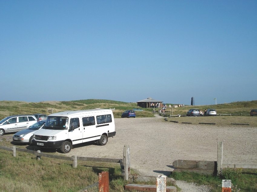
ACCESS: ♦♦♦♦ – Access is through a traffic-controlled tunnel to the paid car park, followed by a walk across the reserve.
TYPE: – Natural west-shore Chalk exposures and loose material must be distinguished from imported tunnel spoil on the reserve platform.
DIRECTIONS
♦ Use the signed Samphire Hoe turn from the A20 Dover-to-Folkestone carriageway. Wait for the traffic signal before entering the access tunnel.
♦ Continue to the car park and follow current payment instructions. The operator’s address is CT17 9FL.
♦ Follow the designated path west across the reserve to the shore. Opening is from 07:00 until dusk, with last entry at 19:00; obey any temporary closures.
♦ Ref: 51.10480°N, 1.27553°E
♦ The original guide estimated about 15–20 minutes from the car park to the western shore. Treat that as historical walking context: current paths, weather and any restrictions may require a different route or more time.
FOSSIL HUNTING
The original account records brachiopods, bivalves, corals, worm tubes and occasional ammonites, with pyrite also present. Note the colour and texture of the rock and whether a specimen comes from the natural shore or displaced material.
Ask the ranger or manager about collecting before removing specimens. Do not hammer cliffs, sample reserve spoil or take bulk Chalk for microfossil processing without permission. Fresh cliff-fall debris is not a safe collecting target.
The original local account also reports gastropods, fish and shark remains, occasional echinoids preserved in flint, and ammonites exceeding 30 cm. These describe historical finds, not typical yields or a reason to approach unsafe cliff falls; keep unusual vertebrate fragments and large fragile fossils supported and seek advice before preparation.


A chronological record of fossil discoveries, geological research and scientific milestones associated with Samphire Hoe.
26 January 1843 – Round Down Cliff blasted for the railway
A major controlled blast created space for the Folkestone–Dover railway at the foot of the cliffs. The artificial platform, known as the Great Fall, began a long sequence of engineering changes to the shoreline now occupied by Samphire Hoe.
7 February 1844 – The cliff-foot railway opened
Completion of the railway fixed transport infrastructure below the Chalk cliffs and changed their exposure to direct marine erosion. The present landscape combines natural strata with extensive engineered ground.
1880–1881 – Early Channel Tunnel investigations
Trial tunnelling at Abbot’s Cliff was followed by boring from Shakespeare Cliff. These separate working sites on the wider coast helped establish the practical importance of the Chalk beneath the Channel; neither is a natural bed within the modern reserve.
1896–1909 – Shakespeare Colliery explored buried strata
Coal workings were developed on the site later occupied by Samphire Hoe. Coal Measures were reached deep beneath the Chalk, but flooding and other difficulties prevented commercial success. The colliery closed in 1909 after only limited production.
1969 – Cenomanian beds described in detail
Kennedy’s work refined the stratigraphy and ammonite succession between Folkestone and Dover. At the western reference sections, the numbered bands and fossil horizons remain important for recognising the Cenomanian beds.
1970–1975 – Another tunnel attempt left the access route
A tunnel through the cliff was cut in 1970 to reach the old colliery site for a renewed Channel Tunnel project. Government support was withdrawn in 1975, after an experimental drive. This engineering history underlies today’s unusual access through the cliff.
1988–1993 – The reclaimed Hoe platform created
New sea walls enclosed lagoons that were filled with chalk-marl spoil from the Channel Tunnel. By 1993 contractors’ buildings were being removed and the platform landscaped, producing the artificial ground beside the natural cliff succession.
1989–1995 – Lydden Spout marker beds correlated
Gale’s detailed studies of the nearby Lydden Spout succession identified distinctive limestone, marl and fossil horizons that could be followed across the Anglo-Paris Basin. They provided the measured framework for later climate-event research.
1994–1996 – A Middle Cenomanian climate event identified
Carbon-isotope work recognised a double-peaked excursion in the Lydden Spout succession, subsequently named the Middle Cenomanian Event 1. Fossils in the Arlesiensis and primus beds helped connect the chemical signal with incursions of cooler-water fauna.
17 July 1997 – Samphire Hoe opened to the public
The reclaimed site opened as a publicly accessible reserve. Its managed paths created a convenient approach to the west shore, while the adjacent natural cliffs retained their separate geological and tidal hazards.
2014 – Samphire Hoe Chalk included in hardening research
A study of regional Chalk hardening documented the upper Zig Zag Chalk, Plenus Marls and Holywell succession in the Samphire Hoe cliff, providing an exact-locality record of the natural bedrock above the reclaimed platform.
2022–2023 – Microfossils reveal changing sea conditions
Petrizzo and Gale’s study of Lydden Spout, published online in 2022 and in the 2023 journal volume, used planktonic foraminifera with isotope and macrofossil records to investigate the Middle Cenomanian Event. The results linked cooler-water incursions with changing water-column structure and nutrient conditions.
References
Mortimore, Wood & Gallois (2001), British Upper Cretaceous Stratigraphy, Folkestone to Kingsdown account
Petrizzo & Gale (2022 online; 2023 volume), Planktonic foraminifera document palaeoceanographic changes across MCE 1
Natural England/NCC, Folkestone Warren SSSI citation
Samphire Hoe / Getlink: Creation of Samphire Hoe
Duperret, Mortimore & Wyns (2016), La partie anglaise du bassin anglo-parisien, Bulletin d’Information des Géologues du Bassin de Paris 53(1), 15–25
Samphire Hoe / Getlink: History
Jeans et al. (2014), Regional hardening of Upper Cretaceous Chalk in eastern England
Samphire Hoe / Getlink: Visit us
Samphire Hoe existing UK Fossils guide
GEOLOGY
Samphire Hoe brings together two very different geological settings: the natural Chalk cliffs and the low reserve platform built from chalk-marl spoil excavated for the Channel Tunnel. The platform is artificial ground, so a chalk fragment found there has been moved from its original geological position. The cliff behind it retains a natural succession, including upper Zig Zag Chalk, the Plenus Marls and Holywell Nodular Chalk, with New Pit Chalk and Lewes Nodular Chalk higher up. Keeping those settings separate is essential when interpreting both the rocks and their fossils.
The natural succession began as marine sediment in the Late Cretaceous. In the older Grey Chalk, changes in the proportion of clay and carbonate produced alternating softer marly layers and harder limestones. The detailed Lydden Spout reference section, about 500 m farther west, records the transition from West Melbury Marly Chalk to Zig Zag Chalk. Fossil-rich horizons there include the dark Arlesiensis marl and the Cast Bed above the Tenuis Limestone, with small bivalves, brachiopods and corals. These named beds belong to that separately located measured section; they explain the neighbouring marine succession without turning the reclaimed Hoe into a natural vertical log.
Towards Samphire Hoe, the upper Zig Zag Chalk becomes paler and less clay-rich beneath the greenish Plenus Marls. The marls form a conspicuous break below hard nodular Holywell Chalk and mark the base of the White Chalk Subgroup in the modern classification. Above them, strongly cemented chalk is followed by shell-rich beds containing abundant fragmented Mytiloides. The contrast between clay-rich seams, hard nodules and gritty shell debris records real changes in sediment accumulation and preservation, rather than differences caused solely by modern weathering.
Smoother New Pit Chalk occupies part of the higher cliff, while coarser, yellowish Lewes Nodular Chalk with marls, hardgrounds and regular flint bands occurs above. Erosion can bring material from these upper levels into fallen debris beside the lower exposures, obscuring its original height. Along the natural shore, the fossil’s surrounding matrix and its recorded find setting therefore matter as much as identification: a shell in fine chalk, one in a concentrated debris bed and a specimen in transported tunnel spoil preserve different kinds of geological information.

Explore the formations, individual beds and marker horizons at Samphire Hoe.
The natural west-shore Chalk cliffs reached from Samphire Hoe, with the separately identified Lydden Spout reference section about 500 m farther west. The reserve platform is artificial tunnel-spoil ground, not an in-situ vertical Chalk succession.
CHALK GROUP
The bedrock was deposited in a marine setting during the Late Cretaceous. Fine carbonate sediment is interspersed with clay-rich marl seams, fossil-rich horizons and surfaces recording pauses or erosion on the sea floor.
GREY CHALK SUBGROUP
The account follows the exposed succession from older to younger beds. Historic Lower, Middle and Upper Chalk divisions do not coincide with all the modern formation boundaries.
West Melbury Marly Chalk Formation
Darker marly chalk alternates with paler, harder limestone beds in regular sedimentary rhythms. The detailed lower-to-middle Cenomanian record described here belongs to Lydden Spout, about 500 m west of Samphire Hoe. The modern measured study covers about 25 m of the West Melbury–Zig Zag transition; this is not the thickness of the whole formation or of the reclaimed Hoe.
Orbirhynchia mantelliana Band 1
The lowest of three brachiopod-rich bands in the wider Abbot’s Cliff–Lydden Spout sequence lies above the paired M6 sponge limestones. Its published exposure is towards Abbot’s Cliff, farther west than the core Samphire Hoe shore; it supplies context for the younger Lydden Spout bands.
Orbirhynchia mantelliana Band 2
The middle brachiopod band occurs close above the first appearance of the ammonite Cunningtoniceras inerme in this coastal succession. It forms part of the lower Middle Cenomanian interval recognised by its combined brachiopod and ammonite fauna.
Arlesiensis Bed
A dark, fossil-rich marl lies below the lower of two prominent limestones. It contains abundant small bivalves, including Oxytoma seminudum, with serpulids and Inoceramus schoendorfi. The pectinid giving the bed its name is recorded as Chlamys arlesiensis in the recent study and under older generic combinations in earlier descriptions.
Lower prominent limestone above the Arlesiensis Bed
This conspicuous limestone directly succeeds the dark fossiliferous marl in the Lydden Spout reference sequence. It is separate from the higher Tenuis Limestone and is retained as an unnamed local marker rather than assigned an invented formal name.
Tenuis Limestone
The higher of the two prominent limestones contains the first local Acanthoceras rhotomagense. It forms a major correlation marker at the top of the West Melbury Marly Chalk, immediately below the Cast Bed of the Zig Zag Chalk.
Zig Zag Chalk Formation
Marl–limestone rhythms continue into the lower part of this formation, becoming progressively less clay-rich upwards. The lower part at Lydden Spout includes the fossil-rich Cast Bed and Middle Cenomanian climate-event record. Higher Zig Zag Chalk forms the cliff succession towards Samphire Hoe below the Plenus Marls.
Cast Bed: the primus horizon
The bed above the Tenuis Limestone contains abundant small brachiopods, including Grasirhynchia grasiana, G. martini, Kingena concinna and Modestella geinitzi. Small corals Micrabacia coronula, the bivalve Entolium orbiculare and a second abundance of Oxytoma seminudum accompany them. Rare Praeactinocamax primus links the bed with an incursion of cooler-water fauna.
Orbirhynchia mantelliana Band 3
The uppermost brachiopod band ranges through a thicker interval here than in several other southern English sections. It lies below a succession of nine conspicuous limestone bands.
Nine-limestone rhythmic interval
Above the upper brachiopod band, nine conspicuous limestones alternate with softer chalk. Each is approximately 0.12–0.20 m thick in the published coastal log. The ordinal labels below simply distinguish these successive layers; they are not formal bed names. The third to seventh harder layers lie between the sponge-rich lower bands and the higher coral-bearing Micrabacia horizon. Concinnithyris subundata is abundant through the interval and above the Micrabacia Band.
First limestone above Orbirhynchia Band 3
Discontinuous concentrations of sponges form the lowest limestone in the sequence above the upper brachiopod band.
Second limestone above Orbirhynchia Band 3
A second discontinuous sponge-rich limestone lies above the first, separated from it by softer chalk.
Third limestone above Orbirhynchia Band 3
This is the third harder layer in the nine-limestone succession.
Fourth limestone above Orbirhynchia Band 3
This is the fourth harder layer in the nine-limestone succession.
Fifth limestone above Orbirhynchia Band 3
This is the fifth harder layer in the nine-limestone succession.
Sixth limestone above Orbirhynchia Band 3
This is the sixth harder layer in the nine-limestone succession.
Seventh limestone above Orbirhynchia Band 3
This is the seventh harder layer in the nine-limestone succession.
Eighth limestone above Orbirhynchia Band 3
Abundant small corals Micrabacia coronula occur on the upper surface of this limestone. This is the Micrabacia Band, equivalent to Band 11 in Kennedy’s 1969 scheme.
Ninth limestone above Orbirhynchia Band 3
The highest limestone completes the counted succession above the upper brachiopod band, succeeding the coral-bearing Micrabacia horizon.
Jukes-Browne Bed 7
Coarse-grained chalk forms a slightly projecting layer in the higher Grey Chalk succession west of Samphire Hoe. Kennedy described a bed of laminated structures in this interval. The unit is a historical numbered bed within Zig Zag Chalk, not a formation or member.
White Bed: Jukes-Browne Bed 8
Relatively pale, less clay-rich chalk overlies Bed 7 and underlies the greenish Plenus Marls. Its contrast with those marls is conspicuous in air-weathered sections of the west-coast cliff succession.
WHITE CHALK SUBGROUP
The subgroup begins with the Plenus Marls at the base of the Holywell Nodular Chalk Formation. Older descriptions placed the Plenus Marls at the top of Lower Chalk; that historical classification differs from the modern formation hierarchy.
Holywell Nodular Chalk Formation
The formation includes the basal Plenus Marls and overlying hard, nodular chalk. The higher part is strongly condensed on the Folkestone–Dover coast and contains concentrated bivalve shell debris. Its named marker beds are not all preserved as separate layers in the way they are in expanded Sussex sections.
Plenus Marls Member
Greenish marl and chalk layers form a clear break between the White Bed below and pale, indurated chalk above. The member is visible in the Samphire Hoe cliff. Its expression varies along the coast: nearby Shakespeare Cliff and the eastern Warren preserve an eight-bed succession, whereas the immediate Hoe exposure is best recognised by its overall greenish colour and its contacts.
Holywell Nodular Chalk Formation
Above the basal Plenus Marls Member, the rest of the Holywell succession consists of hard nodular chalk and younger shell-rich beds. These belong to the parent formation, not to the Plenus Marls Member.
Hard nodular chalk above the Plenus Marls
Very hard nodular chalk above the marls initially lacks the abundant shell debris of the younger beds. This restricted interval corresponds more closely to the traditional Melbourn Rock than does the entire Holywell formation. The descriptive term does not create a separate formal member here.
Mytiloides shell-debris or Grit Beds
Fragmented bivalve shells are densely concentrated in the condensed upper Holywell succession. Air-weathered sections on the Lydden Spout cliff track display the gritty texture especially clearly. They are historical geological observations; the steep cliff path is not an alternative visitor route from the reserve.
New Pit Chalk Formation
Massive, bedded chalk with relatively few flints forms part of the higher Samphire cliff. Marl layers and basal hardgrounds distinguish this interval above the Holywell chalk.
Gun Gardens Main Marl: the Lulworth Marl boundary
This marl is used to mark the Holywell–New Pit formation boundary. The marked change from shell-rich, nodular chalk below to smoother chalk above is recorded in the Lydden Spout cliff-path section. The two names reflect alternative regional schemes for the same boundary marker.
Lewes Nodular Chalk Formation
Coarser yellowish chalk with softer marl layers, nodular hardgrounds and regular flint bands occupies the highest part of the Samphire cliff. These high-level strata are separate from the beach-level fossil exposures.
Artificial ground of Samphire Hoe
The low reserve platform was made from chalk-marl spoil excavated during construction of the Channel Tunnel and placed in enclosed lagoons. Fossils or chalk fragments in that material have been moved from their original geological position, so a find on the platform cannot automatically be assigned to the cliff bed behind it.
References
Jeans et al. (2014), Regional hardening of Upper Cretaceous Chalk in eastern England.
SAFETY
The shore is not safe regardless of tide. Check sea conditions and your return route, and leave before the tide cuts off passage.
Stay on designated reserve paths, keep dogs on leads and avoid cliffs, fresh falls and old steep cliff tracks. The beach’s loose stones and rocks require much better footing than the reserve circuit.
EQUIPMENT
Wear sturdy footwear with a strong grip and carry a small bag, individual padding, labels and a hand lens. Bring suitable clothing, drinking water and a charged phone.
For a beachcombing visit, leave hammers, chisels and digging tools at home. Do not carry heavy rocks or overfill a bag on slippery ground.
CLEANING AND TREATING
Label each find with its locality, date and, if known, the bed or source rock. Pack fragile chalk fossils separately and support thin shells with their matrix.
Start with gentle dry brushing and gradual room-temperature drying. Do not force matrix from echinoid tests or use acids, bleach or routine varnish. Leave unusual or important specimens unprepared for specialist assessment.
Keep pyrite-bearing material dry and separate from delicate specimens. Check periodically for powdering, cracking or an acidic smell; seek conservation advice rather than washing or varnishing a deteriorating specimen.
IDENTIFY YOUR FINDS
Need help identifying a fossil? Share clear photos, where you found it and its size with the community.
FURTHER READING
Mortimore, Wood & Gallois (2001), British Upper Cretaceous Stratigraphy, Folkestone to Kingsdown account
Petrizzo & Gale (2022 online; 2023 volume), Planktonic foraminifera document palaeoceanographic changes across MCE 1
Samphire Hoe / Getlink: Visit us
Samphire Hoe / Getlink: Creation of Samphire Hoe
Samphire Hoe / Getlink: History
Natural England/NCC, Folkestone Warren SSSI citation
Duperret, Mortimore & Wyns (2016), La partie anglaise du bassin anglo-parisien, Bulletin d’Information des Géologues du Bassin de Paris 53(1), 15–25
ACCESS RIGHTS
Samphire Hoe is managed reserve land beside the protected Folkestone Warren coast. Ask the ranger or manager before removing specimens; public opening of the reserve is not consent to collect or sample.
Do not dig, remove in-situ fossils, sample reclaimed spoil or enter closed areas. Follow designated paths, keep dogs on leads and obey current opening and closure notices.
It is important to follow our ‘Code of Conduct’ when collecting fossils or visiting any site. Please also read our ‘Terms and Conditions’.
LINKS
♦ Fossil Discussions
♦ Fossil Articles
♦ Buy Fossils, Tools and Equipment
♦ Buy Crystals, Meteorites, and Artefacts
♦ Join Fossil Hunts
♦ UK Fossils Network


