

Spyway Dinosaur Footprints, near Langton Matravers in Dorset, is an outdoor National Trust attraction where sauropod dinosaurs left their mark on an Early Cretaceous lagoon margin. Visit to explore the footprints, geology and discovery story; leave all fossils and rock in place. The former Keates Quarry name survives in the history and photographs of the site.


ATTRACTION: In-situ sauropod dinosaur footprints; observation only, no collecting.
CHILDREN: An outdoor learning visit with adult supervision on uneven ground.
ACCESS: A countryside walk from National Trust Spyway car park via Priest’s Way; uneven surfaces and gates.
TYPE: Geological attraction and historic quarry tracksite, Early Cretaceous.
DIRECTIONS
♦ From the B3069 at Langton Matravers, follow Durnford Drove and the National Trust directions towards Spyway car park. The final approach is a single-track road; the car park is reached by a rough track and has limited spaces. Check the National Trust visitor page for current parking arrangements and charges.
♦ From Spyway car park, follow the path south towards the sea, then turn right onto Priest’s Way, heading west. Continue for about three-quarters of a mile (1.2 km) along Priest’s Way. The dinosaur footprints are signposted on the right, just beyond the turning for Acton. Follow the signed visitor route rather than entering neighbouring quarries.
♦ The walking approach and exposed stone can be uneven or muddy. This is a countryside visit rather than a surfaced, step-free attraction; check current access information before travelling if mobility is a concern.
THE DINOSAUR FOOTPRINTS
The main attraction is a limestone surface marked by large, shallow, rounded or oval depressions. These are trace fossils: evidence of dinosaurs moving across soft sediment, rather than the fossilised bones of the animals themselves. More than a hundred impressions have been documented, although weathering, vegetation and rubble mean that their visibility changes.
Most impressions are interpreted as sauropod hindfoot prints; a smaller number may record the forefeet. Sauropods were long-necked, plant-eating dinosaurs. The surviving detail is insufficient to identify a particular species, and a definite brachiosaur identification should not be inferred from older labels or illustrations.
Look for differences in the size and shape of the depressions, low rims around some prints and the way individual impressions overlap the natural cracks in the rock. The tracks do not form unambiguous long trails, so it is not possible to reconstruct a clear herd procession or a single timed event from the visitor surface.
Keep every part of the footprint surface intact. Enjoy the shapes and photograph them without digging, scraping, chalking or lifting material. The attraction is for observing fossils in place.
OTHER FOSSILS AND HISTORICAL PHOTOGRAPHS
The limestone itself contains small bivalve shells, oyster fragments and ostracods. Some shelly textures may be visible where the rock is naturally exposed, although the smallest fossils are best understood from the published study. All rock and fossils must remain in place.
The photographs below preserve the former Keates Quarry guide’s record of bivalves, fish, turtle material and an isopod labelled Archaeoniscus brodiei. These historical specimens are not a list of fossils to collect at the visitor attraction, and their precise beds are not established by the photographs.


Image 1: Bivalves from Keates Quarry
Image 7: Archaeoniscus brodiei
How the Spyway dinosaur footprints were discovered, studied and opened to visitors.
1997 – Tracks recognised during quarrying
Kevin Keates and Trev Haysom recognised dinosaur footprints when removal of Upper Freestone exposed the surface below. The National Trust commissioned an investigation led by Joanna Wright.
1998 – The first systematic record
The initial National Trust study recorded 111 tracks and three further uncertain impressions before the surface was protected and quarrying continued nearby. The old record is now important for tracks that have weathered or become obscured.
2013–2014 – Re-exposure and digital recording
The surface was uncovered again in 2013, and a 2014 photogrammetric survey created a three-dimensional record. This allows later changes to be measured rather than inferred from memory.
2016 – Public access and a clearer name
The National Trust tracksite opened to visitors in 2016. The name Spyway Quarry subsequently replaced Keates Quarry for the tracksite, distinguishing the visitor attraction from the quarry firm. Dorset National Landscape uses the visitor name Spyway Dinosaur Footprints.
2021–2024 – The footprints reassessed
New fieldwork and comparison with earlier models increased the mapped inventory to 138 impressions. The published reassessment emphasized poor preservation, uncertainty over continuous trackways and likely transmitted tracks, and reconsidered a supposed tail mark as possible wood.
GEOLOGY
The Spyway footprint surface is within the Stair Hole Member of the Durlston Formation, Purbeck Limestone Group. It is Berriasian, Early Cretaceous, rather than an imprecisely dated surface spanning both sides of the Jurassic–Cretaceous boundary. Shelly limestone and mudstone record a marginal-marine lagoon landscape.
The tracks occur on the upper surface of the Bottom Freestone beneath the Upper Freestone, using quarrymen’s names below formal member rank. Their exposure resulted from removal of the overlying stone. A mapped historical inventory of 138 impressions is not a promise that every track remains visible today.
The footprint surface is part of the local stone-quarrying story, but historic specimens from neighbouring workings cannot automatically be assigned to the footprint bed. The tracks do not by themselves establish a particular brachiosaur species, a juvenile herd or a precisely timed single episode.
KEATES QUARRY IN THE SITE’S HISTORY
Quarrying exposed the dinosaur surface in 1997 and gave the site its former name, Keates Quarry. These original photographs include quarry views and specimens from the earlier guide. Their captions and historical context are retained; the working quarry is not presented here as a visitor or fossil-hunting destination.


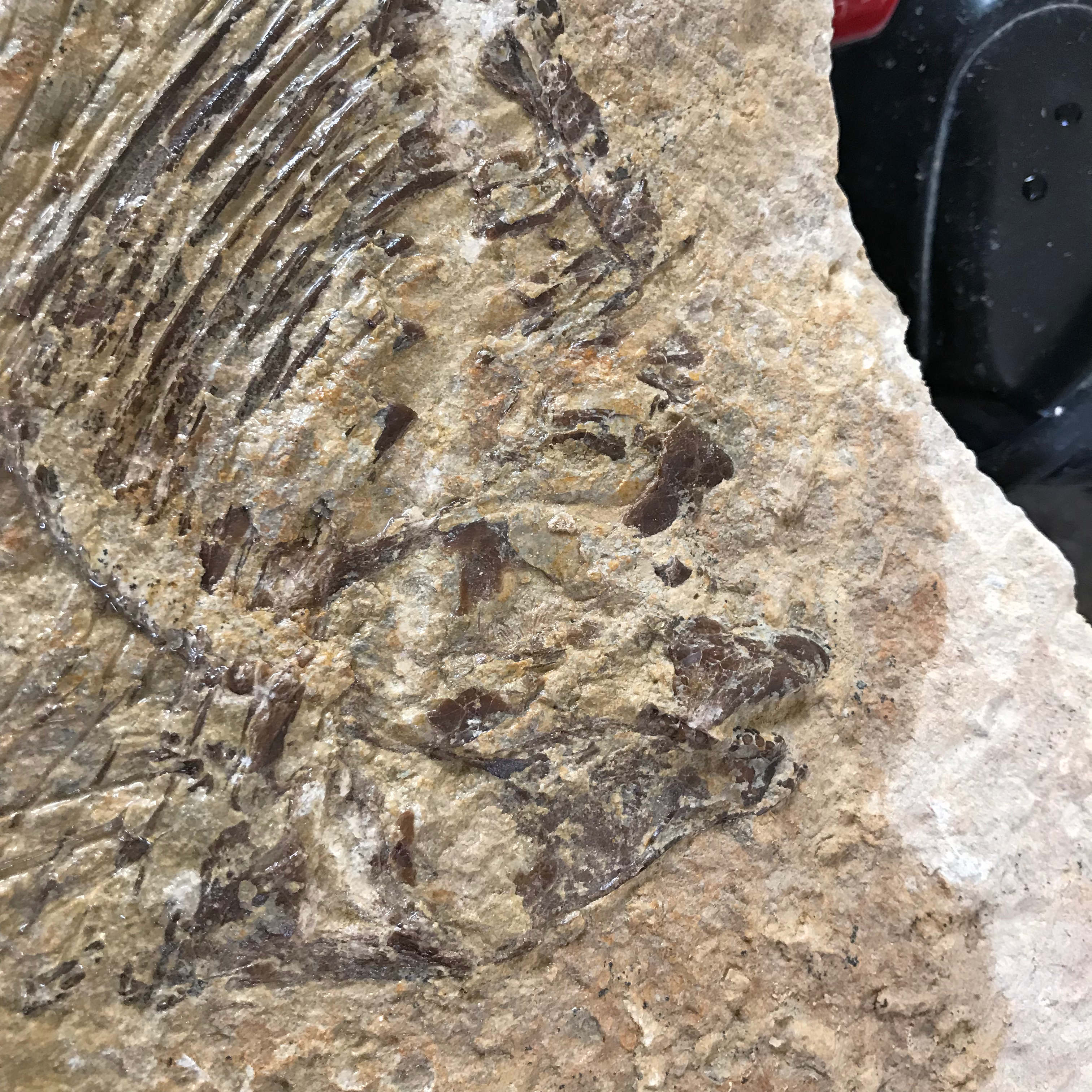
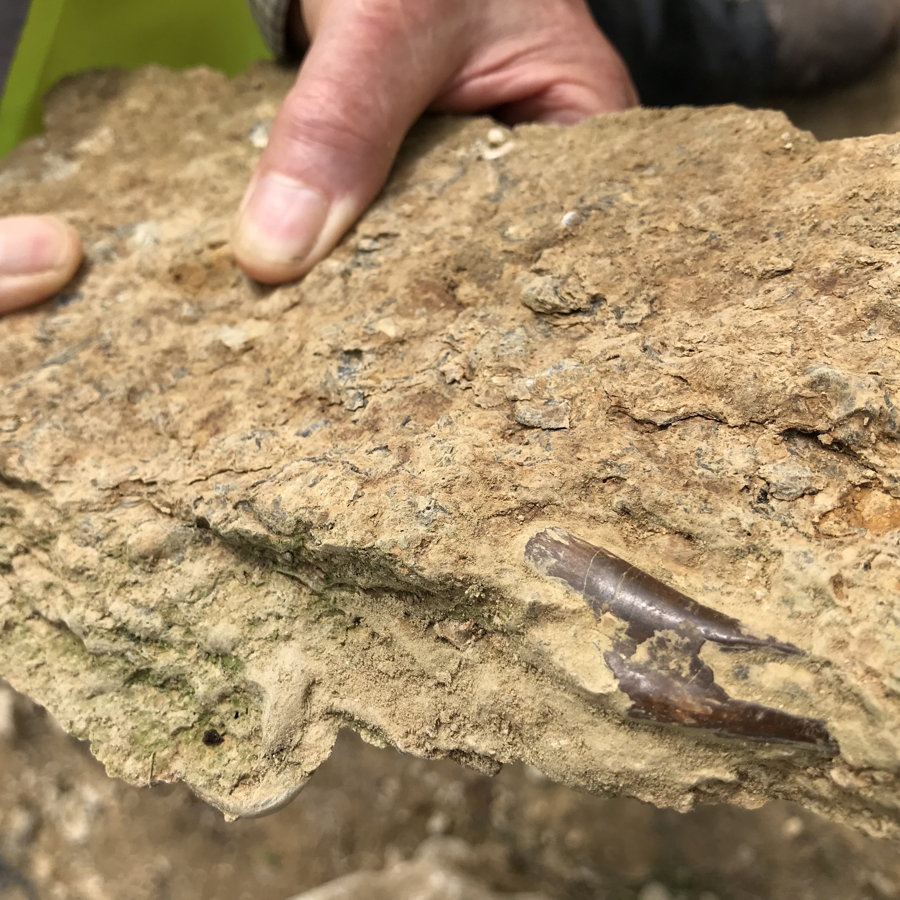
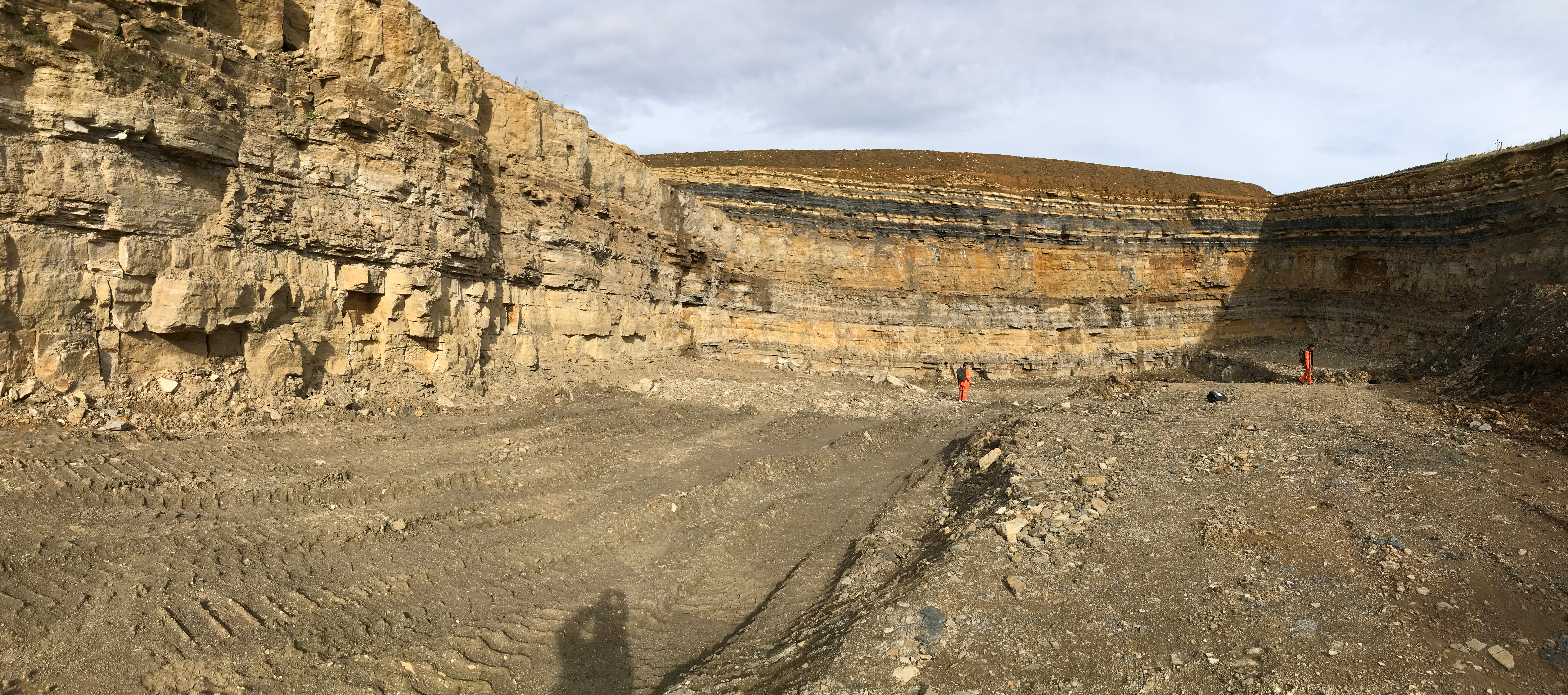

Image 9: Macromesodon daviesi: fish


The detailed geological succession at Spyway Dinosaur Footprints.
The public footprint surface is an exact bed within the Stair Hole Member, rather than a generic Purbeck quarry exposure. Quarrymen’s names are useful below member level, but are not formal formations.
PURBECK LIMESTONE GROUP
The public track surface belongs to an earliest Cretaceous lagoon-margin succession. The group name does not mean that every Purbeck fossil known in Dorset occurs in this one quarry.
Age: Berriasian at the track horizon
Durlston Formation
The track-bearing succession lies within the upper of the two modern Purbeck formations. The broader historical term “Purbeck Limestone Formation” does not identify its modern formation or precise position relative to the Jurassic–Cretaceous boundary.
Stair Hole Member
Shelly limestone and mudstone record a marginal-marine landscape. The older Intermarine Member terminology is incorporated into this member in the framework used by Butler and colleagues. About 6 m above the track surface was documented on the eastern quarry side.
Age: Berriasian
Bottom Freestone
This quarrymen’s bed is about 0.30 m thick locally. Small bivalve shells, oyster fragments and ostracods occur in its pale bioclastic limestone. Its upper surface carries the sauropod impressions, possibly transmitted deformation below the original walking surface.
Track-bearing surface
The 2024 study reports 138 mapped impressions using historical records and models, but some are now obscured or too weathered to recognize. Clear continuous trackways and precise trackmaker identity are not securely established. A sauropod interpretation is supported, but a definite brachiosaur species is not.
Upper Freestone
The overlying shelly limestone was removed during quarrying to expose the tracks. Its less orderly shell fabric was interpreted as rapid deposition, perhaps during a storm. This remains an interpretation, not proof of burial within a known number of hours.
Whetson
A traditional quarry unit labelled directly above Upper Freestone in the published east-face photograph. The study does not give an independently measured thickness or a separate fossil assemblage for this unit.
Thornback
A named quarry layer above Whetson in the illustrated local succession. The name and relative position are documented, but formal member rank and dimensions are not established.
Roach
A higher named quarry unit shown above Thornback. Here Roach is a Purbeck quarrymen’s term; do not confuse it with the Portland Roach of the older Portland Freestone succession.
Grub/Shingle
The upper labelled quarry unit in the published photograph. Its local trade name is retained; no detailed separate measured log or taxon inventory is provided in the study.
Grooves on the footprint surface
Long grooves once interpreted as tail-drag marks were reconsidered in 2024 as probable impressions of wood. They should not be used to reconstruct a definite dinosaur tail movement.
Historical quarry specimens
Original Keates Quarry specimen photographs provide historical context. Their exact source beds are not verified, so they should not be used to extend the fossil inventory of the public footprint surface.
References
BGS: Durlston Formation
DIGS: historical footprint-site record
National Trust: Spyway visitor information
Butler and colleagues (2024): Spyway dinosaur tracks
SAFETY
Keep to signed paths and the visitor area. Uneven limestone, loose stones and muddy ground can be slippery; supervise children closely and keep away from quarry edges and neighbouring workings. Leave fences, rock faces and spoil heaps alone.
Wear footwear suitable for a countryside walk and the weather. Grazing animals use the surrounding landscape: keep dogs on leads and give livestock and farm machinery space. If extending the walk to the coast, stay well back from cliff edges; mobile reception can be poor or absent there.
PLANNING YOUR VISIT
Bring weather-appropriate clothing, drinking water and a camera if you want to record the footprints. Allow time to read the interpretation board and compare several impressions. Check National Trust notices and the forecast before setting out.
CARING FOR THE FOOTPRINTS
Leave the exposed surface, loose rock and every fossil where they are. Do not attempt to clean, prepare, prise out or improve a footprint for a photograph. Report fresh damage or a concern to the National Trust rather than disturbing the site yourself.
FURTHER READING
Butler and colleagues (2024): Sauropod dinosaur tracks from Spyway Quarry
Dorset National Landscape: Spyway Dinosaur Footprints and walking directions
National Trust Spyway visitor information
BGS Durlston Formation
DIGS historical Keates footprint-quarry record
ACCESS RIGHTS
The National Trust’s Spyway dinosaur footprint site is open for public visits via the signed route. It is a no-collecting attraction: do not remove fossils or rock, or damage the surface. Follow current signs and any temporary restrictions.
The historic Keates Quarry name in photographs and scientific records refers to the discovery and quarrying context. It does not provide access to neighbouring working quarries. The footprint locality has been recorded as a Regionally Important Geological Site; this local designation should not be described as a statutory SSSI without separate evidence.
It is important to follow our ‘Code of Conduct’ when visiting any site. Please also read our ‘Terms and Conditions’.
LINKS
♦ Fossil Discussions
♦ Fossil Articles
♦ Buy Fossils, Tools and Equipment
♦ Buy Crystals, Meteorites, and Artefacts
♦ Join Fossil Hunts
♦ UK Fossils Network


