
Overview
Directions
- Follow the A299 towards Herne Bay and take the Herne Bay exit, following the A2990 left at the roundabout.
- Turn right at the next roundabout, then left at the junction onto the main road towards Studd Hill. Follow the brown signs for Hampton Pier.
- The original approach reaches the car park beside the recreation ground, play area and toilets about 350 m after the Hampton Pier turn. Follow current parking signs; council arrangements include seasonal charging.
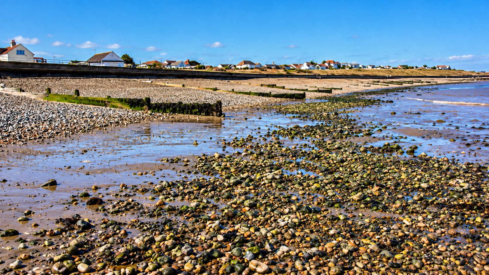
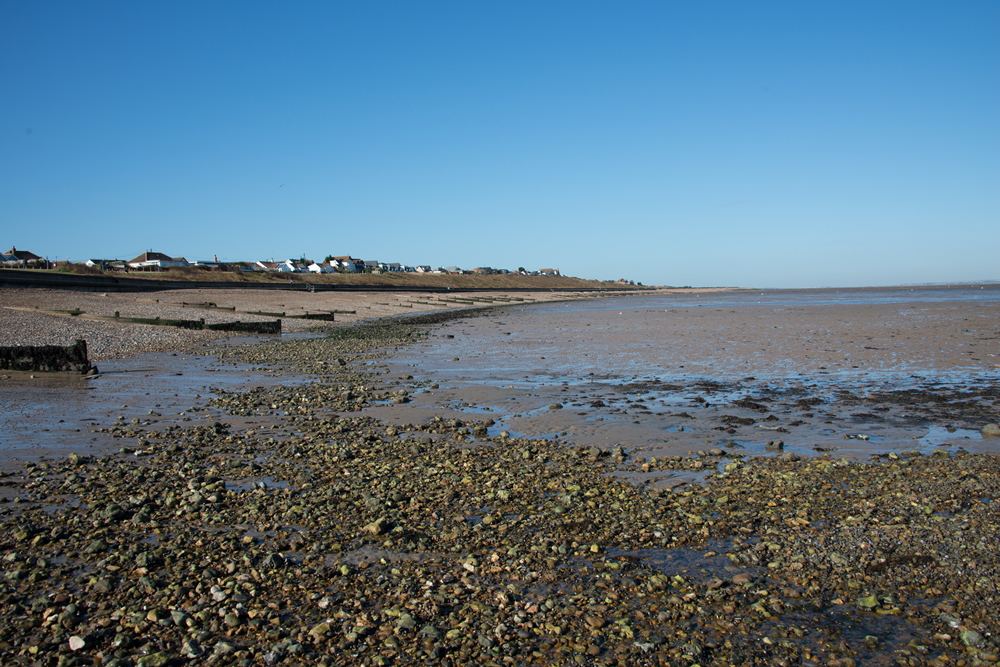
- Walk down to the shore and westwards from Hampton Pier towards Long Rock. The approximately 2 km stretch becomes pebbly towards its western end.
- Locality reference: 51.36883°N, 1.09424°E.
Location photographs
Swipe to browse · Select a photograph to enlarge






Fossil Hunting
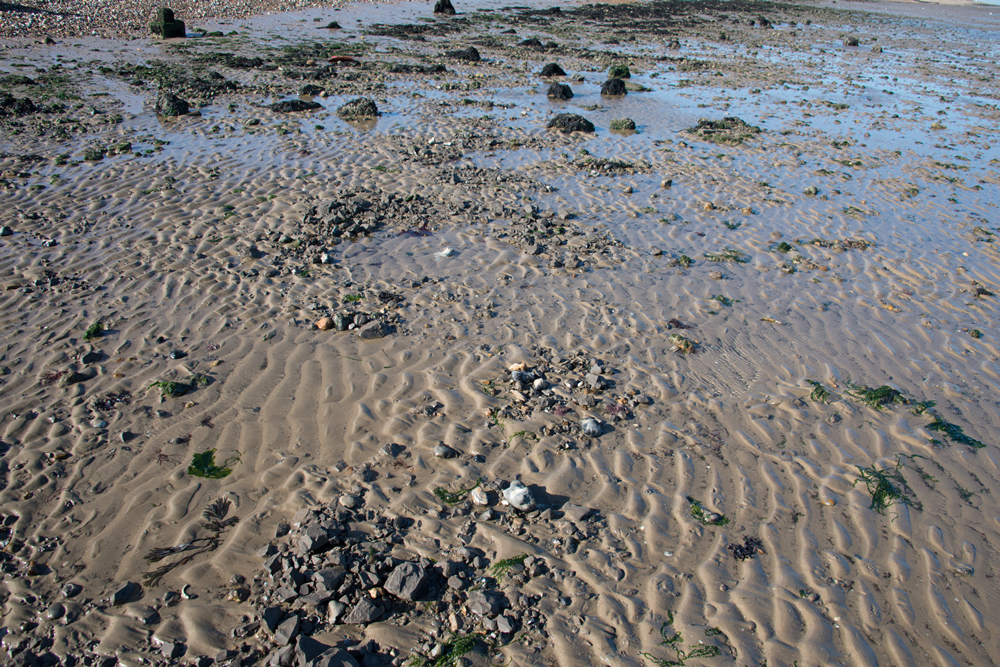
Look for loose fossils and phosphatic nodules on firm sand around small patches of London Clay. Natural exposure varies considerably; fossils can be easy to notice against sand yet remain uncommon. Towards Long Rock, pebble cover makes searching different from the clearer sandy stretches near Hampton.
The original field account records pyritised fruits and seeds, common fossil wood, and less frequent fish teeth and vertebrae, nautiloids and crustacean remains. Bivalves, gastropods, crinoids and trace fossils add to the fauna. Preserve delicate material with its surrounding matrix and keep finds from different patches separately labelled.
Studd Hill is the type locality of the early horse relative Hyracotherium leporinum. Its historical mammal discovery is important, but such remains are exceptionally rare and should not be an expectation for casual collecting. Photograph and record any unusual bone carefully and seek specialist advice before preparation.
The younger cover near Hampton and Long Rock has a separate record of large Pleistocene mammals. A bone from loose shingle or a fissure within older clay is not automatically Eocene; retain its context rather than assigning its age from the surrounding bedrock alone.
Fossil photographs
Swipe to browse · Select a photograph to enlarge

Discoveries and milestones
A chronological record of fossil discoveries, geological research and conservation milestones associated with Studd Hill.
1839 – Studd Hill mammal reported
William Richardson’s collecting at Studd Hill yielded the partial skull that Richard Owen presented to the Geological Society on 18 December 1839. Its discovery showed that the marine London Clay could also preserve rare terrestrial mammals.
1841 – Hyracotherium leporinum formally described
Owen’s description and Richardson’s account of the locality were published. The Studd Hill specimen became the name-bearing basis of Hyracotherium leporinum; Richardson also recorded major changes in exposure and abundant plant remains.
1981 – Historical cliff evidence synthesised
The Faversham Geological Survey memoir brought together the Studd Hill cliff record, the mammal discovery and the observations of plant-bearing London Clay, preserving their precise coastal context.
About 1960 – Former cliff exposures covered
Holmes (1981) records slope bevelling towards and past Studd Hill and concreting about 1960, following damaging storms in 1946, 1953 and 1958. This engineering history explains why the older natural-cliff observations cannot be treated as a description of exposures available today.
References
Holmes 1981, Geology of the country around Faversham, Sheet 273
Richardson and Owen contemporary reports, Geological Society proceedings 1838–1841
Benton, Cook and Hooker 2005, British Tertiary fossil mammal sites, GCR32
Geology
Studd Hill’s London Clay records an early Eocene sea receiving fine sediment and material transported from the surrounding land. Fresh blue clay and weathered chocolate-brown clay, with septarian nodules, were described in historical cliff sections. The Geological Survey recorded a face up to about 15 m high, but the modern sandy shore more often reveals small patches of clay. That old measurement describes a former exposure, not a continuous cliff available to examine today.
The clay belongs to the Aveley Member of the London Clay Formation, within the Thames Group. The local guide assigns it to informal Division B1, while the Geological Conservation Review places the important mammal locality in Division B near the Isselicrinus crinoid horizon. This fossil-based position gives the finds their stratigraphic context without turning scattered foreshore patches into a measured bed-by-bed section.
The mixture of fossils helps explain the original environment. Marine molluscs, crinoids, fish and crustaceans occur alongside wood, fruits and seeds brought from land. Pyritised plant material and the exceptionally rare early horse relative Hyracotherium leporinum record that land-to-sea connection. Subsequent coastal erosion releases resistant nodules and mineralised fossils; waves redistribute them among sand and pebbles, so a beach concentration is not necessarily the original fossil horizon.
Much younger Quaternary gravel and brickearth locally covered the London Clay, and some historically described patches have since been lost to erosion. Their large-mammal remains belong to a separate, younger history. Bones can also occur in fissures cutting older clay, so being found within or beside London Clay does not by itself make a bone Eocene. The variable cover towards Hampton and Long Rock should therefore be distinguished from both the marine clay and the separate historical sections farther towards Swalecliffe.

Detailed geology and bed-by-bed succession
Detailed geology and stratigraphy of Studd Hill.
THAMES GROUP
The early Eocene marine deposits belong to the Thames Group. The units described here are the beds represented at this collecting locality; the complete regional group is not exposed on this shore.
London Clay Formation
Fine marine sediment forms blue-grey clay when fresh and brown clay where weathered. Carbonate concretions, phosphatic nodules and pyrite occur within the clay, but they are different materials: a loose nodule is not itself a formal bed and does not establish the exact horizon of a beach find.
Aveley Member
The B divisions of the London Clay lie within the Aveley Member in the current BGS framework. Its regional character is mainly silty clay with discontinuous claystone concretions; some levels contain finer sandy or micaceous partings. B1 and B2 are informal subdivisions within this framework, rather than formal members. No complete member thickness is implied for this foreshore.
Division B1 and the Isselicrinus interval
The guide identifies B1, and the Geological Conservation Review places the Studd Hill type locality of Hyracotherium leporinum in Division B near the Isselicrinus horizon. That fossil association supports the lower London Clay context without supplying a modern bed-by-bed thickness log. Small clay patches on the sandy shore are more usual than a continuous platform.
Historical blue and brown cliff clay, with septaria
The Geological Survey recorded a Stud Hill cliff near TR 151 678 exposing up to 15 m of blue and chocolate-coloured clay with septarian nodules. Richardson’s nineteenth-century observations linked fresh erosion to abundant transported Eocene vegetation and the discovery of a mammal skull. The 15 m is an old cliff measurement, not a claim that an open face of that height is available today.
Historical Studd Hill gravel and brickearth
Holmes (1981) records a former gravel patch at about 18 m OD at Studd Hill, already entirely lost to erosion by his account. In 1939, shallow pockets at TR 1498 6772 still contained crudely interbedded subangular gravel, coarse sandy stony brickearth and stony chocolate clay. These are historical observations of Quaternary cover, not a currently accessible measured section. Mammuthus primigenius was recorded from the gravels, including a molar fragment reported by Evans in 1897. Palaeoloxodon antiquus apparently came from fissures in the underlying London Clay: that position does not make the elephant remains Eocene. Kennard’s historical Pupilla muscorum and Succinea oblonga records from “Studhill Cliff” may represent the less gravelly part of this cover or a younger deposit; their precise horizon remains uncertain.
Hampton and Long Rock cover
Brickearth and gravel overlie or obscure the London Clay towards Hampton and the Swalecliffe end. These much younger deposits account for the separate record of large Pleistocene mammals. The variable gravel-and-brickearth cover includes deposits formerly described as Pleistocene river gravel. Its mammal bones are much younger than B1, and the whole western Swalecliffe section is not a continuously exposed Studd Hill succession.
References
BGS Lexicon: London Clay Formation
BGS Lexicon: Aveley Member
Aldiss 2014, Palaeogene stratigraphical framework, OR/14/008
UK Fossils, Studd Hill (field inspection 2012)
Benton, Cook and Hooker 2005, British Tertiary fossil mammal sites, GCR32
Holmes 1981, Geology of the country around Faversham, Sheet 273
Richardson and Owen contemporary reports, Geological Society proceedings 1838–1841
Safety
Check tide times before going onto the flats. Water can enter channels and cover a return route behind you, while soft clay, slippery pebbles and hidden mud make retreat slower.
Keep children on firm ground under close supervision. Convenient parking does not make the whole foreshore safe, and exposed clay can be difficult to cross even when the beach first appears dry.
Equipment
A hand lens, sturdy footwear, tide information, a phone and padded specimen containers are sufficient for examining loose material. No hammer is needed for routine collecting.
Cleaning And Treating
Keep phosphatic nodules whole in the field and wrap them individually. Exposed limbs or bones may continue beneath apparently blank matrix. Begin with a soft brush and stop if the fossil or its matrix moves with the dirt. Hard nodules can require fine mechanical preparation under magnification by an experienced preparator.
Avoid household acids, bleach and routine varnishing. Pyritic specimens need appropriate cleaning followed by dry, stable storage and regular checks for powdering, cracking or acidic decay. Do not seal wet material into long-term storage. Keep potentially important finds unprepared until a specialist has examined them.
Identify Your Finds
Need help identifying a fossil? Share clear photos, where you found it and its size with the community.
Further Reading
Deposits: Seeds from the London Clay (regional background)
Deposits: Crystals and minerals of the London Clay (regional background)
Holmes 1981, Geology of the country around Faversham, Sheet 273
Benton, Cook and Hooker 2005, British Tertiary fossil mammal sites, GCR32
Richardson and Owen contemporary reports, Geological Society proceedings 1838–1841
BGS Lexicon: Aveley Member
Access Rights
The coastal habitats around Long Rock fall within the sensitive Thanet Coast area. Avoid disturbing shorebirds or damaging banks, sea defences and grassland.
Limit casual collecting to small loose-weathered material. Public access does not authorise digging into clay platforms or protected banks; obtain the necessary permission for intrusive work.
It is important to follow our ‘Code of Conduct’ when collecting fossils or visiting any site. Please also read our ‘Terms and Conditions’.
Links
♦ Fossil Discussions
♦ Fossil Articles
♦ Buy Fossils, Tools and Equipment
♦ Buy Crystals, Meteorites, and Artefacts
♦ Join Fossil Hunts
♦ UK Fossils Network


