
Overview
Directions
- Arrange permission for the exact route and activity before travelling. The published approach is via the B4371 towards Church Stretton, turning towards Rushbury, then continuing through Rushbury towards Upper Millichope and the farm. Use the landowner’s current arrival instructions rather than relying on an old roadside parking description.
- The original coordinate, 52.50384°N, 2.70941°W, is the road/farm approach reference. It is not a verified parking bay or the precise position of every scientific sample. Do not block the road, gateways or farm access.
- The scientific stream section is described between SO 5190 8977 and SO 5213 8935. These are research-section references, not an invitation to enter either endpoint. The old guide used an iron gate, stream fork, small bridge and farm-track crossing as landmarks; fences, trees and water conditions may have changed.
- Do not follow the old directions over a gate, around a field boundary or beyond a wire obstruction unless the landowner has specifically agreed that route. The additional exposure formerly described about 250 m north of the farm was especially erosion-sensitive and is not an alternative unarranged collecting site.
Location photographs
Swipe to browse · Select a photograph to enlarge


Fossil Hunting
This stream is valuable because its fossils can be tied to sedimentary layers, sampled communities and recorded scientific localities. It should be approached as a protected research section rather than a place for unrestricted collecting. Earlier visitors described shells washed out of mudstone into gravel, but a loose stream fossil has lost its original bed position unless that provenance is independently established. Observe and photograph before handling, and remove material only within an explicit landowner arrangement.
The historical visitor account distinguished fine shingle to the right of an iron gate, where small brachiopods, especially Atrypa, were reported. Look for repeated shell ribs, the hinge region and symmetry of a valve, rather than identifying a species from a rounded outline alone. Even apparently hard loose shells can have delicate margins; a worn stream specimen may not preserve the features needed to match a published species.
To the left of the gate, the old account described coarser, rockier stream material and a broader range of fossils. A fork and small water outfall marked a passage obstructed by fallen trees and wire. Beyond that, a stretch near a small hill and bridge, continuing to the farm-track crossing, was described as especially rich in corals. These remain historical observations of three visitor areas. They are not the numbered scientific samples, nor a safe route through present obstacles.
The reported loose fauna includes brachiopods, corals, bivalves, gastropods, graptolites, cephalopods and trilobites. The original guide names Dalmanites and Calymene; scientific studies add much more precise but separately scoped records. Trilobite fragments may show segmented shields or diagnostic head structures. Corals may show repeated internal partitions, gastropods coiled shell form and nautiloids chambered straight or curved shells. Weathered fragments require caution before a detailed identification is assigned.
Graptolites provide important age evidence but are not always easy field specimens. Look for fine colony impressions with regular thecal detail on naturally exposed mudstone surfaces, using oblique light and magnification. The published Middle Elton fauna includes common Saetograptus varians and Neodiversograptus nilssoni, alongside a longer source-spelled list in the detailed geology. A specimen should not be assigned to one of those species merely because the locality is known to yield it.
Brachiopod and trilobite occurrences change through the section and between different studies. The Geological Conservation Review traces Dicoelosia biloba and Dalmanites myops from the underlying Lower Elton into the basal 3–10 m of Middle Elton. Watkins’s separate section 1E records a mudstone community called the Glassia obovata Association and substantial variation between individual samples. Keep those authors’ sample definitions and locality scopes intact rather than treating every published name as common everywhere in the stream.
The fine-grained rock also preserves scientific evidence that is not a casual hand-specimen target. Acritarchs, chitinozoans and spores were recovered by laboratory study; sample MD14 contains the named spore Retusotriletes cf. warringtonii. The specialist sample location and preparation methods matter. The same applies to the small ostracod fauna and to rare or tentative graptolite records from the separately described Lower Elton exposures.
For any authorised observation or sampling, record the exact place, whether the material was loose or in situ, the matrix and the sample identifier supplied by the project. Do not dig either bank, undermine trees or alter a clay layer to obtain fossils. The former guide’s conflicting instructions about roadside and field-side banks do not establish present permission. Leave an unusual or potentially important specimen unprepared and obtain expert advice, retaining its associated rock and field information.
Fossil photographs
Swipe to browse · Select a photograph to enlarge


Discoveries and milestones
Significant discoveries, geological research and conservation milestones at Upper Millichope.
1952 – The fossiliferous stream section is described
Shirley described the Upper Millichope stream section, subsequently cited in the detailed Geological Survey account. This is an early published description of the locality, rather than a verified date of its first fossil discovery.
1968 – Survey collections and detailed Ludlow work are published
The Geological Survey memoir documented the stream lithology, collecting localities 101 and 102, and registered fossil suites. Later geological reviews also cite Shergold and Shirley’s 1968 Ludlow work for important local mapping and graptolite evidence.
1969 – Spore and graptolite studies distinguish separate samples
Richardson and Lister recorded spores, microplankton and chitinozoans in Middle Elton sample MD14, including Retusotriletes cf. warringtonii. A separate study by Holland, Rickards and Warren discussed poorly preserved Lower Elton graptolites from Millichope and explicitly limited the age inference that could be drawn from them.
1979 – A bed-resolved ecological profile is published
Watkins studied the Glassia obovata Association in the 15.8 m section 1E, documenting sample-by-sample changes in abundance and diversity and bentonite-associated faunal destructions. The detailed table retains a one-count discrepancy in sample 1E8 rather than supporting an artificially corrected total.
1989 – Upper Millichope Stream Section is notified as an SSSI
The stream section was notified for its Lower Ludlow stratigraphy and fossil evidence, including graptolites, trilobites, brachiopods and an acritarch microflora. The designation protects scientific interest; it does not create public access or collecting permission.
2000 – Scientific value and collecting damage are reviewed
The Geological Conservation Review set out the Middle Elton section’s geological and palaeontological importance and documented damage from indiscriminate collecting. It described visits as subject to special landowner permission and limited to small parties of bona-fide researchers.
Geology
Upper Millichope exposes a fossiliferous early Ludlow marine succession in the stream northwest of the farm. The selected Geological Conservation Review site concerns the Middle Elton Formation, Gorstian Stage, within the Silurian. The broader brook also exposes Lower and Upper Elton strata, but these are explicitly outside that selected GCR core. The statutory SSSI citation uses a broader Lower-and-Middle Elton description, so the conservation wording and scientific section limits should not be treated as identical.
At the Lower-to-Middle Elton transition, shaly, shelly-dominated siltstones give way to more compact blue- and olive-grey, brown-weathering blocky calcareous siltstones and silty mudstones. This is a change into the compact Middle Elton facies, not into softer shale. The formation develops blocky or conchoidal fracture, argillaceous carbonate nodules and numerous ash-derived clay layers. The GCR estimates about 100 m of succession, dipping 10–12° south-east; that estimate is not a 100 m-high stream bank.
The BGS memoir describes pale-grey, bedded, slightly calcareous mudstone weathering olive or buff, with limestone doggers and thin calcareous beds. Doggers are particularly conspicuous in bands higher in its described sequence, while small nodules and thin carbonate beds are more prominent towards the base. These differences affect both weathering and fossil preservation: resistant carbonate pieces can survive as loose stream material after softer mudstone has broken down.
The fauna combines seabed communities with pelagic organisms and minute planktonic remains. The assemblages have been interpreted in a marine shelf to shelf-slope setting, with the early Gorstian transgression providing wider context. Disarticulated shells need not have travelled far: the GCR interprets much of the shell material as relatively local. Neither a precise water depth nor a single volcanic source is established by the available locality records.
Watkins’s 15.8 m section 1E provides a much finer ecological study within a limited part of the succession. Its fossil abundance, density and diversity change between samples, and the profile highlights three bentonite-associated faunal destructions. Those events are not three newly named beds. The nine samples tabulated in detail are only part of the sixteen-sample figure profile, and their centimetre heights must not be confused with the approximately 100 m formation estimate.
Stream erosion creates intermittent exposures and loose fossil-bearing material, but it also removes the relationships that give the site its scientific value. The statutory designation and research history reflect that importance. The chart provides a scoped overview; the expandable account retains individual markers, the separate sample records and the limits of older taxonomic and numerical evidence.

Detailed geology and bed-by-bed succession
Detailed geology, fossil records and sample-by-sample evidence at Upper Millichope.
Locality and scale. The GCR Middle Elton section extends approximately 500 m along the stream between SO 5190 8977 and SO 5213 8935. Its approximately 100 m succession estimate is stratigraphical, not a bank height. Watkins’s section 1E, the BGS collecting localities 101–102 and the visitor guide’s three areas are separate records and must retain their own identifiers.
LOWER LUDLOW SHALES GROUP
Regional framework and conservation scope. The Gorstian Lower Ludlow Shales grouping provides the broader mudstone–siltstone framework. The statutory SSSI citation describes Lower and Middle Elton and a Lobograptus scanicus graptolite fauna with acritarch microflora typical of the Tylotopalla pyramidale Biozone. The GCR expressly excludes the broader brook’s Lower and Upper Elton exposures from its selected Middle Elton site. These source scopes remain distinct.
Middle Elton Formation
Lower boundary and basal 3–10 m. The GCR draws the Lower-to-Middle Elton junction at a change from shaly, shelly-dominated siltstones to more compact blue- and olive-grey, brown-weathering, blocky calcareous siltstones and silty mudstones. Dicoelosia biloba and Dalmanites myops continue from the underlying formation into its basal 3–10 m. This author’s range statement should not be turned into an unqualified absence claim for every higher sample reported under another scheme.
Compact mudstone and siltstone succession. Middle Elton rocks have brown-weathering surfaces, blocky or conchoidal fracture and argillaceous carbonate nodules. The described approximately 100 m formation interval dips 10–12° south-east. The onset of graptolitic Middle Elton is assigned to the combined Neodiversograptus nilssoni–Lobograptus scanicus interval. No formal local member subdivision or continuous exposed bank of that full thickness is asserted.
Limestone dogger bands. BGS describes pale-grey bedded mudstone, slightly calcareous when fresh and olive or buff when weathered, through about 600 yards upstream from SO 521 893. Fine-grained limestone doggers occur particularly in bands higher in that described sequence, reaching 2 ft across and 9 in thick. These are individual dogger dimensions, not the thickness of a limestone formation.
Basal thin carbonate beds and small nodules. Thin calcareous beds and layers of small limestone nodules are more conspicuous towards the base of the BGS-described stream sequence. Their number, individual thicknesses and correlation with each Watkins sample are not given; they must not be manufactured from the broader description.
Yellow silica-sand layers. The BGS account also records soft, yellow, fine-grained silica-sand layers. Its available text transcription loses the numerical thickness before “in thick”; no thickness is supplied here until the printed value is verified. Nor is each layer equated automatically with a separately identified bentonite.
Bentonites and ecological events. Approximately fifteen bentonites are recorded through the described formation interval. Individual thicknesses, source volcanoes and bed-by-bed correlations to other valleys are not established in this account. Watkins’s section 1E profile highlights three faunal destructions associated with bentonites, but those arrows are ecological events in that measured profile, not three formal named beds or a complete catalogue of all fifteen ash layers.
Wider upstream exposures. Beyond the BGS main section, mudstone and silty mudstone with bands of nodular limestone continue upstream towards SO 526 907, south of Stanway Manor. This is broader-stream context, not an enlargement of the selected GCR core or evidence that each locality shares the same samples and fossils.
Published GCR graptolite record. The account says at least fourteen species were recorded but names twelve: Saetograptus varians, Neodiversograptus nilssoni, Colonograptus colonus colonus, Saetograptus chimaera chimaera, Monograptus uncinatus uncinatus, Monoclimacis micropoma, Saetograptus roemeri, Spinograptus spinosus, Pristiograptus dubius, Bohemograptus bohemicus, Saetograptus incipiens, Pristiograptus aff. tumescens. The first two are described as common. These are the source’s taxonomic usages; the two unnamed species are not invented, and spelling or synonymy is not revised without a taxonomic source.
Other GCR fauna. The account includes trilobites Leonaspis, Ananaspis, Rhaphiophorus and Dalmanites; brachiopods Glassia, Aegiria and Isorthis; acritarchs and chitinozoans; and rarer orthoconic and cyrtoconic nautiloids, bivalves, gastropods and solitary corals. Its largely undescribed ostracod fauna must not be converted into a named species list. Source spellings are retained here, separately from the spellings in other studies.
BGS Silurian collecting localities and registered suites. Locality 101 is at SO 5205 8952 and 80 yards upstream, with suite FGD 2219–2254; locality 102 is SO 5208 8946, with JD 1556–1596. The lists below retain those Silurian locality assignments and older source nomenclature. The memoir’s Ordovician appendix reuses the numbers 101–102 for other places and is excluded. Suite ranges do not identify one particular accession for every taxon.
BGS locality 101. solitary corals, Amphistrophia funiculata, Atrypa reticularis, Brachyprion spp., Craniops implicata, Gypidula galeata, Howellella elegans, Isorthis orbicularis, Leptaena rhomboidalis, Sphaerirhynchia wilsoni, Cypricardinia subplanulata Reed, Dalmanites myops. These are historical source records, not a claim that every specimen can be found on a present visit.
BGS locality 102. Metaconularia aspersa, solitary corals, Chonetoidea grayi, ‘Dalmanella’ spp., Glassia compressa, Leptaena rhomboidalis, Lingula striata J. de C. Sowerby, Resserella cf. elegantula, Bucanopsis expansa, Ecculiomphalus laevis, Loxonema cf. sinuosum, Murchisonia articulata, ‘Pleurotomaria’ spp., Cardiola interrupta J. de C. Sowerby, Dualina longiuscula Barrande, Dawsonoceras annulatum, Michelinoceras bullatum, Acidaspis coronata Salter, Dalmanites myops, Monograptus varians Wood. These are historical source records, not a claim that every specimen can be found on a present visit.
Watkins section 1E: exact scale and ecological method. The profile runs from SO 5204 8959 at its base to SO 5212 8943 at its top and is 15.8 m thick. It samples the mudstone-facies Glassia obovata Association. Figure 22 plots fossil density per 0.1 m², relative abundance and diversity per fifty individuals; the three destruction arrows are associated with bentonites. The nine Table 17 samples below cover only part of its sixteen-sample profile.
1E8. Sample position 877 cm above the profile base; sampled thickness 23 cm. Printed non-pelagic total 88 versus 89 from the retained transcription; the one-count discrepancy is unresolved, with no value adjusted to force agreement.
1E9. Sample position 812 cm above the profile base; sampled thickness 12 cm. Printed non-pelagic total 59, reproduced by the retained transcription.
1E10. Sample position 732 cm above the profile base; sampled thickness 10 cm. Printed non-pelagic total 96, reproduced by the retained transcription.
1E11. Sample position 636 cm above the profile base; sampled thickness 15 cm. Printed non-pelagic total 236, reproduced by the retained transcription.
1E12. Sample position 546 cm above the profile base; sampled thickness 15 cm. Printed non-pelagic total 86, reproduced by the retained transcription.
1E13. Sample position 421 cm above the profile base; sampled thickness 5 cm. Printed non-pelagic total 153, reproduced by the retained transcription.
1E14. Sample position 191 cm above the profile base; sampled thickness 20 cm. Printed non-pelagic total 68, reproduced by the retained transcription.
1E15. Sample position 102 cm above the profile base; sampled thickness 8 cm. Printed non-pelagic total 126, reproduced by the retained transcription.
1E16. Sample position 0 cm above the profile base; sampled thickness 12 cm. Printed non-pelagic total 203, reproduced by the retained transcription.
Complete Table 17 taxon-by-sample record. The following preserves every taxon row and every non-zero entry across samples 1E8–1E16, using the author’s source nomenclature. Samples not named in a row have printed dashes, transcribed as zero; this is not proof of biological absence. Asterisks mark the author’s pelagic forms, excluded from the non-pelagic totals. Counts are published table entries, not necessarily complete animals, and do not measure present-day collecting likelihood.
solitary trochoid coral. 1E11: 1.
syringoporid. 1E12: 1.
Aegiria grayi*. 1E8: 1; 1E9: 725; 1E10: 5800; 1E11: 1880; 1E12: 1580; 1E13: 86; 1E14: 76; 1E15: 215; 1E16: 26.
Amphistrophia funiculata. 1E11: 1.
Craniops implicata. 1E10: 3; 1E11: 160; 1E12: 2; 1E13: 3; 1E15: 62; 1E16: 2.
Dicoelosia biloba. 1E16: 1.
Eospirifer radiatus. 1E16: 2.
Glassia obovata. 1E8: 8; 1E10: 5; 1E11: 5; 1E12: 3; 1E14: 3; 1E16: 4.
Howellella elegans. 1E13: 1.
Isorthis clivosa. 1E8: 29; 1E9: 4; 1E10: 2; 1E11: 4; 1E12: 7; 1E13: 25; 1E14: 14; 1E15: 9; 1E16: 21.
Leangella segmentum. 1E9: 1; 1E11: 7.
Lingula n. sp.. 1E14: 1; 1E16: 3.
Ludfordina pixis. 1E13: 65; 1E16: 60.
Mesopholidostrophia laevigata. 1E11: 2; 1E12: 2; 1E13: 5; 1E16: 11.
Parastrophinella sp.. 1E8: 12; 1E9: 12; 1E10: 22; 1E11: 4; 1E12: 10; 1E13: 29; 1E14: 3; 1E15: 4; 1E16: 2.
Plagiorhyncha sp.. 1E8: 4; 1E9: 12; 1E10: 29; 1E11: 9; 1E12: 36; 1E13: 4; 1E14: 7; 1E15: 13; 1E16: 7.
Protochonetes minimus. 1E9: 12; 1E10: 12; 1E11: 4; 1E12: 9; 1E13: 4; 1E14: 18; 1E15: 12; 1E16: 10.
? Protozeuga sp.. 1E8: 1; 1E14: 2; 1E15: 1.
Resserella sabrinae nunfieldensis. 1E8: 3; 1E10: 2; 1E11: 2; 1E14: 1.
Skenidioides lewisii. 1E8: 1; 1E9: 6; 1E10: 3; 1E11: 3; 1E12: 1; 1E13: 5; 1E14: 3; 1E16: 65.
Cymbularia cf. fastigata. 1E8: 2; 1E11: 4.
Euomphalus sp.. 1E10: 1; 1E11: 4.
gastropod sp. B. 1E11: 1.
Leptozone striatissima. 1E10: 2; 1E11: 3; 1E16: 2.
Loxonema sinuosa. 1E8: 1; 1E15: 3.
pleurotomariacean sp. B. 1E8: 4.
Sinuspira stokei. 1E11: 2; 1E12: 1; 1E14: 1.
Temnodiscus salopiensis. 1E13: 1.
bivalve sp. B. 1E12: 1.
Butovicella migrans*. 1E10: 2; 1E14: 1; 1E15: 1.
Cardiola interrupta*. 1E9: 1; 1E11: 1; 1E13: 1; 1E16: 1.
‘Cyrtodonta’ perovalis. 1E9: 1.
Dualina striata*. 1E8: 1; 1E15: 1; 1E16: 1.
Goniophora cymbaeformis. 1E16: 1.
grammysid sp. A. 1E8: 2; 1E9: 1; 1E10: 1; 1E11: 3; 1E14: 3; 1E15: 4; 1E16: 2.
Leptodesma ampliata. 1E10: 1.
modiomorphid sp. D. 1E10: 1; 1E16: 1.
Mytilarca siluriana. 1E15: 2; 1E16: 1.
Nuculites pseudodeltoideus. 1E16: 1.
Nuculites woolhopensis. 1E11: 1; 1E12: 3; 1E16: 1.
Praectenodonta ludensis. 1E9: 1; 1E10: 1; 1E16: 1.
Praenucula sp.. 1E8: 7; 1E9: 2; 1E10: 3; 1E11: 1; 1E14: 3; 1E15: 2.
indeterminate pteriaceans. 1E10: 1; 1E15: 1.
indeterminate bivalves. 1E9: 1; 1E11: 3; 1E12: 1; 1E13: 1; 1E14: 2.
‘Cyrtoceras’ laevis. 1E8: 3; 1E9: 1; 1E15: 3.
Cyrtocycloceras tenuiannulatum. 1E16: 1.
Cyrtocycloceras tracheale. 1E10: 1; 1E11: 1; 1E16: 1.
Dawsonoceras annulatum. 1E8: 1; 1E12: 1.
Kionoceras caniculatum. 1E12: 1.
‘Orthoceras’ dimidiatum*. 1E8: 4; 1E10: 6; 1E15: 7; 1E16: 6.
‘Orthoceras’ gregarium*. 1E8: 2; 1E9: 5; 1E10: 9; 1E11: 1; 1E12: 7; 1E13: 1; 1E14: 14; 1E15: 8; 1E16: 5.
? Polygrammoceras bullatum. 1E8: 1.
indeterminate cephalopods*. 1E8: 3; 1E9: 1; 1E11: 2; 1E12: 2; 1E13: 3; 1E14: 1; 1E16: 1.
Calymene sp.. 1E11: 1; 1E13: 2.
Dalmanites myops. 1E8: 10; 1E9: 4; 1E10: 5; 1E11: 9; 1E12: 5; 1E13: 7; 1E14: 6; 1E15: 8; 1E16: 3.
Leonaspis coronata. 1E12: 1; 1E13: 1; 1E15: 1.
Raphiophorus parvulus. 1E9: 1; 1E10: 1; 1E11: 1.
Ceratiocaris sp.. 1E14: 1.
Hyolithes forbesi (Sharpe). 1E12: 1; 1E15: 1.
MD14 microflora, Middle Elton. Richardson and Lister’s 1969 sample MD14 is a shelly mudstone stream exposure at SO 5210 8944. Their Table 2 and appendix record spores, microplankton and chitinozoans; the only named spore marked in that sample column is Retusotriletes cf. warringtonii. The nineteen regional sample columns and ten regional taxon rows are not all Upper Millichope records. MD12 near the Speller, about 0.9 km west, is a separate lower–Middle Elton junction sample. No figured type, slide accession or measured spore abundance is securely assigned to MD14 here.
Separately scoped Lower Elton graptolite material. Holland, Rickards and Warren (1969) describe four physical pieces from Lower Elton Beds of Millichope, collected by P. J. Lespérance and forwarded by J. H. Shergold; no exact point is stated. They include an indeterminate distal fragment, a part and counterpart probably referable to Pristiograptus dubius, and a poorly preserved Monograptus sp. cf. varians varians, possibly instead M. aff. ludensis. Proximal hooks were unclear, and the authors declined an unequivocal age determination, finding only slight further support for a nilssoni age. A part and counterpart are not two demonstrated individuals. This material is outside the selected Middle Elton core unless independently located; the following My 82M accession in the paper belongs to May Hill, not Millichope.
Historical visitor areas. The original guide distinguishes fine brachiopod-bearing shingle on one side of an iron gate; coarser, more varied stream material towards the fork and water outfall on the other; and a coral-rich stretch beyond the former obstruction, near a bridge and farm track. A separate point about 250 m north of the farm was described as erosion-sensitive. None is assigned arbitrarily to a BGS locality or Watkins sample.
Archival geological photograph. The BGS memoir’s photograph catalogue records A9539, a stream section in Lower Ludlow Shales 300 yards north-north-west of Upper Millichope, with C indicating that colour was available. This is a photographic catalogue reference, not a fossil voucher, and no exposure date or specimen identification is inferred from it.
References. Greig and colleagues (1968), Geology of the country around Church Stretton, Craven Arms, Wenlock Edge and Brown Clee, stream description and Silurian appendix; Richardson and Lister (1969), spore study, Table 2 and appendix; Holland, Rickards and Warren (1969), Millichope Lower Elton graptolites; Watkins (1979), section 1E, Figure 22 and Table 17; Aldridge and colleagues (2000), British Silurian Stratigraphy, Upper Millichope account; Natural England, Upper Millichope Stream Section SSSI citation; BGS Lexicon LLUS; original UK Fossils Upper Millichope guide.
Safety
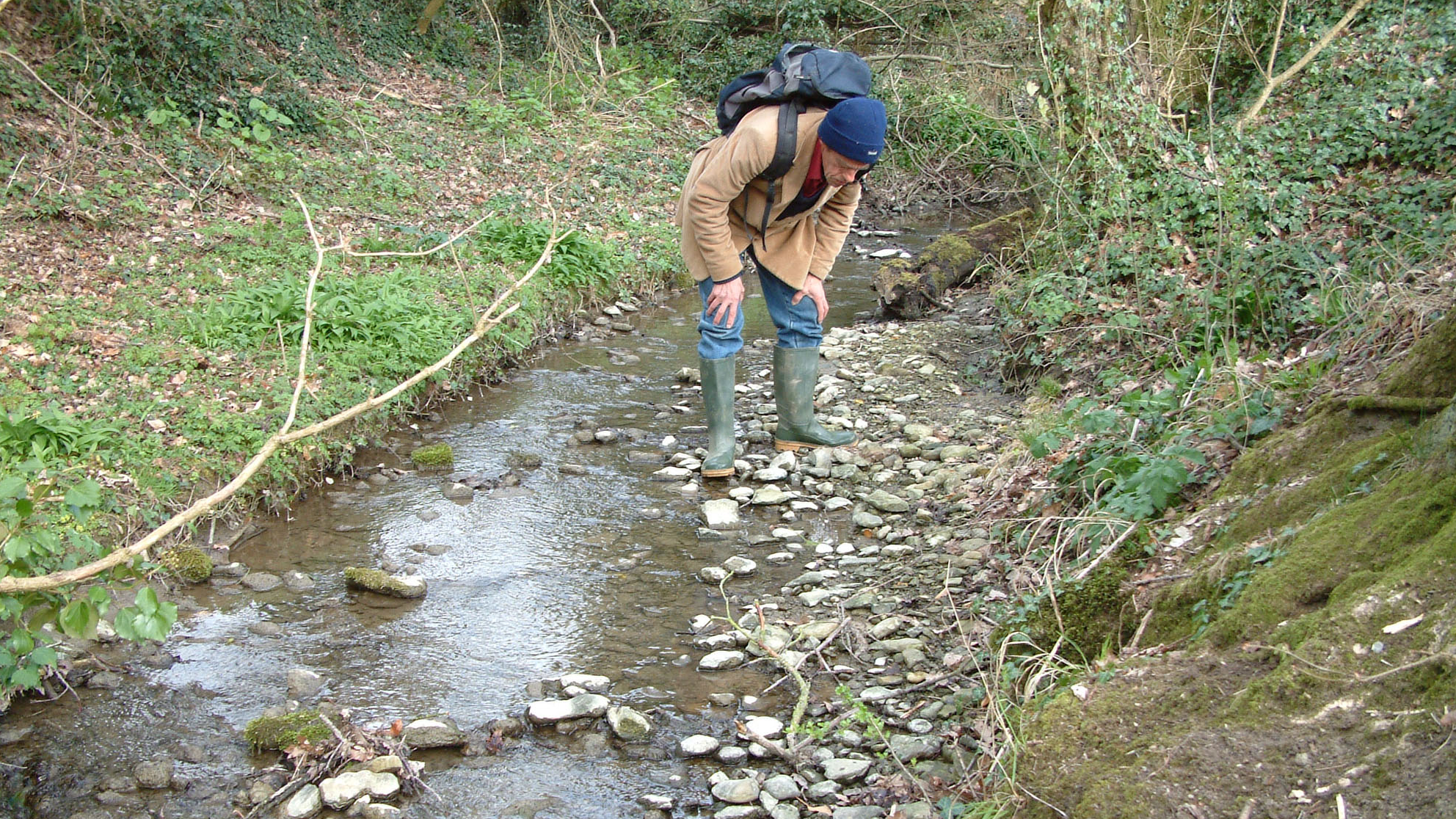
Do not enter without an agreed route and visit arrangement. Stream depth and flow can change quickly after rain, and submerged stones, mud and slippery banks can make even a short section difficult. Avoid high-water conditions and turn back where an obstruction prevents safe progress.
The original guide records wire, sharp metal and fallen trees. Do not climb fences, step over concealed wire, scramble around an outfall or enter unstable bank cavities. Keep clear of undercut banks and tree roots, and respect livestock and working farm access.
Cover cuts, avoid swallowing stream water and wash hands before eating or drinking. Use clean water for washing. These ordinary hygiene precautions do not replace a safe route or authorisation to enter the stream.
Equipment
For an arranged scientific or observational visit, take sturdy waterproof footwear appropriate to the agreed route, a hand lens, camera, scale and a notebook or field-recording device. Carry the agreed access details and avoid carrying equipment that encourages unapproved digging or splitting.
Where a sampling plan permits material to be taken, use separate labelled rigid containers and soft wrapping. Protect small brachiopods, shale surfaces and counterparts individually instead of mixing them in one bag.
Cleaning And Treating
For authorised loose material, retain the original label and associated matrix, and photograph it before cleaning. Mudstone and calcareous siltstone can fracture differently from the fossils they contain; begin with minimal dry brushing and avoid soaking fragile shale or pulling small shells from attached rock.
Do not apply acid, bleach or varnish. Calcitic fossils may be damaged together with the calcareous matrix, and preparation can remove features needed for identification. Leave unusual specimens and research samples unprepared for specialist assessment; sampling and laboratory extraction should follow the approved research plan.
Identify Your Finds
Need help identifying a fossil? Share clear photos, where you found it and its size with the community.
Further Reading
Natural England: Upper Millichope Stream Section SSSI citation
Geological Conservation Review: Upper Millichope Middle Elton section
BGS Church Stretton memoir: Upper Millichope lithology, localities 101–102 and fossil records
Richardson and Lister (1969): spores and the separately identified MD14 sample
Access Rights
Upper Millichope Stream Section is a notified SSSI. Its citation records geological and palaeontological interest, not a right of public entry or fossil removal. The 2000 Geological Conservation Review described access as requiring special landowner permission and being restricted to small parties of bona-fide researchers. A present visit or sampling arrangement must be confirmed directly before entry; no current open-collecting permission has been established.
The roadside guide pin and rounded scientific endpoints do not define a permitted collecting parcel. Official mapping protects a narrow stream strip, and approximate points can fall just outside it. Do not use that discrepancy to treat the stream as unprotected, cross fields, bypass fences or work either bank.
Follow the landowner’s current conditions and any conservation restrictions for the exact proposed activity. Avoid damage to fossiliferous banks, clay layers and numbered study horizons, and keep research sample provenance separate from loose stream observations.
It is important to follow our ‘Code of Conduct’ when collecting fossils or visiting any site. Please also read our ‘Terms and Conditions‘
Links
♦ Fossil Discussions
♦ Fossil Articles
♦ Buy Fossils, Tools and Equipment
♦ Buy Crystals, Meteorites, and Artefacts
♦ Join Fossil Hunts
♦ UK Fossils Network


