

West Angle Bay exposes folded Lower Carboniferous limestone and shale, with crinoid stems, brachiopods and other marine fossils visible on weathered rock surfaces. The sandy beach is a good starting point for a family visit, while the surrounding cliffs reveal the change from Devonian river deposits to a shallow sea.


FIND FREQUENCY: ♦♦♦♦♦ – Crinoid fragments are abundant on many limestone surfaces; complete crowns and other delicate fossils are exceptional.
CHILDREN: ♦♦♦♦♦ – The main sandy beach suits a family visit. Supervise children closely on the rocky shore and keep away from cliffs.
ACCESS: ♦♦♦♦♦ – A slipway leads from the car park to the beach. The rocky margins are uneven and access to individual exposures depends on the tide.
TYPE: Cliffs, rocky foreshore and fossil-bearing limestone surfaces; an observation and photography locality unless removal has been expressly authorised.
DIRECTIONS
♦ From Pembroke, follow the B4320 towards Angle, then the signs through the village to West Angle Bay on its western side.
♦ Use the car park behind the main beach and the slipway onto the shore. Check the signs on arrival for current parking arrangements.
♦ Ref: 51.68580°N, 5.10859°W. This is a general bay reference, rather than a route to every geological exposure.
♦ Begin at the main beach and examine the nearby rocky margins when the tide allows. Do not make your return dependent on rounding a headland or crossing a channel that may fill behind you.
FOSSIL HUNTING
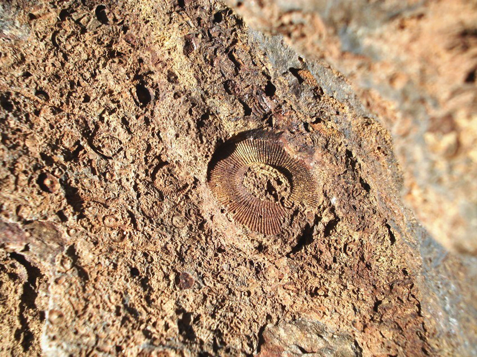
Crinoids are the easiest fossils to recognise here. Although often called sea lilies, these animals were relatives of starfish and sea urchins. Their stems broke into small, jointed pieces after death: round or angular discs, short bead-like lengths and circular impressions are common sights on the weathered limestone. Look at a clean, naturally exposed surface with a hand lens rather than trying to split a block. A damp rock can reveal detail, but the safest viewing position is always more important than getting a closer photograph.
The limestone outcrops along the northern side of the main bay provide particularly good opportunities to see crinoidal rock in place. Softer mudstone layers weather away between harder limestone beds, leaving fossils standing in relief. On the southern side, similar material can be examined on exposed bedding surfaces and among limestone blocks. Loose blocks have lost their precise bed position, so record that uncertainty rather than assigning every photographed fossil to the same layer.
Look beyond the stems for ribbed brachiopod shells, coral sections and bryozoans. Brachiopods may retain a curved shell outline and radiating ribs; bryozoans can appear as fine branching fragments or delicate net-like structures. These can be much less conspicuous than the crowded crinoid debris. In the published Lime Kiln Cove crinoid horizon, productid and rhynchonellid brachiopods occur with crinoid ossicles and occasional fenestellid and branching bryozoans in a fine, grey, impure carbonate mudstone. That particular association is a documented bed, rather than a description of every limestone in the bay.
West Angle has also yielded unusually complete crinoids. The species Hylodecrinus cymrus was described from a specimen in Lime Kiln Cove, on the north side of the main bay. Its bowl-shaped cup has prominent ridges and pits at the plate corners, with slender arms and a pentagonal stem. The specimen is held by National Museum Wales as NMW2008.18G.1. An isolated stem disc cannot establish that identification: the named species depends on the detailed cup and arm characters. The description reported a single known specimen at the time, not a guarantee that only one exists today.
The same published study lists other crinoids recorded from the Black Rock Limestone at West Angle: Rhodocrinites versimilis, Actinocrinites laevissimus, Dialutocrinus tessellatus, Platycrinites sp., Blothrocrinus longidactylus, Holcocrinus smythi and Taxocrinus hibernicus. These are scientific locality records cited from earlier research; they are neither a list of easily identifiable loose stems nor evidence that all came from the holotype’s bed. Dixon also described a patch of articulated sea urchins and crinoids in the northern coves. The later crinoid paper states that the sea-urchin exposure had been eroded away, so visitors should not expect to find that historic colony still in place.
The red and grey sandstone succession farther around the bay tells a different fossil story. Grey beds within the upper Skrinkle succession contain historical records of plant debris, fish remains, bivalves and ostracods among deposits associated with rivers and the approaching sea. Dixon’s northern and southern collections differ substantially. On the south side, the beds he numbered 8, 10 and 14 include concentrations of shells; bed 14 was especially rich in the bivalve recorded as Ptychopteria damnoniensis. The northern record includes fish teeth and scales in particular grey or calcareous horizons. These old names and records are explained in the detailed geology below; they should not be used to label an unprovenanced fragment or transferred to the crinoid limestones.
For a useful record, photograph the whole surface and then the fossil with a scale, noting which side of the bay you visited and whether the rock was attached or loose. Do not hammer the cliffs, bedrock or in-situ fossils. The museum’s locality leaflet asks visitors to leave the fossils here, and removal requires the permissions explained under ACCESS RIGHTS. A potentially important articulated fossil is best left undisturbed, photographed and reported to National Museum Wales with its precise location.


Significant fossil discoveries, collections and geological research at West Angle Bay.
1846 – Early measured sections and collections
Henry De la Beche described the transition beds at West Angle. Material collected by De la Beche, John Phillips and John William Salter later helped document the shell-bearing southern succession and the change between red-bed and marine environments.
1865 – A southern brachiopod figured
A southern West Angle specimen recorded as Orbiculoidea nitida was figured by Thomas Davidson. The later Survey account identifies the figured specimen by register number 6989, linking an early illustration with a particular historic collection.
1896 – A West Angle bivalve illustrated
George Whidborne figured southern West Angle material recorded as Ptychopteria damnoniensis. The specimen was subsequently identified in the Survey account as register number 7446, providing a documented example of the bay’s shell-bearing transition beds.
1921 – Detailed north and south successions documented
Edward Dixon published separate measured accounts of the Skrinkle Sandstones and Lower Limestone Shales, together with fossil lists and structural observations. These records distinguish the two sides of the bay and remain important for interpreting the historic collections, although some names and geological boundaries have since changed.
1971–1977 – The period boundary placed within the red-bed succession
Spore and conodont work showed that the Devonian–Carboniferous boundary lies within the upper Skrinkle succession, below its conventional lithological top. This separated a boundary in geological time from the later, more obvious change to predominantly marine limestone and shale.
1982 – Depositional environments described in detail
Brian Williams, John Allen and John Marshall set out the river, floodplain and marginal-marine history of the northern section, including the Gupton and West Angle units. The contrasting conglomerates, calcretes and fossil-bearing grey beds helped explain the changing sediment supply and approach of the Carboniferous sea.
2003 – The geological coast recognised in its SSSI citation
The Angle Peninsula Coast citation described the scientific importance of the West Angle red beds, carbonate cliffs and platforms. The protected coast includes evidence for changing environments across the Devonian–Carboniferous transition and later deformation.
2009 – Carbonate-ramp environments investigated
Lisa Abbott mapped and logged the Lower Carboniferous succession, distinguishing four facies associations and interpreting changing conditions on a carbonate ramp. A simplified part of this work subsequently provided the geological setting for the named crinoid from Lime Kiln Cove.
2013–2014 – A new crinoid named from Lime Kiln Cove
Cindy Howells and Thomas Kammer described Hylodecrinus cymrus, the first reported European occurrence of its genus. The study appeared online in 2013 and in its journal volume in 2014. The holotype, NMW2008.18G.1, came from a documented horizon in the northern carbonate section; similarities to North American species suggested a biological connection, although the direction of migration remained uncertain.
2015 – The Old Red Sandstone framework revised
A revised regional lithostratigraphical framework placed the Gupton and West Angle formations within the Skrinkle Sandstones Subgroup of the Brecon Beacons Group. West Angle remained a key reference locality, while the detailed account retained differences between the northern and southern successions.
GEOLOGY
West Angle Bay exposes two connected chapters in the area’s history. The older rocks around its margins include red conglomerates, sandstones and mudstones deposited by rivers and on floodplains. They are followed by the Skrinkle succession, in which grey, fossil-bearing layers become increasingly important as marine influence spread across the landscape. The limestone and shale within the main bay record the succeeding Lower Carboniferous sea. These changes are not a single clean line between ‘land’ and ‘sea’: marginal environments and marine incursions occur below the conventional top of the sandstone succession.
In current terminology, the Ridgeway Conglomerate Formation belongs to the Milford Haven Subgroup of the Daugleddau Group. Above a major break, the Gupton and West Angle formations belong to the Skrinkle Sandstones Subgroup of the Brecon Beacons Group. The northern Gupton outcrop includes the thin Stackpole Sandstone subdivision; the overlying West Angle Formation has a lower conglomeratic division and an upper red-grey, or heterolithic, division. Coarse sediment, soil-carbonate nodules and finer floodplain beds give way to grey beds with plant debris, shells and fish remains. The upper succession extends into the Tournaisian, so its red-bed appearance does not mean that every layer is Devonian.
The marine rocks are assigned to the Avon Group, traditionally called the Lower Limestone Shales, followed by the lower part of the Pembroke Limestone Group, represented here by the Black Rock Limestone Subgroup. The latter is the current rank; ‘Bluck’s Pool Limestone’ is an obsolete name encountered in older accounts. Mud and carbonate accumulated on a gently sloping marine ramp. The published 23 m Lime Kiln Cove log records an overall change from shallower ramp conditions to quieter, deeper outer-ramp deposition. Crinoids and shell fragments may be crowded in some limestone beds, while other beds contain much more mud and fewer fossils.
The bay is broadly synclinal, but its shore is not an undisturbed stack. Strong folding, cleavage and faults repeat and interrupt the outcrops; thrusting brings shale into the limestone tract on the north side of the main beach. It is therefore unsafe to turn the distance walked along the shore into a thickness, or to join the more northerly red-bed log directly onto every carbonate exposure. Published thicknesses also use different limits. The detailed section keeps the historical north and south logs, the disputed modern sandstone figures and the separate Lime Kiln Cove log distinct rather than combining them into a misleading total.


The northern and southern red-bed logs, historical carbonate beds and separate Lime Kiln Cove crinoid section.
Reading the sections. The northern red-bed section, the southern red-bed section and the folded carbonate rocks of the main bay are separate records. The succession below runs broadly from older to younger, but each measured log retains its own numbering and limits. Dixon’s 1921 measurements are given in feet, as published, without implying modern surveying precision. His use of ‘Skrinkle Sandstones’ and ‘Lower Limestone Shales’ predates the present framework and does not define the Devonian–Carboniferous boundary.
Old Red Sandstone Supergroup. Current BGS parentage places the older Ridgeway succession and the younger Skrinkle succession in different groups. The broad age label of the supergroup must not override the evidence that the upper West Angle succession extends into the Tournaisian.
DAUGLEDDAU GROUP
MILFORD HAVEN SUBGROUP
Ridgeway Conglomerate Formation
The northern coast section exposes red-brown and purple conglomerates alternating with siltstone and sandstone. The GCR account gives a local thickness of about 120 m. Conglomerate beds are commonly 1–3 m thick, with poorly sorted, subangular to rounded pebbles in a sandy matrix; the clasts include quartzite, vein quartz, greywacke, siltstone, felsite and green phyllite. Typical clasts are 1–5 cm across, with some reaching 20 cm. Some beds have cross-bedding or imbricated pebbles, while others are largely massive and rest on erosional bases.
Finer intervals and the upper contact. Siltstone-dominated units, reported as 1–25 m thick, contain stacked fining-upward cycles about 0.5–2 m thick. A thin basal conglomerate may be followed by laminated or cross-bedded sandstone, ripple-laminated siltstone and a mudstone cap. Mudstone caps about 20–40 cm thick contain burrows, including the trace recorded as Beaconites antarcticus; desiccation cracks and immature calcrete profiles show exposure and soil development. The uppermost beds include calcretised mudstone and a distinctive grey-green, cross-bedded sandstone about 1.25 m thick. These are descriptions of the northern GCR section, not beds in the crinoid-bearing carbonate log.
The coarse deposits have been interpreted as alluvial-fan and braided-river sediment supplied broadly from the south. Their precise age is less secure than that of the younger fossil-bearing succession: the 2015 framework discusses an Early Devonian assignment, whereas the current Lexicon retains a broader Early–Mid Devonian range. A major depositional break separates them from the Skrinkle succession. The locally sharp contact is not a continuously dated record of the intervening time.
BRECON BEACONS GROUP
SKRINKLE SANDSTONES SUBGROUP
The subgroup, called a group in older accounts, includes the Gupton and West Angle formations. A crucial numerical discrepancy remains in the published framework. The 2015 northern reference section totals 128 m: 6 m of Gupton Formation, 63 m of the lower West Angle division and 59 m of its upper division, consistent with the GCR’s approximately 130 m description. Elsewhere the same report gives the West Angle Formation at its type locality as about 60 m, divided into 43 m and 17 m; the current Lexicon repeats those figures. These statements are retained as different source-bound descriptions. They cannot be combined or silently treated as equivalent measured limits.
Gupton Formation
Stackpole Sandstone Member (informal subdivision)
The north-side section contains about 6 m assigned to the Stackpole Sandstone subdivision. The base is sharp and slightly uneven. Its lowest approximately 1.25 m comprises dull-red silty mudstone with very finely laminated sandstone, in centimetre- to decimetre-scale packages. Burrows at some levels were described as Skolithos-like and Chondrites-like; resemblance does not establish a more precise taxonomic determination. Hard pink quartzose sandstone forms most of the upper part, in sheet-like beds or channelled, cross-bedded bodies, locally pebbly and erosively based. Published interpretations include a lower lacustrine interval followed by ephemeral streams and sheet floods. The Lower Sandstone Member described at Freshwater West is not added to this West Angle section.
West Angle Formation
Conglomerate Member (informal subdivision)
In the northern reference account this division is 63 m thick. Its base is an approximately 1 m cross-bedded conglomerate with a scalloped lower surface. Stacked fining-upward cycles have conglomeratic or sandy lower parts, up to about 2.5 m thick, capped by thicker siltstone. Three beds display lateral-accretion structures, indicating sideways growth within channels. The varied clasts include vein quartz, acid igneous material, mylonite, purple quartzite and locally derived fragments; the assemblage differs from the Ridgeway conglomerates below. Red siltstones include immature calcretes and, around 20 m above the base, disturbed dark-grey mudstone laminae within grey-green siltstone. Sediment supply was interpreted as coming from the north-east, across the basin margin. The separate 43 m Lexicon figure is the unresolved alternative described above, not an extra unit.
Red-Grey Member / Heterolithic Member (informal subdivision)
The northern reference section gives 59 m, beginning near a malachite-bearing horizon. Red, mauve and green-grey sandstone and silty mudstone commonly form fining-upward packages capped by mottled mudstone and calcrete. Some upper sandstone bases carry thin granule layers about 6–7 cm thick. Grey mudstone, calcareous sandstone and limestone horizons contain plants, bivalves, ostracods, root traces and fish remains; five historically termed ‘marine’ intervals were recognised. Their assemblages and sedimentary structures record changing river, lagoon, tidal-flat and coastal-barrier conditions rather than a permanent open sea throughout. The separate 17 m type-locality figure in the Lexicon remains a conflicting source description.
Lower distinctive grey horizon, northern reference log. Around 33 m above the base of the Red-Grey division, a 0.4 m nodular calcrete is followed by about 0.15 m of grey mudstone with bivalves, plant debris and fish teeth. Burrowed grey sandstone above fines upward over about 0.4 m into grey mudstone, then mottled mudstone before red beds return. These heights belong to this particular member log.
Higher distinctive grey horizon. A nearby higher interval begins with about 0.45 m of green-grey, cross-bedded quartzitic sandstone with calcretes. Above it are approximately 0.3 m of ferruginous grey mudstone and sandstone with abundant Planolites burrows, about 0.5 m of brown-grey calcareous cross-bedded sandstone, and a rubbly bioclastic limestone cap about 0.10 m thick. These layers must not be confused with the much younger crinoid horizon in Lime Kiln Cove.
Uppermost sandstone succession and the period boundary. About 7 m below the conventional subgroup top, red-grey interbedding is replaced by grey shale and thin, yellow-weathering dolomitic sandstone. Historical records include fish fragments, Modiola lata, crinoid ossicles and a lingulid, with an orthocone in the underlying red siltstone. Approximately 3 m of cross-bedded sandstone with bryozoans and ooids caps the conventional succession. The GCR places the Devonian–Carboniferous boundary about 8–15 m below that conventional top from spore and conodont evidence. The 2015 framework discusses late Devonian LE spores near 45 m in its northern member section, followed 6–8 m higher by Tournaisian VI assemblages. These are biostratigraphic observations, not an instruction to place the time boundary at the Avon contact.
Alternative lithological boundaries. The 2015 north/south correlation diagram distinguishes the conventional top from proposals to use lower marine flooding surfaces. Its first marine boundary alternatives are around 33 m in the north and 24 m in the south, with another northern flooding surface around 45 m. These proposals refer to lithostratigraphic placement within the logged succession. They are not two independently dated Devonian–Carboniferous boundaries, and the member datum must accompany any quoted height.
Dixon’s northern Skrinkle log, bottom to top. The fourteen historical beds total 413 ft. The numbering below belongs only to this northern red-bed log; it is distinct from both the southern sequence and the carbonate log. The lithologies retain Dixon’s observations while the ages and modern boundaries are interpreted separately above.
North Skrinkle bed 1 — 21 ft. Thin red or pink quartzitic sandstones contain quartz pebbles and marl flakes, with marl partings and local downward sandstone injections. The base on the Ridgeway succession is sharp and slightly uneven, without a basal conglomerate at the measured point.
North Skrinkle bed 2 — 200 ft. Mainly red marl alternates with sandstone, conglomerate and breccia, locally green or brown and containing calcrete or yellow-weathering cornstone. A 15 ft coarse unit forms the base. Dixon recorded a thin grey-green sandy shale around 60 ft above it, together with erosion features and sandstone injections within the interval.
North Skrinkle bed 3 — 12 ft. Red or grey marl and quartzitic sandstone include yellow-weathering conglomeratic cornstone, malachite and pyrite. Coal laminae and indeterminate plant fragments were recorded, with sandstone injections extending down into underlying marl.
North Skrinkle bed 4 — 30 ft. Red marl and sandstone are bounded by breccias at the bottom and top; calcrete and a horizon of sandstone injections were recorded.
North Skrinkle bed 5 — 66 ft. Predominantly red marl and quartzitic sandstone alternate with conglomeratic cornstone and some finer conglomerate. A thin grey-green mudstone interval was considered possibly fossiliferous, rather than positively identified as a separate fossil bed.
North Skrinkle bed 6 — 8 ft. Green-grey mudstone and quartzitic sandstone include conglomeratic cornstone. Fish remains were frequent in the basal cornstone; mudstone contained indeterminate bivalves, plants and a lenticular concentration of fish debris. Historical tentative identifications included a Megalichthys? tooth, a Psammodus-like tooth and a possible rhizodont scale and tooth.
North Skrinkle bed 7 — 6 ft. Marl and sandstone, partly quartzitic, retain some red coloration in their lower part.
North Skrinkle bed 8 — 5 ft. Grey shale and pyritic sandstone contain plant fragments and coal laminae reaching 2 inches thick. Bedding-plane movement had disturbed part of the interval.
North Skrinkle bed 9 — 24 ft. Red marl and sandstone, green at the base and top, contain calcrete.
North Skrinkle bed 10 — 1½ ft. Dark-grey shale and sandstone form a thin interval between the red beds and the next calcareous band.
North Skrinkle bed 11 — 2½ ft. Grey or pink fossiliferous limestone and sandstone, locally quartzitic or containing calcrete, have abundant thin-shelled bivalves and ostracods. Dixon noted that the fossils were difficult to extract.
North Skrinkle bed 12 — 15 ft. Red marl and sandstone, green near the top, include thin conglomeratic cornstone. An orthocone fragment was recorded near the base under the historical name Orthoceras.
North Skrinkle bed 13 — 12 ft. Grey fossiliferous calcareous sandstone and shale overlie a conglomeratic base with quartz, sediment and calcrete fragments and fish remains. Small tubes penetrate the underlying marl. The sandstones include shale fragments, brachiopods, crinoids and the bivalve recorded as Modiola, becoming decalcified where weathered. This is the 12 ft red-bed-log unit, not the 32 ft carbonate bed of the same number.
North Skrinkle bed 14 — 10 ft. Red fossiliferous calcareous sandstone with small pink quartz pebbles is divided by red and green marl partings. Bands of branching bryozoan material were recorded. Dixon included it below his Lower Limestone Shales, while recognising uncertainty over the period boundary.
Dixon’s southern Skrinkle log, bottom to top. Eighteen historical beds total about 493 ft. The lowest few feet were not seen and beds 1 and 17 were approximate measurements. Numbering is independent of the northern and carbonate logs.
South Skrinkle bed 1 — about 45 ft. Basal sandstone contains abundant red marl flakes locally. The lowest few feet above the Ridgeway red marl were concealed.
South Skrinkle bed 2 — 210 ft. Marl, sandstone, conglomerate and breccia include yellow-weathering cornstone and local manganese nodules. Some coarse material resembles the northern bed 2, but large rhyolitic fragments, more than 6 inches across, occur in a breccia interval.
South Skrinkle bed 3 — 10 ft. Grey and red sandy marl, conglomerate and yellow cornstone include malachite, coal laminae and indeterminate plants. The grey colour locally crosses the bedding. Dixon’s register numbers J.M.873–875 refer to this southern bed, not northern bed 3.
South Skrinkle bed 4 — 60 ft. Red and green sandstone, chiefly quartzitic, alternates with marl, conglomerate, cornstone and occasional grey shale.
South Skrinkle bed 5 — 4½ ft. Quartzitic and conglomeratic sandstone is associated with purple-green limestone recorded as unfossiliferous.
South Skrinkle bed 6 — 24 ft. Grey shale and sandstone include gastropod-rich sandstone near the base, higher conglomeratic and quartzitic beds and a thin compact limestone. Historical records include Spirorbis sp., indeterminate bivalves and gastropods, possible goniatites and ostracods.
South Skrinkle bed 7 — 20 ft. Red and green marl alternates with brown-coated sandstone and grey shale. The upper shales contain abundant structures described as possible worm casts.
South Skrinkle bed 8 — 7 ft. Cross-bedded quartzitic sandstone contains plant and shale fragments and lenses of dark limestone crowded with small gastropods and tubes. Historical records include Serpula advena, cf. Sphenotus soleniformis, Bellerophon and Loxonema?. The shell-rich lenses were interpreted as concentrations washed together among the sands.
South Skrinkle bed 9 — 9 ft. Grey shale and sandy mudstone accompany buff sandstone and pyrite crystals.
South Skrinkle bed 10 — 11 ft. Highly fossiliferous grey shale and limestone record a varied historical assemblage: Retzia?, Rhynchonella laticosta and allied forms, Actinopteria?, possible Sanguinolites mimus, cf. Sphenotus soleniformis, gastropods, ostracods, isolated crinoid ossicles and broken bryozoans. These are the old determinations, not modern species confirmations.
South Skrinkle bed 11 — 45 ft. Red marl and sandstone with occasional green bands begin with purple calcrete-bearing marl. The highest red marl surface was described as bored before the green sandstone above was deposited.
South Skrinkle bed 12 — 1½ ft. Green conglomeratic sandstone contains dark sediment fragments and fish debris. Small reddish calcareous sandstone lenses at the top yielded a possible Aviculopecten and a gastropod.
South Skrinkle bed 13 — 2 ft. Pale-green sandy mudstone is penetrated locally by material from the overlying bed, interpreted by Dixon as filling cracks formed before the next sediment accumulated.
South Skrinkle bed 14 — 5 ft. Dark-grey sandy shale and limestone nodules contain abundant bivalves recorded as Ptychopteria damnoniensis. Other old records include an uncertain Ptychopteria, Sanguinolites?, Loxonema? and Orthoceras sp.
South Skrinkle bed 15 — 17 ft. Grey and buff sandstone, shale and mudstone include possible worm casts, rare fish remains including the historical genus Lophodus, and fragments bearing decalcified tubes recorded as Serpula advena. Much of the sandstone is quartzitic; some was calcareous before weathering.
South Skrinkle bed 16 — 5 ft. A coarse sandstone weathers brown.
South Skrinkle bed 17 — about 10 ft. Grey sandstone and shale include a partly concealed upper interval, with shale visible at the top.
South Skrinkle bed 18 — 7 ft. Red calcareous sandstone contains well-rounded red quartz pebbles, streaks of marl and broken shells, including brachiopods and crinoid ossicles. It underlies Dixon’s southern Lower Limestone Shales section.
Historic fossil collections: northern Skrinkle succession. Dixon’s eight-locality matrix lists fifteen positive occurrence cells for the north side, including observations for which specimens were not preserved. The named or qualified entries are Pachytheca?, Lingula?, Modiola lata, Orthoceras sp., Cytherella?, Acrolepis?, Cladodus sp., Ctenacanthus sp., Lophodus sp., Megalichthys?, Psammodus-like teeth, Psephodus laevissimus? and a possible rhizodont scale and tooth. Isolated crinoid ossicles and ostracods form the two additional unpreserved observation entries. The question marks and resemblance terms are essential parts of those historical records.
Historic fossil collections: southern Skrinkle succession. The south-side column contains twenty-eight positive occurrence cells. Its historical records include Serpula advena, Spirorbis sp., possible worm casts, a batostomellid bryozoan, Orbiculoidea nitida, Retzia?, Rhynchonella laticosta and allied forms, Actinopteria?, Aviculopecten?, Cucullaea unilateralis?, Lithodomus sp., Myophoria deltoidea, Phthonia?, Prothyris contorta, Ptychopteria damnoniensis, an apparently new but uncertain Ptychopteria, Sanguinolites mimus, Sanguinolites?, cf. Sphenotus soleniformis, Bellerophon sp., Loxonema?, Tropidodiscus trilobatus with possible variety bisulcatus, Goniatites?, Orthoceras sp., ostracods and Lophodus sp. Crinoid ossicles and Euomphalus sp. were separately marked as not preserved. The bed description qualifies Sanguinolites mimus more cautiously than the table, so its identification should remain tentative.
The combined forty-three positive cells are occurrences in two columns, not forty-three distinct valid species. Blank cells mean that a record was not listed, not that the fossil was absent. Fossils from the table’s other localities are excluded here: in particular its two Spirifer verneuili-related entries are not West Angle records. The locality-level register lists are north E.D.1882–1907, Pl.1020–1024 and 1195–1205, J.M.896–931; south P.S.515–543, E.D.1326, 1330–1335 and 1817–1819, Pg.4152–4230 and Pl.1025–1031. These ranges do not provide a specimen-by-specimen allocation of every taxon. Figured southern material includes Orbiculoidea nitida, register 6989, and Ptychopteria damnoniensis, register 7446.
Carboniferous Limestone Supergroup. The Avon Group and the overlying Pembroke Limestone Group are the relevant modern group-level units in the main bay. No additional formation is inferred merely because it belongs to these groups elsewhere in South Wales.
AVON GROUP
Dixon’s Lower Limestone Shales, bottom to top. The fifteen numbered intervals below are a historical carbonate-transition log, with north and south thicknesses where Dixon supplied them. They are not the Skrinkle beds numbered above. The southern basal beds differ lithologically and are described separately. Faulting affects the upper interval, and Dixon’s approximate northern subdivision totals of 98 ft, 142 ft and about 320 ft give about 560 ft overall. This is not a newly calculated exact modern group thickness.
Carbonate bed 1 — north ½ ft. Fine grey calcareous sandstone rests above the pebbly red sandstone of Dixon’s older succession.
Carbonate bed 2 — north 9 ft. Shale alternates with thin crinoid- and brachiopod-bearing limestone. Some crinoid ossicles are reddened.
Carbonate bed 3 — north 12 ft. Shale contains sandstone partings with phosphatic nodules.
Carbonate bed 4 — north 2 ft. Conglomerate has mainly white quartz pebbles with a few red examples, locally abundant shale fragments and quartzitic or calcareous cement.
Carbonate bed 5 — north 15 ft. Shale contains thin dark limestone beds.
Southern replacement of basal beds 1–5. The southern interval is divided into four different units, rather than five direct north–south equivalents: (a) 5 ft of shale with thin quartzitic or friable sandstone; (b) 7 ft of decalcified shale with ostracods, moulds of modioliform bivalves, thin weathered sandstone and phosphate nodules; (c) 1 ft of impersistent quartzitic sandstone; and (d) 24 ft chiefly of shale, with dark limestone above and plant-rich, fine pyritic sandstone lenses in the middle. A few brachiopods accompany those plant fragments, suggesting a marine contribution. These four values must not be added onto the northern log.
Carbonate bed 6 — north 8½ ft; south 6½ ft. Thin ooid limestones have shale partings below and sandstone associations above, with a conglomeratic base of locally reworked material. Dixon additionally described 8 ft of fine, cross-bedded sandstone containing ooid-limestone lenses above the southern ooid beds. That separately discussed interval is one reason not to manufacture a new exact southern grand total from the paired table.
Carbonate bed 7 — north 14 ft; south 11 ft. Red or grey limestone and calcareous sandstone alternate irregularly and may be sandy or pebbly. Some layers contain iron-rich bryozoan debris, dark crinoid ossicles and thick-shelled bivalves. Historical material was identified as Myophoria deltoidea; Dixon also discussed a possible Myophoria trigona record. These old determinations should not be treated as a newly revised fauna.
Carbonate bed 8 — north 37 ft; south 40 ft. Shale contains thin ostracod limestones in its lower half and quartzitic sandstone in its upper half, leading into the stronger sandstone development above.
Carbonate bed 9 — north 32 ft; south 35 ft. Ripple-marked quartzitic sandstone with shale partings contains phosphatic nodules, fish remains and scattered smooth white quartz pebbles. The southern section is subdivided into (i) 2 ft of quartzitic sandstone with possible bivalve casts, (ii) 8 ft of sandstone and shale with abundant burrows or ‘worm casts’, and (iii) 25 ft of thin quartzitic sandstone and shale with phosphatic lenses reaching 4 inches thick. The phosphatic material includes casts of crinoids, bivalves, brachiopods and goniatites, together with fish teeth. The three subdivisions are already included in the 35 ft measurement.
Carbonate bed 10 — north 21 ft; south 13 ft. Shale and fine sandstone have quartz pebbles in the lower part, with phosphatic nodules, fish teeth and other fossils towards sandstone tops higher in the interval. A coral provisionally compared with Palaeacis obtusa was recorded from the fossiliferous sandstone tops in the northern outcrop.
Carbonate bed 11 — north 5 ft; south 3¼ ft. Buff-weathering cross-bedded sandstone contains large calcareous concretions.
Carbonate bed 12 — north 52 ft; south 46 ft: the historical Fish Beds. Shale, sandstone and limestone contain phosphatic nodules and fish remains at some bed bases, with thin ostracod-rich layers. Brachiopods were the most frequent fossils overall, despite the name. The account records an ophiuroid and fish material referred tentatively to a cladodont, Orodus and Pleuroplax. These were historical determinations or suggestions of new forms, not secure modern species assignments. Burrowed laminae are also described.
Carbonate bed 13 — north 32 ft; south 31 ft. Shale with nodular limestone and some sandstone contains abundant fossils, many partly replaced or encrusted by silica in the form described as beekite. Cleistopora and zaphrentid corals occur. This is distinct from the northern Skrinkle bed 13, which is only 12 ft thick.
Carbonate bed 14 — north 18½ ft; south 13 ft. Mainly shelly limestone and fine calcareous sandstone. Decalcification locally leaves a recess, so a gap in the present cliff may reflect weathering rather than a missing depositional interval.
Carbonate bed 15 — north about 300 ft; south unmeasured. Shale with thin, often sandy limestone includes abundant corals and brachiopods; some limestone is conglomeratic, phosphatic or cherty. Individual impersistent limestone beds are rarely more than 4–5 ft thick. Historical northern records include Cleistopora, zaphrentids and Cyathaxonia; southern beds also contain abundant Palaeacis. The northern thickness was estimated across a fault-affected section, not measured continuously, and must retain ‘about’. The published paired table leaves the southern thickness blank.
Structure and lateral changes in the carbonate succession. In the northern coves, a fault interrupts the upper shale succession and a thrust brings a strip of shale into the main limestone tract. Bedding and cleavage have different orientations, and folded or repeated exposures cannot simply be summed. Southern foreshore reefs include uncertain structural relationships in the historical mapping. Dixon’s detailed locations identify nodular beds, Fish Beds and phosphatic sandstone intervals on that side, but the isolated reefs should not be forced into a single continuous modern log.
PEMBROKE LIMESTONE GROUP
BLACK ROCK LIMESTONE SUBGROUP
The lower Pembroke Limestone succession forms the main limestone outcrops within the bay. Dark, impure limestone, mudstone, nodules, chert and silicified fossils occur, with strong folding and faulting. The published crinoid study assigns the exposed Avon and lower Pembroke succession here to the Courceyan part of the Tournaisian. Its regional diagram extends to younger units elsewhere, but those should not be added to the local 23 m log. A separate exposure of the younger Gully Oolite Formation is not established by this local log.
Lime Kiln Cove: the published 23 m log. Howells and Kammer used a simplified section based on Abbott’s work through the exposed lower Black Rock Limestone. Four facies associations record a general deepening: lower beds represent a ramp setting between fair-weather and storm wave-base; overlying associations indicate progressively more offshore conditions; the upper association consists of mud-rich and fossiliferous carbonate beds deposited on the deeper outer ramp. The published figure is not a complete measurement of every formation shown alongside it, and its width scale represents maximum bioclast size where fossils exceed 10%, rather than a general grain-size scale for all sediment.
The Hylodecrinus cymrus horizon. The holotype came from a thin, conspicuous bed approximately 18 m above the logged Black Rock base at Lime Kiln Cove, British National Grid SM 8528 0332. It is fine-grained, mid-grey, impure carbonate mudstone with common carbonate nodules and non-branching burrows, often backfilled with crinoid debris. About 10% fossil content comprises productid and rhynchonellid brachiopods, crinoid ossicles, occasionally still joined, and rare fenestellid or branching bryozoans. It belongs to the upper, fourth facies association. Quiet conditions below storm wave-base were inferred, with occasional rapid burial suggested by articulated crinoids. The adjacent mapped parallel faults have a reported combined throw of about 3 m; that is displacement, not the thickness of the fossil bed.
The holotype’s cup is 3.9 mm high and 6.9 mm wide; the preserved crown exceeds 11.5 mm and the arms exceed 8 mm. Those are measurements of one specimen, NMW2008.18G.1, rather than a size range for the species. Its cup ridges and arm-plate characters distinguish it from North American comparisons. The other eight species in the paper’s comparison table are not local records. Similarities suggest a relationship across the former ocean, but the authors could not establish the direction of migration with certainty.
Abbott’s wider mapping and log coverage. The 2009 report separately gives minimum exposed thicknesses of 11 m for Avon rocks and 30 m for Pembroke Limestone, with structural uncertainty. Its four logs are not consecutive pieces of one stack: one is about 20 m long, two are on the southern limb and one on the northern limb. The report describes nineteen facies and distinguishes four facies associations. These report-wide figures have different limits from the published 23 m crinoid section. They do not justify a summed bay-wide thickness or bed-by-bed correlation without the full original logs.
Historic echinoid exposure. Dixon described a patch of articulated sea urchins with crinoid cups, arms and pinnules on a bedding plane in the first northern cove. The later crinoid study explicitly says that this patch had eroded away. Its importance lies in the evidence for exceptional preservation under quiet conditions, not in a promise that the original fossil pavement remains visible.
References
Dixon, E. E. L. (1921). The Geology of the South Wales Coalfield, Part XIII: The Country around Pembroke and Tenby. Geological Survey memoir. Relevant West Angle fossil matrix and collections, pp. 48–50; northern and southern Skrinkle logs, pp. 53–59; carbonate sections and structures, pp. 115–121.
Williams, B. P. J., Allen, J. R. L. and Marshall, J. D. (1982). Old Red Sandstone facies of the Pembroke peninsula, south of the Ritec Fault. In Geological Excursions in Dyfed, South-west Wales, pp. 151–174.
Wilby, P. R. West Angle Bay (North). In Barclay and colleagues (2005), The Old Red Sandstone of Great Britain, Geological Conservation Review 31, pp. 286–291. Chapter 5.
Barclay, W. J., Davies, J. R., Hillier, R. D. and Waters, R. A. (2015). Lithostratigraphy of the Old Red Sandstone successions of the Anglo-Welsh Basin. BGS Research Report RR/14/02, especially the separate Skrinkle and West Angle thickness descriptions. Report.
Howells, C. and Kammer, T. (online 2013; volume 2014). A new crinoid from the Mississippian (Early Carboniferous) of South Pembrokeshire, Wales. Geological Journal 49(2), 207–212; DOI 10.1002/gj.2514. Author-posted paper.
Abbott, L. (2009). The Depositional Environments of the Pembroke Limestone Group at West Angle Bay, Pembrokeshire. University of Manchester MEarthSci report, 79 numbered pages. The mapped minimum thicknesses and report-wide facies coverage are distinct from the simplified published 23 m log.
British Geological Survey, current Lexicon entries: Ridgeway Conglomerate Formation, Gupton Formation, West Angle Formation, Skrinkle Sandstones Subgroup, Avon Group and Black Rock Limestone Subgroup. Parent entries establish the group/subgroup relationships used above.
SAFETY
Check a current local tide forecast and the sea conditions before entering the rocky coves. Keep a clear route back to the main beach and leave ample time for the return. An open sandy bay does not make every cove or headland safe from tidal cut-off; do not rely on older assurances that this cannot happen.
Keep away from the foot of unstable cliffs and do not climb faces or stacks to reach a bed. Wet limestone, algae, loose stones and uneven bedding surfaces can be slippery. Wear footwear with good grip, take care across channels and supervise children closely at the transition from sand to rock. Avoid exposed shore sections during rough seas.
EQUIPMENT
Bring a hand lens, camera, small photographic scale, notebook, suitable footwear and current tide information. A phone map is useful, but record a location while you are there rather than relying on a close-up photograph alone. This visit does not require a hammer or chisel; leave tools for extracting fossils at home unless a separately authorised scientific visit specifically requires them.
CLEANING AND TREATING
Leave fossils on the shore as you find them. Do not scrub, scrape or chemically clean an in-situ surface for a photograph. Changing the light angle and including a scale usually gives a more useful record than trying to expose additional detail.
If a specimen has been removed with the necessary permission, keep its locality and bed information with it. Let wet material dry slowly and begin with a soft brush only where the surface is sound. Crinoids and many shells are calcitic, so household acids can damage the fossil as well as its limestone matrix. Hard limestone generally calls for careful specialist mechanical work under magnification; weathered shale may crumble if soaked. Leave an articulated or potentially important specimen unprepared until a museum or experienced conservator has advised on it.
IDENTIFY YOUR FINDS
Need help identifying a fossil? Share clear photos, where you found it and its size with the community.
FURTHER READING
National Museum Wales: West Angle fossils leaflet
Howells and Kammer: the Lime Kiln Cove crinoid and its geological setting
Geological Conservation Review: the Anglo-Welsh Old Red Sandstone, including West Angle Bay (North)
BGS: the Old Red Sandstone lithostratigraphical framework
Pembrokeshire Coast National Park: geological conservation and collecting advice
Natural Resources Wales: Angle Peninsula Coast SSSI citation
ACCESS RIGHTS
West Angle lies within the Arfordir Penrhyn Angle / Angle Peninsula Coast SSSI. National Museum Wales asks visitors not to collect the fossils and specifically advises against hammering the cliffs or in-situ material. Plan a visit to observe and photograph the fossils where they lie.
Pembrokeshire Coast National Park advises that fossils or minerals must not be removed from SSSIs without permission from Natural Resources Wales and the landowner. No current collecting permission for this locality has been established for this guide. Ask both before planning any removal, including loose material; access from the car park or along a public path does not provide that permission. For genuine scientific work, follow NRW’s written-permission process and any conditions attached to it.
It is important to follow our ‘Code of Conduct’ when collecting fossils or visiting any site. Please also read our ‘Terms and Conditions‘
LINKS
♦ Fossil Discussions
♦ Fossil Articles
♦ Buy Fossils, Tools and Equipment
♦ Buy Crystals, Meteorites, and Artefacts
♦ Join Fossil Hunts
♦ UK Fossils Network


