

Mortimer Forest, near Ludlow, preserves an internationally important record of Silurian seas in wooded quarries, stream banks and trackside cuttings. Brachiopods, corals, trilobites and graptolites accompany changes from limestone to mudstone and siltstone. The numbered geological trail, measured research sections and older informal collecting circuit are distinct routes, with access and sampling conditions to check before visiting.


FIND FREQUENCY: ♦♦♦♦ – Many fossil groups are documented across distinct exposures. Abundance, preservation and permission vary by subsite; no single stop yields the whole forest fauna.
CHILDREN: ♦♦♦ – Signed visitor walks can suit supervised families, but steep banks, research quarries and roadside stops need separate judgement and are not unrestricted collecting areas.
ACCESS: ♦♦ – The forest has several official car parks and walking trails. Geological exposures are spread out, and the old informal circuit is not a verified current route.
TYPE: – Separate woodland quarries, trackside and stream exposures, including protected scientific reference sections. Walking access does not grant fossil-removal rights.
DIRECTIONS
♦ For the forest’s official visitor routes, use Vinnalls car park, SO 474 731, off the Ludlow–Wigmore road about 2½ miles south-west of Ludlow. Forestry England currently lists free parking and a 7 ft / 2.1 m height barrier. Its surfaced Easy Access Trail is a visitor facility, not a guarantee of access to the geological banks.
♦ Whitcliffe car park, SO 495 740, is on the Wigmore road about a mile south-west of Ludlow; follow the brown tourist sign from Ludford Bridge. Black Pool car park, SO 497 717, is off the B4361 Ludlow–Richard’s Castle road and also has a 7 ft / 2.1 m barrier. Choose a starting point using the current forest map and the particular route you intend to follow.
♦ The original guide coordinate, 52.35718°N, 2.76698°W, refers to an approximate roadside start for an informal circuit. That account began at a lay-by beyond the Forestry Commission entrance, followed a track beneath twin overhead cables, then continued roughly 1½ km before a steep path descended on the right. It has not been matched confidently to every current track and geological subsite.
♦ The historical circuit continued past two features called aqueducts, reaching a gorge near the second, then climbed a very steep path near a seat and electricity pole to a hilltop clearance and another cutting across the forestry road. Those landmarks explain the original observations and photographs; they should not be used to leave a permitted path or enter an unstable cutting.
♦ For the small brachiopod exposure beyond that hilltop, the original directions say turn left while the fossil-hunting text says right. That conflict is unresolved. Use a current mapped, signed route and return by a known permitted path rather than following an uncertain turn.
♦ The numbered geological trail is a different itinerary. Its old account begins west of Vinnalls with the Monstay and Pitch Coppice quarries, returns towards the stop-4 stream locality, and continues through separate roadside stops towards Ludford Corner. Check the current trail information and safe roadside access; the research sections at Goggin Road, Deer Park/Haye Park and Sunnyhill are not interchangeable with these numbered stops.
♦ For a research or organised geological visit, arrange the exact sites and activity with Forestry England before travel. Follow its current signs, barriers and diversions, keep clear of working areas, and allow enough daylight for the distance between exposures. Do not assume a historical clearance is still open or safely accessible.
FOSSIL HUNTING
Mortimer Forest is most rewarding when each fossil is treated as evidence from a particular exposure. The forest spans several formations and depositional settings: a coral-bearing limestone block, a graptolite impression in mudstone and a small brachiopod from siltstone need not have come from the same part of the succession. Begin by identifying the actual stop or research section and examining naturally weathered surfaces from safe ground. A mixed, unlabelled “Mortimer Forest” collection loses much of its scientific usefulness.
The old informal circuit first described loose brachiopods and other shells on a steep, rocky footpath. Around its second aqueduct and gorge it recorded small mudstone and shale cuttings with brachiopods, cephalopods, trilobites and worm tubes, including loose material in scree. These are valuable visitor observations, but the individual exposures have not been securely matched to named formations or scientific sample numbers. Do not attach a precise age or published species list to one of those loose finds without establishing its provenance.
At the hilltop tree-clearance area and the cutting across the forestry road, the earlier guide reported corals, brachiopods, crinoids and very large shells. It called the large shells bivalves and described a shell-rich zone near the top of the cutting, extending about 1–1½ m vertically. That is an attributed identification and exposure description, not a measured thickness of a formal shell bed. In particular, it must not be reidentified automatically as one of the separately documented Kirkidium brachiopod banks.
A further small cutting on the informal circuit was said to yield many small brachiopods, but its left-versus-right route instruction conflicts within the original account. Keep that record as an unlocated historical observation. Photographs of old collecting or cleared ground are not assurances that the same route or exposure is safe today.
The numbered Monstay stops provide a different, identified context. The lower quarry exposes flaggy limestone and mudstone, while the higher quarry has hard nodular Much Wenlock Limestone. Fossils were described as sparse, with brachiopods and other skeletal remains often best seen on weathered surfaces. Crinoid pieces have regular disc-like or star-shaped cross-sections; colonial fossils show repeated skeletal structures. Such features help identify broad groups without assigning an unsupported species from a weathered fragment.
Pitch Coppice, trail stop 3, exposes the internationally defined base of the Ludlow Series and Gorstian Stage. The transition from nodular limestone to Lower Elton mudstone is scientifically important in its own right. Shells, corals and small graptolite specimens in the published measured section have bed-specific records. Observe the boundary and fossils in place rather than sampling a world reference section casually; the protected exposure is not a source of interchangeable collecting blocks.
The stop-4 Middle Elton horizon, also discussed in the separate Vinnels guide, is associated with trilobite fragments, brachiopods, orthoconic nautiloids and graptolites. The nearby historic stream locality and prepared trail excavation have different published coordinates and must remain distinct labels. A graptolite’s regular fine colony pattern and a trilobite’s segmented shield may be visible in shale, but a pale mark or isolated curve is not enough for a species determination.
Along the Wigmore Road educational exposures, the fossil assemblages change with the rocks. The Upper Elton stop at Gorsty is noted for nautiloids and Pristiograptus tumescens. Lower Bringewood calcisiltstones contain broken brachiopod material, while the harder Upper Bringewood stop records corals including Heliolites, Favosites and Rhabdocyclus, together with Kirkidium banks. These are published records for particular stops, not identifications of the old informal hilltop shells.
Lower Leintwardine roadside quarries show fossiliferous, sometimes honeycomb-weathered calcisiltstones and shell bands, with brachiopods, bivalves and other groups documented at distinct levels. Upper Leintwardine exposures add a characteristic fauna that includes Neobeyrichia lauensis, Alcymene puellaris and Encrinurus stubblefieldi in the cited accounts. The Lower Whitcliffe locality is more irregularly and thickly bedded and records an increased role for nautiloids and bivalves. The detailed account keeps each stop and older taxonomic usage separate.
Sunnyhill’s boundary exposures and the research tracks reveal why assemblage interpretation needs more than a list of names. Shell beds may be concentrated, reworked or mixed; valve orientation, size distributions and surrounding sediment help distinguish those processes. Some fossils cross a formation boundary, while others appear or disappear below it. A first observed Dayia or a last coral in one sample is not a universal definition of the Ludfordian boundary.
For any material that the land manager expressly permits you to take, record the exact subsite, position, observed horizon and whether it was loose or in situ. Keep small shells, shale counterparts and fragile colonial fossils wrapped separately. Do not dig banks, remove reference-section markers, pry slabs from cuttings or work below loose blocks. Photograph potentially significant material and seek advice before disturbing or preparing it.

Significant discoveries, geological research and conservation milestones at Mortimer Forest.
1839 – Sunny Hill Bank enters the published geological record
The later Geological Conservation Review identifies Murchison’s 1839 mention of “Sunny Hill Bank” as an early published record of the Sunnyhill locality. This is an attributed historical reference, not a verified first fossil discovery or a date for the modern quarry excavations.
1947 – A landslip exposes an Upper Bringewood bedding surface
A landslip at the later locality 22 moved about 11 ft of flaggy limestone and calcisiltstone on a thin shale seam, revealing a broad fossil-bearing bedding surface. The later description records shell orientation and distribution. This dated landslip has not been identified with the visitor guide’s unnamed tree-clearance exposure.
1959–1963 – The local Ludlow framework and standard sections are established
Revised divisions of the Ludlow succession were introduced in 1959 and documented in the 1963 monograph. The work described Monstay, Pitch Coppice, the Wigmore Road localities, Mary Knoll and Sunnyhill, with measured boundary sections and separately numbered fossil localities.
1969 – Microscopic spores are tied to individual forest samples
A detailed spore study published exact LD sample localities, rock descriptions and microfossil codes from Pitch Coppice, Mary Knoll, the roadside sequence and the landslip. Thirteen of the 24 local samples carry an Appendix S code and thirteen have named spores marked in Table 1. These sample-specific records do not establish one uniform forest-wide spore assemblage.
1969 – The geological site receives SSSI notification
The official Natural England citation records the initial Mortimer Forest SSSI notification in 1969. This conservation milestone concerns the designated geological exposures, not every path or part of the wider forest, and is not a grant of specimen-removal permission.
1973 – New forestry-road exposures extend the research record
New exposures made during forestry-road construction were described, opening longer parts of the Ludlow sequence than had been available for the earlier monograph. Later detailed work at Goggin and Deer Park built on these new sections.
1975 – Conservation-funded clearance supports teaching and research
Funding began for improving old exposures and excavating new ones. Roadside teaching localities and three research tracks were selected for different purposes, with the Forestry Commission carrying out clearance. The SSSI citation also records a revision in 1975. These works do not establish the condition of the exposures today.
1977 – The Geological Trail guide provides an educational route
The published Mortimer Forest Geological Trail guide organised teaching exposures through the local Silurian succession. Its existence and purpose are documented in the following year’s report; the unrecovered complete booklet is not treated here as an independently checked source for every modern route instruction.
1978 – The three research sections are logged in detail
The original report published measured sections A, B and C, mapping separate cuttings, unexposed intervals and fault repetition. Recorded collections were intended to form a national reference collection with locality and horizon information, making the geological context as important as the fossil names.
1979 – Benthic-community profiles quantify local faunal change
Seven exact Mortimer sections were documented in a quantitative ecological study. The work distinguished Sunnyhill, the landslip margin, Mary Knoll, Old House Road, Hazel Coppice, High Vinnalls and Goggin, with separate abundance and density profiles rather than a pooled collecting list.
1981 – A replacement Upper Elton boundary exposure is excavated
A specially excavated exposure on a branch of Goggin Road provided a basal boundary stratotype for Upper Elton after the original section near Owney Wood was lost. This later reference exposure is distinct from the faulted contact in the 1978 main-road log.
1988 – Shell-bed taphonomy and range charts are published
Detailed quadrat counts, shell-orientation and population analyses examined how local shell beds formed. Sunnyhill and Haye Park range charts retained separate sampling sequences, and the study documented erosional shell lenses, transported concentrations and more dispersed assemblages. The paper identified its collection and a separate raw-data supplement.
1992 – Boundary isotope evidence and revised protection are documented
A carbon-isotope study included Pitch Coppice and reported a negative excursion approximately at the Wenlock–Ludlow boundary. Separately, Mortimer Forest was renotified as an SSSI on 18 February, with extensions and reductions recorded in its citation. Isotope correlation and conservation designation address different aspects of the locality.
1994–1996 – Goggin boundary placement is re-evaluated
New lithological and microfossil evidence moved the interpreted base of the Ludlow lower in the Goggin succession. Later sources report an approximately 11 m revision, while the BGS account of the 1994 work gives 14.8 m and different formation estimates. The disagreement is retained rather than presented as one precisely settled measurement.
1998 – An electronic synthesis links the reference sections and fossil groups
The BGS synthesis brought together measured sections, exact shelly-fossil matrices, graptolite horizons, conodonts and chitinozoan zonation. Its discussion distinguishes firm bed records from inferred correlations and highlights several disagreements in boundary position, faunal change and thickness.
2000 – The Geological Conservation Review consolidates the site accounts
The review described Pitch Coppice, Wigmore Road, Goggin, Sunnyhill and Deer Park as distinct geological sites and set out their scientific and conservation roles. Educational roadside sections were distinguished from the formal reference sections that need protection from overuse.
2025 – A new regional lithostratigraphical framework is proposed
A BGS report proposed changes affecting the traditional Elton, Bringewood and younger local divisions. It explicitly described the framework as preliminary and said the Welsh Borderland changes required approval and further consideration. The proposal is a research development, not evidence that every established local formation name has already been replaced.
GEOLOGY
Mortimer Forest lies in the type area of the Ludlow Series, where separate exposures record a long history of Silurian marine deposition. The formal trail begins in upper Wenlock limestone, passes through the Gorstian and Ludfordian successions, and reaches the marine-to-Pridoli transition at its eastern, Ludford Lane/Ludford Corner end. These rocks are encountered across different quarries, roadsides and research tracks; they are not one continuous cliff or a single measured walk.
The Wenlock limestone records carbonate production and skeletal accumulation in the marine shelf environment. At Pitch Coppice, the change to Lower Elton mudstone marks the internationally defined base of the Ludlow Series and Gorstian Stage. Finer sediment and graptolite-bearing mudstone form part of the early Ludlow deepening history on the eastern margin of the Welsh Basin, while shelly organisms continued to occupy the seabed. The local boundary is a formally selected reference point, not a claim that every fossil changed at precisely the same surface.
The Elton succession gives way to more carbonate-rich Bringewood rocks, followed by fossiliferous Leintwardine and Whitcliffe siltstones. This broad evolution reflects changing sediment supply, water conditions and benthic communities on a marine shelf affected by storms and reworking. Carbonate-rich sediment persists above the basal Lower Leintwardine at Sunnyhill, so limestone texture alone cannot diagnose Upper Bringewood or locate the Ludfordian boundary.
Fossil communities provide several kinds of evidence. Graptolites, conodonts and palynomorphs help correlate separated sections, whereas brachiopod, molluscan, coral and trilobite assemblages illuminate seabed conditions and preservation. Shell concentrations can reflect local disturbance or transport rather than an undisturbed living community. Quantitative studies at exact Mortimer localities measured these differences, and their sample counts and repository records must retain their original scope.
The rocks are folded into the Ludlow Anticline and locally disrupted by faults. At Goggin Road, faulting removes parts of the succession and repeats older strata; at Deer Park and Sunnyhill, intervals are hidden between exposures. Later work revised one Goggin boundary interpretation below its earlier position. A tidy diagram that stacks every observed thickness would therefore be misleading. The overview chart identifies the formal trail framework, while the detailed geology keeps the research logs, gaps, repeated beds and numerical disagreements visible.
The informal collecting circuit described in the old guide has useful observations of mudstone, shale, corals and large shells, but not a securely located measured succession. Its gorge, hilltop clearance and shell zone must not be assigned to a named research section by resemblance alone. Equally, the terminal riverside transition at Ludford Corner and the separate Whitcliffe type sections should not be treated as if they were an exposure in that woodland circuit.

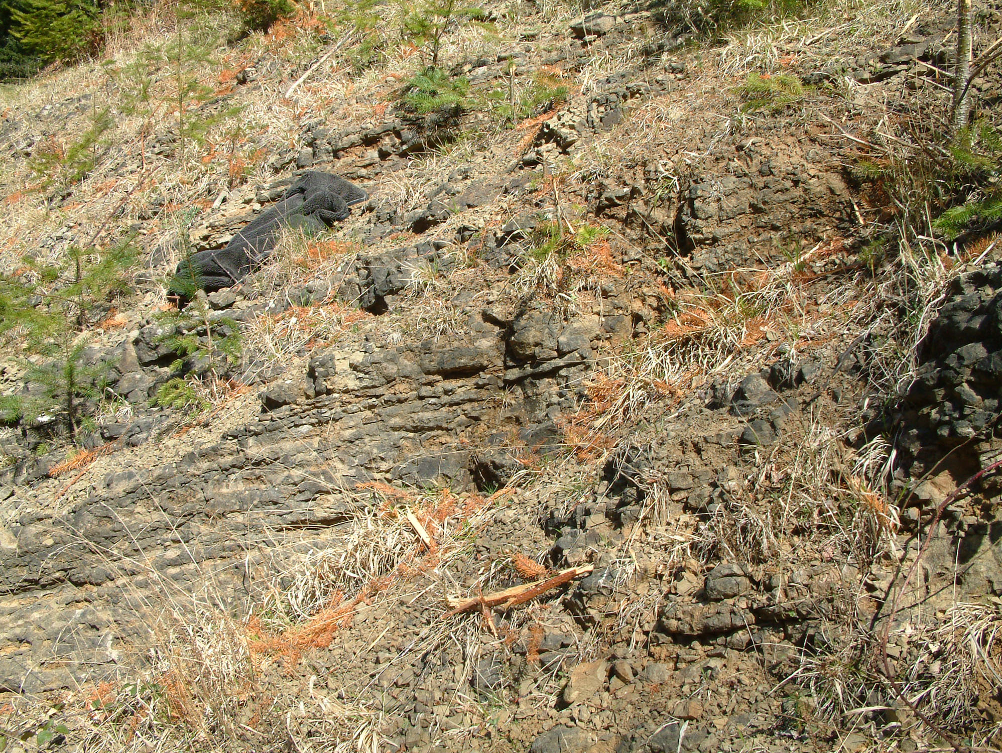
Detailed Mortimer Forest geology: distinct trail stops, measured research sections and exact fossil records.
How to read this locality. Three different sets of places are described below: the original informal forest circuit, the thirteen numbered Geological Trail stops, and the separately measured research sections A–C. Historical localities and later ecological samples retain their own identifiers. Similar fossils or matching formation names do not prove that two exposures are the same place.
The informal circuit remains uncorrelated. The original account records loose shells on a steep rocky path; brachiopods, cephalopods, trilobites and tube fossils around the gorge near the second structure called an aqueduct; and corals, brachiopods, crinoids and large shells at a hilltop clearance and opposite-road cutting. Its shell-rich zone was described as extending approximately 1–1.5 m vertically, not as a surveyed bed thickness. The author called the large shells bivalves; they cannot be renamed as Kirkidium brachiopods without specimen evidence. A final small-brachiopod cutting has conflicting left/right directions. None of these unnamed stops is assigned here to a measured research bed.
Age and marine setting. The formal trail spans upper Wenlock rocks, the Gorstian and Ludfordian stages of the Ludlow Series, and the eastern transition towards Pridoli deposits. The succession records a marine shelf on the eastern margin of the Welsh Basin, including early Ludlow deepening, later carbonate-rich sedimentation and storm-influenced siltstones. The ICS June 2026 estimates place the Gorstian between about 426.7 ± 1.5 and 425.0 ± 1.5 million years ago and the Ludfordian between about 425.0 ± 1.5 and 422.7 ± 1.6 million years ago. These are boundary-age estimates, not dates measured from each local bed.
Names, ranks and historical usage. The established formation names and the Elton, Bringewood, Leintwardine and Whitcliffe groupings used by the Geological Conservation Review provide the framework here. Older publications use “Beds” and the local stages Eltonian, Bringewoodian, Leintwardinian and Whitcliffian; those labels are retained only when explaining their records. “Aymestry Limestone” is an older lithological usage whose carbonate facies can extend into basal Lower Leintwardine at Sunnyhill. It is not a reliable one-to-one substitute for Upper Bringewood.
The 2025 proposed framework. Davies proposed a regional rationalisation including Wootton Formation, Pitch Coppice Mudstone Member, Goggin Road Formation, Aymestry Formation and Mortimer Group. The report calls the framework preliminary and says the Welsh Borderland changes require approval, implementation and further consideration of some local assignments. These proposals do not establish that the familiar Mortimer formation names have already been superseded, nor do they supply a new bed-by-bed log for this guide.
The formal trail: separate exposures. The numbered trail begins at High Vinnalls. Stops 1–3 show Monstay and Pitch Coppice; stop 4 is the Vinnels trackside stream bank. Stops 5–12 are the Wigmore Road teaching localities, with stop 13 at the separate eastern Ludford Lane/Ludford Corner interval. Historical directions and excavation descriptions identify the published sites, not their present condition or permission to sample.
Much Wenlock Limestone Formation
Stops 1 and 2: Monstay. The lower quarry shows alternating flaggy limestone and mudstone; the higher quarry shows harder nodular limestone. The 1963 references are SO 4716 7301 and SO 4722 7304. The older account found fossils scarce, including Atrypa reticularis, Rhipidomella hybrida, Eospirifer radiatus, Sowerbyella and reddened tubular bryozoans. The SSSI citation additionally records sparse graptolites in lower flags and corals, bryozoans, brachiopods, acritarchs and chitinozoans in the Monstay succession, without assigning each group to one measured bed.
Stop 3: Pitch Coppice boundary stratotype. At SO 4723 7298 in the current ICS listing, the rapid change from nodular limestone to more argillaceous siltstone defines the bases of the Ludlow Series and Gorstian Stage. The measured log records 3.35 m of underlying Much Wenlock Limestone and 1.76 m of overlying Lower Elton. These are exposed intervals; the original visitor account’s shorter estimate is not a competing whole-formation thickness. The following beds are described from older to younger, reversing the printed table’s top-down order.
Pitch Coppice: A. The lowest 0.85 m seen consists of massive grey nodular limestone with scattered shells. “Seen” identifies an exposure limit, not the bed’s complete thickness.
Pitch Coppice: B. A 0.25 m limestone contains scattered shells but is described as poorly fossiliferous.
Pitch Coppice: C. Soft pale olive-grey calcareous shaly siltstone, 0.20 m thick, weathers back to form a conspicuous recess in the recorded quarry face.
Pitch Coppice: D1. The 0.70 m nodular-limestone interval includes a 0.03 m shelly limestone at its base; the remainder resembles D3, with occasional thin shale partings and sparse fossils.
Pitch Coppice: D2. This 0.75 m interval has the same nodular limestone and occasional shale-parting lithology as D3, with sparse fossils.
Pitch Coppice: D3. Nodular limestone with occasional thin shale partings forms a 0.45 m interval; fossils are sparse.
Pitch Coppice: E. A 0.15 m bed of hard crystalline limestone is poorly fossiliferous. Its top is the defined E/F1 boundary.
ELTON GROUP
Lower Elton Formation
Pitch Coppice: E/F1 boundary. The top of limestone E and base of shale-rich F1 define the Lower Elton, Gorstian and Ludlow boundary here. The measured section totals 3.35 m below and 1.76 m above this contact.
Pitch Coppice: F1. The basal 0.25 m of Lower Elton consists of shale with nodular limestone and numerous shells and corals. It overlies the boundary at the top of E.
Pitch Coppice: F2. A 0.01 m bentonite separates F1 from F3. The occurrence is an ash-derived horizon, not a separate formation.
Pitch Coppice: F3. A 0.50 m interval of silty shale and nodular limestone contains numerous shells and corals.
Pitch Coppice: F4. The uppermost exposed metre comprises soft olive calcareous shaly siltstone with limestone lenses and shell fragments. The top is the limit of the recorded exposure.
Pitch Coppice: F1 graptolite positions. Molyneux records questioned determinations of ?Saetograptus varians at 0.03 m and ?Neodiversograptus nilssoni within 0.23 m above the boundary, both in F1. These collection levels do not prove globally synchronous evolutionary first appearances.
Pitch Coppice: acritarch W3/L1. The historical W3/L1 acritarch zonal boundary was placed 0.6 m above the lithological boundary. Later close sampling found overlap, so a sharp universal palynological break should not be assumed.
Pitch Coppice microfossils and isotope evidence. Rare Ozarkodina excavata and Panderodus equicostatus occur in both formations, but published precise bed positions are unavailable. Molyneux places the exposed succession in Sutherland’s chitinozoan Biozone 1; sample PC13 is estimated to come from bed A, with neither zonal boundary visible. The 1992 carbon-isotope work reported declining values and an approximately boundary-level negative excursion. This correlation observation is not a local radiometric date.
Pitch Coppice bed fauna matrix conventions. The following source-spelled rows retain every mark in the published matrix. x means present and ? means uncertain. The columns are A, B, C, D1, D2, D3, E, F1, F3, F4. Any column not listed for a row is blank in the source, not proof that the taxon was biologically absent. Ash beds not included as matrix columns have no invented fauna. The names are historical source usages, not a taxonomic revision.
Pitch Coppice bed fauna: Aegiria grayi. Source marks: B x. All other columns are unmarked.
Pitch Coppice bed fauna: Atrypa reticularis. Source marks: A x; B x; C x; D1 x; F4 x. All other columns are unmarked.
Pitch Coppice bed fauna: Craniops implicatus. Source marks: F4 x. All other columns are unmarked.
Pitch Coppice bed fauna: Dalejina hybrida. Source marks: C x. All other columns are unmarked.
Pitch Coppice bed fauna: Dicoelosia biloba. Source marks: F4 x. All other columns are unmarked.
Pitch Coppice bed fauna: Eospirifer radiatus. Source marks: D1 x; F4 x. All other columns are unmarked.
Pitch Coppice bed fauna: Eospirifer sp.. Source marks: F4 x. All other columns are unmarked.
Pitch Coppice bed fauna: Glassia?. Source marks: A x; B x; F4 x. All other columns are unmarked.
Pitch Coppice bed fauna: Gypidula galeata. Source marks: E x; F4 x. All other columns are unmarked.
Pitch Coppice bed fauna: Howellella subinsignis. Source marks: A x; B x. All other columns are unmarked.
Pitch Coppice bed fauna: Hyattidina?. Source marks: F3 x. All other columns are unmarked.
Pitch Coppice bed fauna: isorthid. Source marks: A x; B x; F1 x. All other columns are unmarked.
Pitch Coppice bed fauna: Leptaena depressa. Source marks: D3 x; F1 x; F4 x. All other columns are unmarked.
Pitch Coppice bed fauna: Leptostrophia filosa. Source marks: C x; D1 x. All other columns are unmarked.
Pitch Coppice bed fauna: Nucleospira pisum. Source marks: F3 x. All other columns are unmarked.
Pitch Coppice bed fauna: Orbiculoidea sp.. Source marks: F4 x. All other columns are unmarked.
Pitch Coppice bed fauna: orthoids. Source marks: B x; D1 x; D2 x; E x; F4 x. All other columns are unmarked.
Pitch Coppice bed fauna: Mesopholidostrophia laevigata. Source marks: F1 x. All other columns are unmarked.
Pitch Coppice bed fauna: rhynchonelloid. Source marks: B x. All other columns are unmarked.
Pitch Coppice bed fauna: Salopina?. Source marks: C x. All other columns are unmarked.
Pitch Coppice bed fauna: Sphaerirhynchia wilsoni. Source marks: A x; B x; D1 x; F4 x. All other columns are unmarked.
Pitch Coppice bed fauna: Strophonella euglypha. Source marks: A x; B x; D1 x; F1 x; F4 x. All other columns are unmarked.
Pitch Coppice bed fauna: Visbyella?. Source marks: F4 x. All other columns are unmarked.
Pitch Coppice bed fauna: Poleumita discors. Source marks: F4 x. All other columns are unmarked.
Pitch Coppice bed fauna: Trilobites (fragments only). Source marks: F4 x. All other columns are unmarked.
Pitch Coppice bed fauna: Beyrichia clausa. Source marks: B x. All other columns are unmarked.
Pitch Coppice bed fauna: Catenipora?. Source marks: F1 x; F3 x; F4 x. All other columns are unmarked.
Pitch Coppice bed fauna: Coenites?. Source marks: B x. All other columns are unmarked.
Pitch Coppice bed fauna: cf. Cystihalysites westwoodensis. Source marks: F3 x. All other columns are unmarked.
Pitch Coppice bed fauna: Favosites sp.. Source marks: F3 x. All other columns are unmarked.
Pitch Coppice bed fauna: Heliolites?. Source marks: F4 x. All other columns are unmarked.
Pitch Coppice bed fauna: ?Palaeofavosites rugosus. Source marks: F1 x. All other columns are unmarked.
Pitch Coppice bed fauna: Planalveolites cf. labechii. Source marks: F1 x; F3 x; F4 x. All other columns are unmarked.
Pitch Coppice bed fauna: Planocoenites sp.. Source marks: F3 ?; F4 x. All other columns are unmarked.
Pitch Coppice bed fauna: Propora tubulata. Source marks: F4 x. All other columns are unmarked.
Pitch Coppice bed fauna: solitary corals. Source marks: D1 x. All other columns are unmarked.
Pitch Coppice bed fauna: Spongophylloides grayi. Source marks: F1 x; F3 x. All other columns are unmarked.
Pitch Coppice bed fauna: Stelliporella sp.. Source marks: F1 x; F3 x; F4 ?. All other columns are unmarked.
Pitch Coppice bed fauna: Striatopora cf. coenitoides. Source marks: F1 x. All other columns are unmarked.
Pitch Coppice bed fauna: Thecia sp.. Source marks: F4 x. All other columns are unmarked.
Pitch Coppice bed fauna: Stromatoporoids. Source marks: F1 x; F3 x. All other columns are unmarked.
Pitch Coppice bed fauna: Fenestella sp.. Source marks: F4 x. All other columns are unmarked.
Pitch Coppice bed fauna: Ptilodictya sp.. Source marks: F4 x. All other columns are unmarked.
Pitch Coppice bed fauna: miscellaneous bryozoa. Source marks: A x; B x. All other columns are unmarked.
Pitch Coppice bed fauna: stick bryozoa. Source marks: F4 x. All other columns are unmarked.
Pitch Coppice bed fauna: Crinoids (debris). Source marks: B x; D3 x; F1 x; F4 x. All other columns are unmarked.
Middle Elton Formation
Stop 4: Vinnels. The trail bank is SO 4775 7315. GCR separately identifies an older stream locality at SO 4777 7329, while the 1963 text and appendix give SO 4777 7324. Its same-horizon correlation does not erase those coordinate differences. Olive mudstone contains Dalmanites, brachiopods, orthoconic nautiloids and graptolites; neither Pitch Coppice’s boundary log nor Goggin’s 85 m estimate belongs to this small bank.
Upper Elton Formation
Stop 5: Gorsty. The GCR describes a strike section from SO 4789 7357 towards SO 4760 7350. Evenly bedded flaggy calcareous siltstone contains common nautiloids and Pristiograptus tumescens, with rarer Lingula lata, Shagamella ludloviensis, Cardiola interrupta, Panderodus, Ozarkodina excavata and palynomorphs. The 1963 names for these local records are retained separately below.
BRINGEWOOD GROUP
Lower Bringewood Formation
Stop 6: Mary Knoll roadside quarry. At SO 4828 7377, olive calcareous siltstone has wavy partings and local nodules. Broken brachiopods include Leptaena depressa, Leptostrophia filosa, Mesopholidostrophia lepisma, Shagamella and Shaleria. The GCR also records fragmentary Kockelella, Ozarkodina and Panderodus, Dalmanites, acritarchs and an unstudied ostracod fauna. The latter cannot be expanded into a species list.
Upper Bringewood Formation
Stop 7: the carbonate-rich scarp. At SO 4874 7389, harder and more nodular calcareous rock contains Kirkidium shell banks, Heliolites, Favosites, Rhabdocyclus, Atrypa reticularis, Gypidula lata, Leptaena depressa and Strophonella euglypha. GCR conodonts are abundant Ozarkodina confluens, O. excavata, Panderodus unicostatus and P. recurvatus, with rarer Kockelella variabilis, Ozarkodina scanica and Oulodus; palynomorphs are also reported.
LEINTWARDINE GROUP
Lower Leintwardine Formation
Stops 8 and 9: lower and higher roadside intervals. SO 4887 7392 exposes approximately 10 m of the basal formation; SO 4912 7399 exposes about 6 m of its upper part. Regular flaggy calcisiltstone, locally nodular and honeycomb-weathered, carries shell bands with Fuchsella amygdalina, Atrypa reticularis, Dayia navicula, Isorthis orbicularis, Microsphaeridiorhynchus nucula, Shagamella ludloviensis and Sphaerirhynchia wilsoni. This paired GCR list is not assigned to every individual bed. The lower quarry yields Ozarkodina, Panderodus, Distomodus, Pelekysgnathus, Oulodus, Pseudooneotodus and Decoriconus; the higher quarry records Saetograptus leintwardinensis. Both have palynomorphs.
Upper Leintwardine Formation
Stops 10 and 11: separate younger levels. About 3 m is recorded at each quarry, SO 4922 7408 and the slightly younger SO 4930 7411. These less-calcareous flaggy siltstones lack the characteristic honeycomb appearance of the lower formation. The paired GCR fauna includes Neobeyrichia lauensis, Aegiria grayi, Fuchsella, Goniophora, Bembexia, Serpuloides, Salopina lunata, Protochonetes ludloviensis and abundant Alcymene puellaris and Encrinurus stubblefieldi. The historical lists below distinguish localities 26 and 27 rather than copying every record between them.
WHITCLIFFE GROUP
Lower Whitcliffe Formation
Stop 12: western roadside Whitcliffe exposure. At SO 4981 7430, bedding becomes thicker and more irregular. The GCR notes increased bivalves and orthoconic nautiloids, including Kionoceras, Leurocyloceras and Orthoceras, while Camarotoechia, Protochonetes, Salopina and some Dayia remain. The older account records concretions up to 12 inches across and fossil-rich bedding surfaces within an otherwise sporadically fossiliferous interval.
Upper Whitcliffe Formation
Stop 13 and the Pridoli transition. The eastern trail endpoint is the Ludford Lane/Ludford Corner interval, including Upper Whitcliffe and the transition into Pridoli deposits. It is a separate town-side exposure. Measurements, bone-bed specimens and Whitcliffe riverbank samples from there are not appended to an unnamed forest cutting or to research sections A–C.
Research section A: Goggin Road. The separately measured track runs from approximately SO 4720 7189 to SO 4765 7170, with intermittent low banks extending for almost 2 km and dips of about 10–16° ESE. The GCR’s approximately 200 m section scale includes more than the exposed lengths in individual cuttings. Body reference sections and the later basal Upper Elton stratotype must be distinguished from the numbered teaching trail.
ELTON GROUP
Lower Elton Formation
Goggin Road A: Lower Elton interval. White and Lawson estimated about 45 m of Lower Elton, with six bentonite horizons. The lower part was poorly exposed; the small tabulated cuttings below are separated by gaps and do not form a single complete 45 m face.
Goggin Road A: Revised basal Ludlow. The GCR, citing 1994/1996 studies, places the basal Ludlow about 11 m below the 1978 interpretation, at SO 4724 7187. Molyneux’s separate account of Sutherland’s revision gives 14.8 m. The two source statements are retained; neither authorises silently adjusting all 1978 thicknesses.
Goggin: revised thicknesses remain source-specific. Molyneux’s summary of Sutherland gives approximately 58 m Lower Elton, 95 m Middle Elton, 35 m Upper Elton and 22 m Lower Bringewood, compared with White and Lawson’s 45, 85, 19 and 17 m. These reflect different interpretations and section estimates. The original beds remain identifiable without pretending that one arithmetic adjustment produces a single agreed modern log.
Goggin A1–5: reading the local log. The following order runs upwards through the recorded cutting. The ash numbers used here distinguish positions in the source table; they are not formal named beds. The original basal Ludlow interpretation lay at the base of A1, but later boundary revisions extend lower and do not renumber this lithological log.
Goggin Road A A1–5: A1. Pale olive silty calcareous mudstone; scattered nodules. The recorded thickness is 1 m.
Goggin Road A A1–5: A2-lower. Mudstone; prominent basal limestone nodules. The recorded thickness is 0.3 m.
Goggin Road A A1–5: ash 1. A bentonite 0.02 m thick occupies this position in the printed local log.
Goggin Road A A1–5: A2-upper. Pale olive silty calcareous mudstone with scattered limestone nodules. The recorded thickness is 1.74 m.
Goggin Road A A1–5: ash 2. A bentonite 0.01 m thick occupies this position in the printed local log.
Goggin Road A A1–5: A3. Pale olive silty calcareous mudstone with scattered limestone nodules. The recorded thickness is 1.4 m.
Goggin Road A A1–5: ash 3. Mica-rich bentonite. The recorded thickness is 0.03 m.
Goggin Road A A1–5: A4. Pale olive silty calcareous mudstone with scattered limestone nodules. The recorded thickness is 1 m.
Goggin Road A A1–5: ash 4. A bentonite 0.03 m thick occupies this position in the printed local log.
Goggin Road A A1–5: A5-lower. Mudstone, nodules common. The recorded thickness is 0.4 m.
Goggin Road A A1–5: ash 5. A bentonite 0.02 m thick occupies this position in the printed local log.
Goggin Road A A1–5: A5-upper. Pale olive silty calcareous mudstone; nodules common below. The recorded thickness is 1.55 m.
Goggin A6: a separate higher cutting. The A6 log lies higher in the historical Lower Elton succession. An exposure gap separates it from A1–5; the following lower, ash and upper intervals are not presented as direct continuations of the earlier cutting.
Goggin Road A A6: A6-lower. Olive calcareous mudstone with nodules forms a 0.45 m interval. A 0.04 m decalcified siltstone occurs 0.39 m above its base.
Goggin Road A A6: A6-ash. A bentonite 0.05 m thick occupies this position in the printed local log.
Goggin Road A A6: A6-upper. Olive calcareous mudstone with scattered nodules forms a 6.50 m interval. A 0.03 m decalcified siltstone occurs 2.10 m above its base.
Goggin Road A: Lower/Middle contact. The Lower-to-Middle Elton contact was not exposed between A6 and A7–9. No exact boundary bed or gap thickness can be supplied from that log.
Middle Elton Formation
Goggin Road A: Middle Elton interval. The 1978 Middle Elton estimate is about 85 m, including ten bentonite horizons. Its highest beds were probably removed by faulting; the individual cuttings must retain their separate locations.
Goggin Road A A7–9: A7. Light olive-grey silty mudstone, darker than Lower Elton; rich graptolites. The recorded thickness is 1 m.
Goggin Road A A7–9: A8. Light olive-grey argillaceous siltstone. The recorded thickness is 1 m.
Goggin Road A A7–9: A8-ash. The bentonite above A8 reaches 0.08 m thick; this is a maximum recorded thickness.
Goggin Road A A7–9: A9. Light olive-grey rather flaggy siltstone. The recorded thickness is 1 m.
Goggin Road A: A10–11. At A10–11, 3.70 m of argillaceous siltstone has a prominent bedding surface 2.20 m above the base. Fossil collections below and above that plane were distinguished.
Goggin Road A A12–14: A12. Flaggy siltstone with 2 cm ashes 1.40 m and 1.80 m above base. The recorded thickness is 2.5 m.
Goggin Road A A12–14: A13-ash. A bentonite 0.03 m thick occupies this position in the printed local log.
Goggin Road A A12–14: A13. Flaggy siltstone with 2 cm ash 1.13 m above base. The recorded thickness is 1.65 m.
Goggin Road A A12–14: A14-ash. A bentonite 0.06 m thick occupies this position in the printed local log.
Goggin Road A A12–14: A14. Light olive-grey flaggy siltstone. The recorded thickness is 2.6 m.
Goggin Road A: A15. Approximately 1.50 m of flaggy siltstone was imperfectly exposed at A15. This is an approximate local exposure, not a precisely measured complete interval.
Goggin Road A: A16–23. A16–23 forms an almost continuous upper Middle Elton reference interval of about 21.5 m along rising ground. A21 overlaps the stratigraphical position of A19–20 and is not added again to the total.
Goggin Road A A16–18: A16-ash. A bentonite 0.02 m thick occupies this position in the printed local log.
Goggin Road A A16–18: A16. Flaggy siltstone. The recorded thickness is 1.4 m.
Goggin Road A A16–18: A17-ash. A bentonite 0.03 m thick occupies this position in the printed local log.
Goggin Road A A16–18: A17. Flaggy siltstone. The recorded thickness is 1.18 m.
Goggin Road A A16–18: A18-ash. A bentonite 0.02 m thick occupies this position in the printed local log.
Goggin Road A A16–18: A18. Flaggy siltstone with 8 cm ash 1.30 m above base. The recorded thickness is 1.68 m.
Goggin Road A A19–20: A19. Flaggy siltstone. The recorded thickness is 0.1 m.
Goggin Road A A19–20: A20. More massive and sandier siltstone. The recorded thickness is 1 m.
Goggin Road A: A21. About 1 m of poorly exposed siltstone at A21 is approximately equivalent to A19–20. It is a lateral exposure of that interval, not a further metre stacked above it.
Goggin Road A: A22. A22 includes a 0.03 m bentonite 0.20 m above the local section base and thin sandy beds within flaggy siltstone. The paper does not give the whole cutting a separate measured thickness.
Goggin Road A: A23. At A23, the highest visible Middle Elton includes thin fine-grained sandstone and calcareous siltstone beds up to 0.07 m thick, possibly foreshadowing the lithology of Upper Elton.
Goggin Road A: Middle/Upper fault. The upper Middle Elton and lowest Upper Elton are interrupted by faulting. The separately excavated 1981 replacement basal Upper Elton stratotype on a branch track must not be drawn as an intact contact within the 1978 main-road log.
Upper Elton Formation
Goggin Road A: Upper Elton A24–28. Only the highest 19 m was recorded in 1978, the lower portion being faulted out. A24–28 comprises hard pale olive-grey sandy siltstone, less flaggy than Middle Elton, with hard calcareous beds up to 0.08 m thick.
Goggin Road A: Elton/Bringewood transition. Over approximately 2 m, flaggy Upper Elton siltstone with calcareous bands gives way to harder, more massive calcareous siltstone. A slight change of ground slope marked the transition in the original account.
BRINGEWOOD GROUP
Lower Bringewood Formation
Goggin Road A: Lower Bringewood A29–31. A29–31 exposes the basal 17 m of Lower Bringewood in the 1978 interpretation. The hard massive calcisiltstone includes silty limestone in the higher part.
Goggin Road A: Upper fault A32. At A32, a second fault cuts out higher Lower Bringewood and places repeated Upper Elton on its southern upthrown side. This older rock is a structural repetition, not a younger depositional reversal.
Goggin: graptolite zonal limits. Saetograptus varians varians and Spinograptus spinosus at A7 indicate the Neodiversograptus nilssoni Biozone. Faunas from A15 upwards were assigned to the Lobograptus scanicus Biozone, although a latest nilssoni age cannot be excluded solely from their ranges. Molyneux records Pristiograptus tumescens at A24, A25, A27(?) and A28; its lowest local record lies 1–4 m above the faulted Upper Elton base. At least 20 m separates A24 from the highest determined underlying graptolites at A19, so the zonal boundary is not precisely observed.
Goggin: chitinozoan zones 2–4. In Molyneux’s account of Sutherland, zone 2 begins near A1 above the loss of Conochitina sp. aff. elegans in GR9; its sparse diagnostic fauna makes an interzonal interpretation possible. Zone 3 begins with Cingulochitina gorstyensis in GR19, correlated with A10–11 and probably the base of A10. Zone 4 begins with Angochitina elongata in GR30 somewhere within A16–18; its exact position is unrecorded.
Goggin: chitinozoan zones 5–6. Zone 5 begins with Ancyrochitina ancyrea and A. cf. primitiva in GR45. Sutherland’s stated 18.8 m below the Upper Elton top and plotted mid-formation placement conflict with the 1978 estimate of only 19 m for the preserved formation. Zone 6 begins with Gotlandochitina swifti in GR62, estimated 8 m above the Lower Bringewood base. The cited figure estimates about 20 m for that formation, rather than White and Lawson’s 17 m; the lithostratigraphical summary separately gives about 22 m. These mediated estimates do not supply a precise new bed tie.
Goggin: community changes are extended. BGS records summarised by Molyneux include Glassia obovata-association elements at A1, A2 and A6, but not every intervening locality. A19 yielded only orthocones and graptolites in those records. A22–23 and much of Upper Elton carry a more restricted fauna; Mesopholidostrophia lepisma and Heliolites occur at A24, and the brachiopod reappears at A28. Through A29–31, additional large brachiopods, Dalmanites and bryozoans appear over about 12 m rather than at one universal event plane. The historical White–Lawson lists below preserve their original, differently bounded collections.
Goggin: additional BGS faunal records. The pooled A1, A2 and A6 records include Atrypa reticularis, Craniops implicatus, Dalejina hybrida, Dicoelosia biloba, Glassia?, Protochonetes minimus, Resserella, Skenidioides and Dalmanites. A20–21 include Dalmanites, Aegiria, Glassia and Skenidioides lewisii. These source lists do not assign every name to every one of those localities. The lower A1–6 interval also contains Amphistrophia funiculata, Leptaena cf. depressa, Strophonella euglypha and corals, illustrating the transitional fauna.
Goggin: late Elton to Bringewood return of shelly fauna. Molyneux identifies Protochonetes minimus as characteristic of A22–23 and much of Upper Elton, accompanied at some levels by Aegiria grayi, Lingula, Shagamella minor, Shaleria and orthocones. In the later transition, A29 records Atrypa reticularis, Dalmanites and bryozoans; A30 adds Amphistrophia funiculata, Leptaena and Strophonella; A31 has Leptaena cf. depressa and Strophonella euglypha. These are BGS records summarised in 1998, separate from the ambiguous 1978 abbreviation.
Goggin: figured palynomorphs. GCR Figure 5.9 illustrates the acritarch Multiplicisphaeridium variable and chitinozoan Ancyrochitina gogginensis from Lower Elton at Goggin Road. The caption supplies formation and locality, not a numbered A bed or a specimen-to-sample concordance.
Research section B: Deer Park and Haye Park. The GCR section extends approximately SO 4845 7135–4899 7111, while Molyneux gives the slightly narrower SO 4849 7129–4898 7111. Its roughly 550 m trackside exposure represents about 84 m of succession, dipping 10–15° ESE. It provides body and boundary reference sections for successive Bringewood, Leintwardine and Lower Whitcliffe units; it is not one of the informal route’s proven stops.
BRINGEWOOD GROUP
Lower Bringewood Formation
Deer Park Road B: B1–6 Lower Bringewood. B1–6 records the uppermost 21 m of Lower Bringewood: irregularly bedded pale olive-grey calcisiltstone, with limestone nodules increasingly conspicuous towards the top.
Deer Park Road B: B1–6 upper ash. A bentonite reaches 0.10 m thick approximately 4 m below the Lower Bringewood top. Molyneux assigns it to locality B5; it is included within the logged formation interval.
Upper Bringewood Formation
Deer Park Road B: B7 Lower/Upper Bringewood contact. At B7, nodular calcareous siltstone is sharply succeeded by hard grey silty limestone, defining the Lower-to-Upper Bringewood contact in this section.
Deer Park Road B: B7–11 Upper Bringewood lower. White and Lawson recorded 5.5 m of basal Upper Bringewood in B7–11. This lower exposed interval must remain separate from the gap and upper exposure.
Deer Park Road B: B8 Kirkidium band. At B8, a Kirkidium knightii-rich band is 0.10 m thick and lies 1.20 m above the Upper Bringewood base. Its brachiopods cannot identify the informal route’s reported large bivalves without independent evidence.
Deer Park Road B: Upper Bringewood gap. The 1978 log places an unexposed interval of approximately 10 m above the lower exposed Upper Bringewood. This gap is not a ten-metre outcrop and has no bed-by-bed fossil list.
Deer Park Road B: B12–20 Upper Bringewood upper. The uppermost 2 m, examined at B12–20 in the 1978 account, consists of rubbly nodular limestone with thin shaly siltstone beds.
Deer Park Road B: Upper Bringewood total. The 1978 Upper Bringewood estimate is 17.5 m: 5.5 m exposed below, about 10 m unexposed and 2 m exposed above. The later GCR gives approximately 2 m below and 5 m above the gap. These differently reported subdivisions are not reconciled into an invented log.
LEINTWARDINE GROUP
Lower Leintwardine Formation
Deer Park Road B: B20–21 basal Lower Leintwardine. Between B20 and B21, Upper Bringewood nodular limestone changes sharply to thin flaggy calcareous siltstone and irregular silty shell-rich beds of Lower Leintwardine.
Deer Park Road B: B21–37 Lower Leintwardine. The 1978 account records a complete approximately 20 m Lower Leintwardine interval. Above the thin basal flags and coquinas, the siltstones become thicker bedded and contain scattered calcareous nodules.
Upper Leintwardine Formation
Deer Park Road B: B38 Upper Leintwardine. B38 comprises approximately 3.5 m of flaggy pale olive-grey calcareous siltstone assigned to Upper Leintwardine. Its distinct fauna is documented separately below.
WHITCLIFFE GROUP
Lower Whitcliffe Formation
Deer Park Road B: B39–46 Lower Whitcliffe. B39–46 exposes the lowest 23 m of Lower Whitcliffe in the 1978 account: grey to greenish-grey calcisiltstone, thickly flaggy below and thinner bedded higher. The GCR summary instead gives about 21 m; neither figure is a complete formation thickness.
Deer Park: distinct last occurrences. Molyneux’s BGS data place the last recorded Amphistrophia funiculata at B13, Mesopholidostrophia lepisma at B20, Kirkidium knightii at B8, Strophonella euglypha at B12, Favosites? at B10 and Heliolites at B11. They do not disappear at one common boundary. About 2 m separates the highest assigned older association from B21’s lower Sphaerirhynchia-association fauna; that is a faunal sampling interval, not an invented unconformity.
Deer Park: higher fauna and graptolites. Saetograptus leintwardinensis leintwardinensis occurs at B27, about 5.5 m above the Lower Leintwardine base, and B29–37. Diversity increases around B31, estimated 12 m above the base; Cherns’s Haye Park profile begins about 10 m above it. Generic Calymene, Encrinurus and Neobeyrichia records below the Upper Leintwardine cannot automatically be resolved to species. B38 records the characteristic younger assemblage. B39 contains Microsphaeridiorhynchus nucula, Protochonetes ludloviensis, Aegiria grayi and questioned Neobeyrichia lauensis?, showing that the association change is approximate.
Deer Park: chitinozoan zones 7–8. Zone 7 begins with Gotlandochitina sp. aff. villosa in DPR2, estimated 25 m below the Lower Bringewood top and therefore below the 1978 measured section. Zone 8 begins with Cingulochitina sp. aff. cingulata in DP15, estimated 2.5 m below the top and inferred 0.5 m below the top of B5. The highest reported zone-8 sample is estimated 2.6 m above the Upper Bringewood base and only probably belongs to B9–10, whose interval spans 1.3–4.7 m. These ties are explicitly approximate.
Deer Park: a nearby ostracod locality has a mapping conflict. Siveter’s locality 62 at SO 4890 7109 is cited for Atterdagia versiculus, Embryotoxotis convallis, Hemsiella? sp. A, Lophoctonella cf. scanensis and Sleia equestris, assigned in that study to Upper Leintwardine. Molyneux notes that its coordinate plots on mapped Lower Whitcliffe. It remains a separate nearby record with unresolved formation attribution, not a fauna silently added to B38.
Deer Park: additional BGS and GCR records. Molyneux’s Lower Bringewood assemblage also includes Amphistrophia funiculata, questioned Pholidostrophia?, Shagamella minor, bryozoans and Dalmanites, with Mesopholidostrophia-association fauna continuing at B12 in Upper Bringewood. GCR describes abundant diverse chitinozoans in both Bringewood formations and identifies Belonechitina and Eisenackitina toddingensis as characteristic late Gorstian forms here; no exact B-bed positions are supplied for them.
Research section C: Sunnyhill–Overton. This section spans approximately SO 4948 7254–4974 7244. Sunnyhill Quarry contains the base-Ludfordian GSSP and basal Lower Leintwardine stratotype; the track provides higher reference intervals. The C numbers are White and Lawson’s combined bed/locality identifiers; letters A–I belong to the 1963 boundary log. Their different schemes are not interchangeable with numbered trail stops.
BRINGEWOOD GROUP
Upper Bringewood Formation
Sunnyhill C: C1. The lowest 0.44 m seen at C1 has a massive appearance but irregular flaggy bedding, fine mica and common small shells and debris. Its lower limit is the recorded exposure limit.
Sunnyhill C: C2. C2 is a 0.02 m bentonite between the two lower micaceous calcisiltstone beds.
Sunnyhill C: C3. C3 is 0.58 m of pale olive-grey finely micaceous calcisiltstone with irregular flaggy bedding and relatively few fossils.
Sunnyhill C: C4. C4 is a 0.20 m bentonite within Upper Bringewood, distinctly thicker than the lower C2 ash.
Sunnyhill C: C5. C5 is 1.40 m of pale olive-grey calcisiltstone, ranging from fairly massive to flaggy and locally very fossiliferous with shell debris.
Sunnyhill C: C6. C6 is 0.85 m of hard nodular limestone, massive towards its base and otherwise not very fossiliferous. A thin Strophonella euglypha-rich layer occurs 0.50 m above its base.
Sunnyhill C: C7 (A). C7, historical A, comprises nodular limestone and calcisiltstone with abundant shell debris. It is very fossiliferous. The printed thickness is 0.61 m in 1978 and 0.60 m in the 1998 table.
Sunnyhill C: C8 (B). C8, historical B, consists of grey nodular crinoidal limestone and pale olive-grey calcisiltstone with shell debris. White and Lawson print 0.61 m; Molyneux’s later table prints 0.60 m.
Sunnyhill C: C1–8 sum. The 1978 C1–8 table sums to 4.71 m although its prose says 4.69 m. The 1998 table sums to 4.69 m, while its prose subdivisions of 2.64 m and 2.07 m sum to 4.71 m. These centimetre-scale inconsistencies remain unresolved.
LEINTWARDINE GROUP
Lower Leintwardine Formation
Sunnyhill C: (C) boundary shale. The approximately 0.006 m shale parting, historical bed C, marks the base of Lower Leintwardine and the Ludfordian GSSP. Its small thickness does not establish an erosional unconformity.
Sunnyhill C: C9 (D). C9, historical D, is 0.48 m of nodular crinoidal limestone and calcisiltstone; the log describes it as not very fossiliferous.
Sunnyhill C: C10 (E). C10, historical E, is a 0.05 m shale whose possible bentonitic nature remains qualified.
Sunnyhill C: C11 (F). C11, historical F, is 0.38 m of pale olive-grey to medium-grey massive nodular limestone, often crinoidal and containing silty layers.
Sunnyhill C: C12 (G). C12, historical G, is a 0.08 m bentonite within Lower Leintwardine.
Sunnyhill C: C13 (H). C13, historical H, is 1.37 m of pale olive-grey silty nodular limestone.
Sunnyhill C: C14 (I). C14, equivalent to historical bed I, is 2.40 m of pale olive-grey flaggy calcisiltstone, described as very fossiliferous.
Sunnyhill C: C9–13. Carbonate-rich sedimentation continues for the lowest 2.36 m of Lower Leintwardine, C9–13. Limestone therefore persists above the stage and formation boundary; a limestone fragment alone cannot distinguish the two formations.
Sunnyhill C: C16–18. C16–18 occupies the lower eastern quarry face. The top of C17 formed a prominent ledge and the top of C18 a conspicuous bedding plane; higher beds were described along the adjacent track.
Sunnyhill C: C19–25. C19–25 is less calcareous and lacks the limestone beds seen lower in the Lower Leintwardine succession. Its fossil levels retain the separate C identifiers.
Sunnyhill C: C26–28. The highest 3.2 m of Lower Leintwardine at C26–28 returns to hard massive calcisiltstone with scattered limestone nodules.
Sunnyhill C: Lower Leintwardine total. White and Lawson estimated approximately 29 m for Lower Leintwardine. The GCR instead describes about 2.3 m of basal carbonate-rich beds followed by about 30 m of siltstone. Those descriptions have different reported totals and are not silently harmonised.
Upper Leintwardine Formation
Sunnyhill C: C29. C29, the basal metre of Upper Leintwardine, is hard pale olive-grey massive calcisiltstone with scattered nodules, lithologically resembling the highest Lower Leintwardine beds.
Sunnyhill C: C30–31. C30–31 supplies a further 2 m of pale olive-grey sandy, mainly flaggy siltstone to the end of the track cutting.
Sunnyhill C: Upper boundary gap. A roughly 4 m unexposed interval contains the Upper Leintwardine–Lower Whitcliffe boundary. The three metres of exposed Upper Leintwardine do not establish its complete thickness here.
WHITCLIFFE GROUP
Lower Whitcliffe Formation
Sunnyhill C: Adjacent Overton Lower Whitcliffe. Approximately 17 m of Lower Whitcliffe in the adjacent Overton quarry and roadside section was reported to White and Lawson by D. Antia. It was not measured in the same detail by those authors and retains that personal-communication evidence grade.
Sunnyhill: transitional shelly assemblages. Scattered Kirkidium knightii does not by itself demonstrate a Kirkidium coquina association. Watkins and Molyneux favour the Mesopholidostrophia laevigata Association for the older assemblage. Lawson and White’s distribution ends Strophonella euglypha, Favosites and Kirkidium at C8, while other taxa disappear earlier. Watkins places the main community change a little over 1 m below the formation top; Dayia navicula, Howellella elegans, Isorthis orbicularis and Microsphaeridiorhynchus nucula enter below the boundary, and Cherns records solitary corals above it. Neither first Dayia nor a supposed universal last coral defines this boundary.
Sunnyhill: graptolite horizons. Saetograptus leintwardinensis leintwardinensis is recorded about 0.25 m above the Lower Leintwardine base in C9; farther up it occurs around C17–18, C23–26, the highest metre of Lower Leintwardine and in Upper Leintwardine. The cited records do not extend it above Upper Leintwardine. These multiple occurrences should not be condensed into a single exact first-appearance surface.
Sunnyhill: conodonts. Upper Bringewood yields Ozarkodina confluens, O. excavata and Panderodus, without precise published bed positions. These also dominate abundant conodonts in the lowest metre of Lower Leintwardine. C11, approximately 0.5–0.9 m above the formation base, additionally yields Kockelella variabilis and Coryssognathus dubius; the former is the highest reported local record of that species.
Sunnyhill: chitinozoan markers. Molyneux places Sutherland’s zone 9 at the appearance of Gotlandochitina? sp. A in SH15, at the Upper Bringewood top immediately below the boundary shale. Zone 10 begins with Angochitina milleri in SH25 within C16. The reported level is 8 m above the Lower Leintwardine base in text but approximately 7.3 m in the cited figure. Both lie within C16; the discrepancy remains, and the unrecovered full monograph limits independent rechecking.
Sunnyhill: older dating and correlation qualifications. The GCR cites an old radiometric result of 407 ± 14 million years for the 0.20 m C4 bentonite, described there as 3.45 m below the Upper Bringewood top. This historical estimate is not substituted for the current stage ages and does not resolve the centimetre-scale log inconsistencies. The same account reports sparse Saetograptus leintwardinensis subspecies indeterminate within Lower Leintwardine and says that the acritarch L2/L3 boundary lacks the detailed local stratigraphy needed for exact confirmation. Its regional Neobeyrichia nutans and Hemsiella cf. loensis fauna is not asserted as an exact Sunnyhill occurrence.
Sunnyhill bed fauna matrix conventions. The following source-spelled rows retain every mark in the published matrix. Lower-case x means present; upper-case X means common to very common; ? is uncertain. The columns are C1, C3, C5, C6, C7, C8, C9, C11, C13, C14. Any column not listed for a row is blank in the source, not proof that the taxon was biologically absent. Ash beds not included as matrix columns have no invented fauna. The names are historical source usages, not a taxonomic revision.
Sunnyhill bed fauna: Aegiria grayi. Source marks: C1 X; C5 x; C9 X. All other columns are unmarked.
Sunnyhill bed fauna: Atrypa reticularis. Source marks: C1 X; C3 X; C5 x; C6 X; C7 X; C8 X; C9 X; C11 X; C13 X; C14 X. All other columns are unmarked.
Sunnyhill bed fauna: Craniops implicatus. Source marks: C1 X; C3 x; C7 x; C9 x; C11 x; C13 X. All other columns are unmarked.
Sunnyhill bed fauna: dalmanellids. Source marks: C1 x; C5 x; C6 x; C7 x; C8 X; C9 x; C13 x. All other columns are unmarked.
Sunnyhill bed fauna: Dayia navicula. Source marks: C8 x; C9 x; C11 x; C13 x; C14 X. All other columns are unmarked.
Sunnyhill bed fauna: Eospirifer radiatus. Source marks: C5 x. All other columns are unmarked.
Sunnyhill bed fauna: Howellella elegans. Source marks: C1 x; C7 x; C11 x; C13 X; C14 X. All other columns are unmarked.
Sunnyhill bed fauna: Hyattidina canalis. Source marks: C14 X. All other columns are unmarked.
Sunnyhill bed fauna: Isorthis orbicularis. Source marks: C1 x; C3 x; C5 X; C6 x; C7 X; C8 X; C9 X; C11 X; C13 X; C14 X. All other columns are unmarked.
Sunnyhill bed fauna: Kirkidium knightii. Source marks: C7 x; C8 x. All other columns are unmarked.
Sunnyhill bed fauna: Leptaena depressa. Source marks: C1 x; C5 x; C7 x; C14 x. All other columns are unmarked.
Sunnyhill bed fauna: Leptostrophia filosa. Source marks: C1 x; C11 x; C13 x. All other columns are unmarked.
Sunnyhill bed fauna: Lingula lata. Source marks: C8 x. All other columns are unmarked.
Sunnyhill bed fauna: Lingula lewisii. Source marks: C8 x; C9 x; C11 x; C13 x; C14 x. All other columns are unmarked.
Sunnyhill bed fauna: Mesopholidostrophia lepisma. Source marks: C1 X; C3 x; C5 x; C6 x. All other columns are unmarked.
Sunnyhill bed fauna: Microsphaeridiorhynchus nucula. Source marks: C1 x; C5 x; C7 x; C8 X; C9 x; C11 X; C13 X; C14 X. All other columns are unmarked.
Sunnyhill bed fauna: Orbiculoidea rugata. Source marks: C1 x; C13 x; C14 x. All other columns are unmarked.
Sunnyhill bed fauna: Protochonetes ludloviensis. Source marks: C11 x; C14 x. All other columns are unmarked.
Sunnyhill bed fauna: Salopina lunata. Source marks: C13 x. All other columns are unmarked.
Sunnyhill bed fauna: Schizocrania striata. Source marks: C14 x. All other columns are unmarked.
Sunnyhill bed fauna: Shagamella minor. Source marks: C1 X; C3 X; C5 X; C6 X; C7 X; C8 x; C9 x; C11 x; C13 X; C14 X. All other columns are unmarked.
Sunnyhill bed fauna: Shaleria ornatella. Source marks: C11 x; C13 x. All other columns are unmarked.
Sunnyhill bed fauna: Shaleria sp.. Source marks: C1 X; C7 x; C8 x. All other columns are unmarked.
Sunnyhill bed fauna: Sphaerirhynchia wilsoni. Source marks: C1 X; C3 x; C6 x; C7 x; C8 X; C9 x; C11 X; C13 X; C14 X. All other columns are unmarked.
Sunnyhill bed fauna: Strophonella euglypha. Source marks: C1 x; C3 x; C6 X; C7 x; C8 x. All other columns are unmarked.
Sunnyhill bed fauna: Cardiola interrupta. Source marks: C8 x; C11 x; C14 x. All other columns are unmarked.
Sunnyhill bed fauna: Cypricardinia planulata. Source marks: C1 x; C6 x; C7 x; C11 x; C14 x. All other columns are unmarked.
Sunnyhill bed fauna: Fuchsella amygdalina. Source marks: C13 x; C14 x. All other columns are unmarked.
Sunnyhill bed fauna: Mytilarca mytilimeris. Source marks: C13 x; C14 x. All other columns are unmarked.
Sunnyhill bed fauna: Pterinea cf. tenuistriata. Source marks: C1 x; C3 x. All other columns are unmarked.
Sunnyhill bed fauna: Pterinotella retroflexa. Source marks: C9 x; C14 x. All other columns are unmarked.
Sunnyhill bed fauna: Bembexia lloydii. Source marks: C13 x. All other columns are unmarked.
Sunnyhill bed fauna: Bucanopsis expansus. Source marks: C13 x; C14 x. All other columns are unmarked.
Sunnyhill bed fauna: Cyclonema coralii. Source marks: C13 x; C14 x. All other columns are unmarked.
Sunnyhill bed fauna: Euomphalopterus alatus. Source marks: C1 x; C8 x; C13 x. All other columns are unmarked.
Sunnyhill bed fauna: Poleumita globosa. Source marks: C3 x. All other columns are unmarked.
Sunnyhill bed fauna: Kionoceras angulatum. Source marks: C3 x. All other columns are unmarked.
Sunnyhill bed fauna: Orthoceras ibex. Source marks: C6 x. All other columns are unmarked.
Sunnyhill bed fauna: orthocones. Source marks: C8 x; C14 x. All other columns are unmarked.
Sunnyhill bed fauna: Dalmanites vulgaris. Source marks: C1 x. All other columns are unmarked.
Sunnyhill bed fauna: Proetus obconicus. Source marks: C11 x; C13 x; C14 x. All other columns are unmarked.
Sunnyhill bed fauna: proetids. Source marks: C7 x. All other columns are unmarked.
Sunnyhill bed fauna: Favosites sp.. Source marks: C1 x; C5 x; C6 x; C7 x; C8 x. All other columns are unmarked.
Sunnyhill bed fauna: Rhabdocyclus porpitoides. Source marks: C1 x; C3 x; C7 x. All other columns are unmarked.
Sunnyhill bed fauna: trochoid solitary corals. Source marks: C6 x; C7 x; C8 x. All other columns are unmarked.
Sunnyhill bed fauna: Stenopora fibrosa. Source marks: C1 x; C5 x. All other columns are unmarked.
Sunnyhill bed fauna: branching bryozoans. Source marks: C1 X; C3 X; C5 X; C6 X; C7 X; C8 x; C9 x; C13 X; C14 X. All other columns are unmarked.
Sunnyhill bed fauna: encrusting bryozoans. Source marks: C3 x; C6 x. All other columns are unmarked.
Sunnyhill bed fauna: crinoid columnals. Source marks: C7 X; C8 X; C9 X; C11 X; C13 X; C14 X. All other columns are unmarked.
Sunnyhill bed fauna: Keilorites squamosus. Source marks: C14 x. All other columns are unmarked.
Sunnyhill bed fauna: tentaculitids. Source marks: C5 x. All other columns are unmarked.
Historical locality fauna: how the lists are scoped. The following records preserve the 1963 names, localities and separate collection levels. Names such as Conchidium knighti, Chonetoidea grayi, Monograptus and Calymene neointermedia are the authors’ usages; spelling differences and old combinations are not silently modernised. A species reported at one level is not thereby present throughout the forest. Historical access and abundance observations describe the study, not present collecting conditions.
1963 locality 14/15 Monstay; Much Wenlock Limestone. At SO 4716 7301 / SO 4722 7304, the source records Atrypa reticularis, Rhipidomella hybrida, Eospirifer radiatus, Sowerbyella sp., tubular bryozoa. Fossils were scarce; the tubular bryozoans were reddened.
1963 locality 17 stream; Middle Elton. At SO 4777 7324, the source records Chonetoidea grayi, Dalmanites myops, small orthoconic nautiloids, Monograptus nilssoni–M. scanicus assemblage. Graptolites were difficult to find. The source coordinate’s northing 7324 differs from the GCR’s 7329.
1963 locality 18 Gorsty; Upper Elton. At SO 4789 7357, the source records Monograptus tumescens, Brachyprion sp. nov., Slava interrupta, Lingula sp.. The source describes good specimens of Monograptus tumescens as common.
1963 locality 19; Lower Bringewood. At SO 4828 7377, the source records Brachyprion sp. nov., Shaleria sp. nov., Gypidula lata, Leptaena rhomboidalis, Strophonella filosa, Chonetes lepisma, Lingula lewisi. Fossils were not abundant, although Brachyprion was common.
1963 locality 20 Mary Knoll north quarry; Upper Bringewood. At SO 4855 7369, the source records Conchidium knighti, Leptaena rhomboidalis, Atrypa reticularis, Strophonella euglypha, Gypidula lata, Favosites, Poleumita globosa. The described section was about 12 ft thick. It has not been matched to the informal hilltop route.
1963 locality 22 landslip 1947; Upper Bringewood. At SO 4733 7382 prose / SO 4732 7382 appendix, the source records Strophonella euglypha, Atrypa reticularis, Gypidula lata, Isorthis orbicularis, Favosites. About 11 ft of flags moved on a thin shale seam in 1947, exposing a surface on which fossil orientation and distribution could be studied. The prose coordinate is SO 4733 7382; Appendix 1 gives SO 4732 7382. This is not a proven identification of the informal route’s tree clearance.
1963 locality 23; Upper Bringewood. At SO 4874 7389, the source records Conchidium knighti. The source names Conchidium and refers generally to associated characteristic fossils; it does not independently repeat a longer list here.
1963 locality 24 lower 4 ft; Lower Leintwardine. At SO 4888 7392, the source records Atrypa reticularis. Atrypa was concentrated in a prominent band at the top of the lowest 4 ft of tough blue-grey limestone and calcisiltstone.
1963 locality 24 next 10 ft; Lower Leintwardine. At SO 4888 7392, the source records Isorthis orbicularis, Atrypa reticularis, Chonetes lepisma. These records belong to the next 10 ft of massive nodular calcisiltstone with honeycomb weathering.
1963 locality 24 higher beds; Lower Leintwardine. At SO 4888 7392, the source records Isorthis orbicularis, Chonetes lepisma, Sphaerirhynchia wilsoni, Leptostrophia filosa, crinoid columnals. Isorthis was very common and crinoids rare. The authors saw no Dayia within the quarry; that is a historical observation, not a universal absence.
1963 locality 24 succeeding roadside beds; Lower Leintwardine. At SO 4888 7392 vicinity, the source records Dayia navicula, Fuchsella amygdalina, Isorthis orbicularis, Chonetes lepisma, Camarotoechia nucula, Sphaerirhynchia wilsoni, corals. Corals were described as rare and exceptional at this level.
1963 locality 25 lowest 3 ft; Lower Leintwardine. At SO 4910 7399, the source records Monograptus leintwardinensis, Dayia navicula, Strophonella euglypha, Camarotoechia nucula, Shaleria ornatella, Leptaena rhomboidalis. All these forms were described as common in the lowest 3 ft.
1963 locality 25 succeeding 4 ft; Lower Leintwardine. At SO 4910 7399, the source records Fuchsella amygdalina, Shaleria ornatella, Atrypa reticularis, Isorthis orbicularis, Chonetes lepisma, Leptaena rhomboidalis, Dayia navicula. In the succeeding 4 ft, Fuchsella occurred in bands and Shaleria was common.
1963 locality 25 higher inaccessible beds; Lower Leintwardine. At SO 4910 7399, the source records Shaleria ornatella, Dayia navicula, Isorthis orbicularis, Pteronitella retroflexa. Shaleria and Dayia were common; the inaccessibility is the source’s historical description.
1963 locality 25 above road; highest Lower Leintwardine. At SO 4910 7399, the source records Isorthis orbicularis, Shaleria ornatella, Chonetes lepisma, Leptaena rhomboidalis, Fuchsella amygdalina, Dayia navicula, Craniops implicata. This is a distinct collection from the highest Lower Leintwardine above the road.
1963 locality 26; Upper Leintwardine. At SO 4922 7407, the source records Neobeyrichia lauensis, Shaleria ornatella, Salopina lunata, Isorthis orbicularis, Camarotoechia nucula, Protochonetes ludloviensis, bryozoans, Atrypa reticularis, Encrinurus sp., Calymene neointermedia, Orbiculoidea rugata, Serpulites longissimus. The source recorded about 8 ft exposed. Neobeyrichia, Shaleria, Salopina, Isorthis, Camarotoechia, Protochonetes and bryozoans were the commonest forms.
1963 locality 27; Upper Leintwardine. At SO 4930 7412, the source records Neobeyrichia lauensis, Shaleria ornatella, Calymene neointermedia. The authors referred to most locality-26 forms but specifically emphasised only these three; the complete earlier list is not copied here.
1963 locality 28; Lower Whitcliffe. At SO 4979 7430, the source records Protochonetes ludloviensis, Camarotoechia nucula, Salopina lunata, Michelinoceras bullatum, Goniophora cymbaeformis, Kionoceras angulatum, Fuchsella amygdalina, Serpulites longissimus. Fossils were sporadic; Protochonetes and Camarotoechia were common and covered some bedding surfaces. Concretions reached 12 inches across.
1963 locality 29 Overton; Lower Whitcliffe. At SO 4973 7244, the source records Dayia navicula, Protochonetes ludloviensis, Camarotoechia nucula, Salopina lunata, Schizocrania striata, Serpulites longissimus, Michelinoceras sp., Fuchsella amygdalina. Dayia was common, Protochonetes fairly common and Camarotoechia abundant.
1963 locality 32; Lower Bringewood. At SO 4936 7260, the source records Atrypa reticularis, Howellella elegans, Strophonella euglypha, Strophonella funiculata, crinoid columnals. These names belong to this historical sampled track exposure.
1963 locality 33; Lower Bringewood. At SO 4934 7263, the source records Gypidula lata, Atrypa reticularis, Brachyprion sp. nov., Chonetoidea grayi, Fardenia pecten, Howellella elegans, Leptaena rhomboidalis, Leptostrophia filosa, Shaleria sp. nov., Sphaerirhynchia wilsoni, Strophonella euglypha, Dalmanites myops, Encrinurus sp., Beyrichia sp., solitary corals, Cornulites serpularius. The source describes a diverse assemblage, with Gypidula fairly common.
1963 locality 34; Lower Bringewood. At SO 4930 7268, the source records Leptaena rhomboidalis, bryozoans. The beds were softer and fossils less common than in the adjoining exposure.
1963 locality 35; basal Upper Bringewood. At SO 4933 7268, the source records solitary corals, Atrypa reticularis, Strophonella euglypha, Brachyprion sp. nov., Eospirifer radiatus, Howellella elegans, Leptaena rhomboidalis, Shaleria sp. nov., Strophonella funiculata. Atrypa and Strophonella euglypha were fairly common; a nearby roadbank additionally yielded Favosites. Conchidium was not found here, although rare specimens occurred at Sunnyhill locality 30.
1963 locality 37; Upper Leintwardine. At SO 4942 7242, the source records Camarotoechia nucula, Chonetoidea grayi, Protochonetes ludloviensis, Calymene neointermedia, Serpulites longissimus. Small exposures and tree-root debris supported a western downthrow of at least 100 ft on the Sunnyhill Fault. These Upper Leintwardine records are not a normally stacked continuation across the fault.
1963 locality 196 Mary Knoll boundary; Upper Elton. At SO 4873 7292, the source records Monograptus tumescens, Chonetes lepisma, Dalmanites myops. These records belong to the rapid local lithological and faunal transition; the Upper Elton and basal Lower Bringewood lists are kept separate. Monograptus was abundant in flaggy bands; other shells were uncommon.
1963 locality 196 Mary Knoll boundary; basal Lower Bringewood. At SO 4873 7292, the source records Monograptus tumescens, Brachyprion sp. nov., Chonetes lepisma, Dalmanites myops, Camarotoechia nucula, Dayia navicula, bryozoans, ostracods. These records belong to the rapid local lithological and faunal transition; the Upper Elton and basal Lower Bringewood lists are kept separate. Monograptus remained fairly common, Chonetes became very common and the increasing shells occurred in brown-weathering decalcified beds.
1963 locality 30 Sunnyhill A; Upper Bringewood. At SO 4953 7255, the source records Conchidium knighti, Strophonella euglypha, Rhabdocyclus, small trochoid corals, Atrypa reticularis, crinoid columnals, Camarotoechia nucula, Howellella elegans, Isorthis orbicularis, Leptaena rhomboidalis, Sphaerirhynchia wilsoni. This is the lower 2 ft of the original Upper Bringewood boundary log; Atrypa was abundant and crinoids common.
1963 locality 30 Sunnyhill B; Upper Bringewood. At SO 4953 7255, the source records Atrypa reticularis, Isorthis orbicularis, crinoid columnals, Camarotoechia nucula, Dayia navicula, Sphaerirhynchia wilsoni, Monograptus sp.. In the upper 2 ft, Atrypa and Isorthis dominated and Monograptus was unidentifiable to species. The formal boundary was not simply chosen at this assemblage change.
1963 locality 30 Sunnyhill D–H; Lower Leintwardine. At SO 4953 7255, the source records Atrypa reticularis, Camarotoechia nucula, Isorthis orbicularis, crinoid columnals, Chonetes lepisma, Dayia navicula, Shaleria ornatella, Sphaerirhynchia wilsoni, Craniops implicata, Lingula lewisi, Orbiculoidea rugata, Slava interrupta, Beyrichia sp., ?Gypidula. Atrypa, Camarotoechia, Isorthis and crinoid columnals were common. One possible Gypidula occurred at the top of H; pentagonal crinoids were sparse in F and H.
1963 locality 30 Sunnyhill I; Lower Leintwardine. At SO 4953 7255, the source records Chonetes lepisma, Dayia navicula. Chonetes and Dayia were abundant as the rock became thinly flaggy and shaly, above the chosen faunal boundary.
1963 locality 16 Pitch Coppice; Much Wenlock Limestone. At SO 4726 7301, the source records Favosites asper, Heliolites interstinctus, Thecia grayana, solitary coral, bryozoans, Atrypa reticularis, Gypidula galeata, Leptaena rhomboidalis, Resserella elegantula, Sphaerirhynchia wilsoni, Strophonella euglypha, Poleumita discors, Lituites ibex, crinoid columnals, Dalmanites myops, Hemsiella maccoyana, Primitia sp.. The source pools this quarry interval rather than giving a bed-by-bed distribution. Its Wenlock name Favosites asper is retained; the Lower Elton contained abundant broken shell debris but poorly identifiable fossils.
1963 locality 16 Pitch Coppice; Lower Elton. At SO 4726 7301, the source records Atrypa reticularis, Chonetes minimus, Leptaena rhomboidalis, Resserella elegantula, Calymene sp., bryozoans, crinoid columnals, ostracod fragments. The source pools this quarry interval rather than giving a bed-by-bed distribution. Its Wenlock name Favosites asper is retained; the Lower Elton contained abundant broken shell debris but poorly identifiable fossils.
White and Lawson’s 1978 collections: exact restrictions. These A/B/C collection records use the report’s taxon spellings and abundance statements. The headings identify the actual interval assigned by the authors; interval lists are not redistributed to every constituent bed. “P. minimus” in the Upper Elton paragraph is left abbreviated because its antecedent is ambiguous, even though the report fully names Protochonetes minimus elsewhere.
1978 A Goggin, Lower Elton: A1–6 interval, not each bed individually. Amphistrophia (A.) funiculata, Atrypa reticularis, Craniops implicatus, Dalejina hybrida, Gypidula galeata, Protochonetes minimus. Abundant varied fauna in mudstone and nodules; listed brachiopods particularly common.
1978 A Goggin, Lower Elton: A1–6 interval. tabulate corals, solitary rugose corals. Well represented.
1978 A Goggin, Lower Elton: A1–6 interval. graptolites. None recorded by authors in 1978; historical observation, not biological absence.
1978 A Goggin, Middle Elton: Lower beds, e.g. collection A7. Saetograptus (Colonograptus) varians varians, Spinograptus spinosus. Present; graptolites common throughout sequence.
1978 A Goggin, Middle Elton: A15 and above. Saetograptus (S.) chimaera chimaera, Saetograptus (S.) chimaera semispinosus, Pristiograptus dubius. Present in higher beds.
1978 A Goggin, Middle Elton: A7–9 basal beds. Aegiria grayi, Acidaspis coronata, Dalmanites sp., Raphiophorus sp.. Numerous shells; source-spelled historical names.
1978 A Goggin, Middle Elton: Most of succession above basal beds. Glassia sp., orthocones. Generally sparse shelly fauna, small brachiopods and orthocones.
1978 A Goggin, Middle Elton: A12–14 example. Dalmanites sp.. Fragments locally common.
1978 A Goggin, Middle Elton: A21 example, higher part. Aegiria grayi. Numerous at scattered horizons.
1978 A Goggin, Upper Elton: A24–28 preserved interval. Pristiograptus tumescens. Main common graptolite.
1978 A Goggin, Upper Elton: Scattered horizons of preserved interval. P. minimus [unexpanded source abbreviation]. Common. Abbreviation ambiguous after Pristiograptus tumescens; Protochonetes minimus fully named on p. 3. Do not silently expand to a graptolite.
1978 A Goggin, Upper Elton: A28 near top. Pholidostrophia (Mesopholidostrophia) lepisma. Rare.
1978 A Goggin, Lower Bringewood: Basal 17 m exposed interval. Amphistrophia (A.) funiculata, Atrypa reticularis, Pholidostrophia (Mesopholidostrophia) lepisma. Large brachiopods present; lepisma explicitly common.
1978 A Goggin, Lower Bringewood: Basal 17 m interval. graptolites. Rare or absent, unlike underlying Upper Elton.
1978 B Deer Park/Haye Park, Lower Bringewood: Uppermost 21 m, especially limestone-nodule horizons. Atrypa reticularis, Sphaerirhynchia wilsoni, Strophonella euglypha. Common.
1978 B Deer Park/Haye Park, Lower Bringewood: Uppermost 21 m. Leptaena cf. depressa, Pholidostrophia (Mesopholidostrophia) lepisma, Shaleria sp., Favosites sp., Phaulactis sp., Rhabdocyclus sp.. Present, source-qualified.
1978 B Deer Park/Haye Park, Upper Bringewood: B8; 0.10 m band 1.20 m above formation base. Kirkidium knightii. Very common.
1978 B Deer Park/Haye Park, Upper Bringewood: B7–11 lower interval. Strophonella euglypha, Favosites sp., Heliolites sp.. Common, tabulate colonies.
1978 B Deer Park/Haye Park, Upper Bringewood: Uppermost beds B12–20. Shagamella ludloviensis. Fairly common.
1978 B Deer Park/Haye Park, Upper Bringewood: Uppermost beds B12–20. Amphistrophia (A.) funiculata, Leptaena cf. depressa, Leptostrophia filosa, Pholidostrophia (Mesopholidostrophia) lepisma, Sphaerirhynchia wilsoni, Rhabdocyclus sp.. Well represented; Rhabdocyclus small button coral.
1978 B Deer Park/Haye Park, Upper Bringewood: Formation interval; no tighter bed given. Shaleria sp., Dalmanites myops. Other recorded fossils.
1978 B Deer Park/Haye Park, Lower Leintwardine: Throughout 20 m interval. Howellella elegans, Microsphaeridiorhynchus? nucula. Common.
1978 B Deer Park/Haye Park, Lower Leintwardine: Bands below B33; also higher levels. Dayia navicula. Very common in lower bands, occurs higher.
1978 B Deer Park/Haye Park, Lower Leintwardine: Lower half. Isorthis (Protocortezorthis) orbicularis, Salopina lunata. Well represented.
1978 B Deer Park/Haye Park, Lower Leintwardine: Basal few metres B21–24. Sphaerirhynchia wilsoni. Confined to this basal interval in authors sectionB.
1978 B Deer Park/Haye Park, Lower Leintwardine: Upper half. Shagamella ludloviensis. Well represented.
1978 B Deer Park/Haye Park, Lower Leintwardine: B34–37. Leptaena cf. depressa, Shaleria ornatella. Common at top.
1978 B Deer Park/Haye Park, Lower Leintwardine: B34–37. Aegiria grayi, Atrypa reticularis, Calymene sp., Proetus (Lacunoporaspis) obconicus, Warburgella (Tetinia) ludlowensis, Saetograptus leintwardinensis. Also occur.
1978 B Deer Park/Haye Park, Upper Leintwardine: B38, 3.5 m. Neobeyrichia lauensis, Aegiria grayi. Common.
1978 B Deer Park/Haye Park, Upper Leintwardine: B38. Shaleria ornatella var., Calymene puellaris [neointermedia], Encrinurus stubblefieldi, Cytherellina siliqua. Associated fauna; historical bracketed equivalence retained.
1978 B Deer Park/Haye Park, Lower Whitcliffe: Lowest 23 m B39–46. Microsphaeridiorhynchus? nucula, Protochonetes ludloviensis. Abundant; fauna less varied than below.
1978 B Deer Park/Haye Park, Lower Whitcliffe: Lowest 23 m B39–46. Dayia navicula, Orbiculoidea rugata, Fuchsella amygdalina, Serpulites? longissimus. Associated.
1978 C Sunnyhill, Upper Bringewood: C1–8 interval. Atrypa reticularis, Isorthis sp., Kirkidium knightii, Sphaerirhynchia wilsoni, Favosites sp., Syringopora sp., Rhabdocyclus sp.. Scattered specimens; generally poorly fossiliferous.
1978 C Sunnyhill, Upper Bringewood: Thinbed 0.50 m above base C6. Strophonella euglypha. Common.
1978 C Sunnyhill, Lower Leintwardine: Lowest boundary-stratotype beds. Atrypa reticularis, Dayia navicula, Isorthis (Protocortezorthis) orbicularis. Common in layers.
1978 C Sunnyhill, Lower Leintwardine: C16–18 main quarry. Atrypa reticularis, Isorthis (Protocortezorthis) orbicularis, Sphaerirhynchia wilsoni, Shagamella ludloviensis. Numerous.
1978 C Sunnyhill, Lower Leintwardine: C16–18 main quarry. Dayia navicula. Well represented.
1978 C Sunnyhill, Lower Leintwardine: C19 track section. Dayia navicula, Isorthis (Protocortezorthis) orbicularis, Sphaerirhynchia wilsoni. Common/numerous.
1978 C Sunnyhill, Lower Leintwardine: C24–28 highest interval. Aegiria grayi, Microsphaeridiorhynchus? nucula, Salopina lunata, Shagamella ludloviensis, Shaleria ornatella. Common.
1978 C Sunnyhill, Lower Leintwardine: C24–28 highest interval. Atrypa reticularis, Leptaena cf. depressa, Proetus (Lacunoporaspis) obconicus, Warburgella (Tetinia) ludlowensis, Saetograptus leintwardinensis. Also included in varied fauna.
1978 C Sunnyhill, Upper Leintwardine: C29–31 interval. Neobeyrichia lauensis, Calymene puellaris [neointermedia]. Two important forms not recorded in underlying Lower Leintwardine by these authors.
1978 C Sunnyhill, Upper Leintwardine: C29–31 interval. Microsphaeridiorhynchus? nucula, Cytherellina siliqua. Particularly common.
1978 C Sunnyhill, Upper Leintwardine: C29–31 interval. Shaleria ornatella var., Leptaena cf. depressa, Encrinurus stubblefieldi, Saetograptus leintwardinensis. Also present.
Quantitative study 1: Watkins’s separate sections. The seven Mortimer profiles below have independent coordinates, sample numbers and measured lengths. Figure 16 gives relative-abundance curves for 2D–2F; Figure 23 gives fossil densities for 2I–2J. Most bulk samples were about 4, 000 cm³, generally 1–20 cm thick and spaced near a metre, but volumes were not standardised. Figure 16’s diversity is rarefied richness at 50 individuals, not the raw species total. The graphical curve widths are not converted here into invented exact percentages.
Watkins 2D: Sunnyhill boundary stratotype. At SO 4953 7255, the measured profile is 17.8 m with 15 samples. 2D1–2D11 Lower Leintwardine; 2D12–2D15 Upper Bringewood. Holland et al.1963 locality 30; Fig 16; lower stage/formation contact; not the complete regional succession.
Watkins 2E: western border of Whitcliffe Spur Road landslip. At SO 4722 7376, the measured profile is 3.4 m with 3 samples. 2E1–2E3 Upper Bringewood. Small south-side cutting and adjacent low dip surfaces; Fig 16; not a stratigraphic boundary stratotype; do not identify with an unnamed route stop without a map.
Watkins 2F: Mary Knoll Valley. At SO 4873 7292, the measured profile is 5.1 m with 5 samples. 2F1–2F3 Lower Bringewood; 2F4–2F5 Upper Elton. North side of forestry track; type contact described Holland et al.1963 Fig 12; poorly exposed, boundary itself covered during Watkins observations.
Watkins 2G: Old House Road south-side exposure. At SO 4832 7257, the measured profile is 0.9 m with 1 samples. 2G1 Upper Elton. Lawson 1973b locality 30; not Sunnyhill locality 30 of Holland 1963.
Watkins 2H: Hazel Coppice Road north-side cutting. At SO 4759 7350, the measured profile is 2.6 m with 4 samples. 2H1–2H4 Upper Elton. West end Lawson 1973b locality 27.
Watkins 2I: west High Vinnals forestry-road junction. At SO 4750 7161, the measured profile is 3.6 m with 6 samples. 2I1–2I6 Middle Elton. Lawson 1973b locality 70; Fig 23 density profile. LetterI is easily confused with numeral 1 in OCR.
Watkins 2J: south Goggin Road deep double-sided cutting. At SO 4743 7171, the measured profile is 7.2 m with 12 samples. 2J1–2J12 near basal Middle Elton. Lawson 1973b locality 69; Fig 23 density profile.
Watkins Figure 16, section 2D. A plotted occurrence is recorded for Eospirifer radiatus, Mesopholidostrophia laevigata, Dalejina hybrida, Stropheodontids, Solitary corals, Leptaena depressa and Lepidoleptaena sp., Shaleria ornatella, Trilobites, Atrypa reticularis, Tentaculites, Cornulites, Serpulites, Bryozoa, Various brachiopod species, Bivalves, Gastropods, Howellella elegans, Sphaerirhynchia wilsoni, Isorthis clivosa–I.orbicularis lineage, Hyattidina canalis, Dayia navicula, “Camarotoechia” nucula, Cephalopods, Salopina lunata, Protochonetes ludloviensis. No polygon is plotted for Gypidula lata, Leptostrophia filosa, Isorthis clivosa. This preserves the printed profile-level record, not an occurrence in every bed or proof of biological absence where a polygon is missing.
Watkins Figure 16, section 2E. A plotted occurrence is recorded for Eospirifer radiatus, Gypidula lata, Mesopholidostrophia laevigata, Dalejina hybrida, Stropheodontids, Solitary corals, Leptostrophia filosa, Leptaena depressa and Lepidoleptaena sp., Trilobites, Atrypa reticularis, Tentaculites, Cornulites, Serpulites, Bryozoa, Various brachiopod species, Bivalves, Gastropods, Howellella elegans, Sphaerirhynchia wilsoni, Isorthis clivosa–I.orbicularis lineage, “Camarotoechia” nucula. No polygon is plotted for Isorthis clivosa, Shaleria ornatella, Hyattidina canalis, Dayia navicula, Cephalopods, Salopina lunata, Protochonetes ludloviensis. This preserves the printed profile-level record, not an occurrence in every bed or proof of biological absence where a polygon is missing.
Watkins Figure 16, section 2F. A plotted occurrence is recorded for Eospirifer radiatus, Gypidula lata, Mesopholidostrophia laevigata, Dalejina hybrida, Stropheodontids, Solitary corals, Leptaena depressa and Lepidoleptaena sp., Trilobites, Atrypa reticularis, Bryozoa, Various brachiopod species, Bivalves, Gastropods, Howellella elegans, Sphaerirhynchia wilsoni, Isorthis clivosa–I.orbicularis lineage, Cephalopods. No polygon is plotted for Leptostrophia filosa, Isorthis clivosa, Shaleria ornatella, Tentaculites, Cornulites, Serpulites, Hyattidina canalis, Dayia navicula, “Camarotoechia” nucula, Salopina lunata, Protochonetes ludloviensis. This preserves the printed profile-level record, not an occurrence in every bed or proof of biological absence where a polygon is missing.
Watkins Figure 23, section 2I. A plotted occurrence is recorded for Dalmanites myops, Microbivalves, Bivalves, Gastropods, Protochonetes minimus, Crinoids. No polygon is plotted for Ostracods, Leonaspis coronata, Rhaphiophorus parvulus, Parastrophinella sp., Plagiorhyncha sp., Glassia obovata, Resserella sabrinae nunfieldensis [historical label; subspecies spelling requires taxonomic verification]. This preserves the printed profile-level record, not an occurrence in every bed or proof of biological absence where a polygon is missing.
Watkins Figure 23, section 2J. A plotted occurrence is recorded for Ostracods, Dalmanites myops, Leonaspis coronata, Rhaphiophorus parvulus, Microbivalves, Bivalves, Gastropods, Parastrophinella sp., Plagiorhyncha sp., Glassia obovata, Resserella sabrinae nunfieldensis [historical label; subspecies spelling requires taxonomic verification], Protochonetes minimus, Crinoids. This preserves the printed profile-level record, not an occurrence in every bed or proof of biological absence where a polygon is missing.
Watkins: ecological change and the 60 m gap. At Sunnyhill 2D, the reported change from the Mesopholidostrophia laevigata to Sphaerirhynchia wilsoni Association spans about 2 m within the local limestone facies, involving brachiopod turnover, loss or reduction of corals and reduced bryozoan abundance and diversity. Mary Knoll 2F’s boundary was covered when studied. Figure 23 explicitly separates 2J and 2I by a 60 m gap; their 7.2 m and 3.6 m logs are not a continuous 10.8 m section. The 2I microbivalve peak is labelled 108 specimens per 0.1 m². Other curve heights remain graphical.
Watkins: study material and limits. The paper deposited fuller quantitative data in the Palaeontology Library of the British Museum (Natural History). It assigned brachiopods, cephalopods and encrinurid trilobites, about 85% of the study collection, to that museum, and other groups to the University of California Museum of Paleontology. This does not provide individual Mortimer accession numbers. Regional pooled tables, Whitcliffe profiles 2A–2C and other districts cannot supply missing local records for 2D–2J.
Quantitative study 2: Cherns’s bedding-surface quadrats. Table 1 records fourteen 20 × 20 cm quadrats, each 400 cm², in Lower Leintwardine at SO 4895 7240. They belong to that exact point, not automatically to Sunnyhill, a numbered trail stop or the informal hilltop. The full ten-column local dataset is retained below. Minimum and maximum counts are the paper’s counting alternatives, not confidence intervals or promised collecting yields.
Cherns quadrat notation. For each taxon, four orientation counts are listed in this order: convex-up pedicle/right, convex-up brachial/left, concave-up pedicle/right, concave-up brachial/left. Pairs of minimum/maximum counts follow. Pedicle and brachial apply to brachiopods; right and left to Fuchsella. “Blank” means an empty printed cell, never an assumed measured zero. The ten columns are A Dayia navicula, B Howellella elegans, C Isorthis orbicularis, D Microsphaeridiorhynchus nucula, E Protochonetes ludloviensis, F Salopina lunata, G Sphaerirhynchia wilsoni, H Other brachiopods, I Fuchsella amygdalina, J Other macrofossils.
Cherns Table 1, quadrat 1. Dayia navicula: 35, blank, 56, blank; minimum/maximum 91/91; Isorthis orbicularis: 6, 2, blank, 1; minimum/maximum 6/9; Microsphaeridiorhynchus nucula: blank, blank, blank, blank; minimum/maximum 2/2; Fuchsella amygdalina: blank, blank, 1, blank; minimum/maximum 1/1. All entries are blank for Howellella elegans, Protochonetes ludloviensis, Salopina lunata, Sphaerirhynchia wilsoni, Other brachiopods, Other macrofossils. Printed total minimum/maximum: 100/103. Convex-up: 43.6%. Unstated percentage cells are blank in the source.
Cherns Table 1, quadrat 2. Dayia navicula: 22, blank, 2, blank; minimum/maximum 24/24; Isorthis orbicularis: 15, 9, blank, 12; minimum/maximum 21/46; Fuchsella amygdalina: blank, 1, blank, blank; minimum/maximum 1/1. All entries are blank for Howellella elegans, Microsphaeridiorhynchus nucula, Protochonetes ludloviensis, Salopina lunata, Sphaerirhynchia wilsoni, Other brachiopods, Other macrofossils. Printed total minimum/maximum: 46/61. Convex-up: 77.0%. Isorthis pedicle: 32.6%. Unstated percentage cells are blank in the source.
Cherns Table 1, quadrat 3. Dayia navicula: 32, blank, 3, blank; minimum/maximum 35/35; Isorthis orbicularis: 6, 3, 8, 7; minimum/maximum 14/24; Sphaerirhynchia wilsoni: blank, blank, blank, blank; minimum/maximum 6/6; Other brachiopods: blank, 1, 1, blank; minimum/maximum 1/2; Fuchsella amygdalina: 6, 2, blank, blank; minimum/maximum 6/8; Other macrofossils: blank, blank, blank, blank; minimum/maximum 4/4. All entries are blank for Howellella elegans, Microsphaeridiorhynchus nucula, Protochonetes ludloviensis, Salopina lunata. Printed total minimum/maximum: 66/79. Convex-up: 72.5%. Isorthis pedicle: 58.3%. Unstated percentage cells are blank in the source.
Cherns Table 1, quadrat 4. Dayia navicula: 26, blank, 26, blank; minimum/maximum 52/52; Isorthis orbicularis: 12, 14, blank, 10; minimum/maximum 24/36; Sphaerirhynchia wilsoni: blank, blank, blank, blank; minimum/maximum 2/2; Other brachiopods: 25, 12, blank, blank; minimum/maximum 25/37; Fuchsella amygdalina: 1, blank, blank, blank; minimum/maximum 1/1. All entries are blank for Howellella elegans, Microsphaeridiorhynchus nucula, Protochonetes ludloviensis, Salopina lunata, Other macrofossils. Printed total minimum/maximum: 104/128. Convex-up: 71.4%. Isorthis pedicle: 33.3%. Unstated percentage cells are blank in the source.
Cherns Table 1, quadrat 5. Dayia navicula: 103, blank, 50, blank; minimum/maximum 153/153; Isorthis orbicularis: 3, 2, blank, 4; minimum/maximum 6/9; Microsphaeridiorhynchus nucula: blank, blank, blank, blank; minimum/maximum 5/5; Other brachiopods: 2, blank, blank, blank; minimum/maximum 2/2. All entries are blank for Howellella elegans, Protochonetes ludloviensis, Salopina lunata, Sphaerirhynchia wilsoni, Fuchsella amygdalina, Other macrofossils. Printed total minimum/maximum: 166/169. Convex-up: 67.1%. Unstated percentage cells are blank in the source.
Cherns Table 1, quadrat 6. Dayia navicula: 2, blank, 16, blank; minimum/maximum 18/18; Isorthis orbicularis: 10, 2, 1, 5; minimum/maximum 11/18; Other brachiopods: 1, blank, 1, blank; minimum/maximum 2/2; Fuchsella amygdalina: 1, 4, blank, blank; minimum/maximum 4/5. All entries are blank for Howellella elegans, Microsphaeridiorhynchus nucula, Protochonetes ludloviensis, Salopina lunata, Sphaerirhynchia wilsoni, Other macrofossils. Printed total minimum/maximum: 35/43. Convex-up: 46.5%. Unstated percentage cells are blank in the source.
Cherns Table 1, quadrat 7. Dayia navicula: 1, blank, blank, blank; minimum/maximum 1/1; Isorthis orbicularis: 24, 20, 2, 9; minimum/maximum 29/55; Fuchsella amygdalina: 1, blank, blank, blank; minimum/maximum 1/1. All entries are blank for Howellella elegans, Microsphaeridiorhynchus nucula, Protochonetes ludloviensis, Salopina lunata, Sphaerirhynchia wilsoni, Other brachiopods, Other macrofossils. Printed total minimum/maximum: 31/57. Convex-up: 80.1%. Isorthis pedicle: 47.3%. Unstated percentage cells are blank in the source.
Cherns Table 1, quadrat 8. Dayia navicula: 7, blank, blank, blank; minimum/maximum 7/7; Isorthis orbicularis: 70, 38, 4, 1; minimum/maximum 74/113; Microsphaeridiorhynchus nucula: blank, blank, blank, blank; minimum/maximum 1/1. All entries are blank for Howellella elegans, Protochonetes ludloviensis, Salopina lunata, Sphaerirhynchia wilsoni, Other brachiopods, Fuchsella amygdalina, Other macrofossils. Printed total minimum/maximum: 82/121. Convex-up: 95.8%. Isorthis pedicle: 65.5%. Unstated percentage cells are blank in the source.
Cherns Table 1, quadrat 9. Dayia navicula: 3, blank, blank, blank; minimum/maximum 3/3; Isorthis orbicularis: blank, 1, blank, 4; minimum/maximum 5/5; Microsphaeridiorhynchus nucula: blank, blank, blank, blank; minimum/maximum 2/2; Sphaerirhynchia wilsoni: blank, blank, blank, blank; minimum/maximum 2/2; Fuchsella amygdalina: 10, 5, blank, blank; minimum/maximum 10/15. All entries are blank for Howellella elegans, Protochonetes ludloviensis, Salopina lunata, Other brachiopods, Other macrofossils. Printed total minimum/maximum: 22/27. Convex-up: 82.6%. Fuchsella right: 66.7%. Unstated percentage cells are blank in the source.
Cherns Table 1, quadrat 10. Dayia navicula: 238, blank, 46, blank; minimum/maximum 284/284. All entries are blank for Howellella elegans, Isorthis orbicularis, Microsphaeridiorhynchus nucula, Protochonetes ludloviensis, Salopina lunata, Sphaerirhynchia wilsoni, Other brachiopods, Fuchsella amygdalina, Other macrofossils. Printed total minimum/maximum: 284/284. Convex-up: 83.8%. Unstated percentage cells are blank in the source.
Cherns Table 1, quadrat 11. Dayia navicula: 10, blank, blank, blank; minimum/maximum 10/10; Isorthis orbicularis: 92, 48, blank, 7; minimum/maximum 99/147; Sphaerirhynchia wilsoni: blank, blank, blank, blank; minimum/maximum 2/2. All entries are blank for Howellella elegans, Microsphaeridiorhynchus nucula, Protochonetes ludloviensis, Salopina lunata, Other brachiopods, Fuchsella amygdalina, Other macrofossils. Printed total minimum/maximum: 111/159. Convex-up: 95.5%. Isorthis pedicle: 67.3%. Unstated percentage cells are blank in the source.
Cherns Table 1, quadrat 12. Isorthis orbicularis: 11, 4, 1, 2; minimum/maximum 12/18; Microsphaeridiorhynchus nucula: blank, blank, blank, blank; minimum/maximum 3/3; Sphaerirhynchia wilsoni: blank, blank, blank, blank; minimum/maximum 62/62; Other brachiopods: 1, blank, blank, blank; minimum/maximum 1/1. All entries are blank for Dayia navicula, Howellella elegans, Protochonetes ludloviensis, Salopina lunata, Fuchsella amygdalina, Other macrofossils. Printed total minimum/maximum: 78/84. Unstated percentage cells are blank in the source.
Cherns Table 1, quadrat 13. Dayia navicula: 136, blank, 16, blank; minimum/maximum 152/152; Isorthis orbicularis: 1, blank, blank, blank; minimum/maximum 1/1; Microsphaeridiorhynchus nucula: blank, blank, blank, blank; minimum/maximum 12/12; Other brachiopods: blank, blank, 1, blank; minimum/maximum 1/1; Other macrofossils: blank, blank, blank, blank; minimum/maximum 36/36. All entries are blank for Howellella elegans, Protochonetes ludloviensis, Salopina lunata, Sphaerirhynchia wilsoni, Fuchsella amygdalina. Printed total minimum/maximum: 202/202. Convex-up: 89.0%. Unstated percentage cells are blank in the source.
Cherns Table 1, quadrat 14. Dayia navicula: 246, blank, 96, blank; minimum/maximum 342/342; Other brachiopods: 3, 1, blank, blank; minimum/maximum 3/4; Other macrofossils: blank, blank, blank, blank; minimum/maximum 3/3. All entries are blank for Howellella elegans, Isorthis orbicularis, Microsphaeridiorhynchus nucula, Protochonetes ludloviensis, Salopina lunata, Sphaerirhynchia wilsoni, Fuchsella amygdalina. Printed total minimum/maximum: 349/349. Convex-up: 72.2%. Unstated percentage cells are blank in the source.
Cherns: printed arithmetic conflicts. Quadrat 2 prints an Isorthis maximum of 46 although the displayed valves sum to 36; the 32.6% pedicle percentage uses 46, whereas the overall maximum of 61 and composition plot use 36. Quadrat 14 prints a total minimum of 349 although its taxon minima sum to 348; its maximum 349 is consistent. Quadrat 7 prints 80.1% convex-up, while the displayed counts suggest about 80.7%. The printed values remain unchanged.
Cherns: composition is not a time series. Figure 3A orders the quadrats 10, 14, 5, 1, 13, 3, 4, 6, 2, 9, 11, 8, 7 and 12 by assemblage composition. Their joining curves are not a stratigraphical trajectory. The figure’s mean sample size of 133 agrees with maximum counts; the prose mean near 120 agrees with minimum counts. Quadrat 10 contains 284 Dayia; quadrat 14 has 342 plus minor other fossils. Marked small-scale variation prevents one sample from representing every shell bed.
Cherns Figure 4: different sample numbers. The population samples below are Figure 4’s own identifiers. They are not quadrat numbers from Table 1 or sample numbers in Figures 5–6. The two printed numbers are examined sample size and individuals per 400 cm² respectively. Histogram bins and graphically drawn means or standard deviations have no invented numerical values.
Cherns Figure 4: Dayia navicula. At SO 4895 7240: sample 1, n = 60, density = 75; sample 2, n = not printed, density = 105. Type 2 dispersed shells, locally derived; poorly defined/bioturbated bedding.
Cherns Figure 4: Dayia navicula. At SO 4895 7240: sample 3A, n = not printed, density = 67. Type 1 sheet-laminated current shell layer; A–D adjacent sites from one horizon. Recorded orientations: 3A: convex-up.
Cherns Figure 4: Dayia navicula. At SO 4895 7240: sample 3B, n = not printed, density = 75; sample 3C, n = not printed, density = 66. Same bed as 3A. Recorded orientations: 3B: convex-up; 3C: convex-up.
Cherns Figure 4: Dayia navicula. At SO 4895 7240: sample 3D, n = not printed, density = 91. Same bed as 3A; separate hatch shows convex-up subset. Recorded orientations: 3D: convex-up.
Cherns Figure 4: Dayia navicula. At SO 4895 7240: sample 4, n = 82, density = 41. Type 1 shell sheet in sheet-laminated unit. Recorded orientations: 4: convex-up.
Cherns Figure 4: Dayia navicula. At SO 4895 7240: sample 5, n = 60, density = 120. Type 1 close-packed current accumulation in interbedded siltstones. Recorded orientations: 5: convex-up.
Cherns Figure 4: Dayia navicula. At SO 4895 7240: sample 6, n = not printed, density = 66. Type 1 close-packed current accumulation in interbedded siltstones; nearly all single pedicle valves. Recorded orientations: 6: concave-up.
Cherns Figure 4: Dayia navicula. At SO 4895 7240: sample 7, n = 70, density = 88. Same deposit category as 6; nearly all single pedicle valves. Recorded orientations: 7: concave-up.
Cherns Figure 4: Dayia navicula. At SO 4895 7240: sample 8, n = 70, density = 45. Thin local single-shell layer, mainly unbroken; 75% conjoined; mean length 8.2 mm versus 6.5 mm local average as stated in text. Recorded orientations: 8: articulated.
Cherns Figure 4: Salopina lunata. At SO 4895 7240: sample 16A, n = 40, density = 32; sample 17A, n = 30, density = 45. Type 1 skeletal accumulations; 19–20 prominent skeletal limestones; others mostly thinner bedding-surface accumulations. Figure hatching separates pedicle valves; unhatched parts are not a new taxon. Recorded orientations: 16A: convex-up; 17A: convex-up.
Cherns Figure 4: Isorthis orbicularis. At SO 4895 7240: sample 16B, n = 60, density = 56; sample 17B, n = 30, density = 38; sample 19, n = 30, density = 38; sample 20, n = 90, density = 72; sample 21, n = 60, density = 67; sample 22, n = 40, density = 42; sample 23, n = 60, density = 56; sample 24, n = 40, density = 32; sample 25, n = 70, density = 58; sample 26, n = 40, density = 32; sample 27, n = 40, density = 34. Type 1 skeletal accumulations; 19–20 prominent skeletal limestones; others mostly thinner bedding-surface accumulations. Figure hatching separates pedicle valves; unhatched parts are not a new taxon. Recorded orientations: 16B: convex-up; 17B: convex-up; 19: convex-up; 20: convex-up; 21: convex-up; 22: convex-up; 23: convex-up; 24: convex-up; 25: convex-up; 26: convex-up; 27: convex-up.
Cherns Figure 4: Salopina lunata and Isorthis orbicularis. At SO 4895 7240: sample 18, n = not printed, density = 6 + 23. Type 1 skeletal accumulations; 19–20 prominent skeletal limestones; others mostly thinner bedding-surface accumulations. Figure hatching separates pedicle valves; unhatched parts are not a new taxon. Recorded orientations: 18: convex-up.
Cherns: the separate Whitcliffe comparison. Figure 4’s Shaleria ornatella samples 42–46 are from SO 5071 7428. They compare dispersed low-energy populations and tightly packed imbricated shell accumulations, but do not add five more population samples to the Mortimer point at SO 4895 7240. Their full records are preserved as comparators, not local collecting promises.
Cherns: preservation and sediment movement. Many shell concentrations are interpreted as modestly transported and rapidly buried, retaining some original patchiness. Convex-up disarticulated shells are common, but Figure 4’s Dayia samples 6–7 mainly have concave-up pedicle valves, while sample 8 is about 75% articulated in the text and has a stated mean length of 8.2 mm against the local 6.5 mm mean. Other beds contain dispersed shells and bioturbated sediment. Plate 41 figure 2, at SO 4893 7245, shows an erosional shell-lens base and an escape burrow within a sheet-laminated unit; the whole succession cannot be described as trace-free or undisturbed life assemblages.
Cherns Figure 5: Sunnyhill / eastern Ludlow. Coordinates: SO 4953 7255, SO 4971 7246. Samples 1–40. A spatially extended Sunnyhill profile, not the single quadrat site SO 4895 7240 and not the entire Mortimer trail. Approximately below 0 to 4 m, 10–12 m, and 15–just over 30 m on the plotted scale, separated by unexposed breaks. Values are visual readings, not a newly surveyed continuous thickness. Basal Aymestry Limestone facies passes upward to calcareous siltstones including sheet-laminated units. A marked bentonite is drawn at sample 7. Base Lower Leintwardine at 0 m; base Upper Leintwardine near sample 38, approximately 28 m. Neither establishes a new precise bed-level definition beyond the cited source. These graphical levels are approximate; the source’s complete raw sample-by-taxon counts have not been recovered.
Cherns Figure 6A: western Ludlow lower succession composite. Coordinates: SO 4561 7354, SO 4618 7537, SO 4620 7363. Samples 1–40. Three spatially distinct western sections are grouped in this one profile. Do not move these coordinates or its taxa to Sunnyhill, Haye Park, Vinnels, or the guide’s unnamed hilltop. Approximately below 0 to 9 m, base Lower Leintwardine at 0 m. Aymestry Limestone facies through the basal interval, then calcareous siltstones. These graphical levels are approximate; the source’s complete raw sample-by-taxon counts have not been recovered.
Cherns Figure 6B: western Ludlow middle Lower Leintwardine. Coordinates: SO 4893 7245. Samples 1–22. Distinct from quadrat site SO 4895 7240, although nearby. Do not join its 0 m datum directly to A or C. About 0–4.5 m, a separate local zero. Calcareous siltstones with sheet-laminated units. These graphical levels are approximate; the source’s complete raw sample-by-taxon counts have not been recovered.
Cherns Figure 6B: storm-deposited laminae at SO 4893 7245. The lower part of this separately located section contains lenticular sheet-laminated units up to 20 cm thick and a few metres wide. Laminae are generally less than 1 mm thick, locally 2–3 mm. Sharp or slightly erosional bases underlie internal low-angle trough-filling sets identified as hummocky cross-stratification; occasional current-ripple lamination, bioturbation at bed tops and discrete escape burrows are also recorded. Fine sand forms less than 10% at the base, compared with generally less than 5% in the usual interbedded sediment. Cherns interprets these as suspension deposits from waning storm or ebb currents. These observations belong to the Figure 6B section, not the nearby quadrat point SO 4895 7240.
Cherns Figure 6C: Haye Park, western Ludlow upper succession. Coordinates: SO 4876 7117, SO 4883 7115. Samples 1–22. Haye Park is distinct from Sunnyhill, middle Lower Leintwardine section 6B, and Vinnels. Approximately 10–22 m on its plotted scale, base Upper Leintwardine near sample 21 at 21 m. Calcareous siltstones with sheet-laminated units. These graphical levels are approximate; the source’s complete raw sample-by-taxon counts have not been recovered.
Cherns range-chart axes are not occurrence lists. The following 46 shared taxon or group axes identify how to read Figures 5–6. A name on the axis does not establish occurrence in every section or sample. The printed abundance classes are 1–2, 3–7, 8–12, 13–17 and 18+, not percentages. Exact raw counts are in the separately cited 48-page British Library supplement SUP 14033, which has not been recovered.
Cherns chart labels: Brachiopoda. 1 Aegiria grayi; 2 Atrypa reticularis; 3 Craniops implicatus; 4 Dayia navicula; 5 Howellella elegans; 6 Hyattidina canalis; 7 Isorthis (P.) orbicularis; 8 Leptaena depressa; 9 Leptostrophia filosa; 10 Lingula lata; 11 Lingula lewisii; 12 Microsphaeridiorhynchus nucula; 13 Orbiculoidea rugata; 14 Protochonetes ludloviensis; 15 Salopina lunata; 16 Schizocrania striata; 17 Shagamella ludloviensis; 18 Shaleria (P.) ornatella; 19 Sphaerirhynchia wilsoni; 20 Strophonella euglypha. These are axis labels only.
Cherns chart labels: Bivalvia. 21 Cardiola sp.; 22 Cypricardinia planulata; 23 Fuchsella amygdalina; 24 Goniophora cymbaeformis; 25 Mytilarca mytilimeris; 26 Pterinea sp.; 27 Pteronitella spp.. These are axis labels only.
Cherns chart labels: Gastropoda. 28 Bembexia lloydii; 29 Cyclonema corallii; 30 Loxonema spp.; 31 other gastropods. These are axis labels only.
Cherns chart labels: Cephalopoda. 32 nautiloid cephalopods. These are axis labels only.
Cherns chart labels: Graptoloidea. 33 Saetograptus leintwardinensis; 34 Saetograptus leintwardinensis primus. These are axis labels only.
Cherns chart labels: Trilobita. 35 Calymene spp.; 36 Encrinurus spp.; 37 proetid trilobites. These are axis labels only.
Cherns chart labels: Ostracoda. 38 non-palaeocope ostracodes; 39 Neobeyrichia spp.; 40 other beyrichiacean ostracodes. These are axis labels only.
Cherns chart labels: Miscellanea. 41 bryozoans; 42 crinoids; 43 solitary rugose corals; 44 tabulate corals; 45 cornulitids, tentaculitids; 46 Keilorites sp., “Serpulites” sp.. These are axis labels only.
Cherns: counting and correlation limits. Bivalved macrofauna combined articulated specimens with the greater single-valve count and half the indeterminate valves. Trilobite elements, fragmented bryozoans and crinoid ossicles used different fractional conventions; ostracod estimates were acknowledged to be less complete. Sample volume was not a common fixed denominator. Aegiria, diagnostic trilobites, the Shaleria acme and Neobeyrichia do not define one synchronous regional plane: at Haye Park the neobeyrichiid horizon is above Aegiria and the first recorded Calymene puellaris and Encrinurus stubblefieldi. The separate Upper Leintwardine stratotype at SO 5071 7428 lacked recovered neobeyrichiids in this study.
Cherns: collection provenance. The study’s Ludlow material is registered as BGS Zs 3874–4503 at Keyworth. This aggregate range does not identify a particular specimen with a particular Mortimer bed. The separate Cardiff accession 78.35G concerns other-area material and is not used as a Mortimer voucher.
Quantitative study 3: Richardson and Lister’s exact samples. The following 24 LD samples retain the 1969 lithologies, original unit labels, offsets and coordinates. S means spores present, M microplankton and C chitinozoa in the Appendix. Table 1 has 27 spore-name axes across these samples: 648 cells, only 20 marked taxon/sample occurrences and seven locally marked names. Empty cells are unmarked, not measured zero abundance or proof of a sterile sample.
Richardson–Lister Table 1 axis convention. 1 Retusotriletes cf. warringtonii; 2 Ambitisporites cf. dilutus; 3 Archaeozonotriletes chulus var. chulus; 4 Archaeozonotriletes chulus var. inframurinatus; 5 cf. Synorisporites verrucatus; 6 Archaeozonotriletes chulus var. nanus; 7 cf. Synorisporites downtonensis; 8 cf. Streelispora granulata; 9 Retusotriletes sp. A; 10 Apiculiretusispora synorea; 11 Apiculiretusispora sp. C; 12 Apiculiretusispora spicula; 13 Retusotriletes cf. minor; 14 Synorisporites downtonensis; 15 Synorisporites tripapillatus; 16 Synorisporites verrucatus; 17 ? Archaeozonotriletes cf. divellomedium; 18 Cymbosporites echinatus; 19 Cymbosporites verrucosus; 20 ? Perotrilites sp. A; 21 Retusotriletes dubius; 22 Apiculiretusispora sp. A; 23 Emphanisporites cf. micrornatus; 24 ? Archaeozonotriletes dubius; 25 Retusotriletes warringtonii; 26 Emphanisporites micrornatus; 27 Emphanisporites cf. neglectus. For each sample below, only marked taxa are named; every other one of these 27 axes is blank in its source column. Historical spore names and qualifiers are preserved.
Richardson–Lister LD1. At SO 4726 7301; original unit Wenlock Limestone; Appendix code MC. Impure nodular limestone; quarry in wood at Pitch Coppice. Holland, Lawson & Walmsley 1963 locality 16. All 27 named-spore cells are blank in Table 1.
Richardson–Lister LD2. At SO 4726 7301; original unit Lower Elton Beds; Appendix code SMC. Olive-grey siltstone, 17 in above the historical base of Lower Elton Beds at Pitch Coppice. Locality 16; 17 in=0.4318 m, a unit conversion only. No automatic bed-number concordance with later logs. Table 1 marks Retusotriletes cf. warringtonii (x), Ambitisporites cf. dilutus (x), Archaeozonotriletes chulus var. inframurinatus (x), Archaeozonotriletes chulus var. nanus (x). Every other listed taxon is unmarked.
Richardson–Lister LD3. At SO 4726 7301; original unit Lower Elton Beds; Appendix code SMC. Limestone nodule 5 ft 6 in above LD2 at Pitch Coppice. Locality 16; 5 ft 6 in=1.6764 m above LD2, not a directly measured height above a later boundary. Table 1 marks Retusotriletes cf. warringtonii (x), Ambitisporites cf. dilutus (x), Archaeozonotriletes chulus var. nanus (x). Every other listed taxon is unmarked.
Richardson–Lister LD5. At SO 4789 7357; original unit Upper Elton Beds; Appendix code SMC. Olive-grey calcareous siltstone; roadside exposure 70 yd SSW of Gorsty Farm. Locality 18. Table 1 marks Archaeozonotriletes chulus var. inframurinatus (x). Every other listed taxon is unmarked.
Richardson–Lister LD6. At SO 4828 7377; original unit Lower Bringewood Beds; Appendix code M. Grey nodular siltstone approximately 90 ft above base; roadside exposure 170 yd NNE of Mary Knoll House. Locality 19; use historical stratigraphic placement, not an invented direct tie to another logged bed. All 27 named-spore cells are blank in Table 1.
Richardson–Lister LD7. At SO 4838 7378; original unit Lower Bringewood Beds; Appendix code SM. Grey shelly calcareous siltstone; small roadside quarry 120 yd ESE of LD6. Locality 201. Table 1 marks Archaeozonotriletes chulus var. inframurinatus (x). Every other listed taxon is unmarked.
Richardson–Lister LD8. At SO 4856 7381; original unit Lower Bringewood Beds; Appendix code SMC. Thin shelly limestone band; small quarry 100 yd E of LD7. Locality 205. Table 1 marks Archaeozonotriletes chulus var. inframurinatus (x). Every other listed taxon is unmarked.
Richardson–Lister LD9. At SO 4865 7385; original unit Lower Bringewood Beds; Appendix code SM. Grey shelly limestone; roadside exposure 540 yd ENE of Mary Knoll House. Locality 208. Table 1 marks Archaeozonotriletes chulus var. inframurinatus (x), cf. Synorisporites downtonensis (x), Apiculiretusispora synorea (x). Every other listed taxon is unmarked.
Richardson–Lister LD10. At SO 4874 7389; original unit Upper Bringewood Beds; Appendix code SMC. Hard nodular limestone near base; roadside exposure 660 yd ENE of Mary Knoll House. Locality 23. Table 1 marks Retusotriletes cf. warringtonii (x). Every other listed taxon is unmarked.
Richardson–Lister LD11. At SO 4855 7369; original unit Upper Bringewood Beds; Appendix code M. Silty limestone; trackside quarry 400 yd E of Mary Knoll House. Locality 20. All 27 named-spore cells are blank in Table 1.
Richardson–Lister LD12. At SO 4855 7369; original unit Upper Bringewood Beds; Appendix code M. Silty limestone 8 ft above LD11. Locality 20. All 27 named-spore cells are blank in Table 1.
Richardson–Lister LD13. At SO 4888 7392; original unit Lower Leintwardine Beds; Appendix code MC. Olive-grey calcareous siltstone near base; roadside quarry 810 yd ENE of Mary Knoll House. Locality 24. All 27 named-spore cells are blank in Table 1.
Richardson–Lister LD13B. At SO 4888 7392; original unit Lower Leintwardine Beds; Appendix code MC. Olive-grey shelly siltstone 5 ft above LD13. Locality 24. All 27 named-spore cells are blank in Table 1.
Richardson–Lister LD14. At SO 4888 7392; original unit Lower Leintwardine Beds; Appendix code M. Olive-grey siltstone 6 ft above LD13B. Locality 24. All 27 named-spore cells are blank in Table 1.
Richardson–Lister LD15. At SO 4894 7392; original unit Lower Leintwardine Beds; Appendix code SM. Olive shelly siltstone approximately 20 ft above LD14; roadside exposure 880 yd ENE of Mary Knoll House. Locality 212. Table 1 marks Archaeozonotriletes chulus var. inframurinatus (x). Every other listed taxon is unmarked.
Richardson–Lister LD16. At SO 4910 7399; original unit Lower Leintwardine Beds; Appendix code M. Olive siltstone near top; roadside quarry 1080 yd ENE of Mary Knoll House. Locality 25. All 27 named-spore cells are blank in Table 1.
Richardson–Lister LD16B. At SO 4910 7399; original unit Lower Leintwardine Beds; Appendix code MC. Olive-green shelly calcareous siltstone 5 ft above LD16. Locality 25. All 27 named-spore cells are blank in Table 1.
Richardson–Lister LD17. At SO 4910 7399; original unit Lower Leintwardine Beds; Appendix code M, recording microplankton without an S spore code. Soft olive-grey siltstone 5 ft above LD16B, locality 25. All 27 named-spore cells are blank in Table 1. This agrees with the Appendix; the SM code on the following row belongs to LD18.
Richardson–Lister LD18. At SO 4922 7407; original unit Upper Leintwardine Beds; Appendix code SM. Buff-yellow shelly calcareous siltstone; roadside exposure 1230 yd ENE of Mary Knoll House. Locality 26. The nearby Table 1 LD35 column belongs to a different Whitcliffe locality. Table 1 marks Retusotriletes cf. warringtonii (x). Every other listed taxon is unmarked.
Richardson–Lister LD19. At SO 4930 7412; original unit Upper Leintwardine Beds; Appendix code SM. Flaggy siltstone at top; roadside exposure 840 yd W of Whitcliffe North. Locality 27. Table 1 marks Retusotriletes cf. warringtonii (x). Every other listed taxon is unmarked.
Richardson–Lister LD20. At SO 4937 7416; original unit Lower Whitcliffe Beds; Appendix code SMC. Olive-yellow shelly calcareous siltstone; roadside exposure 750 yd W of Whitcliffe North. Locality 242; distinguish this western forest-road sample from eastern riverbank Whitcliffe sections. Table 1 marks Apiculiretusispora sp. C (x). Every other listed taxon is unmarked.
Richardson–Lister LD55. At SO 4730 7379; original unit Upper Bringewood Beds; Appendix code SMC. Olive blocky calcareous siltstone; topmost bed of landslip exposure 700 yd WNW of Gorsty Farm. This is a separate coordinate from Watkins 2E and must not be declared identical without crosswalk evidence. Table 1 marks Archaeozonotriletes chulus var. inframurinatus (x). Every other listed taxon is unmarked.
Richardson–Lister LD56. At SO 4873 7292; original unit Lower Bringewood Beds; Appendix code SMC. Weathered olive-grey shelly siltstone approximately 10 ft above base; track section 950 yd NW of Sunnyhill Cottages. Locality 196; Holland et al. 1963, p. 140, Figure 12. Shares coordinate with Watkins 2F, but sample intervals must still be correlated explicitly. Table 1 marks Retusotriletes cf. warringtonii (x). Every other listed taxon is unmarked.
Richardson–Lister LD58. At SO 4873 7292; original unit Lower Bringewood Beds; Appendix code MC. Decalcified buff-yellow shelly siltstone; same locality as LD56, estimated 25 ft higher in the succession. This sample does not have an S code; microplankton and chitinozoa only recorded in the Appendix. All 27 named-spore cells are blank in Table 1.
Richardson–Lister: Appendix and table scope. Thirteen local samples carry an S code, and thirteen have a named spore marked in Table 1. Across the 24 local samples, the table contains 20 positive cells representing seven historical spore labels. LD17 is M with no S code and its Table 1 column is blank; LD58 is MC, also without an S code. Neighbouring LD34–35 are other localities and cannot supply missing local occurrences. The paper’s broader statements that spores were less than 1% of most assemblages and occurred in 37 of 56 Ludlow samples do not quantify every Mortimer sample.
Richardson–Lister: age and repository limits. The source’s “Devonian” heading above the Ludlow Bone Bed reflects an older age convention, not the modern assignment. Figured MPK specimens were deposited at IGS Leeds and WB slides at King’s College London, but the plate captions do not provide a complete specimen-to-LD-sample concordance. A formation label alone cannot turn every illustrated Lower Elton or Lower Whitcliffe spore into a verified specimen from this forest.
Conservation and the meaning of these logs. The Mortimer Forest SSSI comprises separate geological localities, including Monstay, Pitch Coppice, Goggin, Deep Wood, Wigmore Road, Mary Knoll, Deer Park and Sunnyhill. Its citation records notification in 1969, revision in 1975 and renotification with boundary changes on 18 February 1992. The historic 6.46 ha figure is not evidence of a new change merely because a current GIS figure differs. Scientific importance, mapped designation, walking access and permission to remove fossils are separate questions.
Research and evidence limits. The old logs describe exposures created or cleared decades ago; they do not certify present visibility. The full 1977 trail booklet, 1989 Lawson–White chapter, Sutherland’s full 1994 monograph and Cherns’s SUP 14033 remain unrecovered here. Results cited through BGS or GCR are identified as mediated evidence. No missing raw count, exact taxonomic revision, collecting licence or unobserved boundary is supplied to make the record look more complete.
Complete PC and SH chitinozoan occurrence matrices. The BGS report’s separate Pitch Coppice and Sunnyhill profile diagrams attribute their palynological samples to Sutherland (1994). Together they contain 113 occurrence dots in 272 cells: Pitch has 69 marks in 12 samples × 12 taxon axes; Sunnyhill has 44 in 16 × 8. A solid dot records a plotted occurrence, not abundance. An unmarked cell means only that no dot is shown, not biological absence. These samples are distinct from the shelly-fauna bed matrices above. The full Sutherland monograph has not been independently checked here.
Pitch Coppice matrix taxon key. 1: Ancyrochitina gogginensis; 2: Ancyrochitina cf. pachyderma; 3: Ancyrochitina sp. A; 4: Ancyrochitina sp.; 5: Bursachitina sp. A; 6: Conochitina sp. aff. elegans; 7: Conochitina pachycephala; 8: Conochitina cf. proboscifera truncata; 9: Conochitina rudda; 10: Conochitina sp. A; 11: Conochitina sp.; 12: Rhabdochitina conocephala. All qualifiers and question marks retain the source identification. Axis numbers below refer only to this matrix.
PC4. Solid occurrence dots on axes 4, 5, 7, 11. Unmarked axes: 1, 2, 3, 6, 8, 9, 10, 12. Graphical/source position: F3, above the F2 bentonite. This is a source-relative position, not a newly calculated sample depth.
PC3. Solid occurrence dots on axes 1, 3, 4, 5, 11. Unmarked axes: 2, 6, 7, 8, 9, 10, 12. Graphical/source position: Lower part of F3, above F2. This is a source-relative position, not a newly calculated sample depth.
PC2. Solid occurrence dots on axes 2, 4, 7, 8, 9, 11, 12. Unmarked axes: 1, 3, 5, 6, 10. Graphical/source position: F1, below the F2 bentonite. This is a source-relative position, not a newly calculated sample depth.
PC1. Solid occurrence dots on axes 3, 4, 7, 9. Unmarked axes: 1, 2, 5, 6, 8, 10, 11, 12. Graphical/source position: Lowest part of F1, just above the formation/series boundary. This is a source-relative position, not a newly calculated sample depth.
PC6. Solid occurrence dots on axes 1, 2, 3, 4, 6, 7, 9, 11, 12. Unmarked axes: 5, 8, 10. Graphical/source position: E, just below the formation/series boundary. This is a source-relative position, not a newly calculated sample depth.
PC7. Solid occurrence dots on axes 1, 2, 4, 7, 8, 9, 10, 11. Unmarked axes: 3, 5, 6, 12. Graphical/source position: Upper D3, immediately below E. This is a source-relative position, not a newly calculated sample depth.
PC8. Solid occurrence dots on axes 1, 8, 9, 11, 12. Unmarked axes: 2, 3, 4, 5, 6, 7, 10. Graphical/source position: D3. This is a source-relative position, not a newly calculated sample depth.
PC9. Solid occurrence dots on axes 1, 2, 4, 7, 12. Unmarked axes: 3, 5, 6, 8, 9, 10, 11. Graphical/source position: D2. This is a source-relative position, not a newly calculated sample depth.
PC10. Solid occurrence dots on axes 1, 2, 4, 6, 7, 9. Unmarked axes: 3, 5, 8, 10, 11, 12. Graphical/source position: At or near the top of the C recess, below D1. This is a source-relative position, not a newly calculated sample depth.
PC11. Solid occurrence dots on axes 1, 5, 7, 9. Unmarked axes: 2, 3, 4, 6, 8, 10, 11, 12. Graphical/source position: C recess. This is a source-relative position, not a newly calculated sample depth.
PC12. Solid occurrence dots on axes 1, 2, 3, 4, 5, 7, 9, 10. Unmarked axes: 6, 8, 11, 12. Graphical/source position: At or near the base of C, above B. This is a source-relative position, not a newly calculated sample depth.
PC13. Solid occurrence dots on axes 2, 5, 9, 12. Unmarked axes: 1, 3, 4, 6, 7, 8, 10, 11. Graphical/source position: A; the linked chitinozoan account explicitly calls this bed assignment estimated. This is a source-relative position, not a newly calculated sample depth.
PC sample coverage. The legend range includes codes without plotted rows: PC5. No result, zero or barren-sample interpretation is supplied for those missing rows.
Sunnyhill matrix taxon key. 1: Ancyrochitina ansarviensis?; 2: Ancyrochitina gogginensis; 3: Ancyrochitina narcissa; 4: Ancyrochitina sp. A; 5: Belonechitina mortimerensis; 6: Cingulochitina sp. aff. cingulata; 7: Gotlandochitina? sp. A; 8: Vinnalochitina granosa. All qualifiers and question marks retain the source identification. Axis numbers below refer only to this matrix.
SH22. Solid occurrence dots on axes 7. Unmarked axes: 1, 2, 3, 4, 5, 6, 8. Graphical/source position: Upper plotted C14. This is a source-relative position, not a newly calculated sample depth.
SH14. Solid occurrence dots on axes 7, 8. Unmarked axes: 1, 2, 3, 4, 5, 6. Graphical/source position: C14, below SH22. This is a source-relative position, not a newly calculated sample depth.
SH9. Solid occurrence dots on axes 6, 7, 8. Unmarked axes: 1, 2, 3, 4, 5. Graphical/source position: C11, below the C12 bentonite. This is a source-relative position, not a newly calculated sample depth.
SH8. Solid occurrence dots on axes 4, 6, 8. Unmarked axes: 1, 2, 3, 5, 7. Graphical/source position: Lowest C11, immediately above C10. This is a source-relative position, not a newly calculated sample depth.
SH7. Solid occurrence dots on axes 6, 8. Unmarked axes: 1, 2, 3, 4, 5, 7. Graphical/source position: At the labelled C10 bentonite horizon; matrix alone does not establish which lithology was processed. This is a source-relative position, not a newly calculated sample depth.
SH6. Solid occurrence dots on axes 6, 8. Unmarked axes: 1, 2, 3, 4, 5, 7. Graphical/source position: Upper C9, below C10. This is a source-relative position, not a newly calculated sample depth.
SH5. Solid occurrence dots on axes 6, 8. Unmarked axes: 1, 2, 3, 4, 5, 7. Graphical/source position: C9, below SH6. This is a source-relative position, not a newly calculated sample depth.
SH4. Solid occurrence dots on axes 2, 3, 6, 8. Unmarked axes: 1, 4, 5, 7. Graphical/source position: C9, below SH5. This is a source-relative position, not a newly calculated sample depth.
SH3. Solid occurrence dots on axes 1, 2, 3, 6, 8. Unmarked axes: 4, 5, 7. Graphical/source position: Lower C9, below SH4. This is a source-relative position, not a newly calculated sample depth.
SH2. Solid occurrence dots on axes 2, 3, 6, 7, 8. Unmarked axes: 1, 4, 5. Graphical/source position: Near the base of C9, above SH1. This is a source-relative position, not a newly calculated sample depth.
SH1. Solid occurrence dots on axes 3, 6, 7, 8. Unmarked axes: 1, 2, 4, 5. Graphical/source position: At or very near the basal Lower Leintwardine contact on the diagram; no numerical offset is inferred. This is a source-relative position, not a newly calculated sample depth.
SH15. Solid occurrence dots on axes 3, 6, 7. Unmarked axes: 1, 2, 4, 5, 8. Graphical/source position: Top of Upper Bringewood, immediately below the basal Lower Leintwardine thin shale, explicitly stated in the linked account. This is a source-relative position, not a newly calculated sample depth.
SH16. Solid occurrence dots on axes 2, 3, 5, 6. Unmarked axes: 1, 4, 7, 8. Graphical/source position: Upper C8, below SH15. This is a source-relative position, not a newly calculated sample depth.
SH18. Solid occurrence dots on axes 2, 5. Unmarked axes: 1, 3, 4, 6, 7, 8. Graphical/source position: C6, below C7. This is a source-relative position, not a newly calculated sample depth.
SH20. Solid occurrence dots on axes 5. Unmarked axes: 1, 2, 3, 4, 6, 7, 8. Graphical/source position: Low C5, immediately above the C4 bentonite. This is a source-relative position, not a newly calculated sample depth.
SH21. Solid occurrence dots on axes 3. Unmarked axes: 1, 2, 4, 5, 6, 7, 8. Graphical/source position: Low C3, immediately above the C2 bentonite. This is a source-relative position, not a newly calculated sample depth.
SH sample coverage. The legend range includes codes without plotted rows: SH10, SH11, SH12, SH13, SH17, SH19. No result, zero or barren-sample interpretation is supplied for those missing rows.
Pitch scale and lowest sample. The diagram’s visible vertical scale reads 10 m, whereas the linked measured section totals 5.11 m, comprising 3.35 m of Much Wenlock Limestone and 1.76 m of Lower Elton. This discrepancy is retained, and the scale is not used to calculate sample depths. The linked account explicitly calls PC13’s assignment to bed A estimated. Chitinozoan Biozone 1’s lower limit is not located, and its upper limit lies above the exposed quarry strata.
Sunnyhill boundary and adjacent-track marker. SH15 is explicitly placed at the top of Upper Bringewood, immediately below the basal Lower Leintwardine thin shale. Its Gotlandochitina? sp. A occurrence must not be moved into the younger formation. The zone 10 marker Angochitina milleri in SH25 belongs to an adjacent track section, with a stated height of 8 m and a figure-derived estimate of about 7.3 m above the Lower Leintwardine base, both within C16. SH25 is outside this quarry-profile matrix.
Separate profile graptolite: ? Neodiversograptus nilssoni. Separate profile graptolite occurrence in F1, between the PC2 and F2 levels; no PC sample identifier assigned. SECTIONS/PITCH.PDF p. 4 says within 0.23 m above the base of the Ludlow Series, in F1.
Separate profile graptolite: ? Saetograptus (C.) varians. Separate graptolite occurrence at the plotted height of PC1, not a demonstrated PC1 chitinozoan-residue identification. SECTIONS/PITCH.PDF p. 4 expands (C.) to (Colonograptus) and gives 0.03 m above the Ludlow base in F1.
Separate profile graptolite: Saetograptus leintwardinensis leintwardinensis. Separate profile occurrence in C9, between SH5 and SH4; it is not entered in either SH sample matrix.
References. Holland, C. H., Lawson, J. D. and Walmsley, V. G. (1963), The Silurian rocks of the Ludlow district, Shropshire, Bulletin of the British Museum (Natural History), Geology 8, 95–171. White, D. E. and Lawson, J. D. (1978), The stratigraphy of new sections in the Ludlow Series of the type area, Ludlow, Salop, England, IGS Report 78/30. Molyneux, S. G. (1998), The Ludlow Series (Upper Silurian) of the type area, BGS Research Report RR/98/004. Aldridge, R. J. and colleagues (2000), British Silurian Stratigraphy, Geological Conservation Review 19, chapter 5.
References: quantitative studies and current framework. Richardson, J. B. and Lister, T. R. (1969), Upper Silurian and Lower Devonian spore assemblages from the Welsh Borderland and South Wales, Palaeontology 12, 201–252. Watkins, R. (1979), Benthic community organization in the Ludlow Series of the Welsh Borderland, Bulletin of the British Museum (Natural History), Geology 31, 175–280. Cherns, L. (1988), Faunal and facies dynamics in the Upper Silurian of the Anglo-Welsh basin, Palaeontology 31, 451–502. Davies, J. R. (2025), A systems-based lithostratigraphy for the Lower Palaeozoic Welsh Basin and adjoining region, BGS Open Report OR/25/018. Current ICS GSSP definitions and chart, and the official Mortimer Forest SSSI citation, were checked in October 2026.
SAFETY
Expect steep or slippery tracks, stream crossings, gorge terrain and loose stones. Stay away from undercut banks, unstable quarry faces and blocks that could move underfoot. Do not follow a historical shortcut or descend a cutting simply because an old photograph shows someone there.
Several formal trail stops are beside the Wigmore road. Plan where to stand safely, watch for traffic and avoid waiting on a carriageway or narrow blind verge. Supervise children closely and choose visitor walks appropriate to their ability; a family-friendly forest does not make every geological exposure suitable.
Respect forestry vehicles, active operations, barriers and diversions. Wind, fallen branches and changing vegetation can affect access. The retained September 2025 operations notice is not evidence of a continuing closure, but current signs and conditions must always be followed.
Take a reliable map, allow for the distance between stops and leave enough daylight to return by a known route. The original informal circuit has an unresolved left/right instruction, so it should not be treated as reliable turn-by-turn navigation.
EQUIPMENT
Take good walking boots, weatherproof clothing, drinking water, food, a current forest map and a reliable means of navigation. A hand lens, camera, scale, notebook and spare labels allow useful geological recording without damaging an exposure.
If you have site-specific permission for a loose specimen, use separate wrapping and rigid boxes for fragile shells, shale and projecting corals. Keep its precise locality label with it. Picks, wedges and face-working tools are unnecessary for an observational visit and should not be carried as an assumption of sampling permission.
CLEANING AND TREATING
Fossils from Mortimer Forest occur in different matrices, so retain each specimen’s locality and rock information before cleaning. For authorised loose material, begin with gentle dry brushing and close inspection. Shale may separate or crumble, while calcareous matrix can fracture together with a shell or coral. Preserve counterparts and do not force fossil and rock apart.
Avoid routine acid treatment, bleach, varnish or coatings. Many fossils are calcareous, and aggressive cleaning can remove both the specimen and its diagnostic detail. Let damp material dry gradually; leave fragile, unusual or scientifically important pieces unprepared for specialist advice.
IDENTIFY YOUR FINDS
Need help identifying a fossil? Share clear photos, where you found it and its size with the community.
FURTHER READING
Deposits Magazine: review of Jenkinson’s Mortimer Forest Geology Trail booklet
White and Lawson (1978): the three measured Mortimer Forest research sections
Geological Conservation Review: the Ludlow type-area sites
BGS: Molyneux’s 1998 electronic guide to the Ludlow type area
Holland, Lawson and Walmsley (1963): original Ludlow district monograph
Cherns (1988): faunal and facies dynamics, with exact Mortimer Forest samples
Forestry England: current forest parking and visitor routes
Forestry England: research and organised-visit permissions
Natural England: Mortimer Forest SSSI citation
ACCESS RIGHTS
Forestry England provides public visitor routes in Mortimer Forest, subject to signs, operations and other restrictions. Permission to walk is separate from permission to remove fossils, excavate or sample. No general current collecting grant has been established for all the geological sites. Obtain the land manager’s agreement for the exact subsite and activity before disturbing material.
Mortimer Forest SSSI is a multipart designation protecting selected exposures, including major scientific reference sections. It does not cover every car park, path or informal collecting point simply because those places share the forest name. Conversely, a route outside a mapped part does not create collecting rights. Refer to the exact site boundary and the land manager’s conditions.
Scientific research and specified organised activities require Forestry England permission through its published process, which normally asks for at least eight weeks’ notice. Historical research access or a past educational clearance is not a current permit. Prepared educational sites and world stratotype sections have different purposes; protect the latter from casual disturbance.
It is important to follow our ‘Code of Conduct’ when collecting fossils or visiting any site. Please also read our ‘Terms and Conditions‘
LINKS
♦ Fossil Discussions
♦ Fossil Articles
♦ Buy Fossils, Tools and Equipment
♦ Buy Crystals, Meteorites, and Artefacts
♦ Join Fossil Hunts
♦ UK Fossils Network


