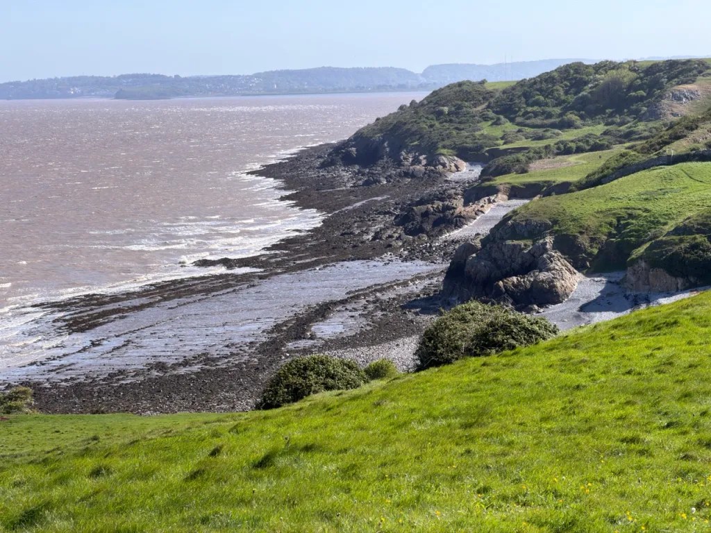
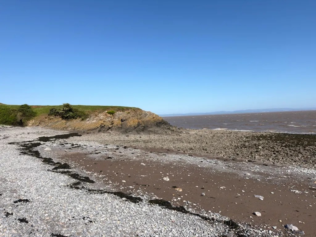
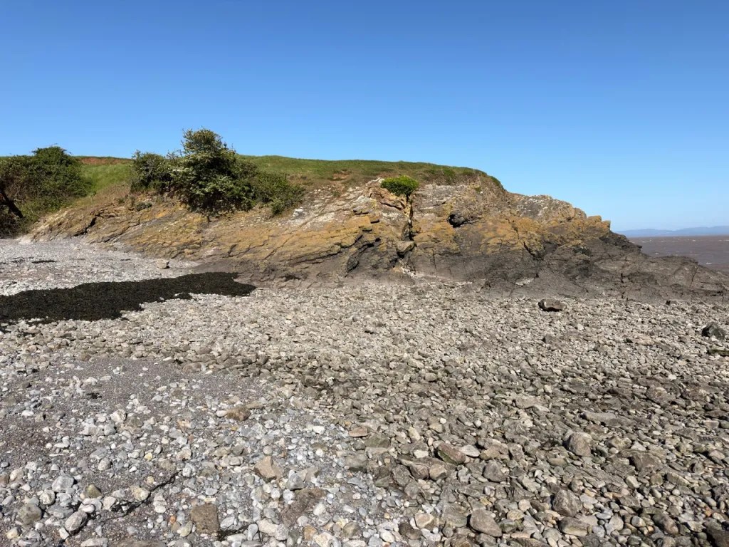
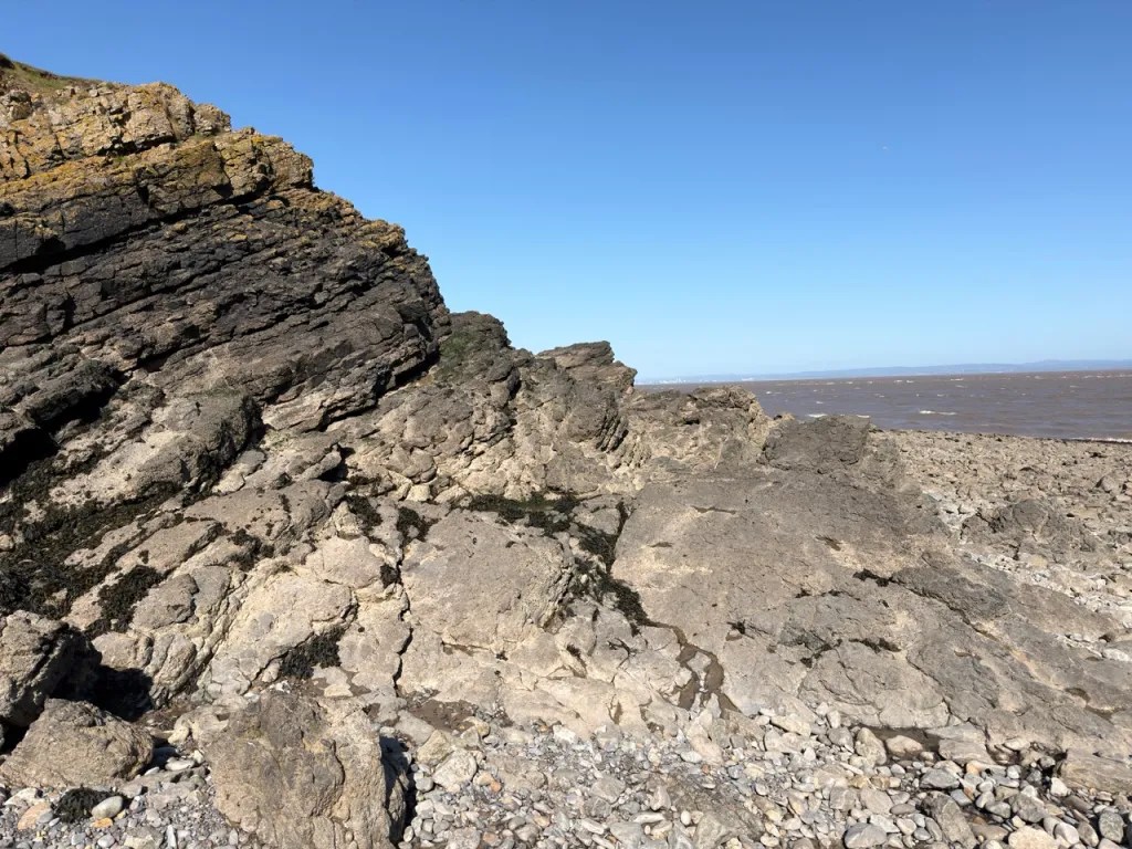
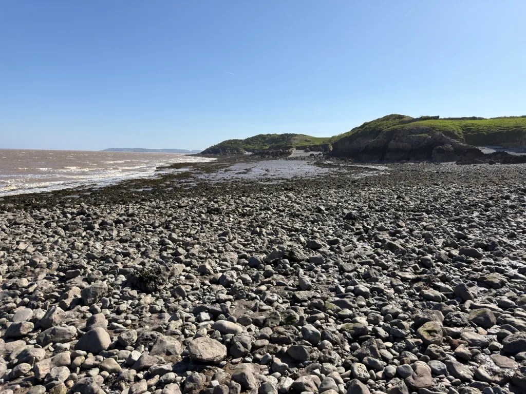
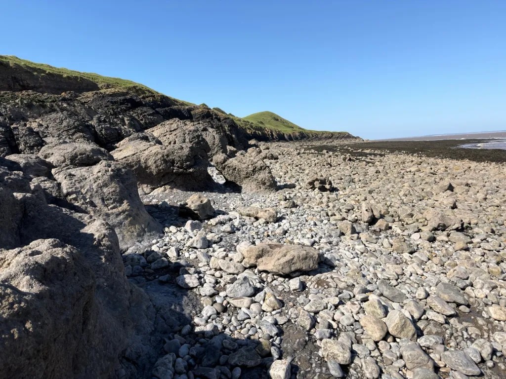
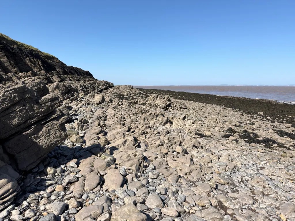
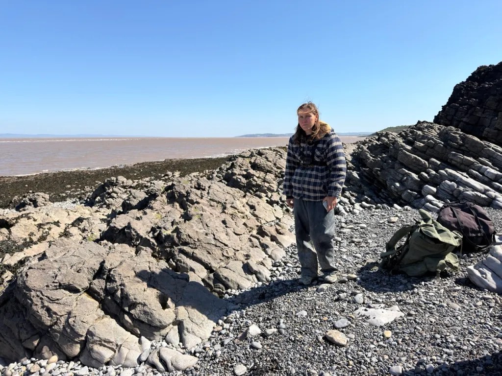
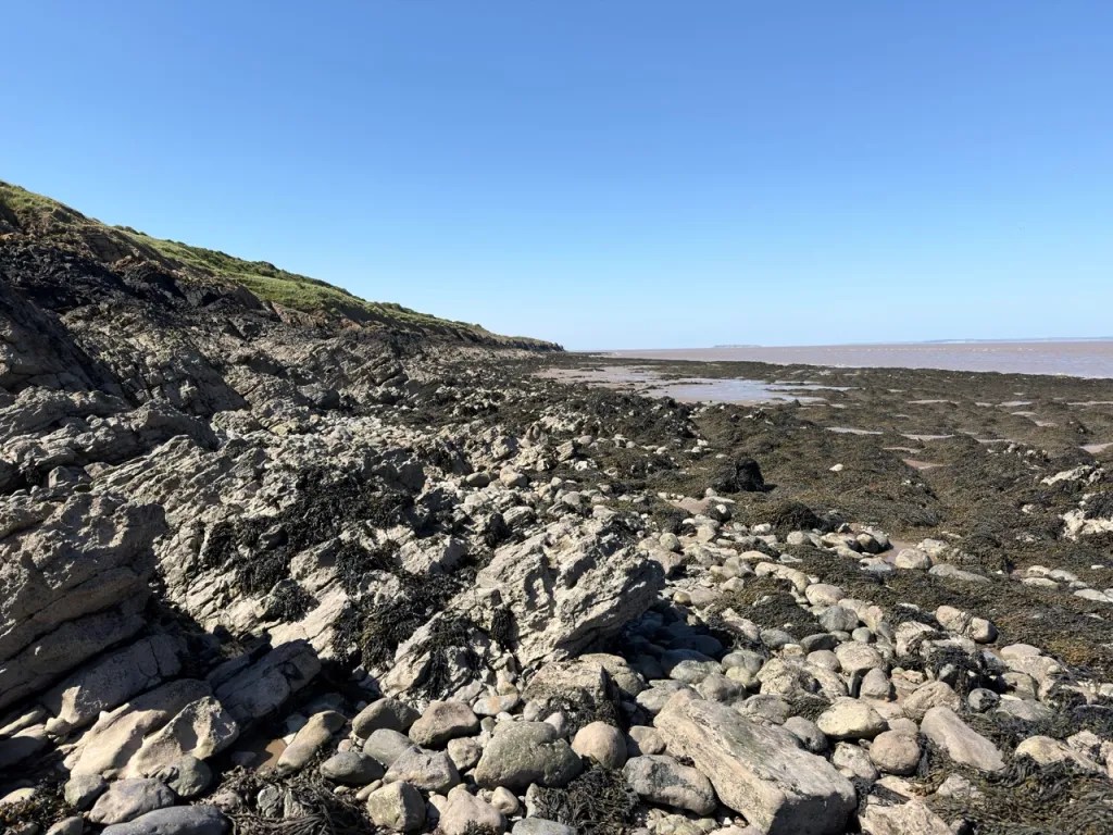
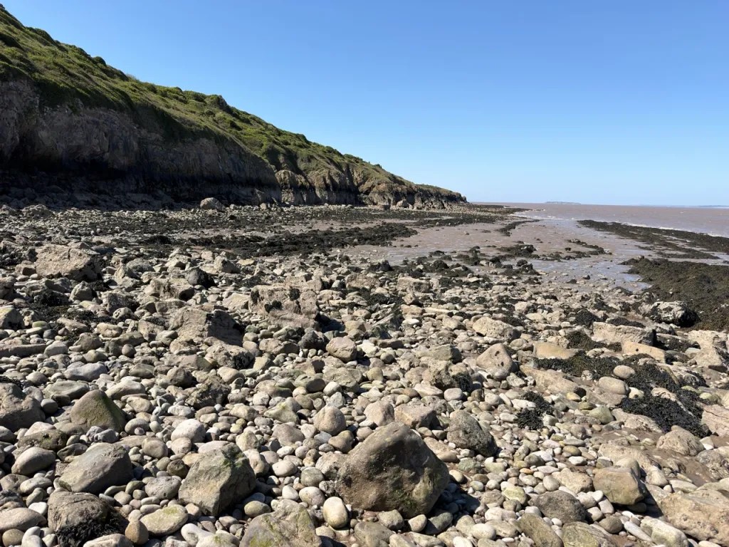
Middle Hope, on the headland north of Weston-super-Mare, is one of the most important Early Carboniferous coastal geology sites in south-west England. The foreshore exposes fossil-rich limestones together with the remarkable Middle Hope Volcanic Member, where submarine eruptions produced tuffs, lapilli and pillow lava within a tropical marine succession. Crinoids, brachiopods and corals are especially characteristic, with trace fossils, bryozoans, molluscs and other marine fossils also present.


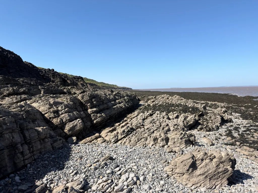
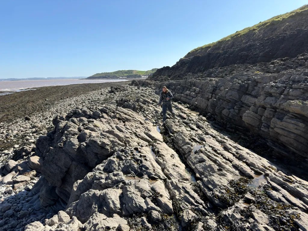
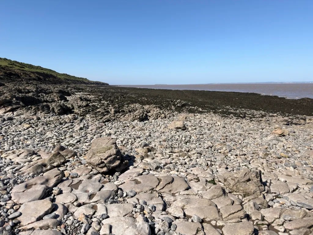
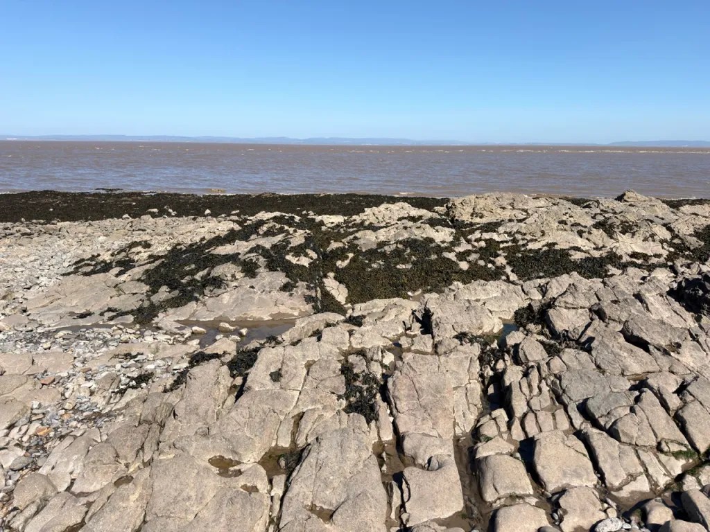


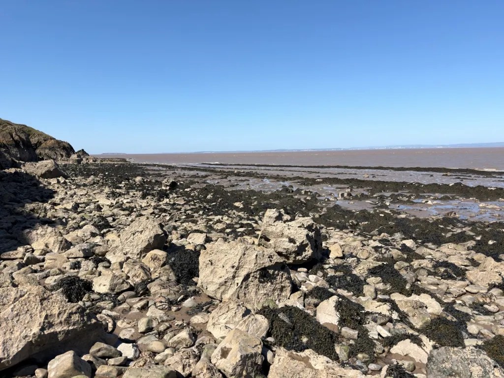
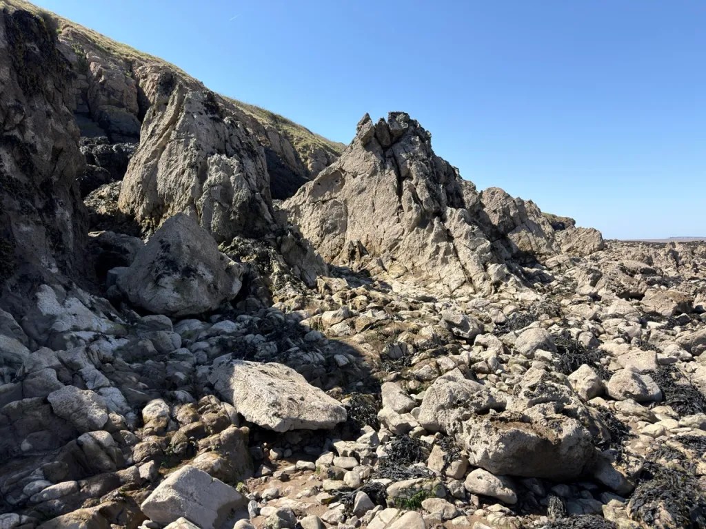
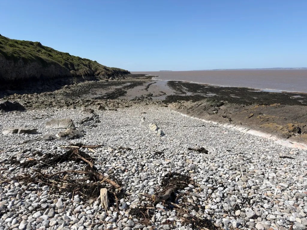
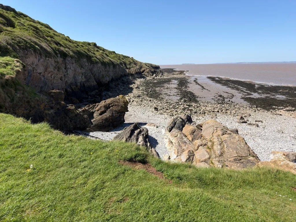
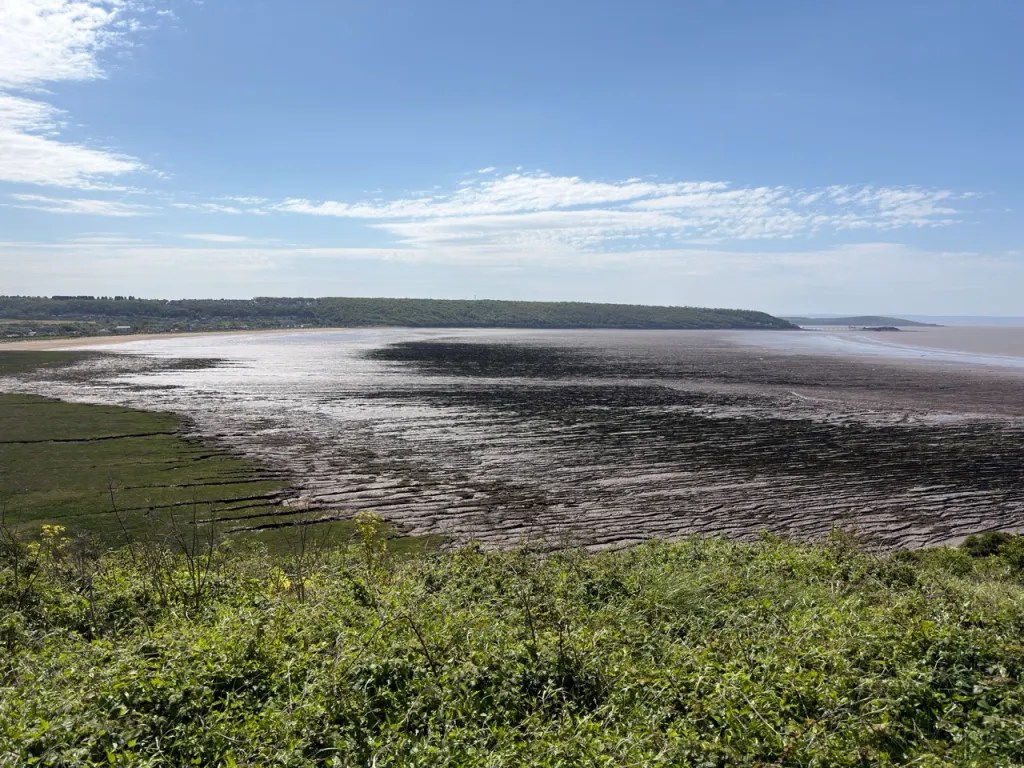
FIND FREQUENCY: ♦♦♦ – Fossils are abundant in many of the Early Carboniferous limestones at Middle Hope, particularly crinoid debris and corals, but most are firmly embedded in very hard rock. The site is an SSSI, so collecting should be restricted to permitted loose material and the bedrock must not be hammered without the necessary permissions.
CHILDREN: ♦ – This is a difficult coastal locality with sharp, uneven and slippery limestone, steep sections, tidal hazards and areas of soft mud. It is better suited to experienced fossil collectors and geologists than to young children or beginners.
ACCESS: ♦♦ – Parking is straightforward at the National Trust car parks, but reaching the best exposures involves a walk across the headland or around a rough foreshore. Some coastal sections become inaccessible as the tide rises.
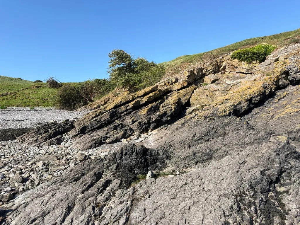
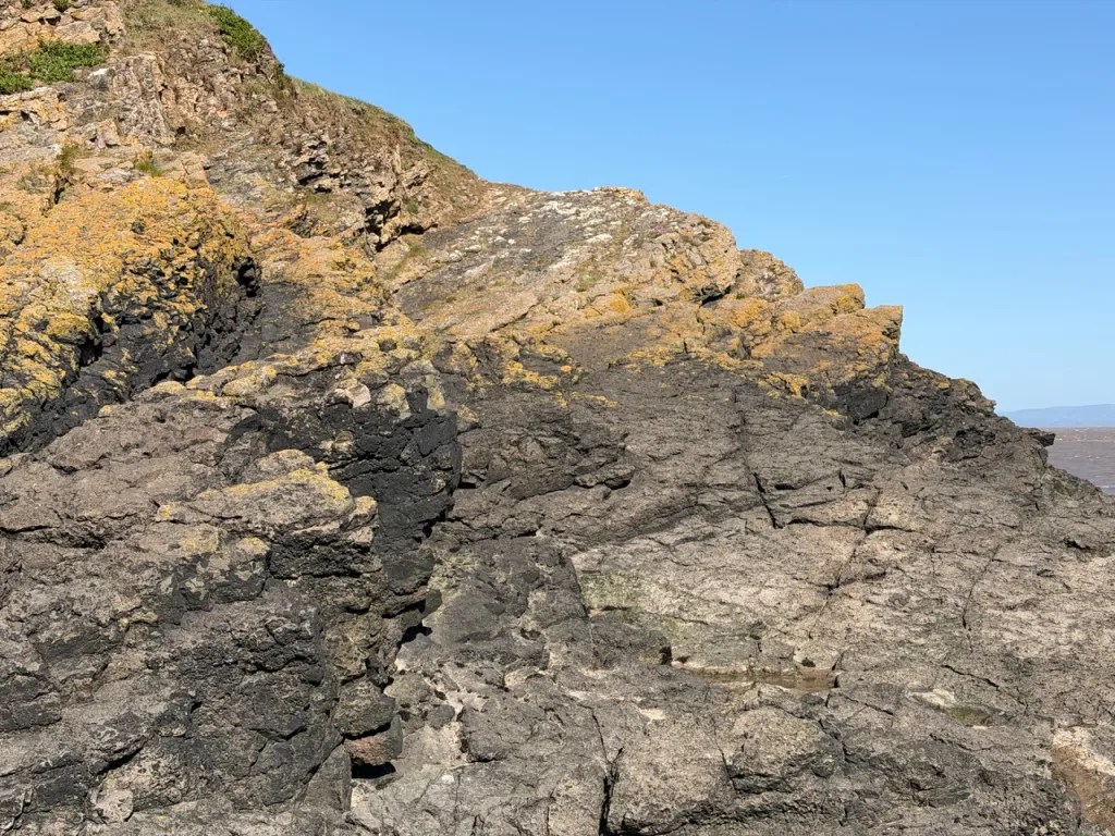
TYPE: Middle Hope is a cliff, rocky foreshore and headland locality. Fossils occur mainly within Early Carboniferous limestone of the Black Rock Limestone Subgroup, while the Middle Hope Volcanic Member includes tuffs, volcaniclastic beds and a distinctive submarine pillow lava.
DIRECTIONS
♦ Middle Hope lies immediately north of Sand Bay and Kewstoke, on the headland north of Weston-super-Mare. Leave the M5 at Junction 21 and follow signs towards Kewstoke and Sand Bay.
♦ Continue via the B3440 / Queen’s Way, then Lower Norton Lane, Sand Road and Beach Road towards Sand Point and Middle Hope. National Trust parking is available at the end of the Sand Bay road and at Middle Hope. Check the latest National Trust parking arrangements before travelling, as payment systems and charges can change.
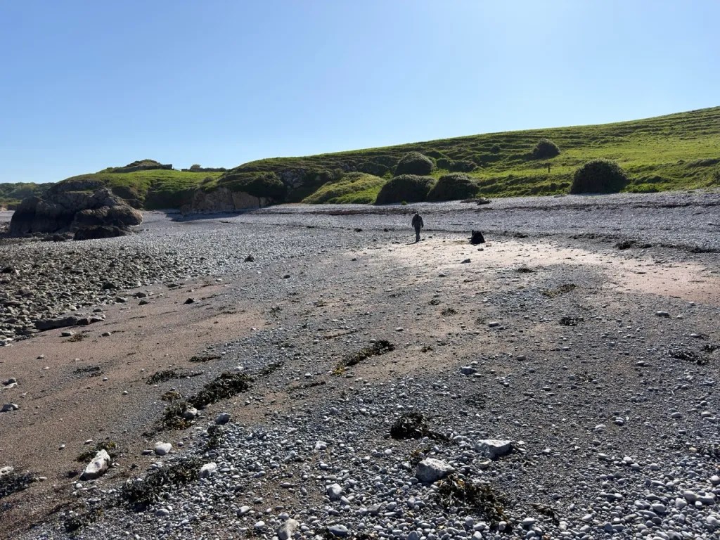
♦ For the western fossil and volcanic section, it is best to walk up Middle Hope, following the path all the way around the peninsula, and drop down in the small bay at Middle Hope itself. Trying to access from the saltmarsh on the southern side can be both boggy, and very hard going. It is also very easy to get cut off by the tide by trying to walk this way round.
♦ The most important volcanic sequence is also exposed on the northern side of the peninsula, especially around Swallow Cliff.
♦ National Trust postcode for Middle Hope: BS22 9YU; Google Maps
♦ Alternative Sand Point postcode: BS22 9UD; Google Maps
♦ What3Words Location: ///concluded.type.kinder
VIDEO FILM
FOSSIL HUNTING
Middle Hope is best approached as a site for examining fossils in their geological setting rather than as a location for heavy collecting. The most fossiliferous rocks are the dark grey Early Carboniferous limestones of the Black Rock Limestone Subgroup, exposed around the cliffs and foreshore of the headland. Because the limestone is extremely hard and the site is protected as an SSSI, concentrate on loose material already detached by natural erosion and on photographing fossils that remain in the bedrock. The western part of the peninsula around Swallow Cliff is especially important because fossiliferous limestone is interbedded with the Middle Hope Volcanic Member.
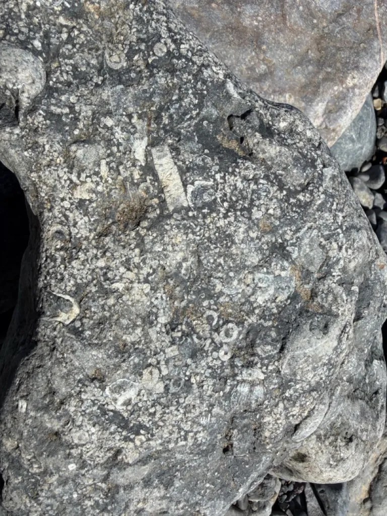
Crinoids are among the most abundant fossils. Their skeletons were built from numerous calcite plates and circular stem ossicles, which separated rapidly after death and were spread across the sea floor. Many limestones are therefore strongly crinoidal, with individual columnals and broken stem sections visible throughout the rock. Some beds contain such a high proportion of crinoid debris that the rock itself is largely composed of skeletal material. Complete crinoids are extremely rare; loose stem fragments and ossicles are the normal finds.
Rugose and tabulate corals are another characteristic part of the Middle Hope fauna. Older collecting guides often referred broadly to horn-shaped corals as Zaphrentis, but the detailed BGS work records a much more specific succession. Lower Black Rock Limestone beds include Sychnoelasma clevedonensis and Zaphrentites delanouei, while higher levels contain corals characteristic of the Caninophyllum patulum Biozone, including Caninophyllum patulum greeni, Caninophyllum patulum patulum, Caninia cornucopiae, Cyathoclisia tabernaculum, Sychnoelasma konincki and Fasciculophyllum densum. Michelinia also occurs in the succession. Weathered corals can stand proud of limestone surfaces, but species-level identification should be made cautiously because many specimens are incomplete or silicified.
Brachiopods, bryozoans and molluscs occur with the corals and crinoids. The finer-grained beds and shale partings can preserve brachiopods particularly well, while the volcanic interval contains marine bioclastic material mixed directly with tuff. One distinctive sandstone within the eastern volcanic exposures contains numerous vertical burrows and is associated with the brachiopod Lingula mytiloides. Higher in the succession, the lower Gully Oolite has yielded brachiopods including Delepinea notata, Levitusia humerosa, Megachonetes cf. magna and Syringothyris cuspidata, together with gastropods such as Straparollus.
Trace fossils are also important at Middle Hope. Bioturbated limestones below the volcanic rocks contain burrows referred to Zoophycos, Chondrites, Planolites and Thalassinoides-like forms. These record animals living and feeding within the sea-floor sediment. Some fossils in the chert-rich part of the Black Rock Limestone are silicified, making them more resistant to weathering and sometimes easier to see on natural surfaces. The association of fossils, burrows, storm-worked limestones, tuffs and pillow lava makes Middle Hope especially valuable for reconstructing a living marine ecosystem affected by repeated volcanic activity.
Middle Hope also preserves a much younger fossil record. Pleistocene raised-beach and slope deposits occur locally around the headland and contain marine and terrestrial molluscs. The SSSI citation identifies an Ipswichian Interglacial raised-beach sequence with abundant molluscan material and foraminifera, overlain and underlain by cold-climate slope deposits. These Quaternary deposits are scientifically important and should be left undisturbed.


Some of the most important geological and palaeontological milestones at Middle Hope include the first detailed Geological Survey descriptions of its volcanic rocks, early twentieth-century studies that separated the Middle Hope and Spring Cove volcanic horizons, modern fossil zonation, and T. J. Faulkner’s reconstruction of the growth and subsidence of an Early Carboniferous submarine volcanic high.
1841 — William Sanders describes the Middle Hope raised beach
Sanders published an early account of the raised-beach deposits at Middle Hope. This began a separate line of research into the headland’s Quaternary shore platform, fossil molluscs and changing sea levels, distinct from the much older volcanic rocks.
1899 — Archibald Geikie and Aubrey Strahan publish an early Geological Survey account
Middle Hope’s igneous rocks were already attracting Geological Survey attention by the end of the nineteenth century. Archibald Geikie and Aubrey Strahan included the locality in the Survey’s published work in 1899. Their observations of the lava and large calcite-filled amygdales were cited by later researchers, establishing Middle Hope as an important locality for understanding volcanic activity within the Carboniferous Limestone of the Bristol district.
1904 — Conwy Lloyd Morgan and Sidney Hugh Reynolds describe the Carboniferous igneous rocks
Conwy Lloyd Morgan and Sidney Hugh Reynolds published a major study of the igneous rocks associated with the Carboniferous Limestone of the Bristol district. At Middle Hope they described several separate volcanic exposures and recognised that the volcanic ejecta become thinner eastwards, while lava is concentrated towards the western end. Their work strongly supported a contemporaneous volcanic origin for the lavas and tuffs rather than a much later intrusion.
1905 — Thomas Franklin Sibly distinguishes two volcanic horizons in the Weston district
Thomas Franklin Sibly’s work on the Carboniferous Limestone of the Weston-super-Mare district showed that the volcanic rocks occurred at two distinct stratigraphical levels. The lower volcanic horizon is the Middle Hope succession within the Black Rock Limestone, while the higher volcanic rocks occur around Spring Cove. This distinction became fundamental to later mapping and prevented the two volcanic episodes from being treated as a single horizon.
1917 — Sidney Hugh Reynolds revisits the Middle Hope volcanic sequence
Reynolds returned to the Bristol district volcanic rocks and provided further detail on Middle Hope. He documented the irregular, discontinuous nature of the basaltic lava at the western exposure and its relationship with the surrounding tuffs. These observations helped establish that the rounded basalt bodies represent submarine pillow lava and that the volcanic sequence records repeated eruptions and sedimentation in a marine setting.
1930 — G. E. Bush describes the Avonian succession of the Woodspring promontory
G. E. Bush published a study of the Carboniferous Limestone succession of the Woodspring promontory, the headland that includes Middle Hope. His measured stratigraphical work contributed to the increasingly detailed understanding of how the fossiliferous limestones, dolomitised beds and volcanic horizons fit into the wider Lower Carboniferous succession of the Weston area.
1967 — Geological Survey remapping by G. W. Green
During the modern Geological Survey resurvey of the region, G. W. Green mapped the Middle Hope area on the six-inch / 1:10,000 sheet ST 36 NW in 1967. This work formed part of the detailed field mapping later incorporated into the 1983 Geological Survey memoir for the Weston-super-Mare district and provided a modern structural and stratigraphical framework for the headland.
1973–1979 — renewed sedimentological study of the limestones and volcanic rocks
S. C. Matthews, M. Butler and P. M. Sadler included Middle Hope in their 1973 work on Lower Carboniferous successions in North Somerset. D. L. Speedyman subsequently reviewed the volcanic rocks of the Bristol region, and D. H. Jeffreys studied the sedimentology of the Dinantian volcaniclastic carbonate rocks of Middle Hope and Spring Cove in 1979. These studies shifted attention from simple bed description towards the processes that formed the carbonate shelf and volcanic deposits.
1983 — Whittaker and Green establish the detailed modern section and fossil zonation
A. Whittaker and G. W. Green’s Geological Survey memoir Geology of the country around Weston-super-Mare provided the most detailed published bed-by-bed account of the Middle Hope coast. Beds A1–A23 were logged through the Black Rock Limestone, volcanic sequence, dolomitised upper interval and Gully Oolite. Fossil collections allowed the succession to be placed within coral and conodont biozones, including the Zaphrentites delanouei, Caninophyllum patulum and Siphonophyllia cylindrica assemblage biozones. The Middle Hope Volcanic Member was subsequently formalised in BGS lithostratigraphy with Swallow Cliff as its type section.
1989 — T. J. Faulkner reconstructs the growth and demise of the Middle Hope volcanic high
T. J. Faulkner published the influential study The Early Carboniferous (Courceyan) Middle Hope volcanics of Weston-super-Mare: development and demise of an offshore volcanic high. By combining sedimentology, volcanology and palaeontology, Faulkner showed that the volcanic pile grew upwards through progressively shallower water. The volcanic beds reach about 37 m at Swallow Cliff but thin to only a few metres eastwards, indicating a volcanic source to the west. The pillow lava demonstrates submarine eruption, while the overlying cross-bedded grainstones record the later drowning and erosion of the volcanic high.
2003 — Geological Conservation Review identifies Middle Hope as a nationally important volcanic site
The Geological Conservation Review synthesis of Britain’s Carboniferous and Permian igneous rocks highlighted Middle Hope as an exceptional Tournaisian locality. Its national importance lies in the combination of pillow lava, lapilli-tuffs, marine limestones, fossils and sedimentary structures, which together allow the growth and subsequent subsidence of a submarine volcanic cone on a carbonate shelf to be reconstructed in unusual detail.
GEOLOGY
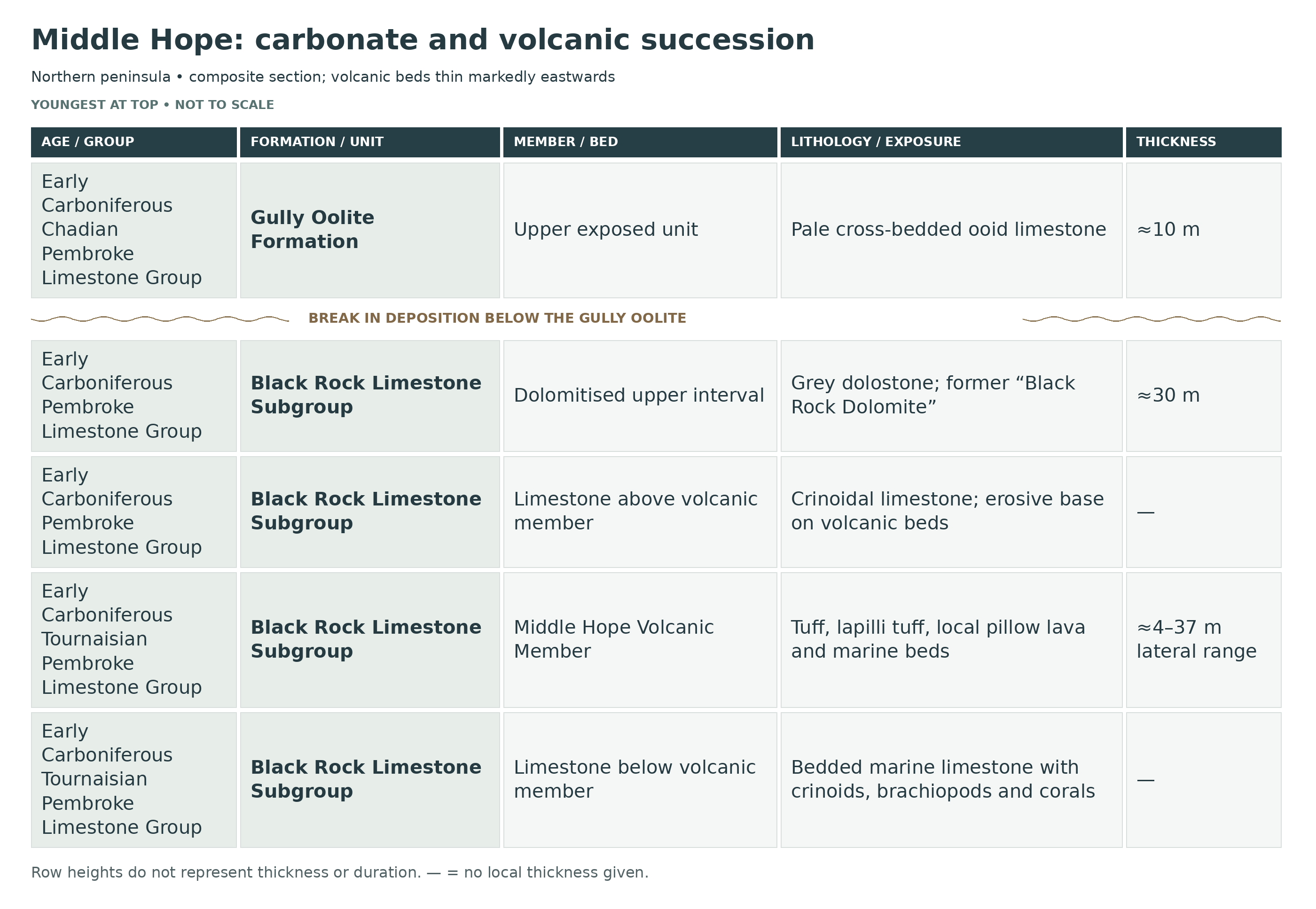
Middle Hope exposes one of the finest Early Carboniferous coastal sections in south-west England. The rocks belong principally to the Pembroke Limestone Group and span the upper part of the Black Rock Limestone Subgroup into the Gully Oolite Formation. In older literature the section was divided into the Black Rock Limestone, Black Rock Dolomite and Gully Oolite. Modern BGS terminology treats the first two as parts of a single Black Rock Limestone Subgroup because the dolomitisation is secondary rather than a primary change of sedimentary formation.
The oldest exposed rocks are dark grey to nearly black, well-bedded crinoidal limestones of the Black Rock Limestone Subgroup. They formed on the outer part of a shallow marine carbonate ramp during the Tournaisian, when Britain lay close to the Equator. Crinoids, brachiopods and rugose and tabulate corals were common, while burrowing organisms disturbed the sediment. Chert nodules and silicified fossils become abundant towards the level immediately below the volcanic succession.
The Middle Hope Volcanic Member interrupts this normal limestone succession. At Swallow Cliff it is approximately 32–37 m thick and consists of red-brown and green tuffs, lapilli-tuffs, thin limestones, sandstones, conglomeratic beds and a prominent basaltic pillow lava approximately 3.5–4.3 m thick. The pillow structures and calcite-filled amygdales show that basalt erupted beneath seawater. The volcanic beds thin dramatically eastwards to around 4 m, indicating that the eruptive centre lay towards the western end of the peninsula.
The sequence records the rise and fall of a local submarine volcanic high. Early tuffs become coarser upwards, indicating increasingly energetic eruptions. Volcanic material was repeatedly mixed with marine skeletal debris and reworked by currents and storms. As the volcanic pile grew, the sea became progressively shallower above it and some sandstone beds developed wave ripples and dense vertical burrows. Eventually volcanic activity ceased, the high was eroded and submerged, and cross-bedded bioclastic limestones accumulated above it as a high-energy marine shoal.
Above the volcanic member, the Black Rock Limestone Subgroup continues upwards through crinoidal and darker well-bedded limestones into a strongly dolomitised upper interval, historically called the Black Rock Dolomite. The overlying Gully Oolite Formation is a pale, massive, cross-bedded ooid limestone deposited in shallow, high-energy water. Faunal evidence shows an important break in deposition close to the top of the dolomitised succession. The rocks were later tilted, folded and faulted during Variscan deformation, producing the steeply inclined beds seen around the headland today.

A much younger geological story is preserved locally above the Carboniferous bedrock. The Middle Hope SSSI includes a Pleistocene fossil cliff and shore platform with raised-beach and slope deposits. These contain molluscs and foraminifera and record changes between temperate interglacial sea-level conditions and colder periglacial episodes. The raised beach has been correlated with the Ipswichian Interglacial, making Middle Hope important for both Carboniferous geology and Quaternary sea-level history.

This is a detailed stratigraphical breakdown of Middle Hope, where a Tournaisian to Chadian marine carbonate succession exposes the Black Rock Limestone Subgroup, the type section of the Middle Hope Volcanic Member and the overlying Gully Oolite Formation. The classic Geological Survey bed numbers A1–A23 are retained because they remain useful in the field, while the headings follow modern BGS lithostratigraphical terminology.
Section Architecture
The Middle Hope coast provides nearly continuous exposure through the upper three-quarters of the Black Rock Limestone Subgroup and into the Gully Oolite Formation, although beach material, seaweed, structural disturbance and local faults interrupt individual parts of the section. The best-known western log is at Swallow Cliff, where the Middle Hope Volcanic Member is thickest and includes the pillow lava. The same volcanic interval reappears in several exposures farther east but becomes progressively thinner. The highest beds, including the Gully Oolite, occur close to the National Trust parking area at the western end of the headland.
Terminology Note
The 1983 BGS memoir divided the section into Black Rock Limestone, Black Rock Dolomite and Gully Oolite. Current BGS lithostratigraphy places the first two within the Black Rock Limestone Subgroup of the Pembroke Limestone Group; the former Black Rock Dolomite is no longer treated as a separate formation because it represents secondary dolomitisation of the original limestone. The Middle Hope Volcanic Member remains a formal unit and is restricted to Middle Hope, with Swallow Cliff as its type section.
PEMBROKE LIMESTONE GROUP
BLACK ROCK LIMESTONE SUBGROUP (TOURNAISIAN TO CHADIAN)
Beds A1–A2 — Lower exposed Black Rock Limestone
The BGS estimates roughly 70–75 m for bed A1 alone, with the approximately 8 m cherty bed A2 above it. Both comprise dark grey to nearly black, fine-grained, well-bedded crinoidal limestone; their combined thickness must not be reported as 70–75 m. These beds contain crinoids, brachiopods and corals and were deposited on the outer part of a shallow marine carbonate ramp. In A2, about 8 m thick, chert nodules become abundant and many corals and brachiopods are silicified. The lower fossil assemblages include Sychnoelasma clevedonensis and Zaphrentites delanouei; the incoming of a richer coral fauna marks the transition into the Caninophyllum patulum Biozone.
Middle Hope Volcanic Member (Tournaisian)
Bed A3 — Lower tuffaceous interval, about 5 m
The base of the volcanic member is marked by red-brown and green tuffs and thin tuffaceous limestone ribs. Parts are commonly obscured by beach cover. A pale grey and red soft shale occurs near the base. The abrupt incoming of volcanic ash above normal marine limestone records the onset of local submarine volcanism.
Bed A4 — Bioclastic limestone, about 1.2 m
This thin dark grey and brown limestone contains marine skeletal debris, including Michelinia and spiriferid brachiopods. Its position within the volcanic sequence demonstrates that normal marine carbonate production continued between eruptive episodes and that the volcano remained submerged.
Beds A5–A6 — Red-brown and green tuff with ferruginous limestone, about 6 m
A5 consists mainly of weathered red-brown and green tuff with limestone lenses, especially near its base. A6 is a thinly bedded red ferruginous tuffaceous limestone resting on an uneven surface. The increasing grain size and abundance of lapilli within the lower volcanic succession indicate eruptions becoming progressively more energetic.
Bed A7 — Crinoidal limestone with zaphrentoid corals, about 3.5 m
A grey granular crinoidal limestone temporarily interrupts the tuffs. It contains zaphrentoid corals and a band of chert nodules near the top. Dolomitisation and silicification affect the upper part and penetrate down joints. This is an excellent example of marine carbonate sedimentation resuming between volcanic phases.
Beds A8–A9 — Green tuffs and red chert, about 4 m
Fine- and coarse-grained green tuffs alternate through A8, while A9 is represented by a thin red chert layer that can be strongly contorted. These beds form part of the increasingly energetic volcaniclastic phase preceding the main lava.
Bed A10 — Basaltic pillow lava, about 3.5–4.3 m
This is the best-known volcanic feature at Middle Hope. The basalt is deeply weathered and contains abundant calcite-filled amygdales, some reaching several centimetres across. Its irregular pillowed form demonstrates eruption directly into seawater. The highly amygdaloidal upper surface and the way tuffs occupy spaces around the lava show that volcanic and sedimentary processes were occurring together on the sea floor.
Bed A11 — Sandy crinoidal limestone with tuff and chert, about 3 m
Above the pillow lava is a blue-grey sandy crinoidal limestone with lines of chert nodules and partings of fine tuff containing abundant basaltic lapilli. The bed is locally disturbed, reflecting the unstable volcanic sea floor and repeated mixing of carbonate sediment with eruptive debris.
Beds A12–A14 — Upper tuffs and red limestones, about 5 m
A12 is approximately 3 m of green tuff, followed by red limestone with lenticular green tuff seams in A13 and red nodular limestone with ferruginous clayey partings in A14. These beds mark the waning stages of the main volcanic episode at Swallow Cliff. The top of the member is erosive and is overlain by coarse crinoidal limestone.
Eastward volcanic exposures and the Pipe Rock
The volcanic member is repeated farther east along the northern coast. At the second major exposure, about 700 m west-north-west of Woodspring Priory, the volcanic succession is around 29.5 m thick and includes tuffs, thin limestones, volcaniclastic conglomerates and a distinctive laminated sandstone riddled with vertical cylindrical burrows. This “Pipe Rock” is associated with the brachiopod Lingula mytiloides. Farther east the volcanic member continues to thin, reaching only a few metres near St Thomas’s Head. The progressive thinning is one of the strongest indications that the volcanic source lay to the west.
BLACK ROCK LIMESTONE SUBGROUP — ABOVE THE VOLCANIC MEMBER
Beds A15–A21 — Upper Black Rock Limestone above the volcanic member
The volcanic member is overlain erosively by pale grey coarse crinoidal limestone in A15, locally containing volcanic fragments at its base. Above are darker, well-bedded limestones A16–A20 and a grey crinoidal limestone A21, whose uppermost part is dolomitised. Together these beds form a fining-upwards marine succession interpreted as a high-energy offshore shoal that developed as the volcanic high was eroded and progressively drowned. Crinoid debris remains common and rolled corals occur locally.
Coral and conodont biozones through the Black Rock Limestone Subgroup
Fossil collections allow the Middle Hope succession to be divided biostratigraphically. Lower beds belong to the Zaphrentites delanouei assemblage biozone. A rich coral fauna then marks the Caninophyllum patulum Biozone, with Caninophyllum patulum greeni in the lower part and C. patulum patulum higher up. The uppermost dolomitised interval reaches the Siphonophyllia cylindrica Biozone. Conodonts independently place much of the volcanic succession within the Polygnathus communis carina Biozone of the historical BGS scheme, making Middle Hope useful for correlating coral and conodont zonations.
Bed A22 — Dolomitised upper Black Rock Limestone Subgroup, about 30 m
A22 is the interval historically called the Black Rock Dolomite. It consists of grey, massive, medium- to fine-grained dolostone that weathers very pale grey and commonly develops a criss-cross fracture pattern. Fossils are often preserved as calcite-filled moulds. The lower few metres are better bedded and more fossiliferous, with Caninophyllum patulum patulum; the highest beds yield forms including Siphonophyllia cylindrica and Delepinea notata. Modern BGS terminology includes this secondary dolomitised interval within the Black Rock Limestone Subgroup.
Individual Beds Within The Grouped BGS Intervals
These measurements belong to the western BGS bedA log. They must not be combined with the differently generalised GCR section as though both were the same measured column. Existing grouped descriptions above retain their environmental context; the entries below make each supported individual bed explicit. The BGS A15–A21 package totals approximately 50 m, whereas the GCR/Faulkner sedimentological summary describes a 24 m post-volcanic grainstone unit; these differently defined intervals must not be treated as identical measurements.
Bed A1 — Non-Cherty Lower Limestone (estimated 70–75 m)
The oldest exposed limestone lacks the abundant chert and widespread silicified fossils characteristic of A2. Its thickness is estimated from partly covered foreshore, not a completely clean face.
Bed A2 — Cherty Limestone (8 m)
Chert nodules and silicified corals and brachiopods become common. The top is locally pink-stained with thin red clay partings.
Middle Hope Volcanic Member — Supplementary Bed Detail
Bed A5 — Weathered Tuff (5 m)
Red-brown and green tuff contains limestone lenses, especially low in the bed.
Bed A6 — Ferruginous Tuffaceous Limestone (1 m)
Thin red limestone has an uneven base and records carbonate deposition mixed with volcanic debris.
Bed A8 — Green Tuff (3.7–4.3 m)
Coarser and finer volcanic layers alternate beneath the chert marker.
Bed A9 — Red Chert Marker
A thin red chert layer is locally contorted. The source does not give it a separate numerical thickness.
Bed A12 — Upper Green Tuff (3 m)
This distinct tuff lies above the sandy crinoidal limestone interval.
Bed A13 — Red Limestone With Tuff Seams (1 m)
Green tuff forms lenticular bands within the red carbonate.
Bed A14 — Nodular Red Limestone (1 m)
Irregular iron-rich clay partings may represent decomposed tuff.
BLACK ROCK LIMESTONE SUBGROUP — POST-VOLCANIC BEDS
Bed A15 — Coarse Crinoidal Limestone (10.5 m)
The erosive basal part contains volcanic fragments; this bed begins the post-volcanic carbonate package.
Bed A16 — Bedded Granular Limestone (7.6 m)
Dark-grey granular limestone forms a separate well-bedded interval.
Bed A17 — Fine Dark Limestone (2.4 m)
One or two beds of nearly black fine limestone contain scattered crinoid ossicles.
Bed A18 — Upward-Coarsening Limestone Package (9 m)
Fine dark limestone with scattered ossicles passes up into better-bedded granular limestone.
Bed A19 — Coral-Bearing Limestone (1.5 m)
A granular limestone bed contains rolled corals near its base in places.
Bed A20 — Bedded Granular Limestone (12 m)
Dark-grey granular limestone forms a substantial bedded package.
Bed A21 — Crinoidal Limestone (7 m)
The upper part of this grey crinoidal limestone is dolomitised, before the main A22 interval.
Gully Oolite Formation (Chadian)
Bed A23 — Basal Gully Oolite, about 10 m exposed in the western section
The Gully Oolite is a pale grey to white, very massive, cross-bedded ooid limestone formed in shallow, high-energy water. Its lowest part is locally crinoidal and fossiliferous before passing upward into purer oolite. Fossils recorded from the basal beds include Caninia cf. caninoides, Caninophyllum arrhiaci, Fasciculophyllum densum, Michelinia cf. megastoma, Delepinea notata, Levitusia humerosa, Megachonetes cf. magna, Syringothyris cuspidata and Straparollus. A significant break in deposition occurs around the transition from the upper dolomitised Black Rock succession into the Gully Oolite.
BLACK ROCK LIMESTONE SUBGROUP — EASTERN EXPOSURE
Middle Hope Volcanic Member — Eastern Exposure
Separate Eastern Volcanic Log: Exposure 2, ST 3371 6643
This BGS log describes a different section east of Swallow Cliff, listed from youngest to oldest. Its bracketed 1–19 numbers are Morgan and Reynolds’s scheme, not the western A numbers. Do not sum its beds with the western section or imply that the pillow lava persists here. The unmeasured limestones bound the volcanic interval; historical fossil identifications and exposure comparisons follow the original source.
Unmeasured Upper Bounding Crinoidal Limestone
[Massive crinoidal limestone]
Bed 19 — Mostly Unexposed Interval And Basal Tuff (3.0 m)
[19] Most unexposed; lowest metre (seen at one place) comprising red and purple shaly tuff
Bed 18 — Coarse Crinoidal Limestone (3.7 m)
[18] Dark grey to grey, coarsely crinoidal limestone with F. densum and Michelinia sp.
Bed 17 — Green And Red Tuff (1.5 to 2.1 m)
[17] Green and red tuff; coarse and fine layers including decomposed basalt clasts
Bed 16 — Pipe Rock (0.75 m)
[16] ‘Pipe-rock’-laminated coarse and fine sandstone traversed by numerous vertical cylindrical sediment-filled pipes (Plate 8)
Bed 15 — Fine-Grained Tuff (0.6 m)
[15] Fine-grained tuff
Bed 14 — Limestone (0.05 m)
[14] Limestone
Beds 13–12 — Clast-Rich Tuff (4.4 m)
[13]- [12] Tuff with abundant variable-sized pebbles and fragments of limestone (Black Rock types), chert, dolomite, brown and green tuff and mudstone clasts
Bed 11 — Brown Fine-Grained Tuff (0.36 m)
[11] Brown fine-grained tuff
Bed 10 — Limestone (0.4 m)
[10] Limestone
Bed 9 — Fossiliferous Brown Tuff (6.7 m)
[9] Brown fine-grained tuff with’Edmondia‘ and gastropods in upper part
Bed 8 — Red Crinoidal Limestone (0.3 m)
[8] Red crinoidal limestone
Bed 7 — Brown Fine-Grained Tuff (0.6 m)
[7] Brown fine-grained tuff
Bed 6 — Fine-Grained Dolomite (0.08 m)
[6] Fine-grained dolomite (cf. bed 3 of ‘exposure 3’ of Morgan and Reynolds, 1904b, p. 200)
Bed 5 — Brown Fine-Grained Tuff (1.1 m)
[5] Brown fine-grained tuff
Bed 4 — Argillaceous Limestone (0.15 m)
[4] Compact rather argillaceous limestone
Bed 3 — Contorted Brown Tuff (3.35 m)
[3] Brown fine-grained tuff, much contorted
Bed 2 — Limestone Bands With Shale And Tuff (2.1 m)
[2] Limestone in bands (0.08 to 0.15 m) with partings of red shale. Green tuff band 0.3 m below top
Bed 1 — Unmeasured Lower Bounding Cherty Limestone
[1] [Black Rock Limestone with chert]
Other Eastern Volcanic Exposures — Separate Lateral Sections
At BGS exposure 3 (ST 3392 6655), folding and a nearby fault repeat and distort the beds; the top is not fully exposed and no reliable total thickness was established. The source warns that some historical numbered beds may be repetitions. This section must not be combined with exposure 2 or the western A-bed log.
Exposure 4 Near St Thomas’s Head — Historical Top-To-Bottom Inventory
The BGS records 0.75 m of shaly beds above 0.6 m of fine red tuffaceous limestone and 0.6 m of coarser tuff. Below are an estimated 2 m concealed interval, 2.4 m of red-yellow crinoidal limestone and an estimated 3 m concealed interval above red-stained Black Rock Limestone. Exposure and the uncertain member boundary prevent a simple sum from being used as the volcanic thickness. The source considers at least 2 m proven, perhaps 4 m or as much as 8 m when the uncertain covered interval is included.
At St Thomas’s Head the separate district summary records, from top to bottom, 37 m of Gully Oolite seen, about 45 m of Black Rock Dolomite, 55 m of Black Rock Limestone down to the base of the chert-bearing interval, and a further 85 m of Black Rock Limestone seen below the chert. The Gully Oolite and dolomitised interval compare with 10 m and 30 m respectively in the western A-bed log. These historical eastern measurements require caution: a thrust repeats part of the southern section, and structural disturbance obscures the Gully Oolite–dolomite contact. They are not a clean unrepeated total or additional beds stacked above the western section.
PLEISTOCENE DEPOSITS
Fossil cliff, shore platform and raised beach
Middle Hope also preserves an important Quaternary sequence unrelated to the Carboniferous bedrock. A Pleistocene fossil cliff and shore platform are overlain by slope deposits containing terrestrial and reworked marine molluscs. Younger raised-beach deposits contain abundant molluscs and foraminifera and are in turn overlain by later slope material. The raised beach has been correlated with the Ipswichian Interglacial, while the associated slope deposits record colder climatic phases. The unusual completeness of this sequence is one of the reasons for the site’s geological protection.
Structural Geology
The Carboniferous rocks were deposited approximately horizontally but were later folded, tilted and faulted during the Variscan Orogeny. Middle Hope forms part of the structurally complex Bristol–Mendip region and lies on the continuation of the Lower Severn structural axis. The steep dips, local synclines, faults and repetitions of beds around the headland mean that the coast is not a simple vertical stratigraphical section. This deformation is responsible for the dramatic inclined limestone ridges visible today.
Depositional Environment
The full Middle Hope succession records a shallow tropical carbonate ramp repeatedly disrupted by local volcanism. The lower Black Rock Limestone formed in relatively deeper outer-ramp water below normal wave influence. Increasing volcanic activity built a submarine cone upwards into progressively shallower water, while tuffs and lapilli were reworked by gravity flows, storms and ordinary marine currents. Pillow lava erupted directly onto the sea floor. After volcanism waned, the cone was eroded and drowned, allowing high-energy crinoidal grainstones and later shallow-water ooid shoals of the Gully Oolite to spread across the area.
Swallow Cliff Quaternary Log: Separate From The Carboniferous
Middle Hope Formation — Historical GCR Quaternary Scheme
At ST 325 661 the local Quaternary deposits rest on an older rock platform and fossil cliff. GCR 14 describes about 2.6 m overall, with the following maximum individual bed measurements; these maxima are not necessarily all attained in the same vertical line. Its named Woodspring, Swallow Cliff and Brean divisions are retained as the cited local Quaternary scheme, not confused with the Carboniferous volcanic member.
Middle Hope Palaeosol — Beds 1–3
Bed 1 — Red Stony Clay (up to 0.35 m)
Clay occupies hollows in the rock platform and contains volcanic, limestone and possible Triassic sandstone clasts. Clay coatings record soil development.
Bed 2 — Mottled Stony Clay (up to 0.10 m)
Red-brown silty clay contains possible Triassic marl fragments, some foraminifera and soil-related clay coatings; it grades down into bed 1.
Bed 3 — Very Stony Silty Clay (up to 0.15 m)
Limestone and weathered older-rock clasts occur with terrestrial snails and pockets of reworked marine shell. Beds 1–3 form the Middle Hope palaeosol in the source interpretation.
Woodspring Member — Historical GCR Scheme
Bed 4 — Silty Clay Loam (up to 0.15 m)
Slightly stony brown loam contains angular marl fragments, abundant foraminifera and some soil coatings.
Bed 5 — Very Stony Clay Loam (up to 0.15 m)
Limestone and flint fragments occur with weathered sandstone and marl, in a friable blocky loam.
Bed 6 — Dark Silty Clay Loam (up to 0.02 m)
A very thin brown-black loam separates the stonier beds below and sandier loam above.
Bed 7 — Sandy Loam (up to 0.08 m)
This layer contains abundant marine shell fragments and foraminifera with some land snails. Beds 4–7 are assigned to the Woodspring Member in the GCR scheme and interpreted as slope and wind-worked deposits.
Swallow Cliff Member — Historical GCR Scheme
Bed 8 — Raised-Beach Gravel (up to 1.0 m)
Rounded limestone cobbles lie in a shell-rich matrix. The temperate assemblage is dominated by Macoma balthica, with periwinkles, cockles, limpets and less common marine molluscs. This is the Swallow Cliff Member of the cited scheme.
Brean Member — Historical GCR Scheme
Bed 9 — Upper Stony Loam (up to 0.33 m)
Angular limestone and volcanic clasts occur in a sandy loam above the beach gravel. The GCR interprets renewed cold-climate slope deposition and correlates this layer with its Brean Member.
Modern Soil — Outside The Member Subdivision
Bed 10 — Modern Soil (up to 0.25 m)
The present soil caps the local Quaternary section.
The interglacial character of the raised beach is well supported, but the source discusses conflicting amino-acid results. MIS 5e/Ipswichian is the preferred correlation in that review; an older contribution or age has also been proposed. This uncertainty is retained rather than turning the beach into an exactly dated horizon.
References
Geikie, A. & Strahan, A. (1899). Geological Survey observations on the Carboniferous igneous rocks of the Bristol district.
Morgan, C. L. & Reynolds, S. H. (1904). The igneous rocks associated with the Carboniferous Limestone of the Bristol District.
Sibly, T. F. (1905). The Carboniferous Limestone of the Weston-super-Mare district.
Reynolds, S. H. (1917). Further work on the igneous rocks associated with the Carboniferous Limestone of the Bristol District.
Bush, G. E. (1930). The Carboniferous Limestone Avonian succession in the Woodspring Promontory, Weston-super-Mare.
Matthews, S. C., Butler, M. & Sadler, P. M. (1973). Lower Carboniferous successions in North Somerset.
Speedyman, D. L. (1977). Volcanic rocks of the Bristol Region.
Jeffreys, D. H. (1979). Sedimentology of the Dinantian volcaniclastic carbonate rocks of Middle Hope and Spring Cove.
Whittaker, A. & Green, G. W. (1983). Geology of the country around Weston-super-Mare. British Geological Survey memoir, Sheet 279.
Faulkner, T. J. (1989). The Early Carboniferous (Courceyan) Middle Hope volcanics of Weston-super-Mare: development and demise of an offshore volcanic high.
Waters, C. N. and co-authors (2009). A lithostratigraphical framework for the Carboniferous successions of southern Great Britain.
Geological Conservation Review: Middle Hope, Carboniferous and Permian Igneous Rocks of Great Britain.
Hunt, Middle Hope, GCR14 Quaternary of South-West England
Findlay & Catt (2006), A temporary section in Head at Bourne, Burrington, Somerset
SAFETY
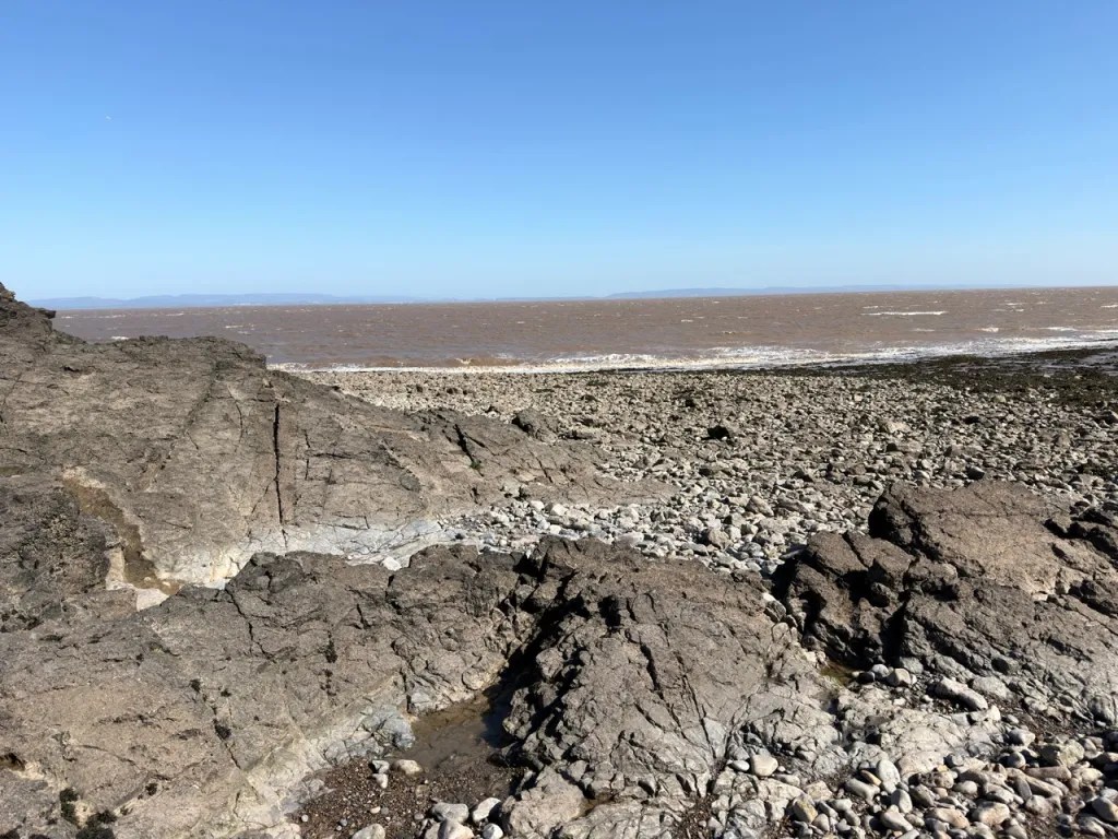
Middle Hope can be dangerous if the tide is misjudged. The Bristol Channel has an exceptionally large tidal range and, around parts of the headland, high water reaches the base of the cliffs and can cut off the return route. Check tide times before setting out and aim to explore on a falling tide, leaving ample time to return. Do not rely on being able to continue around the headland once the tide begins to rise.
The limestone foreshore is extremely uneven, sharp and slippery, with deep cracks, loose blocks and seaweed-covered surfaces. Sand and mudflats exposed at low tide can also be hazardous and should not be crossed unnecessarily; the National Trust specifically warns visitors not to walk too far out over the mud. Keep away from unstable cliff faces and do not work directly beneath loose rock. Sturdy footwear, suitable clothing and a charged phone are strongly recommended.
EQUIPMENT
Because Middle Hope is an SSSI and the most important fossils are commonly visible within hard bedrock, a geological hammer should not be used on the protected exposures. A hand lens and camera are more useful for examining and recording fossils in situ. For permitted loose finds, bring tissue, newspaper or small containers so that specimens do not knock against one another in a rucksack. Good quality walking boots with strong ankle support and grip are essential because the limestone is sharp, fissured and slippery. A tide table or reliable tide app should be treated as essential field equipment at this locality.
CLEANING AND TREATING
Most loose Middle Hope fossils are preserved in hard Carboniferous limestone and are far tougher than fragile shale fossils, but preparation should still be conservative. After a coastal visit, durable loose specimens can be rinsed gently in fresh water to remove salt and mud, then allowed to dry naturally at room temperature. Use a soft toothbrush, wooden cocktail stick or blunt dental-style pick to remove loose dirt from crevices. Do not use heat to accelerate drying.
Do not use vinegar, hydrochloric acid or other acids on ordinary Middle Hope specimens. The fossils and the limestone matrix are largely made of calcium carbonate, so acid can dissolve both the surrounding rock and the fossil itself. Some silicified fossils can technically be prepared chemically by specialists, but this requires controlled laboratory methods and is not recommended for routine collecting.
Where a fossil is partly exposed in very hard limestone, mechanical preparation is usually slow. Work under magnification and remove only small amounts of matrix at a time with fine hand tools. Powered engraving tools, pneumatic pens and air-abrasive systems can produce excellent results in experienced hands, but they can also destroy coral walls, brachiopod shells and crinoid detail very quickly. If the specimen is unusual, well articulated or potentially scientifically important, leave it unprepared until it has been examined by a specialist.
Stable limestone fossils normally need no coating. If a specimen is cracked or friable, a small amount of Paraloid B-72 can be used as a reversible consolidant after the specimen is completely dry. Avoid household varnish, oils and permanent glossy coatings on scientifically useful material. Always keep a label recording Middle Hope, the date, and as accurately as possible the part of the foreshore or bed from which a loose specimen came.
IDENTIFY YOUR FINDS
Need help identifying a fossil? Share clear photos, where you found it and its size with the community.
FURTHER READING
Deposits Magazine – British Carboniferous Limestone (regional background)
GCR / GeoGuide – Middle Hope, North Somerset
British Geological Survey – Geology of the country around Weston-super-Mare (district memoir, including Middle Hope)
Bristol Naturalists’ Society – Middle Hope geology (historical field-meeting notes)
ACCESS RIGHTS
Middle Hope is an SSSI, protected for its biological and geological interest, including Carboniferous limestone, volcanic rocks and the Pleistocene raised beach. Photograph the exposures and leave in-situ features undisturbed. Obtain the landowner’s permission before collecting and establish whether conservation consent is needed; SSSI designation is not an identical collecting rule for every site. Natural England lists mineral extraction, clearance of loose rock and modification of outcrops among operations requiring consent. See the Middle Hope citation and site-specific operations list.
Much of Sand Point and Middle Hope is managed by the National Trust. Follow all on-site signs, keep to permitted access routes and respect seasonal or conservation restrictions. It is important to follow our ‘Code of Conduct’ when collecting fossils or visiting any site. Please also read our ‘Terms and Conditions‘.
LINKS
♦ Fossil Discussions
♦ Fossil Articles
♦ Buy Fossils, Tools and Equipment
♦ Buy Crystals, Meteorites, and Artefacts
♦ Join Fossil Hunts
♦ UK Fossils Network